| Report Type | Full |
| Peak(s) |
Pikes Peak - 14,109 feet Mt. Yale - 14,200 feet Mt. Harvard - 14,424 feet Mt. Columbia - 14,075 feet Missouri Mountain - 14,071 feet Mt. Antero - 14,271 feet Huron Peak - 14,006 feet Crestone Peak - 14,299 feet Challenger Point - 14,086 feet Kit Carson Peak - 14,167 feet |
| Date Posted | 09/11/2014 |
| Date Climbed | 06/29/2014 |
| Author | glenmiz |
| Summer of 14 |
|---|
|
In addition to the 10 peaks shown above, I also climbed four others (Mt. Evans, Mt. Bierstadt, Ellingwood Point and San Luis Peak) for a total of 14 14ers in 2014. This didn't start out the way it ended. With plenty of time on my hands after "retiring" late last year, I started what I thought would be a big deal for me with a solo outing targeting 6 summits in 5 days. A warm-up with Niko went well and, despite Clara's pleas for me to reconsider, I set off on that tour. After I finished and watched Andrew Hamilton, Brett Maune and Justin Simioni's efforts and accomplishments, I aimed the whole thing higher and this turned into a quest of 14's. As it turned out, my aging body fared well and, despite more squeaks than when I started, it is still feeling pretty good. Thanks to all of my hiking partners and 14ers.com posters for giving me the information and confidence needed to finish. Here is some information on the "Summer of 14" Total Mileage: 131.9 miles Elevation Gain: 53,245 feet Pikes Peak: 6/29/2014 Hiking partner(s): Niko Route/RT Mileage: NW Slopes / 14.0 Trailhead elevation/time: 10,118 / 5:30 am Summit elevation/time: 14,110 / 9:00 am Total RT Elevation gain: 4,300 Notes: Camped with Niko at Crags campground. Very nice hike with great views; the Devil's Playground is a magical place (if you ignore the road). We didn't realize the annual car/motorcycle race was taking place and that was truly a spectacle with all of the cars and people watching. Tragically, one of the motorcycles crashed at the finish line just after we arrived at the summit. It was, surprisingly, only the third fatality in the long history of the race. Getting the flight for life helicopter on and off the summit increased our summit time by over an hour.   Mt Yale: 7/2/2014 Hiking partner(s): Solo Route/RT Mileage: SW Slopes / 9.5 Trailhead elevation/time: 9,947 / 5:30 am Summit elevation/time: 14,196 / 9:00 am Total RT Elevation gain: 4,300 Notes: Drove from home (traffic was great) to the TH. This is a truly great hike; cloudy to start but cleared nicely with spectacular views of the surrounding mountains and Arkansas Valley. Trail condition was superb (thanks CFI). 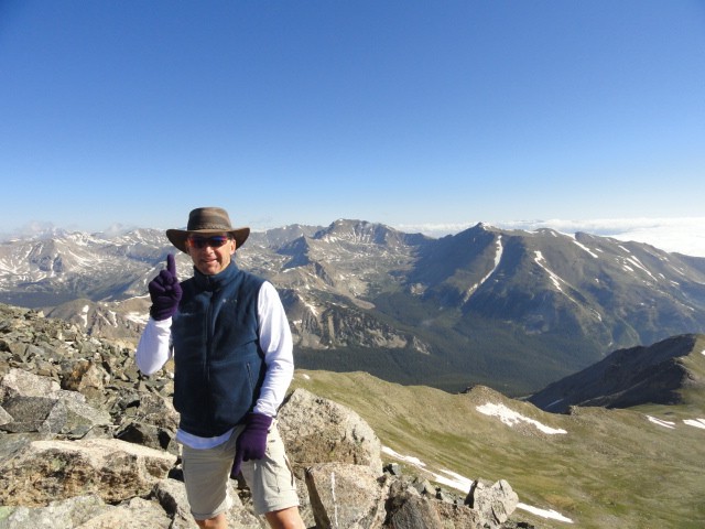  Mt Harvard/Mt Columbia: 7/3/2014 Hiking partner(s): Solo Route/RT Mileage: South Slopes (Harvard), descend West Slopes (Columbia) / 15.0 Trailhead elevation/time: 9,900 / 4:30pm (7/2), 5:25am (7/3) campsite at 11,300' Summit elevation/time: 14,420 / 7:55 am Harvard 14,073 / 11:50 am Columbia Total RT Elevation gain: 6,400 Notes: After completing Yale, made camp near Yale TH and packed up gear for overnight to Harvard/Yale. Left the TH at 4:30pm and found spot to camp around 11,300'. Got an early start and made the Harvard summit by 8am. The traverse was difficult and staying on the "trail" nearly impossible. I made many bad choices leading to zig-zags in the GPS track but eventually found some tracks in one of the snowfields. At that point, joined up with Eric and summited as the grapple started to fall. Joined four hikers that came up West Slopes of Columbia for a quick descent (more accurately, slide) down Columbia's West Slopes route. Grabbed my gear and returned, very tired, to the car, Buena Vista for a cheeseburger and a shower, and, ultimately, to my campsite near Yale trailhead.  Missouri Mountain: 7/4/2014 Hiking partner(s): Solo Route/RT Mileage: NW Ridge from Missouri Gulch / 10.5 Trailhead elevation/time: 9,650 / 5:30 am Summit elevation/time: 14,067 / 9:15 am Total RT Elevation gain: 4,500 Notes: Niko and I had climbed Belford and Oxford from this trailhead so the first part of this trail was familiar. Views of Missouri Mountain as the sun rose were great and I could clearly see some of the remaining snowfields that had been noted in trip and condition reports. I crossed one snowfield and decided I would by-pass it on the way down. On the ridge there was one small spire that was protected by snow on the NE and ice on the SW that posed the most significant challenge on the ridge. Great views of Huron which I planned for the end of my six day trek.  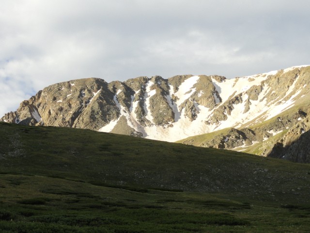 Mt. Antero: 7/5/2014 Hiking partner(s): Solo Route/RT Mileage: West Slopes via Baldwin Gulch jeep road / 15.0 Trailhead elevation/time: 9,650 / 5:30 am Summit elevation/time: 14,269 / 9:55 am Total RT Elevation gain: 5,200 Notes: This is the least inspiring 14'er I've done. The 4wd road is long and, after the creek crossing, difficult to hike on with round rocks trying to twist each ankle on every step. Jeeps and ATV's are constantly driving up and down the road which ends at 13,800'. The last pitch which is a scramble up moderately-sized boulders is fun but, after the seven mile slog up the road, was more difficult than it should have been. I saw several mountain goats along the ridge on the way up the final pitch; two were still on the summit when I arrived.    Huron Peak: 7/6/2014 Hiking partner(s): Niko, Rachel, Will, Megan, Lauren (Sue, Andy, Hope to Brown's Peak) Route/RT Mileage: North Ridge from Lulu Gulch / 8.4 Trailhead elevation/time: 10,300 / 7:10 am Summit elevation/time: 14,003 / 12:00 noon Total RT Elevation gain: 3,980 Notes: This has been my favorite climb, partly because of the people I hiked with but also because of the trail. We saw nary another hiker until 3.5 miles into the hike when we joined the standard route. We also had the best glissade I've experienced coming down the side of Brown's Peak on the descent. Weather looked iffy but cleared up nicely. The ridge was challenging on the ascent because we were too low away from the ridge and the boulders were all unstable. On the descent, we stayed near the top of the ridge.  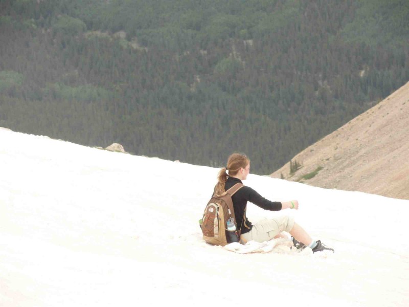 Mt. Evans / Mt. Bierstadt: 7/15/2014 Hiking partner(s): Niko, Riley Route/RT Mileage: NE Face from Summit Lake (Evans), Sawtooth (Bierstadt) / 6.9 Trailhead elevation/time: 12,850 / 4:00am Summit elevation/time: 14,264 / 5:05am Evans 14,060 / 8:05am Bierstadt Total RT Elevation gain: 3,215 Notes: I had climbed Evans once and Bierstadt three times before but Niko wanted to climb Evans and go over the Sawtooth. Since I was finishing the easier of the 14'ers and getting ready to start on Class 3 mountains, I joined them. Niko wanted to be on Evans summit by sunrise so we left early. The route finding up the NE Face was a challenge with head lamps. The Sawtooth was difficult with a serious downclimb of one of the teeth on the way over to Bierstadt. We found a cairned trail around that tooth on the way back. The weather wasn't great on our descent over Mt. Spaulding so it was a good thing we left so early. This was my second Class 3 climb after Long's Peak several years ago. The difficulties were much more sustained than those of Long's but a much shorter hike overall. Riley turned out to be a mountain goat and did a great job of route finding. 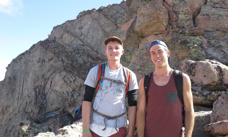 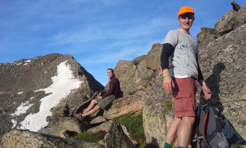 Crestone Peak: 8/2/2014 Hiking partner(s): Niko, Albert Route/RT Mileage: South Face - Red Gully / 14.0 Trailhead elevation/time: 9,900/5:00pm (8/1) 11,650 (South Colony Lakes)/5:50am Summit elevation/time: 14,294/9:55am Total RT Elevation gain: 5,700 Notes: This was my first experience in the Sangre de Cristo range. The road to the upper trailhead was ROUGH. Wow, the red conglomerate is great to climb on and interesting for anyone knowledgeable of geology. We were blessed with a steady downpour on our hike into South Colony Lakes. Fortunately, it stopped raining shortly before we made the lakes and we didn't have any rain overnight. The hike up to Broken Hand Pass was a challenging way to wake up and the climbing at the top quite exciting. We were disappointed losing all of the elevation on the other side of the pass but the wet trail really didn't affect our already saturated boots. Climbing up the Red Gully was challenging but the rock was stable and we enjoyed it. Too bad that about a third of the way up the gully, the fog descended and we couldn't see anything the rest of the way up. The last pitch to the summit gave me the heebie jeebies combining the exposure and the thick fog. Smallest summit I've been on.   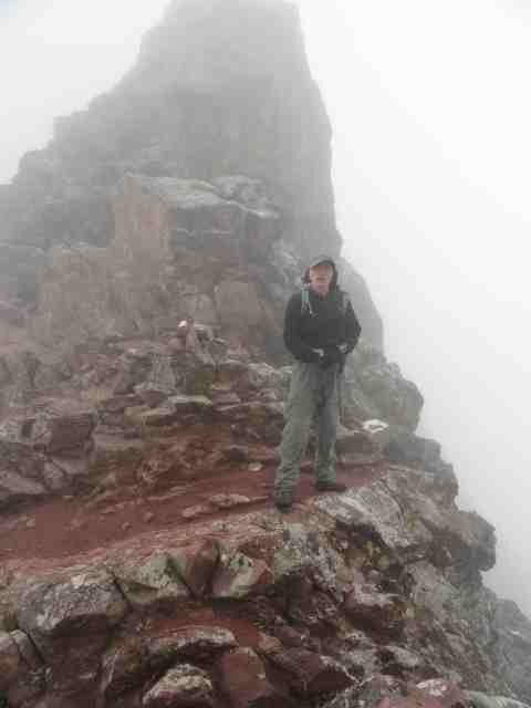  Challenger Pt/Kit Carson Peak: 8/10/2014 Hiking partner(s): Niko, Riley Route/RT Mileage: Challenger N Slope from Willow Creek approach / 14.5 Trailhead elevation/time: 8,850 / 4:10pm (8/9), 5:40am (8/10) campsite at 11,550 Summit elevation/time: 14,081 / 7:55am Challenger Point 14,073 / 9:00am Kit Carson Peak Total RT Elevation gain: 6,250 Notes: Great hike, great weather and great views including seeing what we couldn't see on Crestone Peak the week before. The hike into Willow Lake was smooth but, the next morning, it was clear it took something out of all of us. The North Slope up from Willow Lake to Challenger's ridge is one of the steepest sections I've hiked on and, with loose scree and talus, extremely challenging. The hike over to and up the "avenue" was fun and the gully up to Kit Carson very enjoyable; again, the red conglomerate. We came down the steeper section to the west of the gully we ascended and found it more stable. Trip down uneventful but caught a rock on the road out and had to change a thoroughly flat tire. Since it was Sunday, repair was impossible and we made 170 miles on the donut spare (I've since put a full-sized spare on the Pilot).    Ellingwood Point: 9/6/2014 Hiking partner(s): Albert, Than, Don, Andrea, Donnie, Isaac Route/RT Mileage: North Ridge via South Zapata Creek / 13.1 Trailhead elevation/time: 9,900/3:30am Summit elevation/time: 14,042/9:15am Total RT Elevation gain: 5,700 Notes: This was a great weekend camping at Zapata Falls with a bunch of cool folks. We found this to be a very challenging hike. We had planned on making the traverse to/from Blanca but the weather was questionable and we were tired and didn't want to get caught between. The couloirs were difficult and C3 was a waste of effort and time. The north ridge was a blast with some nice climbing and plenty of exposure. There was some ice which made it tricky below the ridge where things were shaded. Great views from the top of Little Bear, Blanca and Lindsey. Met two people at the summit who described Little Bear/Hourglass - it'll be a while before I'm ready for that. The others in this group, not so much.  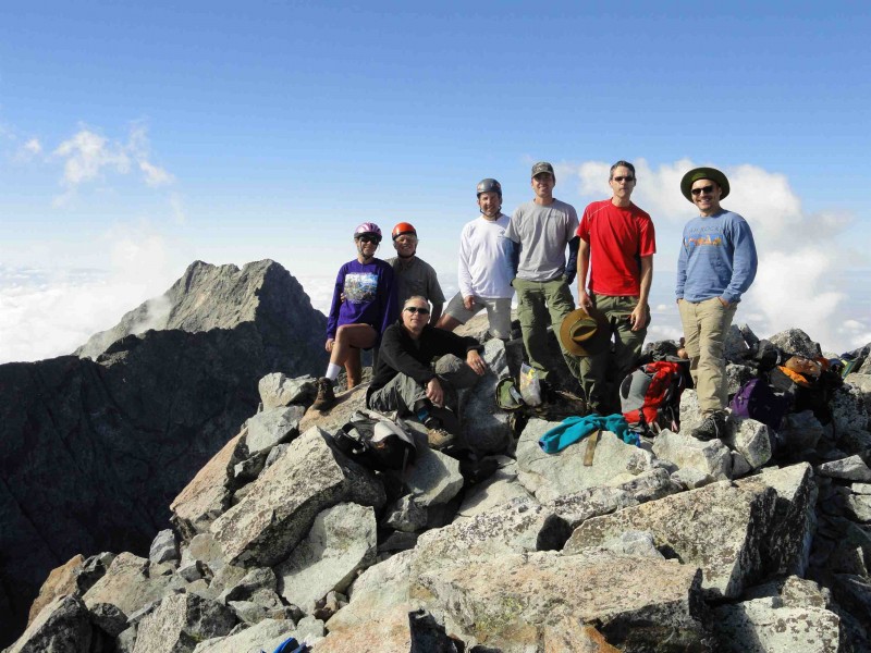 San Luis Peak: 9/10/2014 Hiking partner(s): Clara Route/RT Mileage: South Ridge from West Willow Creek TH/11.0 Trailhead elevation/time: 11,600/7:12am Summit elevation/time: 14,014/11:07am Total RT Elevation gain: 3,700 Notes: Very steep road out of Creede in the dark and moderate 4wd road to get to the TH. When we arrived at TH, it started raining and was 37 degrees. We waited for 30 minutes and decided to hike to the first ridge (continental divide) and check the weather since the rain had stopped. There was a dusting of snow above 12,000'. We saw many elk and two moose on that first pitch. Despite a cold wind, it looked like the clouds were trying to clear so we kept going. Finally, as we arrived on the South Ridge, th clouds cleared and it was a fantastic day to hike. Great views of Uncompahgre and Wetterhorn Peak. Clara brought a multitude of flower seeds back and her garden should have a tint of the La Garita Wilderness in coming years.   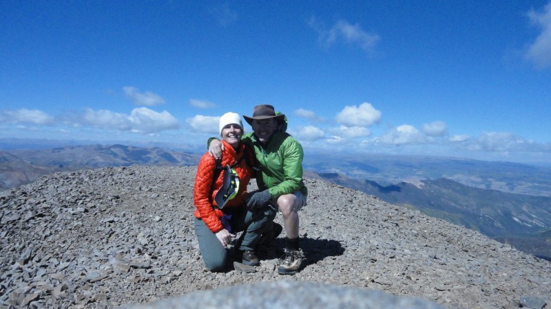 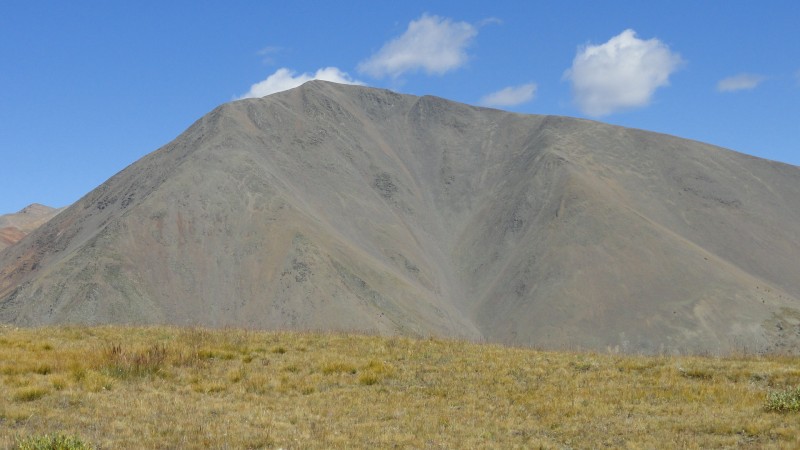 Thumbnails for uploaded photos (click to open slideshow):  Pikes from Devil's Playground")
 Yale summit with Harvard/Columbia in background")
 Huron Peak from Yale")
 Friendly goat on Columbia")
 Missouri Mtn from Belford trail split")
 Huron Peak from Missouri summit")
 Missouri summit")
 Group of goats on Antero")
 Two goats on the summit")
 Antero summit")
 Pike's Peak spectacle")
 Harvard summit")
 Huron summit with my buddies")
 Helluva butt slide Rachel!")
 Bierstadt summit")
 On the Sawtooth")
 Bierstadt from the Sawtooth")
 Niko taking a break in the Red Gully")
 Crestone Peak summit in the fog")
 Niko on Broken Hand Pass")
 Albert at top of Red Gully")
 Challenger summit with Kit Carson and the Crestones in background")
 Riley taking a break on The Avenue")
 Kit Carson summit")
 Andrea on the North Ridge of Ellingwood")
 Ellingwood summit with the whole group and Little Bear in the background")
 Bull moose (another moose to the right)")
 On top of the world with my girl")
 What we couldn't see on the way up")
 Clara wondering about the weather")
|
| Comments or Questions | |||
|---|---|---|---|
|
Caution: The information contained in this report may not be accurate and should not be the only resource used in preparation for your climb. Failure to have the necessary experience, physical conditioning, supplies or equipment can result in injury or death. 14ers.com and the author(s) of this report provide no warranties, either express or implied, that the information provided is accurate or reliable. By using the information provided, you agree to indemnify and hold harmless 14ers.com and the report author(s) with respect to any claims and demands against them, including any attorney fees and expenses. Please read the 14ers.com Safety and Disclaimer pages for more information.
Please respect private property: 14ers.com supports the rights of private landowners to determine how and by whom their land will be used. In Colorado, it is your responsibility to determine if land is private and to obtain the appropriate permission before entering the property.


