| Report Type | Full |
| Peak(s) |
North Maroon Peak - 14,022 feet |
| Date Posted | 07/13/2018 |
| Modified | 03/06/2019 |
| Date Climbed | 07/07/2018 |
| Author | JQDivide |
| Additional Members | FoodieHiker |
| The Better of the Bells |
|---|

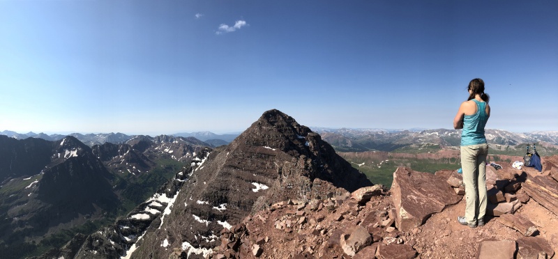
North Maroon Peak with Staci Q and Nicco H It’s so much better than Maroon Peak. Better trail. Better route. Prettier mountain. No 2,800-foot slopping slog. As my wife said, Maroon is the Evil Step Sister. 
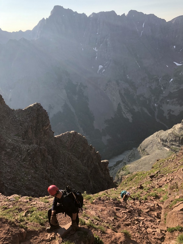
We had been watching the weather forecast all week. We actually canceled plans on Friday morning. But by noon on Friday we were trying to get the plans back in order. A less than stellar forecast quickly changed to a great weather day. We met Nicco and stopped for dinner in BV before heading over Indy Pass to find a place to sleep. The alarm went off at 3 a.m. and we were on the trail before 4 a.m. 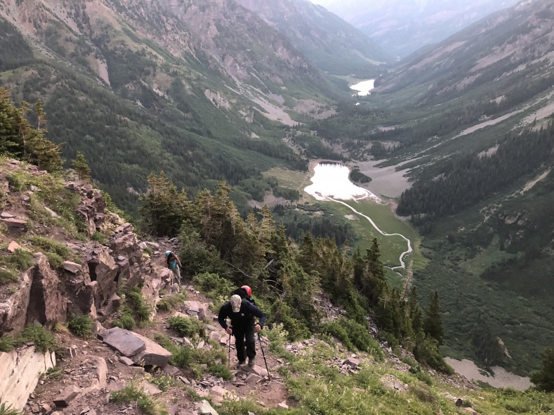
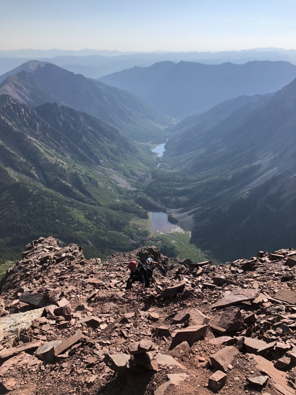
Having just done Maroon two weeks prior, we knew what to expect at the beginning. A bad rocky trail to Crater Lake. It was warm this morning. Very warm. The three of us were down to t-shirts before we reached the Pyramid turn-off. The trail up to Minnehaha Gulch was OK and easy to follow. The Split to hit the creek could easily be missed. But one key thing.. listen for the water. You’ll know you’re getting close. There is a cairn, but it’s not that large. We found a spot to cross that wasn’t great. There were no “complete” log bridges. Several partials with some rocks and low water made for some options. Once across the creek it’s a rocky trail up through a rocky slope. But CFI or someone did a lot of work to make the trail easy to follow. Several places where they placed rock steps. Once out of the rocks, it’s a short distance to the Rock Glacier in the route description. We stopped just this side of the glacier for snacks and quick break. The sky was getting light by now. The smoke from the Lake Christine Fire provided an orange haze on the horizon. We had little to no smoke in this valley. 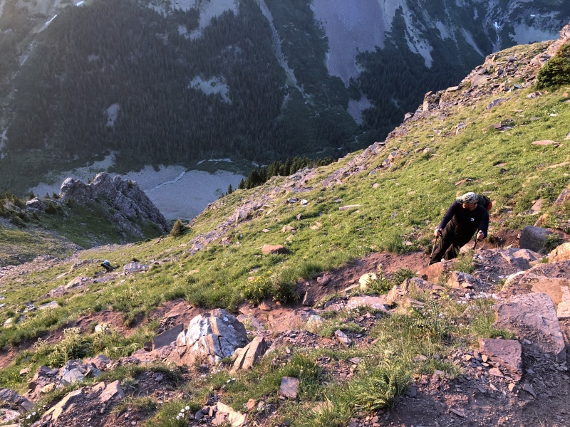
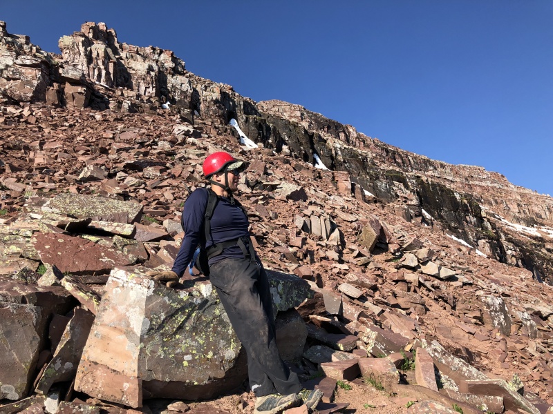
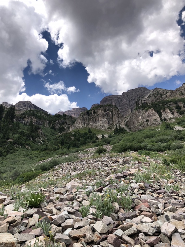
When crossing the rock glacier beware of wobbly rocks and spiders. Cairns do mark a route, but there is not much of a trail. After the glacier, the dirt trail works its way through some trees and shrubs with a few short switchbacks. This is when you realize just how steep this route is. Any fall or trip off the trail is going to hurt. Within minutes we reached the entrance to the first gully. This ‘gully’ isn’t what I expect in a gully. It was steep, but wasn’t all dirt and rock. There is a dirt/rock trail trough a grassy slope. We used trekking poles through this section. At times there was more than one path. Don’t take too long deciding; they all eventually meet back up. 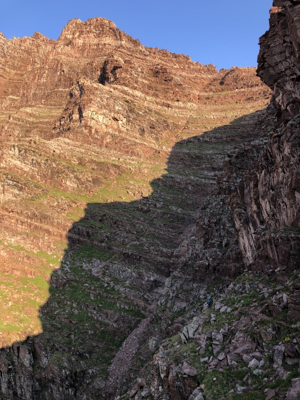
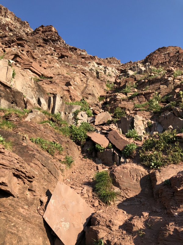
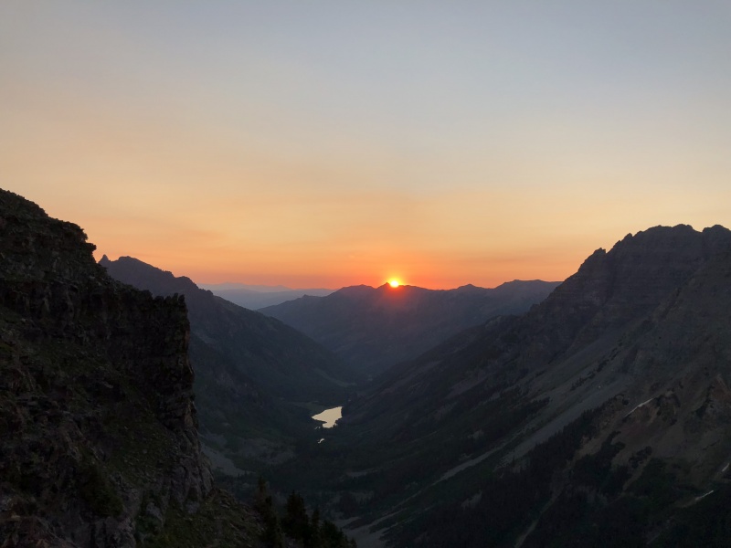
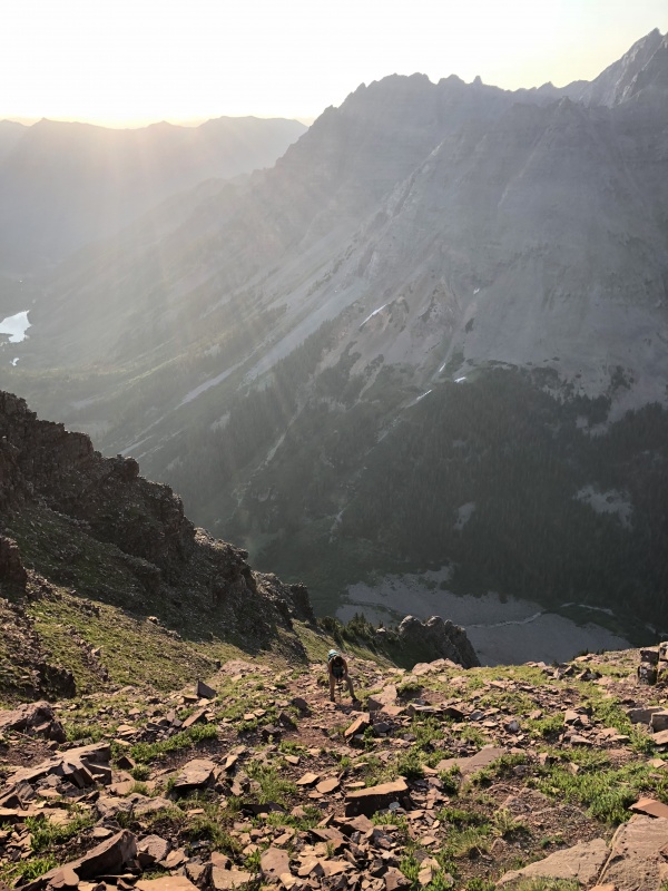
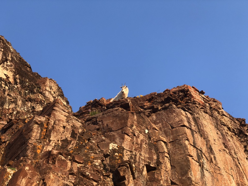
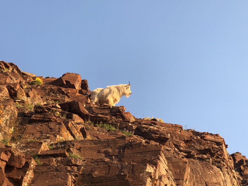
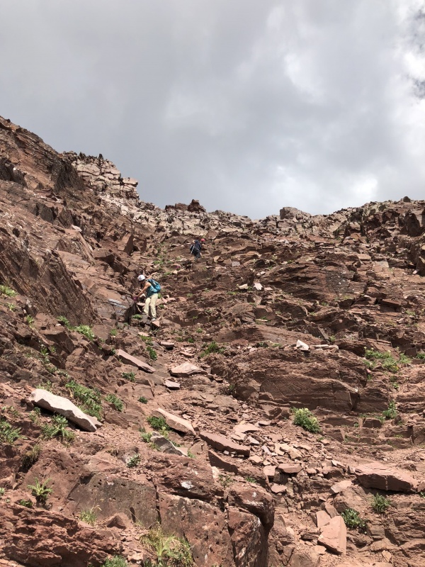
Though it had been light out, we stopped for a few photos of the sunrise. At the top of the gully we were met by a mountain goat. We named him, The GullyWatcher. He stayed between the two gullies most of the day. We rounded the corner and took a quick break. I put away one trekking pole. I was glad to have the single one a few times in the second gully. A couple passed us here, they were moving quicker than us. We gave them a few minutes to create space between us. This gully was steeper than the first, and I used my hands a lot for balance and some scrambling. About two-thirds of the way up, Nicco moved a loaf-of-bread-sized rock and it rolled and bounced down the gully until it shattered. Looking down the gully no one was below us. Well, expect for the mountain goat that now rested at the bottom entrance were we took our break. The loose dirt trail stays mostly on the left side of the gully. At times the trail is a braid of trails, but again, they all lead up. Some spots were looser than others. Some spots had solid rock… but what’s really solid in the Elks? Near 13,000, I think we found the trail that leads to the top of the first gully. I’ve read you can take the first gully all the way to its finish instead of entering the second gully at its bottom. 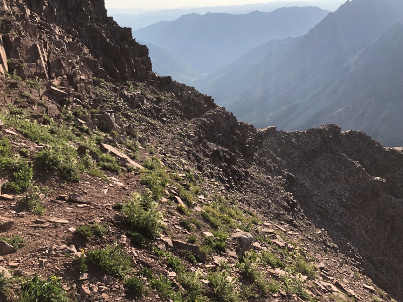
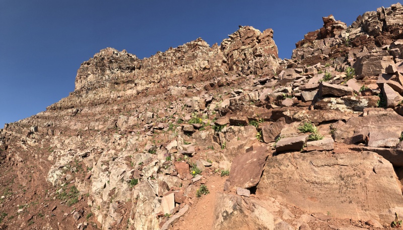

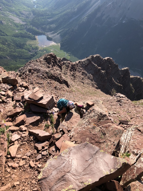

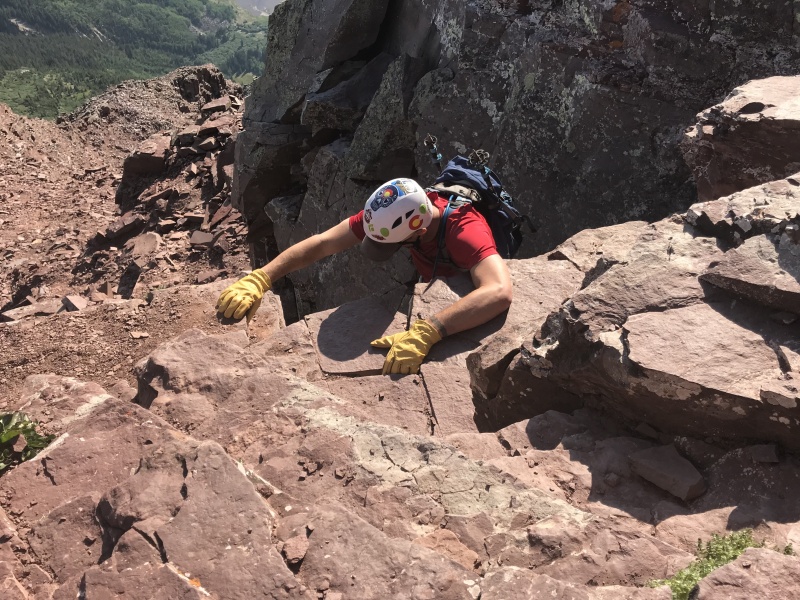
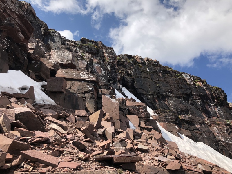
From here we were close to the “notch” The route finding begins here. There were cairns in good places. And some in other places that weren’t so good. I think we went too far left instead of going up and left. We backtracked just a bit and found some fun Class 3 scrambling and climbing to work our way up to the ridge. There was a tricky spot or two, but that just made it more fun. Once on the ridge, the area opens up a bit and the rock band comes into view. A few cairns led to the chimney. There was a pile of snow and ice at the base that didn’t cause issues except for wet soles on our shoes. My GAIA coordinates for the chimney were 39.07710, -106.98510. (accuracy is not a given) Staci went first, I followed, and Nicco closed it out. I think you can split the chimney into three moves.
We all climbed out in about 15 minutes. 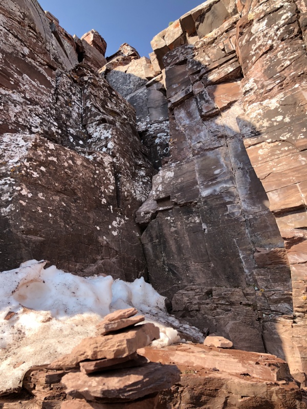

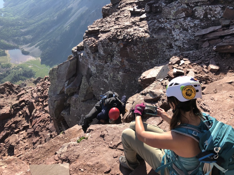
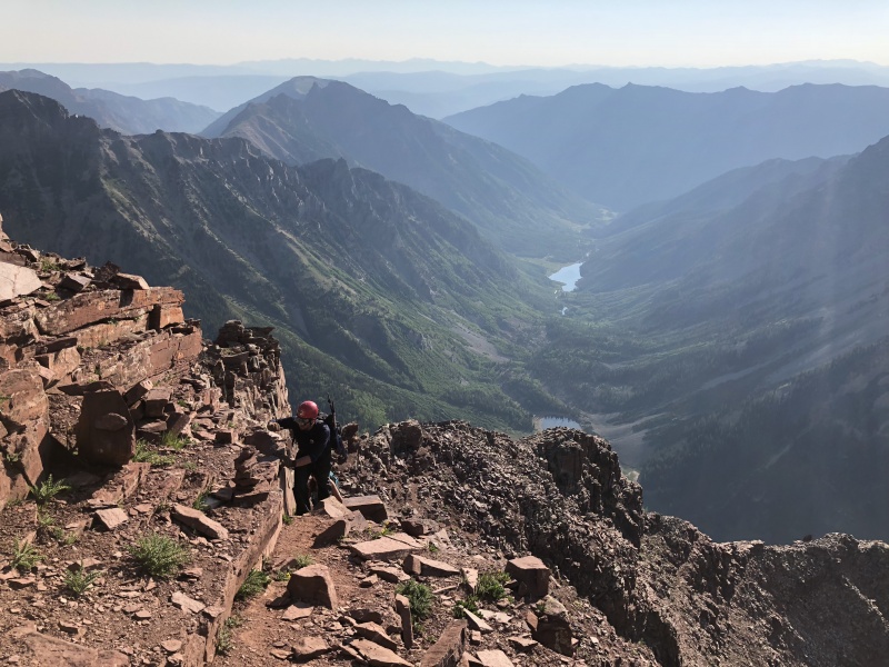
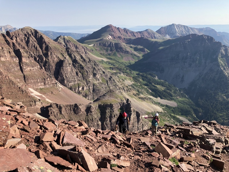
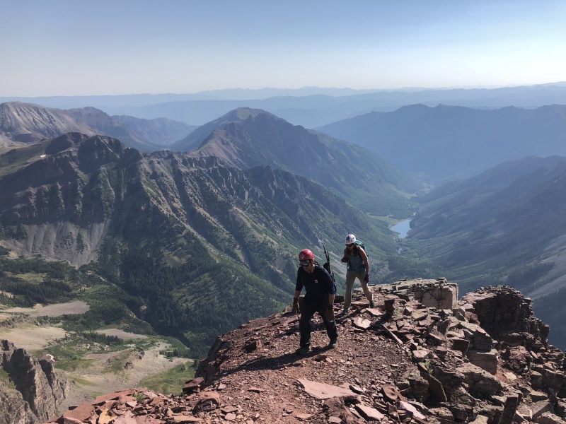
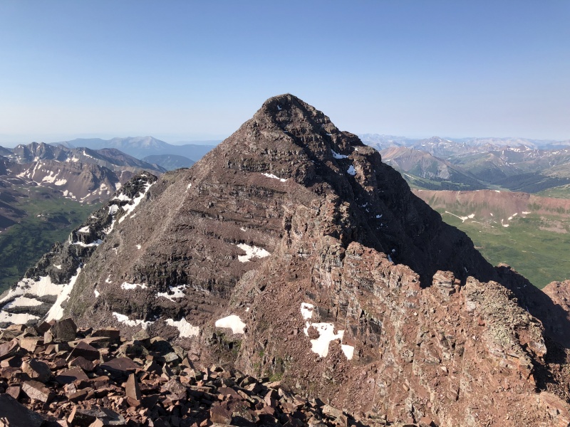
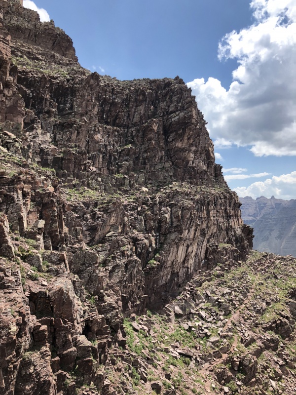
We walked the top of the rock band and followed cairns up. There was a hint of trail too. Some scrambling and some easier terrain. We did climb one short section that gave us a bit of pause on the way up. Just an awkward move, but the cairn was right there. The way down it was very easy. About 50 minutes after the chimney we were on the summit. Absolutely gorgeous weather! We took in the views and watched a few folks on the traverse. We looked at the evil step sister and were very happy about today’s peak. We spent 30 minutes on top... then the group arrived. Six people hit the summit, none with helmets and two without shoes (yep, barefoot). Two of them were playing music on speakers. It was the first peak for at least one of them. In these situations, I do get judgmental, for the sake of my own safety. If you’re not wearing a helmet on a route like this you either don’t understand the risks, or you just don’t care. Either way, that seems bad for other hikers. So we moved down quickly to be out of their range, in case they knocked rocks down. We followed our path back down to the rock band. We decided as a group to go down the Class 3 option. It was fairly easy to find. From above we could see a faint trail below the rock band leading to the bottom of it. (A trail I didn’t notice on the way up, but I wasn’t looking for it.) From above, there is a break in the rocky terrain with a loose dirt path that led to the top of it. When they “merged” the C3 section was there. 

The C3 is probably 50 to 60 yards to the right of the C4 section. Look for blackish rocks. The C3 section was a series short ledges or blocks. There were a few wet spots, but nothing too concerning. There were a couple of cairns near the base of the section. Took the three of us 10 minutes to route find and get down it. From here the descent was uneventful. We took our time on the down climbs and loose dirt paths. The temperature started to rise. We could feel the heat on the rocks in a few spots. Near the bottom of the “second” gully, before entering the first... the mountain goat was laying down just above the trail, the GullyWatcher. 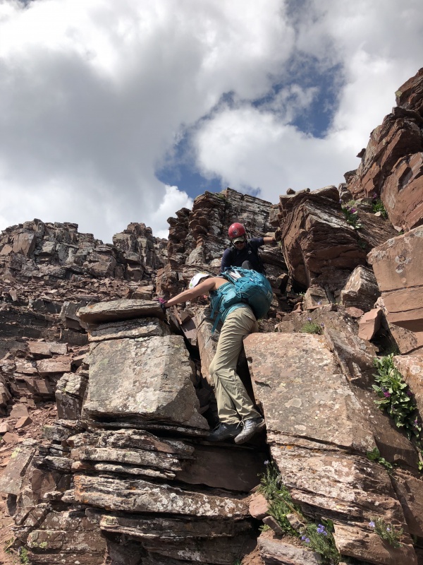


We took a break after the rock glacier and talked to few people that were coming down. All of them had something to say about the unhelmetted group they passed. One guy said he just missed some rock fall caused by some other guys in the second gully. We saw some goats in the trees above Crater Lake. We saw more than 50 people at Crater Lake. A trail steward said it was busy. We passed more people coming up and were down by 2:50 p.m. We had lost Nicco between the two lakes, as we tried to leap frog slow hikers. He said that was good for him. He wanted reflect on the day. It was an awesome day. We had some cold beers. I took a quick rinse off in the creek by the parking lot. We talked to several folks in the parking area then headed to Aspen to eat at Mi Chola, good Mexican food, not just regular Tex-Mex. Such a better day than Maroon Peak. I’d be happy to do this peak again. 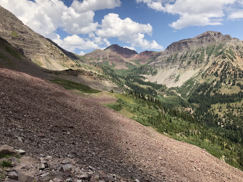

More on the Class 3 Route 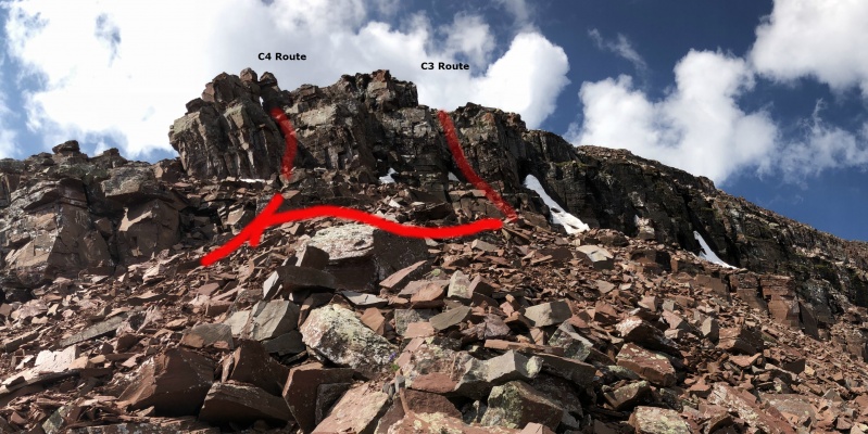

C3 Section: my GAIA coordinates were 39.07726, -106.98568, not sure how accurate this is, as I know some points were not matching up to the map. GAIA Info.... Started at 2:48 a.m. 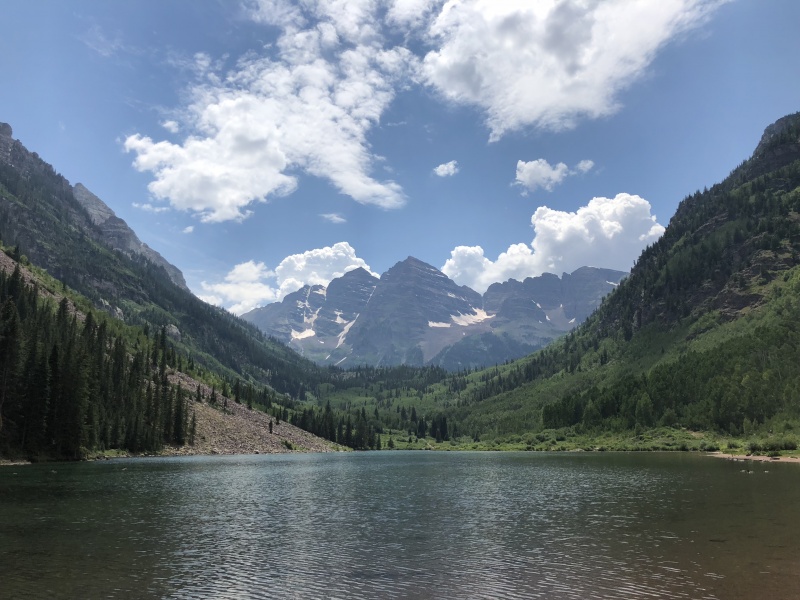
My other Elk TRs. Maroon: https://www.14ers.com/php14ers/tripreport.php?trip=18668 Pyramid: https://www.14ers.com/php14ers/tripreport.php?trip=18775 Capitol : https://www.14ers.com/php14ers/tripreport.php?trip=19129 Thumbnails for uploaded photos (click to open slideshow): ")
")
")
")
")
")
")
")
")
")
")
")
")
")
")
")
")
")
")
")
")
")
")
")
")
")
")
")
")
")
")
")
")
")
")
")
")
")
")
")
")
")
")
")
")
")
")
")
|
| Comments or Questions | ||||||||||||
|---|---|---|---|---|---|---|---|---|---|---|---|---|
|
Caution: The information contained in this report may not be accurate and should not be the only resource used in preparation for your climb. Failure to have the necessary experience, physical conditioning, supplies or equipment can result in injury or death. 14ers.com and the author(s) of this report provide no warranties, either express or implied, that the information provided is accurate or reliable. By using the information provided, you agree to indemnify and hold harmless 14ers.com and the report author(s) with respect to any claims and demands against them, including any attorney fees and expenses. Please read the 14ers.com Safety and Disclaimer pages for more information.
Please respect private property: 14ers.com supports the rights of private landowners to determine how and by whom their land will be used. In Colorado, it is your responsibility to determine if land is private and to obtain the appropriate permission before entering the property.


