



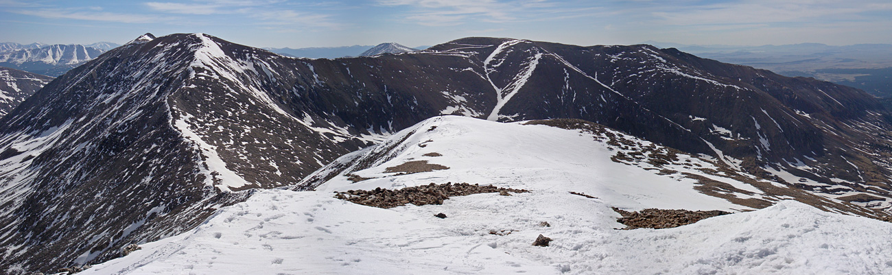


Combo: Decalibron Standard Route Difficulty: Class 2 Total Elevation Gain: 3,500' Round-trip Distance: 7.5 mi |
|
Mt. Democrat - East Slope Standard Route Difficulty: Class 2 Total Elevation Gain: 2,150' Round-trip Distance: 4 mi |
|
Mt. Lincoln - West Ridge Standard Route Difficulty: Class 2 Total Elevation Gain: 2,600' Round-trip Distance: 6 mi |
|
Mt. Bross - West Slopes Standard Route Difficulty: Class 2 Total Elevation Gain: 2,250' Round-trip Distance: 3.25 mi |
|
Mt. Cameron - West Ridge Standard Route Difficulty: Class 2 Total Elevation Gain: 2,250' Round-trip Distance: 4.75 mi |
|
Mt. Lincoln - East Slopes Difficulty: Class 2 Total Elevation Gain: 2,650' Round-trip Distance: 6.5 mi |
|
Mt. Lincoln - Lincoln Amphitheater Difficulty: Class 2 Total Elevation Gain: 3,400' Round-trip Distance: 4.75 mi |
|
Mt. Bross - East Slopes Difficulty: Class 1 Total Elevation Gain: 2,900' Round-trip Distance: 9 mi |
|
 |
Mt. Bross - S Gully Difficulty: Class 2 Easy Snow Total Elevation Gain: 3,250' Round-trip Distance: 9.5 mi |
| |
Mt. Bross - Dolly Varden Gully Difficulty: Class 2 Easy Snow Total Elevation Gain: 2,900' Round-trip Distance: 4 mi |
| |
Mt. Democrat - South Slope Difficulty: Difficult Class 2 Moderate Snow Total Elevation Gain: 2,150' Round-trip Distance: 2.5 mi |
Combo: Decalibron Standard Route Difficulty: Class 2 Total Elevation Gain: 3,500' Round-trip Distance: 7.5 mi |
|
Mt. Democrat - East Slope Standard Route Difficulty: Class 2 Total Elevation Gain: 2,150' Round-trip Distance: 4 mi |
|
Mt. Lincoln - West Ridge Standard Route Difficulty: Class 2 Total Elevation Gain: 2,600' Round-trip Distance: 6 mi |
|
Mt. Bross - West Slopes Standard Route Difficulty: Class 2 Total Elevation Gain: 2,250' Round-trip Distance: 3.25 mi |
|
Mt. Cameron - West Ridge Standard Route Difficulty: Class 2 Total Elevation Gain: 2,250' Round-trip Distance: 4.75 mi |
|
Mt. Lincoln - East Slopes Difficulty: Class 2 Total Elevation Gain: 2,650' Round-trip Distance: 6.5 mi |
|
Mt. Lincoln - Lincoln Amphitheater Difficulty: Class 2 Total Elevation Gain: 3,400' Round-trip Distance: 4.75 mi |
|
Mt. Bross - East Slopes Difficulty: Class 1 Total Elevation Gain: 2,900' Round-trip Distance: 9 mi |
|
| |
Mt. Bross - S Gully Difficulty: Class 2 Easy Snow Total Elevation Gain: 3,250' Round-trip Distance: 9.5 mi |
| |
Mt. Bross - Dolly Varden Gully Difficulty: Class 2 Easy Snow Total Elevation Gain: 2,900' Round-trip Distance: 4 mi |
| |
Mt. Democrat - South Slope Difficulty: Difficult Class 2 Moderate Snow Total Elevation Gain: 2,150' Round-trip Distance: 2.5 mi |

| 8 Recent Reports | |
|---|---|
Hoosier Pass to DeCaLiBron   By: hobbes7714 Peak(s): Mt. Democrat, Mt. Cameron, Mt. Lincoln, Mt. Bross, North Star Mountain, Clinton Peak, Wheeler Mountain, McNamee Peak, Traver Peak Added: 10/11/2026 |
|
| Decalibron - Standard Backwards By: toddfromlegal Added: 10/7/2026 |
|
| Decalibron - Labor Day Weekend By: knova Added: 9/7/2026 |
|
| Decalibron Loop By: cosmit Added: 9/3/2026 |
|
| Kona The Mountain Dog By: sfreytag Peak(s): Grays Peak, Torreys Peak, Kelso Mountain, Wildhorse Peak, Missouri Mountain, Uncompahgre Peak, Redcloud Peak, Mt. of the Holy Cross, Mt. Princeton, Mt. Columbia, Mt. Oxford, Mt. Massive, Mt. Cameron, Mt. Democrat, Mt. Yale Added: 1/8/2026 |
|
| Buckskin to Democrats Southeast ridge By: CaptainSuburbia Added: 9/11/2025 |
|
| Return for the Kite Lake 14ers By: overthe59hill Added: 7/25/2025 |
|
| DeCaLiBron in July By: skippyville Added: 7/8/2025 |

 Mount Lincoln
 Mount Democrat
 Mount Bross


