Log In 
Difficulty
 Class 2 
Risk Factors
ExposureModerate
RockfallModerate
Route-FindingLow
CommitmentLow
TrailheadKite Lake 12,000 feet
Summit14,293 feet
Elevation Gain2,600 ft
Length Round-TripRT6 mi
Peak Conditions188 reports
Downloadsgpx GPX  kml KML
Photo
Show More
Route Last Updated: Jul 2026

Trailhead

Take Colorado 9 to Alma. In the middle of town and on the west side of the road, look for a small sign for the road to Kite Lake. It's across the road from the "Caniglia Real Estate" building. Turn here and drive a bit through a residential area. Continue 6 miles to Kite Lake. The last mile of this road can be a bit more rough, but a good-clearance 2WD should still be able to make it to within a couple hundred yards of the TH lot, when the road is dry. There are restrooms and some camping spots at the trailhead and an $8 fee is required.

Route Description

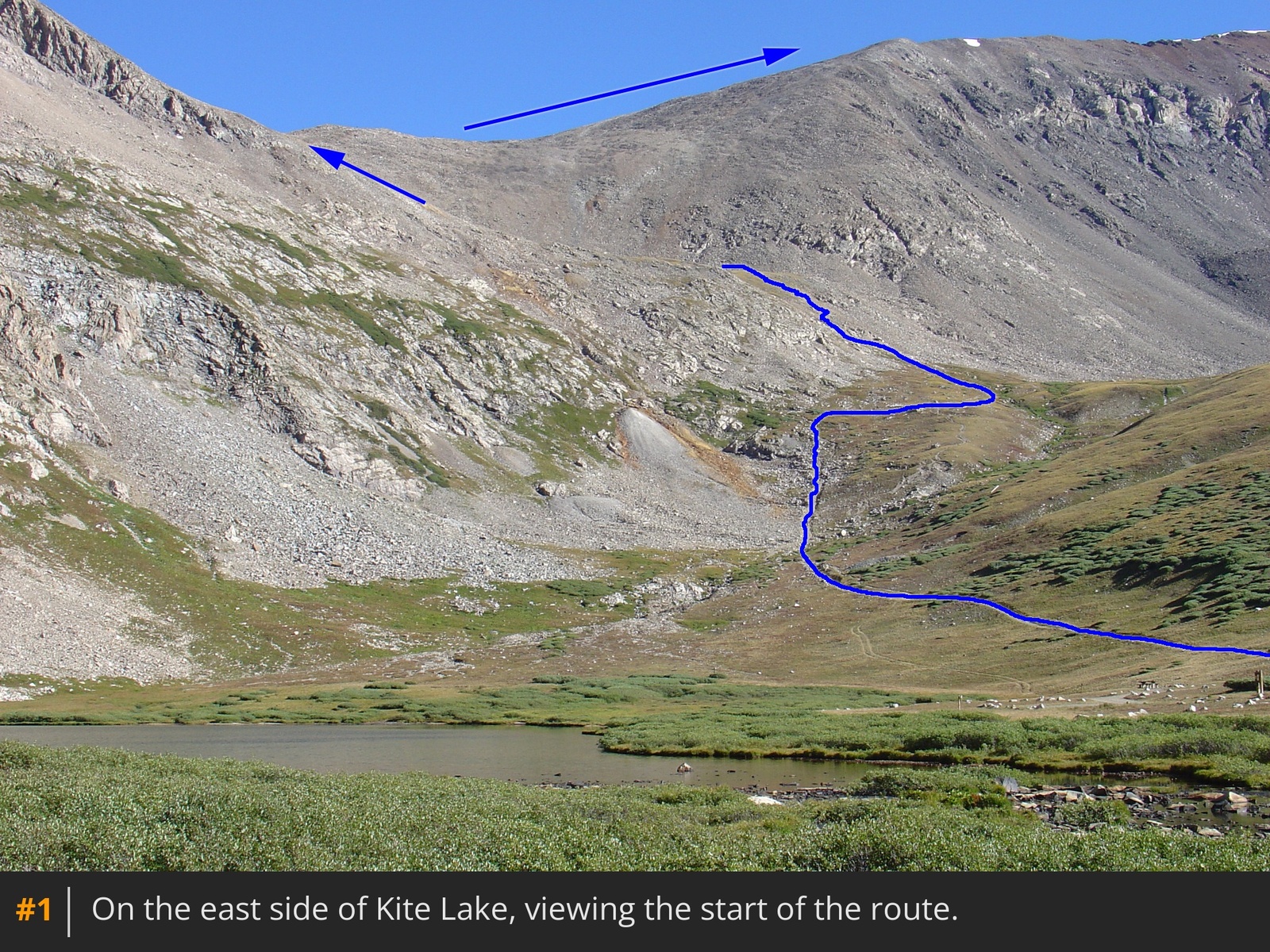
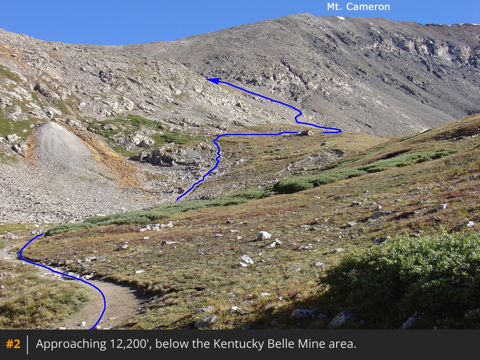
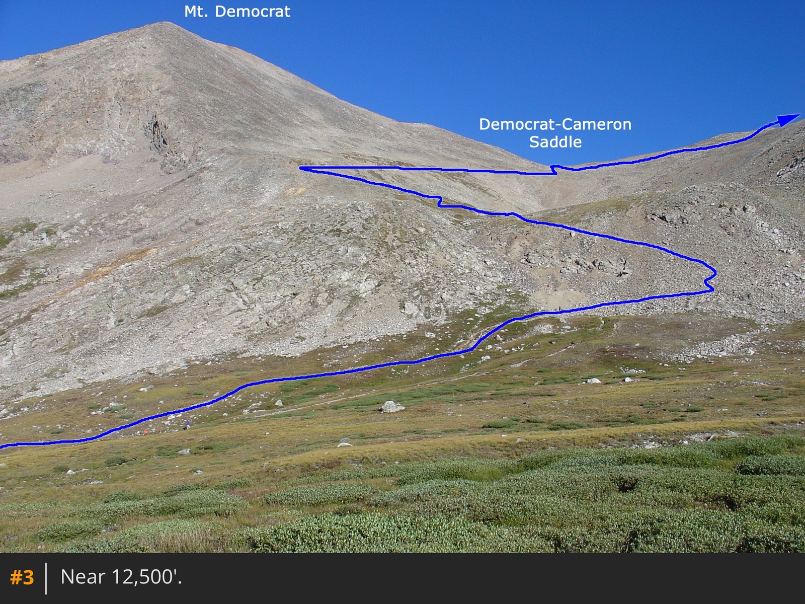
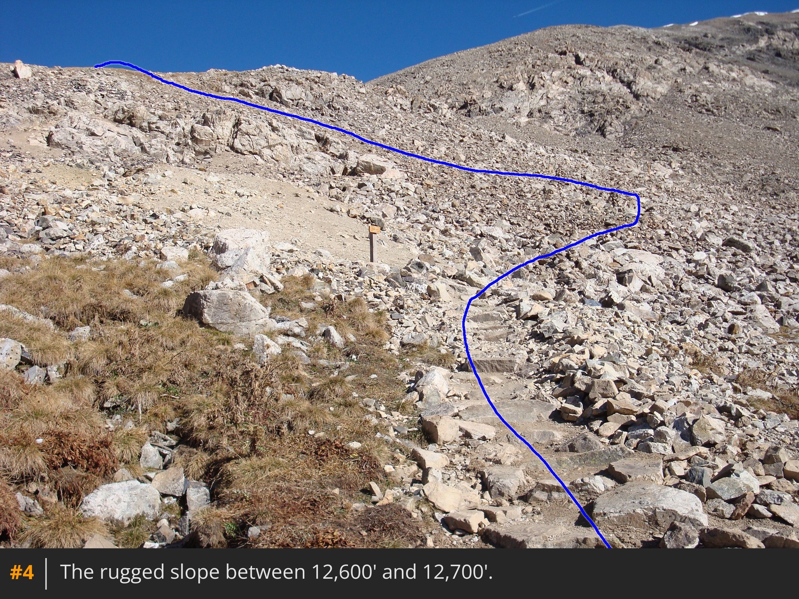
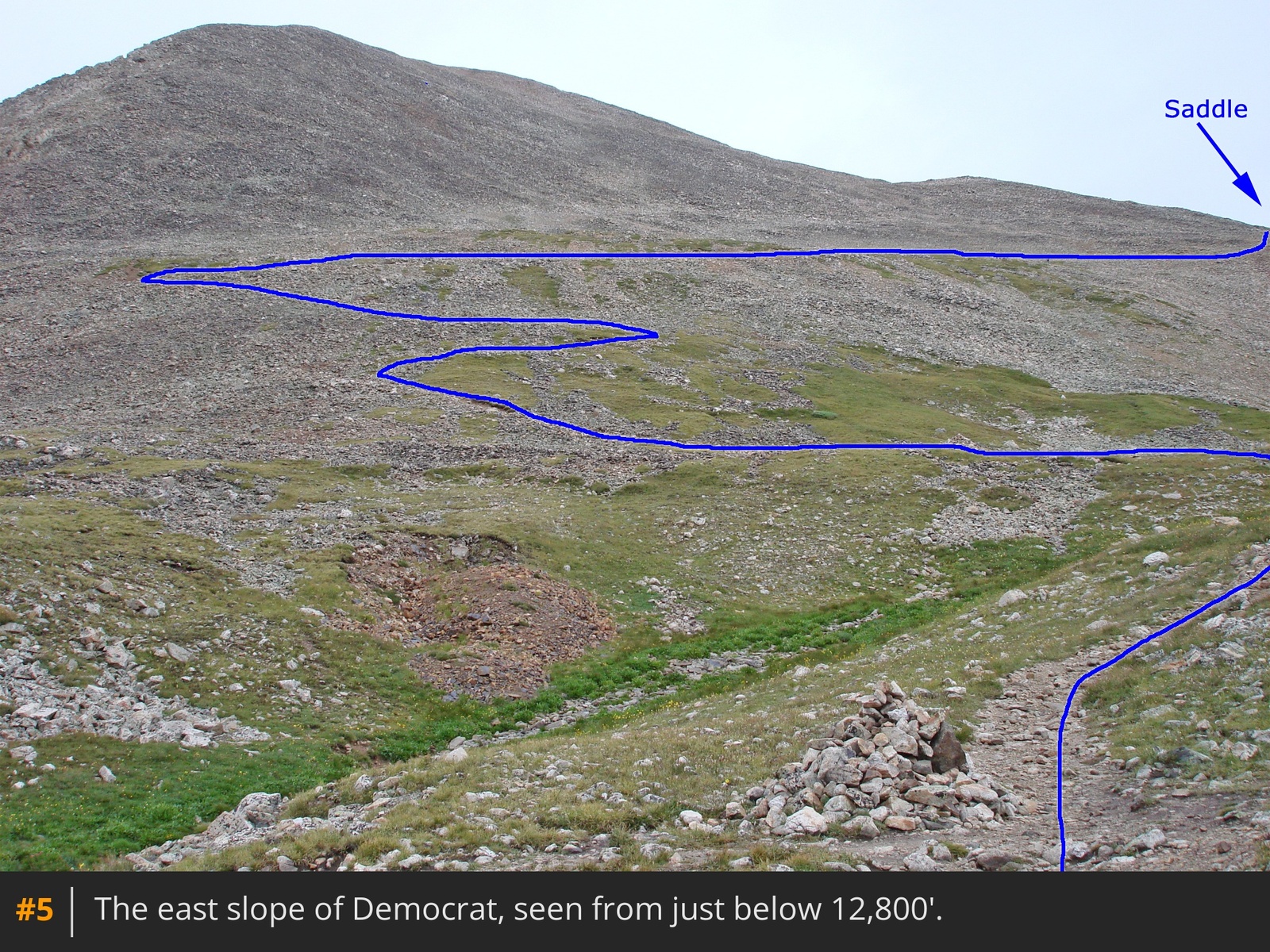
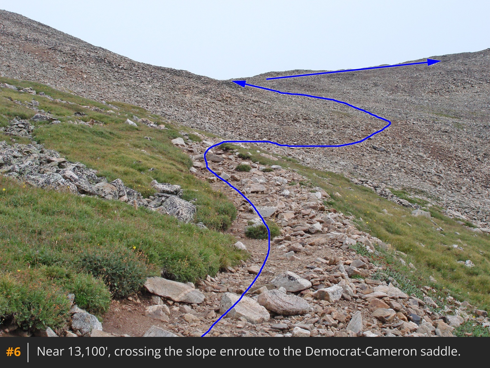
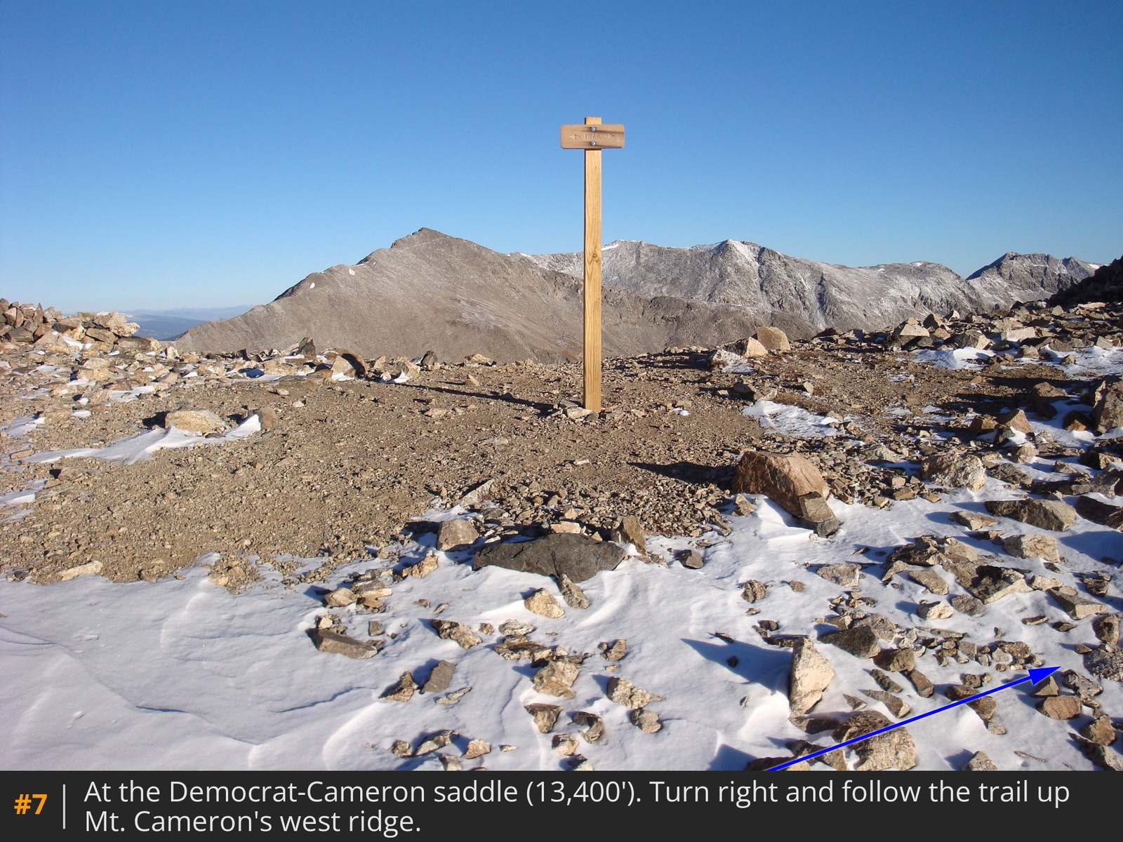
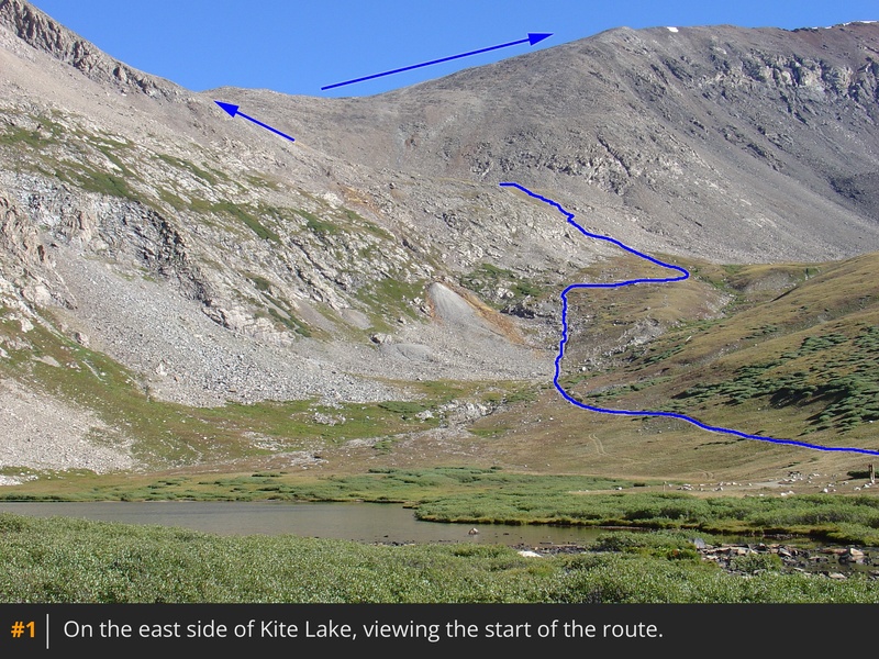
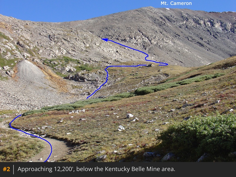
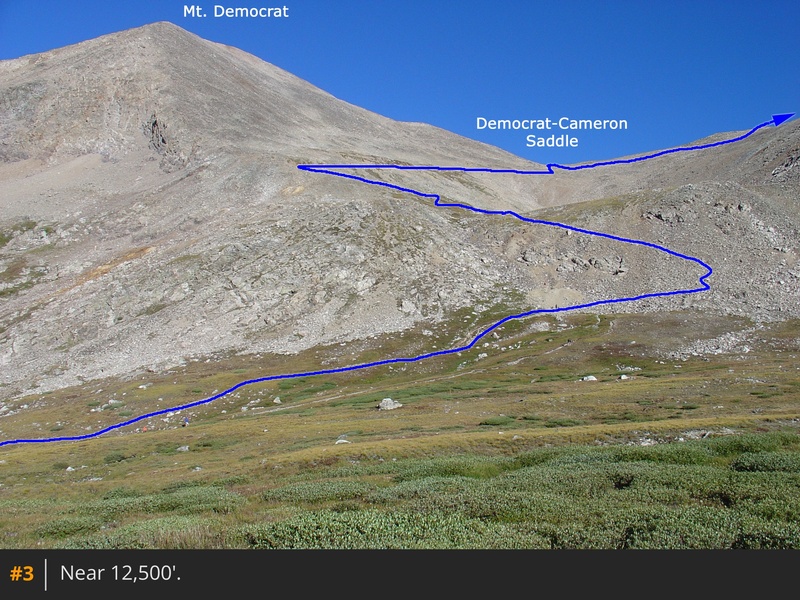
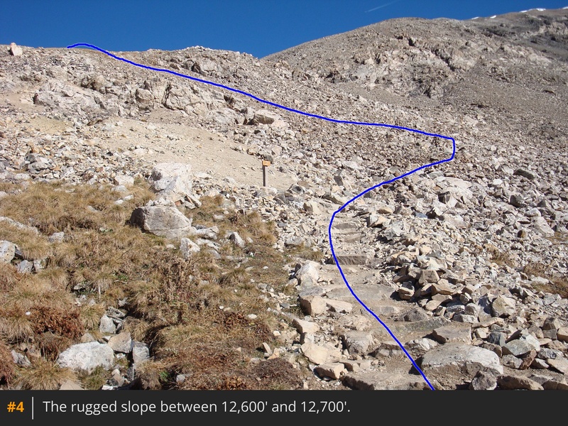
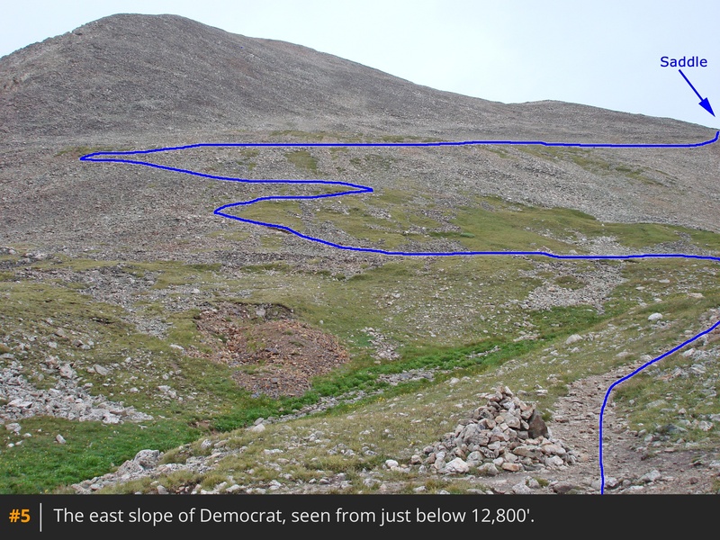
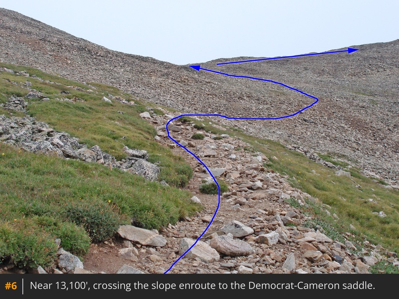
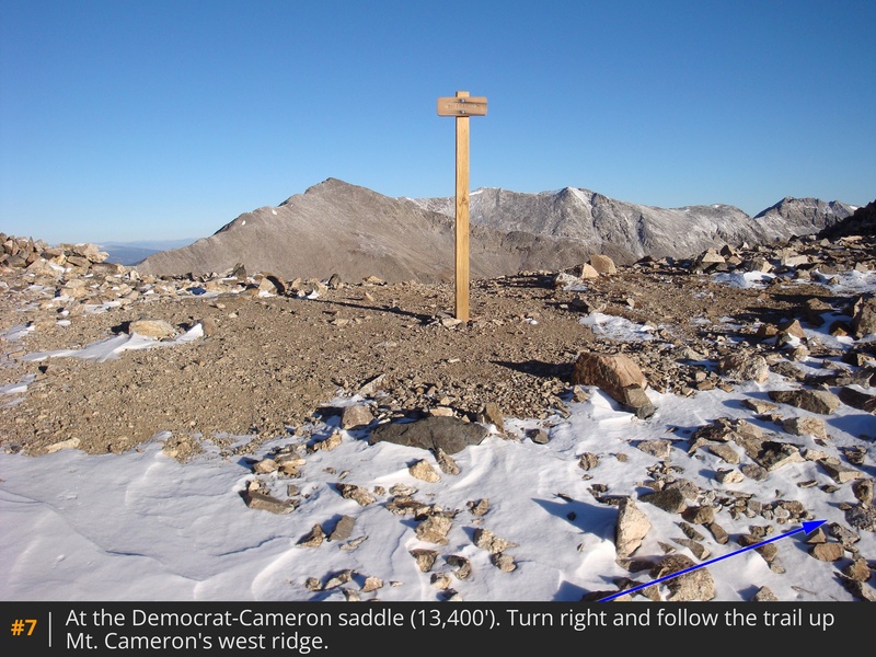
From the parking area, follow the blocked road past the lake. After the lake, begin the ascent out of the basin  1  2. Near 12,200', pass a collapsed mine shack. At 12,600'  3, follow the trail up a rugged slope  4 to reach the base of Mt. Democrat's east slope  5. Near 12,800', the trail swings left (south) briefly before turning right and heading north across the east slope to reach the Democrat-Cameron saddle  6  7.

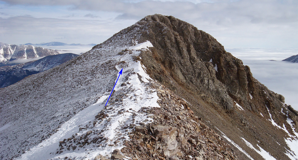
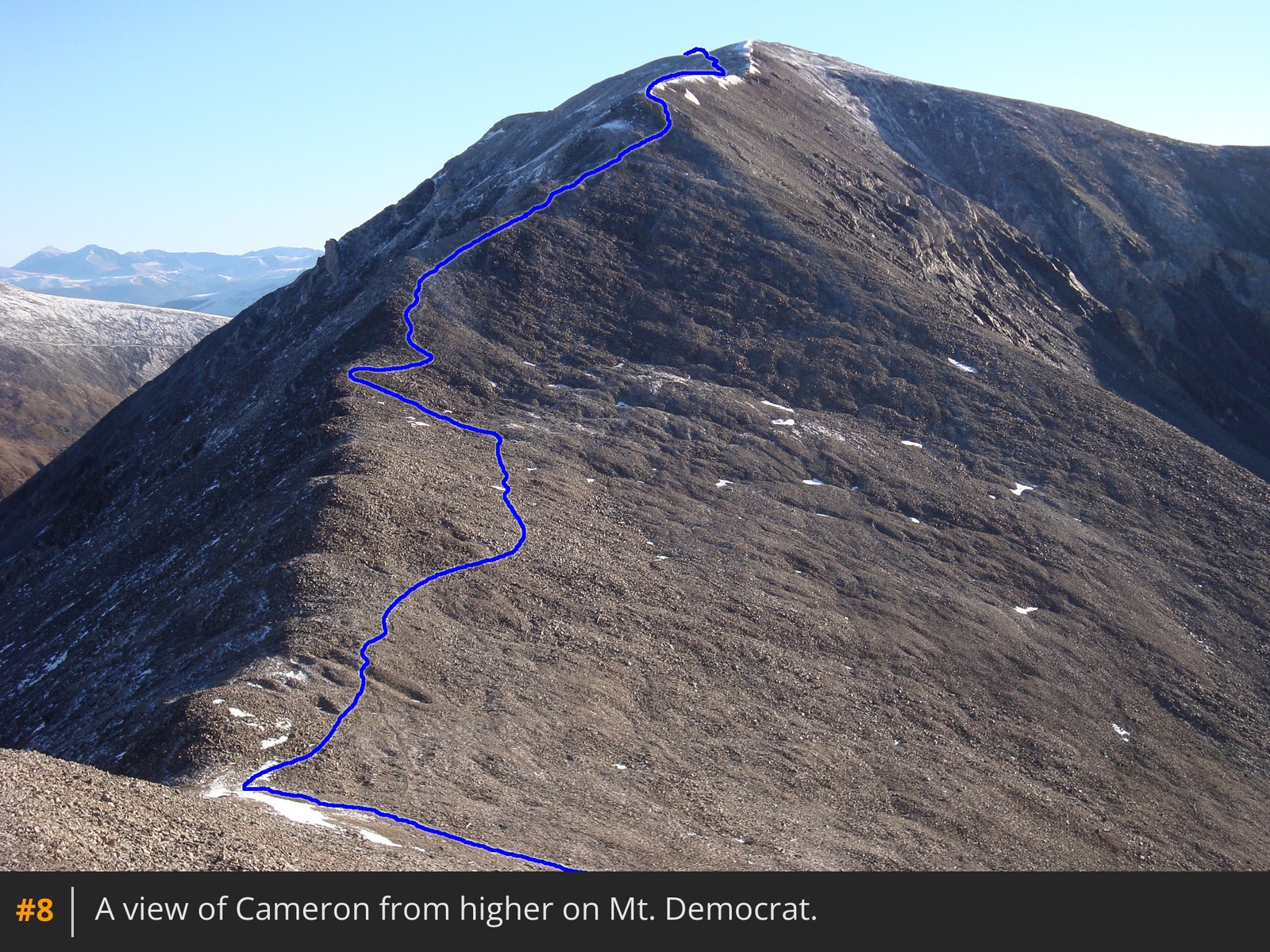
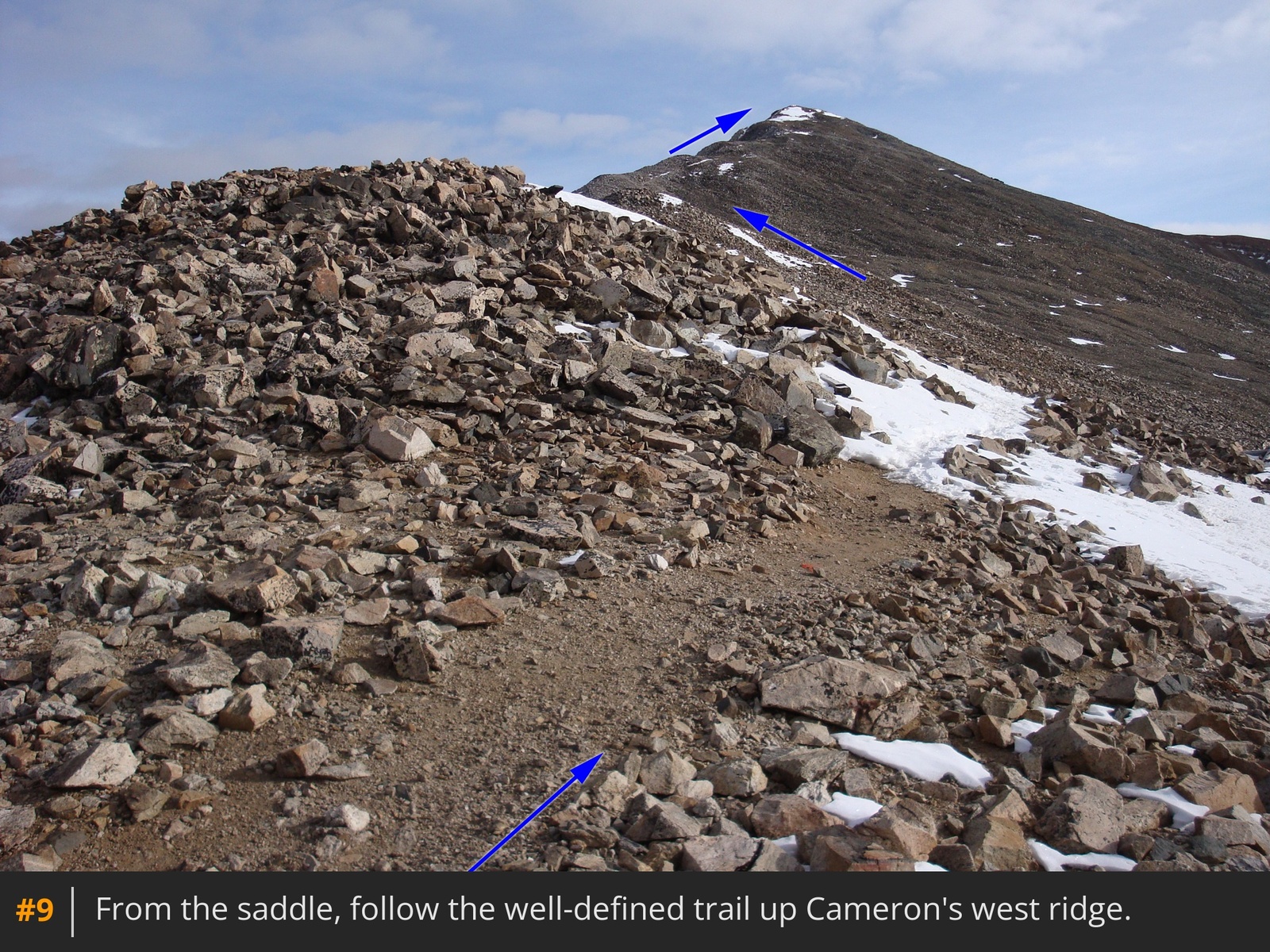
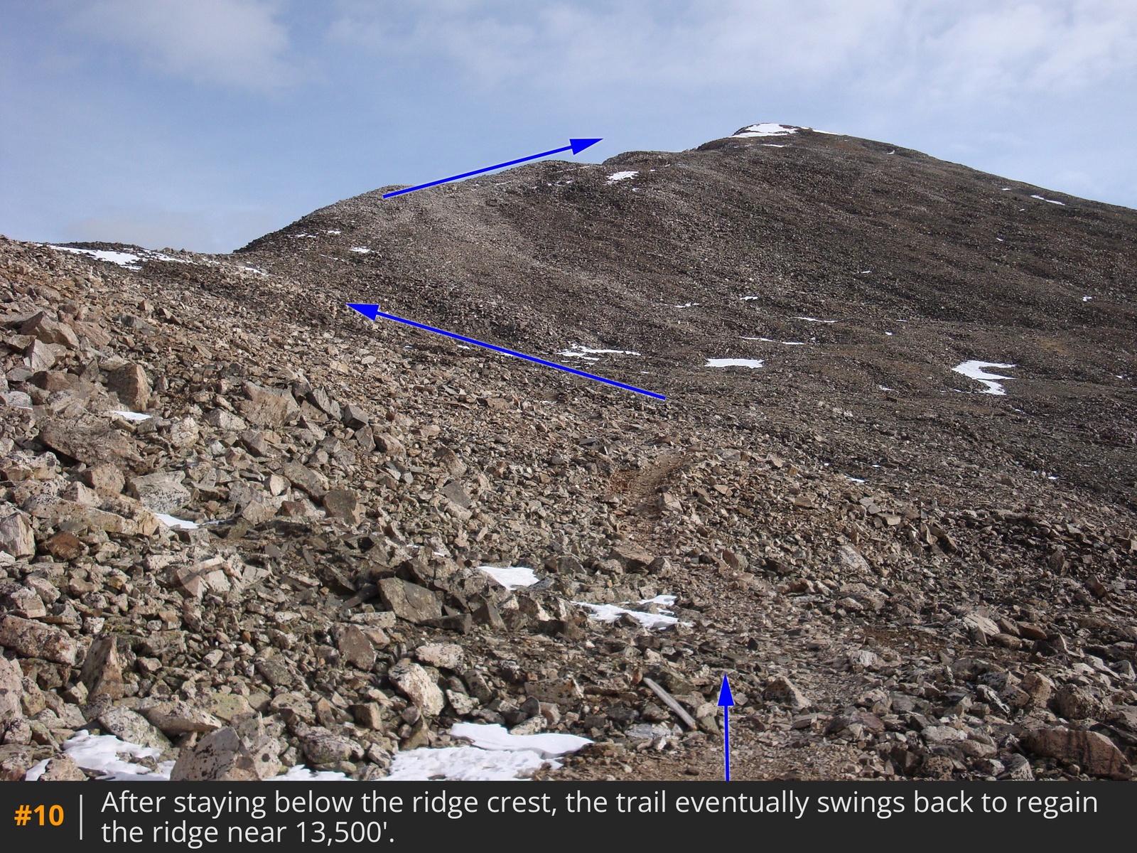
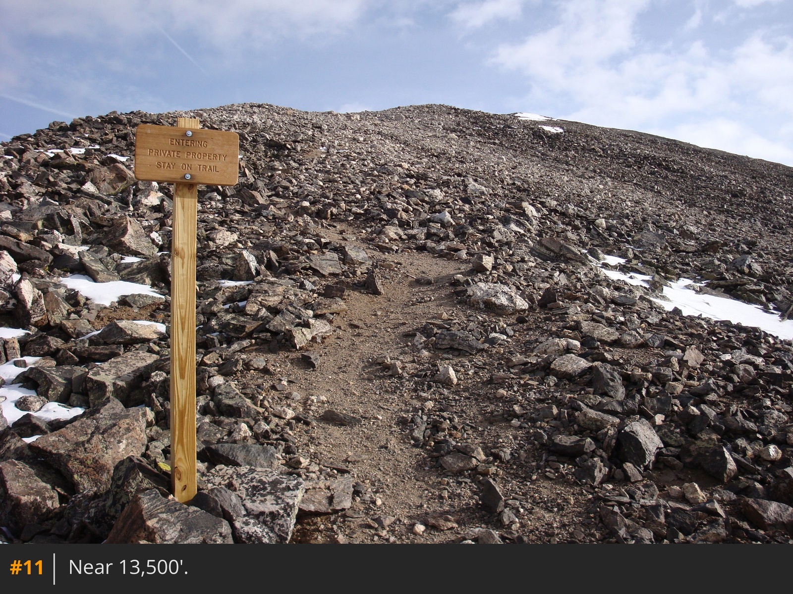
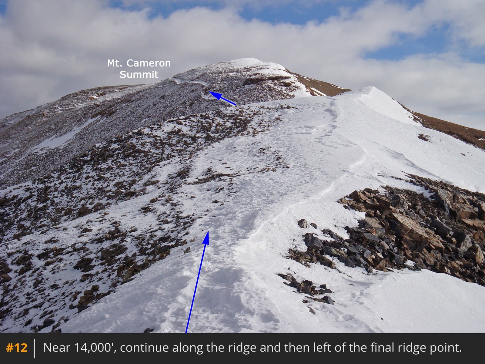
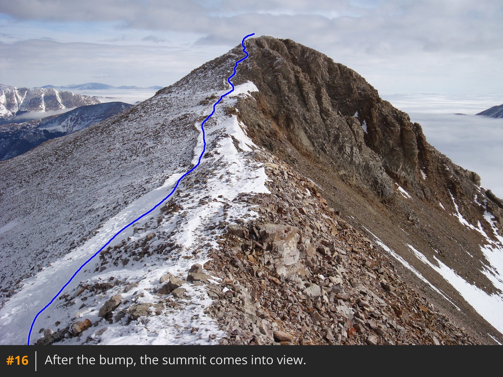
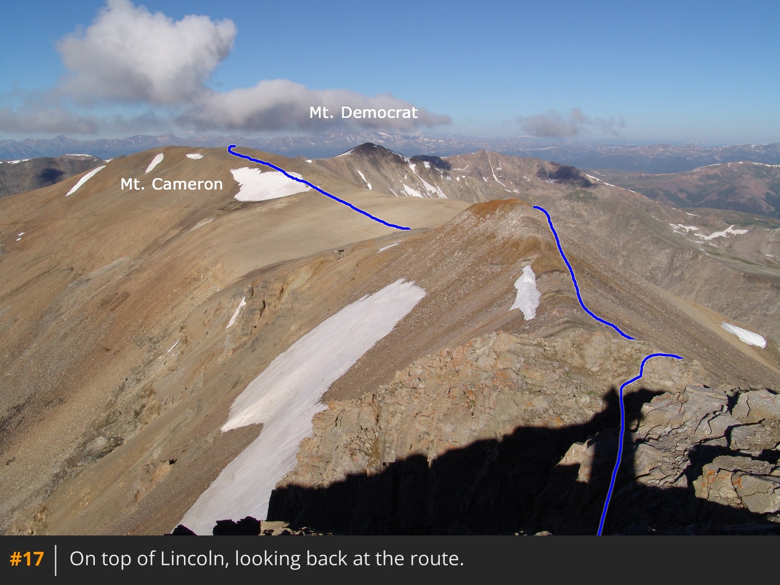
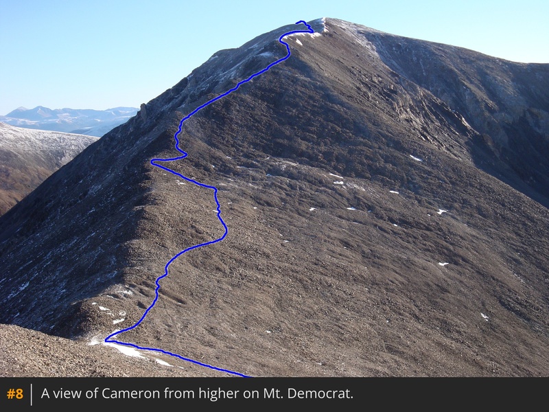
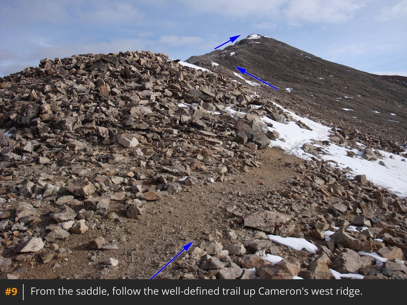
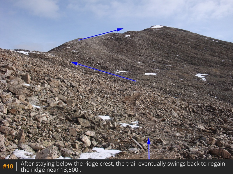
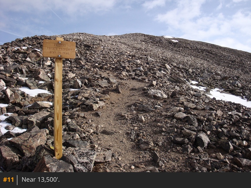
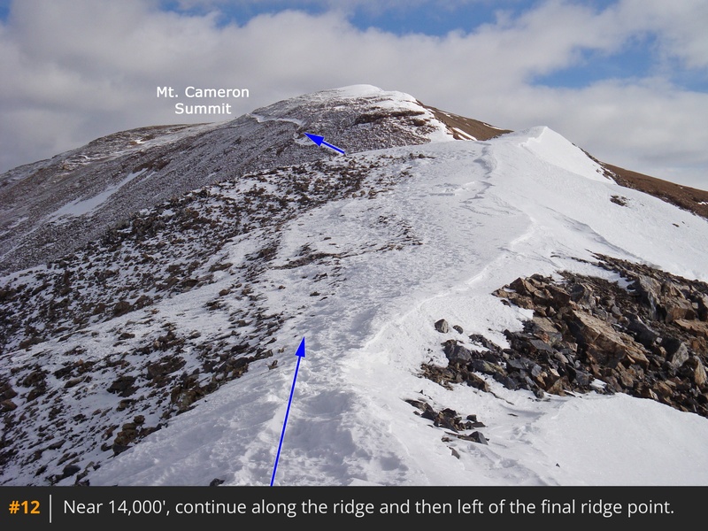
From the saddle, turn right and follow the trail along the right side of Mt. Cameron's west ridge  8  9. After some hiking below the ridge crest, the trail swings left to regain the ridge near 13,500'  10  11. Continue along the ridge to 14,000', where the steepness eases, and you can see the remaining hike to Cameron's summit  12. Pass a bump on the left side and walk up to the top of Cameron .

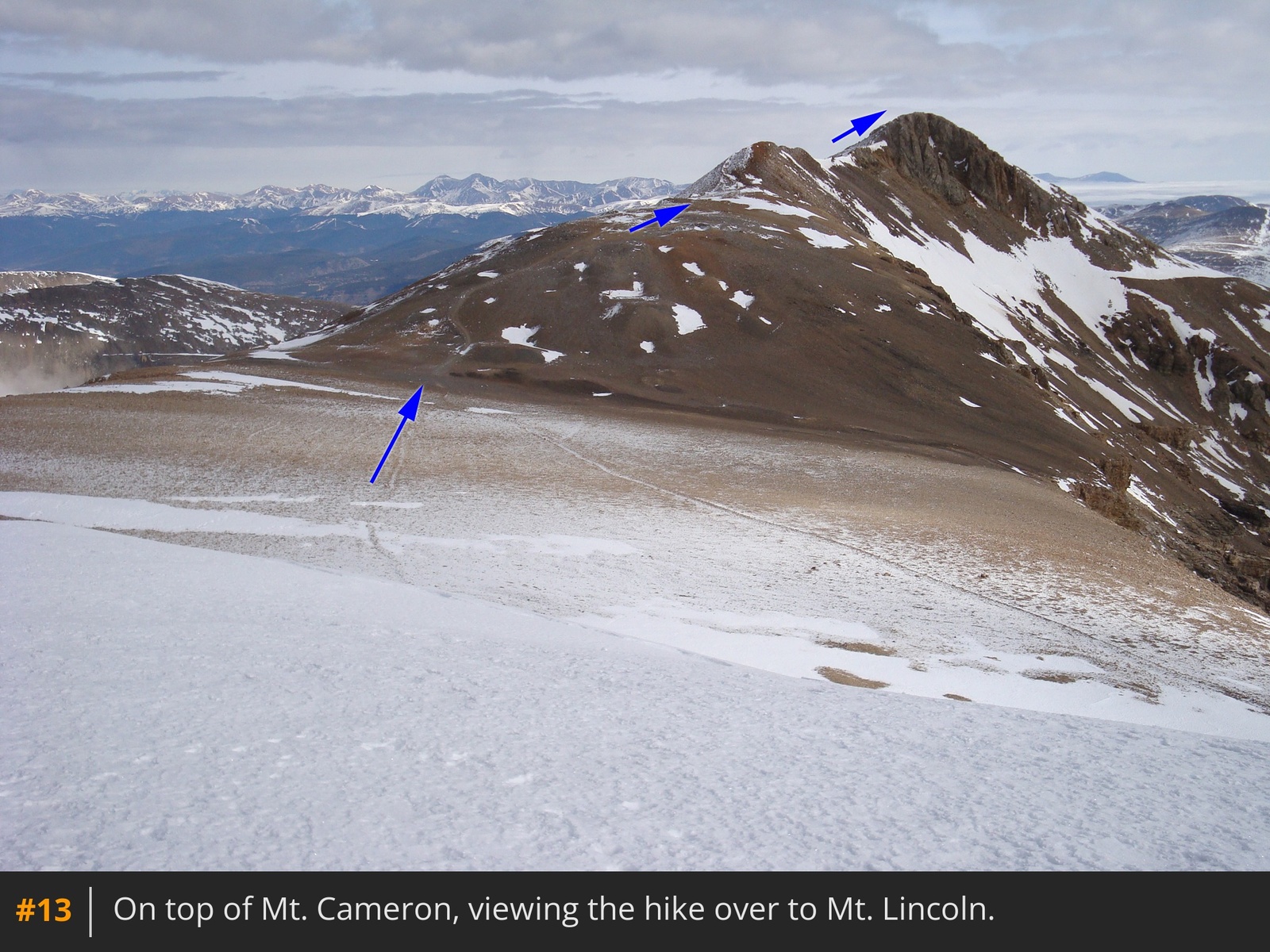
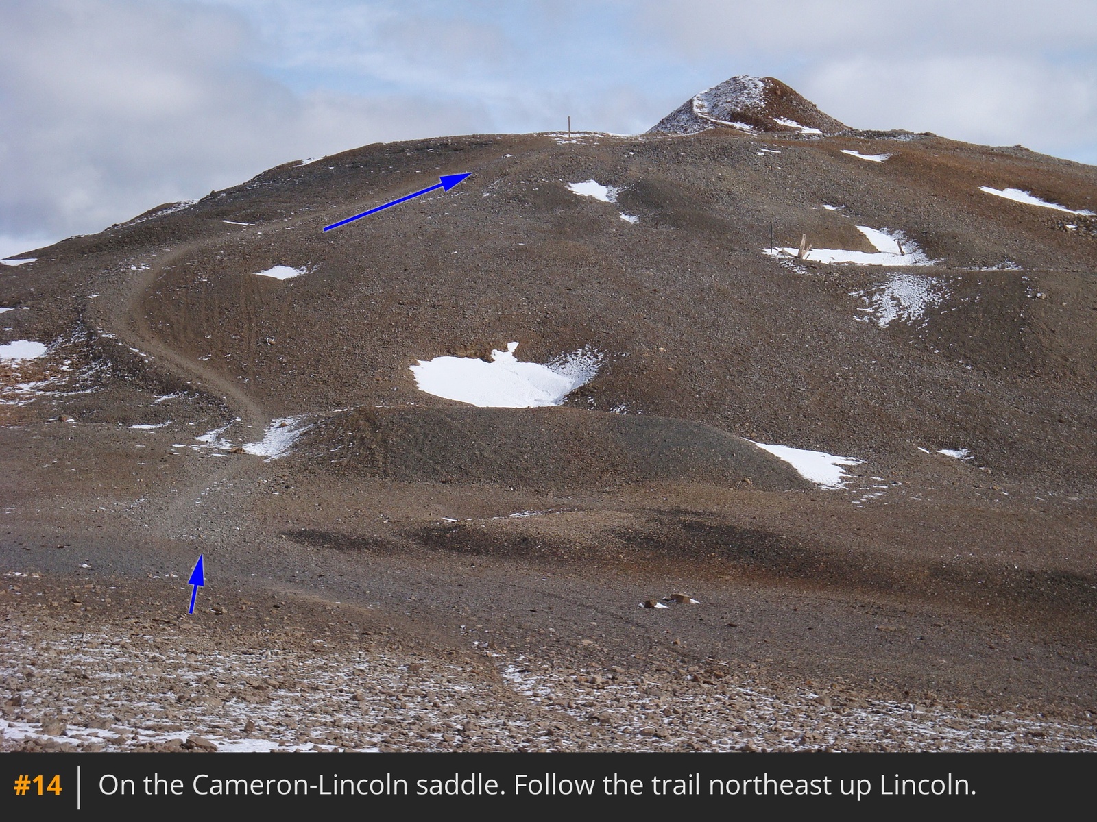
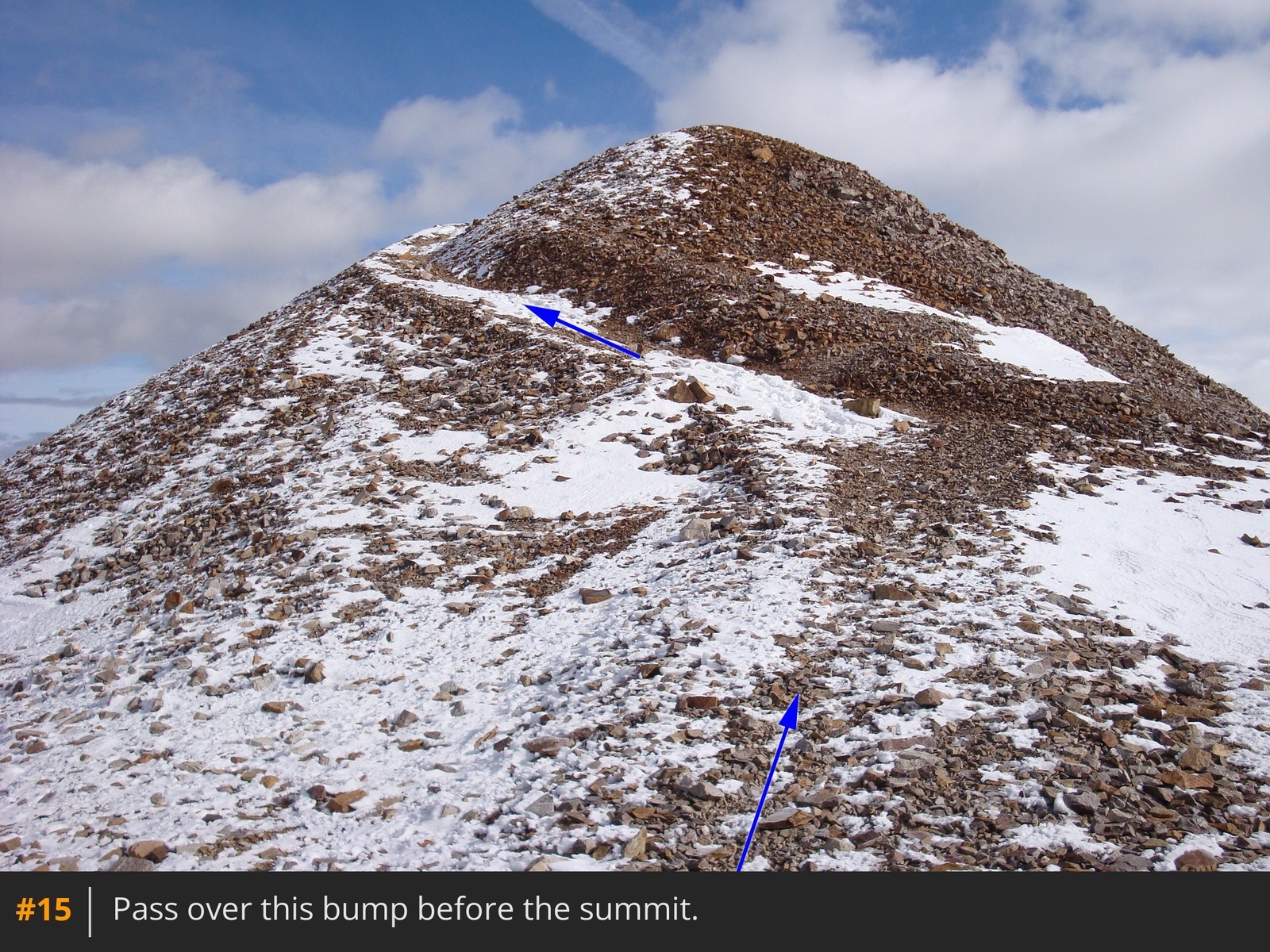
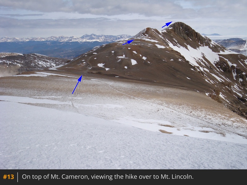
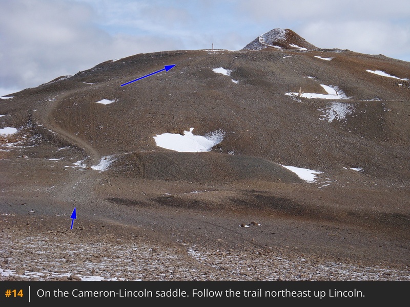
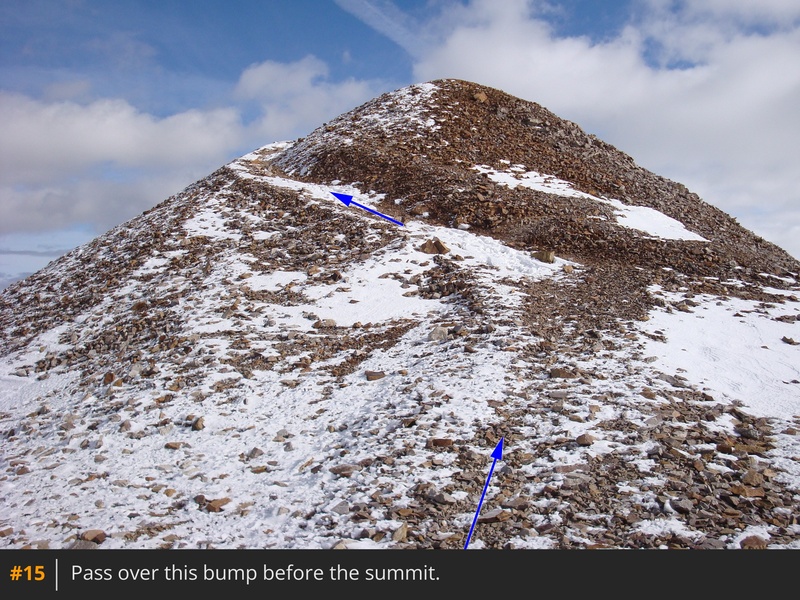
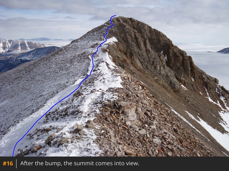
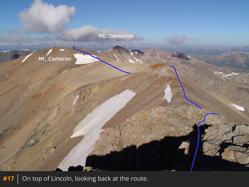
 13 shows the next leg of the hike over to Mt. Lincoln. Leave Cameron and descend northeast to the Cameron-Lincoln saddle  14. Follow the trail past a bump  15 to see Lincoln's summit  16. Walk over to the final, Class 2 pitch and gain the summit  17.

Maps

JPG Image
Static Map JPG

Interactive Map & 3D Flythrough
Human Verification Required

Photos

#1#2#3#4#5#6#7#8#9#10#11#12#13#14#15#16#17

Weather

Caution: The information contained in this route may not be accurate and should not be the only resource used in preparation for your climb. Failure to have the necessary experience, physical conditioning, supplies or equipment can result in injury or death. 14ers.com and the author(s) of this route provide no warranties, either express or implied, that the information provided is accurate or reliable. By using the information provided, you agree to indemnify and hold harmless 14ers.com and the route author(s) with respect to any claims and demands against them, including any attorney fees and expenses. Please read the 14ers.com Safety and Disclaimer pages for more information.

Please respect private property: 14ers.com supports the rights of private landowners to determine how and by whom their land will be used. In Colorado, it is your responsibility to determine if land is private and to obtain the appropriate permission before entering the property.
Heading to a 14er soon? Don't forget the 14ers.com mobile app.
Google Play     Apple App Store