Locate the marked Lenawee trail and start northwest up into the forest -
1. Lenawee is a well-maintained trail and used by mountain bikers who ride it from the top of the A-Basin ski area. Pass through an avalanche path (
2) and continue to 11,500' where you'll get a nice view into Thurman Gulch -
3. Continue on the excellent trail and exit the forest, near 11,800' -
4. With Lenawee Mountain's south ridge in view, follow the trail south and then north above tree line -
5 and
6. Now in the open tundra, continue north to 12,200' before leaving the Lenawee trail and heading northeast toward the ridge -
7.
Without a trail, walk less than 1/2 mile northeast to reach the crest of the south ridge, near 12,600' -
8 and
9. Continue north and northwest 1/2 mile up the easy ridge and gain a 13,100-foot point -
10. Well, you don't actually have to gain the top of the point because you can easily skirt the last 50' on the east side. After hiking roughly 3.25 miles, you finally have a clear view to the summit -
11.
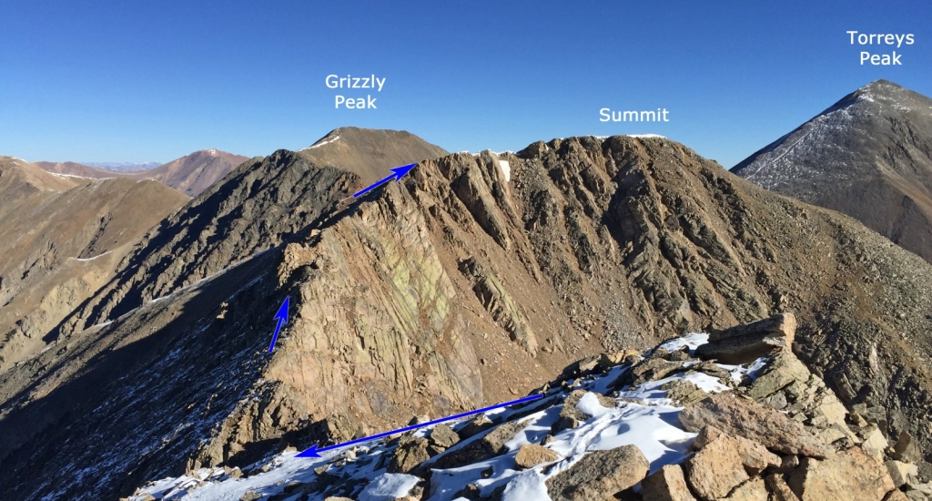
Now the fun begins! The summit is 0.6 mile away but there's a rugged ridge in your way and it includes some drop and regain in elevation. The difficulty of the remaining route can be kept at "Difficult" Class 2 but if there's snow present, you'll definitely be forced to make a few Class 3 moves. From the point, weave your way down to the low point of the ridge -
12. Staying on the ridge, hike over a distinct point, which is easier than it looks -
13. Continue on or just left of the ridge crest -
14,
15 and
16. As you approach the turn toward the summit, bypass the ridge crest on the left (
17) and follow easier terrain up to the top -
18,
19 and
20.
