This simple hike follows a 4wd road and subsequent trail all the way to Horseshoe's summit. While driving up the Fourmile Creek road, locate a 4wd road on the left, near 11,600' and approx. 0.75 mile past the Leavick site. The 4wd road goes all the way to 13,200'. Park here (2wd) or drive 0.5 mile up the 4wd road to locate a small parking area on a corner -
1. Walk up the road (
2) and Horseshoe comes into view near 12,000' -
3. Pass some mine ruins near 12,600' (
4) and zigzag west to the end of the road at the Horseshoe-Peerless saddle -
5,
6 and
7.
From the 13,200-foot saddle, turn south to see the remaining route up Horseshoe -
8. Walk past some mine prospect holes and locate a trail leading up Horseshoe's northeast ridge -
9. Hike approx. 800' of elevation up the ridge (
10 and
11) to reach the summit -
12 and
13. On your descent, you can add 13,348-foot Peerless Mountain by hiking a short distance north from the Horseshoe-Peerless saddle -
14 and
15. It's less than 200' of elevation gain, Class 2 and provides good views of 14er Mt. Sherman and surrounding 13ers -
16.


 GPX Track File
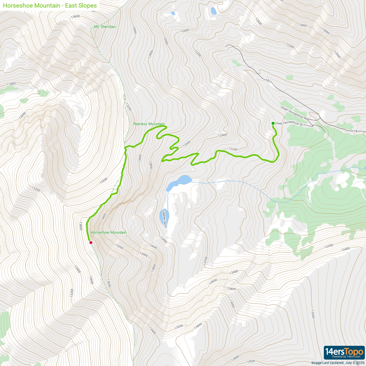


