From the Ranger Station, start up the East Longs Peak trail. After hiking 0.5 miles, stay left at a signed trail junction. Continuing through the forest, you'll pass Goblins Forest and then switchback up a hill before crossing Alpine Brook on a log bridge. Leave the dense forest and approach tree line near 11,000', approximately 2.5 miles from the trailhead. Longs Peak comes into view here, along with the route past 13er Mt. Lady Washington and toward Granite Pass (
1). Keep hiking southwest along Mills Moraine until you reach the Chasm Lake trail junction
at 11,550'.
At the junction, turn right to traverse west and northwest across Mt. Lady Washington's northeast slope (
2). Continue hiking to Granite Pass
, where you'll find another trail junction. Stay left on the East Longs Peak trail and ascend an easy slope (
3). After a series of switchbacks, arrive at the Boulder Field
near 12,400', where you get an incredible view of Longs (
4). The trail continues south through the Boulder Field, passing a restroom and some tent sites (available by reservation only) (
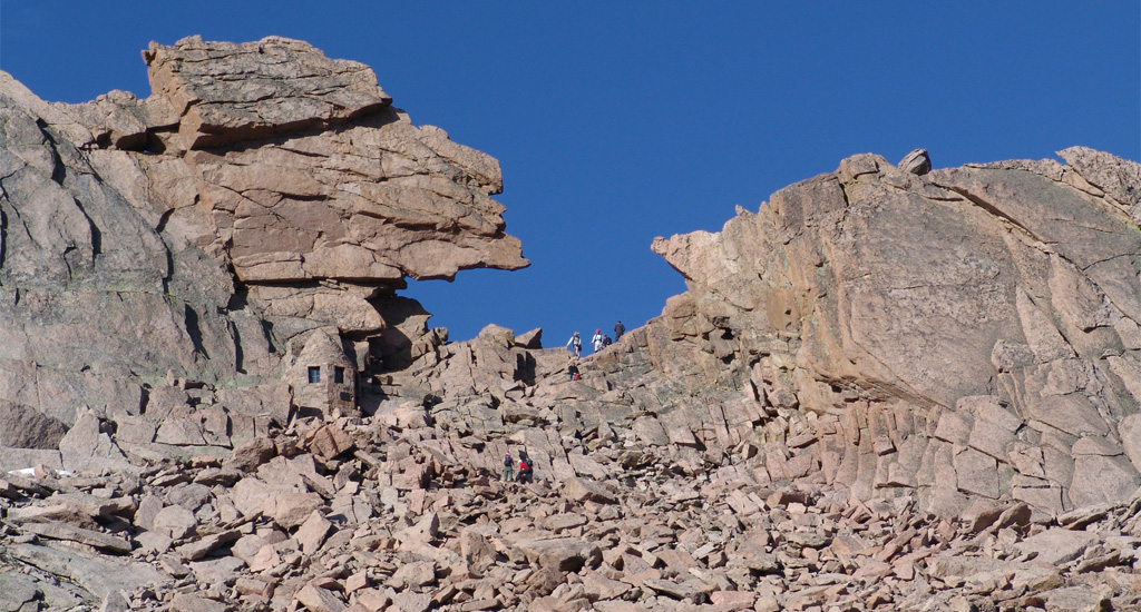
5). Your next objective is to reach the Keyhole, a prominent notch in the ridge between Longs and 13er Storm Peak. At approximately 12,800', the trail fades out. Follow cairns up through the rocks to reach the The Keyhole
(
6 and
7).
Pass through the Keyhole to emerge on the west side of the ridge (
8), where the terrain becomes more difficult and requires a slower, more deliberate pace. Glacier Gorge is down to your right, while the route runs along ledges to your left. Scramble south along these ledges, following the painted bull's-eyes that mark the route. Roughly a third of the way across the ledges, the route climbs around 50 feet before descending 100 feet, adding some complexity to this section (
9 and
10).
At approximately 13,300', you'll enter The Trough
, a well-defined gully that climbs 600 feet up the east side of Longs (
11). Although the route is still marked, locating the markers occasionally requires searching. Generally, stay in the middle of the Trough, encountering some sections of easy scrambling along the way. Although much of the rock is stable, you'll encounter sections of loose rock. Taken near 13,700',
12 provides a view down the Trough, with climbers visible at its center. At the top of the Trough, you'll encounter a 30-foot section of steeper rock that many climbers consider the crux of the route (
13). Scramble up this short section to arrive at a small, flat area. At this point, you're standing on the ridge that connects Longs to 13er Pagoda Mountain.
Next, you must cross The Narrows
, an exposed ledge that crosses the south side of Longs. Navigate around a couple of awkwardly positioned rocks (
14) and continue across the Narrows (
15,
16, and
17). This section requires steady focus and deliberate movement due to its exposure. After crossing the Narrows, scramble through more difficult terrain to see the remaining route to the summit (
18). The final pitch, known as the Homestretch
, may appear intimidating, but it is relatively straightforward under dry conditions. Ascend carefully along cracks and slabs for the final 300 feet (
19) to reach the large, flat summit (
20 and
21). Congratulations on summiting one of Colorado's most iconic 14ers!
