| Report Type | Full |
| Peak(s) |
Mt. Yale - 14,200 feet Missouri Mountain - 14,071 feet Tabeguache Peak - 14,158 feet Mt. Blue Sky - 14,268 feet Mt. Elbert - 14,438 feet |
| Date Posted | 01/14/2012 |
| Date Climbed | 09/11/2010 |
| Author | noreaster |
| 7 summits |
|---|
|
Ok, not THE 7 summits, but my 7 14er summits back in 2010. After posting a recent trip report I noticed that I never activated my report from 2010...Well, here it is... In early August (2010) I was wondering where I should go for my fall vacation. Had a pretty good feeling I was going to pick Colorado. I was able to secure time off for mid September, about 2 weeks before my big four-0 birthday. Landed in Denver on Sept 11 at 10am. My climbing itinerary was busy. During my trip I met some good people, ran into interesting issues but had an awesome time. The weather was just perfect. Short Summary: 9/11 Fly into DIA, drove out to Mt. Evans (Summit Lake) and hiked to 13,000, drove back to Denver, enjoyed pub life til 1am. 9/12 Mt. Evans 9/13 Mt. Cameron and Mt. Lincoln 9/14 Missouri Mountain 9/16 Tabeguache Mountain 9/18 Mt. Yale 9/19 Mt. Elbert 9/20 Fly back to Massachusetts Sept 11. My flight was uneventful, Southwest Air is awesome, direct flight from Massachusetts into Denver. Landed, got my bags, Jeep rental, and by 10am, I was at REI getting some last minute things. I also stopped at a natural grocer a block away from REI to get my food for the week. I am vegetarian, their food selection is pretty good. By 1pm I was on my way to Mt. Evans, I knew the road was already closed and I was not able to do my usual hike around the summit, but being able to park at the Summit Lake was good enough. I hiked up the trail to the right of the lake. At 13,000 I decided to turn around, I begun to feel the altitude, just a slight dull feeling in my head. Not bad for just landing four hours earlier. Drove back to Denver, checked into my hotel and enjoyed some drinks in LoDo. Decided to turn in at 1am, at that point I was already up for 24 hours. Sept 12. Got up, got into the car, ate some bagels, drank some water on the drive to Mt. Evans, took 285 into Guanella Pass. Got to the trail head a bit late, about 7:30am. This was going to be a good test...Would I be able to summit the day after landing from the sea level? I was not looking forward to the willows. Last year, I tried to summit Spaulding and Evans, was successful on Spaulding but skipped Evans because of bad weather moving in. I did not like the willows at all. Route finding was pretty easy, I was able to go through the willows without a problem, I selected to stay close to the trees on the far side of the willows. I reached the gully fairly quick. 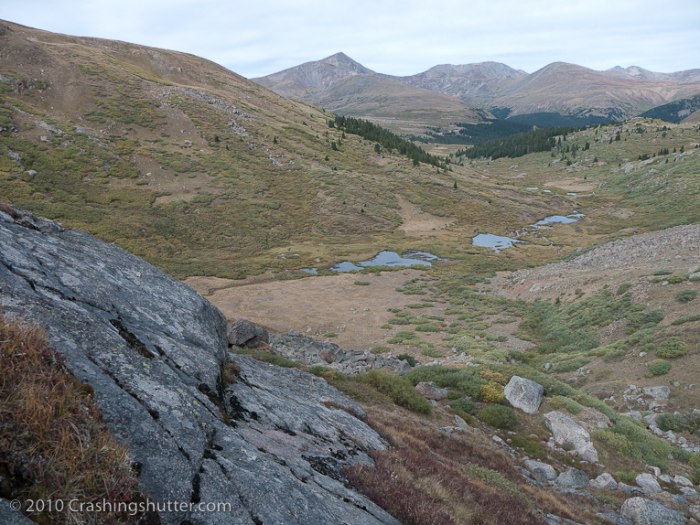 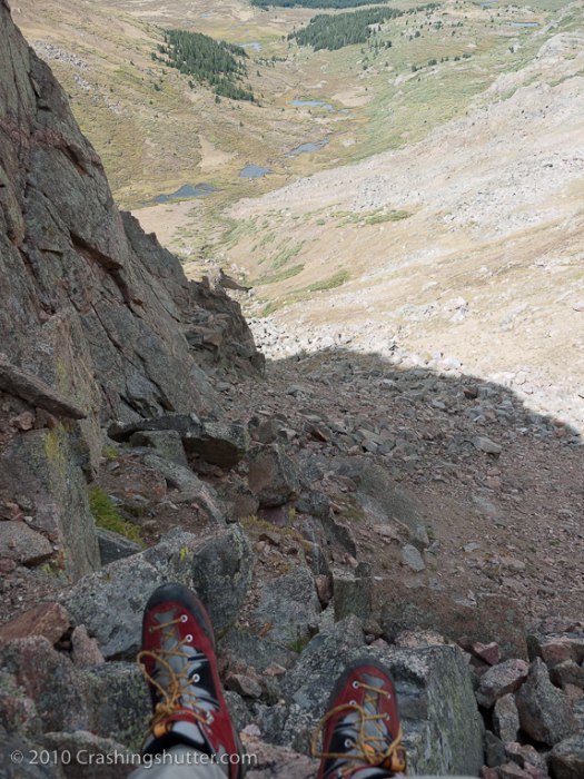 Went on the right side of the gully, it was more interesting, at some point the talus was very unstable so I jetted to the left, back to the trail. Once I was able to cross back to the right, I shot in a straight line towards the sawtooth. Very cool view. The detour was worth the effort. I met a couple of local climbers who just came off the sawtooth and we trekked towards Evans. 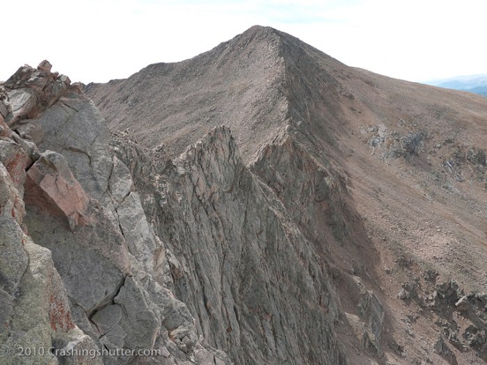  I had to pressure breath quite often but I kept up with their quick pace. At some points my heart was pumping at over 180bpm but I felt great. Reached the summit shortly before 1pm. Noticed the fires up north, aside from the fire near Boulder Canyon, notices a new puff of smoke rising on the horizon. 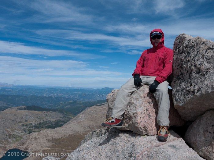 After a quick bite to eat and some water I descended down with one of the guys I met, the other climber was heading to the Summit Lake. He started his day there, climbed Bierstadt then Evans over the sawtooth. Looked like a long trek. Speaking of a long trek, the descent to the parking lot in the GP trail head was long, at least it seemed that way. After a short fine dinner break in the car at the trail head I continued my drive to the next peak, got the the Kite Lake area just before it got dark. I camped in the car. Total calories burned for the day was 4,481. Sept 13. This was going to be short day. I climbed Democrat last year in the snow. I was only missing Cameron and Lincoln. Didn't want to do Bross because of the land issues. I woke up before sunrise and slowly got ready for the hike. I was a bit tired. Couldn't fall asleep the night before until I drank some Sleepy Time tea. Got about 5 hours of sleep. I did ok during the hike though. It was very uneventful. 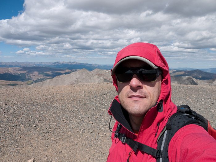 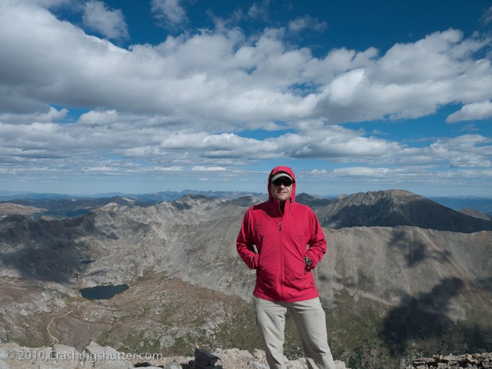 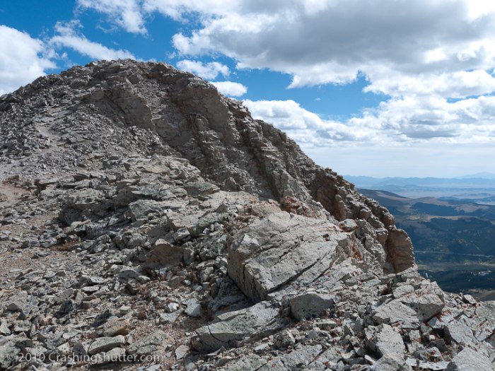 I couldn't believe how featureless Cameron was. After I got down the trail I made a couple of pasta dinners to get some calories in. Total calories burned for these two peaks was a bit over 2,500.   After my belly was full, I continued my drive to Missouri Gulch trail head. I stopped to take some aspen photos on the way. Once at the trail head, I repacked my gear, loaded up and begun the trek up the switchbacks, hoping to make it close to the treeline before it got dark. I selected a nice camp site off the trail, in the wood line, but a bit higher than the old cabin. I set up the bivy, ate some food and went to bed. I felt good aside from a sinus ache, the dry air was really bothering me. As I was falling asleep, something ran right past me, hopping on a couple of rocks, it was size of a fox, all I could see was a silhouette and a noise, something like the alien noises from The Signs. After a few WTF comments to myself I feel asleep.  Sept 14. Woke up before sunrise, ate, took my camp down, cached some of my gear and begun the trek towards Missouri. My sinus pain did not go away, it got worse. I only frank 1 liter of water overnight, I usually drink 2. Maybe that made it worse. I continued towards Elkhead Pass at a medium pace. The hike up the pass was good. I could see the route to Belford to the left, and recalled my ascent 2 years back with sh*tload of blisters on my feet. This time around my feet were super good. I taped all of my toes, the heel, and the ball of my foot. I bought a pair of Garmont Vetta Lite boots, they were very comfortable. 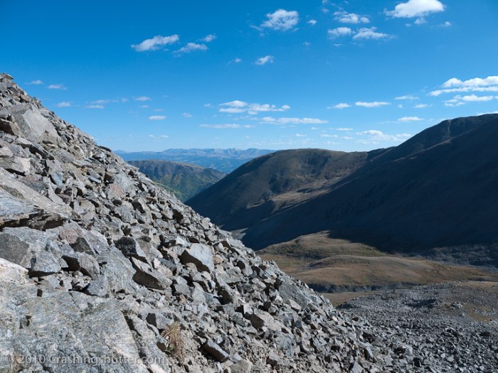 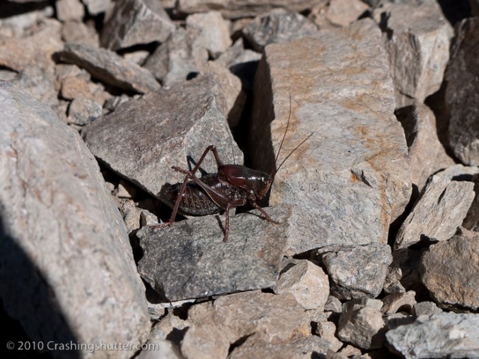  Once I reached the ridge the wind picked up hurling TV size rocks down, I reached the crux of the route, it looked much more difficult on the route photos. Took some nice pics. 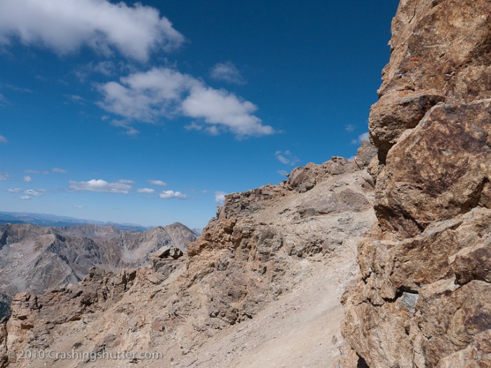 In no time I was on the summit and had the summit for myself for a good hour I was there.  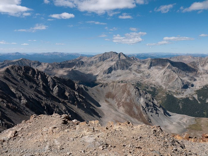 My plans to bag Belforx/Oxford were ruined by my sinus pain. During my descent, I took many breaks to take photos. Great views of the aspens. Found my cache, nothing chewed off by critters, packed it up and made my way to the trail head. Total calories burned on this one was 5,054. I cooked a meal at the trail head and decided that it would be a good idea to spend the next day photographing the aspens. I drove to Buena Vista, got the last room at the Best Western. Had a huge MF meal at Panchos. My belly was stuffed with a bean burrito, a taco, cheese sticks, french fries, and brown rice. Sept 15, no climbing. I drove up to County Road 311 and explored the area, eventually reaching the Davis Meadow trail. Hiked a bit. 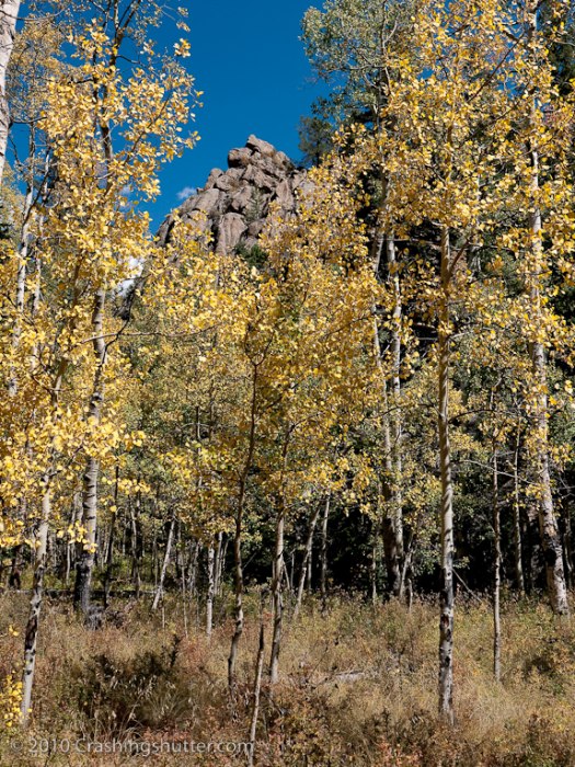  I was maybe a week too early for the full aspen foliage, but did get some good photos. Drove back to Buena Vista and devoured a large pizza. The rest day felt good. I then drove to Salida, really liked the old town. Had some beers at Vic's, ate some food down the street and was back in my room no later than 12am. Sept 16. I met a climber (Uffda) in Poncha Springs and we drove up to Jennings Creek. We knew that the tundra was damaged and that there was a route to climb the West Ridge without impacting it. We did just that. The route was long towards the ridge, we ascended the ridge way to the left of the red talus. Once on the ridge, it was up and down, rock hopping, but it was fun, difficult class 2 and maybe pushing it, low class 3 options. We reached the summit. I took a couple of photos and my battery died. 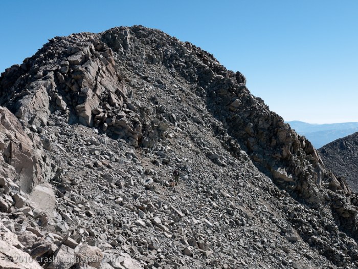  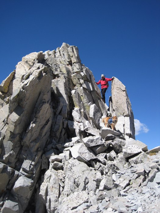  Took some pics on the descent with my iPhone. I felt good during the climb, not bad for the 5th peak. Total calories for this climb was 4,173. I spent the rest of the day driving back to Denver, got a room by DIA, walking distance to Chicco' Italian restaurant. Had a huge salad and pasta. I was picking up my g/f the next morning, our plan was to climb 2 peaks before heading back home. Sept 17. Pretty much driving back to Buena Vista. Dinner, etc. Sept 18. The big Mt. Yale day. We attempted this one twice. Six years ago, as our 1st 14er. Got to 12,500 before turning back. I had an upper respiratory infection, she flew in at 10pm the night before, we drove to BV, and were up at 4am to begin the climb. Epic Fail. The second attempt three years back, a snow climb, the day after we landed from the east coast. We got above the tree line and followed someone's footsteps for a while. I had a feeling that we were off trail. We got to 13,000 when I checked my GPS, we were about half a mile from the route. Well, the trek across the talus slope partially covered with snow took a a while. We got up to 13,800 and decided that with half a liter of water and an hour of daylight was not a good idea to continue. This was the third attempt, we felt really good, I was worried about her acclimatization but we gave it a go. We summited within 4.5 hours. I really liked the final push. Really nice views. 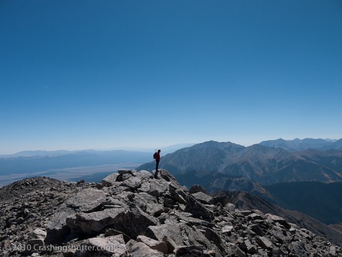 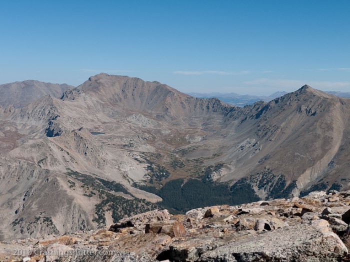 It was really windy on top, we took some photos and begun the trek down. This is the the problems started. First, about half way down the tree line, she lost a diamond loop earing. Then, when we got down to the car, it appeared that my gas was siphoned out. Not too positive, but I remember checking the gas on the way to the trail head and I was well over 1/4 of the tank. When I started the car after the climb, the gas light was on. Very weird. Total calories for the climb 3,796. Sept 19. We decided to do Mt. Elbert, standard route. I read that this is a long hike and it was long for sure. No issues reaching the top. 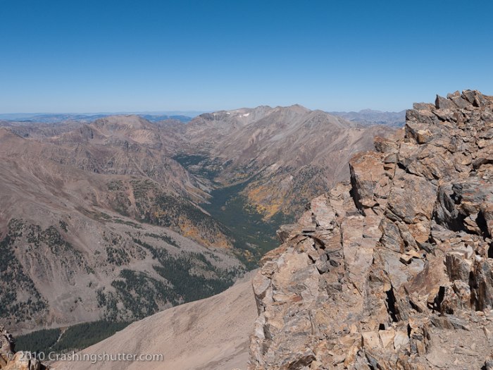 Coming down seemed long, it always does. Upon getting back to the trail head found that my jeep rental had a flat. Great! No problem though, I changed tires before. I was in for a surprise. The tire would not come off. I beat the crap out of it, kicked it, smashed it, and it would not come off. Had to call the rental company, confess where I was and see what they'd do. About 2 hours later a 4x4 truck shows up with 2 big dudes. They were laughing that I couldn't change the tire, but in the end, they were stumped as well, 45 minutes later, they called for a 3rd guy to come down with tools. Just moments after they called him, one of the guys used a huge garage jack to lift up the jeep, got under, and begun to kick the tire from the back with both of his feet. Eventually the tire came off. Spent the night in Leadville. Great food at Tennessee Cafe. Calories for this hike 3,635. Sept 20. Took the flat to a gas station, they fixed it for $15, I was psyched. Drove into Denver in record time, fight was delayed, got home at 12am, was at work for 6am. This was a very cool vacation. Tiring but worth the effort. I figured that I did just over 50 miles of trekking, about 23,000 feet elevation change, and burned around 27,000 calories. Didn't lose a pound though, I actually gained 3 lbs, I was eating like a pig before, during and after each climb. I spent the next week sleeping 12 hours per night. Thumbnails for uploaded photos (click to open slideshow):
 On the way down.")
|
| Comments or Questions |
|---|
|
|
Caution: The information contained in this report may not be accurate and should not be the only resource used in preparation for your climb. Failure to have the necessary experience, physical conditioning, supplies or equipment can result in injury or death. 14ers.com and the author(s) of this report provide no warranties, either express or implied, that the information provided is accurate or reliable. By using the information provided, you agree to indemnify and hold harmless 14ers.com and the report author(s) with respect to any claims and demands against them, including any attorney fees and expenses. Please read the 14ers.com Safety and Disclaimer pages for more information.
Please respect private property: 14ers.com supports the rights of private landowners to determine how and by whom their land will be used. In Colorado, it is your responsibility to determine if land is private and to obtain the appropriate permission before entering the property.

