| Report Type | Full |
| Peak(s) |
"Thunder Pyramid" - 13,944 feet |
| Date Posted | 06/28/2025 |
| Date Climbed | 10/11/2024 |
| Author | PikaSteve |
| Pace Problems vs Thunder |
|---|
|
Pace Problems vs Thunder No basketball in this report, but maybe a few nuggets of inspiration or information for people who climb at a slow pace or who want to climb Thunder Pyramid after the NBA playoffs are over and the snow has melted away. Autumn Thunder Plan B For many folks, Plan A for Thunder Pyramid means a late spring climb up the West Face. Over half of the 3300’ elevation gain after leaving the trail is covered by talus, so climbers appreciate the talus being covered by snow. I’m not very experienced with snow climbing, so I went with Plan B for an autumn climb up Thunder Pyramid and a full talus experience. I always prefer to use the word autumn when talking about mountaineering because the word “fall” should only be used when absolutely necessary. After the previous autumn’s successful hike up Cathedral Peak, I was excited to attempt another Elk Range Centennial Peak. Due to permit requirements, Thunder Pyramid usually takes significant advanced planning. So, on June 15th at 8am, I logged in to recreation.gov to make backcountry reservations and then to aspenchamber.org to make parking reservations. I guessed that either a late August or early October trip would fit my schedule and have good weather. In August, I cancelled the first reservation due a schedule conflict and in September I debated between doing a one-day hike (Plan B—downsides: long day for a slow paced climber and night-before camping or lodging logistics) or backpacking in (Plan C—downsides: I hadn’t used my backpacking gear in two years). A few days before my date, the weather forecast was perfect, so I grabbed the only short-notice “cheap” motel reservation I could find somewhat close to Aspen and committed to Plan B. 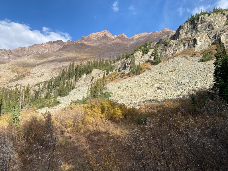
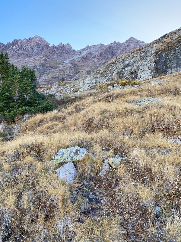
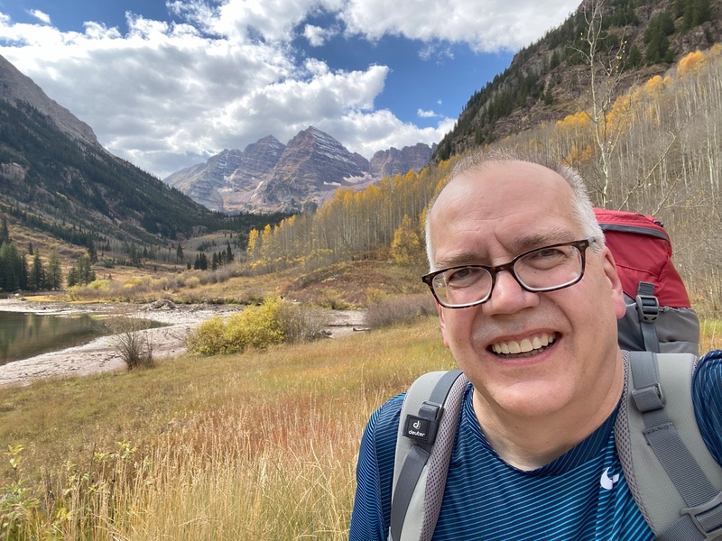
Plan B: Friday October 4, 2024 With a 3:30 wakeup alarm, I was leaving the Glenwood Springs motel before 4:00am and leaving the Maroon Bells parking lot at 5:20. With autumn colors well past peak, there weren’t very many photographers waiting for sunrise and soon I was alone heading up the West Maroon Trail by headlamp. It’s a nice trail, but very rocky, which makes for rough footing in the dark. Most of my trips up or down this section have been in the dark, but I was optimistic that I would see the trail and easily avoid the rocks on the way down. After about an hour I stopped at Crater Lake for snacks and obligatory dawn reflection photos. By 8:00, after 1200 feet of elevation gain, 4 miles of trail and a very shallow creek crossing, a small cairn marked a faint path through fading willows to the day’s first pile of talus. 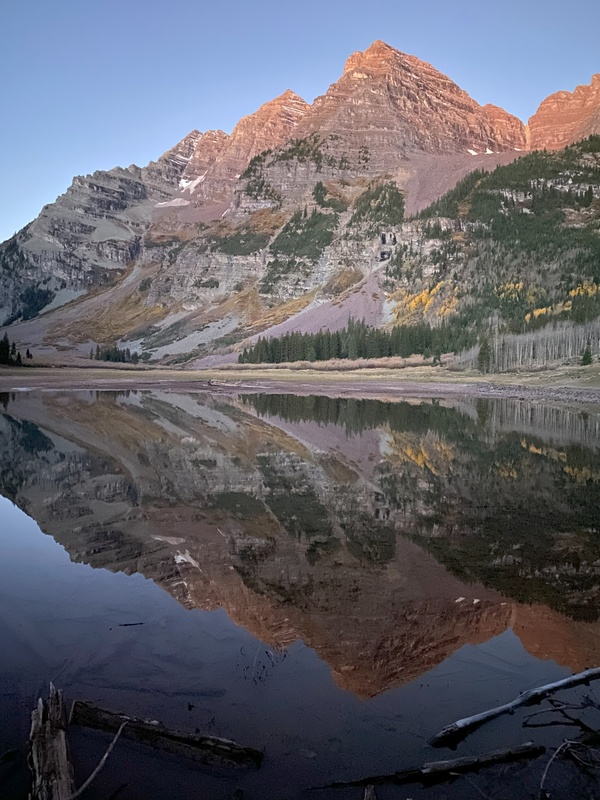
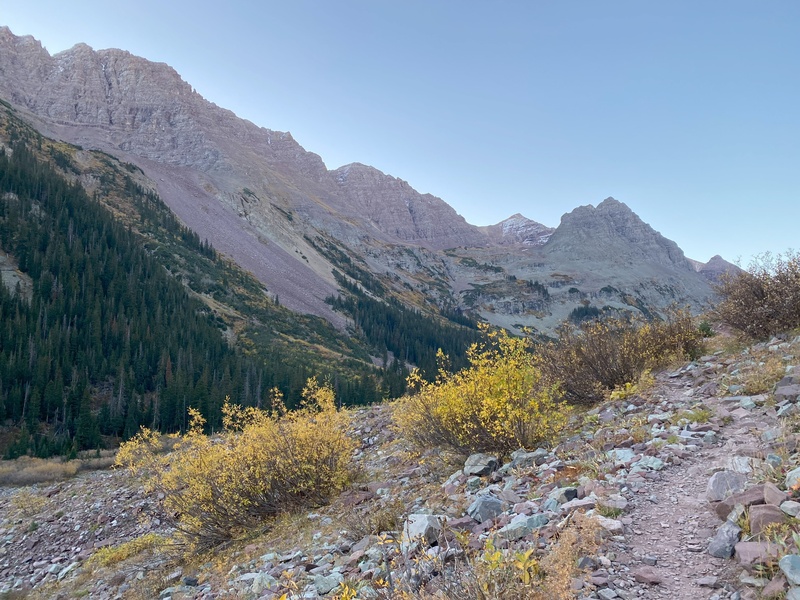

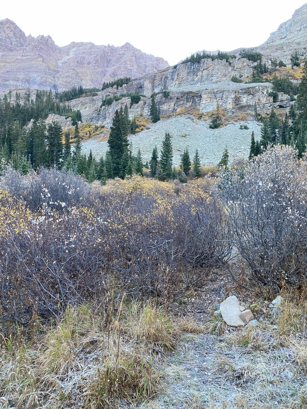
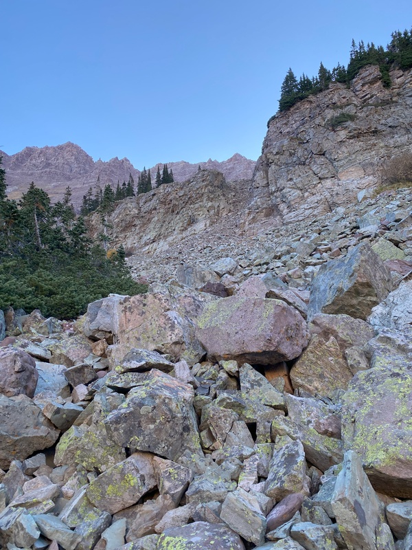
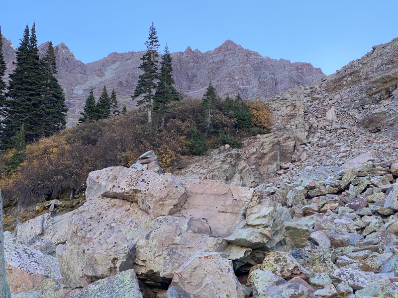
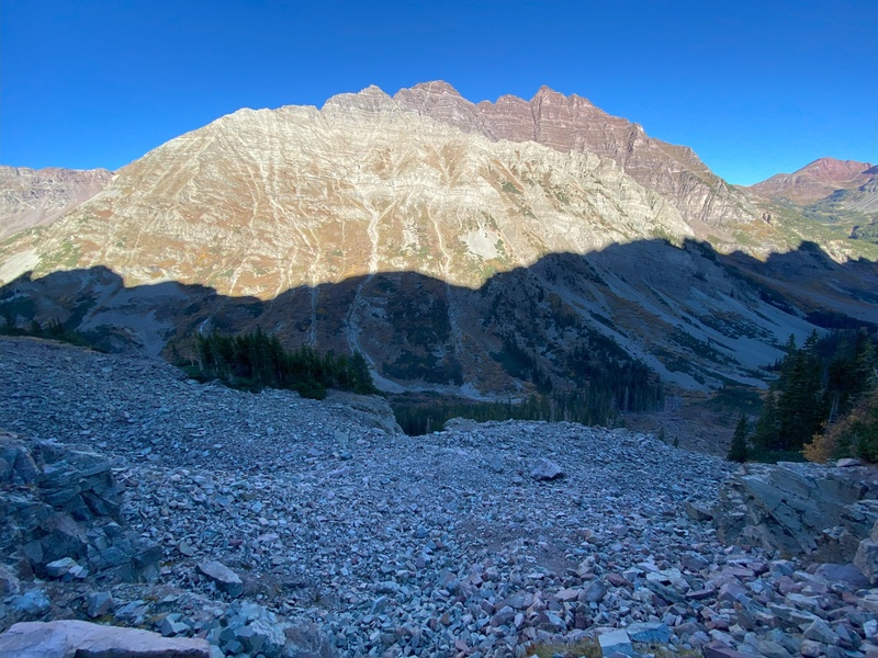
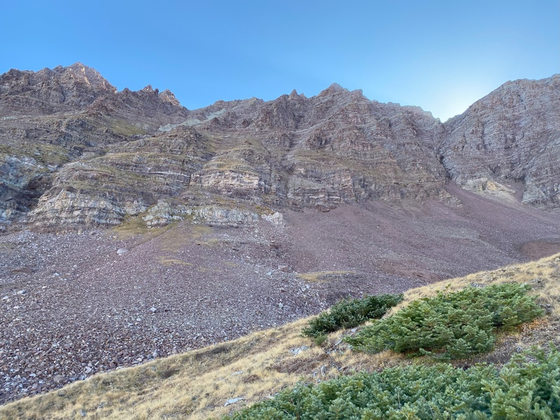
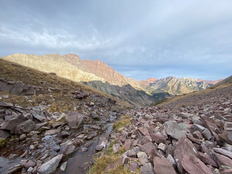
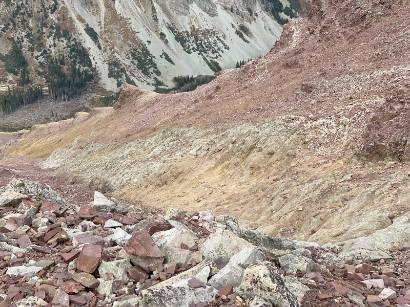
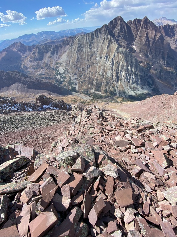
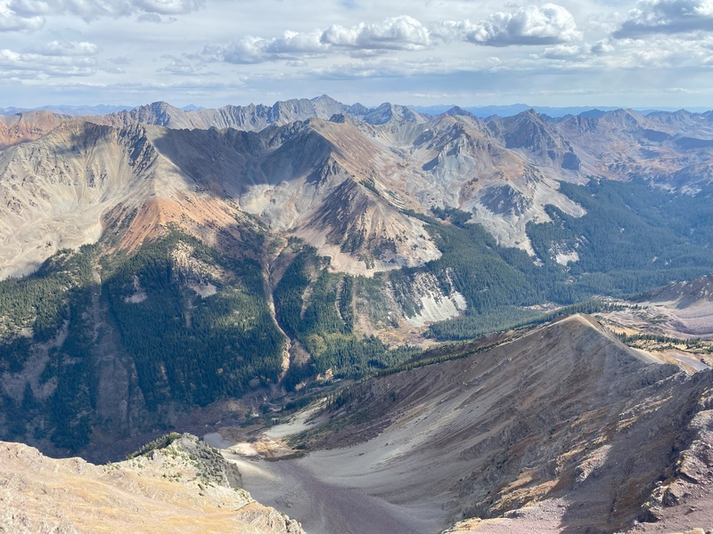
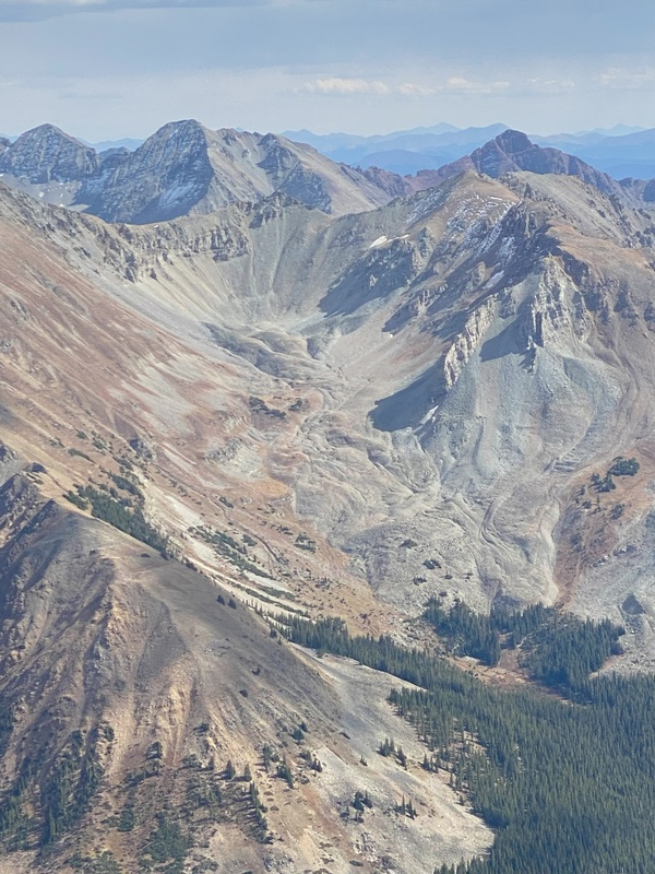
Just over one horizontal map mile and 3300 feet of vertical gain to go. How hard could it be? I felt well warned by WildWanderer as the first three talus gullies slowed my pace but did not dampen my enthusiasm. At the top of each gully, I paused to look forward at Thunder’s white gully and backward at Maroon Peak and its 2800’ slope on the opposite side of the creek. Some say 2800’ of suck while a few say 2800’ of awesomeness. At this point, I thought my 3300’ slope was more awesome with more terrain variety and the most amazing sunlit views looking back at the Bells. The terrain variety continued as the route ascended tundra slopes and eventually crossed the very peaceful creek in Len Shoemaker basin. Then up another talus slope to a left turn on a tundra ramp between cliff bands before zigzagging up a mix of tundra and rocky segments to reach the white gully. 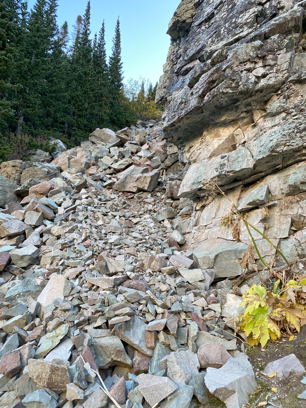
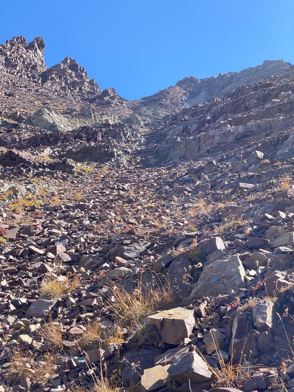
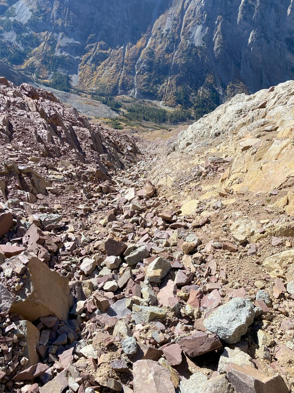
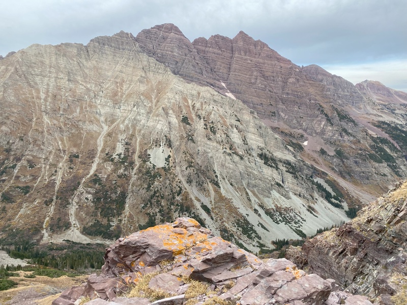
Here, I made a decision that switched me from turtle pace to snail pace. I had forgotten Roach guidance to go to the north side of the gully. Somewhere I had read a report that compared the white gully to Crestone Peak’s red gully. This comparison inspired me to climb up the center of the white gully—very fun, but very slow going and tiring taking big steps up the large rocks. By this time my vertical gain pace had already slowed below 500’ per hour. 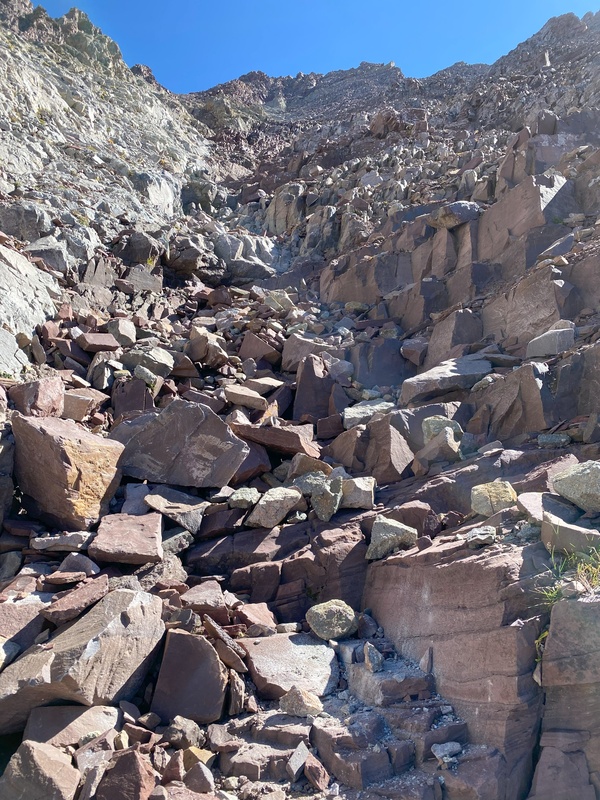
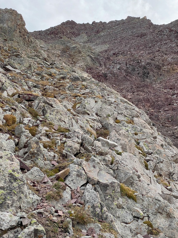
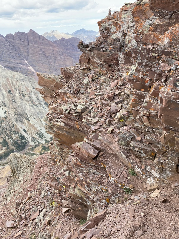
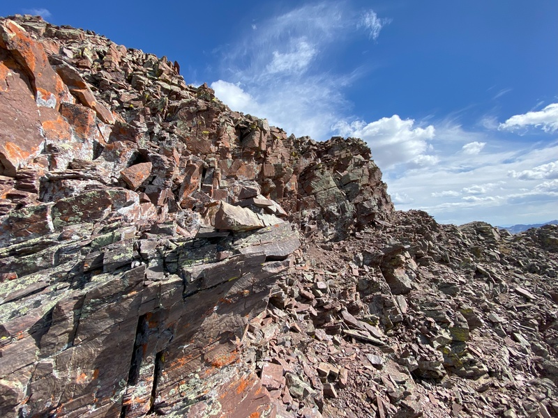
Now following Roach guidance, when the gully steepened at about 13,400’, I turned right to angle out of the gully and start an ascending traverse up the red, rotten, loose rocks for which the Elk Range is famous. About this time, I started getting nervous about unstable Jenga rocks and I also began thinking about a well-known climber who died after a fall at an unspecified location somewhere near Thunder Pyramid or Lightning Pyramid. Logic told me that my location was not quite steep enough for a long tumble, but doubt was still creeping into my brain. 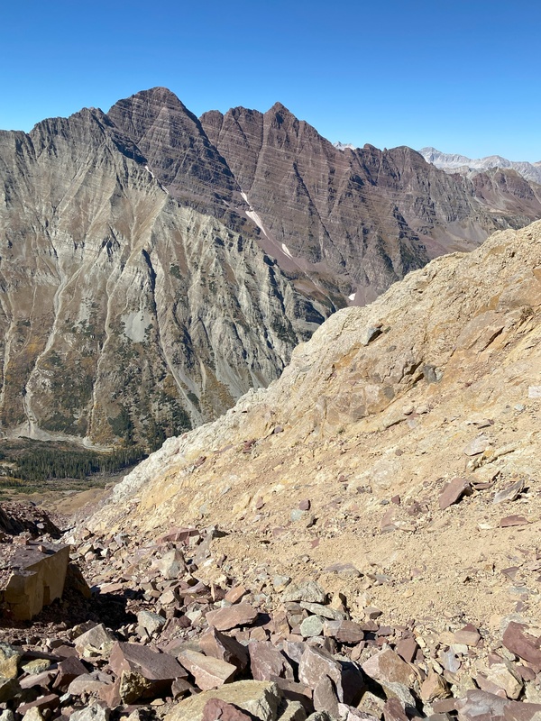

About halfway between leaving the gully and reaching the ridge, I paused again to rest, eat snacks and try to do some math. My Garmin watch said 2:20pm and 13,650’ meaning about 300’ to go but also meaning that I had only averaged about 500’ per hour since leaving the trail. Realistically, it would take at least an hour to reach the summit and another hour to return to this spot. I rarely descend much faster than I ascend, so I guesstimated (can’t do complex math at this altitude) that turning around now, I would be lucky to be back at the trail before complete darkness; if I tried to summit, even if I didn’t slow down further, I would probably be above Len Shoemaker basin with complete darkness and three talus gullies still to go before reaching the trail. I wanted to continue progress on my Centennial quest but didn’t want a fall to end the quest either. After weighing the relative consequences of certain summit fail vs possible fractured fail by fall (or worse), I resigned myself to turning around. After a consolation prize of taking several photos from my high point, I started down the loose red rocks to reach the white gully. 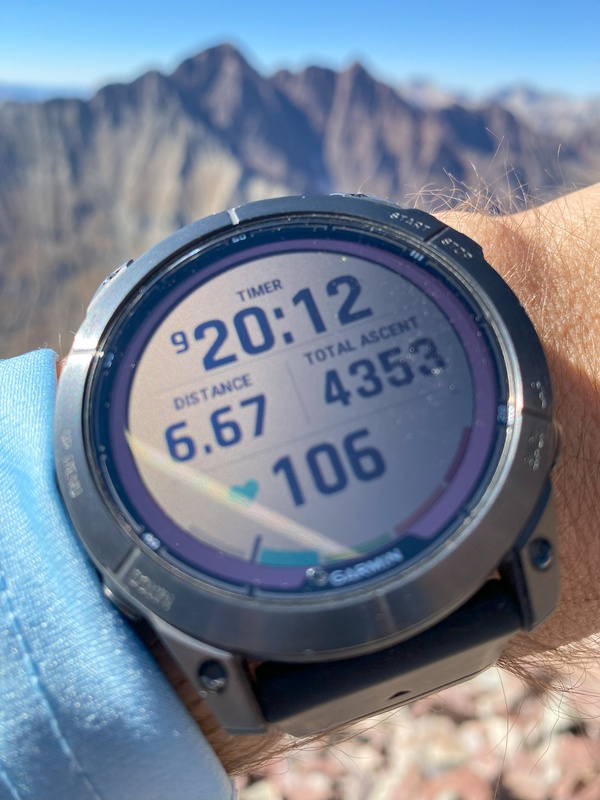
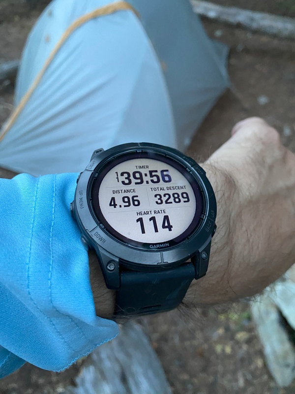
Moving carefully, but “quickly” (for me), it still took four hours to descend 3000’ to the last of the talus gullies and reach the trail at 7:00 just as the last hint of autumn daylight was disappearing. 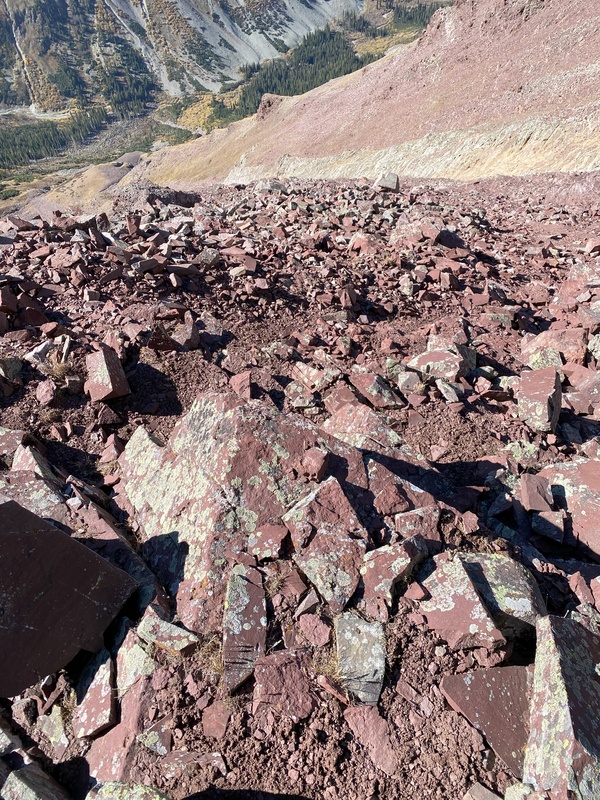

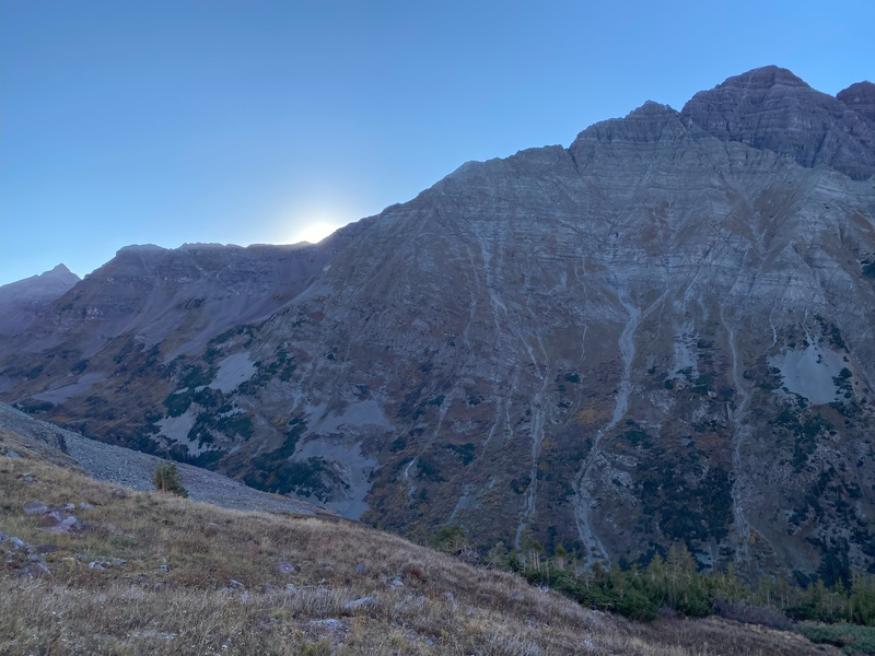
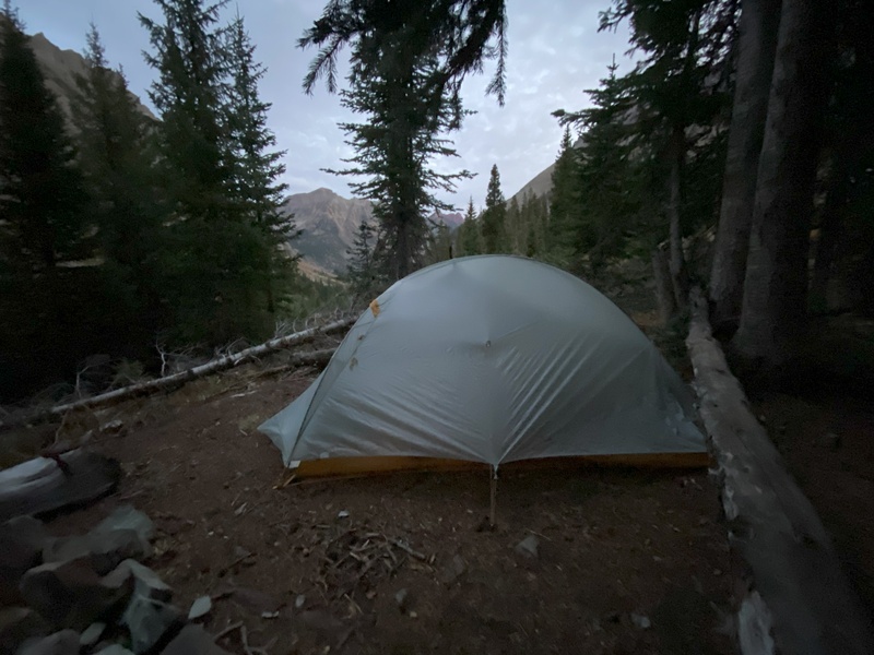
Safely on the trail, I slowly made my way back to the trailhead, taking slightly longer to descend 4 miles than it took to ascend in the morning. Mostly, my brain was on autopilot with a bit of cursing about being on the rocky trail in the dark again. As happens with most of my summit turnarounds, before I even returned to the trailhead, I was thinking about another attempt. I started thinking about Plan A—could I come back next year during snow season? The next day, while taking the scenic route back to Denver over McClure, Kebler and Cottonwood Passes, I started thinking about Plan C—was October weather holding out enough to try a backpacking trip? I waited two days until checking the weather forecast which anticipated continuing warm weather. I was surprised that permits were available on such short notice, but I was able to snag a two-night Maroon Zone dispersed camping backcountry reservation and a bus reservation. The camping permit came with a warning: “On a typical snow year, this campsite is snow covered from early October until late June”. “Typical” has changed—twenty years ago, I never would have imagined climbing high peaks in October, but some of the best Colorado weather days now seem to be in late September and early October. I got to work laying out my backpacking gear, food and bear canister to try Plan C. Plan C: Thursday October 10, 2024 With an early morning Denver departure, I was at the Aspen Highlands parking garage over an hour before my 12:30 shuttle reservation. After getting all my gear ready, I checked in and was able to get on an earlier bus to Maroon Lake. Leaving Maroon Lake at 1:00, in 3.5 hours, I was at my campsite shortly past the West Maroon creek crossing and near the point where the Thunder Pyramid route leaves the trail. Given my backpack weight and restrained pace, I was pleased that it only took 40 minutes longer than last week to reach the campsite. I set up my tent, gathered water from the creek and started filtering and cooking with plenty of daylight remaining. At 9:00, my summit bag for tomorrow was packed (except for the food in the bear canister) and I was trying to calm my mind and go to sleep. 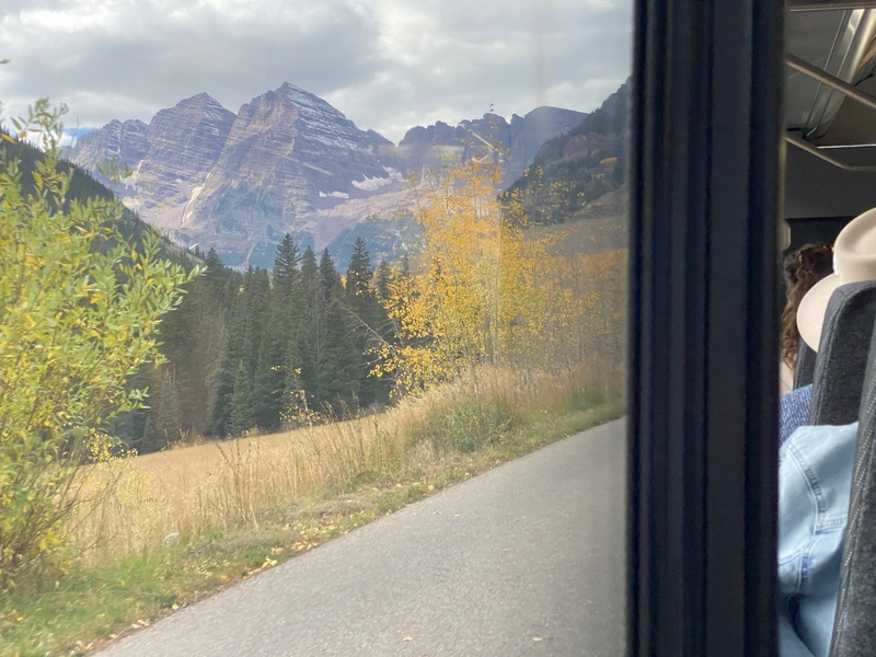
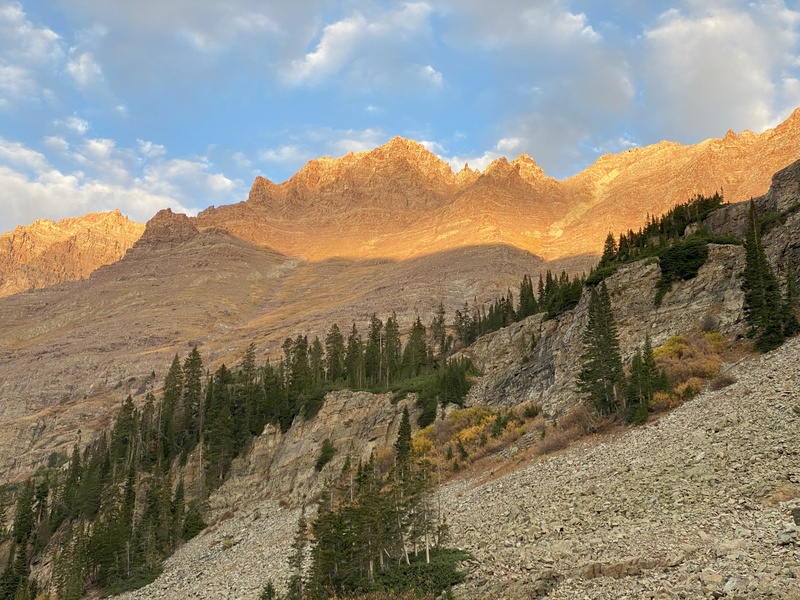
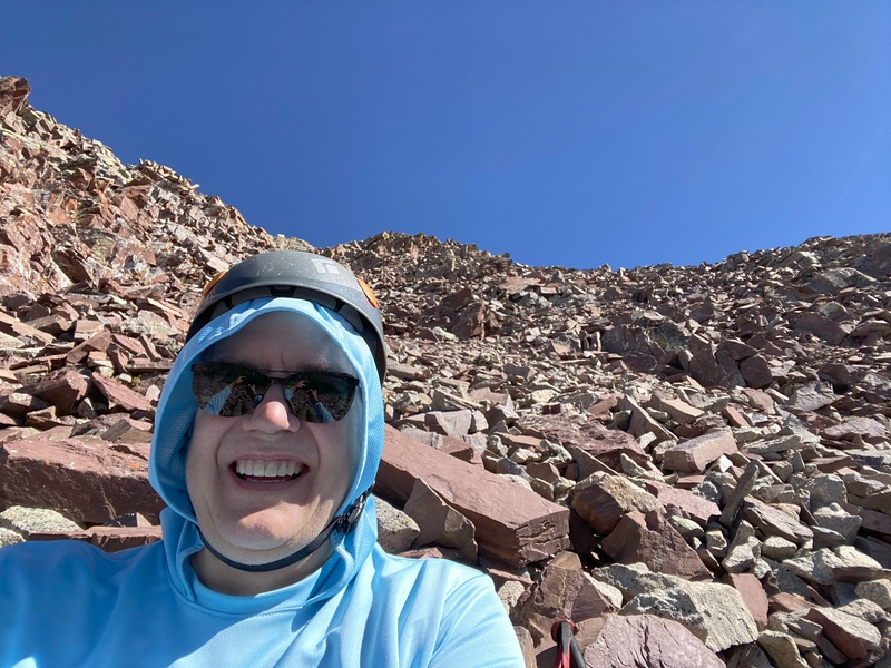
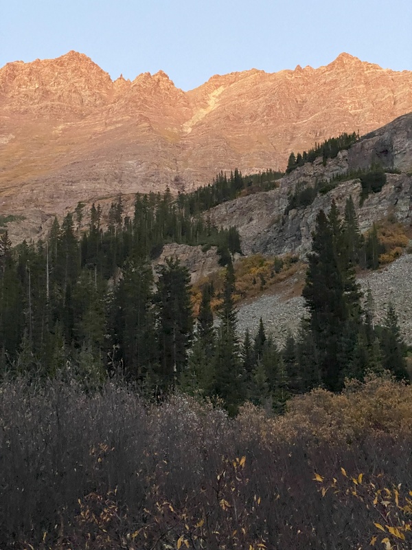
Friday October 11, 2024 At 6:00, I was watching headlamps weave up the 2800’ slope across the valley as I completed my morning preparations. These headlamps would be the closest I would come to seeing any other person today. At 7:00, just before sunrise, I was walking through frosty willows and talus to reach the first approach gully. I mostly retraced last week’s steps until I reached the white gully. This time, I climbed a line just left of the gully where white rocks, tundra and dirt made for a much easier ascent than last week’s path up the blocky talus in the deepest center of the gully. At 13,400’, crossing into and across the gully required a slightly sketchy but manageable crossing of light brown rocks covered with sand. Now on the red Jenga rocks, my balance was on full alert, and my confidence and energy were both much higher than when I reached this section last week. I was able to enjoy the awe of being high up a steep valley wall across from majestic fourteeners. 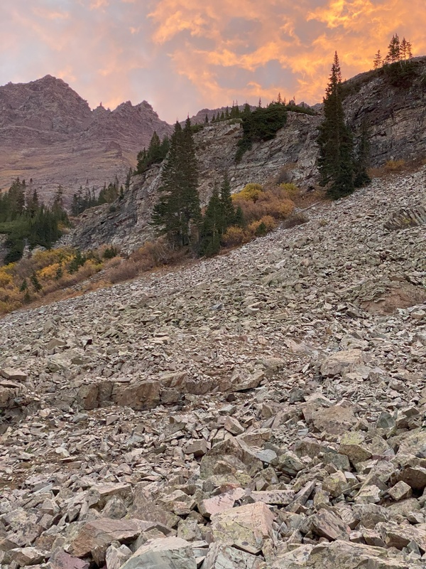

As I passed last week’s turnaround point, I was pleased that I was feeling strong and was about two hours ahead of last week’s schedule—one hour from leaving the trail at 7:00 vs 8:00 and one hour due to faster climbing. As guesstimated last week, it took me about an hour to carefully climb the last 300’ feet to the summit. 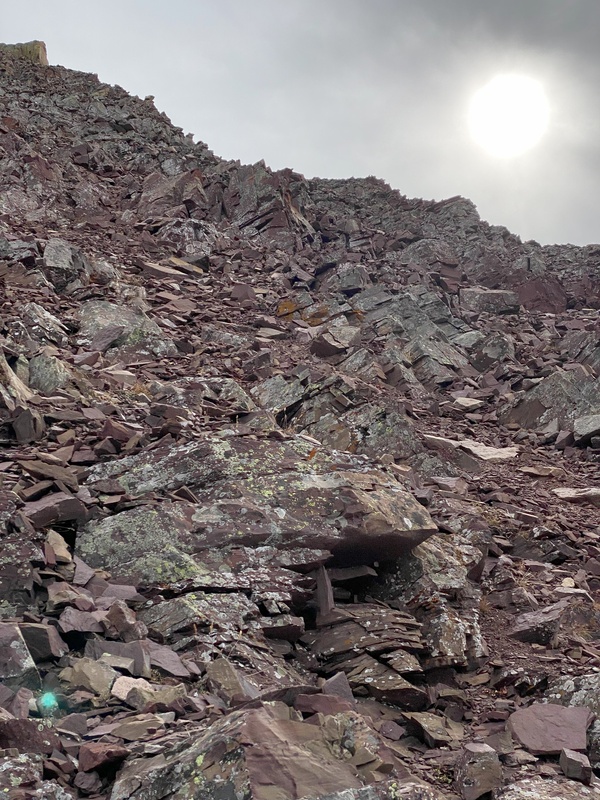
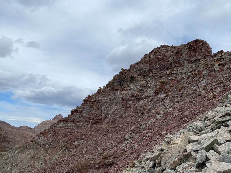
After reaching the ridge, two cairns pointed to where a sedimentary layer leaves the ridge to traverse towards a prominent profile. As I approached the profile, I misinterpreted the two cairns and made a steep scramble between the two cairns and then traversed a bit further before ascending a gully to the summit ridge. On descent, it became obvious that, for easier and less exposed climbing, I should have continued traversing around the profile below the lower cairn before immediately turning right to ascend the hidden far side of the profile toward the higher cairn and continuing up directly to the summit ridge. 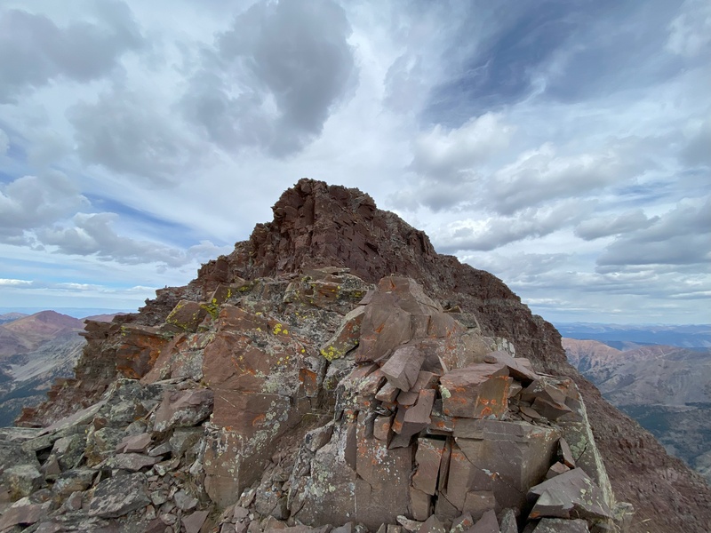
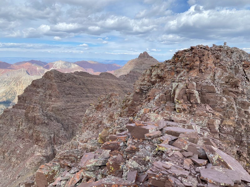
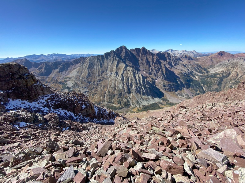
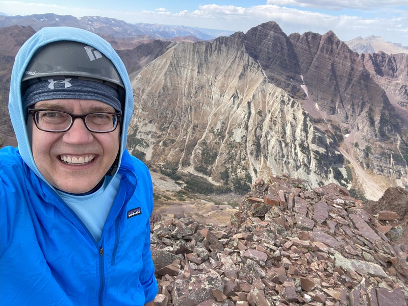
Safely at the summit, several deep breaths helped me release the tension of route-finding, climbing and balancing and switch my focus to enjoying my endorphins and the Elk Range views. I felt lucky to still be healthy at 60, satisfied to be strong enough to climb this high, blessed to be surrounded by mountainous beauty and persistent and even stubborn for safely executing Plan C after safely failing with Plan B. 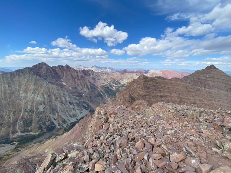
After basking in my rocky mountain high and autumn awe, I refocused my attention on the descent, mindful that people say descending can be more dangerous than ascending and that there have been fatal falls near this peak. 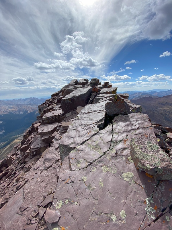
Generally retracing my steps, I was back at my tent at 6:40, just after sunset. Thankfully, I only needed to cook dinner before going to bed rather than worrying about trudging back to the trailhead in the dark. 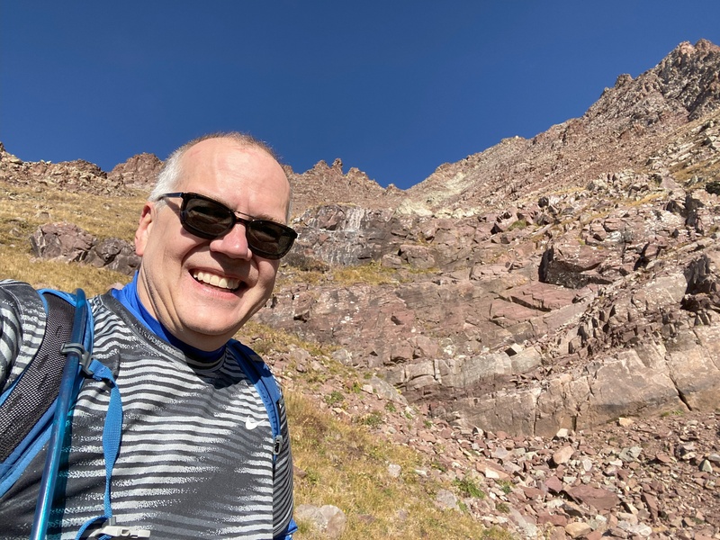
Saturday October 12, 2024 In the morning, feeling recharged, I packed up camp and backpacked down to Crater Lake. I was pleased to be hiking in daylight on the rocky segment from Crater Lake to Maroon Lake. I was feeling responsible for turning around safely during last week's Plan B and feeling proud for a successful summit using Plan C. As I continue my Centennial quest, I suspect that there will be more Plan C backpacking trips in my future. 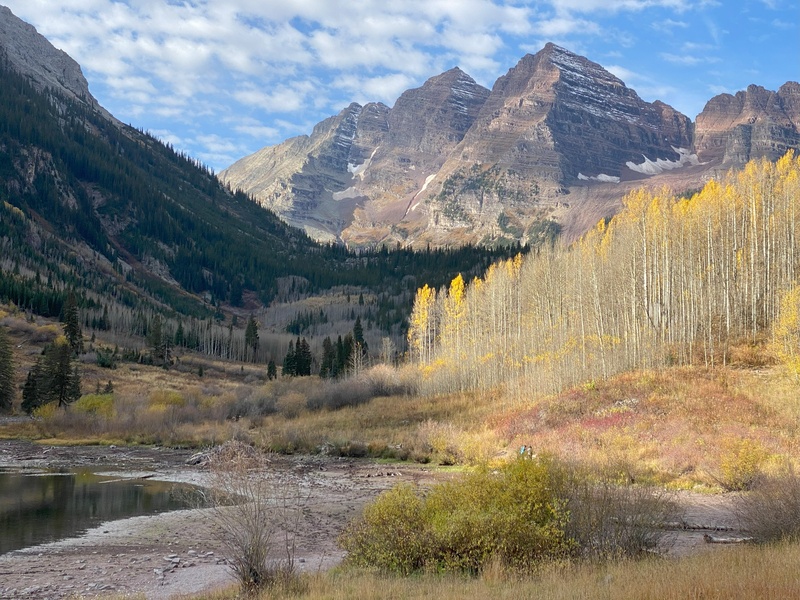
References In preparing for Plan B and Plan C autumn hikes, I found Roachs' book "Colorado's Thirteeners" book and the following references very helpful:
After my hike, I wondered when do most folks climb Thunder Pyramid? Looking at 14ers.com trip reports and conditions reports gives the impression that most people follow Plan A when there is still significant snow. However, when I looked at publicly available climb counts on Lists of John and peakbagger.com, it looks like people are climbing Thunder Pyramid throughout the summer,. The spring climbers just talk about their climbs on 14ers.com more often than the summer and autumn climbers. No matter what your pace is, if you don't mind plenty of talus, don't be afraid to try Plan B or Plan C on Thunder Pyramid. 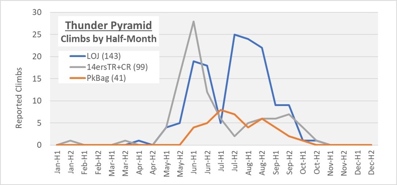
Thumbnails for uploaded photos (click to open slideshow): ")
")
")
")
")
")
")
")
")
")
")
")
")
")
")
")
")
")
")
")
")
")
")
")
")
")
")
")
")
")
")
")
")
")
")
")
")
")
")
")
")
")
")
")
")
")
")
")
")
")
|
| Comments or Questions | |||
|---|---|---|---|
|
Caution: The information contained in this report may not be accurate and should not be the only resource used in preparation for your climb. Failure to have the necessary experience, physical conditioning, supplies or equipment can result in injury or death. 14ers.com and the author(s) of this report provide no warranties, either express or implied, that the information provided is accurate or reliable. By using the information provided, you agree to indemnify and hold harmless 14ers.com and the report author(s) with respect to any claims and demands against them, including any attorney fees and expenses. Please read the 14ers.com Safety and Disclaimer pages for more information.
Please respect private property: 14ers.com supports the rights of private landowners to determine how and by whom their land will be used. In Colorado, it is your responsibility to determine if land is private and to obtain the appropriate permission before entering the property.

