| Report Type | Full |
| Peak(s) |
"Thunder Pyramid" - 13,944 feet "Lightning Pyramid" - 13,729 feet |
| Date Posted | 09/04/2024 |
| Modified | 09/06/2024 |
| Date Climbed | 08/31/2024 |
| Author | 5ClimbingCooneys |
| Thunder Does Not Always Follow Lightning |
|---|
|
I don't usually post trip reports. For the most part, everything has pretty much been done and posted about in enough detail to not require any insights I'd be able to contribute. However, while I was researching Thunder & Lightning, I felt like the info was a little incomplete. I found myself mainly trying to answer three questions:
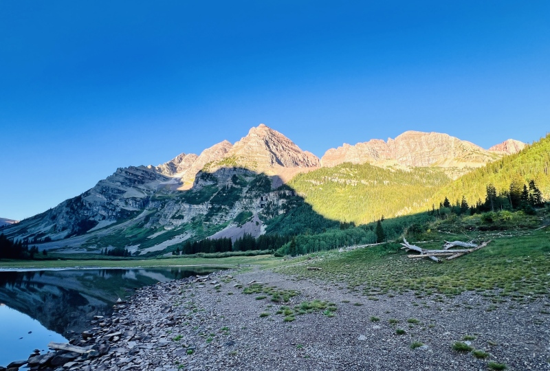
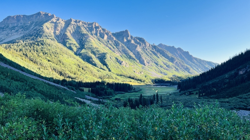
I hope the following proves useful to anyone else asking the same questions. Thoughts About Thunder & Lightning + Background At the time of this writing, I'm 5 peaks away from finishing both the old & new Centennials lists. After knocking off peaks like Dallas, Arrow/Vestal, Ice/West combo, and Cathedral in recent years, Thunder was one of the last peaks I had left in the Centennials that instilled apprehension. For some reason, I was more nervous about this one than I am about Jagged—mainly due to the reportedly steep/rotten nature of Thunder. I attribute most of that apprehension to Roach's description in his guidebook. He seemed to go to great lengths to emphasize how horribly loose and rotten this peak is. After climbing both Thunder & Lightning, I'd say the reports of Thunder's horrid nature have been greatly exaggerated—at least in late summer conditions via the standard west slopes route. Lightning, which we descended via the "standard" couloir, was another matter in regard to loose rock, but still went far better than expected. Since that's a very subjective opinion, here's a little info about me: I'm 41. I grew up the kid of two dedicated Colorado peakbaggers, so Colorado 13ers are very familiar to me. I've climbed around 300 Colorado summits, including all the 14ers. However, I've never ascended to the ability level of many of the more popular and capable contributors of this site. Routes like the Megamydal Traverse (or even the Bells Traverse) are generally beyond my desire/ability to handle. I don't seek out 4th/5th class terrain; I usually try to avoid it. I hate early starts, and a 10-mile route typically takes me most of a day (i.e., I'm not particularly fast most of the time). I also don't like going into routes blind. I tend to do a lot of homework on my routes. Hopefully that info helps put the rest of my report into context. On this climb, I was also accompanied by a friend making his first-ever ascent of any Colorado peak. (He had some solid scrambling skills going in). The quick summary is that I found Thunder to be an enjoyable climb, and not particularly dangerous feeling if climbed on its own. My fear of steep snow when not going downhill on skis and some gear issues scuttled any early-season efforts at climbing Thunder, so I ended up opting for a late summer climb. I'm glad I did! For all the build-up about loose rock, I didn't think this peak was any worse than the average Colorado peak that involves talus slopes. Up until nearly 13,000' on Thunder there's a surprising amount of tundra and solid footing to work with. Overall, the terrain up until that point is really quite enjoyable with a series of grassy ledges and mostly stable rock to work with. There were only a few short sections where we needed to traverse much true talus. Doing so was unremarkable compared to other similar peaks and did not feel particularly exposed or dangerous. The summit ridge was quick and rather fun. If Thunder is your only objective, I'd say it's easier than Cathedral (in summer), and easier than peaks like Hagerman or Ice. I'd also rate it as easier than Pyramid Peak. Be safe, take a helmet, but know if you've climbed any of those other peaks, you probably won't have much trouble with Thunder either. Since I also wanted to include Lightning in the day's quest, that's where things got interesting, but also went surprisingly better than expected. Unlike most other reports, I opted to sequence Lightning AFTER Thunder since Thunder was my main objective and I didn't want to introduce a new peakbagger to the potentially hardest terrain right off the bat. I thought it might be wise to start on a route where the difficulty slowly increased so that we could bail out if need be, or make a hasty retreat in the event of weather without sacrificing the primary objective. This proved to be a good decision, as the day's route slowly increased in difficulty but at a nice, steady rate that wasn't too much for either of us. If you'd like more detail than that, keep on reading.... -------------------------------------------------------------------- The Longer-Winded Version.... After spending a 4-day weekend solo backpacking in the Weminuche earlier this summer, I had a reset moment where I came to the conclusion that doing these peaks solo was becoming a bit too dangerous for my tastes and also a bit too lonely. I enjoy the mountains, but I enjoy them even more when there's someone to share the experience with. Mountain climbing, especially solo, is a very selfish sport, and I was starting to feel the effects of that. I still enjoy solo climbs, but my new self-imposed limit was that anything exceeding easy class three now required a climbing companion whenever possible. With that in mind, my original plan for the weekend was to round up a partner for a quick three-day excursion to pick up Jupiter, Grizzly, and McCauley via a Needleton train drop. One by one, options for climbing partners bailed out. Luckily, as everyone else bailed, one of my more athletic friends who was an experienced sport climber expressed a lot of interest, so we scrambled together a plan and were able to book the last two tickets for a Labor Day weekend trip. Unfortunately, an early bad weather forecast coupled with a broken dishwasher meant I didn't feel like gambling away the cost of the train, so we cancelled those plans on Monday morning, 5 days prior. Armed with a few reports that there may be permits released 3 days prior, I checked the Bells parking reservation site at 8am on Wednesday with the goal of tagging Thunder Pyramid. No dice. I checked all over the site and never could find any confirmation of this practice. At 9am, I gave it one final check, and was surprised to see 10 permits each for Friday and Saturday. The timing and batch of 10 each for two days at a time seemed odd but I wasn't about to pass them up, so I grabbed a midnight-to-midnight for each day and watched with baited breath as the forecast vacillated for the weekend, then steadily improved to the point it looked like weather wouldn't be an issue at all. We gathered supplies and set out from Grand Junction around 7pm Friday evening with the goal to "sneak" into the Bells parking area and sleep for the night, then start our hike around sunrise Saturday. Upon arriving at the Bells parking area, we found a relative lack of signing regarding where specific permit types should park. Was midnight to midnight considered overnight, or day use? Those were the only two options. Luckily, there was a camper with a "host" sign right at the bottom of the overnight lot. We spent a few minutes talking with a very enthusiastic and helpful host who seemed very excited to help. She directed us to park in the overnight lot, take a nice power nap, and leave out early in the morning. I'd been worried they would discourage or outright prohibit car "camping" in the lot, so it was a relief that she was actually encouraging us to use the lot for that very purpose. We bedded down for the night to perfectly clear skies and a lot that was more quiet than any of the other 14er trailheads I've been to in recent memory. We were up and moving toward the trail a little after 6:40am the following morning. I don't think we encountered a single car entering the lot or party prepping to climb at any point in the night. Strange for a Friday night on a Holiday weekend at a 14er trailhead! After spending the night recently at the Handies, Huron, and Massive trailheads, the night spent at the Bells parking lot was pleasantly quiet and felt WAY less crowded. Having a functional restroom was also a nice bonus. After snapping a few obligatory photos at Maroon Lake, we started off at a good clip (at least for me) up the trail to Crater Lake, arriving somewhere around 7:30-ish. There were quite a few people on the trail by this point, but most seemed to be doing the four pass loop. After a few more photos at Crater Lake, we proceeded up the trail to the creek crossing. The trail through here was good, but seemed to go a lot slower. I think it was around 8:20 when we finally hit the creek crossing, taking a few minutes to change out of my trail runners and into more suitable footwear. 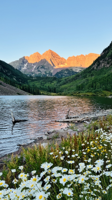
Along the approach to the creek crossing, the most appealing-looking route appears to take off prior to the crossing in order to avoid an obvious swath of avalanche debris. It may be possible to do so, staying to the left of the debris, but this unnecessary. Reading other people's reports, it seemed relatively consistent that the best route toward Thunder was to continue up the trail farther than Roach's description in order to completely bypass the avalanche debris and intersect a rough trail up through three small cliff bands. I found WildWanderer's report especially helpful. The gist is as follows: Take the main trail past the creek crossing and begin ascending on the trail through tall willows. Your goal is to get even with the far edge of the first section of pine trees after the creek crossing that lies in between the trail and the first cliff band. Somewhere at the point where we were nearly equal with the edge of these trees, there were some small openings in the willows where they intersected some young pines and small clearings. We took the path of least resistance toward the right edge of the trees and stumbled across a well-worn path which led to a small meadow. We followed the meadow east-ish toward a large talus field that contained a large boulder near it's western edge. We found some cairns and more sections of spotty trail leading though here. At the head of the talus field, there's a helpful and rather obvious gully that ascends to the northeast and we found more cairns and trail making it's way up to it. We followed plentiful cairns and signs of travel up through the gully, then up through two more gullies as the "trail" led us higher into Len Shoemaker Basin. This part should be relatively easy to follow for most peakbaggers who have developed any sort of off-trail navigation skills. Once through the three minor cliff bands, the going turned to mostly tundra and the routefinding was relatively easy—just follow the path of least resistance. 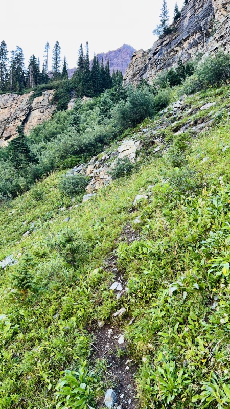
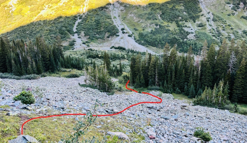
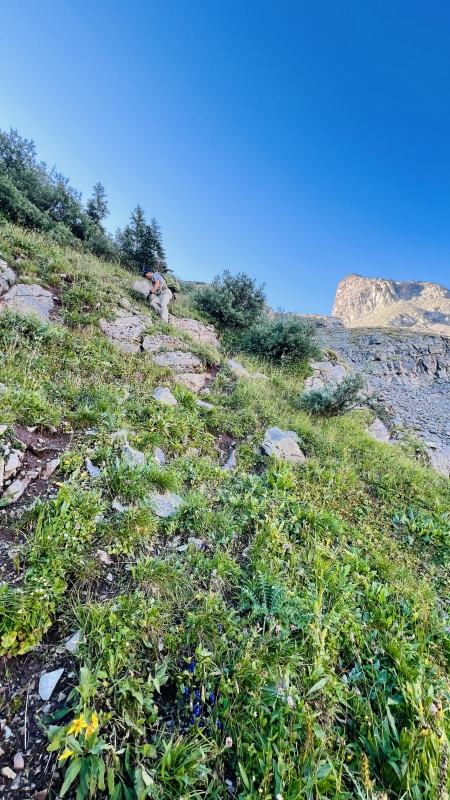
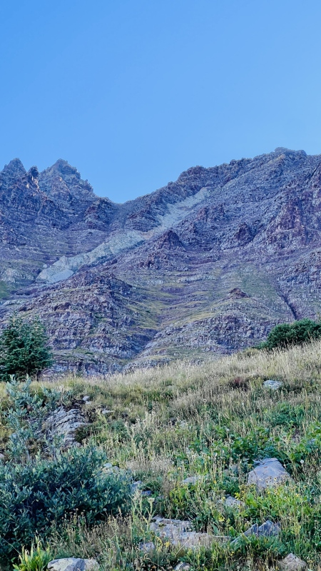
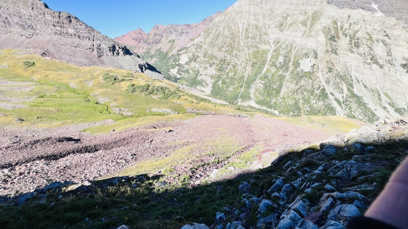
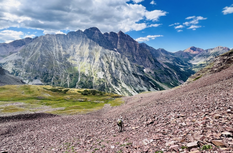
We paused briefly in the basin to consider our choices. With Thunder being a Centennial and Lightning being newly unranked, the priority today was definitely Thunder. By all accounts the ascent up Lightning was likely to contain the more difficult terrain, and our observations in the basin easily confirmed this. There were some nice looking swaths of tundra leading up to Thunder's white gully and from there the rest of the terrain to the summit looked manageable. Conversely, the gully leading to the Thunder/Lightning saddle looked dark, choked, and foreboding. I knew most trip reports mentioning it indicated users had trouble with snow in the gully and usually ended up ascending 4th class terrain outside of the gully itself, which looked even worse. Based on that, we had no idea if we would run into cliffs and drops within the gully itself, and if they'd be any worse than the 4th class options to the side if we were forced out. The foreboding appearance of the gully and my thirst for another Centennial won out, so we set off for Thunder reasoning that we could always try for Lightning and backtrack if needed since the day's weather appeared promising. Unfortunately, I don't have many photos of the lower route up Thunder from the basin due to the sun angle, but it's pretty obvious: just aim for some patches of tundra that break through a small lower cliff band between about 11,800' - 12,000' and wrap over toward the base of the white gully. There's even a bit of a tundra slope leading up through the talus heap below that can expedite progress. Once on the ledges, we quickly picked up the vestiges of a climber's trail and a few cairns. 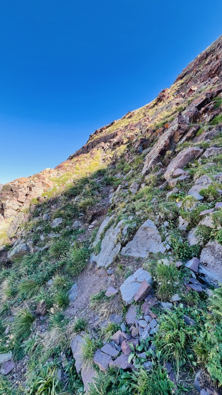
We continued to follow some very pleasant tundra ledges up and up, staying more to the right of the beginnings of the white gully. To this point, the route was everything I've come to love about 13ers: an easy, beautiful trail followed by a pleasant off-trail approach through mixed rock and tundra leading to a private feeling basin with fun little class 2+ pitches here and there to keep things interesting, but no real obstacles or exposure to deal with. I'd climb this stuff all day! 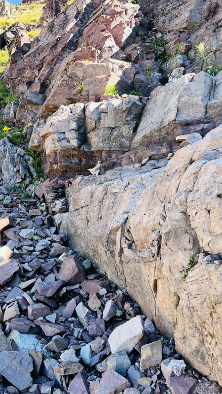
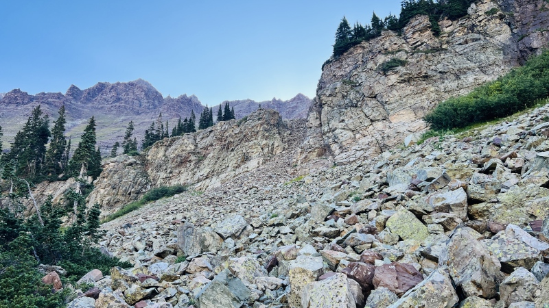
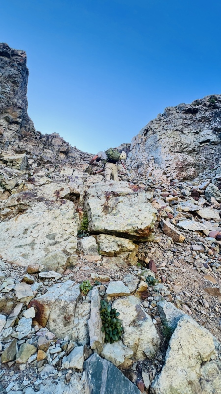
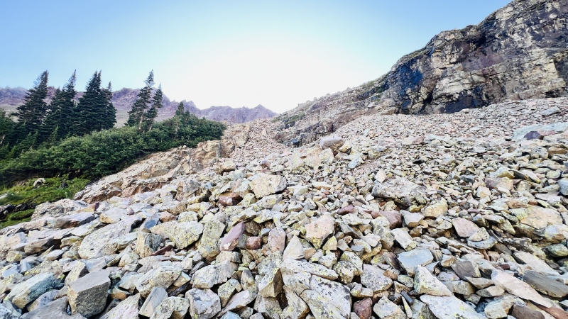
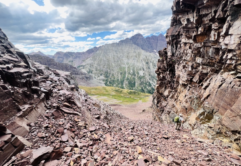
We continued on up around the area of the white gully, each of choosing paths on different sides that both seemed to go equally well. It was steep, but not unnervingly so and we felt quite comfortable and secure in the terrain up until around 13,000'. Around here, the tundra starts to disappear and the amount of talus increases, but it never felt like a loose pile of chossy garbage. There were still lots of firm areas of dirt and embedded rock to work with, or even pitches of solid rock to scamper around on if that's your preference. The route options were plentiful. 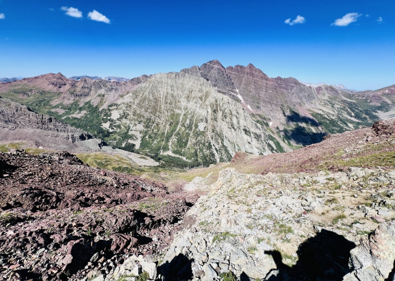
We ascended up more on the left side of the white gully until somewhere past 13,400', then began contouring over to the right. I probably went a little too high, as my altimeter was reading close to 13,550' and I started to encounter some minor drops that I was able to easily avoid. I worked around the crest of a small ridge and found some more solid rock that offered some fun class 2+ ascending. This eventually turned into another swath of prominent gray amidst a sea of red rock, and the quality of rock was noticeably better here, so I followed the little ridge crest for the remainder of the ascent to the ridge proper. 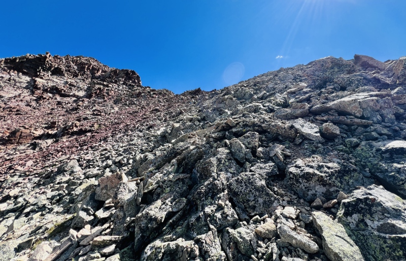
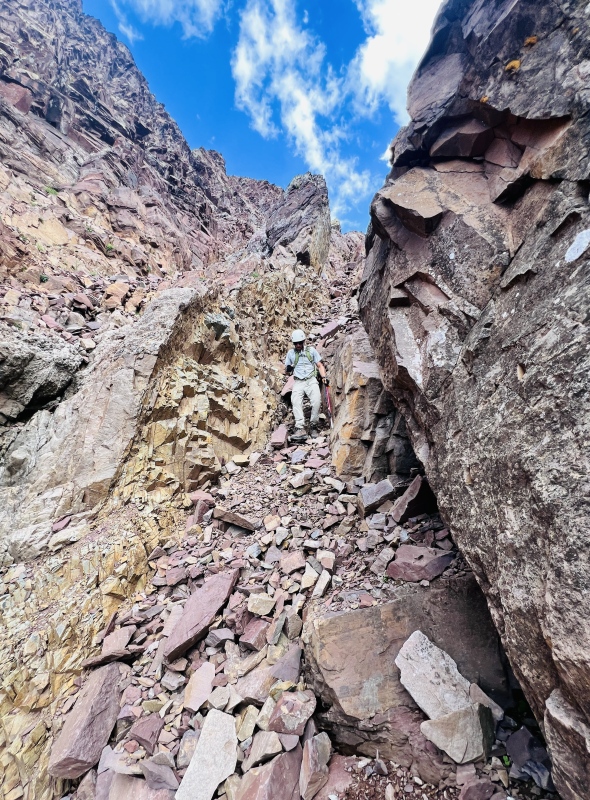
Once on the ridge crest, the first step came almost immediately. At first glance, no obvious bypass presented itself, but we soon spotted a small cairn perched on a ledge part way up the step on the far left (west) side. This marked a nifty little ledge that bypassed any real difficulties and went at a rough class 2+. 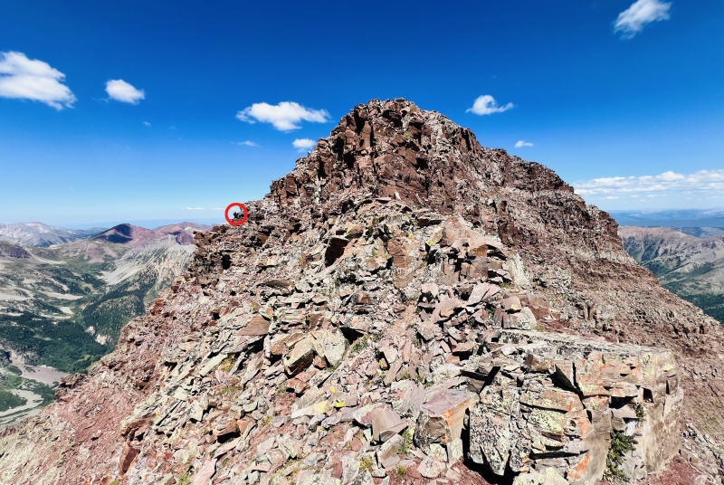
A little more airy scampering along the ridge crest led to a final, small step that took one easy class 3 move to mount, then it was summit-ho! To this point, I felt like Thunder barely deserved a class 3 rating. I typically climb with a 90cm mountaineering axe that doubles as a walking stick and it was only the final step that finally forced me to pass the axe out of my hands and set it above me so that I could use both hands for ascending. Otherwise, I just kept it in one hand like a walking stick the entire way up with no issues, which I tend to view as class 2/2+ terrain. The weather for the day was holding beautifully, so we took a leisurely lunch break, called the family, and contemplated our next steps. It was somewhere around 12:20 when we summited. Slower than we'd hoped, but realizing we'd also been taking a relaxed approach that included photographing the four ptarmigan we encountered for a good 15 minutes, I was definitely NOT disappointed and was relieved to have summited one of my remaining "hard" centennials with little issue. 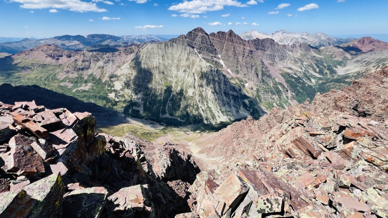
Even though Lightning no longer officially counts (at least according to John Kirk), it seemed almost foolish to ignore the peak altogether since any subsequent ascent would involve a harder route. With mostly clear skies and refueled stomachs, we set off slowly down the airy ridge and headed to the top of the 3rd class couloir mentioned in Roach's route South Ridge route. Getting to the top of the couloir was no issue and was easy to identify. We took a moment to assess our route, attempting to note how far we needed to drop, but the entirety of the couloir was blocked by a small ridge that divides the upper portions. Still, the couloir didn't look all that imposing, so we set off slowly down. It didn't take long for the character of the mountain to begin changing. Whereas the west slopes/white gully had plentiful patches of tundra, pleasantly solid rock options, and an overall angle that didn't instill any significant concern, this couloir was anything but. Similar to the couloir up Cathedral in summer, this one is filled with the worst kind of stuff: hardpan covered in loose gravel topped with sliding rocks over a base of decomposing rock. While there were never any specifically committing moves, the entire thing felt very exposed while descending and we spent most of the descent with both hands and feet engaged with the dirt/rock in order to prevent a fall. It was slow going and felt like a repeat of my slug-fest with Cathedral last September. Not fun! At one point, I seriously considered bailing and retreating uphill, but Joe seemed okay with it and wasn't relishing a re-ascent, so we pressed on. The couloir had an annoying characteristic of making you think you could bail out and traverse over on grassy ledges to the saddle, only to limit escape with short drops in the rock to the west side. That's probably for the best anyway, since if we'd bailed out earlier, the ledges on this side of Thunder all sweep up away from the saddle, making it wise to drop a little below the elevation of the saddle, then angle up unless you want to breach through one of the ledges on the way over to the saddle (not a big deal to do, just annoyingly loose in spots). 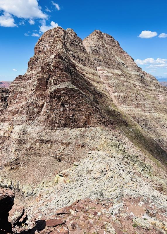
Finally at the saddle, I was developing a severe distaste for Lightning Pyramid and was ready to be off of this pile of garbage. The scamper to Lightning's summit felt slow and endless, though it only took about 10-15 minutes from the saddle and was actually a fun, sporting class 2+ scamper. Borrowing a phrase from Camden7, between the "shitrock" couloir we'd just descended and our impending descent options to either drop into the unknown of the Lightning/Thunder couloir or re-climb what we'd just done and go back down Thunder's west slopes, I was in no mood to enjoy this portion of our climb. Years ago, I climbed with a guy that had developed similar feelings about neighboring Sleeping Sexton and let the mountain know it by reliving himself on the summit. The connecting couloir on Thunder is about that level of "fun," just for reference. With the weather still holding, we enjoyed another long summit break, ate some food, and mulled our options. It had taken us about 1:20 to make the traverse and was now approaching 2pm. We knew the ascent up "shitrock" couloir would go, but would be an absolute suffer-fest. (BTW, I hereby submit that as it's official name). From there, the descent down the west slopes was a known commodity and not very intimidating. On the other hand was the option to attempt a descent of the Thunder/Lightning couloir and hope we didn't encounter anything beyond our skill. I'd come equipped with enough rope and webbing to rig a 50-60' rappel if needed, but options for anchoring on this type of terrain are notoriously few and far between, so I wasn't 100% confident that would suffice if we ran into trouble. With absolutely no confirmed reports of the couloir itself going and a limited view that seemed to end at a significant drop about ½ way down, I was very hesitant to take this approach. The only opinion I could find about the do-ability of this route as a descent option in dry conditions came from WildWanderer who mentioned in her report that she would have rather reversed her route. Keeping that in mind, I reasoned that I'd successfully climbed many other 4th class routes without issue, so odds were that I could make this one work as well. Knowing it was late in the day and we were both dragging a bit ultimately tilted the scales, so off we went, venturing into the relative unknown. The first part of the couloir went easily and was no more than standard class 2 talus. Loose, but easy peasy. This lifted our spirits some, but I was still leery of the drop mid-couloir we couldn't see past. At the point we'd encounter it, we would have dropped nearly 600-800 feet, which would be no small task to re-ascend if it proved insurmountable. As we approached, some additional difficulties presented themselves as the couloir formed several small, steep branches that initially looked cliffy. Taking the center line of one of the southern (left) arms offered some nice, tight opposing rock faces to work with. Luckily, the little arm I chose went much more easily than it appeared at first glance, offering some nice options for stemming-based moves on the descent that were reminiscent of slot canyoneering moves that I've grown fond of. The relative security of having two opposing rock faces to work with was far preferable to the loose, open feeling of the day's previous couloir, so we forged on down into the abyss with the apparent drop looming. 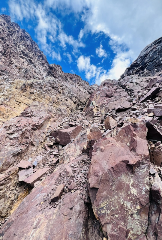
Approaching the apparent drop, we took turns descending to mitigate potential rockfall hazards, or split sides of the couloir whenever possible. The drop itself proved to be little more than a slight bend and minor steepening/narrowing of our passageway that went easily. What a relief! 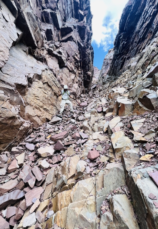
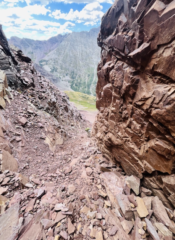
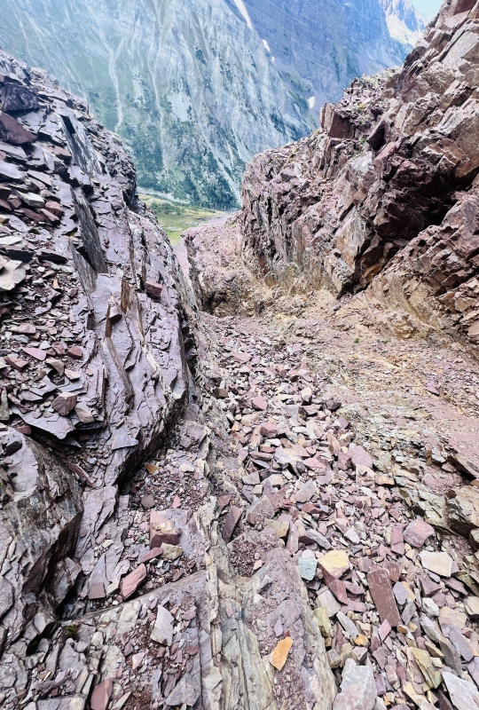
We labored down a little farther, continuing our vigilance in taking turns or splitting sides of the narrow couloir. It didn't take long before another, more significant-looking choke point occurred. Similar to the first, however, the way down involved little more than a single easy 3rd/4th class move before we were back to hugging the steep walls and plunging into the talus. If there is a crux to this couloir, I guess you could say this is it, but it isn't much. I'm sure it would feel much different with snow, but in dry conditions, this should be easily navigated by anyone possessing reasonable skill on 3rd class terrain. It may also feel a lot harder up-climbing due to the shifting rock underfoot, which is why I'd recommend this route in the direction we took (Thunder › Lightning). 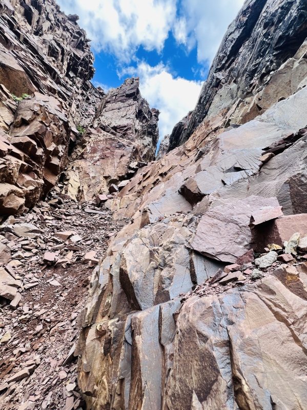
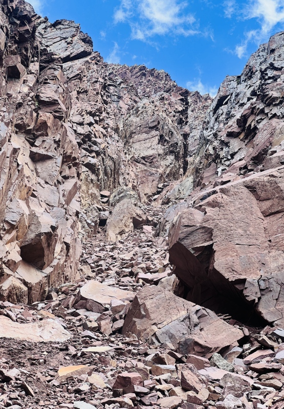
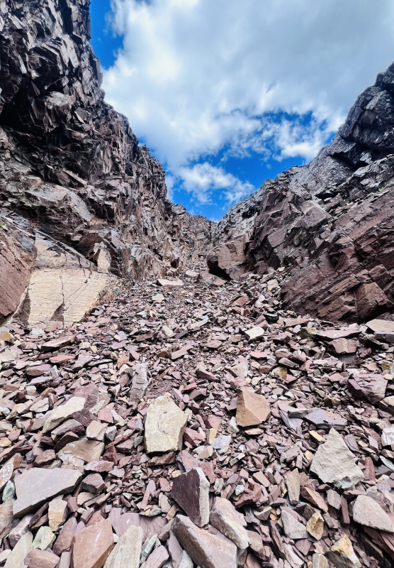
If it doesn't seem like there's much detail in my report about the couloir, that's because it doesn't require much to figure out. There's no specific obstacle to overcome, and the passage goes at somewhere around what I'd estimate as 3rd class. It's probably the narrowest couloir I've navigated to date, which was impressively narrow at times. In places, it reminded me vaguely of a Utah slot canyon, just with elk rock walls instead of smooth sandstone. The walls generally felt solid and secure and gave us a sense of security on the descent as we could consistently use them to brace ourselves. However, the bottom of the couloir is definitely quite loose and contains lots of basketball-size rocks that are ready to roll and ricochet off the walls at the slightest touch. I vastly prefer descending this type of terrain to ascending it, so I found the route far more efficient than the alternative of re-gaining Thunder's ridge and following the west slopes back down. My climbing partner whole-heartedly agreed and we were both elated to find the couloir went so easily relative to the limited descriptions we'd encountered. That being said, while the climbing wasn't particularly difficult or exposed, this couloir would be an absolute death trap if significant rockfall occurred. DO NOT enter it if you suspect another party could be in it. It's like the hourglass on Little Bear overdosed on steroids. The nearly vertical walls and narrow width—often 4-10 feet wide at most and running for at least 600 vertical feet—mean that any rockfall is going to be directed right at your head, or the head of anyone else below. The chance of someone dying in here if multiple parties are present once the snow melts is extremely high. At one point on the descent, rock started settling a few hundred feet above us, sending some large rocks down that stopped about 80' from our heads in one of the small bends. It was reminder that even with great care, accidents can still happen, and this particular couloir is an accident waiting to happen for anyone not experienced with loose talus. Overall, it bears some similarities to the red couloir on Crestone peak, but is far narrower and presents more rockfall hazard which is only mitigated by its relative unpopularity. Getting off my little soap box there, we continued down the remaining piles of talus to the protruding tongue of the emanating rock glacier. This proved one final tricky section to descend as the edge of this tongue has been weathered down to hardpan and is very steep for about 40-80'. I found the best line was to contour around it higher up to meet the tundra as high as possible. Once across, we collapsed into the soft tundra, filled our water, and enjoyed the elation of having successfully descended a potentially difficult route while spending a few moments basking in one of Colorado's hidden pristine places. Filled with relief, fresh water, and snacks as the sun filtered across our faces and clouds rolled by, I was reminded why climbing can be so much fun: the labor, the accomplishment, the beauty, and the camaraderie. Rejuvenated, we set out for the somewhat long, but enjoyable hike back down, enjoying some good conversation and views as the afternoon clouds finally rolled in. Our pace to the car was relatively relaxed as we chatted with a few other campers and hikers along the way. We eventually made it back to the car sometime after 6:45—over a 12 hour day. If you've stuck with me this long, thanks for reading! Please let me know if you find anything that needs corrected or I can help clarify for future climbers. Thumbnails for uploaded photos (click to open slideshow): ")
")
")
")
")
")
")
")
")
")
")
")
")
")
")
")
")
")
")
")
")
")
")
")
")
")
")
")
")
")
")
")
")
")
")
")
")
")
")
|
| Comments or Questions | |||
|---|---|---|---|
|
Caution: The information contained in this report may not be accurate and should not be the only resource used in preparation for your climb. Failure to have the necessary experience, physical conditioning, supplies or equipment can result in injury or death. 14ers.com and the author(s) of this report provide no warranties, either express or implied, that the information provided is accurate or reliable. By using the information provided, you agree to indemnify and hold harmless 14ers.com and the report author(s) with respect to any claims and demands against them, including any attorney fees and expenses. Please read the 14ers.com Safety and Disclaimer pages for more information.
Please respect private property: 14ers.com supports the rights of private landowners to determine how and by whom their land will be used. In Colorado, it is your responsibility to determine if land is private and to obtain the appropriate permission before entering the property.