| Report Type | Full |
| Peak(s) |
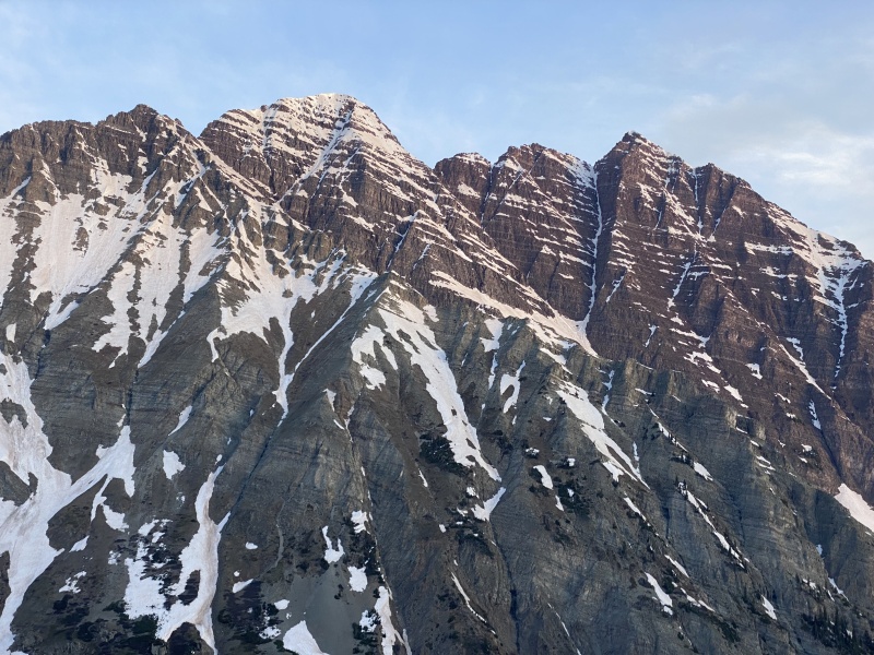
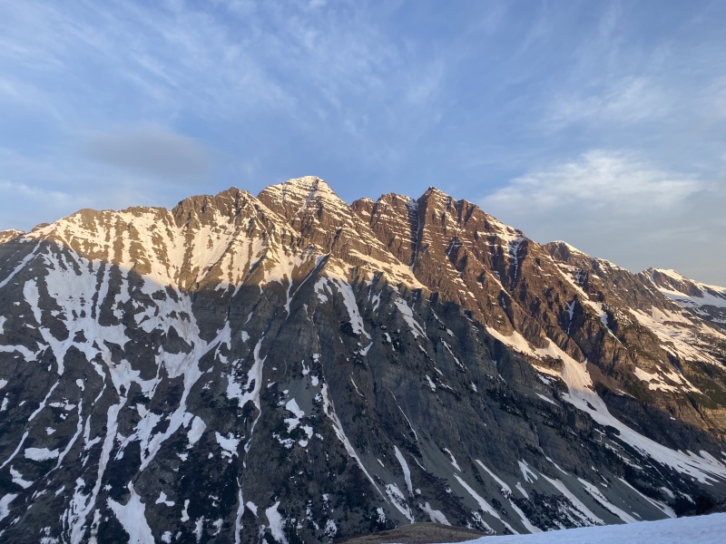
"Thunder Pyramid" - 13,944 feet "Lightning Pyramid" - 13,729 feet |
| Date Posted | 05/30/2022 |
| Modified | 05/30/2023 |
| Date Climbed | 05/28/2022 |
| Author | Camden7 |
| Thunder and Lightning |
|---|
|
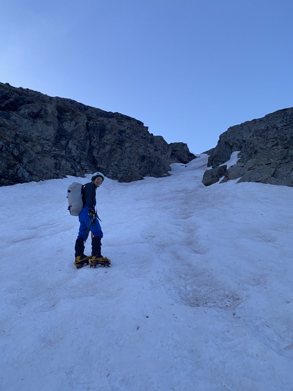
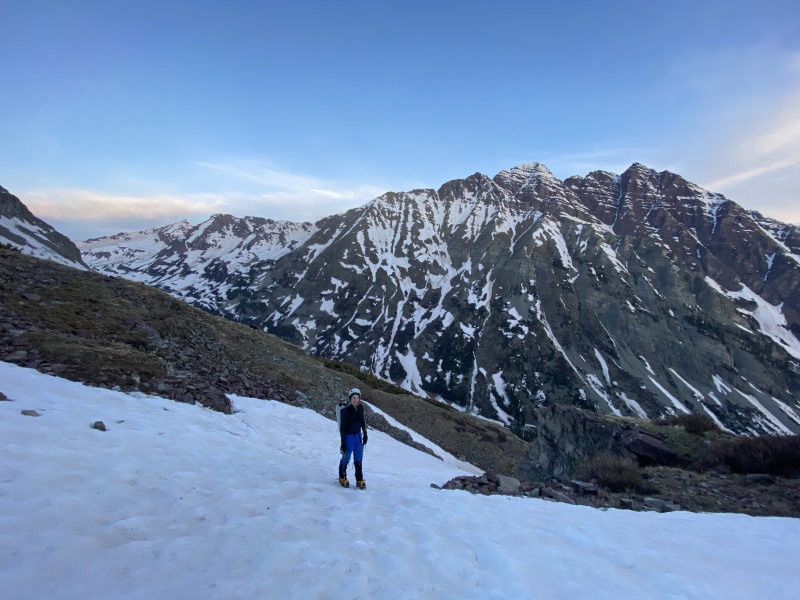
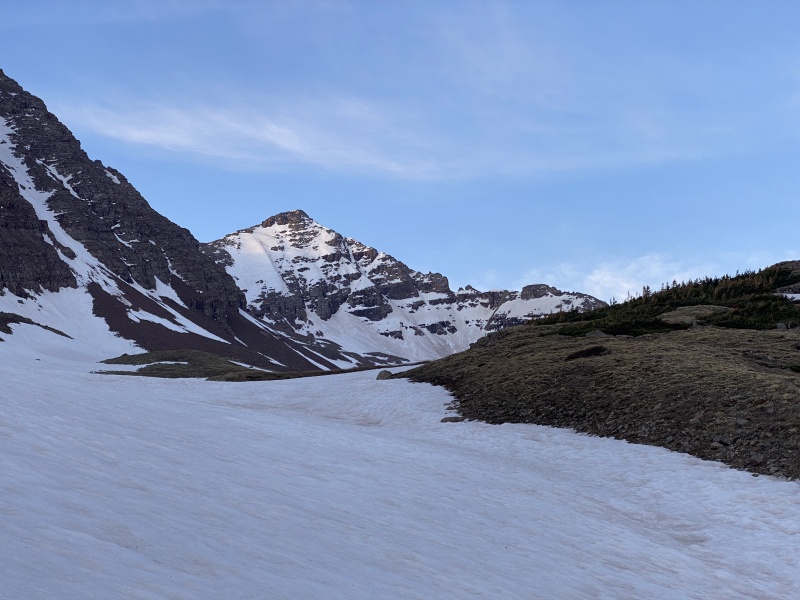
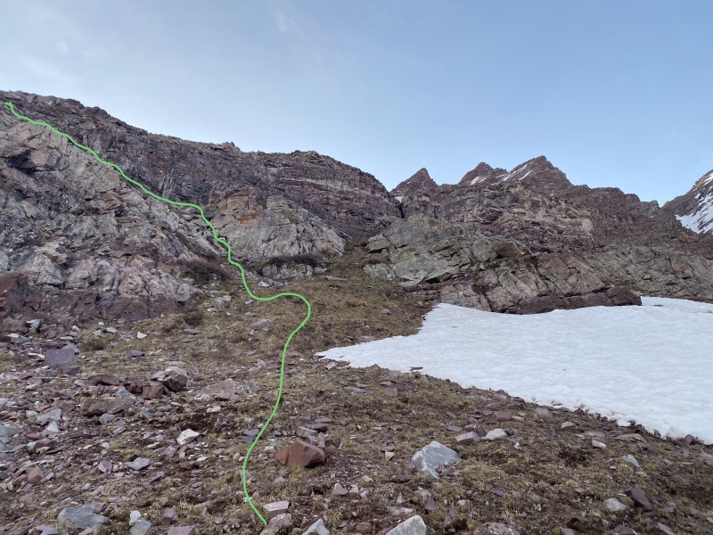
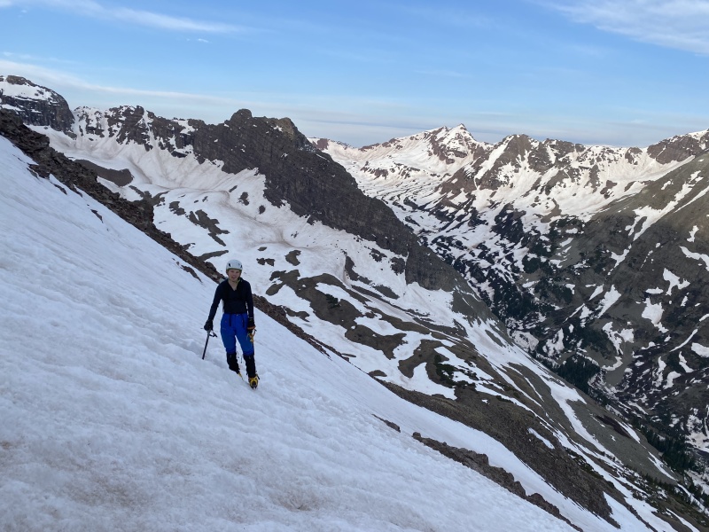
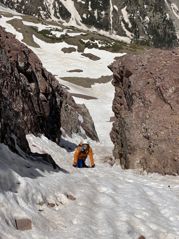
We fly out in 2 weeks... in 10 days, 7 days... My dad and I fly to the Cordillera blanca in Peru on Friday the 3rd of June. I can't walk through the house without wading through waist high piles of gear. Ropes hang from the stairs, a mock crevasse that we practice rescuing each other from several times a week. Everything is closing in. We are feeling super stressed on time. So what do we do? Unpack half our gear and head to Aspen. No better time to bag another Centennial, right? We rolled out Friday afternoon around 3:30 pm, and stopped in Eagle to pick up a little extra trail food for the weekend. I then drove the rest of the way from Eagle to Aspen. In a Sprinter van with nothing but blindspots all over. And it was my first time on an interstate. (I am 15 and just got my learner's permit). Glenwood canyon was interesting. We pull in to the interceptor lot at 8:30 after having dinner in Glenwood. We hit the pillows early knowing that the alarm would hurt. Apple's Radiate alarm wakes us at 1:40. We always use that alarm for really early starts on mountains. I don't know if I should love it or hate it. We get dressed, eat breakfast, and pull away at 1:58. We pull in to the Maroon Lake lot at 2:27. We boot up, throw on packs, and start walking at 2:45. This is my 5th time walking to Crater Lake, and I swear that trail gets rockier every time. And longer. They haven't cleared this years deadfall yet (or left just enough to bother the tourists), so we had to negotiate a couple downed trees, but nothing terrible. We started pretty slow, getting to Crater Lake after 40 minutes. After a sip of water, we set off towards West Maroon Pass. The next 2 mile segment to reach our turn off was brutal with raging creeks, loads of downed trees, and lots of deep snow. It seemed that very few people had been through since the previous weekends storm, if anyone at all. After 55 minutes, we finally reached the Maroon Peak turn off. We continued another couple hundred yards, then post holed east through the forest to he furious West Maroon Creek (3.8 miles from trailhead, ~10,500 feet). I have never seen it so high, but luckily the downed trees from the avalanche path allowed for safe crossing. We plodded up the gentle slopes towards Len Shoemaker Basin, negotiating snow, lots of spring runoff, and an abundance of downed trees. At 10,800 feet we put away headlamps and pulled out crampons and a single axe each. We headed up the middle of three visible snow gullies in the first cliff band. It would have been less steep to take either of the other gullies, but this was the most direct and didn't exceed 50*. The snow was firm and we soon found ourselves faced with the second cliff band. We went far left (northeast). This was again, steeper but more direct than the other options but didn't exceed 45*. At this point, first light was hitting the bells, and we took a series of stops to enjoy the view, totaling at about 30 minutes. A quick snow plod brought us to the base of the cliff and we pulled off crampons. 
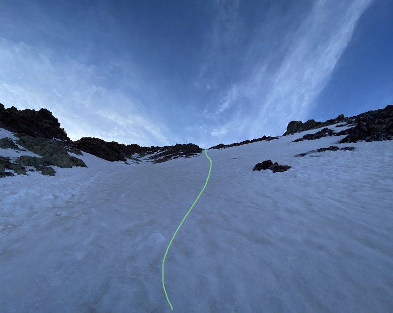
The lower part of the couloir is easy, about 40* I think. Really the only thing about it is the cliff at the bottom making it a no-fall zone. The couloir broadens into a shallow bowl in the middle of the face and shallows to about 35*. Above that it steepens to about 40 again, then the wing out to the ridge is about 45. 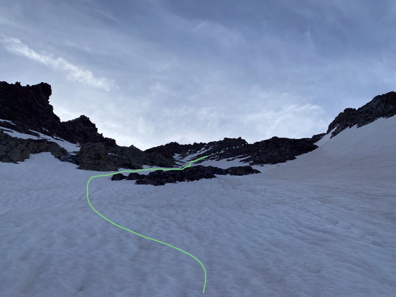
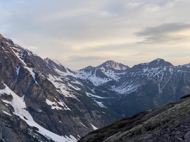
The snow ended about 150 feet below the ridge so we had to climb some horrendous class 2 talus with exposure. Thankfully (?), Many of the rocks were frozen together with verglas. As you climb, views open up to Snowmass and Capitol. 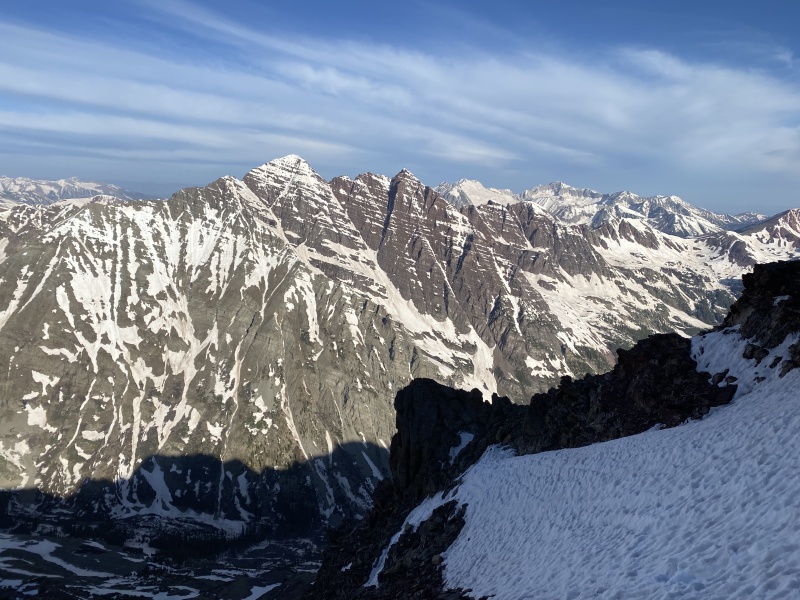
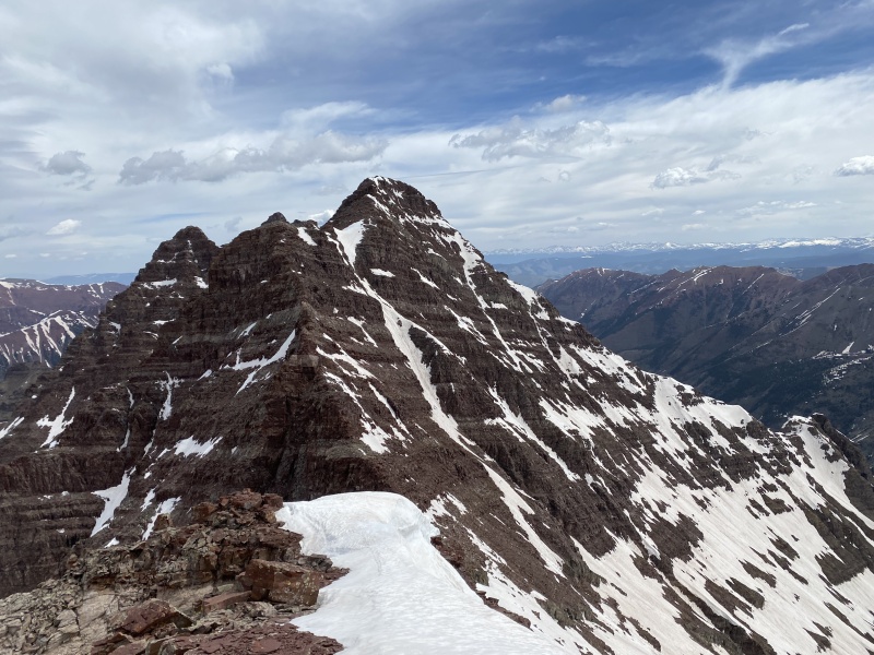
Then, when you hit the ridge, the eastern panorama is a little shocking, from Cathedral Peak to Precarious Peak and everything in between. It is also sunny and warm on the ridge. The ridge to the summit looks really intimidating at first. 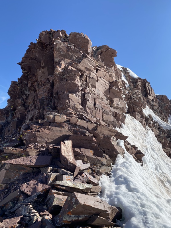
We passed this step by traversing left (northwest) across loose class 3 ledges to a corner. There was one spooky step across and a fall here would ruin more than your day. 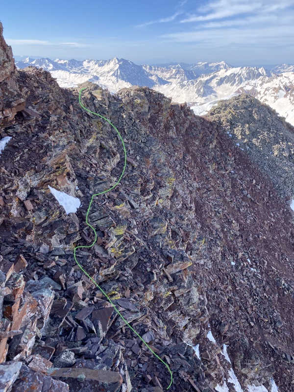
On the way down we found a downclimb that avoided the step across. 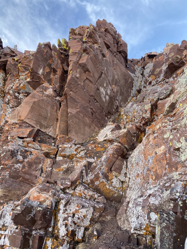
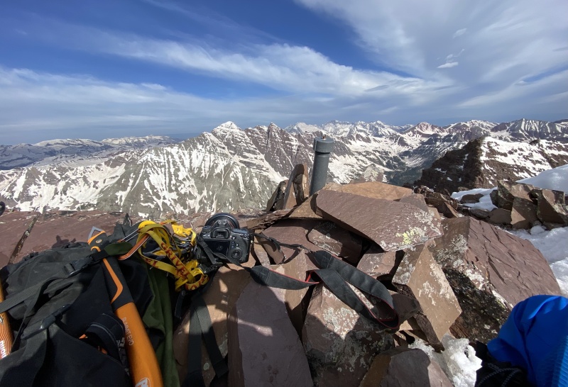
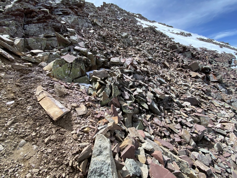
Both the chimney and the ledge have their virtues, ledge is easier but looser and more exposed, chimney is harder but more solid and less exposed. Pick your poison. Once past this cliff band. the summit is yours after an easy but dramatic class 2 ridgewalk. There might be a couple 3rd class moves, but nothing memorably difficult. Anywhere that wasn't snow covered illustrated the true difference between elk 14ers and 13ers. When I had read that Thunder Pyramid was way looser than Pyramid I was like "Yeah whatever, its all bad rock" but TP truly brings it to a new level of loose. The summit was glorious but breezy. we lounged for 15 minutes then continued on our way. 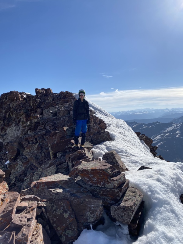
We decided to take a look at the traverse to Lightning Pyramid, which I guess is no longer ranked but is still cool so we figured it was worth a try. I knew the traverse was supposed to go at 4th class, albeit with high exposure and as my dad said "what they call in Latin 'Shit-rock'" The first portion of the ridge south of where we first gained it that morning was easy and fast but loose class 2 with occasional 3rd and minimal exposure. There were a couple cool slabs such as this one: 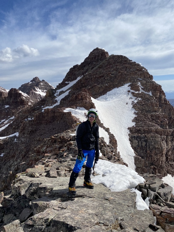
From Point 13,740 we carefully considered our options. The ridge crest was an obvious no-go. The snow couloir was dangerously soft and cliffed out before providing a safe escape. We decided to check out the series of ledges and cliffs on the southeastern side of the ridge. This entire 180 vertical foot downclimb was no-fall terrain the entire time with crumbly rock that was rarely attached to the mountain. I would say this is multiple steps up from any of the standard 14er routes. 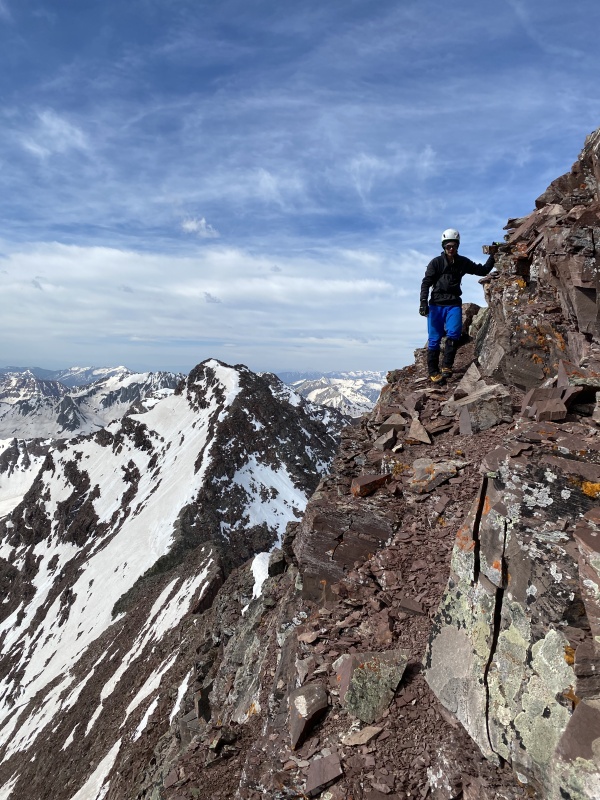
The first 3 or 4 ledges and downclimbs were likely only class 3 but felt harder due to rock quality and exposure. Then came the first of the two largest, steepest bands. Although an easier way down it likely exists, our downclimbing route was quite interesting. We were both looking for a way down the rock band and I found this and began down it first. I would say 5.2 - 5.4 because all the best holds were not attached at all. As in, they were the best holds because you could hold them in your hand. I give the rating of low 5th because I used a finger lock, hand jam (less likely to dislodge rock since you aren't actually pulling), and layback along this pitch. 4th class usually avoids the need for those kinds of techniques. After more 3rd and low 4th class downclimbs, we came to the second major band, longer but less steep than the first one. Our route was a chimney with surprisingly solid rock but bad exposure. We had to pass packs down. I would say a full 25 feet of solid 4th. 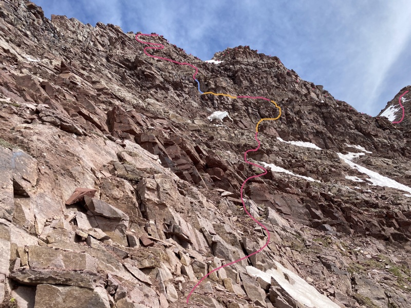
This shows something close to our route. The entire downclimb took about 35 minutes and felt really hard, as I have done very little 4th and 5th class unroped, especially in mountaineering boots instead of approach shoes. Also, we did this as an onsight descent with minimal route knowledge, possibly the hardest way to do something. if we were more informed about the route and going up it instead It likely would have been much easier. 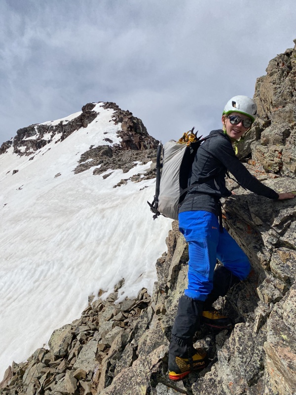
The climb from the saddle to the summit of LP is supposed to be class 2, but with steep and dangerously soft snow above cliffs on the east side where the route is, we had to stay on the ridge crest which offered some fun and cool 3rd class on varying rock quality. On one section of seemingly good rock, a attached block of about 40 pounds held for me but broke when my dad weighted it. Luckily he was able to prevent it from yarding off the mountain. and directly into the Lightning Bolt Couloir where there could have been climbers (there weren't but we didn't know that). 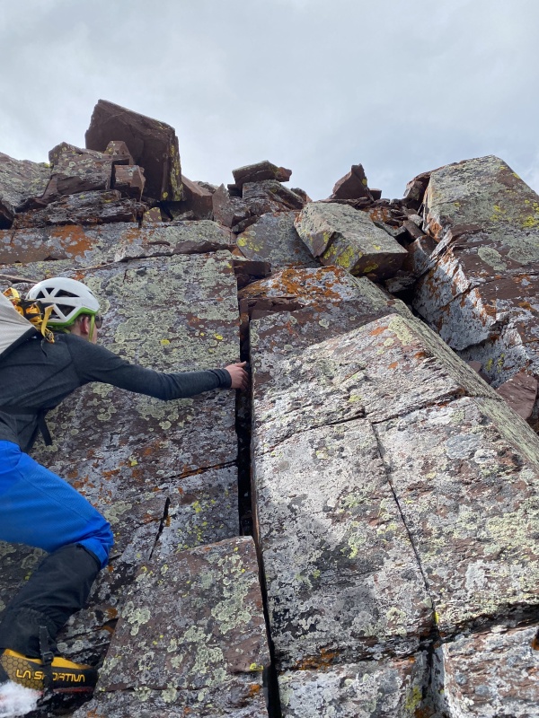
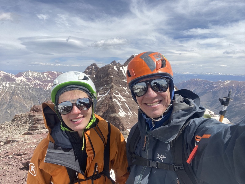
The summit register of lightning had not been signed yet this year, so Team Lyon (our last name) was the first on it for 2022. In the past 7 years it had been climbed something like 28 times, averaging 4 parties per year. That will certainly be less now with LP's demotion. 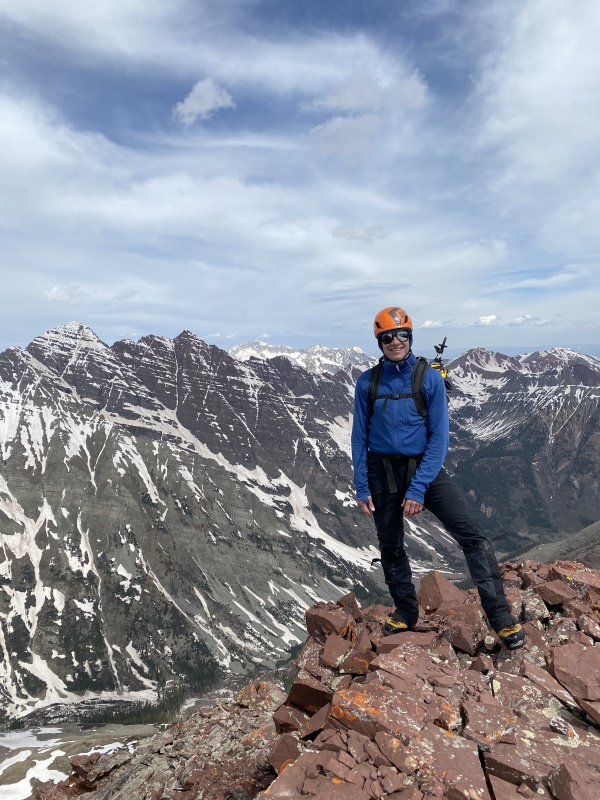
The Lightning Bolt couloir was dry at the top, and the first 200 vertical were as loose as me wearing an XXL tee-shirt. 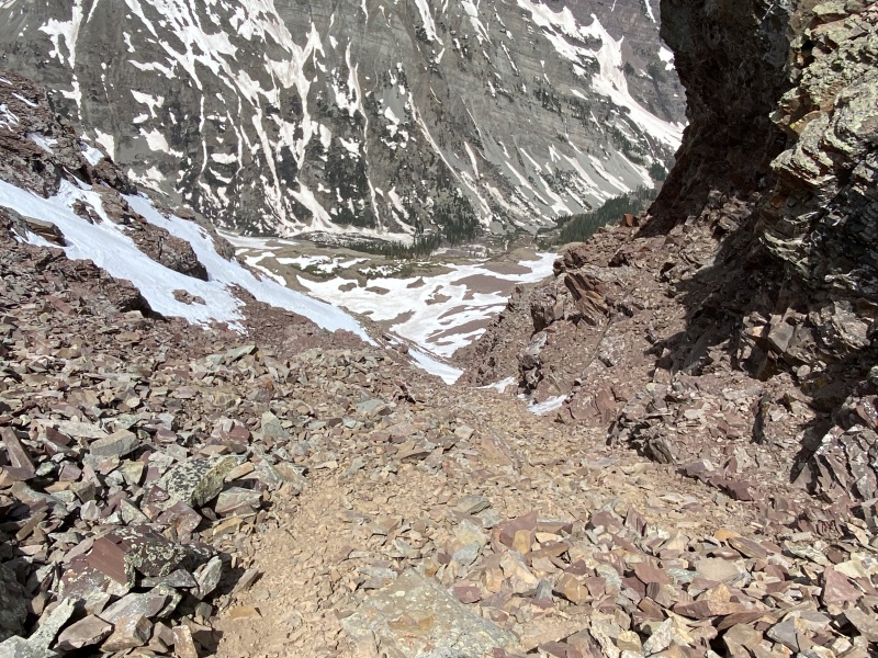
This loose choss was steep, around 60*. A small cliff band made the first choke, and this the couloir held snow from here down. Unfortunately the snow in the upper choke was shallow and soft, resulting in seemingly random occasional post holes to the waist on no fall terrain at the top of a 2,000 foot tall couloir. There is a reason soft snow is hated in the snow climbing world. 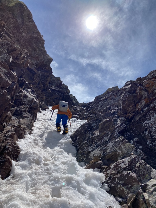
The couloir broadened and became less steep in the middle, somewhat like TP, but even the less steep portions were close to 50. The lower choke was back to around 60, and was terrifying with what is truly "overhanging talus" on both sides. 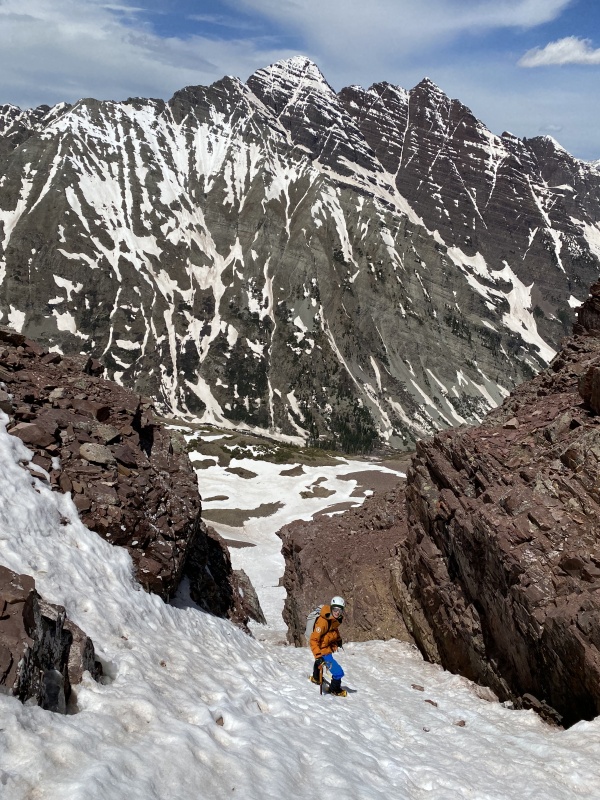
We safely exited the couloir, removed crampons and put away a single tool each. 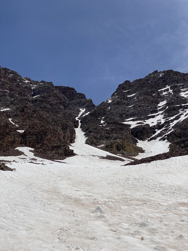
We slowed our descent out of LS Basin to help another party find their way through the cliffs. We were pretty worked so took a long stop before crossing West Maroon Creek. The slog out was slow, post holing to the knee or waist across each slide path on the way out. For some reason Minnehaha Creek and the creek coming out of the North Maroon-Sleeping Sexton rock glacier were both much lower than they had been at 3:30 in the morning. We took another long break at Crater lake to people-watch, them moseyed out. Even early season the tourists were so thick that it was pointless trying to walk faster or pass any of them since there was always another to take the last ones place. Despite taking tons of stops and going super slow to enjoy the awesomeness of where we were, this totaled at about 13 hours. If one were actually trying to be quick I think 10 hours would be more than reasonable. This loop would have been better in reverse, climbing the steeper snow and rock crux, rather than descending both. This wasn't an option for us though, as TP was our objective and LP was an impromptu extra credit. We lucked into a first come first serve site at Silver Bell campground. On a Saturday night. On a holiday weekend. What? How did that even happen? Oh yeah, Saturday night into Sunday was forecasted to be a nonstop downpour. Ah whatever lets just do stuff tomorrow in the rain. So we ate a very small portion of noodles that we cooked up and were fast asleep by 7:30. Why doesn't that ever happen on school nights? The alarm was set for 2:45 (more than an hour later than that morning, basically sleeping in) and the next day we did it all again. Sunday's report of Buckskin BM 13,370 and UN 13,039 Thumbnails for uploaded photos (click to open slideshow): ")
")
")
")
")
")
")
")
")
")
")
")
")
")
")
")
")
")
")
")
")
")
")
")
")
")
")
")
")
")
")
")
|
| Comments or Questions | ||||||
|---|---|---|---|---|---|---|
|
Caution: The information contained in this report may not be accurate and should not be the only resource used in preparation for your climb. Failure to have the necessary experience, physical conditioning, supplies or equipment can result in injury or death. 14ers.com and the author(s) of this report provide no warranties, either express or implied, that the information provided is accurate or reliable. By using the information provided, you agree to indemnify and hold harmless 14ers.com and the report author(s) with respect to any claims and demands against them, including any attorney fees and expenses. Please read the 14ers.com Safety and Disclaimer pages for more information.
Please respect private property: 14ers.com supports the rights of private landowners to determine how and by whom their land will be used. In Colorado, it is your responsibility to determine if land is private and to obtain the appropriate permission before entering the property.


