| Report Type | Full |
| Peak(s) |
Grays Peak - 14,275 feet Ruby Mountain - 13,278 feet Mt. Edwards - 13,860 feet Argentine Peak - 13,743 feet |
| Date Posted | 08/21/2024 |
| Modified | 08/27/2024 |
| Date Climbed | 08/17/2024 |
| Author | Corey17 |
| Solitude over Peru Creek (Ruby/Grays/Edwards/Argentine) |
|---|
|
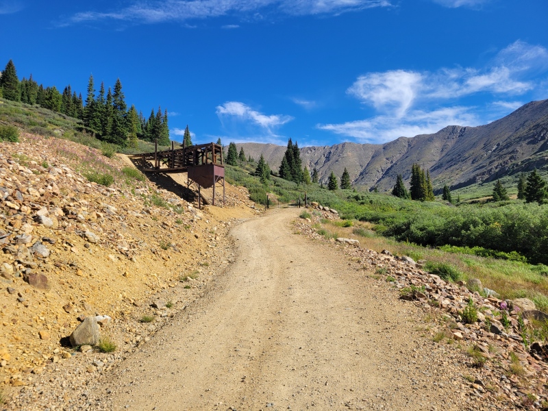
Peru Creek Circuit: Ruby, Grays, Edwards, and Argentine Stats and numbers: Saturday August 17, 2024 Solo TH: Argentine Pass Milage/Gain/Time: ~11 miles / ~5,500 ft / 6:41 As I work toward the Front Range 13er list, peaks like Ruby fascinate me. It’s a humble 13er, totally overlooked by the crushing crowds next door on Grays Peak, and without a strong route above treeline. Taken on its own, it could be an extremely quick outing where I would spend more time driving to and from the TH than hiking! When it comes to peaks like this, I have a habit of doing everything in my power to make them more interesting. Last year, I ran Epaulie and Epaulet from the Abyss trail – and so I was hunting for a more interesting way to make a day out of Ruby. Some time staring at CalTopo, browsing older Trip Reports (most notably the excellent ones written by daway8, jryor121, and d_baker), the idea formed to make an exciting loop by adding in Grays’ South Ridge, and heading across the CDT to Argentine Pass and looping in a few peaks – including Argentine that I still needed to climb! I’m not a fan of early mornings, so the weather forecast the day before was an absolute treat. 0% chance of rain til’ 3:00 PM, then slight chance of storms. That sounds like a 6:00 alarm from home. When said alarm went off and the forecast updated to storms at 4 instead of 3, I rolled over for another hour before getting my alpine start of leaving Littleton by 7:30. The drive went by quickly, and before long I was bumping my way up the Peru Creek Road to the Trailhead. This TH in particular feels unexpectedly far from Denver, due to those long bumpy roads. I drive a Subaru Forester Wilderness and had no issues with the road; most crossovers and beyond will not struggle with this road. The small lot was full when I pulled in around 9:30, so I parked on the side of the road right by the lot. 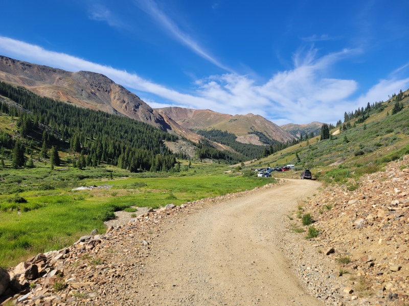
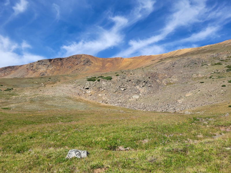
Ruby Mountain I really enjoyed Ruby! The route is fun, has a sweet crescendo, and ends with a great perch to soak in the Continental Divide as it curves around Peru Creek. My route was straightforward, and mirrors the route in Wolfe’s Front Range 13er book. I took the road up, marveling at the clear white waters of Peru Creek, until a left fork appeared to go towards the Peruvian Mine about a half mile up. Stay on that road until it forks again, and go right until the road dead ends into a mine near treeline just shy of 12,000 ft, just over a mile into the day. I took the most obvious line I could find through the willows and small cliff bands into the upper basin – from which point it was easy to pick any line to the summit ridge and just go uphill. The slope up to the ridge was classic 13er Steep, I was able to find sure footing on the slope well West of the ridgeline. From the ridge, it’s a short jaunt to the summit. 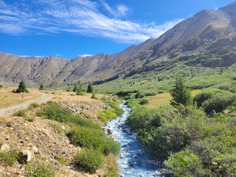
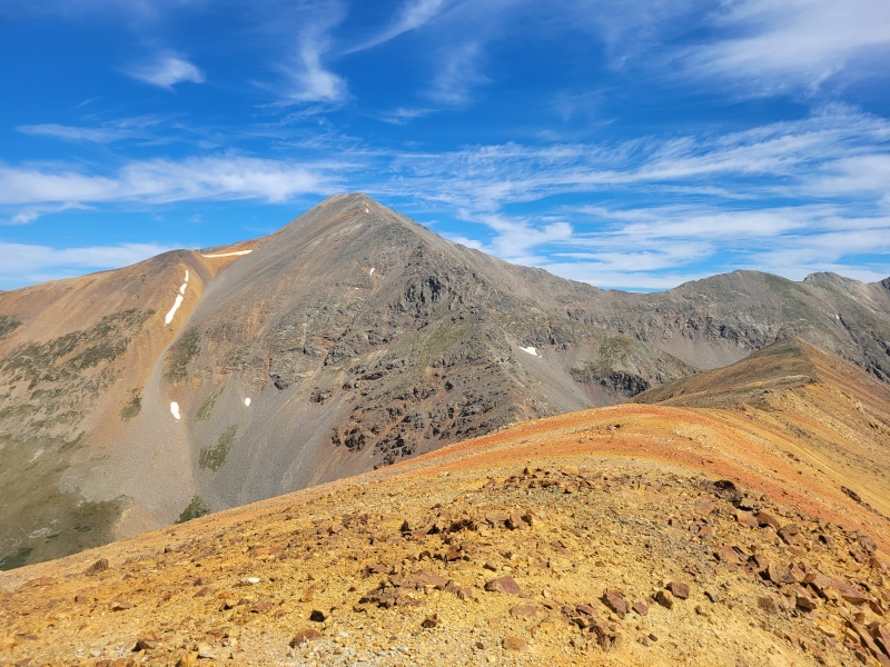
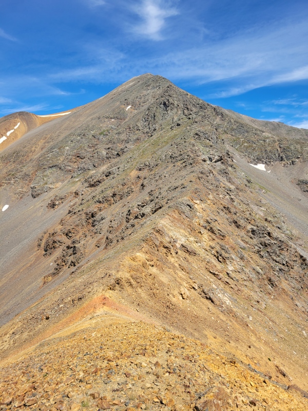
Grays Peak Who knew that Grays Peak, the gentle giant of the Continental Divide, had a spicy Class 3 ridge?!? The ridge from Ruby down to the saddle is nothing but an easy 400 foot descent, gently falling to the 12,800 ft saddle with great views of the lakes atop Peru Creek’s drainage. Then, the spicy part: Grays’ South Ridge. I didn’t take careful note, nor plentiful pictures through this section – and I certainly didn’t look for the easiest line. I would advise the linked TRs at the start of my report for more info on navigating the ridgeline. I was able to stay very close to the ridge crest, tending to hop West off the ridge to systems of ledges and gulleys if ever blocked by too large an obstacle. I brought a helmet and was happy to have it; there’s still a bit of loose rock up there and if you pick an optional class 4 line as I did, the exposure does increase. This ridge was a good deal of fun – there were plenty of options to choose your own difficulty and adventure and practice your route finding as you climb! This was easily the highlight of the climb. The class 3 persists for about 900 vertical feet, until I finally met up with the SE Ridge route at 13,700 feet to find an easy final 500 feet up a practical highway to the summit. This half mile was the only part of the route outside of Argentine Pass in which I had company. 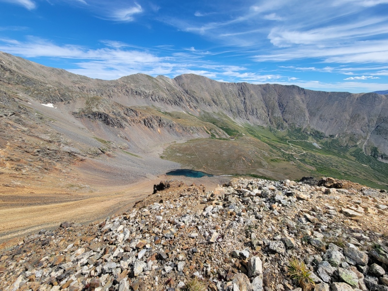

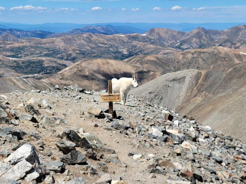
Mt. Edwards Standing atop Grays shortly after Noon, the weather was still holding off and I was greeted by a friendly goat. The summit itself was surprisingly empty – after a few minutes, I had it all to myself. Most people seemed to be either heading down or on the way over to Torreys, which makes sense for the “back to Treeline by Noon” rule that I was so blatantly flouting. A quick weather assessment, and I was off jogging down the faint trail that leads to the Grays-Edwards saddle. The route to Edwards was uninspiring – there were class 2+ options to stay on the ridge, or easier class 1+ options for most of the ridge just on the South side of the ridge. I alternated between the two, taking the first half of the ridge easy to recover from the big climb up Grays. After the main saddle and two unavoidable notches in the ridge, the final pitch to the Edwards summit is a more mandatory Class 2/2+ section – steep and fun! A quick jaunt, and a second visit up this Centennial summit was in my belt. I took the longest break on the Edwards summit taking in some food and resting the now thoroughly wearied legs, and eyed the easy and obvious ridge down to Argentine Pass. Wanting to save my legs for the final descent of the day, I walked most of the way down to the pass. I met some friendly guys who offered me a beer from their side-by-side and added some levity to the day, as I eyed the sky again to make a final go/no-go for Argentine Peak. The clouds had certainly began to build, especially in the direction of Mt. Blue Sky, but I still had a clear window. Up we go. 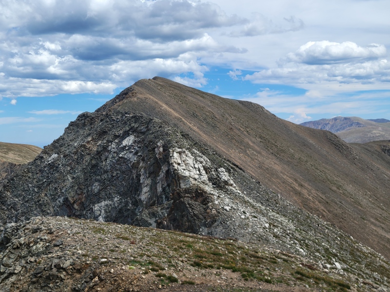

Argentine Peak The route from Argentine Pass to the peak that shares its name is easy and intuitive. Follow the ridge! There are even defined trail segments through some of the steepest spots, especially the 13,400ish bump just before the final push. It’s a mile to go from pass to peak, but it goes quickly. From the summit, I had already made the decision to take the long way down and backtrack to Argentine Pass and take the bomber trail down to my car. I know there’s a route directly from the summit down, and I know that’s it’s extremely steep. Sitting in my overlapping hobbies of peak-bagging and ultrarunning, I’ve learned a smooth trail is worth the long way every time. I jogged down to the pass (WHY ISN’T THE PASS AT THE LOW POINT?), met the trail, and bombed down the now excellent Argentine Pass trail to finish the loop. As I cruised down the trail, the clouds to the South started to turn dark – and the weather forecast was proven accurate this time. Right as the clock hit 4, and I was rounding the final bend to my car, I heard a distant rumble of thunder. Well timed indeed! 
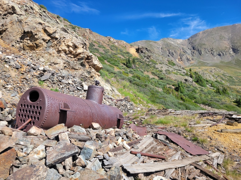
Final Thoughts This is an excellent route! If you’re looking for a fun day above treeline with a delightful class 3+ ridge, multiple summits, and numerous bailout options, look no further! This route is rich in solitude despite the brief crowd interactions on Grays, yet the routes are intuitive to follow and good to practice alpine skills in a lower-risk environment. The Argentine Pass trail makes an excellent anchor to simplify access to 13,000 ft, and a quick way down to coast to your car. Any day above treeline is a good day, and this route is a stupendous way to add some spice to the simple Ruby Mountain. Above all else, the Peru Creek drainage is a stunning place, surrounded by high peaks, lots of mine ruins (historical trash?), and a 
Thumbnails for uploaded photos (click to open slideshow): ")
")
")
")
")
")
")
")
")
")
")
")
")
")
")
")
|
| Comments or Questions | |||||||||
|---|---|---|---|---|---|---|---|---|---|
|
Caution: The information contained in this report may not be accurate and should not be the only resource used in preparation for your climb. Failure to have the necessary experience, physical conditioning, supplies or equipment can result in injury or death. 14ers.com and the author(s) of this report provide no warranties, either express or implied, that the information provided is accurate or reliable. By using the information provided, you agree to indemnify and hold harmless 14ers.com and the report author(s) with respect to any claims and demands against them, including any attorney fees and expenses. Please read the 14ers.com Safety and Disclaimer pages for more information.
Please respect private property: 14ers.com supports the rights of private landowners to determine how and by whom their land will be used. In Colorado, it is your responsibility to determine if land is private and to obtain the appropriate permission before entering the property.