| Report Type | Full |
| Peak(s) |
Humphreys Peak (AZ) 12634' Wheeler Peak (NM) 13162' Mt. Elbert - 14,438 feet La Plata Peak - 14,344 feet Huron Peak - 14,006 feet Mt. Bierstadt - 14,066 feet Pikes Peak - 14,109 feet Wheeler Peak (NV) 13062' Mount Whitney (CA) 14494' Mt. Sherman - 14,043 feet |
| Date Posted | 08/19/2024 |
| Date Climbed | 09/07/2016 |
| Author | HikesInGeologicTime |
| Come Hail or High Pointers |
|---|
|
Note: y'all probably know the drill by now on where to find my podcast and this particular episode in audio form on it, but if not, do a search for Of Mice and Mountaineers. If it's not on your preferred platform that is something besides iTunes (long story about my beef with Apple), let me know so I can spread it farther and wider. For those of you who like reading long, rambling stories with pretty pictures, this one actually has some pictures and maybe something resembling a story...? Just once in my life, I would like to have a nice, uneventful trip up and down Pikes Peak. I know, I know. Record scratch, hold up, back up; some of you are checking the title of this particular episode to make sure you clicked on the right one, because didn’t I already cover Pikes in great detail, not just on the time I succeeded at reaching its summit but in griping about how failing to do so a previous time set me up for mountaineering if not romantic success on Mount Freaking Bierstadt’s summit? Suffice to say that truly intelligent people learn from their mistakes. “That was awful. I’m never doing it again,” they say, and they actually hold true to that promise. Those of us who are book-smart but not, like, practical-smart declare, “That was awful. I really don’t ever want to do that again…at least, not the exact same way I did it the first time. Lemme see if I can do it again but make it even worse!” An increase in sufferfest potential will not, of course, be the stated intention for a rehash of unpleasantries. Often it is simply the side effect, the means to a completely different end that somehow winds up being the crux of the story when it was only meant to be a potential throwaway line, a build-up to what is supposed to be the main event. But here I am totally getting ahead of myself when it comes to today’s story, all in the name of casting the baited hook out into the water and waiting for a yoink on the line. And now that I’m hopefully reeling a few curious fishies in, allow me to go back to the waters of the mid-2010s…the waters otherwise known as the Pacific, since those are the ones most closely associated with Southern California. 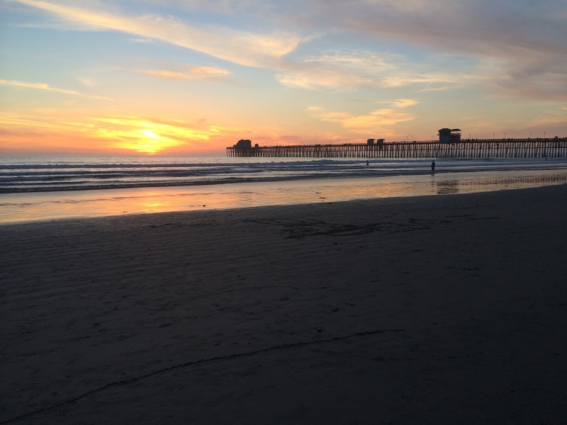
That was where I’d taken up residence for a time starting in early 2015, a few months after I’d needed Search and Rescue’s assistance on Longs Peak, and where I was still more or less officially living - not as in having gotten a Cali driver’s license or anything, but at least where I had my mail sent - after the more successful and less, um, SAR-ry outing in September of 2015. Once I returned to SoCal after spending a few weeks of that September with family, I was bound and determined to make the Golden State my new and permanent home. Beaches and Hollywood were where it was at, dude. I was putting Colorado’s fourteeners in the rear view mirror. Of course I needed to make my commitment to California a matter of record in the only way I knew how: by setting my sights on Mount Whitney, its highest jut of rock as well as the tallest in the entirety of the Contiguous United States plus Hawaii at 14,505 feet or similar, depending on which measurements you’re using. So yes, a fourteener, but a California fourteener, or even Califourteener. Totally different beast from what I knew and…well…hated is too strong a word, but “disliked” probably doesn’t go far enough into what Longs had done to what remained of my mental health, so maybe strongly disliked? Regardless, a totally different beast it actually did turn out to be, but naturally I had no way of knowing that at the time I applied for a permit to climb this extraordinarily popular peak. I did and believe I can still feel proud of the logic I used in my application to the permit lottery: as a solo hiker intending to summit in a single day rather than breaking up the not-insignificant mileage with a night of camping at Trail Camp, I suspect I improved my odds right at the beginning of the form. At the time and perhaps still, one could choose up to fifteen dates they’d be willing and able to hike. Most of mine were on weekdays in September, a month which I already recognized from Longs and earlier is a hiker’s best chance of hitting the magic timeframe between monsoon season and persistent-snow-and-ice season in the Rockies; I figured similar logic would apply to the High Sierras. Nevertheless, I’d heard that the permit lottery is called such for a reason. More people want to climb Whitney than the terrain can sustain, or so I assume is the logic, but whatever the rationale, demand far outweighs supply. Still, let it be whatever this atypically completely sincere lesson is worth to future applicants that not only did I receive a congratulatory email informing me that I had been selected to receive a permit, I had even secured my first choice of dates: Wednesday, September 7th, 2016. Not only would I have as high a chance of fine weather as one is ever likely to find at high altitudes, I would also have all summer to get ready. I figured I’d probably need it. There was, after all, that whole bit about having been granted a permit for me and me alone to hike something in the neighborhood, again depending on whose metrics one is using, of 22 miles and six thousand vertical feet of elevation gain…in a single day. Longs, at a mere 15 miles and just under 5000 feet of elevation gain, had probably been my most combined mileage- and vert-intensive outing to that date, and look how well that had turned out! 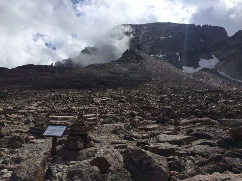
I did have a couple advantages, I also figured. One was that Longs had sucked for reasons above and beyond those particular stats, like its Class 3 - or scrambling, a.k.a. rock-climbing-lite necessitating, for people with genuinely fun hobbies - sections. I planned to take the standard route of the well-established and -maintained trail from Whitney Portal up as opposed to the Mountaineer’s Route preferred by more adventurous visitors. I would be able to handle this outing as a hiker, not a climber or poseur to the latter title. My first summit of Longs had also gone awry thanks to the self-destructive insulin pump I had replaced with a more reliable model by the time of my second visit to Rocky Mountain National Park’s greatest height, and having field-tested it there gave me confidence that it should be able to hold its own for the greatest height in Sequoia and Kings Canyon NPs/the lower 48. As far as prep for that latter superlative point, I also had the advantage of the perfect playground in my childhood home in which to prepare. As with my stay post-Longs the previous autumn, my family was once again happy to host, and it was once again easy to clear my schedule. Being a writer/editor/proofreader as my “real” job has made me able to work from home, or wherever I’ve been able to find free wifi, since well before COVID made it cool, and it still wasn’t as if agents, talent managers, and/or producers were exactly clogging up my inbox and voicemails with pleas to be an integral part of their multimillion-dollar budget projects, so I had few compunctions about packing up most of my closet - Colorado weather being a reliably fickle entity all to itself - double- and triple-checking to make sure all my doors and windows were shut tightly and locked, and setting out to spend summer in my home state. Since I was going to be road-tripping it anyway out of the practicality of having my own vehicle handy for visiting trailheads as well as an extremely strong dislike of flying, I figured I might as well make a couple stops on the way. This was going to be the Summer of the Penultimate in State High Points, after all, so I might as well keep plugging away at my checklist of high points in multiple states. I already had my own birth state’s Mount Elbert checked off as my very first, and late in 2015, I’d added Texas’ Guadalupe Peak to my collection of future obsessive-compulsive trigger points - er, state high points list. Arizona’s Humphreys Peak wasn’t right off Google Maps’ suggested method for getting back home, but it was between Southern California and Denver, so early in the morning on July 4th of 2016, I took a side trip from Flagstaff with visions of the ostensible greatest view in the southwesternmost Fourth Corner state in my head. 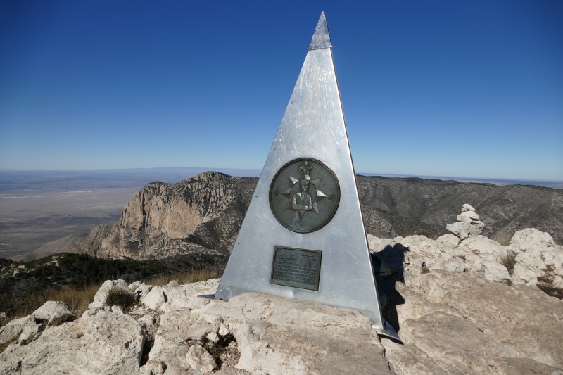
By now, it should be taken as the greatest honor I can bestow on a given mountain when I say that I can remember little to nothing about it. Humphreys was one of those honored prominences. One of those few recollections included passing - or being passed by? - a young-looking chap in running shorts, carrying by the thin plastic handle a gallon of water in a container that appeared to have come straight from a grocery store shelf. I also recall sighing over a false summit or a few; perhaps unsurprising, given that the high point of the state also marks the highest bump along an eroded and dormant volcano, but a bit irritating nevertheless. 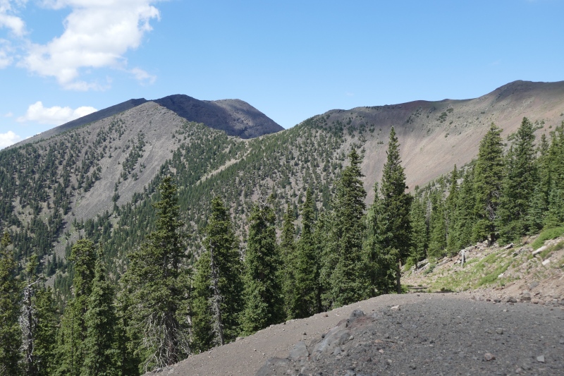
I do also recollect taking a lift ride after I’d completed the full round-trip hike. I have yet to ski Arizona Snowbowl, the ski area built into a segment of the same ancient volcano, but I have ridden its highest chairlift in summer, which was an entertaining follow-up that allowed me a particularly fresh opportunity to point at the nearby summit and brag to fellow tourists, “See that? I just climbed it this morning!” 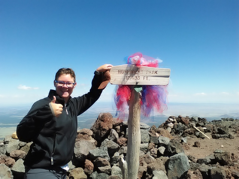
Three days later, I continued an apparent theme of state high points with adjacent ski areas when I parked at the base of the Taos ski resort and used the Bull of the Woods trail to ascend New Mexico’s Wheeler Peak. There is a shorter, more direct route up the mountain that cuts through some of the ski area, but I had wanted to take the longer trail. I was, after all, training for Mount Whitney, which would push the limits of what I knew I could do in terms of distance as well as elevation gain. Bull of the Woods, which has a section of descent on the uphill that would thus need to be ascended on the downhill, would, I thought, be a passable test for stretching those limits without breaking them. I’m not sure I passed, however. While I can and will once again chalk the overall lack of distinctive memories about the uphill to it being a perfectly fine and dandy outing, I do remember a moment or several whining about my life choices to a group of younger, spry-er-looking hikers passing me shortly above treeline. I was also feeling like I’d had enough ups and downs when I reached the so-called summit of Mt. Walter, which is the official second-highest point in New Mexico…even if it is not a ranked summit, or one with at least 300’ of prominence from the saddle shared with its higher neighbor Wheeler, thus making it more of the Mister Congeniality of New Mexico mountains than the proud silver medalist according to some hair-splitting peakbaggers. 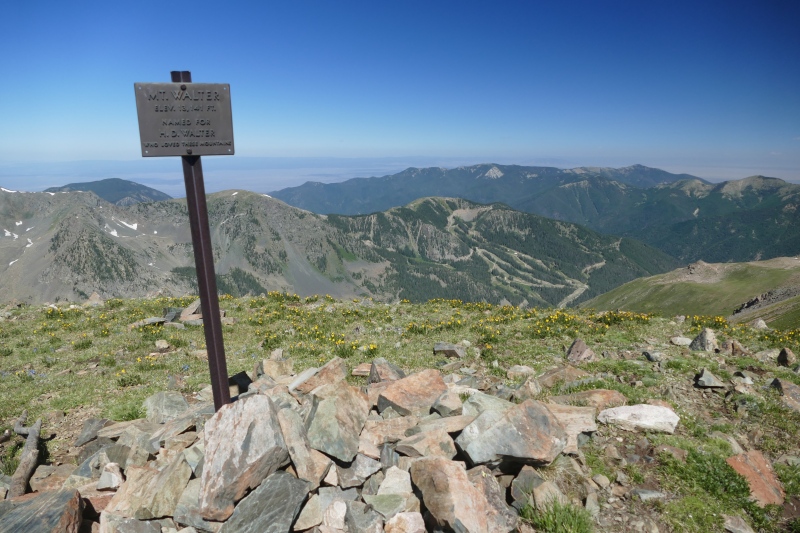
But even with less than 300’ to drop and then re-climb to the subsidiary, I decided that, once I’d taken my victory pics, exchanged some summit banter, and enjoyed some lunch, the greater stretch of elevation re-gain farther down the mountain meant I was ready to join the Path More Traveled along the Williams Lake route back to my car. I don’t remember whether I actually stopped in at the lively bar at the ski resort’s base area that the trail drew me toward or merely thought about it after my altogether blissfully unmemorable descent. 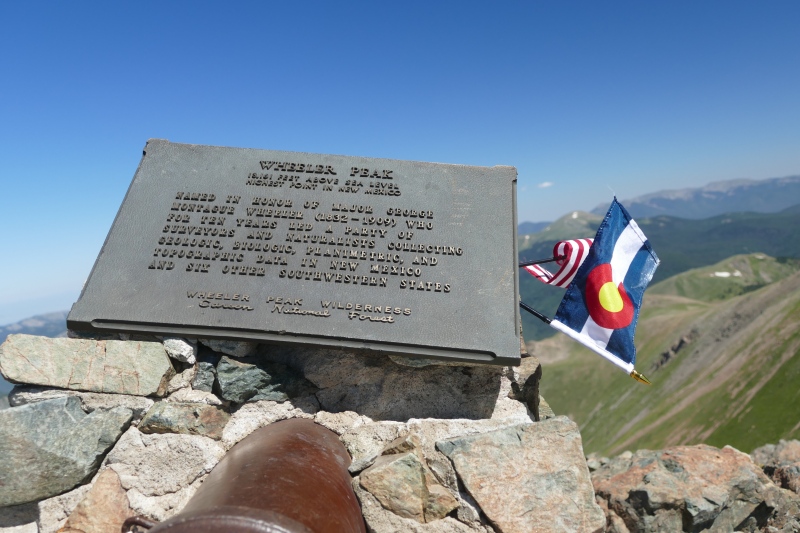
If I did order some overpriced food and/or beverages, however, I didn’t linger long. I had a certain theme I wanted to keep going. Humphreys had been over 12,000’, so a 12er; Wheeler 13k’, so a 13er. I felt it necessary to keep the streak going with yet another state high point, and of course the next one had to be a fourteener, although necessity would dictate I’d have to drop the “adjacent ski area” requirement. But even without that, Rainier, with its permits and required glacier travel experience, was not a good option for me at that time even if it hadn’t been majorly out of the way, and a major point of this whole high-pointing exercise was to train for 14.5k’ Whitney, as in the mountain I wouldn’t be able to climb for another two months. I still don’t remember much more about the standard Northeast Ridge on Elbert from my repeat trip on July 9th, 2016, than I did from my very first trip up it in 2012. I can guess that not having the ex-boyfriend around must’ve made the experience a more pleasant one on the second go-round, though I was still very much in the early stages of feeling devastated by the loss of my high school bestie Jimmy as a consistent presence in my life. But apparently the nearly four years’ interim between my first and second pilgrimages to my own state’s high point had been enough time for me to forget just how steep it is for a mountain with a trail the whole way up it. I played leapfrog with a group of hikers who, if I recall correctly, were new to fourteeners at the time, grousing to them as they stopped for a break below treeline that “this sure is turning into a hate-screw of a hike,” only with more R-rated wording. One of the members of that group, Eric, who gave me his permission to mention him by name, would become active on 14ers.com under the screenname yaktoleft13 about the same time I would, and we have exchanged family-friendlier commentary since. I would also attempt another peak at the far southern end of the Sawatches, Elbert’s range, with him and his wife Amanda - also present for my, uh, remarks on the pride of the Sawatch…although unconstrained by the larger group and having definitely gotten their fourteener legs underneath them by that second outing, they outpaced me early enough in the hike that I quickly encouraged them to carry on without me. I have been told by mutual, also-faster-than-me friends that Eric has gone on outings with while I eagerly waited at home to hear details after the fact that he still has very vivid memories of my profanity-laden expression of feelings about the second-highest prominence in the Lower 48 + Hawaii, ones it seems I may have piled on about further once we all reached that stature-esque summit in July 2016, which, despite my lack of specific memories of such expression, seem far enough in line with my overall perky nature that I have no grounds for protesting such a record. 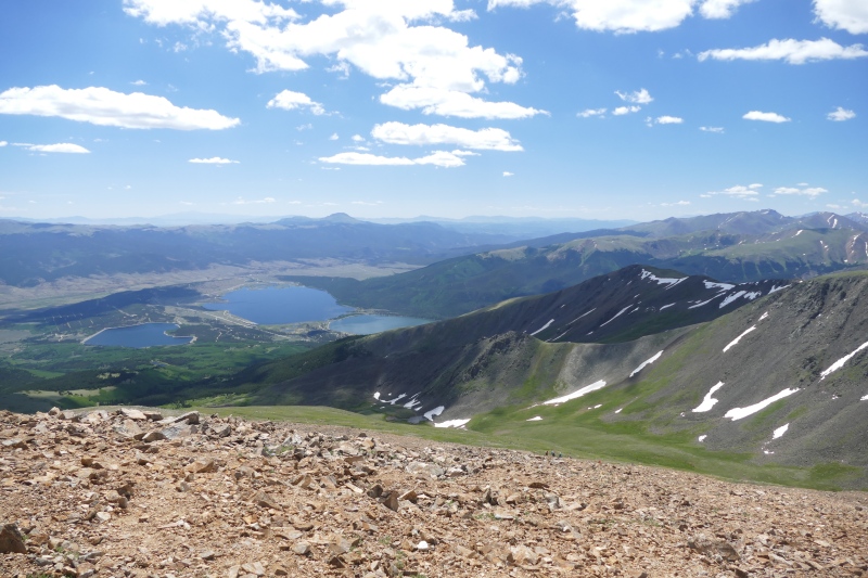
But hey, at least on our first and, to date, only time sharing a summit together, I succeeded at my silly little mini-goal of summiting state high pointers in successively leveled-up elevation strata in under a week. Now, however, it was time to give training for The High Point of State High Points - besides Denali, anyway - the seriousness befitting such a lofty undertaking. The training was so serious that, even though I felt obligated to check my saved pictures as well as the summit/hiking log I began with Humphreys that summer and then re-check it earlier this year once I decided to get with the twentieth century and digitize that summit/hiking log on Google’s off-brand version of Excel, I still needed to triple-check the now-digitized version to see whether I climbed La Plata Peak, the next fourteener south of Elbert, or Huron Peak, just south of La Plata, first. For all I remember about the two of them from that summer, they may as well have been merged into one giant Sawatch Frankenpeak called La Hurta. All available records say I summited La Plata first. I will have to take their word for it. Aside from remembering a view into a lovely valley that a more recent revisit of Huron revealed was probably not visible from the more southern peak’s trail and therefore must have been taken from La Plata’s, I remember absolutely nothing about the fifth-highest fourteener in Colorado. 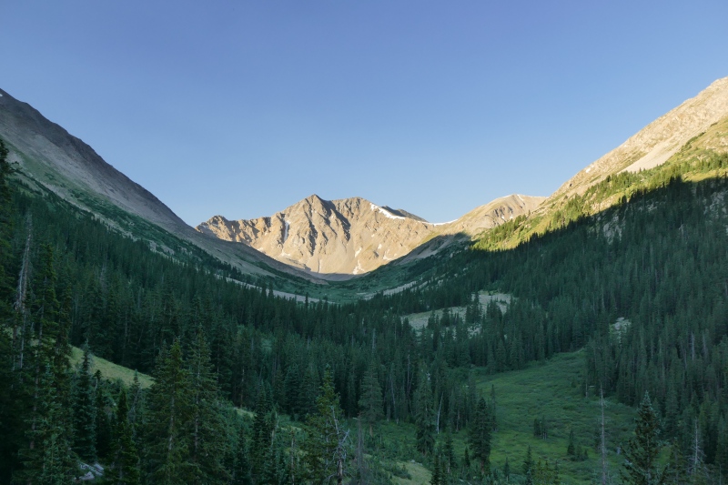
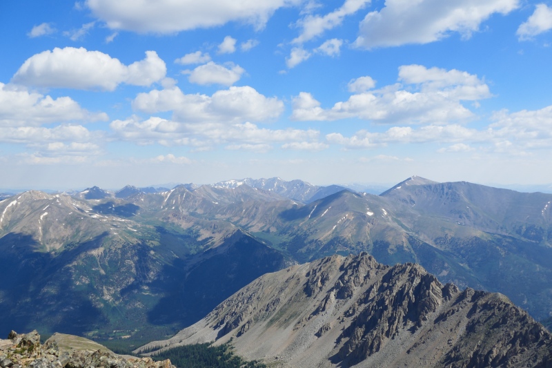
This is, however, once again not meant as an insult, per se. To prove it, allow me to take a bit of sidetrack into that revisit of my second new fourteener of 2016, a revisit that took place a month and change following my fourteener finish that I did with a friend who is looking to complete a second lap on the fourteeners and who also wanted to test out some new gear before winter arrived. I can see why all I remembered about the second-shortest fourteener in my home state from my first time on it was briefly renaming it in my mind from Huron to Hurl-on - I believe I had picked up a bad salad from the City Market in Dillon the night before my 2016 hike, or at least that’s what I’m calling the culprit, because in the realm of TMI, I remember that the spinach leaves appeared relatively unchanged the, uh, second time I saw them - when I’d reached a flat spot along the trail a short ways above the trees. Outside of this unfortunate memory, however, my second trip confirmed that there is nothing remarkable about the standard route up Huron, and for that as well as the outstanding views from the summit, it has solidified its place in my Top Five list of Fourteeners I’d Be Willing to Repeat. Of course, it helped that impression that I was spared the four additional miles roundtrip the more recent time thanks to my friend’s 4Runner and willingness to beat the absolute snot out of it, four miles I’m sure I was not spared the first time, as I am pretty sure I must’ve hiked it from the lower trailhead that would have both been less traumatic to my Subaru Outback as well as more conducive to that extra-mileage training I claimed to be going after on the first occasion. 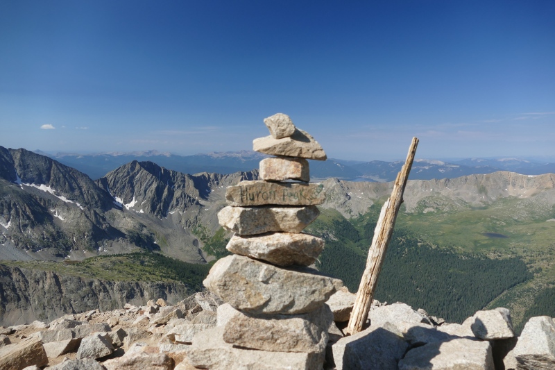
My overall sense, however? I would repeat a third, fourth, fifth, etc. time nevertheless, despite the high likelihood that I will probably never be willing to risk my Outback, a.k.a. the Unofficial Car of Colorado for Those Who Can’t Afford 4Runners, on the rougher 4WD road to the upper trailhead. 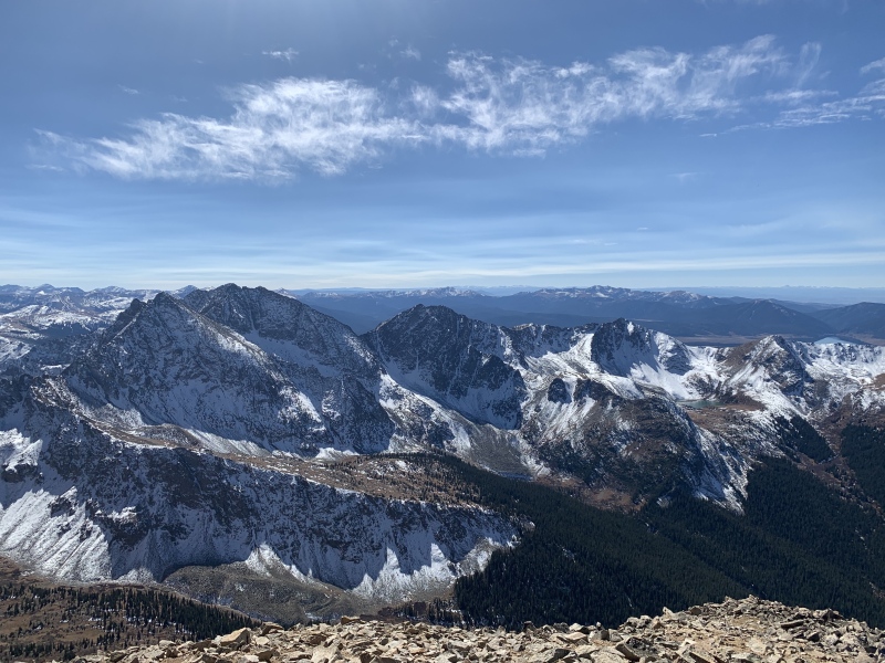
I think it must also have been Huron, though maybe was La Plata, for which I missed the split for the trail going up to the peak and continued on the road or something that could maybe pass for one for far too long before realizing I wasn’t making any progress, elevation-wise, and turned around in disgruntlement for the need I already recognized to return at a later date in order to attain the summit. By the time I did find where I was supposed to have peeled off the road and forged upward, I deemed it too late in the day to do so, as it was solidly in monsoon season, and while I had apparently learned nothing about paying attention to trail junctions from my very first attempt of a fourteener on Pikes Peak ten years before this particular training hike, I at least presumably had the dangers of the high country’s all-too-frequent afternoon storms drilled into my head alongside all the prior-years’ blasts of thunder and pelts of hail at last. And thus do I have something almost resembling a smooth segue into the bait…uh, hook…I used to start the entry about High Point Summer with a thunderous roar, heh heh. Not that the thunder was particularly humorous while it was roaring. As is fairly typical for Colorado, monsoon season set in with a bang (okay, I’ll give myself another heh-heh for that one) shortly after my re-entry, so planning trips with enough mileage and vertical to feel that I was giving myself adequate preparation for the challenge I had looming at the end of summer took a bit of luck and a lot of settling for mileage over vert. I spent much of the summer linking trails in Rocky Mountain National Park as well as up to and over other segments of the Continental Divide on days with just enough sunlight in them that I could scoot back down into the trees when our regularly scheduled afternoon storms rolled in on their damnably regular schedule, but in spite of them being a natural training ground, fourteeners largely got put on the back burner; most of the ones I had yet to visit that were within my skill set and could be ground out in the mere few hours I’d have to avoid a repeat of Pikes Take 1, Bierstadt Take 1, the DeCaLi sans Bross Take 1, and Longs Summit Take 1 were heavier on the vert than the miles for my purposes during that particular timeframe, although I did get my own personal record for moving time on Mount Bierstadt that summer when I clocked 2.5 hours up and 2 hours down as a quick little training jaunt close to Denver. 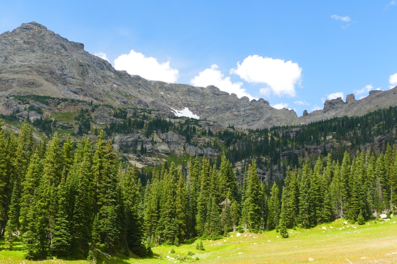
But as the end of August approached and thus the first week of September in hot pursuit, I felt I needed to put my skills to the test before I took on the beast known as Whitney. The best way to do that, I also felt, was to take a day trip up a fourteener of equivalent distance, vert, and technical difficulty, and actually, it kinda would be an advantage if it was one I’d already summited before so that I wouldn’t feel pressure to drag myself all the way up if it proved to be both literally and metaphorically above my abilities. Fortunately, there was a route up a fourteener not too far from Denver that ticked all those boxes: the Barr Trail, home to an annual half- as well as full marathon, up the east side of Pikes Peak. Even with the security of knowing I already had a checkmark for this summit and therefore didn’t need to worry about my eyes getting bigger than my leg muscles during the hike up, I still wanted to approximate Whitney as much as possible, and that meant approximating success on Whitney as much as possible. So of course I wanted my dress rehearsal to be on a nice, sunny, bluebird day like I’d had with Dad and the now-ex-boyfriend and Dad’s possible ex-girlfriend on Take 2 of Pikes…Summit? Of course that was not what the forecast had in mind for me. A lot of times, the monsoons will clear up by the end of August, but in 2016, it seemed that would not happen before I deemed it necessary to start moseying back to California for the Biggest Personal Showdown in the Contiguous U.S. It would be good conditioning in case I did have to climb Whitney in a tight window, I told myself as I narrowed in on August 28th, a day with a high likelihood of afternoon storms but that promised clear skies until noon, that would also leave me with a week and a half to rest up, take stock, pack up, and hit the road before my permit date. I knew Whitney was going to require an alpine, or dark o’clock a.m., start no matter what the weather looked like since I wanted to avoid descending in the dark; might as well practice hiking on minimal sleep with a nice, early, hopefully thunderstorm-avoidant start time for Pikes. Those who get a little shiver of excitement when the creator of a piece of media self-references its title somewhere in the work can get their gooseflesh on when I say that this exact sort of thinking is what first led me to start reflecting on the best-laid plans of mice and mountaineers. Oh indeed, Pikes Take 3 started well enough: the so-late-it-was-early, or was that the other way around? departure time allowed me to dodge any potential traffic or traffic-related issues on southbound I-25, and if I’d encountered any difficulties getting to the trailhead in Manitou Springs, I surely would’ve remembered them, based on how well I seem to only recollect the difficulties. I vaguely recollect thinking R-rated thoughts about the steep switchbacks up and out of the parking area for the first three miles that also serve as the descent for masochists ascending the Manitou Incline, an allegedly fun self-torture device for those wishing to test their skills on 2744 steps going up 2000 vertical feet in less than a mile, so perhaps no surprise that the semi-parallel trail would also resemble the lite version of a torture chamber in places. I also recollect relaxing a little when the grade eases up for the next few miles, although I couldn’t help feeling a little taken aback when I caught a brief dusting of snowflakes glittering in the light of my headlamp. I was naturally aware that it snows 12 months a year somewhere in Colorado, but I was barely outside Colorado Springs, and even Rocky Mountain autumn, all two weeks of it, was still a good week or so away from starting! The flakes passed and the sun rose as I reached Barr Camp, the premier lodging of choice for Pikes Peak overnighters looking to toss and turn at 10,000 feet instead of hiking all night like I was doing. I was a little annoyed at how long it took me to find the pit toilets at the back of the property relative to the trail and more annoyed still at how I long I waited to see if the door to the main cabin would open - I would later learn that the caretakers do not unlock it until 7 a.m., which is also when they start serving breakfast - so I had to take my water, blood sugar check, and rehydration break on the porch before the early morning’s chill reluctantly motivated me to get back on my feet. The clouds starting to spiral in overhead after I broke above the trees and puttered along a long, straight stretch of trail past the 11-mile marker - only two to go! - naturally concerned me. I paused strictly, I told myself, to check the time on my phone and definitely not to gasp for air. 9 a.m. The National Weather Service promised I had until noon. I’m pretty sure I remember looking up to see the Summit House above me. I was gonna take their forecast at its word. 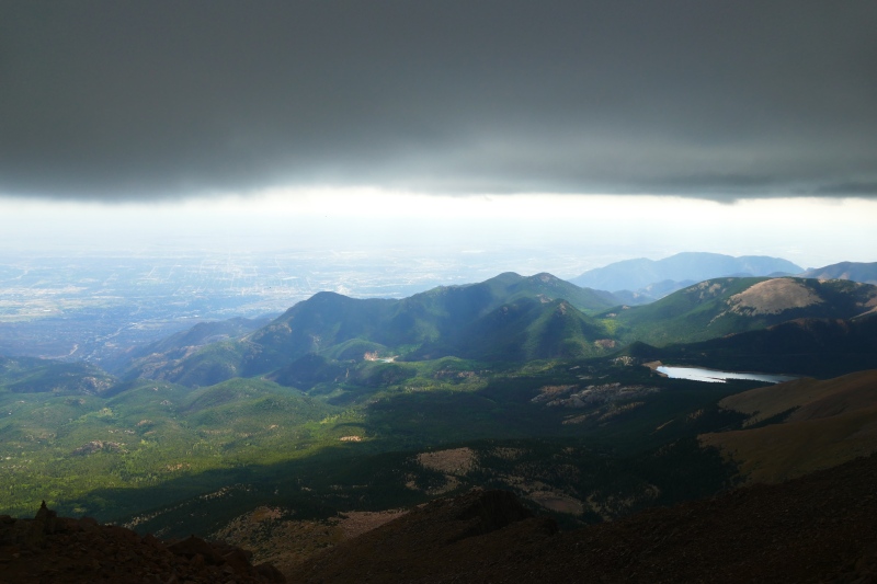
I have clearer recollections of staggering into the Summit House at 10:15 a.m. on this occasion than I had from my first time having done so at…some time…in 2006. In the subsequent decade, Atlas Obscura had blabbed about the donuts to the world. I don’t even actually like donuts, but since I’d missed out on a taste test during my first go-round and felt like the caloric boost could be beneficial to this one anyway, I indulged in one as well as a hot chocolate for my 2016 visit. I’m sure I didn’t look or smell any better than I had in 2006, but while I was taking my purchases to an empty table in the back, some other visitors stopped me to engage in polite conversation anyway. They’d driven up, and my ego got a boost of its own at their thunderstruck responses when I told them I’d walked up - and on the longer trail, no less! I can’t say as I was entirely surprised when, as I settled into my chosen seat to dig into my sweet treats, the clouds that had coalesced around the summit in an impenetrable wall of gray let the first sparks fly, promptly followed by a BOOM that I swore I could feel rumbling through the floor. I stalwartly munched my donut and drank my hot chocolate as those who had driven to the top nervously glanced out the windows for the full sensory experience that followed as a matter of course. This particular donut actually was pretty tasty, I decided, and this particular thunderstorm was annoying in that it had decided to make like everyone’s least-favorite, courtesy-invite party guests and show up an hour and a half ahead of schedule, but at least it had been kind enough to do so while I was indoors this time. I’d take my sweet time with my sweets, and surely it would decide to go bother Colorado Springs by the time I finished in fifteen minutes or so. I should and may not have been entirely surprised when I found myself huddling with the auto travelers just outside the door but still under the Summit House’s roof an hour later, the latter nervously eyeing the few feet or so to their cars in the parking lot from which they were separated by this all-natural fireworks show as well as the addition of graupel, or smaller hail more akin to compacted snow than full-on ice for those uninitiated to Colorado’s capricious climatology, while I stared impatiently at the sky for the break in the clouds I knew had to be coming somewhere. This didn’t look like it was going to clear out entirely for a while, but if I could spot a window just wide enough to bolt (heh) down the uppermost three miles of solid trail into the trees… 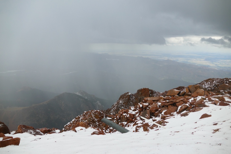
It did occur to me, as I spotted what looked like an honest-to-goodness silver lining peeping between clouds indicating to me that I might have my semi-clear shot, that I could’ve sweet-talked (literally, given the donuts lingering on my breath) one of the tourist groups on the summit, perhaps some of the ones I’d already impressed with my tales of my commanding athletic prowess, into giving me a ride down. Maybe I could’ve pleaded for mercy with the Cog Railway operators, even; bracing my standing form inside a roofed train lurching back down a steep grade would still be an improvement over sprinting outside in a rager of a storm. I dismissed the thought by the time I pulled the microspikes, lightweight traction devices I pretty much always carry because there’s almost always hints of winter somewhere to be found up high in Colorado, out of my pack and pulled them over the soles of my hiking boots, for the ice pellets now coating the parking lot in front of me led me to believe I’d want additional grippiness on the steep switchbacks that first dropped off the summit. Whitney didn’t have a road or Summit House or cog railway, I reminded myself. If the excrement hit the air conditioning unit while I was up there, I’d have nothing but my own two feet to count on, so I figured I’d better commit to this dress rehearsal for the worst-case scenario. Besides, I concluded as I tugged the sides of the second microspike around the base of my shoe, I’d already tried hitching once on the other fourteener that had a road going up it, and my life had probably been in objectively greater danger on that occasion than it had on any for which whatever partners accompanying me and I had been unprotected from the elements! Alas that the break in the clouds that I sprinted out from the Summit House roof’s cover to take advantage of wasn’t really much of one, if it was any of one at all. I could at least almost immediately congratulate myself on my forethought in having put the spikes on despite my worries about having the metal that much closer to my body than it had been when it was still in my pack, as the trail was indeed coated with a couple inches of graupel already, and the continuing flashes of lighting and blasts of thunder encouraged me to make haste without worries of repeatedly slipping, falling, and trying to turn the Barr Trail into the Barr Luge. 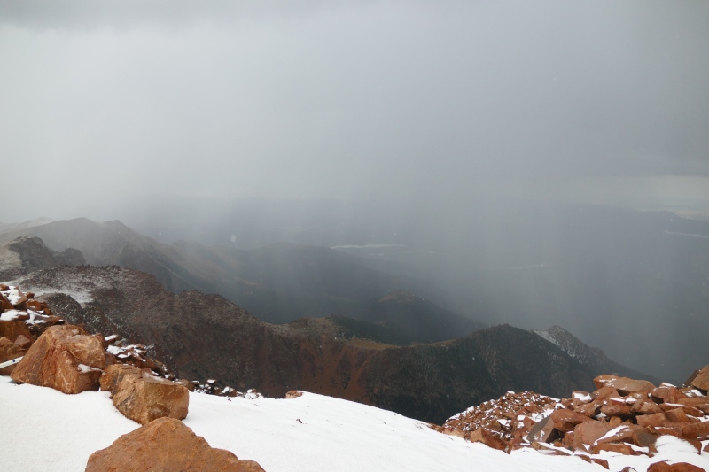
The flashes and blasts were so regular that I might as well have been on the set of a war movie. The graupel being thrown into the mix - and, of greater irritation, into my face - was giving me poignant flashbacks (heh heh, flashbacks…gotta laugh or I’ll cry, I suppose) to Longs, although at least I could also sort of congratulate myself on having not gotten sick to the point where I could barely urge one leg in front of the other on Pikes’ east side. At least this time, the storm clamoring around me had me channeling my inner fifth grader, the one who had almost sprinted quickly enough to receive the full President’s Physical Fitness honors back in the nineties! But clearly I hadn’t been much good at sprinting then, nor was I something like two decades later, and thus, in a faint echo of my first summit of Longs two years earlier, did my legs’ protests quickly radiate outward and upward: was this level of intensity for this duration absolutely necessary? It didn’t take too long to get some part of what remained of my mind on board with finding justifications to resume my more typical, glacial pace. “Quit being a wuss, self,” I told myself as the switchbacks straightened out into the longer, straighter stretches I remembered from when the clouds had started massing menacingly over the summit. “You’re probably just exaggerating how scary this is. Sure, it looks and sounds like the lightning is striking just a few feet away, but it’s probably just that - looks and sounds. Now, let’s wait for the next flash, and then we’ll count our Mississippis, just like when, uh, royal we were kids, and then we’ll be able to prove it’s nowhere near as close as our brain is trying to trick us into thinking it is, precious. “Okay, there’s our flash! One Mississippi, two–” BOOM! the thunder butted in before immediately echoing outward in a crackling cavalcade I could’ve sworn I saw rippling across the sky. “We’re going to die!” I may have wailed to more than my inner Smeagol-Gollum as I tore off down the trail with renewed vigor. But I once again tired of running about a mile and a half below the summit, becoming so tired that I believe that it was with a resignation rather than a resurgence of fear that I observed two lightning bolts strike just beyond the switchback ahead of me. The switchback was a good half-mile or so away, though, I reminded myself wearily, and at least it was appearing as more-distant bolts rather than directly-adjacent-to-me flashes. I’d indeed slowed down to a more regular pace two miles below the summit. The clouds were still intent on preventing any incursion by the sun, but the thunder had faded to more distant growls, and the graupel had stopped falling for the moment. I watched with bemusement as a youngish-looking guy in a hoodie and shorts approached me at a brisk pace. “Did you see a phone on the trail?” he asked me with the defeated tone of one who already knows the answer. I shook my head sympathetically as we both glanced to the ground that was still coated with a couple inches of styrofoam-resembling pellets. “Good luck?” I said, most likely with the audible question mark as he continued up and I down. He would not be the last seeker of something higher on the mountain that I would encounter as I made note of the clouds continuing to swirl overhead, though at least for my own sake, the next group I came across was about halfway between treeline - ergo, below it - and Barr Camp. “How much longer to the summit?” the exasperated and exhausted-sounding leader asked me, and when I couldn’t quite keep the grimace off my face or the hesitation out of my, “Weeeelllllll…” another member of the group jumped in. “Fifteen minutes,” he asserted in a thick Russian accent. “Fifteen very, very long minutes,” I offered back. “You’re still a good four, four and a half miles from the summit.” I then warned them about the storm I had no doubt was still powering on with full force over said summit, then gave a pointed glance at the canvas sneakers Mr. Fifteen Minutes was wearing as I added that the last two and a half miles of trail were snowed under - no point explaining graupel, I felt - and didn’t seem likely to melt out the rest of the day. They nodded, stonefaced. Maybe the leader thanked me as they resolutely passed me to continue upward. The Russian guy caught my eye when it was his turn to pass. “Fifteen minutes,” he insisted. 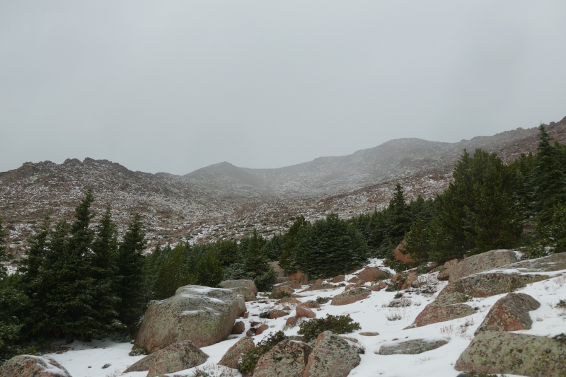
This occasion really was more like my first summit of Longs than like my first attempt at this particular peak all those years ago. “Self, do we really have to do something about this?” I seem to recall sighing as the clouds that indeed still had yet to clear once again announced the fruits of their continued labors with another flash-BOOM. Even though I could count more Mississippis between this latest round of flashes and booms, and even though I was solidly in the cover of the trees, I still felt it somewhat necessary to pick up my pace again - I was only half a mile from Barr Camp now, and besides, those laborious fruits apparently necessitated once again chucking their icy seedpits at the apparently insufficiently fruited plains below, and if my face happened to get in the way, so be it. Happily, on this attempt to gain entry to the main cabin, the door opened. I may have bought a cup of tea from the camp’s caretakers or perhaps some candy - all that running, I could easily have reasoned, surely would’ve counteracted the donut and hot chocolate even if it was in the lung-if-not-leg-friendlier downhill direction. I don’t seem to recall there being much conversation with either the caretakers or fellow wet, shivering hikers as we waited out the storm’s second wind. What I do recall is settling with whatever refreshments I’d purchased at the end of a large table near the door. Someone, almost certainly one or the other of the caretakers, had placed a printout of the National Weather Service’s forecast from 5 a.m., hours after I’d gotten on the trail and therefore had no reception on my phone. According to the printout, since the last time I’d been able to refresh the forecast, NOAA had shifted their timetable to predict storms starting at 10 a.m. It wasn’t too long before the sounds of graupel striking and bouncing off the ground petered out, and after I exited Barr Camp to verify a renewed lack of airborne projectiles, the rest of my return trip proved blissfully uneventful. And despite having a view of the clouds still swarming over Pikes’ summit in my rearview mirror for the whole drive north on I-25, I couldn’t help but be a little bit tickled at my final stats for my biggest day of prep for Whitney: 24 miles and 7600 feet of elevation gain in fourteen hours and 36 minutes. Still think I’m ineligible for your physical fitness award now, Mr. Clinton?!? 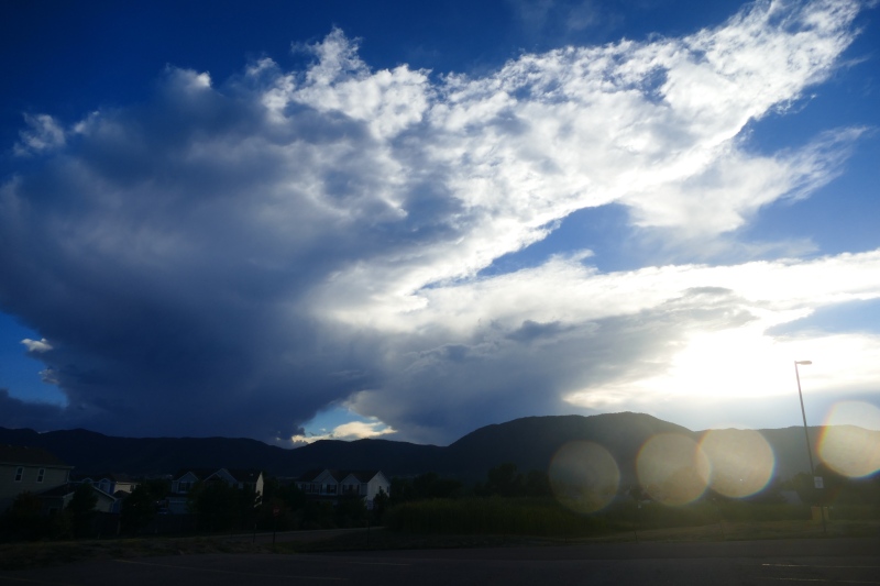
Even though the smell of success on my preparatory peak bore an odd resemblance to the smell of heavy perspiration and perhaps some, shall I say, other bodily fluids occasionally released when the body they belong to is engaged in the latter element of fight-or-flight mode, it was nonetheless with anticipation of both the nervous as well as genuine variety that I re-packed my car a few days later, thanked my relatives for hosting me for so long, and drove off into the sunset yet again. I’d decided to make a stop between leaving colorful Colorado for less-alliterative California in the form of a maintenance hike and state-high-point-with-an-asterisk: the other 13,000-foot Wheeler Peak, this time the one in Nevada. Not to be confused, of course, with the unasterisked New Mexico high point I’d already climbed nor my own home state’s 13k Wheeler Mountain, this high point of Great Basin National Park - unasterisked within those specific parameters - is the highest prominence in the Silver State that is ranked and therefore has that 300’ of prominence that New Mexico’s Wheeler’s subsummit Mt. Walter lacks. Boundary Peak, Nevada’s actual highest thrust of rock, has less than 300’ of prominence from its saddle with its parent peak, whose summit is just across the state line in California, hence the “Boundary” as the real-but-not-ranked high point’s name. But it would be years before I cared about splitting hairs that much. The other Wheeler was a peak conveniently located and readily accessible to my purposes, more so than the remote dirt-road heavy approach to Boundary that I’d read about, though I do remember thinking to myself - perhaps even sharing the thought in the comment box at the trailhead register - that Bob Dylan’s “Idiot Wind” could’ve been the theme song for my second summit of a 13k Wheeler that summer, given how unnecessarily blustery I found conditions to be. 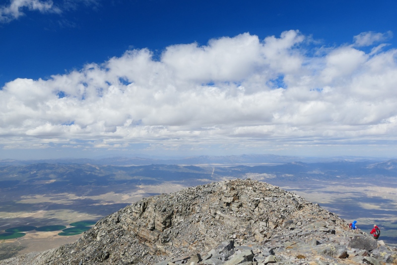
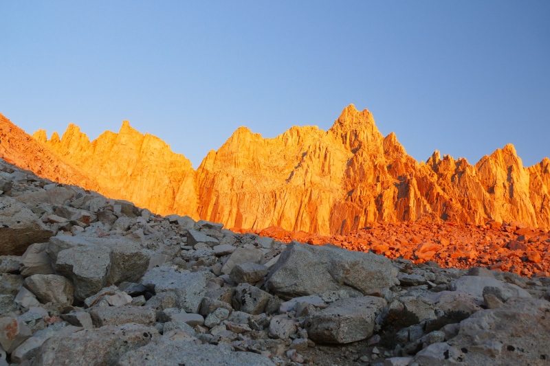
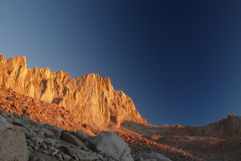
Other than the hardly-atypical-for-an-alpine-prominence gusts, however, I can offer the other Wheeler the same high praise I gave La Plata and Huron in that it was apparently so unremarkable that I have no other vivid recollections seared into whatever gray matter might be left to my name after all my fourteener and other peakbagging pursuits. In other words: two thumbs up, would be eager to revisit on a day with less wind in the forecast! The forecast for the day of my permitted climb up Mount Whitney looked like everything I had hoped for when I’d put it at the top of my application. The Inyo National Forest ranger who handed me said permit along with a couple wag bags, a.k.a. dog bags for humans, when I went to pick it up the day before as the email said to do told me that there had been a few patches of ice reported along the trail, but I believe he described them as “avoidable,” and otherwise offered me no information that deeply concerned me. I double-checked that I’d reunited my microspikes with my pack when I returned to my car, which was now covered with a sprinkling of sand from having driven through Death Valley out of a self-titillating desire to travel close to the contiguous U.S. low point (I had deemed temperatures too hot for my hiking liking to actually make the trek to THE low point in Badwater Basin) and then up to its highest within a 24-hour window, then drove that particular long-suffering Subaru Outback into Lone Pine for the last few hours before I would begin THE Big Event of my summer. I apologetically warned my roommates at the hostel I’d booked for two nights so I could grab some shut-eye in a real bed both before and after said event of my plans for the next day and how they would necessitate my alarm going off at 1 a.m., not to mention the certain subsequent flurry of activity as I got myself and the gear I’d brought inside ready to go, though I promised to keep as quiet as I could manage. They were sympathetic, even excited for me, and we may have gotten dinner together somewhere in town, though it also seems possible that I declined any invitations that might have come my way out of a desire not to unsettle my stomach any more than was absolutely necessary. I believe there was only a stirring or two from the other bunks when the alarm did sound from underneath my pillow, but I also believe that I left the room in an enviable state of peaceful slumber as I shut its door behind me. The road to Whitney Portal, the trailhead and campground whose name marks a lack of subtlety I genuinely appreciate, was dark with nary a creature stirring and therefore uneventful to drive. I unconsciously tried to make an event out of the very start of the hike when I somehow failed to put together that the big, obvious trailhead kiosk with all the signs that lit up quite distinctively in the beam of my headlamp might in fact be the location of the trail’s start, instead stumbling past it and circling the parking lot for an unintentional warm-up before something in my brain clicked that allowed me to get back on track the second time I walked toward the literal signs. Dark o’clock ascents have never been my preference; even before Longs and my hallucinatory experiences in its Goblins Forest on the descent on that particular occasion, I’d never quite been able to shake the scared child in me that had needed to sleep with a light on until high school. This particular alpine start proved even less remarkable than my recent snow-dusted one on Pikes, however, and I found myself pleased with how efficiently I came upon my first trail junction, then more pleased still as I broke above the trees and got a full view of my target and its neighbors alight with alpenglow. My Real Camera, a DSLR I’d received as a birthday gift that year, got plenty of use during the lead-up to and then during the crowning moments of sunrise, and it is a matter of great relief to me that I have those pictures backed up to The Cloud - that of a purely virtual nature, as it would also be impossible to deny my relief there were no literal ones to be seen anywhere in the sky above and beyond Whitney that morning. 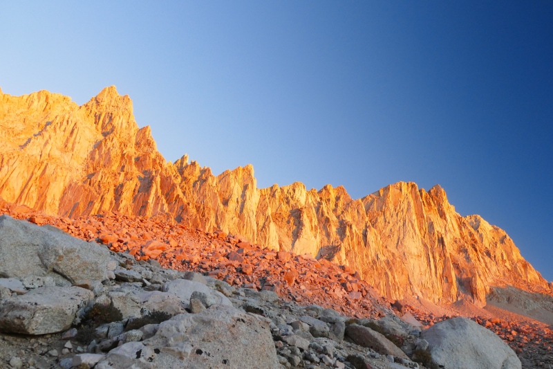
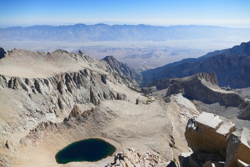
I did start to falter once I started up the area termed either the 97 or 99 Switchbacks, depending on whose math you’re trusting. I certainly couldn’t trust my own, seeing as how I lost count somewhere around Switchback Number 5,473. I can’t remember what exactly it was that I groaned to the spry, silver-haired woman who flew past me and then paused in the crook of Switchback 6,813 or whatever it was to giddily share her joyous feelings on the beauty of the morning and our surroundings, but hopefully whatever response I had that almost certainly expressed some serious doubts about the life choices that had led me to that point were G-rated enough that they merely dented her bubble rather than bursting it entirely. Fortunately, whatever the true number of switchbacks is, it is not infinite…infinity minus one or two, perhaps, but regardless, I did eventually top out at Trail Crest to begin a brief drop down from the Inyo National Forest side of the route to the Sequoia and Kings Canyon National Park side, which is also the side that meets the John Muir Trail at Whitney’s summit. Even though the pitch eased considerably for the remainder of the hike, I was sucking wind way harder than my mile-high born-and-raised lungs as well as my summer of training at similar elevations should have demanded. I would have to woozily step to the side of the trail as best I could to let faster hikers pass, and the audibility of my panting prompted several to look me over with concern and ask, “Are you all right?” But if I wasn’t going to let anything as silly as some massing stormclouds turn me back from Pikes less than two weeks before, I sure wasn’t going to be stopped short of my ultimate goal for the summer by what I would later come to blame on the Sierras’ extra-dry air. Sure, Colorado is perhaps infamous for its own lack of humidity, but our climate is only semi-arid. As my drive through Death Valley the day before had proven, this part of California overlooks full-on desert! And that desert did make for a beautiful view, a stark contrast from the greenery visible from my home state’s high points, when I at last lumbered up to the one point in the Lower 49 that was higher still, signed the register, drank some flavored water, and began photodocumenting in earnest. I dared not get too close to the eastern edge that did overlook the desert; I’d already taken a glance out one of Whitney’s Windows, gaps in the rocky towers forming a natural barrier between the trail and the thousands of feet of sheer drop-off in the direction of Death Valley as well as my home state hundreds of miles away, and looking down from there on that occasion certainly hadn’t helped my already overworked respiratory system. 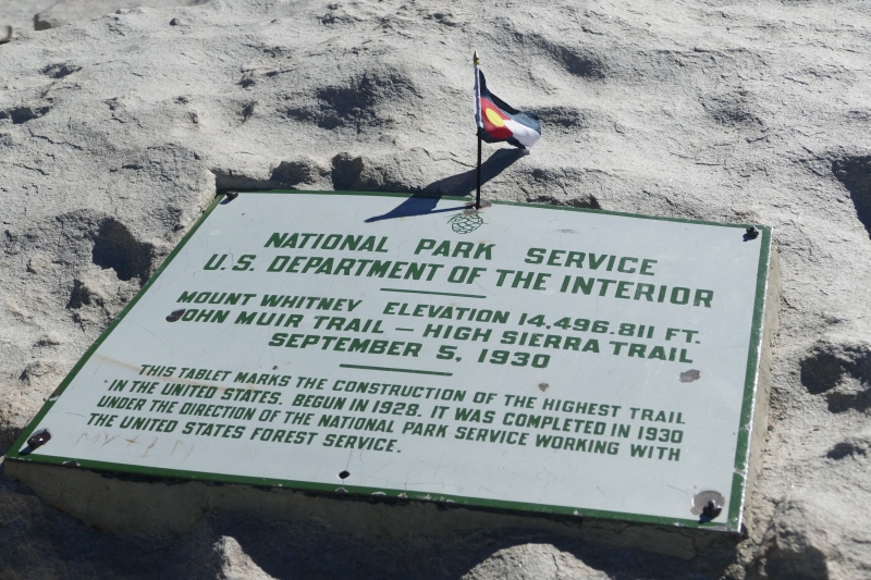
But the good, long summit break afforded me by the conditions every bit as spectacular as hoped for and forecasted roused my spirits, and unlike my first time summiting Longs, my worrisome symptoms seemed to be limited to the uphill portion of the hike. While I certainly had few kind things to say about the re-ascent to Trail Crest, it passed quickly, and while the switchbacks below its other side seemed just as uncountable on the return trip, I felt that I was making far more efficient work of them than I had earlier that morning. The long hike back from treeline also went quickly when I befriended a generous soul who had taken it upon himself to carry out someone else’s wag bag - a full one! - off the summit and down all 10 or 11 miles. Both the chatter about the sheer brazenness of some people - I believe that I remarked that I was almost as agog at the fact that someone would leave their own waste for the Summit Poop Fairy to clean up as I was that whoever had made such a deposit had been granted sufficient privacy in such a high-traffic location to do so - as well as other, less rank topics helped the miles pass quickly, and I suppose I can give some credit to the stench wafting off my new friend’s self-appointed burden for encouraging us to maintain a decent clip. After my descent partner and I cheerily parted ways at Whitney Portal, he to the nearest trash can and I to my car, I was a bit surprised to log my total elapsed time from trailhead to summit and back: fourteen hours, forty-one minutes. Five minutes slower than Pikes Peak, despite the lack of time spent huddling under various manmade shelters in hopes of waiting out the weather that had been necessary on the Colorado mountain. Perhaps Whitney’s evident lack of moisture in its surrounding air really had sucked me dry on the ascent, or perhaps the peril on Pikes had been an even bigger motivator to move my legs and feet than the self-appointed Poop Fairy’s pick-up had. Either way, I was ready for the scenic drive back down to Lone Pine; the shower in the private room I had booked as a post-hike treat to myself; the dinner in town for which the backup summit pictures I’d taken on my suboptimal but serviceable cell phone camera served as proof enough to earn me a free dessert from the restaurant offering such to Whitney summiters; and then, on returning to the room where I’d locked my Real Camera, a blissfully un-alarmed as well as triumphant sleep in a real bed. Whitney was far and away the literal high point of 2016, but unlike Elbert and its similar role in my 2012 life, it was not the start of a precipitous figurative decline. Of course the rest of the year wasn’t all sunny skies - the President-Elect who would be voted in that year is, suffice to say, someone about whom I have even more choice words, choicer even than “strong dislike,” than I do for the POTUS whose sprinting cutoff time was just a little too low for me to meet all his standards of elementary-school athleticism - but there were more highlights in my personal life. I would, after all, get to reunite with some cherished college friends after far too long apart for the wedding of one. After that, I would win another permit lottery, this time to climb Yosemite’s Half Dome, which I would summit despite experiencing the greatest grip of panic I had ever been delivered by my vertigo up to that point as I ascended its Cables. I would also take part in Crater Lake National Park’s annual closure of most of the road around its titular lake to vehicles so that cyclists and pedestrians could come out to play without worries about dodging drivers distracted by the spectacular views - and apparently I was the only person to walk the full 24 miles instead of biking them! 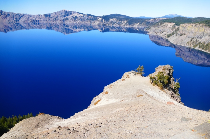
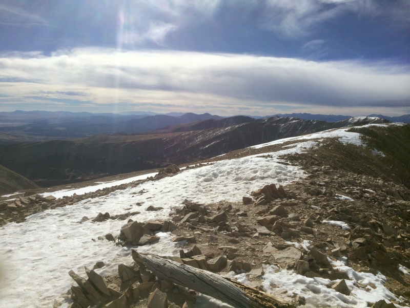
In October, I would decide that my lackluster approach to Hollywood networking, which was netting me a continued unsurprising lack of headway in the filmmaking world, combined with realizing that Colorado’s four seasons (even if sometimes delivered in the span of five minutes) were more homey to me than Southern California’s two of “hot” and “hotter,” not to mention a realization that real estate in Colorado was channeling its fellow C-state in going for the “hotter” side of the equation and that, if I didn’t jump on it, I might lose my chance to own a home in my home state, all in combination meant it was time to load up the car and return inland for good. I enjoyed exploring Utah’s Zion, Bryce Canyon, and Canyonlands NPs on a leisurely drive back to my state of origin, and a month after returning to the Centennial State, I would even prove to myself that the end of warmer weather did not have to mean the end of fourteener season for me. On November 16th, I summited Mount Sherman, a simple and straightforward and therefore largely unmemorable mountain…except for its winds reminiscent of the Nevada Wheeler. At least I was prepared this time with my Stay-Puft Marshmallow Man ski jacket and winter underlayers! 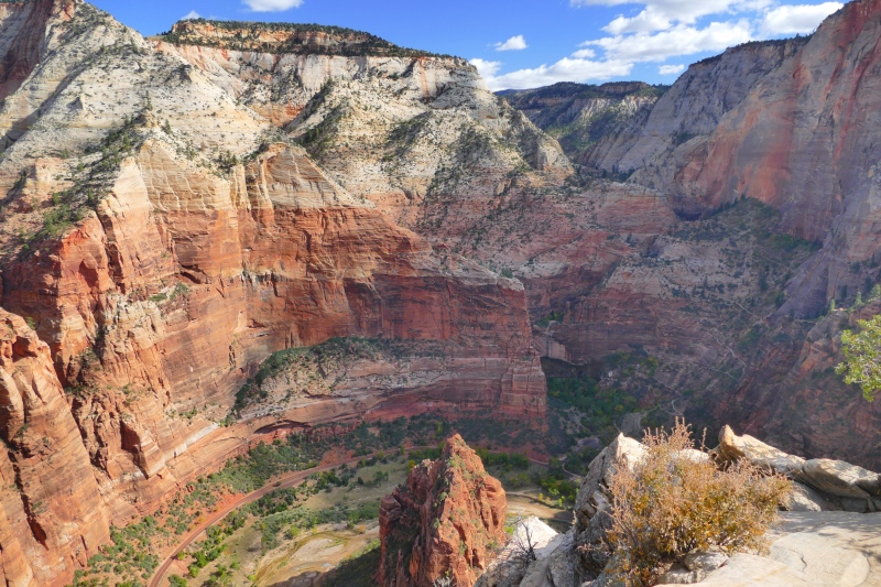
Though it would take a couple months, by the end of the year, I had closed on the residence I still live in as of this writing. A nosy glance at real estate listings every time a neighbor puts their own home on the market generally allows me to pat myself on the back for my prescience in purchasing when I did. Perhaps best of all, it seemed that after ten years of fourteenering, I might have finally learned something from my earliest mistakes. The lack of photographic memories that is more than a bit of a nuisance when it comes to my earliest summits was one I feel I had made up for in abundance, and when it came to Whitney, on two devices, no less. I also believe my second time on Pikes’ summit marked the last occasion on which I would be chased back to the trees by lightning, although I do wish I could say it was the last occasion on which I ever had to deal with precipitous precipitation…including a further occasion of such on that same mountain. But what I would take from my 2016 run-in - or should that be run-on? - with icy trails is confirmation that it’s in one’s best interests to carry microspikes or whatever other lightweight traction they might wish to use throughout the year in the high country, even if one does find themself questioning whether the metal might serve as an additional conduit for lightning. To answer said hypothetical questioning, in cases like what I experienced on Pikes, most likely not. I’d learned while perusing the online version of the Whitney Portal for good-to-know info prior to my Big Day that lightning apparently doesn’t travel through snow the way it does through water. And even though my spikes stayed in my pack when I did encounter ice on the Big Day itself that I was easily able to dodge after I took pictures to prove some sort of point to someone or another at some time, I did and do prefer to have and not need the extra assurance of sure-footedness than to be turned back from a long-desired goal out of fears of turning a Summer Olympics-level endurance hiking feat into a Winter Olympics-worthy event. Of course there probably is some discussion to be had as to whether I made a sound decision on the practice event for the Big Day when I decided to trust in my feet to get me off Pikes despite having other options, but even after the better part of yet another decade, I still think my decision to pit my own skills against Mother Nature was probably the better one. Pikes and what is now the sometimes-ironically-named Blue Sky are the only fourteeners for which there is a readily available secondary option, after all, and there’s nothing quite like deep-seated, visceral terror - whether of the sky or of those going twice the speed limit on that secondary option - to thoroughly and finally make clear the point that one should always play “trust but verify” with the forecast. But of course, as is always the case with my recountings of some of my best-laid plans, there is always a True and Proper(™) lesson in there. And in this case, while of course Whitney really should have been the focal point of this high point recounting, it was overall too uneventful to be more than the denouement, thus proving a somewhat lower point that will truly come to fruition in an entry to come: Pikes, like all other peaks regularly derided by the fourteener community’s elites as too dull to be worth discussion, can often prove to be deceptively dangerous. And just so as to avoid ending on a cliffhanger unworthy of any of the peaks already discussed in this episode with the exception of Whitney’s east face, there is of course a final lesson for all who find themselves needing to take advantage of the wag bags the Inyo National Forest Ranger Station hands out along with a lucky Whitney aspirant’s permit, courtesy of a campaign started by Colorado’s Jefferson County in an exasperated message to dog owners using its trails: if you do find yourself needing to fill a bag, whether because of a peak’s surprising scariness or just an overabundance of coffee on the drive to the trailhead, there is no Poop Fairy, so for Pete’s or Pikes’ or Whitney’s sake, please pack it out yourself. Thumbnails for uploaded photos (click to open slideshow): ")
")
")
")
")
")
")
")
")
")
")
")
")
")
")
")
")
")
")
")
")
")
")
")
")
")
")
|
| Comments or Questions | ||||||
|---|---|---|---|---|---|---|
|
Caution: The information contained in this report may not be accurate and should not be the only resource used in preparation for your climb. Failure to have the necessary experience, physical conditioning, supplies or equipment can result in injury or death. 14ers.com and the author(s) of this report provide no warranties, either express or implied, that the information provided is accurate or reliable. By using the information provided, you agree to indemnify and hold harmless 14ers.com and the report author(s) with respect to any claims and demands against them, including any attorney fees and expenses. Please read the 14ers.com Safety and Disclaimer pages for more information.
Please respect private property: 14ers.com supports the rights of private landowners to determine how and by whom their land will be used. In Colorado, it is your responsibility to determine if land is private and to obtain the appropriate permission before entering the property.


