Download Agreement, Release, and Acknowledgement of Risk:
You (the person requesting this file download) fully understand mountain climbing ("Activity") involves risks and dangers of serious bodily injury, including permanent disability, paralysis, and death ("Risks") and you fully accept and assume all such risks and all responsibility for losses, costs, and damages you incur as a result of your participation in this Activity.
You acknowledge that information in the file you have chosen to download may not be accurate and may contain errors. You agree to assume all risks when using this information and agree to release and discharge 14ers.com, 14ers Inc. and the author(s) of such information (collectively, the "Released Parties").
You hereby discharge the Released Parties from all damages, actions, claims and liabilities of any nature, specifically including, but not limited to, damages, actions, claims and liabilities arising from or related to the negligence of the Released Parties. You further agree to indemnify, hold harmless and defend 14ers.com, 14ers Inc. and each of the other Released Parties from and against any loss, damage, liability and expense, including costs and attorney fees, incurred by 14ers.com, 14ers Inc. or any of the other Released Parties as a result of you using information provided on the 14ers.com or 14ers Inc. websites.
You have read this agreement, fully understand its terms and intend it to be a complete and unconditional release of all liability to the greatest extent allowed by law and agree that if any portion of this agreement is held to be invalid the balance, notwithstanding, shall continue in full force and effect.
By clicking "OK" you agree to these terms. If you DO NOT agree, click "Cancel"...
Report Type
Full
Peak(s)
South Diamond Peak 11,701
North Diamond Peak11,852
Clark Peak 12,951
South Rawah Peak 12,644
North Rawah Peak 12,473
Peak 11, 232
TLDR: Starting at Cameron Pass, following the ridgeline from South Diamond Peak northward to Peak 11,232. From there rejoining trails and linking them back south to Cameron Pass starting point.
Soundtrack - Listening to music while hiking is a subject that gets some people all fired up, but I almost always do it when I'm out. Otherwise I just get 30 seconds of a song stuck in my head all day, so at least this way I get some variety! I often listen to post rock while I’m out, but this time I decided to go heavy on nature-inspired black metal. So just for fun here’s a sampling to set the mood, featuring two from my homeland of the PNW, and the new hotness from the Adirondacks.
Background and route - Last year I did a traverse along the Continental Divide from Monarch Pass to Lake Ann Pass, and wanted to do something similar this year. Looking at the map I got interested in the Rawah/Never Summer area and decided to try and make something happen there. The original plan was a two part trip to do what was described in the TLDR above, followed by a resupply at Cameron Pass, then taking the ridgeline south from Table Iron/Iron, through Static, Richthofen, Cumulus, Paprika, all the way to Cascade, then rejoin the CDT and take the trail back. I ended up only doing the Rawah section.
I had originally planned to scout some sections, especially in the Never Summer portion, but only got up there briefly once, so was going in with fairly limited info. I didn’t find that much information about the area, but a couple reports were useful. Cougar has a report on Montgomery Pass to Clark Peak, and mbnat has a report that covers the short section between North and South Rawah Peaks. Most helpful, a guy named Ryan Buller did this ridgeline north to south over two days as a point to point with a slightly different approach and ending at Cameron Pass. He posted a very helpful 34 minute video of the trip on YouTube that showed it was pretty straightforward the whole way, except one section he diverted around at Island Lake that ended up giving me some trouble too. Most of my research was on the Never Summer portion that I ended up not doing, oh well!
Day 1 - Cameron Pass to just south of South Rawah Peak
Day 1 stats - 15.9mi, 9,100ft gain, 7,400ft loss, 13h42m
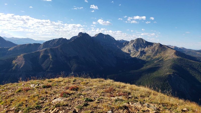
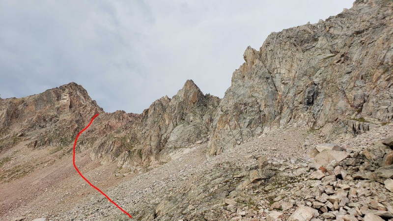
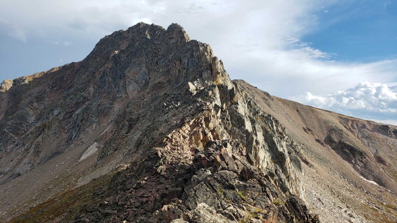
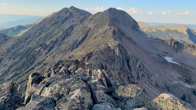
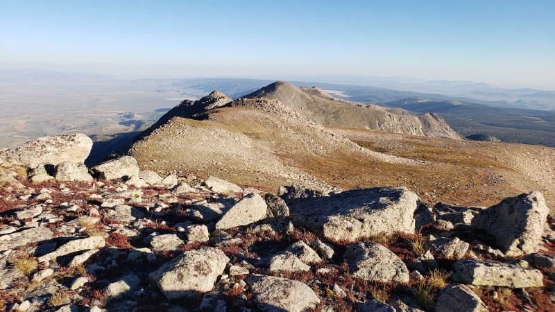
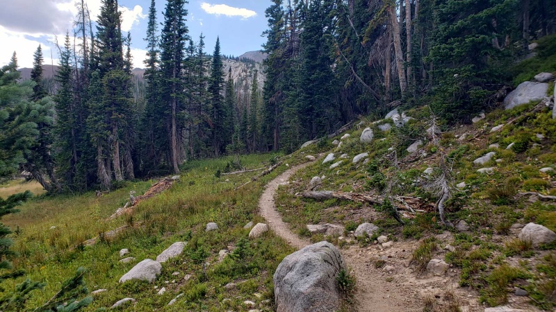
I spent the night at Cameron Pass sleeping in my car, and got moving around 7am. Of course about 15 minutes in I realized I forgot to lock my car, and had to backtrack and start over again. The trail ends around treeline, then it’s an increasingly steep climb up to South Diamond Peak. The weather was great and from here I had a nice view in all directions, including my route to the north and the Never Summers to the south. The first few miles are easy tundra cruising, making for a nice warmup. It gets rockier as you approach Clark Peak (the high point of the route at 12,951) but never really above easy to moderate class 2 in this section. Near Clark Peak I saw my only person on the ridge for the day, a day hiker who started from the west side to tag Clark and a couple other minor peaks.
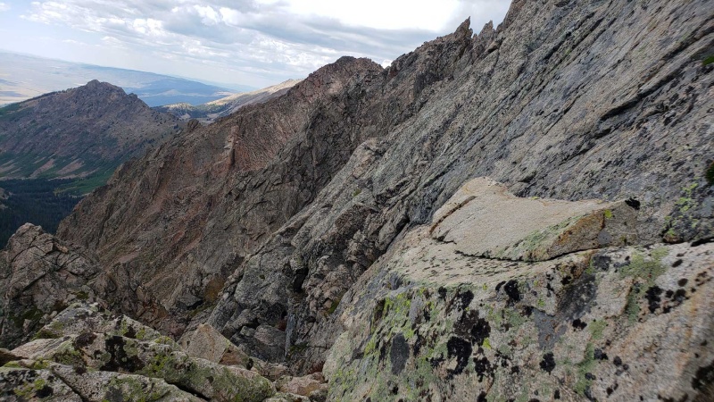
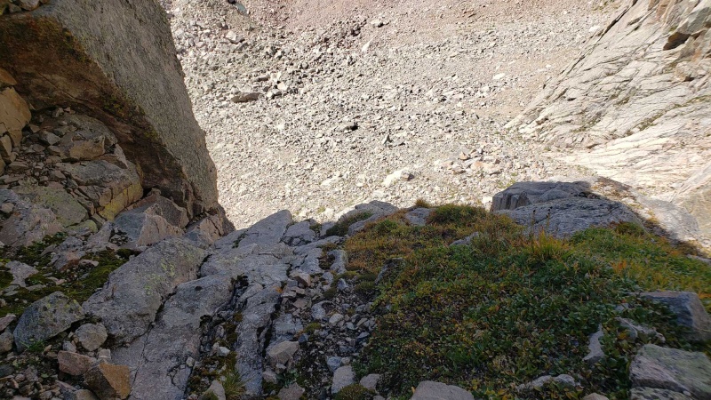
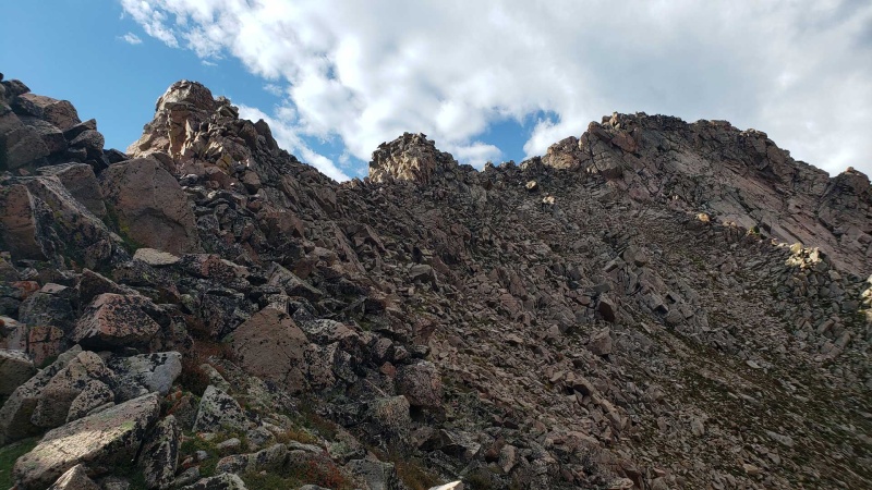
Past Clark Peak the rocks continue, though you can still pretty much always stay ridge direct with a bit of boulder hopping and maybe using a hand here and there. Not long after this you reach the crux of the route, the section to the west of Island Lake. I could immediately see that ridge direct wasn’t an option with the steep terrain and loose rock along the ridge. From the topo and what I could see I hoped I would be able to find a path through the west side using ledges and gullies of relatively solid rock that would prevent me from having to drop all the way down. This led me into some very steep terrain that was a little sketchy but seemed to be going, until I found myself cliffed out with only 50ft to go. Instead I ended up having to backtrack and descend a scree gully, traversing the slope where it started to level out, then reascending to just north of the saddle. This ended up adding about two hours and a lot of effort to my day. There may be a way through this section that stays more directly on the ridge, but it looks very sketchy and I’d suggest just going around it from the start.
Once back on the ridge, the terrain is rocky and complex, but the routefinding is pretty obvious and terrain never exceeds class 3 and some boulder hopping. There is a fair bit of exposure to the east side of the ridge that makes for some cool views, but you can generally avoid getting too close if you want. Here my gpx track shows I dropped a couple hundred feet off the ridge as I approached Rawah Pyramid, though at this point I can’t remember why. By now the sun was going down and while I kept going for about a little while by headlamp, the terrain is rocky and difficult enough that doing it in the dark is slow going at best. Just before the ridge starts the climb to South Rawah Peak I dropped off to the east and set up my bivy in a small flat basin for the night at 12,000ft.
My original (somewhat aggressive) goal was to get through most or all of the ridge on the first day, but I was 6-7mi short of that. This was partially due to the routefinding challenges around Island Lake, but also as the day went on I could feel I was pretty worn out and not moving as well as I had hoped. The week before this trip I had a lot (or rather not a lot) of very poor sleep, so I wasn’t well rested going in. A day hike a few days prior (Holy Cross via Halo Ridge, plus a few adjacent 13ers) took a lot more out of me than it should have, so I had already pushed the Rawah/Never Summer trip back a day to try and rest more. While my muscles still felt pretty good, my overall energy level just felt low. I could tell I was still worn out from the prior week and considered the possibility of cutting my trip short, but figured I’d at least see how the next day went.
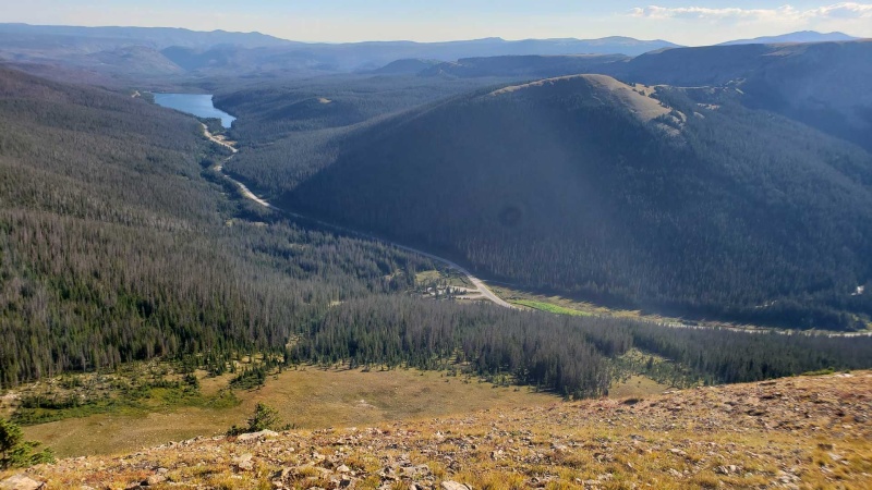
Looking down at Cameron Pass from South Diamond
Great weather and easy terrain to start northbound
View south of the Nokhu Crags and Never Summers beyond
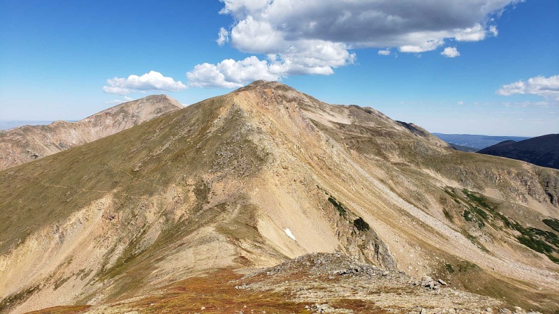
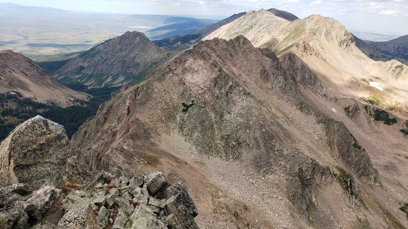
Terrain starting to get a little rocky, Clark Peak on the left
Looking west from a minor summit
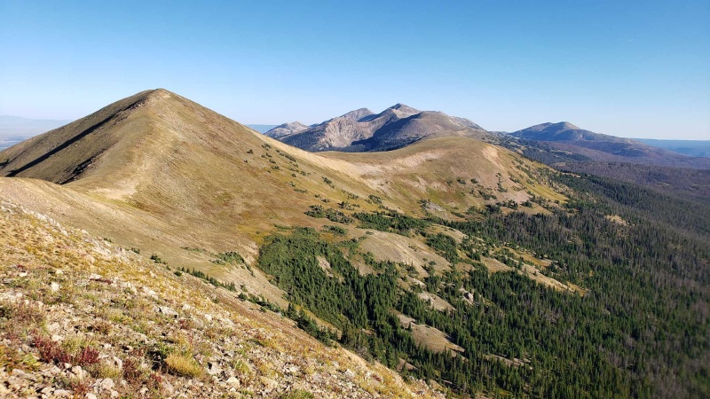
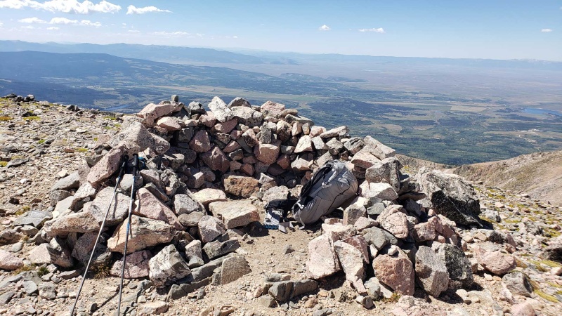
Nice view of the ridge to the north
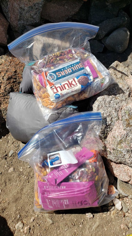
Food!
Steep drop directly in front of me at the crux of the route
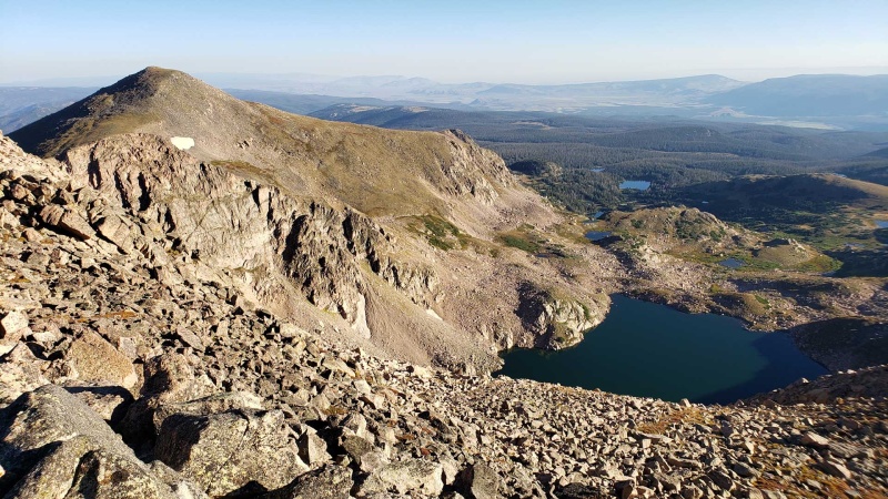
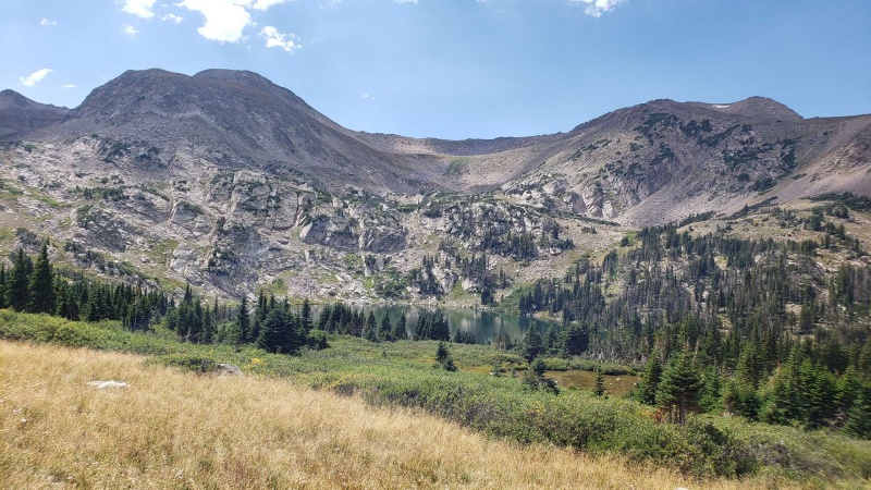
Island Lake
Trying to find a way through on the west slope of the ridge
Close but cliffed out
Route back onto the ridge after descending a scree gully
Looking back at the section I skirted around on the right side of this photo
Terrain to the north once back on the ridge, slow going but fairly straightforward
More ridge terrain north of Island Lake
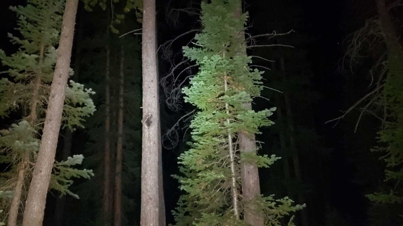
Looking back to Clark Peak in the distance as the sun goes down, Island Lake in foreground
Day 2 - Just south of South Rawah Peak to end of prominent ridge and start of treeline, back on trails south to Cameron Pass
Day 2 stats - 32.7mi, 6,300ft gain, 8,000ft loss, 15h25m
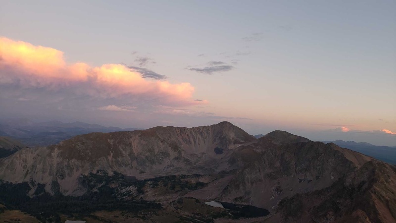
The second day started with a nice sunrise and forcing myself to eat as much as I could manage because I probably didn’t have enough the day before. I started up the first climb of the day to South Rawah Peak and was already feeling tired and worn out. I conceded this to myself when I switched from listening to music to my emergency podcast reserves, something I typically only do when I’m either training on familiar trails or want a distraction because I’m not feeling great. So instead of listening to black metal about trees I ended up listening to a five and a half hour podcast on the Atlantic slave trade.
The first few miles involve a lot of boulder hopping, but you can stay pretty much ridge direct and have a great view of the lakes below you to the east. The weather this day was still excellent, with mostly clear skies and comfortable temperatures. Somewhere around North Rawah Peak I encountered somebody doing the ridge north to south as a point to point in a day. I was a little jealous of how much faster he was moving, and hope my advice about the crux section wasn’t too confusing since I was talking about it coming from the opposite direction while still occasionally using unhelpful descriptors like left and right.
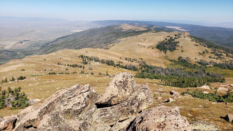
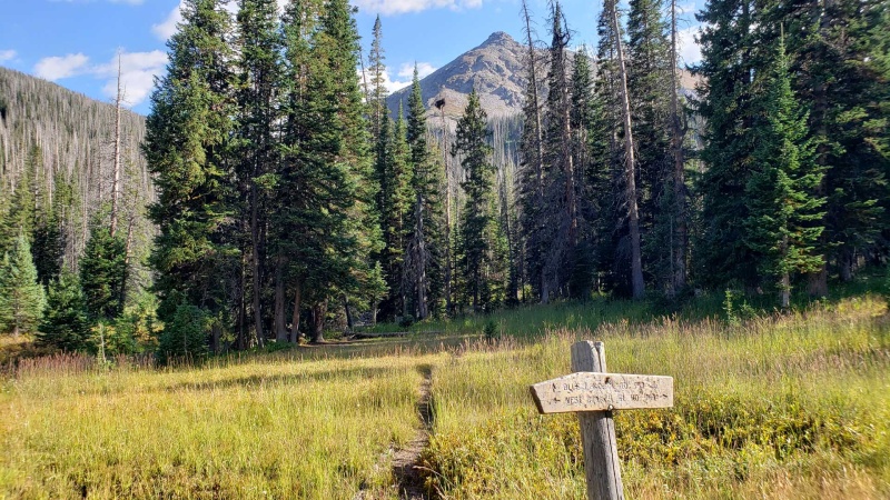
As I made it through the rocky section back onto mostly tundra and came near the end of the ridge I spotted the first of several hunting groups for the day since it was the start of the season and a holiday weekend. I made my way to Peak 11,232 and picked up the Medicine Bow Trail east to start heading back towards Cameron Pass. This trail is a bit spotty and overgrown in places, but is generally easy enough to follow. At a creek crossing I stopped to filter water only to discover that my BeFree (which was fine when I used it a month ago) was clogged, and no amount of shaking and swishing would improve flow beyond a few drops. I filled up with unfiltered water, and since you are reading this, I guess I lived.
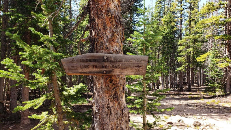
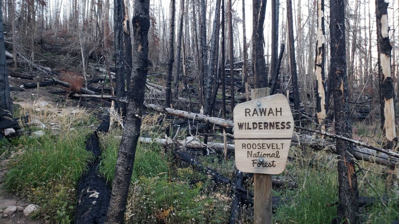
From there I joined the Link Trail and Rawah Trail heading south, both very established and providing nice views of the ridge I had come from that morning and the day before. It turns out that one advantage of actually being on a trail is that you can move faster even if you aren’t feeling 100%, and I made decent time. After going over the pass to Blue Lake I descended into the burn area from the Cameron Peak fire. It’s quite dramatic, but plant life is returning and it’s all part of the natural cycle (though admittedly humans have been putting a couple thumbs on the scale).
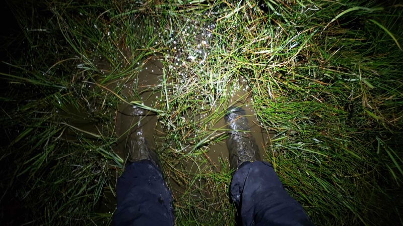
I reached Blue Lake Trailhead and crossed CO-14 as the sky was starting to darken. From there my route took me up a dirt route, through some campsites, and into the Neota Wilderness. It was fully dark at this point, and the Meadow Trail marked on the map turned out to be a huge pain in the ass. In many places it seemed to disappear, and was marked primarily with wooden arrows up high that are quite hard to see when you are watching your feet by headlamp. The “meadows” are really marshes, so I ended up just having to wade through. I found myself constantly alternating between checking GPS to try and stay on route in the hopes it would get better, and using the moon as a rough bearing and just charging directly through the trees. This was a very frustrating 2.5mi which eventually ended when I finally reached Zimmerman Lake. From here it was about a mile of dirt road back to CO-14, then just walking the shoulder of the highway for a couple miles back to my car at Cameron Pass. It wasn’t the most inspiring way to finish the day, but if I knew the condition of the Meadow Trail (at least in the current state and by headlamp) I’d rather just walk CO-14 all the way from the Blue Lake TH.
I arrived back at Cameron Pass a little before 11pm after a 15+ hour day. I don’t remember where exactly I officially decided to cut my trip short, but it was some point in the afternoon. I still wasn’t feeling great and by the time I reached Cameron Pass I definitely didn’t feel like I had the energy to get up early the next morning and attempt the significantly harder Never Summer portion of my original plan. I had planned on three days for that section, which seemed quite unrealistic with my energy levels. In addition the section between Electrode and Tepee has some pretty high consequence terrain, and I didn’t want to get into it if I wasn’t feeling good. And on top of all that, I had to say goodbye to my cat Eddie in June after 14 years. I had been planning on adopting two new cats when I got back from my trip, so cutting it short would allow me to get cats sooner instead of struggling through a route I probably wouldn’t finish anyways. After a big snack I headed home, taking a couple naps along the way.
I’m disappointed I wasn’t able to do the Never Summer portion of my planned route because I had the time and great weather conditions. At the same time I think it was the right choice because I don’t think trying to fight through it would have been a good (or successful) experience. I’m still very interested in doing that section, so hopefully I can get back there next year. Even if I wasn’t feeling 100%, the Rawah portion was excellent, and I would highly recommend it for somebody interested in this kind of trip. And I got new cats!
Sunrise on day two
My pack scattered about getting ready to start day two
Heading north along the ridge
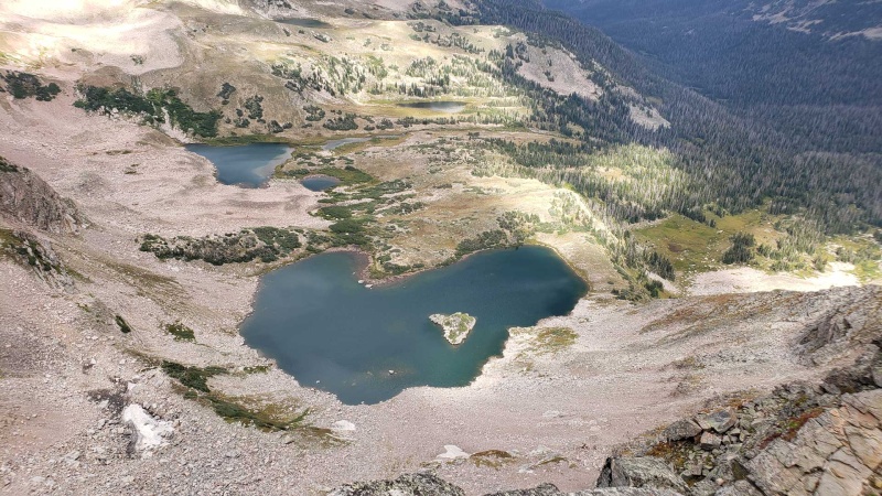
Looking down at Rawah Lake #4
Approaching the end of the ridge (headed east at two bumps on the right by the trees)
Back on signed trails, how civilized
Heading south
I think this is North and/or South Rawah Peaks?
Starting up Blue Lake Trail, NE ridge of Clark Peak in the distance
Cameron Peak fire burn area
Sneaky markers along the Meadow Trail
The “meadow”
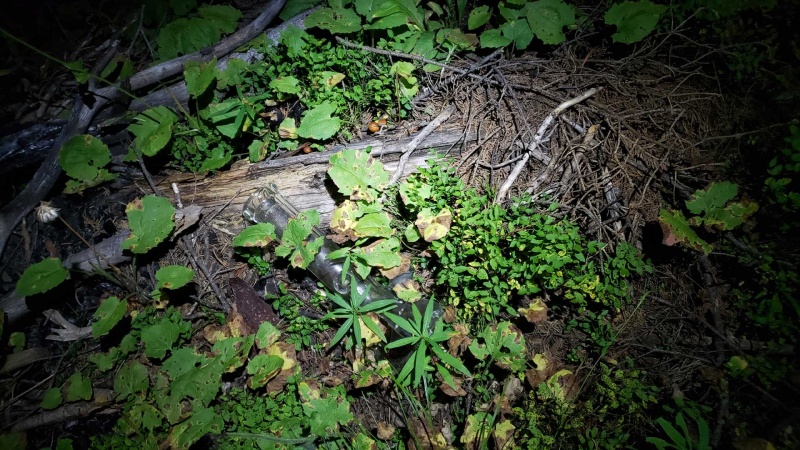
Well some stoners found the trail at some point, so I guess it can’t be that bad?
Post hike car snacks
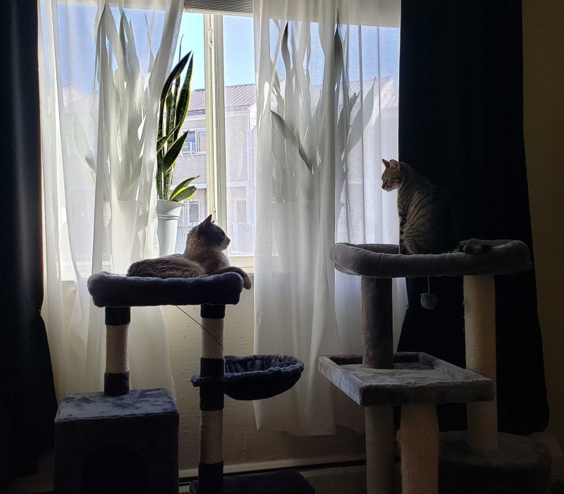
My new cats, Nolan and Ozzy! Not quite friends yet, but we’ll get there!
The end!
My GPS Tracks on Google Maps (made from a .GPX file upload):
That was a big trip, great work! The Never Summer ridges along the divide are a lot more tedious.
The Meadow trail is a cross country ski trail only, because it goes through marshes as you've found out. I think a few trails are like that with the designation and terrain. I only know this from skiing it with a local expert. Would be good to identify those routes when trip planning. I think the forest service mentions it, but not maps.
Nice report, thanks. I have some interest in at least part of this route so this is super helpful with planning. and congrats on the new kitties, they are cute.
cougar - Yeah, I knew the Never Summers would be significantly tougher, I have no idea how long it would actually take and didn't feel strong enough to roll the dice. I think I'll try and get out for a scouting day trip before trying the full line to at least take the trail from Cameron Pass then pick up Electrode, take the ridge to Lead Mountain, then drop off Never Summer Peak back to the trail. That seems to be the hardest section and probably worth a little advance knowledge. I'm sure there are plenty of challenges and surprises south of that too, but that would at least cover what seems to be the trickiest section from what I've found.
I figured something like that was going on with the Meadow Trail because of the elevated (for snow) placement of the markers. Guess that's what happens when you don't get every detail of every bit of trail and make assumptions, but I was more worried about the ridges than the trails!
acasali - Glad this is helpful, It's a great line! I didn't find much info so the video I linked at the beginning was certainly a big help to me and this report can add to that.
I'm quite happy to have cats again. Nolan is 4 years old and very sweet and mellow. Ozzy is only 1 year old and a big troublemaker with lots of kitten energy. He'll settle down and they'll become cuddle buddies eventually...
I actually considered stashing a bike for the (not done) Never Summer portion since much of the return trip would be on the rather boring but flat Grand Ditch trail. I considered doing a point to point and trying to hitch, but that seemed a little too unreliable for my tastes. Instead I usually just do things the hard/stupid way. Though I guess some weirdos actually like trails...
Bikes aren't allowed on grand ditch road. Doesn't make much sense. They are allowed on Michigan ditch, and I've ridden it a couple times from Cameron pass. Both are service roads for water diversion ditches, but different companies and parks.
Cameron pass to Electrode is easy terrain, it gets rougher to the south, but some elite folks have run the whole ridge in a day. Also water sources are more limited than Rawah, aside from the ditch itself and a couple low creeks.
Do you know of any reports of a full ridge run? I've only found sections.
Water sources were definitely expected to be a challenge, and one I kind of expected to just see what happened based on rate of progress and proximity to the limited sources. The rough plan was to start full from Michigan River/Lakes and then see how I was doing and if I could make it down to Lake of the Clouds to top up. From there I would just see how it went, though once you reach Nimbus it seems you aren't too far from a couple options. Things to think about for (hopefully) next year...
Caution: The information contained in this report may not be accurate and should not be the only resource used in preparation for your climb. Failure to have the necessary experience, physical conditioning, supplies or equipment can result in injury or death. 14ers.com and the author(s) of this report provide no warranties, either express or implied, that the information provided is accurate or reliable. By using the information provided, you agree to indemnify and hold harmless 14ers.com and the report author(s) with respect to any claims and demands against them, including any attorney fees and expenses. Please read the 14ers.com Safety and Disclaimer pages for more information.
Please respect private property: 14ers.com supports the rights of private landowners to determine how and by whom their land will be used. In Colorado, it is your responsibility to determine if land is private and to obtain the appropriate permission before entering the property.


")
")
")
")
")
")
")
")
")
")
")
")
")
")
")
")
")
")
")
")
")
")
")
")
")
")
")
")
")
")
")


