| Report Type | Full |
| Peak(s) |
South Rawah Peak - 12,644' North Rawah Peak - 12,473' |
| Date Posted | 08/02/2020 |
| Date Climbed | 08/01/2020 |
| Author | mbnat |
| North and South Rawah Peaks |
|---|
|
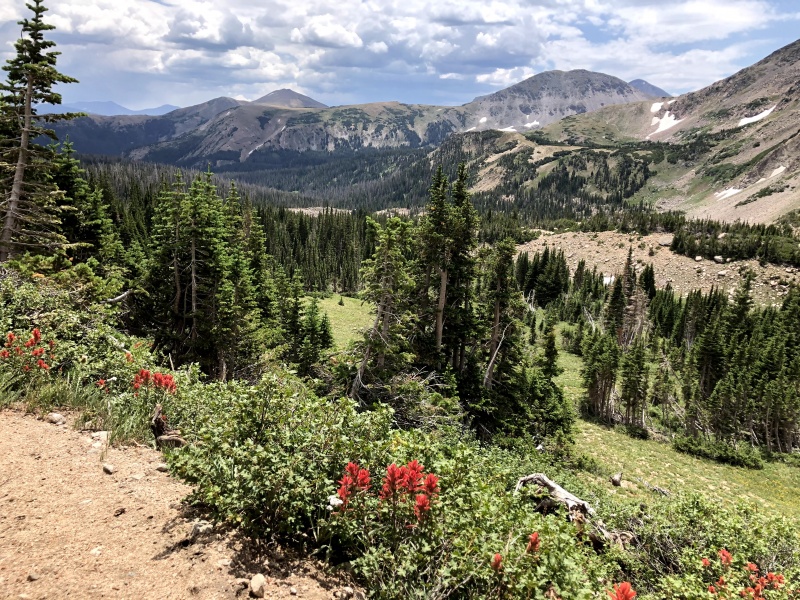
North and South Rawah Peaks 07/31/2020 - 08/01/2020 Distance: ~19.0 miles Elevation: ~5,800' Researching this route proved surprisingly challenging with only a few prior trip reports on the web, so I decided I should write my own and provide some more information for those interested. This is such a beautiful area, and while the trails and lakes see plenty of traffic, the peaks appear to be seldom visited. This has been on my list for a long time, with such easy access from Fort Collins but somehow this was only my first (but surely not last) trip to the Rawah. We left on Friday afternoon, July 31 and arrived at a nearly full West Branch Trailhead at about 6pm, a little later than desired as we hoped to cover as much distance as possible before sunset. We set off a few minutes later up the beautiful trail, winding through aspen groves for the first about 3 miles. This was added to my list to return in the fall! 
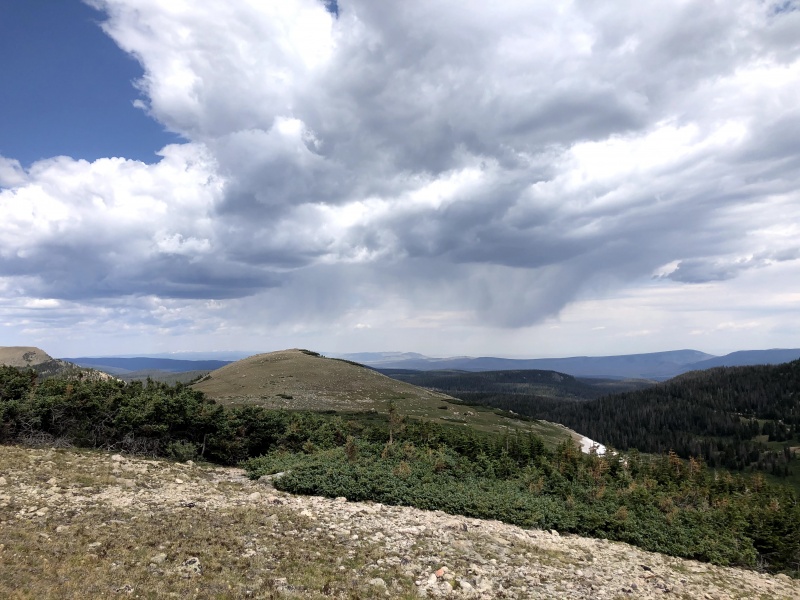
The trails were all very well signed in this region. We followed the West Branch trail passed the junction with the Camp Lake trail, and then took the Rawah trail to the right about 3.6 miles in. The Rawah trail climbs through pine forests up to a junction with the Twin Crater Lakes trail, where we again went right to stay on the Rawah trail. This junction was just after the top of a rise that the trail switchbacks up through, and following the Rawah trail leads to a more gently sloping meadow below Bench Lake and Grassy Pass. As we were rapidly losing light, we weren't able to look around much for the ideal campsite, but ended up finding a nice flat bench in the trees above the trail. This was about 5.7 miles and 2,000' vertical away from the West Branch Trailhead. We were immediately greeted by some aggressive thunder and lightning to the north, which appeared to be heading directly for us. We set up the tent quickly and waited the storm out inside, which brought a healthy downpour and accumulating hail/graupel. 
The storm cleared out quickly and we enjoyed dinner of the end of my 2019 frozen pesto and sun dried tomato crop. We slept comfortably with no more storms the rest of the night. We got a bit of a later than desired start the next day too, not getting on the trail until 8am, but I wasn't too worried with the expected weather and short approach. 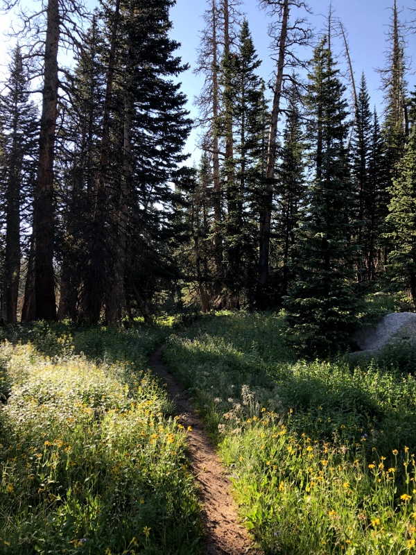
From our campsite, we hiked only a few minutes before getting off trail. We left the Rawah trail just before the trail crosses the North Fork of the West Branch of the Laramie River (what a name). Right before this crossing, you can make out a waterfall to the west. We bushwhacked just a short ways up to the base of the falls to try and find an easy way up to Bench Lake. The plan for the day was to get to Bench Lake, then take the east ridge of South Rawah Peak up, traverse up to North Rawah, then descend by Rawah Lake #4 back to Grassy Pass and return to the trail there. However, the "bench" for which Bench Lake is named for proved steeper than expected and it wasn't just an easy walk through the meadow. To reduce bushwhacking, we stuck pretty close to the stream that flows down from Bench Lake through the falls visible from the trail. 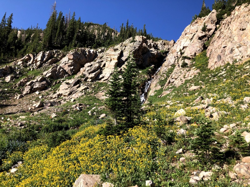
We scrambled up the rocks on the left (south) side of the waterfall in the above photo to get up to Bench Lake. However, you could traverse further to the left around the rocky outcropping to stay on easier grass/dirt but we were looking for some more fun anyway. There were a few loose dirt sections interspersed but it wasn't too bad and we soon reached the lake. We next traversed around the east to south side of the lake to gain the east ridge. 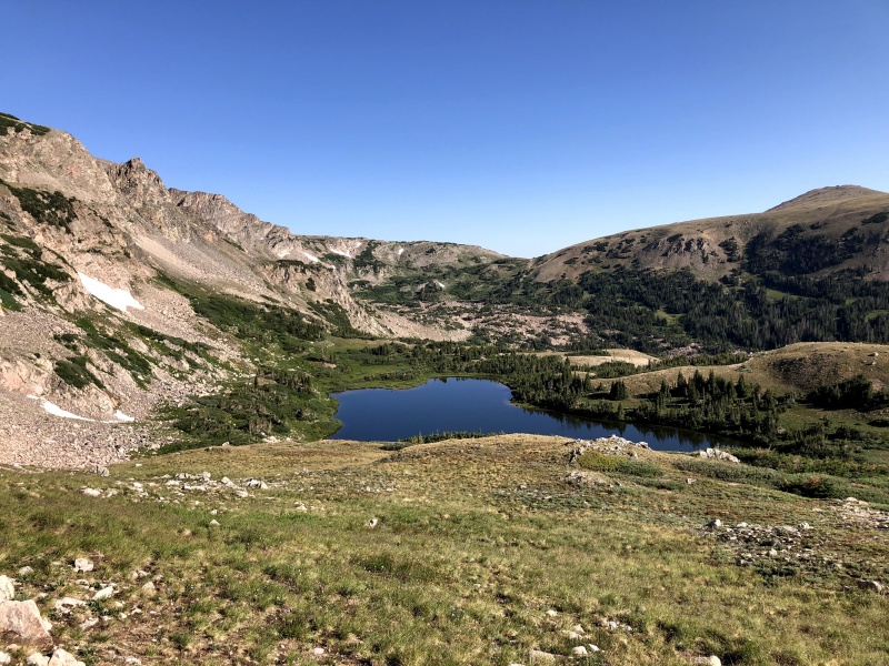
The east ridge was pretty straightforward after that. Just a steep grassy climb with a few rocky sections. You probably could gain the east ridge from the Twin Crater Lakes region by climbing up to the lakes and traversing across tundra/talus around Rockhole lake too but getting at it from Bench lake was pretty easy, besides some routefinding to get to Bench lake in the first place. We arrived at the summit of South Rawah Peak at about 9:45am. 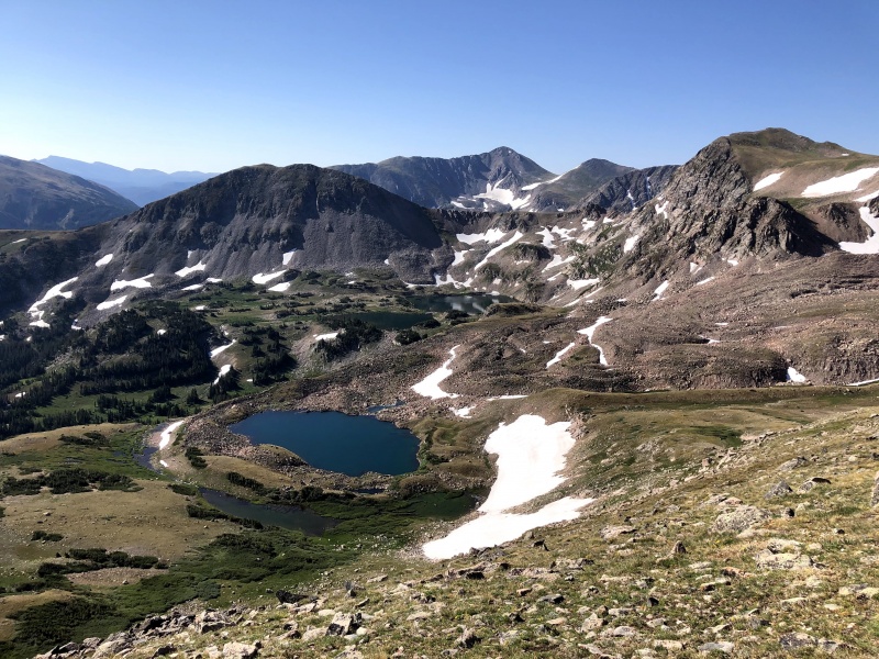
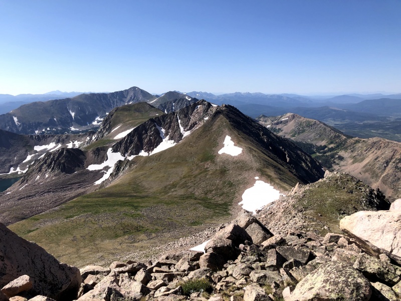

The next task for the day was to traverse across the ridge to North Rawah Peak. This started out as an easy tundra walk with some ups and downs but we could see that there were some obstacles ahead. The first feature was easy scrambling that could easily be kept at Class 2 but we opted for some more fun routes through. 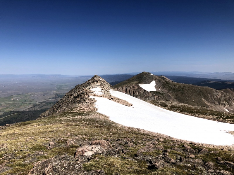
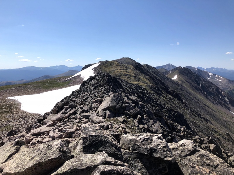
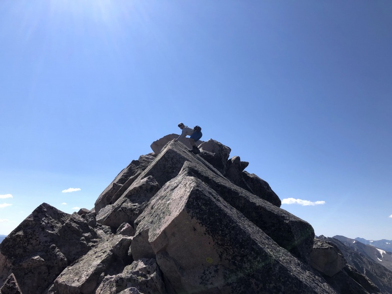
After gaining the top of this first minor obstacle on the ridge, it started to get more interesting! The terrain was still pretty straightforward but the exposure increased dramatically to the east with a shear drop down to Rawah Lake #4. I think that you could keep this section at Class 2 if you dropped down off the ridge to the west frequently. We opted to stay as close as possible to the ridge crest and only drop down one or two times to the west side. But when in doubt, the west side usually offered an easy path around any difficulty. 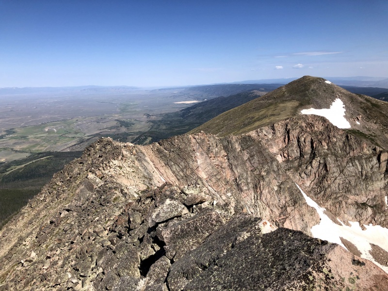
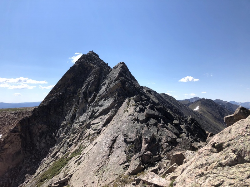
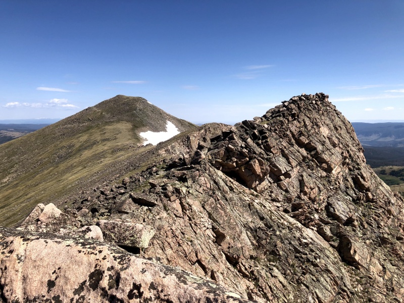
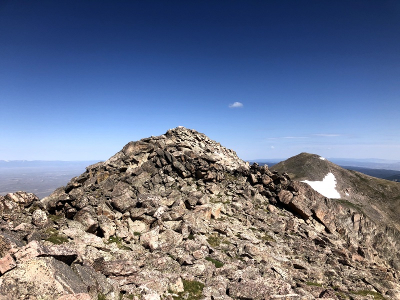
The scramble section was short and the rock was generally very stable. The exposure subsided quickly and we were back on tundra and easy rock hopping from the low point up to the summit of North Rawah. We gained the summit at about 11:15am, taking 90 minutes for the traverse. This was a bit longer than we expected but we were moving pretty slowly. 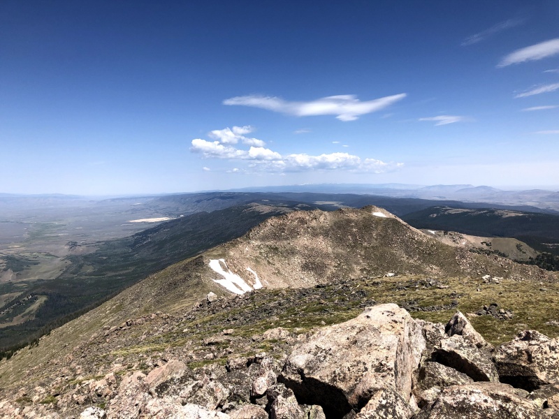
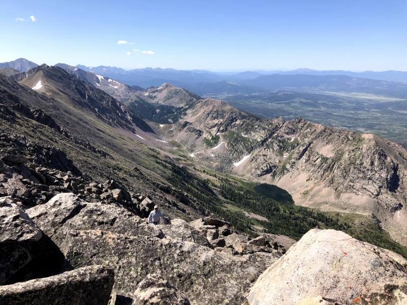
The descent from North Rawah proved to be just more annoying than difficult. We descended back to the low point of the ridge to avoid terrain that looked sort of loose on the SE face of North Rawah. We dropped to the south of a large snowfield and then traversed back and forth across the slope down to Rawah Lake #4 trying to find easier terrain. It was just lots of rock hopping and meandering around larger boulders or looser sections. 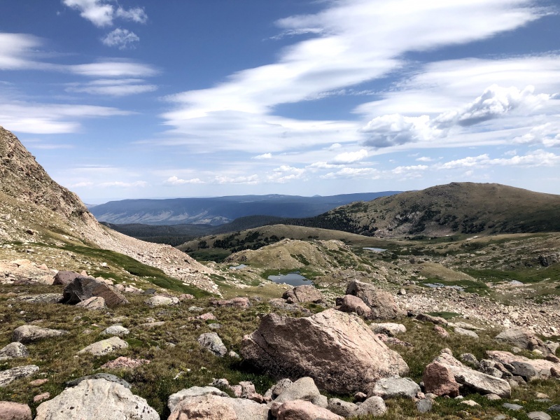
We headed towards Rawah Lake #4 to get a view of the lake and then contour around to Grassy Pass. 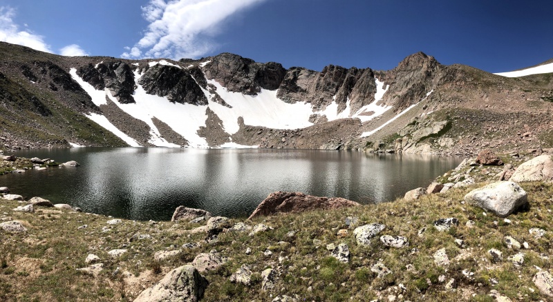
This also took a little longer than expected but was pretty straightforward. We picked up the trail again at Grassy Pass around 12:30pm and were back at camp a little after 1pm, just in time to get in the tent to wait out another brief hailstorm. 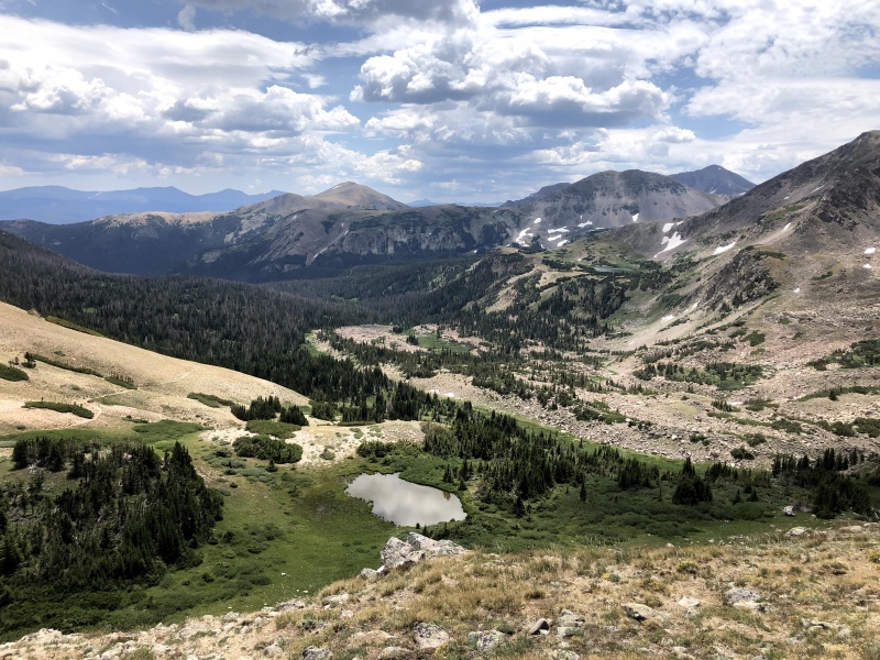
After that it was a long but straightforward pack back to the trailhead, mercifully cooled down by frequent rounds of light rain and wind! Overall this was a great short little trip to some beautiful peaks well worth more attention. I hope this trip report is helpful to anyone else planning a route up here! I only uploaded the GPX file for the second day but we followed the exact same route in on the first. Thumbnails for uploaded photos (click to open slideshow): ")
")
")
")
")
")
")
")
")
")
")
")
")
")
")
")
")
")
")
")
")
")
|
| Comments or Questions | |||
|---|---|---|---|
|
Caution: The information contained in this report may not be accurate and should not be the only resource used in preparation for your climb. Failure to have the necessary experience, physical conditioning, supplies or equipment can result in injury or death. 14ers.com and the author(s) of this report provide no warranties, either express or implied, that the information provided is accurate or reliable. By using the information provided, you agree to indemnify and hold harmless 14ers.com and the report author(s) with respect to any claims and demands against them, including any attorney fees and expenses. Please read the 14ers.com Safety and Disclaimer pages for more information.
Please respect private property: 14ers.com supports the rights of private landowners to determine how and by whom their land will be used. In Colorado, it is your responsibility to determine if land is private and to obtain the appropriate permission before entering the property.


