| Report Type | Full |
| Peak(s) |
Geissler Mountain West - 13,308 feet Geissler Mountain East - 13,381 feet Unnamed 13556 - 13,556 feet Twining Peak - 13,721 feet Unnamed 13541 - 13,541 feet |
| Date Posted | 07/19/2021 |
| Modified | 08/22/2021 |
| Date Climbed | 07/18/2021 |
| Author | bangerth |
| Why do a 14er if you can do five 13ers? |
|---|
|
A couple of years ago, I drove up to Independence Pass with some visiting friends. We had no intentions of hiking any of the mountains around, but I was curious anyway and read up on what's around. I must have come across either @bmcqueen's report or, more likely, @bergsteigen's report which I filed under my brain's "nice idea" category for some unspecified later time. That time arrived this weekend: We had climbed Sneffel's SW ridge on Saturday, and despite my friend Randy's implorations, I didn't feel like sticking around and doing Teakettle with him on Sunday: The descriptions of that mountain just don't sound fun at all, but more importantly, I didn't want to drive home 7 hours by myself after two days in the mountains. So my plan was instead to drive halfway back on Saturday afternoon, stay for the night, hike something on Sunday morning, and then head home for a much shortened drive. Where to go? The "nice idea" sounded like a good idea for a medium length solo day. So I took the scenic route via Montrose, Delta, Paonia, Carbondale, and Aspen, and headed up to the Independence Lake trailhead (the parking lot just below the top of the pass) and was in bed at a totally reasonable 9:30pm for a night that was going to be twice as long as the previous one. For once, the temperature in the car was perfect, my sleeping bag cozy, and good friends from decades ago made pleasant appearances in my dreams. The alarm going off at 4:30am got the middle finger twice but I still managed to be on the trail at 5:05am. The beginning of the route is pretty easy: Follow the trail, take the left going up the switchbacks to the lake. I then followed the lake around a bit until the trail ran out, and then made my way up to the shelf that sits below West Geissler. There turns out to be a nicely located little puddle that allowed me to look east against the morning light to see the route over UN 13,545 later in the day, though I have to admit that I did not appreciate the difficulties that lay on that ridge. More interesting to me was to figure out where to go next heading up to West Geissler's South Ridge. There were remaining cornices along most of the ridge that wasn't a rocky outcrop, and I wanted to avoid those. 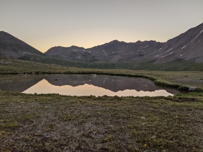
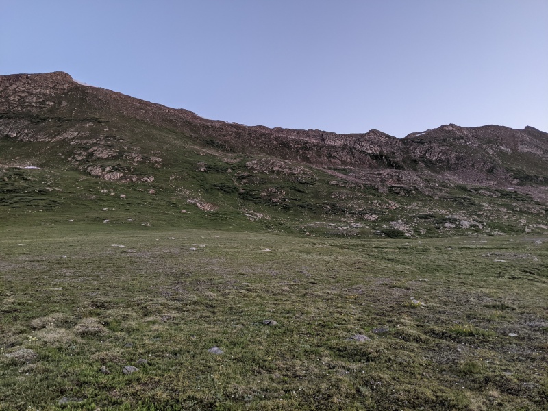
I decided to just head from the end of the shelf up the grassy slope and then angle right roughly where the upper white band hits the ridge. That worked pretty well, although the grassy slope was steep. But then, once you've done the grassy slope going up to Bierstadt's SE ridge, every other grassy slope pales in comparison. The ridge also affords nice views back down to the lake the trail goes to: 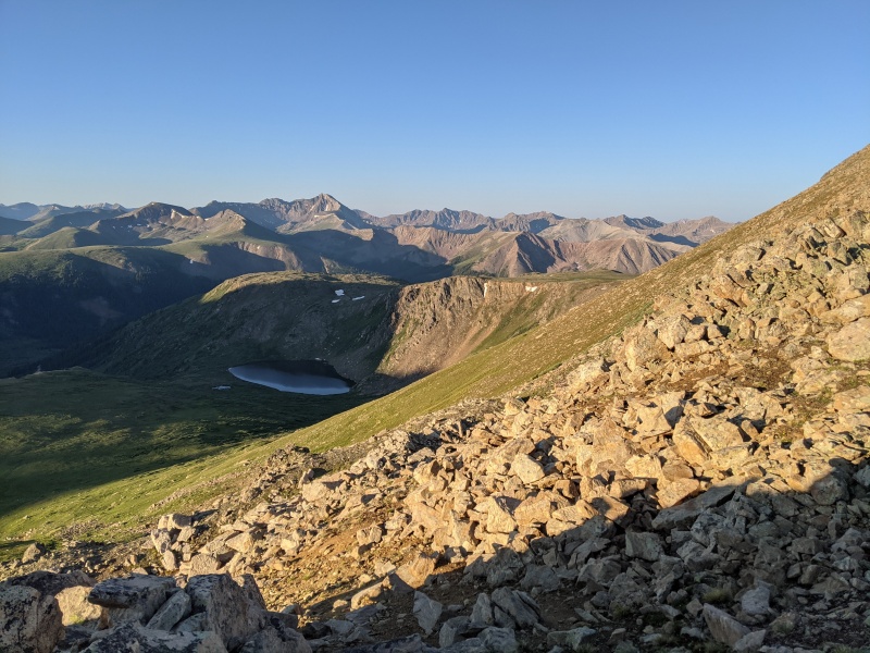
My arrival on the ridge was not welcomed by the local fauna. I happened upon a family of Ptarmigans and because one of the chicks decided to run away in the direction I was moving, just slower, mama ptarmigan decided to intervene and first hissed at and then charged me. The remaining obstacles toward West Geissler were easier to navigate: just a couple of rocky points on the ridge which, if one knew that they were not the summit, one may have chosen to bypass. But there was nothing aggravating enough for me to check the map: I just went over them. Getting from West to East Geissler turned out to be an exercise in nuisance. The downhike is quite loose and wasn't all that much fun. The actual ridge is too blocky, but there is a gully just to its right and I chose to stay with the rocks on its left, maybe 50ft to the side of the ridge. That worked, but it wasn't pleasant. I roughly headed to the right of the snow field in the left picture below. A better view is from the opposite side, looking back towards West Geissler. I stayed just to the left of the ridge. 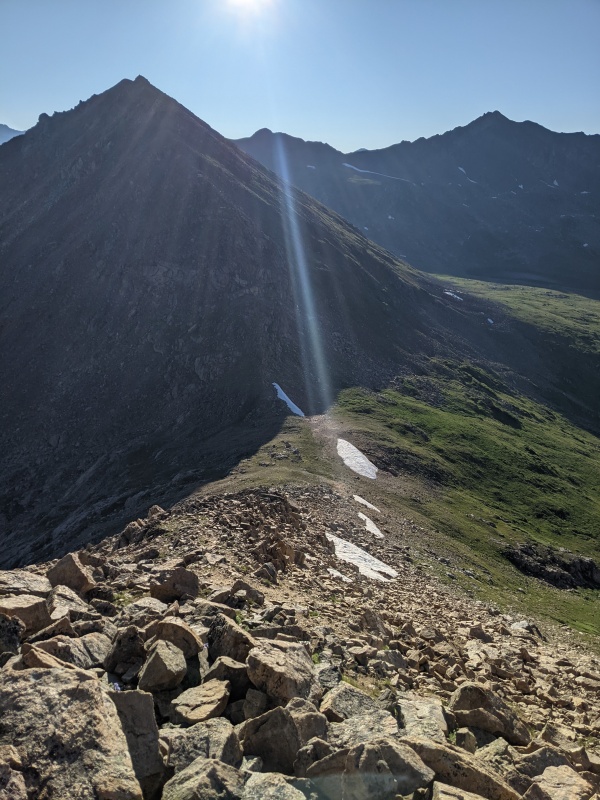

Getting up East Geissler isn't all that much better. The bottom of the ridge blocks easy access through cliffs, so I went right around and angling upward on more grassy slopes until I finally ended up on the ridge not far from the summit. It's a choose your own adventure kind of place: Like for the rest of the day, there are no obvious social trails or cairns, you just have to pick your own path. East Geissler, like West Geissler before, has excellent views of not just the local neighborhood, but far into the distance. The Maroon Bells, Capitol, Massive, and many others were easily identifiable west of me. Of more immediate interest to me, of course, was where to go next. 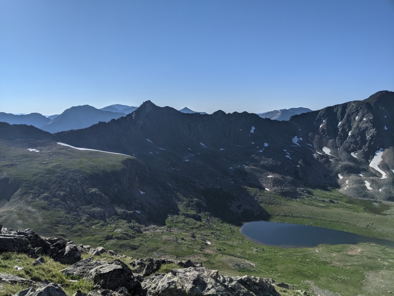
The path is relatively obvious. The east side of East Geissler is an easy downhike, then cross the trail that goes from the lake to the right over into the basin on the left. From there, up to the shelf and across it, and from there to the little saddle at the top of the long snowfield in the picture. Cross the trail was also the only time all day long I actually met anyone. What the picture forebode was also that it's going to get tricky once one is on the ridge. The distant view doesn't quite does it justice, but from close to the saddle above the flat spot on the left side of the picture, it gets quite clear. There is a bit of a honeymoon phase at the beginning of the ridge, but then the game begins to be serious: 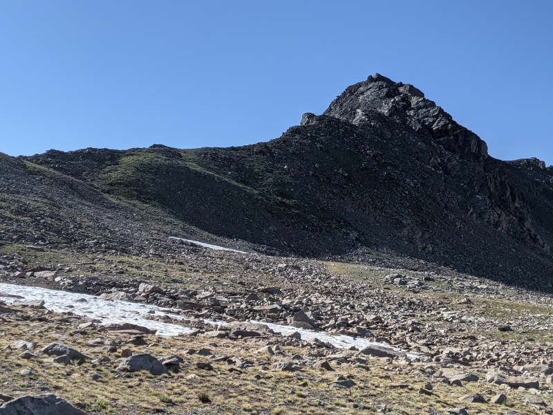
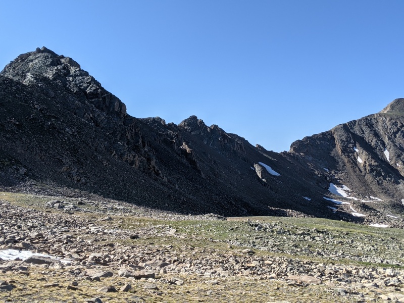
So the fun begins. And so does the commitment: There is no bail point from the ridge until one gets to the top of Twining, two peaks away, and I think that took the better part of three hours to get there. Either way, I really enjoyed this stretch, getting to the top of UN 13,545 is a lovely class 3+ scramble, but without any objective real danger. Many places look like this view of the top: 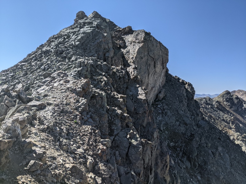
I did not find a summit register (nor did I on any of the other summits) and so did not linger very long. Still two peaks to go, and I wanted to make it over there quickly. What I did not appreciate is how difficult that next stretch would be. I had, partly on purpose because I wanted to train my route finding skills, not read the trip reports again and failed to understand that that ridge is both long and difficult. It also doesn't look like very much from the summit of UN 13,545: 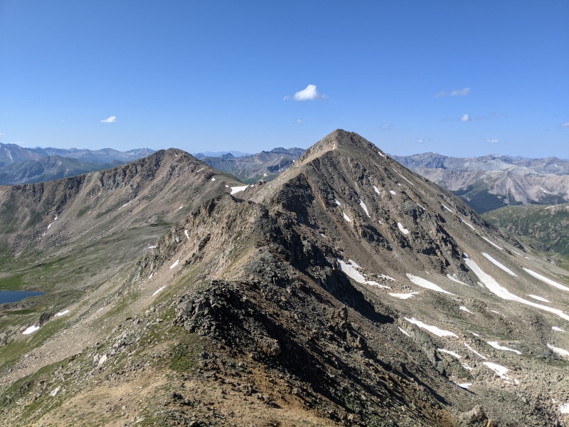
In hindsight, the same is true if one looks at it from the other direction: 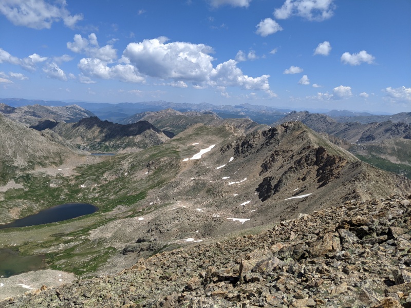
When at the summit of UN 13,545, I had figured that most of these points can be bypassed or at the very least shouldn't present substantial obstacles. That turned out to be wrong: they provide the hiker with a long sequence of class 3+ and class 4 joy which I greatly appreciated though I will admit that by the end of it, I was getting tired both physically and mentally. A lot of it looks like this from close-up: 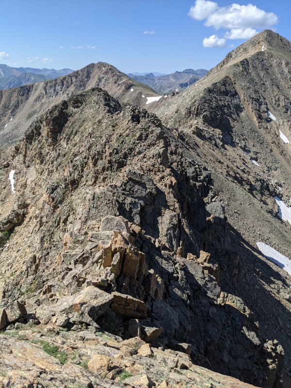
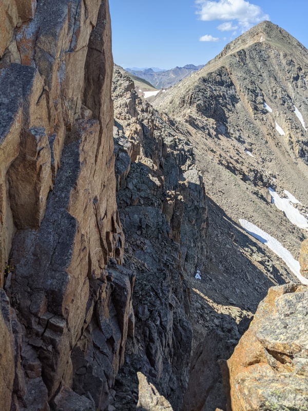
So up and down and up and down I went, often with substantial exposure to both left and right. Nothing too crazy, but enough that one can't space out and dozens of places where one needs to use hands for more than just comfort .(To me, having to use hands for climbing moves is what defines class 4.) It goes like this for a long time. Maybe I should have anticipated this from the view of the ridge between UN 13,545 and Twining I had had from East Geissler (or in fact from the little puddle on the shelf early in the morning), but not worrying too much and just going was part of my goal, and so go I did, enjoying what the path put in front of me. After a long time, I finally made it to the base of the summit block of Twining. There is one last, but substantial obstacle of which I don't have a good picture but a zoom-in of a previous picture shows the area: 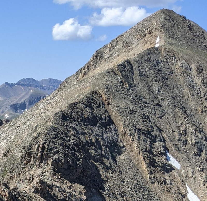
The up-and-down part of the ridge ends at the bottom left of the picture, and the vertical slabs and the stuff to its right block immediate access to the remainder of the ridge upward. I suspect that if one were to spend a bit of time, one could find a class 4 or maybe even class 3 route. I was too lazy and just climbed up 8 ft in a crack just to the left of the last mini-saddle that, admittedly, had a lot of steep slope under it but otherwise was not worse than a couple of 5.low moves. The game is over: The rest of the ridge to the top of Twining was a pretty pleasant class 2+ ridge walk and in relatively short time, one stands on the summit -- which like the rest of the route was empty, in a pleasant change from the hundreds of people we must have encountered the previous day on Sneffels. The views from up there were, like everywhere else, fantastic, showing the entire route I had just taken: 
I had not quite made up my mind what to do from here. One could probably angle down on the southwest side of Twining and make it back to the parking lot via bushwhacking. Or one could head over to the saddle with UN 13,500. Some clouds had appeared on the sky, but nothing that made me worry for the immediate future. I decided to head down to the saddle and check again. It turns out that the way down to the saddle is super easy and didn't even take 20 minutes. Should I keep going? There seems to be some kind of trail that goes over the saddle, easily visible from both Twining and UN 13,500 and (looking it up later) on satellite pictures. But I hadn't been able to see from Twining where it actually goes, so I decided to just keep going towards UN 13,500 -- a good decision, because I still don't know whether that trail actually goes anywhere. From all angles I could see, and from satellite pictures, it looks like it just peters out somewhere SW of the saddle and then I would still have had to bushwhack. So onward, if I can do four peaks I surely can do five. UN 13,500 looks impressive from Twining and from the saddle, what with all of those big blocks towards its summit. But in reality, it's just a short hike to get up there with grass between most of the big blocks. It only took 20 minutes to get to the top, and this time (unlike the first ridge of the day), the welcoming committee was great: A fat and trusty marmot that came to check me out, no doubt hoping that I was one of the many people who come up from Independence Pass and feed it. I politely declined but thanked the marmot for the kind welcome, upon which it retreated to lie some more on the highest rock on the summit and I hiked down the on-and-off trail to Independence Pass and then down the road to the parking lot. That last piece of the trip may not have been my favorite, but five peaks in one hike is still a good day. 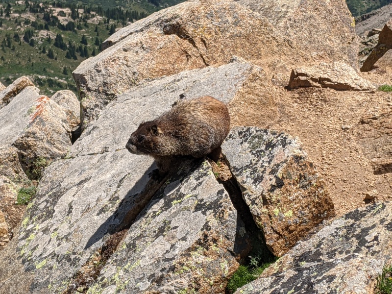
Stats:
|
| Comments or Questions | ||||||
|---|---|---|---|---|---|---|
|
Caution: The information contained in this report may not be accurate and should not be the only resource used in preparation for your climb. Failure to have the necessary experience, physical conditioning, supplies or equipment can result in injury or death. 14ers.com and the author(s) of this report provide no warranties, either express or implied, that the information provided is accurate or reliable. By using the information provided, you agree to indemnify and hold harmless 14ers.com and the report author(s) with respect to any claims and demands against them, including any attorney fees and expenses. Please read the 14ers.com Safety and Disclaimer pages for more information.
Please respect private property: 14ers.com supports the rights of private landowners to determine how and by whom their land will be used. In Colorado, it is your responsibility to determine if land is private and to obtain the appropriate permission before entering the property.
