Download Agreement, Release, and Acknowledgement of Risk:
You (the person requesting this file download) fully understand mountain climbing ("Activity") involves risks and dangers of serious bodily injury, including permanent disability, paralysis, and death ("Risks") and you fully accept and assume all such risks and all responsibility for losses, costs, and damages you incur as a result of your participation in this Activity.
You acknowledge that information in the file you have chosen to download may not be accurate and may contain errors. You agree to assume all risks when using this information and agree to release and discharge 14ers.com, 14ers Inc. and the author(s) of such information (collectively, the "Released Parties").
You hereby discharge the Released Parties from all damages, actions, claims and liabilities of any nature, specifically including, but not limited to, damages, actions, claims and liabilities arising from or related to the negligence of the Released Parties. You further agree to indemnify, hold harmless and defend 14ers.com, 14ers Inc. and each of the other Released Parties from and against any loss, damage, liability and expense, including costs and attorney fees, incurred by 14ers.com, 14ers Inc. or any of the other Released Parties as a result of you using information provided on the 14ers.com or 14ers Inc. websites.
You have read this agreement, fully understand its terms and intend it to be a complete and unconditional release of all liability to the greatest extent allowed by law and agree that if any portion of this agreement is held to be invalid the balance, notwithstanding, shall continue in full force and effect.
By clicking "OK" you agree to these terms. If you DO NOT agree, click "Cancel"...
West & East Geissler, PT 13001, Pt 13545, Twining Peak
Miles: 8.9
Elevation Gain: 4,531'
Partner: Solo
I wanted to get out on a solo 13er ridge run for a little while now, but with the craziness of my May traveling coast to coast and points south, a major flood in my house during my absence Cinco de Mayo weekend causing construction chaos, there was little time for much of anything. I found myself on Thursday wondering what I would do this weekend, after the Mosquito ridge run on Friday with Caroline and Vicki. So I dug up my 13er planning .tpo file and looked at the few lines I drew on the map in the Sawatch. Printed off 2 routes, quickly viewed a couple TR's and was off.
With the Mosquito loop of 5 peaks getting done a bit later than expected, resupplying for the weekend of hiking and cat sitting in Boulder taking longer than desired too, I showed up at the trailhead before Indy Pass at 12:30am, with a 5am wake up call and having only had 3 hours the previous night as well. Oh the things we do to ourselves to go hiking!
The alarm goes off at 5, I hit snooze, put my hiking clothes in my sleeping bag, nap. Alarm -> snooze. Alarm -> reset to 6am. Alarm...... one more snooze for good effect. With Kevin Baker's sighting of a bear on Indy Pass, I wanted it to be light out at the start of my hike. Yup, that's my excuse. So around 7am I finally arrived at the proper trailhead and was ready to start walking.
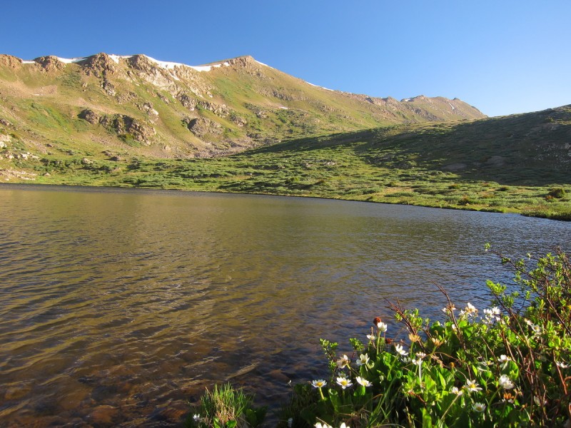
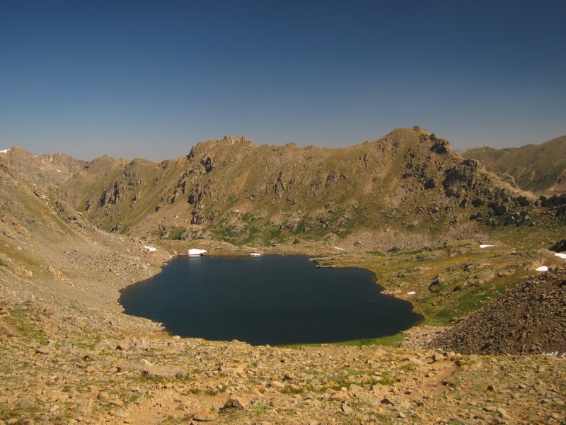
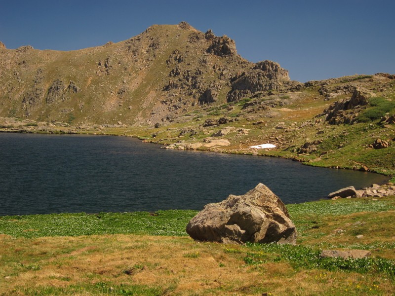
My topo map has two trails going up the valley. One to the saddle between the Geisslers, and the other between East Geissler and Pt 13,545. I wanted to take the one to the Geissler Saddle, so I took the Linkins Lake trail off of the Lost Man Lake trail, and started looking for it. Well, it no longer exists. So up to the lake I went. The off-trail after the lake was easy, so I wasn't too worried. No big willows, just open tundra.
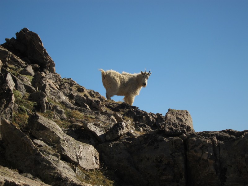
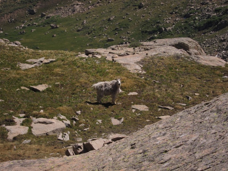
After the lake it was a simple angling ascent up to the ridge below the summit. Along the way, I met my goat companion for half of the loop. And as I walked towards the summit, he would walk in front of me to the summit as well. The 3 Glenwood Springs locals I found on the summit were pleased with my herding of the goat, as it passed right by them.
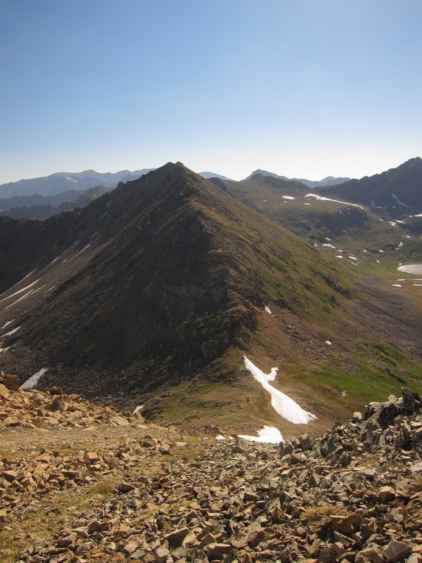
Approaching the first summit, Geissler Mtn West King of the mountain, and my trail-mate for the first 3 peaks Summit of West
Williams Mtn - on the list!
After the summit of Geissler Mtn West, I would only see people along the Lost Man Lake trail. No one on the high ridges or peaks. The guy on the summit mentioned that I was the first person he has ever seen on his semi-regular trip to the Geisslers.
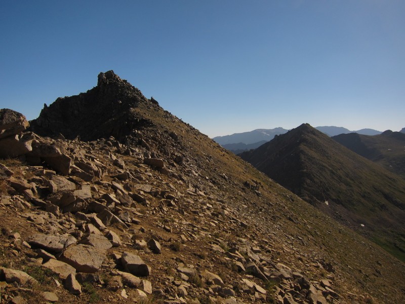
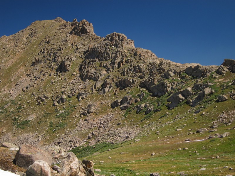
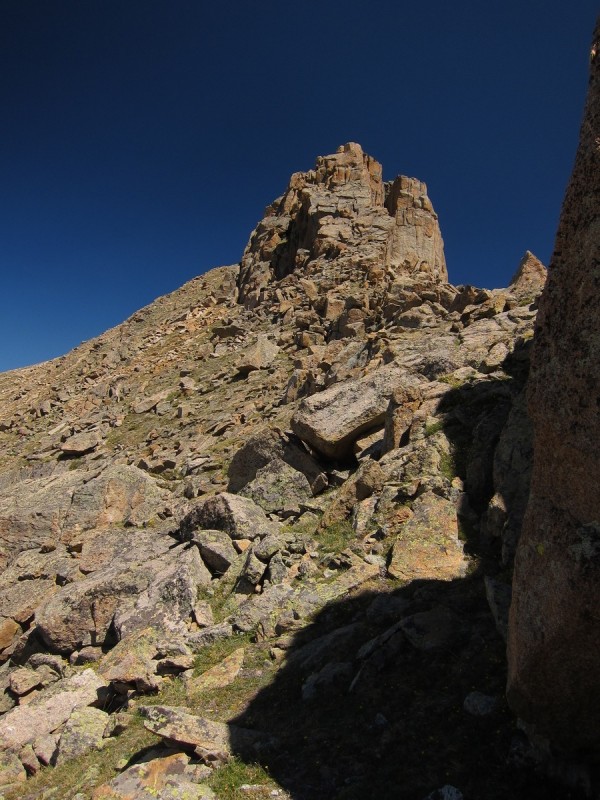
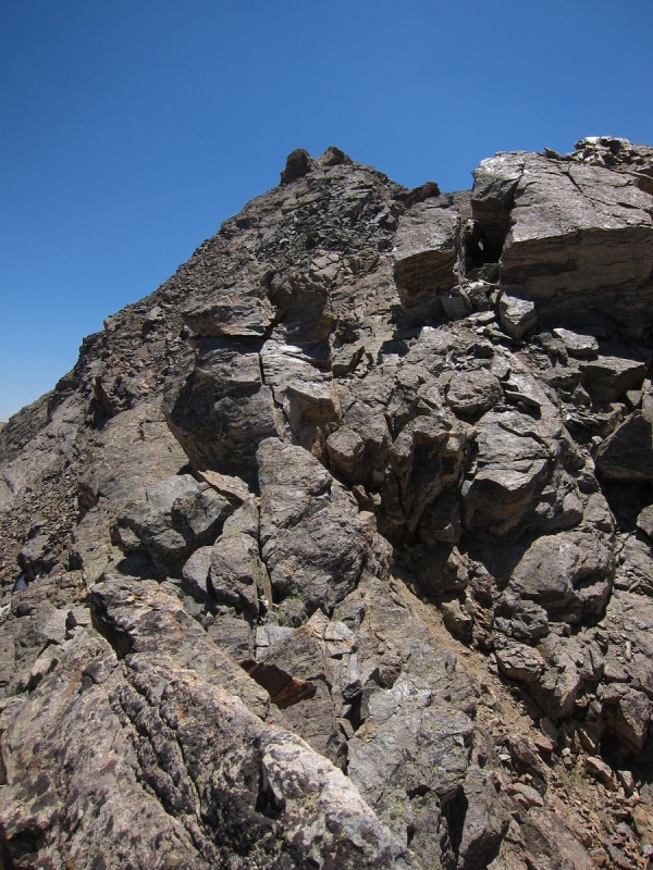
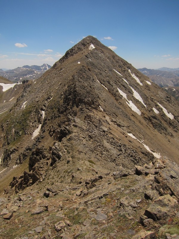
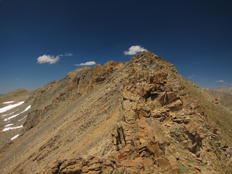
The descent of West and ascent of East is loose but not terrible class 2+. So I made fairly quick work, as I followed the goat along the way. The summit of East has plenty of false summits to get you excited and disappointed over and over again. From there I could get a good view of 13,001 and which of the points on the upper ridge was the true summit. I had been worrying it was the more pointy one on the left. It kinda scared me that it would be exposed class 4. I no longer remembered what chicagotransplant said in his TR.
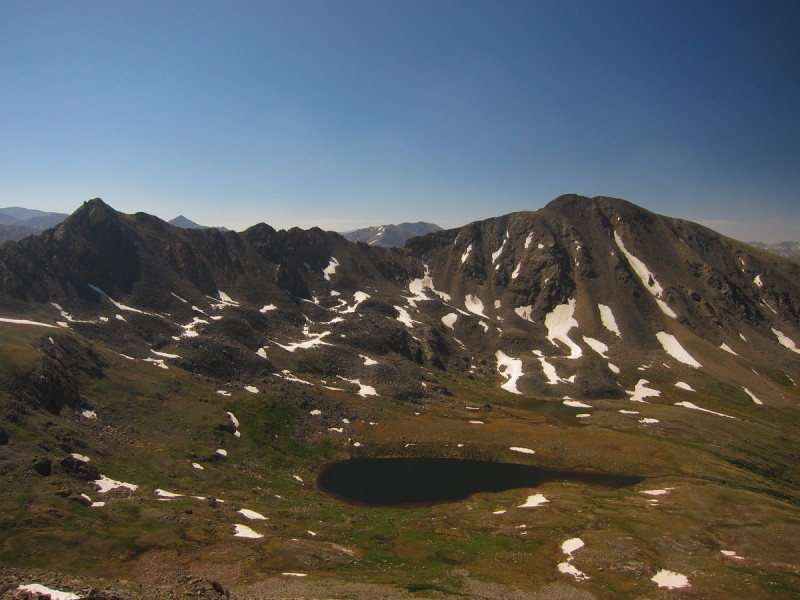
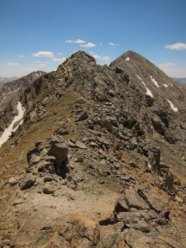
Ridge to East Looking back at the ridge down West Geissler 13,545 and Twining 13,001 from the pass
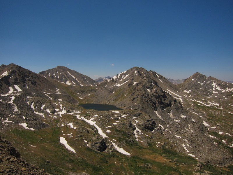
It was tough to drop all that elevation to the lake, but chicagotransplant's TR mentioned that it wasn't worth it to stay higher. So I followed the goat down to the lake and then up to the saddle to 13,001, where he finally dropped into the drainage to the east. I bet he was wondering what I was up to, following him for that long!
By the lake Planning a path along the ridge From the saddle to the summit, slabby and interesting route finding! The goat wondering why I have been following him since the first peak
Once at the saddle there are plenty of slabby rocks to scramble up if you like. Similar to the Flatirons, but granite instead of arcosic sandstone. Most of the ridge gendarms and rocky features can by bypassed easily to the left.
Avoiding an obstacle to the left
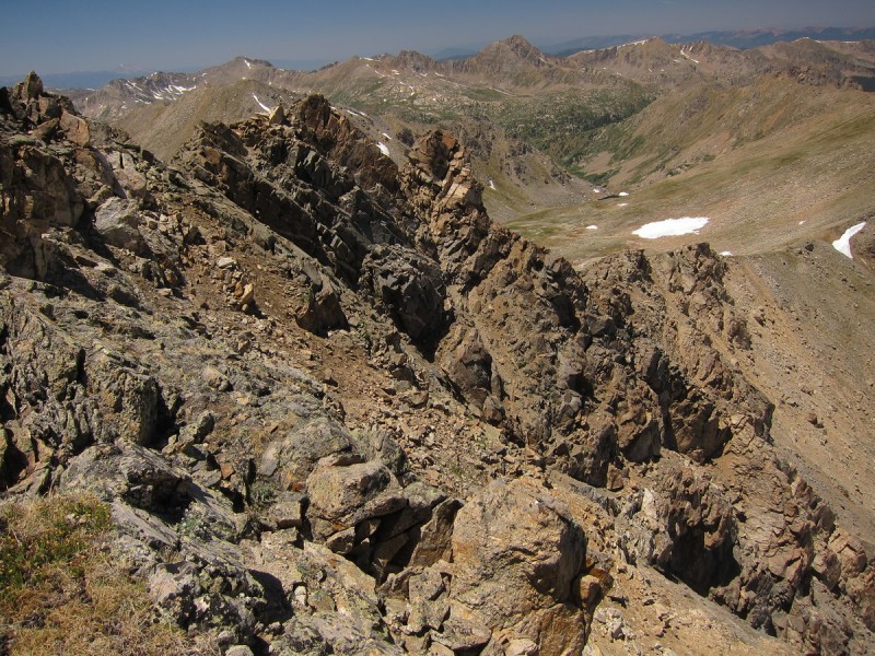
Found a summit register with the usual 13er suspects listed. Didn't stay too long, since I had the hardest ridge run for last to do. I stared out at the surrounding peaks, making plans for next time I was out this way. The Fryingpan wilderness and surroundings are rarely visited, but look splendid for long exhausting ridge runs!
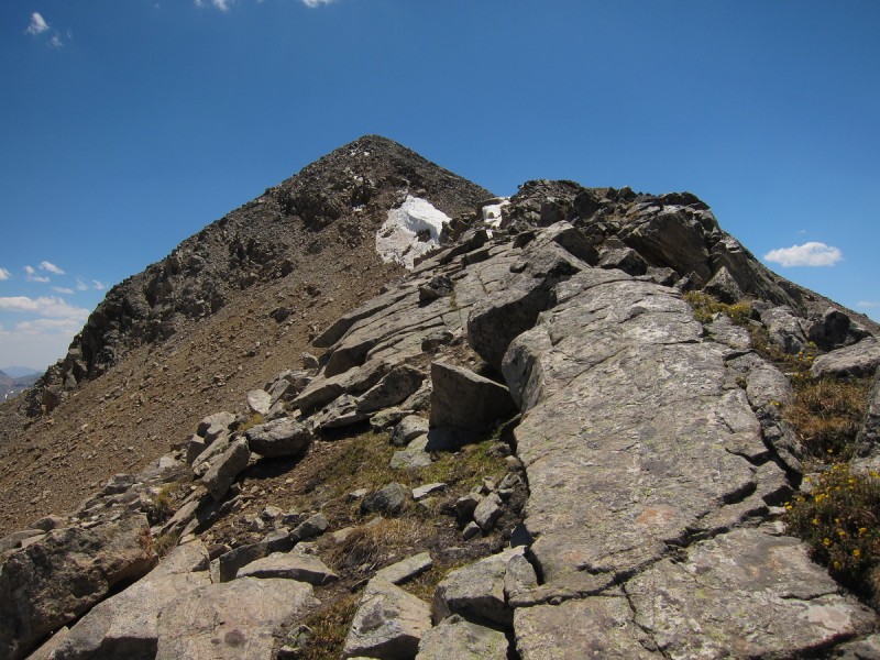
View back to 13,545, Twining, E&W Geissler
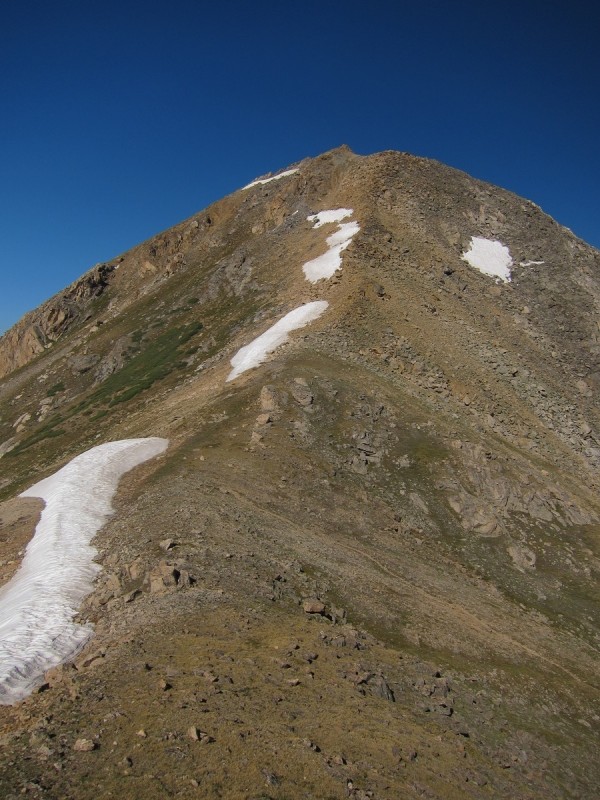
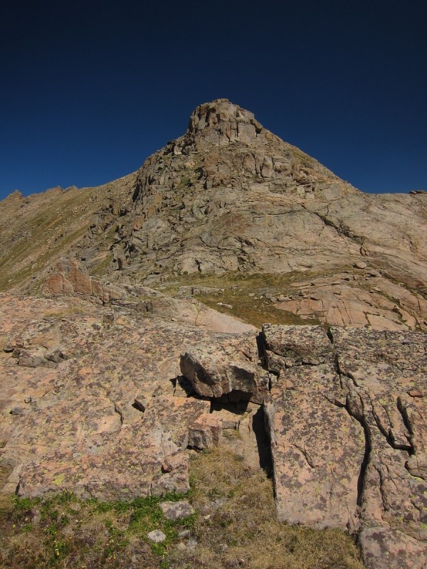
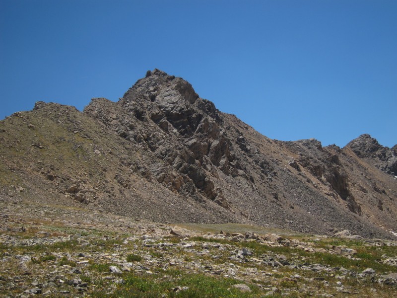
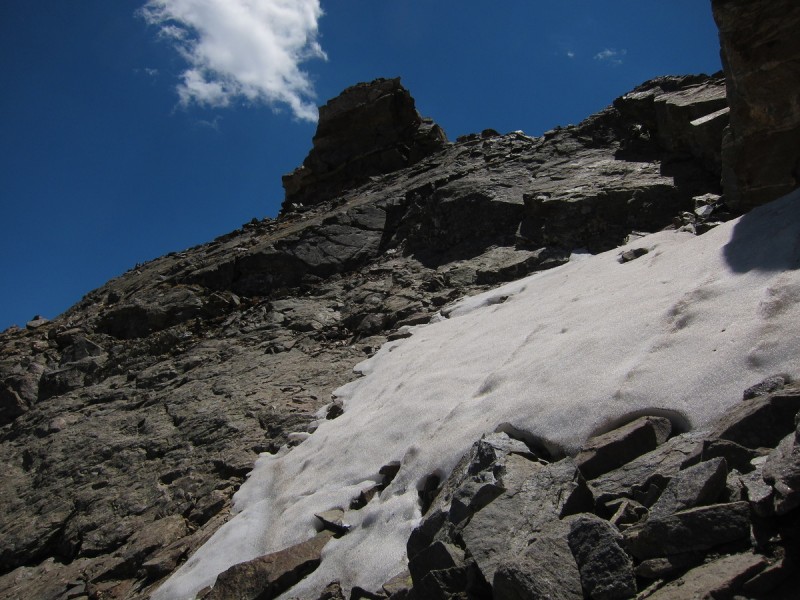
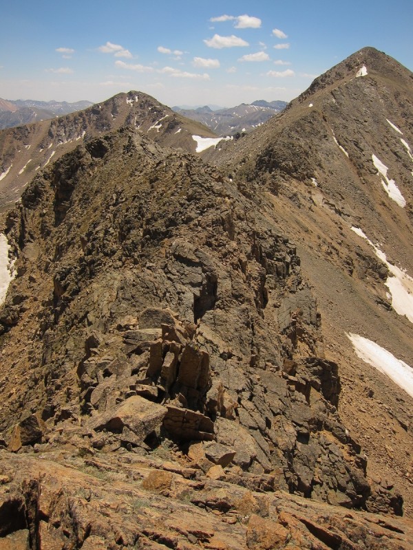
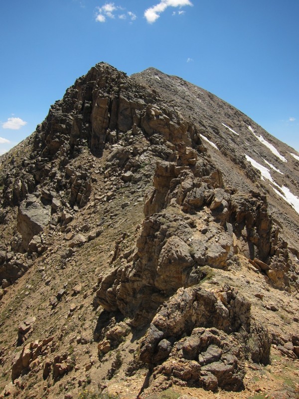
Back up at the Lost Man Lake pass, I spied out my ascent on 13,545. I could keep the ridge at class 3, with some gendarme avoidance maneuvers either to the left or right. There is an easier way at every obstruction, just look for it. Right below the summit, the slightly easier and less exposed path was covered by snow, so I had to bypass that further to the more exposed left on slabby class 3+ with some loose rocks for fun. The last few feet along the ridge were pretty fun to navigate.
13,545 from just above the saddle to East Geissler A class 3 ridge to the summit One of the ridge features. Snow blocked the easier path. some slabby class 3+/4 to left was the option here Looking back down the ridgeline at the gendarmes navigated
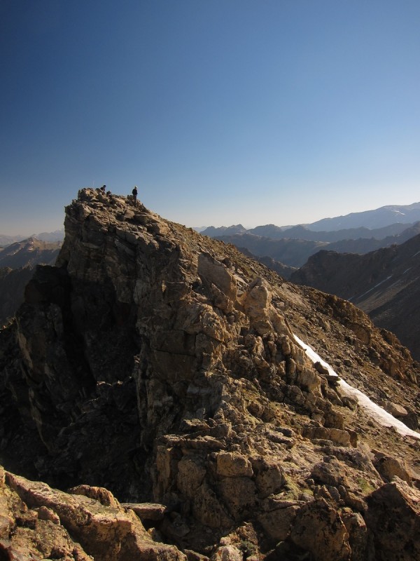
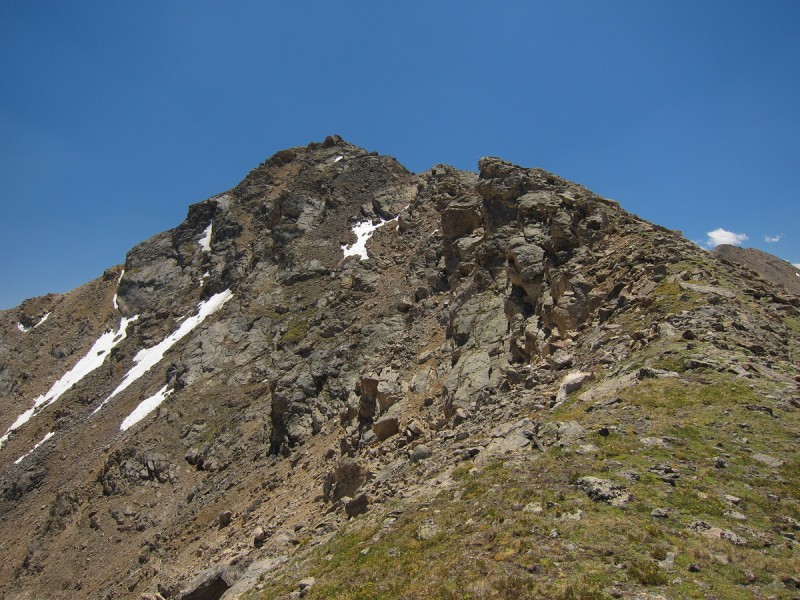
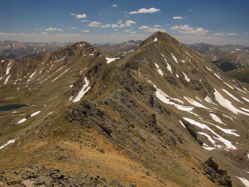
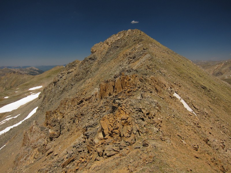
Once on the summit of 13,545 (which only misses being a ranked 13er by 15'), I could spy out the complicated path over to Twining. Even from here, I could see the chimney feature as the crux of the ridge. I'll figure it out when I get to it, there's plenty to do along the way before I get there!
I tried to stay as ridge proper as possible, and only diverting left or right around the gendarmes if necessary. Once I didn't like the exposed moves I had to make to get down off a gendarme, so I went down to the left and then reascended a nasty loose gully to regain the ridge. With a partner, we may have found a way. But solo, I figured it was best just to descend and go the safer way.
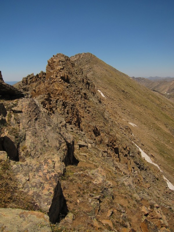
A view to Twining View of first gendarme on way to Twining Look back at 13,545 from first gendarme More gendames to go! Looking back at 13,545 Still more scrambling on way to Twining
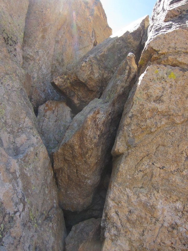
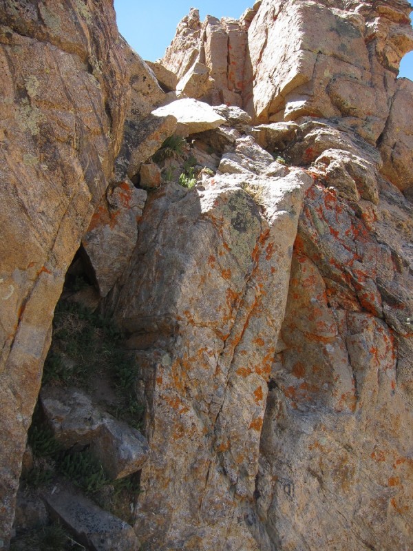
Once past the last gendarme, I got a good view of the chimney crux. It didn't look that bad, there appeared to be a couple decent weakness to exploit. At the base of the crux, I had Option #1 on the left with some boulders in a crack, or the more exposed wall scramble on the right. I went with Option #1. It had a nice stemming move at the start that kept exposure to a minimum. Plus excellent juggy hand holds.
The last and most difficuly crux Chimney Option #1 Chimney Option #2
Once past the chimney, it was just a rocky walk to the summit. It was a bit of a relief after the long day of class 2+/3/4 route finding. It had been fairly mentally taxing, as this was the hardest and most technical solo day I have had so far.
Looking back at a tough, but enjoyable ridgeline Last little bit up Tiwning
I spent some time on the highest summit of the day, perusing my options for future trips once again. It's good to get the lay of the land first hand. Drawing lines on a map and viewing TR's only goes so far to the whole navigation/routefinding planning of trips.
During my gazing, a shocking image came to my eyes. A giant smoke plume was rising to the east of Mt Massive. From my perspective and distance, it "appeared" to be just over the ridge of Massive. Later during my drive to a Front Range trailhead, I would see the smoke below the Mosquito ridge line to the west from my hike on Friday.
The descent to the trailhead was easy at first, but then it ended with traipsing through sometimes dense brittle willows that snapped in two without much provocation. Ouch, we desperately need rain!
My GPS Tracks on Google Maps (made from a .GPX file upload):
Isn't that a great area? So beautiful! I just posted my ”Big Day in the Sawatch” TR where we started at Ind Pass that same morning and did all the peaks around North Fork Lake Creek drainage finishing at Lackawanna & PT13660B. We didn't see anyone on the peaks that day.
trip report. I did the same traverse last summer, but didn't bother dropping to lake on the traverse. Also I think I chose ”Option #2” chimney on Twining. That ”crux” wasn't nearly as difficult in my mind as the Class 3+/4 scrambling along the slabs you show in one of your other pictures.
@Monster5 - It took me about 7 hours round trip when I did it, but I booked it through the easier parts of the Lost Man Trail.
Very unique trip, Otina! I don't think many folks combine those 13ers that way. I'm looking forward to 13001. Looks pretty cool. Glad the bear I saw didn't find ya!
On a side note, and I realize this is cliche to say, but the Geisslers are skier peaks, so be sure to go back opening weekend of Indy Pass in the future, when there is snow and ski em both in a day. Twining, if hit early enough, has a sweet West face line you could link up for the trifecta.
Wish I had asked for your handle, have been reading your trip reports with much amusement since you started writing them... It was a great day up there and thanks for bringing us your goat!
Monster5 - There's flowers in the first photo :wink: I'm not a fan of self portraits, they never turn out well. The only people that want to see that would be my adoptive Alaska Dad. It took me ~9 hours at a steady leisurely pace and at least an hour on top of Twining. Clear blue skies, why rush? So your estimate is good.
wooderson - I didn't pack my Alaskan bear protection kit with me, so daylight was my best defense.
geojed - Well I saw your groups footprints along the 13,545 - Twining ridge! It's what made me think that I could find a way across the ridge, easily enough.
kaiman - It may be because I've been climbing a few class 5 routes in the Flatirons lately, that the slabby C4 pitches before the summit of 13,545 didn't bother me so much.
Caroline - If you would have come along, you may have hurt just as much as me on Sunday. That last mile absolutely killed me! It was like my feet had pounding headaches after ~30 miles and 11.6K in 3 days!
Matt - It's a great route! I wish Anna hadn't forgotten her camera for her TR of the loop (minus 13,001), I may have planned an extra hour into the start time. That ridge is spicy fun!
Kevin - Well, I couldn't leave 13,001 hanging alone! There's no way I could add 13,001 to Steve Knapp's 19+ mi Fryingpan wilderness superloop. 13,001 was my favorite of the day for sure!
SuperPolok - My original plan was to start at Indy Pass and do the loop from there, but it was an extra couple miles and some more elevation gain. That and (quite embarrassingly) I forgot that 13,500 was a ranked peak... I didn't get a lot of time before to plan and check for all the unnamed peaks in the area. Plus the TR that I based it on was chicagotransplant's, and his started with the Geisslers.
Phgerig1 & ursidae - Good to meet you up on the Peak! It's a small world on 13ers eh?
lordhelmut - Darn! Well, let's hope with the very recent acquisition of Dawson's Ski guide, I can minimize hiking said skiers peaks! I've set aside those that I know of, and those that I've seen, but some slip the cracks I guess.
Caution: The information contained in this report may not be accurate and should not be the only resource used in preparation for your climb. Failure to have the necessary experience, physical conditioning, supplies or equipment can result in injury or death. 14ers.com and the author(s) of this report provide no warranties, either express or implied, that the information provided is accurate or reliable. By using the information provided, you agree to indemnify and hold harmless 14ers.com and the report author(s) with respect to any claims and demands against them, including any attorney fees and expenses. Please read the 14ers.com Safety and Disclaimer pages for more information.
Please respect private property: 14ers.com supports the rights of private landowners to determine how and by whom their land will be used. In Colorado, it is your responsibility to determine if land is private and to obtain the appropriate permission before entering the property.