Download Agreement, Release, and Acknowledgement of Risk:
You (the person requesting this file download) fully understand mountain climbing ("Activity") involves risks and dangers of serious bodily injury, including permanent disability, paralysis, and death ("Risks") and you fully accept and assume all such risks and all responsibility for losses, costs, and damages you incur as a result of your participation in this Activity.
You acknowledge that information in the file you have chosen to download may not be accurate and may contain errors. You agree to assume all risks when using this information and agree to release and discharge 14ers.com, 14ers Inc. and the author(s) of such information (collectively, the "Released Parties").
You hereby discharge the Released Parties from all damages, actions, claims and liabilities of any nature, specifically including, but not limited to, damages, actions, claims and liabilities arising from or related to the negligence of the Released Parties. You further agree to indemnify, hold harmless and defend 14ers.com, 14ers Inc. and each of the other Released Parties from and against any loss, damage, liability and expense, including costs and attorney fees, incurred by 14ers.com, 14ers Inc. or any of the other Released Parties as a result of you using information provided on the 14ers.com or 14ers Inc. websites.
You have read this agreement, fully understand its terms and intend it to be a complete and unconditional release of all liability to the greatest extent allowed by law and agree that if any portion of this agreement is held to be invalid the balance, notwithstanding, shall continue in full force and effect.
By clicking "OK" you agree to these terms. If you DO NOT agree, click "Cancel"...
As I was sitting in my living room last night watching the NFL opener while icing my right foot that I hurt earlier this week, I got a text that my hiking partner for today needed to cancel. My pack was already in the car; the alarm was already set for 3:25 AM and the coffee maker was ready to go with the flip of a switch. Well bummer.
I tweaked my foot earlier this week doing the 13ers and 12ers above Berthoud Pass and had already ruled out my original plan of heading down to Lake Como Saturday for the Blanca group in summer (odd that this is the last season in which I need those three peaks). I was pretty sure my foot could handle a hike today, but wasn't positive.
It was almost halftime in the game - generally when I turn off the TV and head upstairs to get ready for bed. I changed my alarm to 4:00 AM instead of 3:25 since I was no longer expecting a knock on my door at 4:00. I figured I'd get up at 4:00, see how I felt, do a little research on peaks (not having an interest in doing the 14er we had planned which would have been new for my partner) and see where the day took me.
A Plan Comes Together
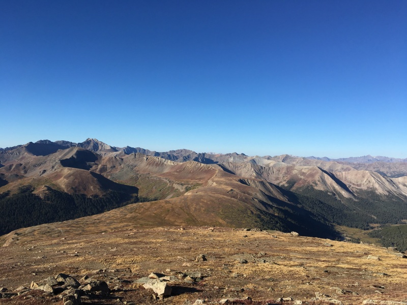
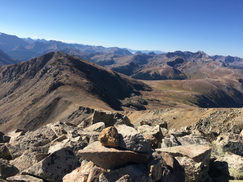
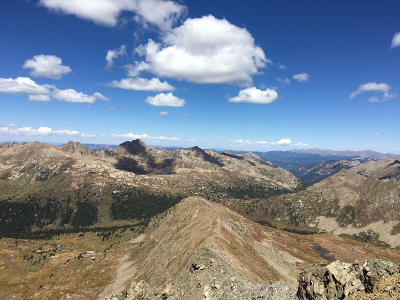
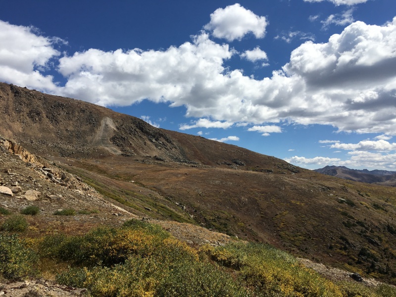
The Elks in the distance.
Having just finished the Centennials, I guess I'm sort of working on the Bi-Centennials now. Racing on the Centennials to try to catch Ryan in time for a joint Jagged Finisher was a blast, but I am relieved to not be "on the clock" anymore. I have so many Bi-Centennials to do that I'm not even thinking about when I might finish those. But I'm still going to try to do them when they make sense.
My quick research in the wee hours of the morning yielded Twining and UN13,500 as a pretty short day from Independence Pass (which will close sometime in the next month or so). A new Bi- and a new Tri- without much risk of aggravating my foot with a long day out. Sold. I headed out from the house about 5:00 AM.
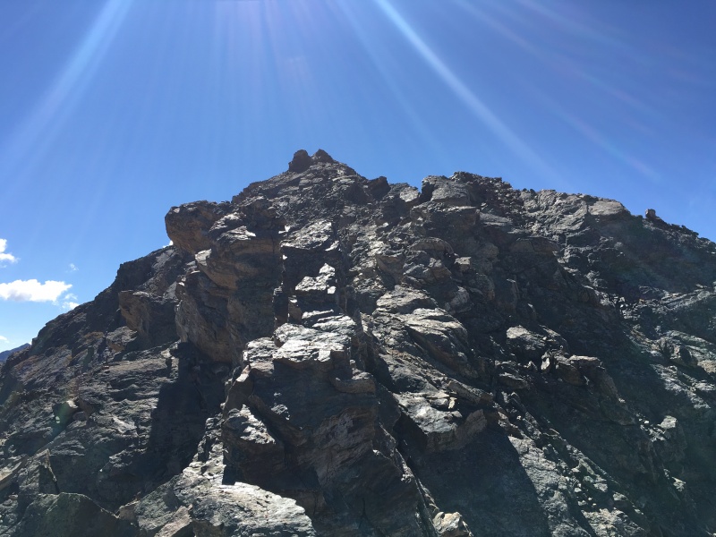
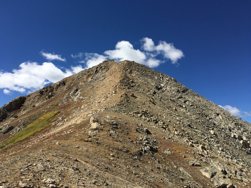
I started walking from Independence Pass at over 12,000' at 7:37 AM and headed up the south ridge of UN13,500, taking it super easy on my foot. I even brought two trekking poles with me today (my regular partners have almost NEVER seen me with two trekking poles!). In 1:09, I was on top of 13,500 - an easy stroll.
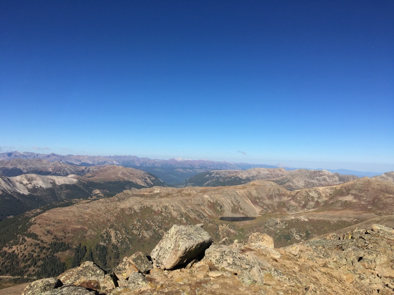
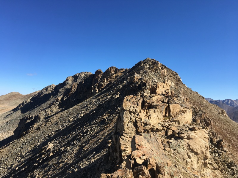
Summit of UN13,500 with Twining peeking out from behind to the left.Twining from the saddle.
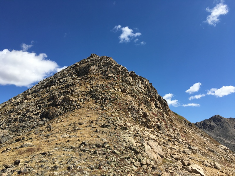
I felt my foot much more on the descent to the saddle with Twining - 2nd trekking pole comes out of the pack. Ah good! With the 2nd pole, I am able to take it super easy downhill and not feel the twinge of pain that got me a number of times earlier in the week. I am optimistic that I'll get up Twining and back down without doing more damage. The walk down to the saddle is easy Class 2 and before long, I am heading up Twining. Going uphill doesn't seem to bother my foot in the least, but I still take it a bit slower than normal. At 2:03 elapsed time, I am on top of a new Bi-Centennial!
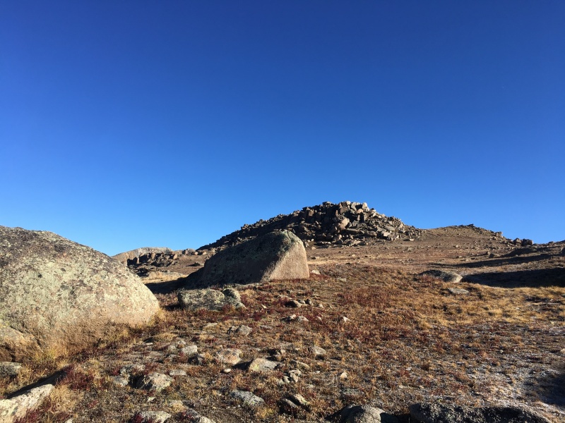
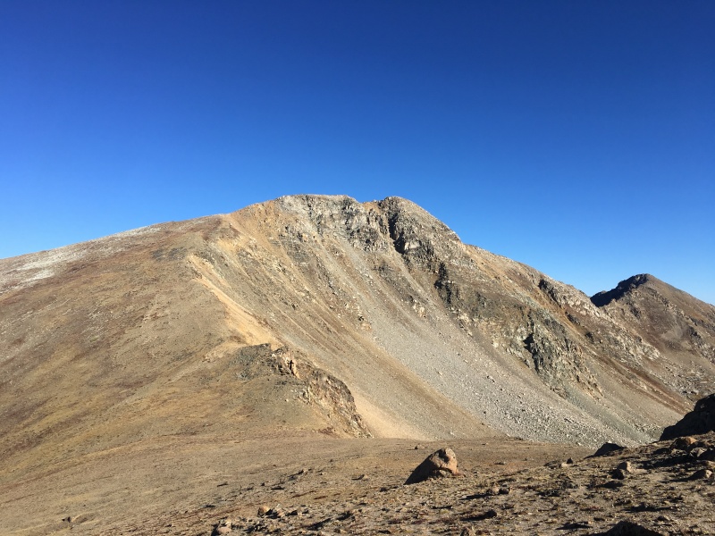
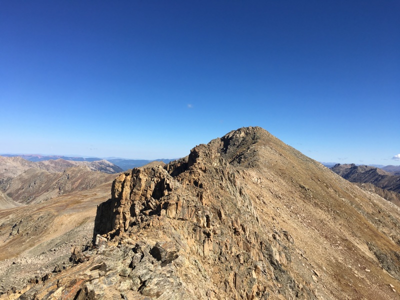
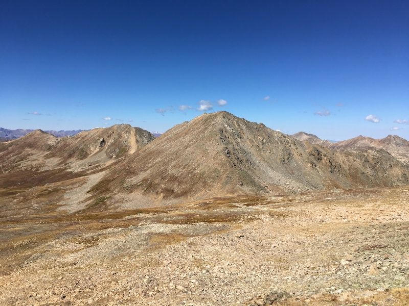
UN13,500 from the summit of Twining.
Decision time. I was intrigued this morning by the fact that East and West Geissler are also right here and both are ranked. Otina did both of them, plus 13,001 and Twining from a switchback on CO 82 on the west side of the pass. I didn't see any trip reports where they were done with UN13,500 and Twining from the Pass. Otina described a few Class 3 parts of the traverse between the Geisslers and Twining, so I know it goes. The ridge going north off of Twining looks fairly icky though.
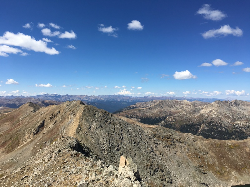
From Twining's summit towards UN13,545.Looking across at the Geisslers with Independence Lake in the foreground.
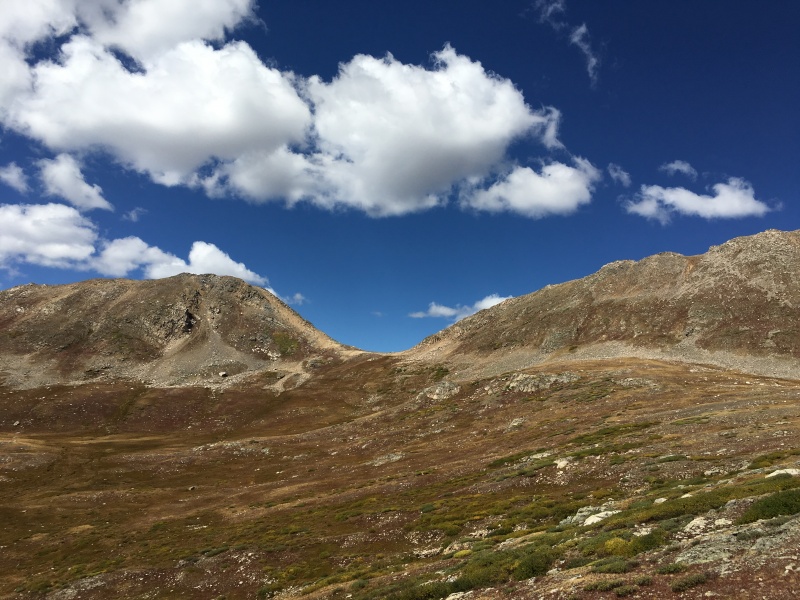
I decide that I have to descend regardless and might as well at least go down to the Twining/UN13,545 saddle where it looks like I can bail if I have to. The descent is fairly easy down to the saddle before the fun begins. I look at my bail option and decide it doesn't look that great. It's time to go uphill again and my foot likes that better anyway. I decide to keep going to the north towards the icky looking part of the ridge.
The ickier part of the ridge from the saddle. It was way easier than it looked.I went up and over the first bump, then skirted the middle bump on a ledge just below the ridge crest on the right (east).
This is definitely a case of "it's way easier than it looks". I bypassed an initial tower on the left (west) side, then I stayed ridge proper for the vast majority of the rest of the way to UN13,545 (with the one exception being on the right, east, side of the middle tower on a grassy ledge system about 15 feet below the ridge crest). Before long, I am standing on UN13,545 (unranked), thinking maybe I'll manage to get the Geisslers today after all.
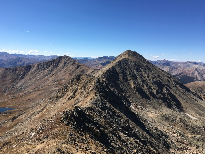
Looking back towards Twining and UN13,500 from UN13,545.Looking back at UN13,545 and the Twining ridge from high on East Geissler.
The descent off of UN13,545 was the trickiest part, but still easy Class 3. I just stayed on the ridge crest and worked my way down a few slabs.
Slabs descending off of UN13,545.
Soon I was on easier ground and cruised over to the saddle with East Geissler.
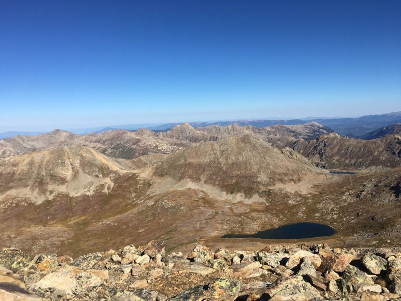
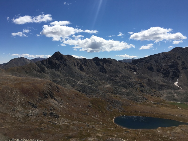
Easy ground from here to the Geisslers.Looking down at Lost Man Lake and UN13,001 above it. Some people seem to do this one with the Geisslers. Hopefully I don't regret not doing it.
It was a tiny bit loose, but really no problem to climb to the summit (4:06 elapsed time to here). The descent to the west down to the saddle with West Geissler was equally straightforward and I began climbing my last bit of up for the day to West Geissler. I chose to stay ridge proper instead of the loose gully to the left. I would rather have things be a little steeper, but more solid any day of the week. I topped out on West Geissler at 4:52 elapsed time, then returned back down to the saddle between the two.
West Geissler from East Geissler.Descent off of East.Looking up west. I stayed on the ridge, not in the loose gully to the left.West Geissler summit.Williams Group across the way looking like fun (for another day).
Now I just had to figure out how to get back to Independence Pass...
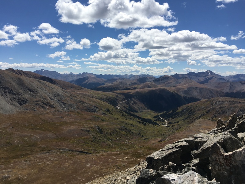
Nice shelf off of Twining's and UN13,500's flanks that leads back to Indy Pass without losing vertical down to the road visible at center.
There is a trail that goes to Independence Lake from the lower switchback on CO 82 that Otina used, and it wasn't terribly far below me. I could see the cars down at that parking area. My car wasn't one of them of course. Walking up the road wouldn't be the end of the world, so I thought about just heading down that way. The whole ascent route though, I had noticed a pretty nice broad shelf running just below Twining and UN13,500. If I could get around the corner and back to that, I thought I would be in great shape to get back to my car without losing extra elevation. It worked out beautifully!
Geissler saddle. I descended down and to the right to Independence Lake and the trail.
I descended from the Geissler saddle and crossed one quick and only mildly unpleasant talus slope to get to Independence Lake. From there, I followed the trail south through the basin until it took a hard right turn and started to descend down to Highway 82. I opted to keep going south across the broad shelf, keeping my altitude at about 12,450 +/-30 feet. I knew the Pass was at almost 12,100', so I was still above my car. I worked my way through a couple of easy rock bands, keeping my elevation relatively constant until I finally got around the final corner and could see the Pass and my car.
Around one last corner hugging the contour on the left, then across to the shelf on the right where a game trail led me out.
From there, I returned to my ascent trail of UN13,500 and dropped the rest of the way to my car.
Stats Solo Mileage - 7.5 RT Vertical ~3,150' Elapsed Times to: UN13,500 (1:09), Twining (2:03), UN13,545 (didn't look - sorry); East Geissler (4:06), West Geissler (4:52), Car to Car RT (6:42).
Thanks for reading and hopefully this is helpful to someone else wanting to do all of these from Indy Pass.
My GPS Tracks on Google Maps (made from a .GPX file upload):
:shock: Just wondering where "twinning" came from. The last I looked, that peak is Twining or maybe you are doing a play on words and I just didn't get. Anyhoo ... nice report. Thanks for posting. Happy trails! :D
Nope, I'm the one who is embarrassed. :oops: Living with The Man for so many years should have taught me that "play on words" lesson long ago. :wink: Have a great day!
following almost your exact path, we got 9.3 miles and 4200 feet. A topo map drawing lines tool says it should be 8.2 and 4000 feet. Just an fyi for anyone following this route, I think the listed 3150' gain is too low.
Thanks for the route and inspiration. A friend invited me along on this one for their birthday 7/12/25 We loved it perfect balance for a fun day. Obviously the area around un13545 was the most interesting, but the whole thing was rewarding. The views all day didn't disappoint.
Caution: The information contained in this report may not be accurate and should not be the only resource used in preparation for your climb. Failure to have the necessary experience, physical conditioning, supplies or equipment can result in injury or death. 14ers.com and the author(s) of this report provide no warranties, either express or implied, that the information provided is accurate or reliable. By using the information provided, you agree to indemnify and hold harmless 14ers.com and the report author(s) with respect to any claims and demands against them, including any attorney fees and expenses. Please read the 14ers.com Safety and Disclaimer pages for more information.
Please respect private property: 14ers.com supports the rights of private landowners to determine how and by whom their land will be used. In Colorado, it is your responsibility to determine if land is private and to obtain the appropriate permission before entering the property.


")
")
")
")
")
")
")
")
")
")
")
")
")
")
")
")
")
")
")
")
")
")