| Report Type | Full |
| Peak(s) |
Castle Peak - 14,274 feet Conundrum Peak - 14,037 feet Maroon Peak - 14,163 feet North Maroon Peak - 14,022 feet Pyramid Peak - 14,029 feet Snowmass Mountain - 14,105 feet Capitol Peak - 14,138 feet |
| Date Posted | 12/20/2020 |
| Modified | 08/08/2021 |
| Date Climbed | 08/11/2020 |
| Author | SpeedWalker |
| Additional Members | MounTimo |
| Elk 14ers in 4 Days |
|---|
|
Elk 14ers in 4 Days Alex "SpeedWalker" Walker Introduction After 24 days of hiking Colorado's 14ers over 5 distinct trips this summer, I was up to 51 peaks completed, just 7 away from my goal of all 58. Just as I had planned, these 7 peaks were concentrated in just one mountain range: the Elk. Now, I had long debated what the timeline should look like for this trip, primarily contemplating whether to go for the Maroon Bells Traverse and shoot for 5 days, or to do the two peaks separately and call it 6. Never did I even consider condensing the whole thing down to 4 days, not until I was halfway through the week and saw that it was possible. But I'm getting ahead of myself here; this is all to say that our day-by-day schedule looked like this:
Of course, Capitol would be the perfect 14er finisher, sitting nicely at the northern end of the final range, and widely considered the hardest 14er. I planned this from the very beginning, when I devised the plan back in August 2019. My friend Tim, who began the summer hoping to finish the 58 alongside me, had since realized that my pace was a little too ambitious for him. However, he would definitely be joining me for the final day's climb, plus whatever other peaks he could manage before then. Day 0 - August 10, 2020 Our drive to the trailhead was pretty standard compared to our previous trips. I got back home from an unrelated road trip around noon, then quickly raced around the house to pack everything up as fast as possible. I picked up Tim, who had bought all the food in my absence, and we set off towards Aspen at around 2:00 PM. To get to this remote mountain town, Google Maps gave us the option of taking either Independence Pass or I-70, a fact which would soon be of great significance to our journey. But that's a story for later in the trip report; for the time being, we chose the former. We stopped in Leadville for an early pizza dinner, which is practically tradition at this point, and got to Aspen a little before 6:00 PM. After dealing with the crazy traffic through the tiny main street and roundabout, we proceeded up Castle Creek Road towards Castle and Conundrum. We planned to head up the dirt road as far as I felt comfortable driving, probably up to the big creek crossing. The road gets rough pretty fast, so parking in the lot beside the paved road is probably smart for lower clearance vehicles. As you approach the creek crossing, there's a few rocky sections bad enough to warrant the "easy 4WD" category on this site. If you look at the route descriptions, this crossing looks like a fairly gentle stream with a nice little footbridge on the side. When we got there, it looked more like a pile of rubble. 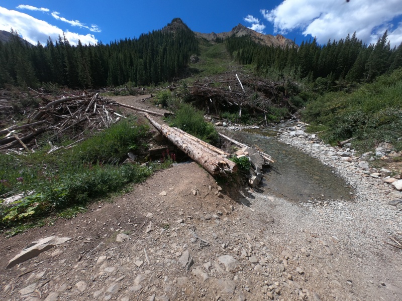
It seems like this area was hit with a huge avalanche within the last few years, destroying the footbridge and covering the road in debris. Though the road is totally clear now, the bridge has been replaced with a few big logs. Still, the stream crossing didn't look too bad; the worst part looked like a large unavoidable rock sticking up right where the water is deepest. We thought about it for a while, but decided it wasn't worth the risk, so we stopped for the night at a small pull-off just before it. It turns out that the road doesn't get much worse for about another mile and a half, so it may have been smart to just go for it. At that point on the road, there's a bridge and a bunch of switchbacks; I wouldn't even think of going past the first one without a high-clearance Jeep-like vehicle. Anyway, an extra 3 miles means nothing to me, and it probably would take just as much time for me to drive it as it would on foot. So, we set up the car to sleep there for the night, and set our alarms for early the next morning. Day 1 - August 11, 2020 Castle Peak/Conundrum Peak- Combination Class 2+ | Distance: 10.35 mi | Gain: 4,114 ft
We woke up at our standard time of 4:00 AM and were soon heading on up the road. If you're on foot, it's just your standard Class 1 walk up to the "parking lot" (for anyone crazy enough to drive that far) at 12,800 ft. The summit of Castle is now less than a mile away, but all of the challenging terrain remains above. The first quarter mile or so is tricky: you're hopping through an uphill boulder field which holds so much snow that, even in August on a hot year, there's still no clearly defined route. You first walk through the boulders and up a little bump, staying more or less in the middle of the huge gully. 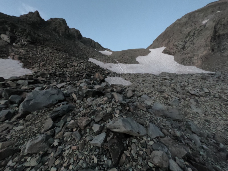
As you can see in the picture above, the most popular route seems to be to head along a well-established trench up a steep slope of lingering snow. This didn't look like a ton of fun, so I followed a less popular trail of cairns around to the left, dodging the worst of it. From there, a more obvious route continues up through the gully for a while, before turning right to avoid what used to be another steep snow pile. Since the snow here was gone, I continued straight up the steep rocks, though it would've been easier to stay on the standard bypass. At this point, you're at the beginning of some small switchbacks which lead to the ridge of Castle. This is also the point where you'll meet back up with the standard route if you decide to descend the (terrible) shortcut off Conundrum. 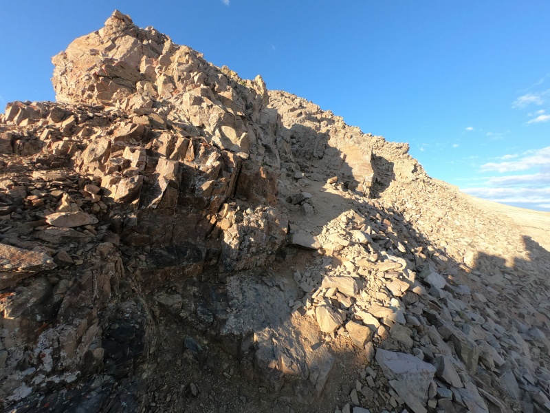
Upon reaching at the ridge, there's barely a quarter mile left to the summit of Castle. Although its "Difficult Class 2" hiking may be harder than before, the rock is so much more solid that it feels infinitely easier than the boulders below. It's all just finding the easiest route up a series of tiny cliff bands, which is usually obvious because its so well-traveled. Just remember to take the path closer to the ridge if you have a choice. There's some pretty steep uphill sections, but the blocky rocks make for great steps, and I didn't find myself ever needing to use my hands. It felt like we were at the top in no time, as most of the elevation gain was done through the boulder field and up the easy switchbacks. I was on the summit of my fifty-second peak of the summer around 7:00 AM. 
At this point, I got my closest ever view of the remaining Elk 14ers, which all have very distinctive looks. The Maroon Bells and Pyramid looked amazing in the front, with pointy Snowmass and giant Capitol in the back. They don't come out great in pictures from this far back, but I was amazed by my first look in person. Turning in the opposite direction, I realized I could also see a huge number of other 14ers in the distance. Sneffels, Uncompahgre, Grays/Torreys, and almost all of the Sawatch were clearly in view. It was cool to be able to see dozens of 14ers and almost every mountain range in the state from one place, all of which I had either just climbed, or was just about to. So, we descended the opposite ridge off Castle towards Conundrum, which is actually pretty steep, but the trail is very well-traveled. There's definitely more loose rock to be avoided than on the way up, but it's okay if you go slow and carefully. It gets much easier once it flattens out near the saddle, and the remainder of the ridge to the top of Conundrum is no worse than the beginning 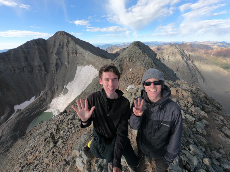
The true summit o this peak is actually a bump further to the north of the first highpoint, and even a lot of maps show the top in the wrong location. I was pretty skeptical about this at the moment, as the south summit still looked higher upon reaching the true one, but I've since convinced myself otherwise. Still being very early in the day, we enjoyed some time at the summit before heading back down the ridge, dreading what was to come. We planned to take the shortcut gully down from the saddle between the two peaks, a route that is inadvisable without snow coverage. The upper part of it was just as bad as I expected: worn-down loose dirt and small rocks that would unavoidably fall as you try to negotiate the steep slope. 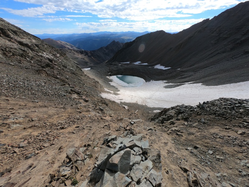
The gully gets smaller and smaller towards a small choke point, where I found myself using my hands to get down the steepest part. Past that, the routes seem to diverge along a still-steep field of talus. The route I had planned went quickly to the left to avoid most of the snow, whereas there seemed to be a popular trench working through the snow all the way to the right of the little runoff pool in the basin. I decided to continue on my path to minimize my time in the snow, which was a mistake. When I got to what looked like a series of small crossings from above, what I saw was a steep, icy slope that seemed nearly uncrossable with the gear I had. 
Still, rather than backtrack, I decided to make my way very carefully across this short but steep sheet of ice. It was a little precarious, but it turned out alright. When I met back up with Tim, who took the logical well-travelled trench through the snow, he made it sound like it was a lot easier. Nonetheless, we made our way carefully back down the boulder field, past the "parking lot," which now held a few crazy 4WD cars, then all the way back down to our own vehicle. 
We made it down the 4WD road just fine, and were back in town around noon. I almost wished we had something else to climb for the day, since it was still so early and the weather was so nice. Instead, I decided to scout out the Maroon Creek Road, because we still didn't exactly know where we were going to spend the night. We couldn't just sleep in the parking lot, like we always do, because our 2 days of parking reservations would begin the following morning (plus it's not allowed, anyway). I knew there were some campgrounds in the area, which would minimize the time spent driving to the trailhead the next morning, but at the entrance station we were told that they were all closed due to bear activity. In the end, we just drove back up Castle Creek Road until hitting Forest Service land, then pulled off and slept in the car, hoping no one would bother us. In the meantime, we found a parking lot hang out in, so I did some last minute route-finding preparations for the Bells Traverse, which I was confident I would attempt, as long as I had the time and good weather. I then had enough time to take a nap, and we eventually found something to eat in town. Day 2 - August 12, 2020 Maroon Peak/North Maroon Peak/Pyramid Peak - Combination Class 4 | Distance: 15.73 mi | Gain: 8,494 ft
We awoke again in the car at 4:00 AM. Unlike most mornings, our first priority was to pack up the car as fast as possible (we would move everything to the front seats to have room to sleep in the back) and drive to the trailhead. We drove right past the entrance station where we learned about the campsites the day before; it seemed like no one was there to check reservations this early in the morning. As far as I can tell, we never actually proved that we payed to be there. I got my gear together very quickly, and set out alone on the trail. Tim would be staying in the car to rest for the day, plus he probably wouldn't have been a fan of the Traverse anyway. I noted the turnoff for Pyramid Peak, which I was planning to hike the following day, and for North Maroon Peak, from which I would likely be descending. I hiked around Crater Lake, still in the dark, and awaited the turnoff I would be taking for (South) Maroon Peak. 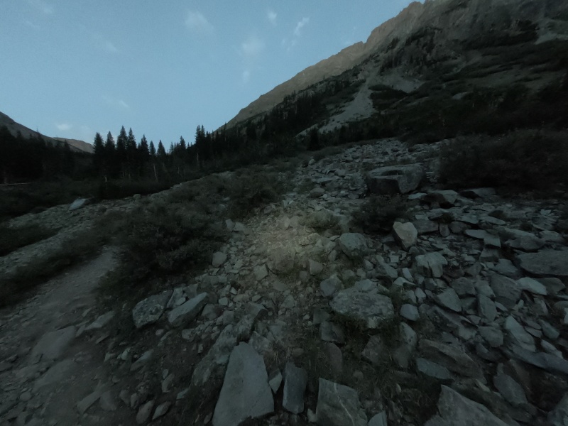
I turned off the main trail a little prematurely, afraid I would miss the mostly unmarked junction. It seems like those in charge of the area go out of their way to not mark anything do with the peaks, whether on the maps at the trailhead or on the trail itself, even though every other junction has a really nice sign. I guess this makes sense to keep unprepared day hikers from wondering up into a dangerous situation (I would argue that the 3,000 ft of elevation gain would do that anyway), but it can be a little confusing if you intend to go up them. At this point, the route turns from a very gentle incline into a steep ascent of around 1,000 ft every half mile. I was surprised at how nice the trail was near the bottom, with lots of convenient rock staircases. 
I know a lot of people complain about this section, but I really didn't mind it. I'd rather get all the elevation gain out of the way all at once on relatively easy terrain, so that the remaining ridge scramble seems comparatively flat. Once you get closer to the top, where the ridge starts, the trail gets even steeper and much less maintained. A few sections held a lot of loose dirt, but nothing too crazy. Near the middle, there's a section that branches off in two equally-popular directions. I took the lower route to the left, but I think the higher route avoids a bit of particularly steep terrain. 
I did the almost 3,000 ft of steep hiking in about an hour flat, without stopping. I took a quick break at the start of the ridge to adjust some layers, have a snack, and consult the route description. You start off on the right side of the ridge, then quickly end up on the left, following a still-discernable route. You soon find some large rock towers that require turning right then scrambling up and through a little chimney (then to the left), the first real Class 3 of the route. 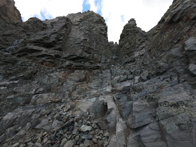
The "trail" continues to be somewhat apparent, with a decent number of cairns to mark the way, as you turn left to avoid a large bump on the ridge. You're now traversing a series of ledges around the west side of the mountain, where you eventually come to the first real crux of the climb: a narrow, steep gully. There's supposedly two of these side by side that you can take, but the first seems to be more popular. This was probably my least favorite part of the entire day, especially since I had just caught up with some other hikers. It took a lot of work to avoid sending down any rocks towards them. 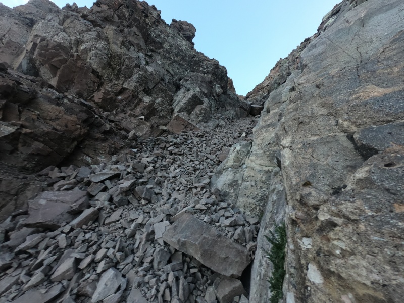
You emerge from the top of the gully onto yet more decently-marked ledges, and soon head up another, much larger gully. I can definitely see how this terrain would be incredibly tricky to someone only vaguely familiar with the route. With a lot of research though (including placing down points on my phone's map at all of the major landmarks), the route-finding really wasn't that bad, especially compared to the terrain on the Traverse. 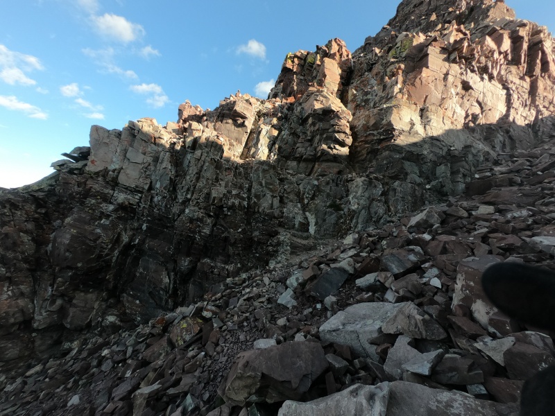
After the big gully is where most of the terrible loose rock ends, and the fun scrambling begins. I don't even remember what the route-finding was like past this point, but I weaved back and forth across and up a few more series of ledges until eventually making it to the ridge. There were still a fair number of cairns, most of which were pointing in vaguely the right direction. 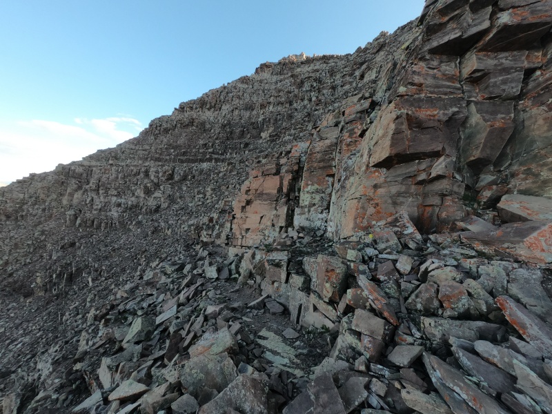
I hit the summit around an hour after making it to the ridge (and around 3 hours since leaving the car). The route description says that "speedy climbers" will take at least 1.5 hours, so I guess I'm just super speedy. The view was incredible, with Pyramid Peak to the east, North Maroon directly to the north, and Snowmass and Capitol a ways behind it. You can see the latter three of those peaks in my summit picture below. 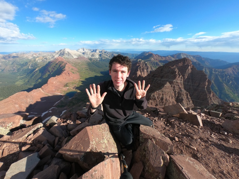
In addition to the views, the weather was also looking decent, plus it was still incredibly early, at just past 8:00 AM. I made the obvious decision to continue on to the Bells Traverse, taking one last look at the route descriptions before leaving. As soon as the hikers behind me made it up to the summit, I was on my way down the opposite ridge. The descent down to the saddle between the two peaks was very straightforward. It's mostly just walking down the obvious top of the ridge while being careful on all the loose rock. There are a couple small cliff bands to descend from; one of the higher ones is pictured above. The hardest part is right before the saddle, where there's some more intense Class 3-4 down-scrambling. 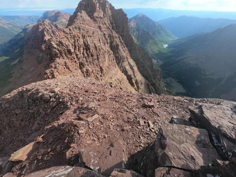
The next part of the route (the first half from the saddle to the top of North Maroon) is by far the most difficult and most confusing part of the entire climb. There are a bunch of little climbable ledges at the very bottom, with cairns that don't quite make it obvious where to ascend. With a bit of looking around though, I found what looked like the correct route, which didn't seem to exceed straightforward Class 4. A lot of vertical movement, but tons of options for holds, and mostly quite stable rock. It was also at this point that it started snowing. Yes, it was beautiful and sunny outside, but it also decided to snow briefly, just as I was getting to the hardest part of the Traverse, which I found quite funny. 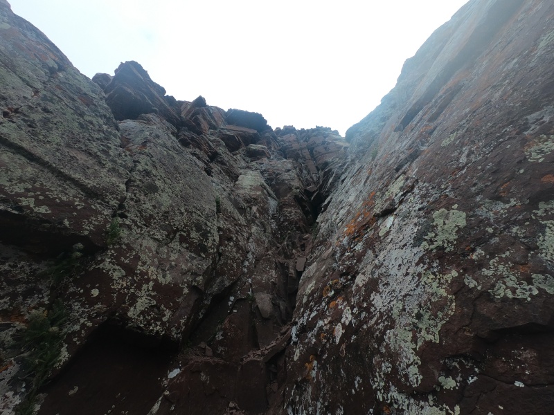
After the first crux section, the ridge flattens out and the terrain becomes quite a lot easier for a bit. But soon, the ridge continues upward, where the second crux begins. The final crack to get to the top holds some of the most difficult moves on the route. It's all pretty straightforward one you find the right place to climb, but still low Class 5. This was definitely the most exposed section of the entire Traverse, although it didn't really bother me. I actually turned around after reaching the top, and was surprised at how dramatic it looked from there. There was a mess of repel anchors tied around some rocks near the top, and from there it's a very short scramble along the ridge to the final crux. 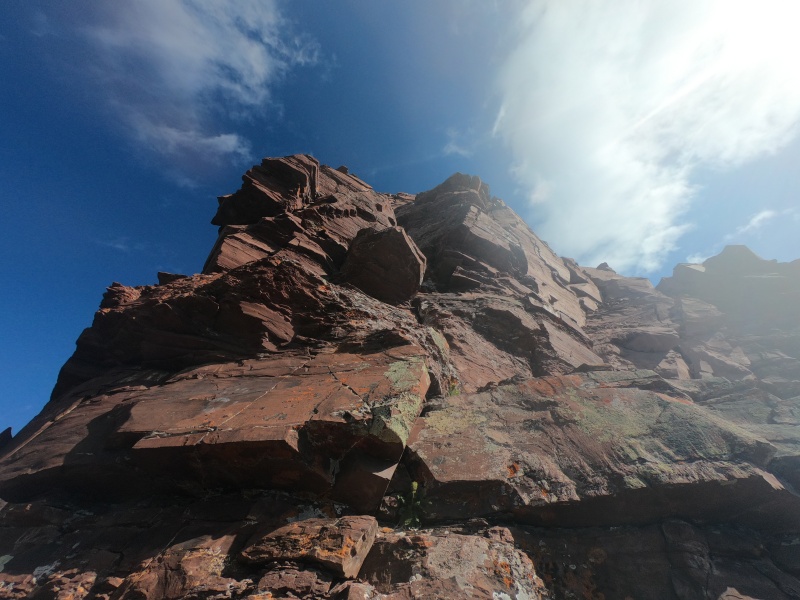
The third and final crux is probably the easiest to find, since it's right after the second, and the two vertical crack options are very distinctive from the pictures. I went up the first crack (on the right), which held the single hardest move on the entire route. Right before emerging to the top, there's a slightly overhanging rock that was fairly tricky to climb over; it felt slightly higher than low Class 5. According to the route description, the crack on the left is easier, so I guess I would try that one next time. 
After this final crux, the rest of the Traverse is a lot easier, with comparatively simpler route-finding. I think you're just supposed to ascend directly over the final bump in the ridge before the summit, but I stayed a little bit lower on the right, which probably made things a little looser and more difficult. 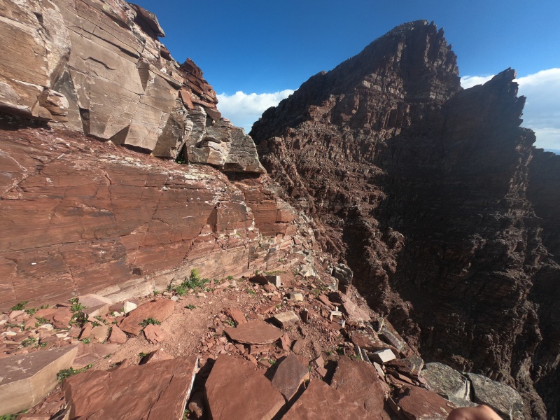
After that, you cross one final little dip then head up some simpler ledges, similar to the top of Maroon Peak. The summit becomes obvious from here. According to my GPS track, I arrived here just 45 minutes from leaving Maroon Peak. In reality, I stopped a few times along the way to consult route descriptions, so it was probably more like an hour. Still, it went by a lot faster than I ever expected it to. Route-finding was absolutely the hardest part, apart from those few sections of trickier climbing. 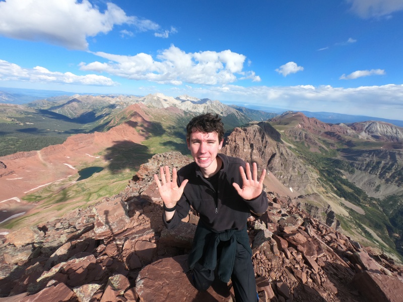
From the top of North Maroon, I started heading down the fairly obvious route along the ridge. It felt pretty similar to descending South Maroon: mostly just walking down while avoiding loose rock, with the occasional ledges to work down or around. I knew the famous Class 4 crux move was coming up somewhere, but I didn't really realize when I hit it. It seemed like there were a couple of similar moves in the same area; I basically just threw my poles down, held myself over the edge, then jumped a few feet to solid ground below. I took a picture of one of the harder areas, and in retrospect it seems to match up with pictures of the crux. 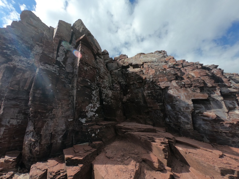
From there, it's just a little further to the first of two huge gullies. For some reason, in my head, I expected them to be to my left, although I very quickly corrected that mistake. The top of the first gully starts out just as rocky and precarious as the route up higher, but gets a lot gentler and more obvious near the bottom. 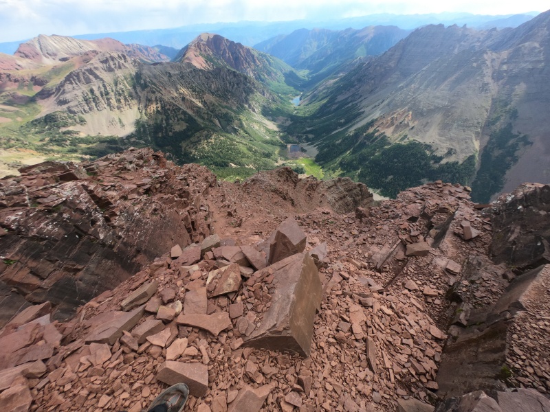
This upper gully gets extraordinarily green by the time you get to the bottom, which I guess makes the route easier to see. Each one descends nearly 1,000 ft, so it's easy hiking but slow-going to avoid loose rock on the downward slope. You take a sharp left at the bottom of the first and across a ledge, then repeat after descending the second gully, where the trail is more obvious. 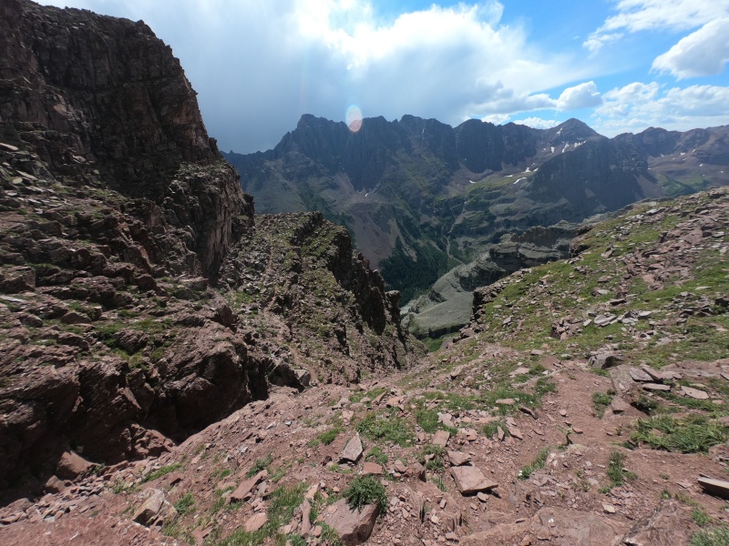
After emerging from the gully, you're confronted with a large boulder field to cross. There seems to be an upper and a lower route, the latter seeming more efficient, so I stayed to the right while crossing it, trying not to gain or lose any excess elevation. It's just your typical boulder hop, nothing too crazy compared to any of the climbing higher on the mountain. I was met by a family of mountain goats here, and not for the last time of the day. 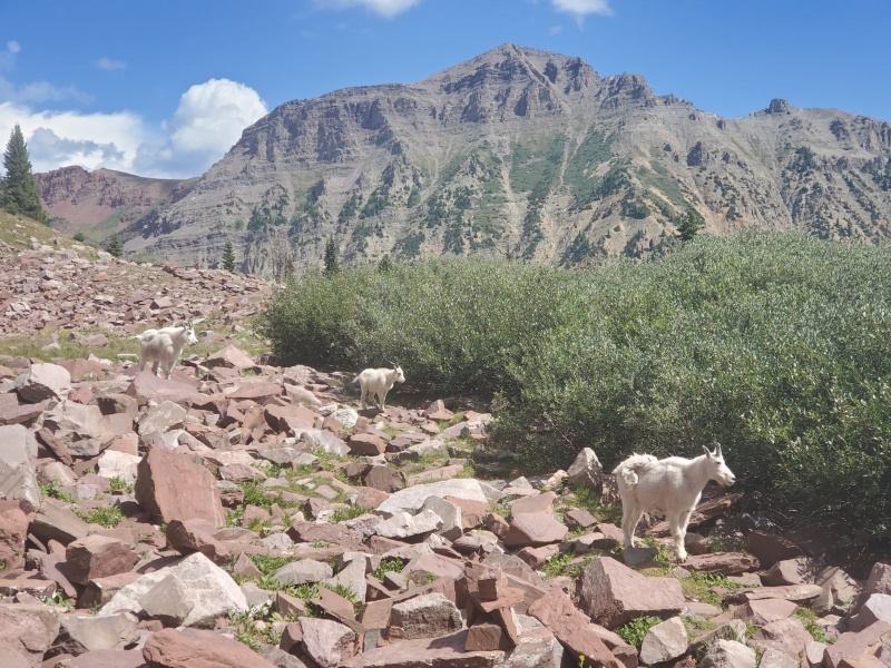
The trail finally solidifies for the final time; it remains easy to follow all the way back. You lose a bit more elevation, cross a creek, then immediately merge back into the main trail, which soon descends back to the turnoff I mentioned earlier. It was only just past 11:00 AM at this point; I had told Tim to expect me back around 4 or 5 at the latest. I thought I would be making it back from the Bells late in the afternoon, then we would camp in the same spot the next night, and drive back up to attempt Pyramid together the next morning. However, my unexpectedly fast time on the Bells meant that I would actually have a chance to finish it today. I knew Tim wouldn't mind me doing it without him; it would mean we could get home a day sooner, which he would be happy about. Despite the snow, the weather was still looking great, I had enough food and water, all the maps and route descriptions were already on my phone, and I knew I could manage it physically. I just had to make it safely up and down Pyramid Peak before 5, so Tim wouldn't worry about me. 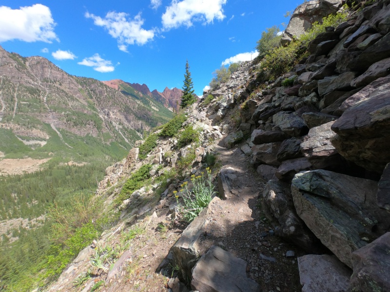
There were a ridiculous number of backpackers and day hikers along the main trail. There was even a huge crowd of tourists with a guide, a very strange sight for the middle of a wilderness area. The first thousand feet or so after the turnoff are steep, just like on Maroon Peak, but more forested and with a much nicer trail. You soon enter the Amphitheatre, a huge bowl-shaped boulder field with a semi-defined trail that starts along the right side. This is where you gain the next thousand feet, eventually curving to the left towards a long series of gullies. 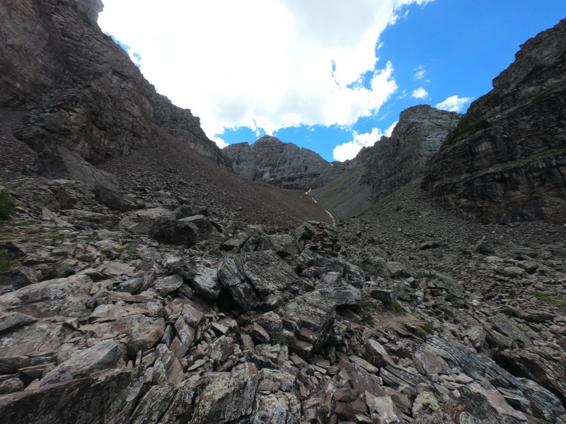
The next thousand feet involves steep climbing up some gullies, which aren't anything too crazy. They're probably a tad more difficult than those on North Maroon: fairly steep, lots of loose rock, and an abundance of mountain goats. This brings you to around 13,000 ft at a saddle. To the right are the final, most difficult thousand feet, with difficult route-finding, some tricky moves, and a lot more loose rock. 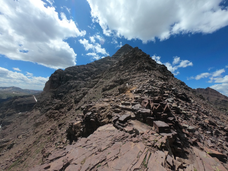
I don't remember all the particulars of this upper route as well as the Bells, since I did a lot less preparation for it (I wasn't expecting to be climbing it this day). But it starts out with some easier ridge scrambling and ledge traversing, then gets a lot trickier past this sort of "leap of faith" move followed by a very narrow, exposed ledge. 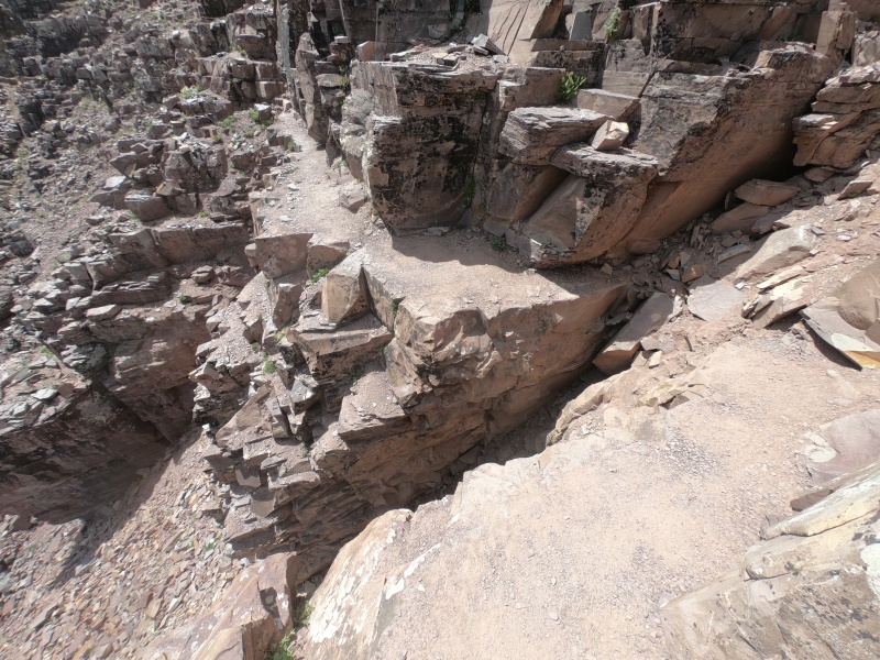
From here to the top, there's another distinctive gully or two, then a lot of hopping up and around crumbling ledges. There aren't a ton of cairns, so you mostly just have make judgements about what looks easiest. I personally felt the route-finding was more difficult than on the standard routes of South or North Maroon, and the difficulty of the moves seemed at least comparable. But considering I was already over 10 miles and 8,000 ft of gain into my hike that day, it very well might have been easier than I thought. Still, I made my way to the top at around 2:00 PM, joining yet another family of mountain goats. Moments later, two fighter jets zoomed through the air right past me and over the Bells. It looked (and sounded) like they were within a half mile of me, and it had to be one of the coolest (and most startling) thing to see during a climb. 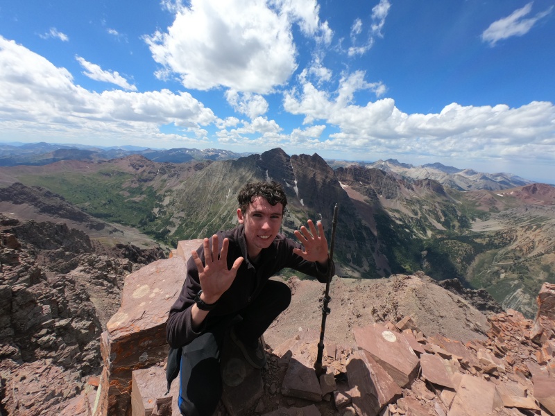
After taking in the great view of the Bells, I took my last sip of water. My estimation about having enough earlier must have been a little off. I was plenty well-hydrated at that moment, so I figured I would be alright by the time I made it to the nearest stream to filter some. I carefully made my way back across the worst of the terrain, down the gully, across the boulder field, and started down the steep approach. I was surprised to find not a single water source along the way, so when I made it back to the lower turnoff, I figured I could wait another mile until I was back at the car. It was approaching 5:00 PM, and most of the tourists had cleared out by this point. The classic view of the Bells from Maroon Lake didn't look too spectacular with the sun in the background, especially after seeing them up close earlier in the day. 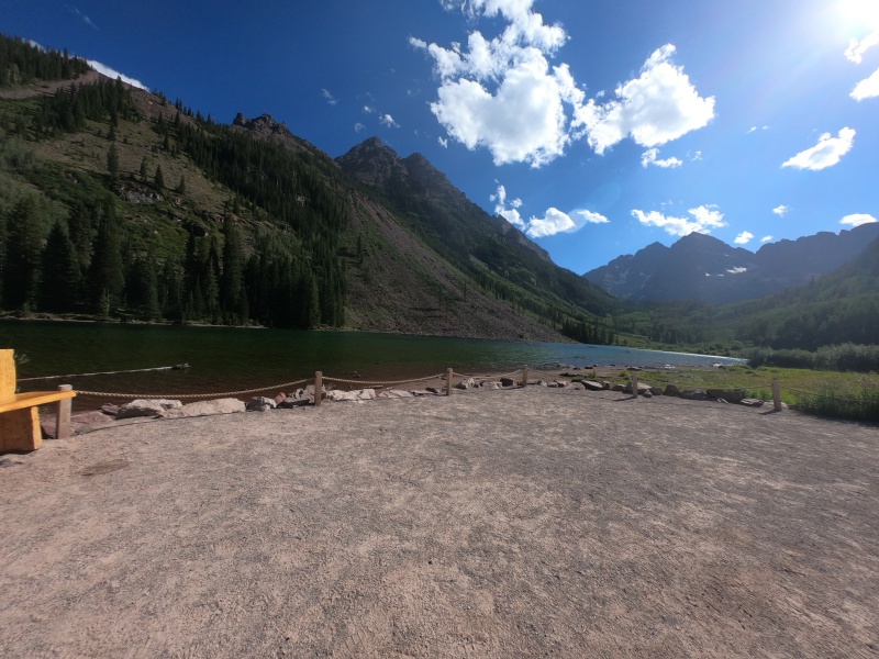
I made it back to the car and surprised Tim about my extra long journey for the day. I jokingly asked if he wanted to stay and climb Pyramid with me again tomorrow, but he seemed happy for me to move right along to the next peak, Snowmass Mountain. He wasn't planning to hike this one with me (since it's the longest route of the week, and the day before Capitol), but it would at least save a second day from our original 6-day itinerary. I drank a ton of water and got back ready to drive back towards town. There were about as many cars in the parking lot as there had been 12 hours earlier: almost none. We completed the relatively short drive over to the Snowmass Creek trailhead, and I made my final preparations for the following morning. I was asleep by 8:00 PM after an exhausting day of hiking, anticipating two more to come. Day 3 - August 13, 2020 Snowmass Mountain - East Slopes Class 3 | Distance: 21.29 mi | Gain: 5,511 ft
Waking up at 4:00 AM once again, I was happy this time to already be at the trailhead, ready to hike. I quietly ate breakfast and got my gear together, then set out on the trail alone. This would be the longest distance I would travel for a single peak all summer, at a staggering one-way distance of over 10 miles from the trailhead. The actual climbing isn't trivial either, but it would take nearly 3 hours at a fast uphill pace to reach the end of established trail. Perhaps a more-overlooked obstacle comes around 6 miles in, at the log jam river crossing. It seems like over the last few years, due to changing water levels or perhaps just movement of the logs, that the preferred location to cross has moved downstream (south) to a slightly narrower portion of the creek. Not knowing that this new easier crossing was possible, I disregarded the proper first turnoff to the right because my GPS track continued to the older crossing. I stepped out onto the endless expanse of logs, and soon realized that the route I was trying to follow no longer existed. 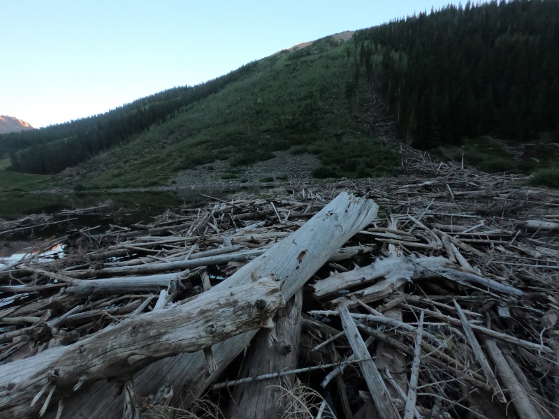
The new arrangement of logs forced me to walk practically parallel to the shore until meeting up with the newer crossing. I realized I had just spent 5 minutes carefully trying to avoid falling into the water, and was still on the same side of the creek, closer to the proper trail I had ignored than the one where I started. All summer, I had largely avoided getting my feet wet in any water crossing, thanks to relatively low water levels, good rock-hopping skills, and a bit of luck. After finally making it to the other side, happy I had at least made it across without incident, I made a final leap towards dry land, but fell just short and completely submerged one foot in the water. After 10 minutes and the most difficult water crossing of the summer, I had failed on the last step. Annoyed, I continued up towards Snowmass Lake, to at least let my shoe dry off before changing into an extra pair of socks. Two miles later, I passed a hoard of backpackers at the extremely overcrowded camping spots by the lake. About halfway down the lakeside trail that heads for the slopes of Snowmass Mountain, I made my second minor water-related route-finding mistake of the day. I turned right onto a side trail that follows the water more closely, rather than staying on the proper trail a little higher. This route, only made possible during lower water levels, is undefined in a few places, and was very wet and muddy. Still, the great morning views of the mirrorlike surface of the lake made up for my wet feet. 
Just past this point, I finally stopped and changed my socks. I entered the boulder field where the trail begins to fade, replaced by endless chains of cairns. It quickly begins to ascend parallel to a gully, and eventually merges into it, getting just steep and loose enough near the top to be annoying. After crossing some water-polished rocks to the north, the trail reemerges for a short period of time, before quickly disappearing for good. 
Past this point, I wasn't exactly sure what to expect. I knew that Snowmass Mountain was traditionally more of a snow climb, since its huge east-facing slopes usually hold snow well into the summer. But because of early melting this year, I knew from conditions reports that there would be little snow left, presumably leaving just an endless boulder field underneath. And while this was true for the most part, I was surprised for the first quarter mile or so to see a nice green grassy field under what appeared to be eternal snow from the satellite view. 
The remaining half mile or so was about as much fun as an empty boulder field ascending 1,000 feet can be: not very. As usual, the popular routes quickly diverge into a tangle of twisting trails marked by constant confusing cairns. It seems like I took a route about as far north (right) as you can go, which might've made things marginally less steep, although it would've made sense to take a more direct route to the entrance point on the ridge. With good snow conditions, this would be about the route you'd want to take if you plan to join the ridge closer to the peak. Anyway, I curved back around to the left and hopped up the last few boulders to the ridge, where you get a good view of the remainder of the route. 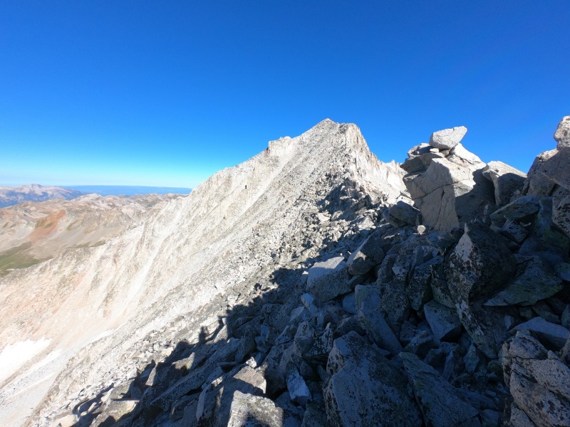
From this point, if you choose your route well, you'll barely find any Class 3 until the final few dozen feet below the summit. The popular route follows a little under the west side of the ridge for most of this final section. There's a very slight deviation that I took by staying a bit higher on the ridge, although I was constantly looking down and realizing that the alternative would've been easier. On the very last stretch of this final portion, you diverge from the steep ridge, lower on the face, then climb up a final gully-type thing to the top. 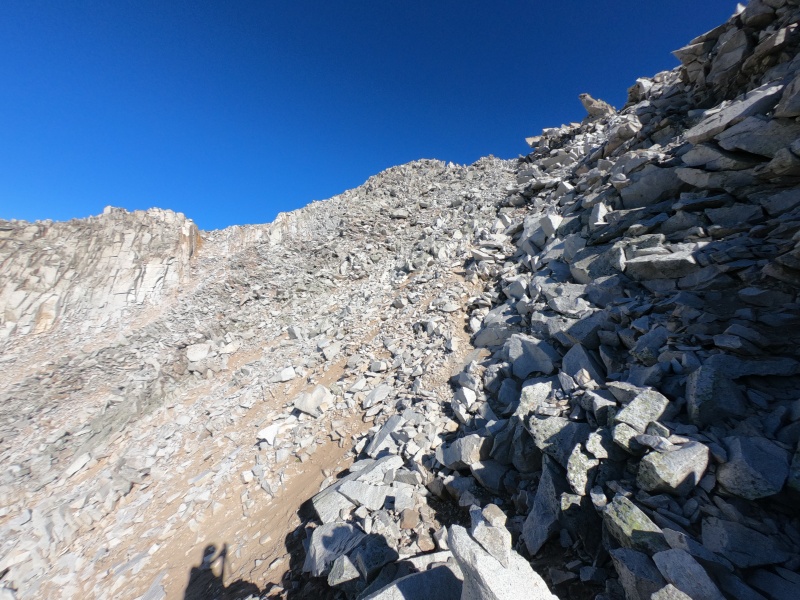
If you took the easier route along the ridge, the moves right under the peak will probably be the first real Class 3 of the entire climb. Still, the class rating definitely understates the difficulty of such a long day of hiking, followed by an intense 3,000 ft climb up endless boulders and snow, most of which I would call a sort of "Class 2+." There's a bit of scrambling along the ridge if you look for it, but if you're looking for good scrambling, the routes up the west side are probably the way to go. I climbed on top of the summit block just before 10:00 AM, marking one of my latest first-summit-of-the-day times due to the sheer mileage. 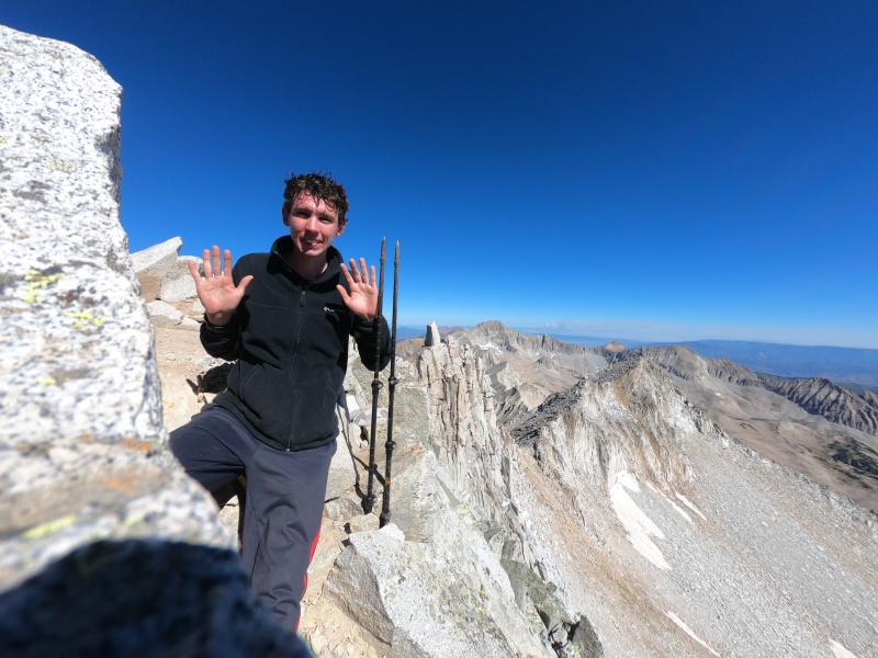
While I was taking the above picture, there was a scary moment where I hit a loose rock with my foot, then watched it launch down the steep eastern face of the peak while triggering dozens of larger rocks to slide along with it. I had heard this sort of cascade of rockfall down a steep face a number of times throughout the summer, but this was the first time I had caused it. Luckily, there's no way anyone would ever be climbing below this area (especially without snow), but it was still a bit shocking to watch it all happen from a simple misstep. 
The air was also getting a little bit hazy, as the new Grizzly Creek Fire just a few dozen miles to the north quickly began to expand. Little did we know that they had just closed not only I-70, where we planned to leave from the next day, but also Independence Pass, where we had come in. But that would be a problem to solve after getting down Snowmass, and up my final 14er of the summer, Capitol Peak. The 10+ miles back to the car went without incident. I only passed one climber high on the mountain all day, but saw a lot more backpackers after returning to the trail. Knowing the proper route across the log jam, I made it across in about a third the time as before. My feet were still a little wet from the first time, but other than that, I still felt good despite having over 45 miles and 18,000 ft of gain on my legs over the last 3 days. As the trail flattened out, I even ran the last few miles back to the trailhead, making it the 8 miles from Snowmass Lake in under 2 hours, without stopping. 
I met back up with Tim in the early hours of the afternoon, and soon we were heading off towards our final 14er trailhead, Capitol Creek. Google Maps suggested a shortcut along some dirt roads, but we needed gas, so I headed back out to the highway and stopped at the tiny town of Snowmass. I also bought a bottle of root beer, which I would carry to the summit of my final peak (although this plan would soon fail spectacularly). My parents texted me about the road closures, but Google Maps showed an easy-looking bypass around the closed part of I-70, so I figured it would be alright tomorrow. We drove up the dirt road to the trailhead, which was certainly much worse than the previous one. Though it was perfectly smooth with very few rocks, it got very narrow and bumpy in a few places, where a smaller vehicle might have trouble simply due to lack of clearance. We spent a long time making sure we were as prepared as ever for the hardest 14er to come, and I still managed to fall asleep around 7:00 PM. Day 4 - August 14, 2020 Capitol Peak - Northeast Ridge Class 4 | Distance: 16.42 mi | Gain: 4,767 ft
I awoke at the usual time of 4:00 AM, ate a usual breakfast, got my usual gear together, and set out with Tim for the for peak number 58. Just 54 days earlier, we had followed the same routine as we started the hike up Mount of the Holy Cross, number 1 of 58 for the summer. We started out on the "ditch" trail, the easier alternative to the "standard" approach route, before they meet up near a creek crossing at about mile 3. Up to this point, you've barely gained 500 ft of elevation, whereas the next 3 miles to Capitol Lake entail 1,500 ft. 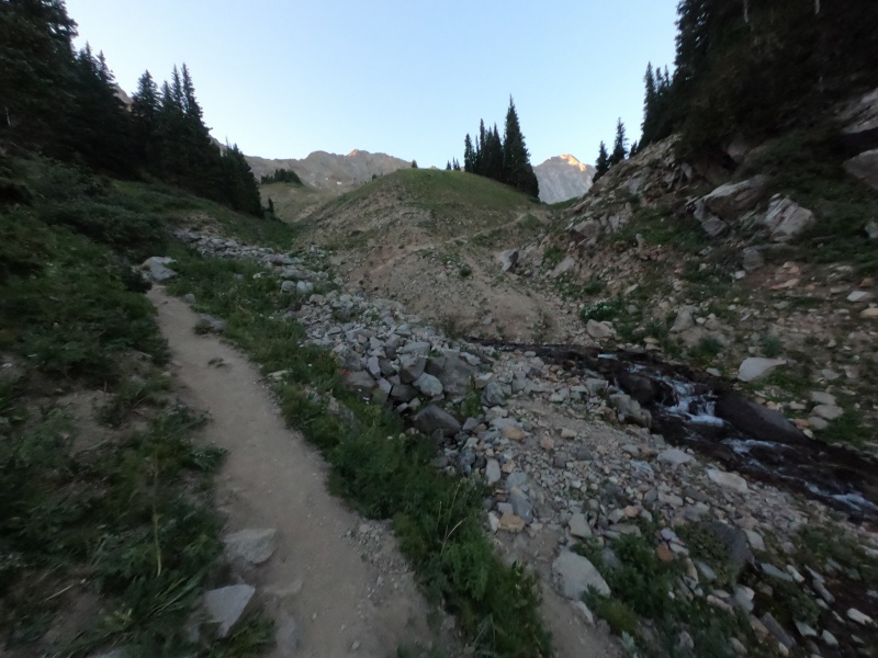
I made it to the big junction near the lake in just under 2 hours, where you can either go left up the ridge, straight towards the lake, or right to some campsites. I quickly went over to the lake to take some pictures as I waited for Tim to arrive. 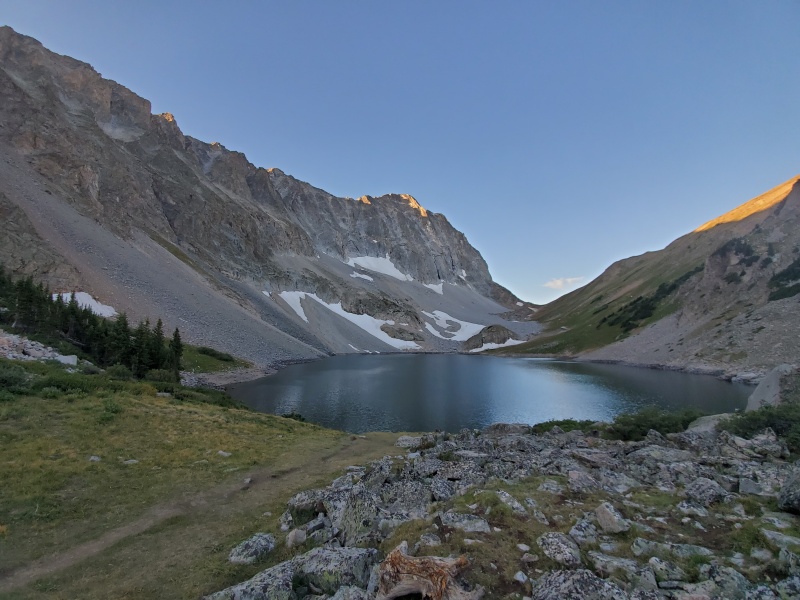
We began the trail up to the ridge, which quickly gets very steep with a number of switchbacks. Still, it seemed very well-built for such a low-traffic peak, plus there was even a CFI crew working on the upper sections as we went past. You ascend about 1,000 ft up to a saddle, which marks the end of easy hiking. The standard route crosses over to the west side of the ridge, then traverses through a boulder field before eventually working up to the "K2" subpeak. 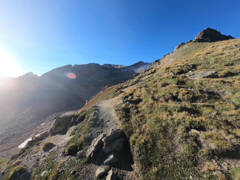
Just past this saddle, there's an area where the trail seems to suddenly go down a steep slope to the left. If you keep going straight instead, you soon end up at a dead end, where more difficult climbing would be required to make it across a gap. So after an awkward little descent and to make it past, you emerge into the bulk of the boulder field. After my time on Snowmass the day before (whose snowy slopes are at a similar aspect to this section), I figured that the usual snowfields lining the route would be completely gone by now. But in fact, there was actually more snow than I had seen on a trail since June, somehow still lingering while Snowmass was completely snow-free. 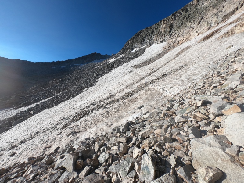
Luckily, the snow was easy enough to cross, with a well-travelled trench and firm early-morning snow. The rest of the boulder field was even slower going, akin to that on Snowmass the day before. It's impossible to follow an exact "standard" route, but cairns mark the way adequately. A while after the worst of the snowfields, you curve around to the right and up a long, rocky slope towards "K2," at over 13,600 ft. It's all relatively simple "Class 2+" hiking up to this point, whereas getting on top of this subpeak requires at least a few Class 3 moves. 
Tim and I stopped at this minor summit to put away our trekking poles and put on our helmets for the difficult, exposed route ahead. Our climb down "K2" actually held one of the hardest moves of the entire day, a point in the downclimb where there's hardly any handholds as you lower yourself onto easier terrain below. I'm not sure if this was the easiest way to go, but it was definitely at least Class 4, albeit on very solid rock. We did bypass around "K2" on our way back, but it was really loose and honestly even less fun than going over. 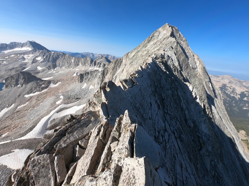
From "K2" to where the standard route diverges from the ridge, the route-finding is extremely obvious. There's a short warm-up along mostly-stable Class 3 rock, but before you know it, you hit the Knife's Edge. This pointy section of ridgeline is very solid and straightforward, although it's extremely exposed, and its shape makes any traditional hiking or scrambling methods impractical. There's a few sections where you can walk alongside it while holding the top for balance, but the majority of the ridge simply has no footholds. The solution, of course, is just to straddle the edge. It's definitely among the most unique sections of any 14er route, and I quite enjoyed it. Tim didn't seem to be quite as much of a fan. 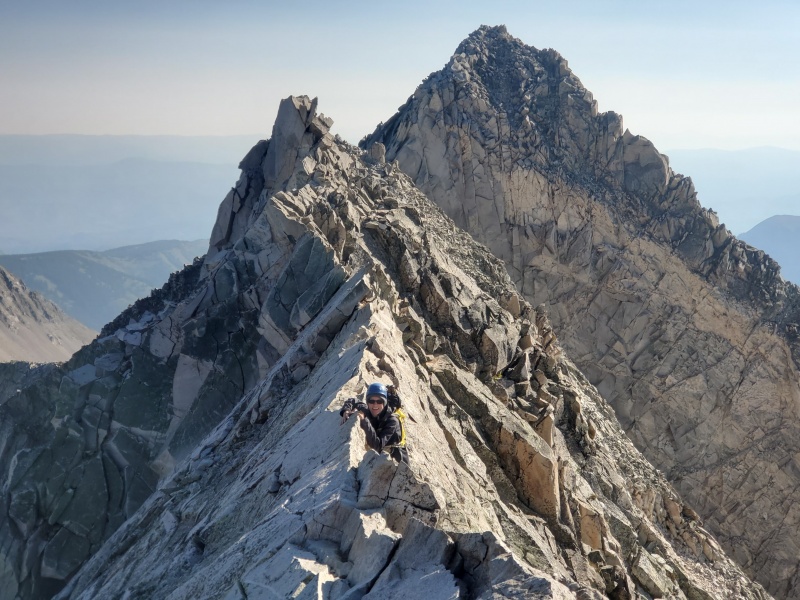
The Knife's Edge kind of stops for a bit in the middle, before restarting for a final stretch. After that, it's relatively easy ridge scrambling for the rest of the way to where the steep part begins. At this point, the standard route soon diverges from the ridge onto some small, steep ledges along the face. These are kind of similar to those around the Maroon Bells, but with a very different quality of rock: less crumbly, but still quite loose. You go back and forth between ascending and traversing a little at a time, using some cairns and a lot of visual judgement to try to find the best way up. The rock is the loosest here out of the entire route, and it holds most of the hardest moves. There's also plenty of exposure to go with it. 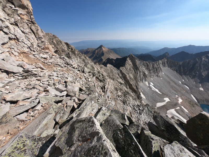
After making it across the majority of the face, you can meet up with the ridgeline near where it takes a turn west, towards the top. With the summit of my 58th and final 14er in view, I scrambled along this final stretch of ridgeline to the summit. I opened up my bag to extract the celebratory root beer, and the bottle was hilariously stiff due to the lower air pressure at altitude. I set it down on a rock near the edge as I began filming something unrelated, not thinking about its precarious position. As I walked over to sit down next to it, I must have barely touched the bottle with my leg, because before I knew it, it was sliding down the face of the mountain. I almost instinctively reached out to catch it, but it was too late. I helplessly watched it pick up speed, flying down the northern face of the mountain and out of sight. It probably bounced all the way down and off the large cliff bands circling the mountain, perhaps exploding on impact with the talus below, or simply waiting to be found in a small snowfield. Regardless, I was quite disappointed about the wasted effort in carrying it to the top, but at least I had finished the goal for which I had brought it. 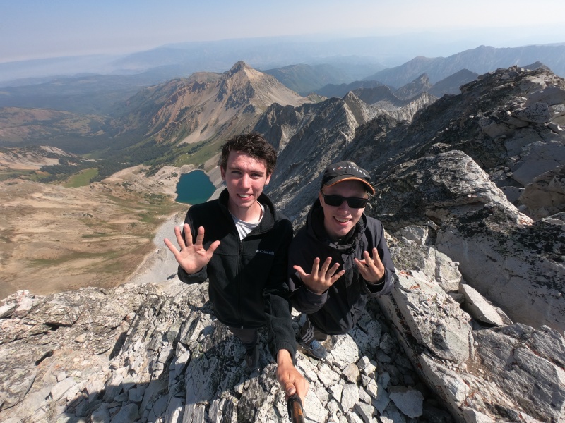
Tim and I made it down the higher sections without incident, although we did run out of water soon afterwards (if only I still had the root beer...). The lake was nearly in sight though, and we quickly found a stream and purified some. Unfazed by the crazy mileage I had already covered over the last few days, I ran the 6 miles back to the trailhead in a little over an hour. Tim arrived soon afterwards, and we threw our stuff in the car, then headed back down from the final trailhead. Upon getting service, I opened up Google Maps to ensure that the alternate path to I-70 was still open, then set out on the highway in that direction, ready to get home. With both that portion of the interstate and Independence Pass closed, the shortest non-dirt alternative would entail taking I-70 west to Grand Junction, highway 50 past Montrose and Gunnison, before finally reaching 285 near Salida. A drive home that's normally under 4 hours would become 8.5 hours long, an option that we didn't even consider, even though it was the "official" workaround. We made it only a few miles up Frying Pan Road before a large electronic sign said to turn around, stating that there was no access to I-70 ahead. Not seeing any viable alternative, we continued on up the road, following Google Maps, which noted no road closures nor even much traffic on that section. We quickly realized the reasoning behind the latter: when we made it to the turnoff, there was a huge blockade with a police car blocking what looked more like a private road. Though it does look passable on a map, there was apparently so much traffic from unprepared vehicles due to Google Maps that they had to close it off, yet somehow hadn't managed to flag the road as "closed." I kept driving past the closure, not wanting to look like an idiot after the giant sign lower in the canyon, and eventually pulled off to figure out what to do. I still didn't even consider highway 50 as an option, since it would not only take well into the next morning to get home, but we had also already spent an hour driving up this road. We didn't have service anymore, but I was able to zoom into my map and see that there was a place where the road did continue up and over the Sawatch range: Hagerman Pass. Not knowing what to expect, but also out of other options, we drove up towards the pass. It seems like we weren't the only ones with the idea, since we got stuck behind a few slower cars once the road turned to dirt. It was really just easy 2WD dirt up until the junction at the end of Frying Pan Road, where Hagerman Pass Road begins. The low clearance car in front of us gave it a couple tries, but couldn't even get the first 20 feet past the rocky turnoff. Being neither a great 4WD driver, nor having the best car for such terrain, I did at least have a bit of experience I had developed over the summer. I figured if we didn't attempt it, we would be sleeping in the back of the car for a fifth night, and the last thing I wanted to do was be driving home all day tomorrow. We made past the first section okay, and with a lot of slow driving, we were soon at the top. It was definitely at the far end of the difficulty of roads I would ever attempt driving, akin to one of the trickier "easy 4WD" roads on this site. The way down the east side was quite a lot harder, with a lot more steep gradients and sharp turns. This held a couple of the worst obstacles I've ever had to drive past; I doubt we even would've made it going uphill. Still, we eventually made it with minimal incident, and it was a huge relief once we finally made it back to the maintained dirt section. Right then, we passed a campground in a forested area with a bunch of idiots having a giant campfire, in the middle of a statewide fire ban while half the country seemed to be burning. Sure enough, the visibility was near zero due to the thick smoke as we made our way back to I-70. Of course, we were also both starving at this point, so we stopped in Dillon for one last pizza of the 14er journey. We made it home right around midnight, many hours later than if the roads were open, but still considerably quicker than if we had gone the long way. Apparently, they had actually reopened Independence Pass to traffic in one direction just as we were struggling on top of Hagerman Pass, but even if we had known to wait there, it's a tossup which one would've been faster. Statistics: June 22, 2020 - August 14, 2020
I also solved a Rubik's Cube on top of each peak (see here), so here are my stats for that:
I went on to climb 20 of the remaining centennials solo throughout the last month of summer. I will return to finish the final 18 in mid-summer of 2021. Thumbnails for uploaded photos (click to open slideshow): ")
")
")
")
")
")
")
")
")
")
")
")
")
")
")
")
")
")
")
")
")
")
")
")
")
")
")
")
")
")
")
")
")
")
")
")
")
")
")
")
")
")
")
")
")
")
")
")
")
")
|
| Comments or Questions | |||||||||||||||||||||
|---|---|---|---|---|---|---|---|---|---|---|---|---|---|---|---|---|---|---|---|---|---|
|
Caution: The information contained in this report may not be accurate and should not be the only resource used in preparation for your climb. Failure to have the necessary experience, physical conditioning, supplies or equipment can result in injury or death. 14ers.com and the author(s) of this report provide no warranties, either express or implied, that the information provided is accurate or reliable. By using the information provided, you agree to indemnify and hold harmless 14ers.com and the report author(s) with respect to any claims and demands against them, including any attorney fees and expenses. Please read the 14ers.com Safety and Disclaimer pages for more information.
Please respect private property: 14ers.com supports the rights of private landowners to determine how and by whom their land will be used. In Colorado, it is your responsibility to determine if land is private and to obtain the appropriate permission before entering the property.