Download Agreement, Release, and Acknowledgement of Risk:
You (the person requesting this file download) fully understand mountain climbing ("Activity") involves risks and dangers of serious bodily injury, including permanent disability, paralysis, and death ("Risks") and you fully accept and assume all such risks and all responsibility for losses, costs, and damages you incur as a result of your participation in this Activity.
You acknowledge that information in the file you have chosen to download may not be accurate and may contain errors. You agree to assume all risks when using this information and agree to release and discharge 14ers.com, 14ers Inc. and the author(s) of such information (collectively, the "Released Parties").
You hereby discharge the Released Parties from all damages, actions, claims and liabilities of any nature, specifically including, but not limited to, damages, actions, claims and liabilities arising from or related to the negligence of the Released Parties. You further agree to indemnify, hold harmless and defend 14ers.com, 14ers Inc. and each of the other Released Parties from and against any loss, damage, liability and expense, including costs and attorney fees, incurred by 14ers.com, 14ers Inc. or any of the other Released Parties as a result of you using information provided on the 14ers.com or 14ers Inc. websites.
You have read this agreement, fully understand its terms and intend it to be a complete and unconditional release of all liability to the greatest extent allowed by law and agree that if any portion of this agreement is held to be invalid the balance, notwithstanding, shall continue in full force and effect.
By clicking "OK" you agree to these terms. If you DO NOT agree, click "Cancel"...
Trailhead: Junction of FS391 & FS392 Route: Sayres Gulch Length: 10.25 miles Vertical: 2800 feet Partners: Solo
After doing Pyramid (TR here), I was looking for something easy and boy did I find it. PT13,295 is almost too easy but the Sayres Gulch is worth seeing and like most mountains, the views from the top were really nice. Another advantage of this lowly 13er is that one is not likely to see anyone (and I didn't) especially on a weekday.
To get to the starting spot, go to the LaPlata TH and drive FS391 for about 2.5 miles to the junction with FS392. The road is a bit rough in spots but not too bad (higher clearance is preferable). I parked on 392 past the junction.
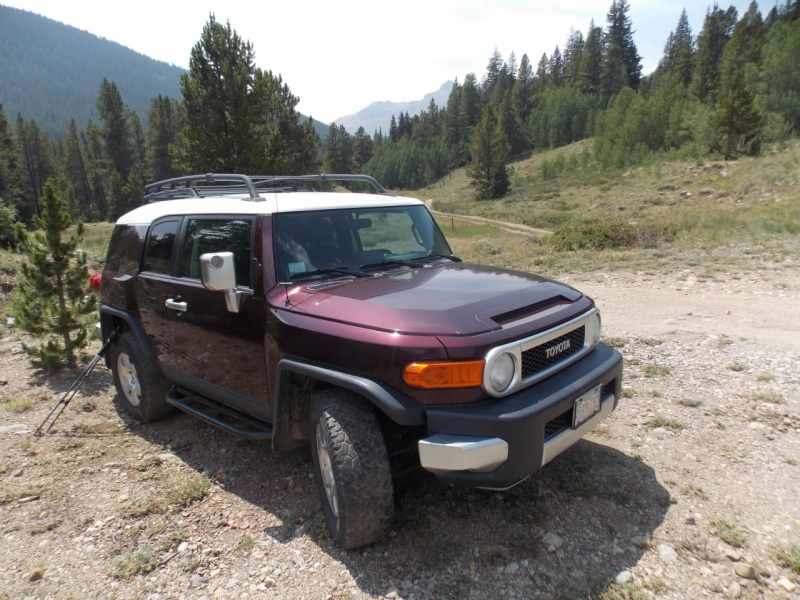
My FJ @ the TH
As an aside, note the tires on my FJ. They are BF Goodrich TA's. I have 98,000 miles on them. I have never had a set of tires last so long. Yeah, I'm due to replace them and given how these have held up, you can bet I will be buying another set. And no, I don't work for BFG <smile>
From the TH, you cross Lake Creek on a bridge that isn't wide enough to drive a standard size vehicle across although it must be wide enough for an ATV as I saw some ATV tracks.
Bridge
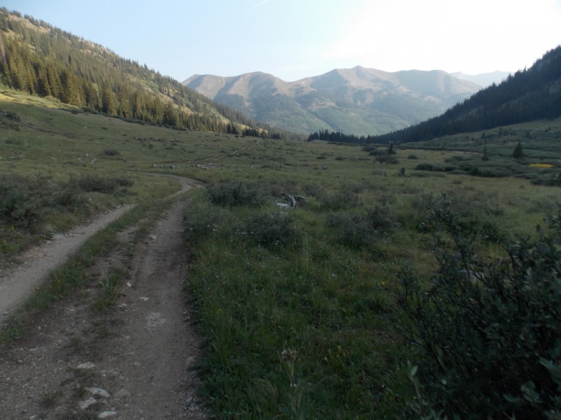
Then it's a matter of just following the old road. It is probably a mile or two to the Wilderness Boundary and a mountain bike could shorten the time but it was such a nice day, I didn't mind the walk.
Looking back
You parallel a Lake Creek tributary so there is the constant sound of a creek.
And there is nice scenery along the way.
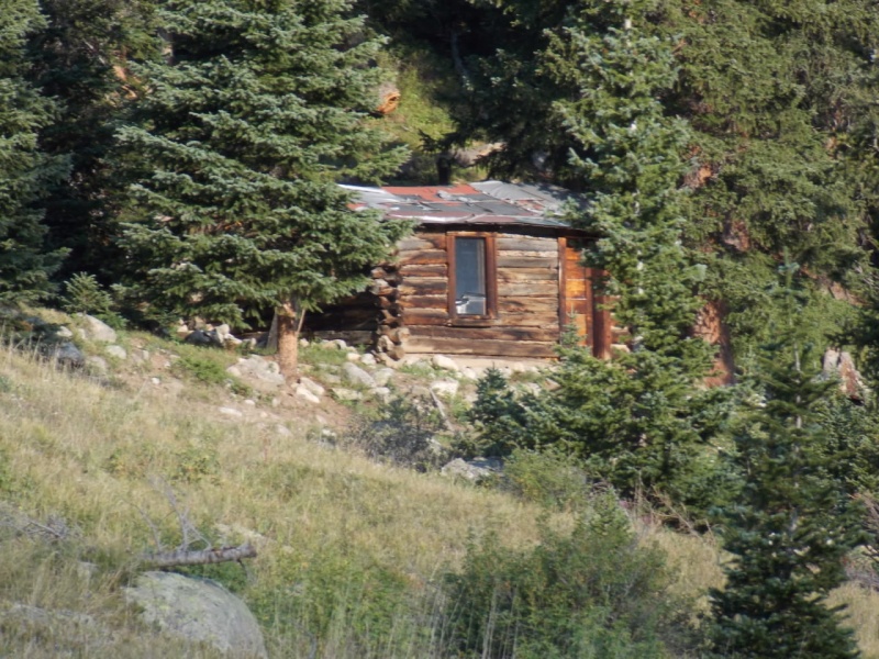
Just before you reach the wilderness boundary, you encounter an old miner's cabin
Or maybe it was a young miner?And then you are in the Collegiate Peaks Wilderness Area
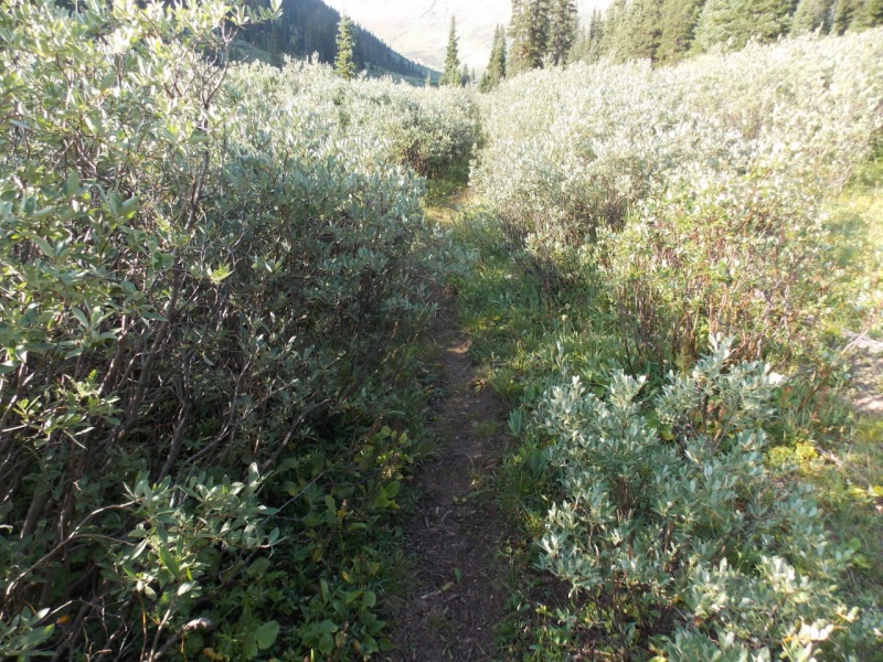
It had been a double track to this point but went single track at the boundary
Avalanche chute
Trail is still pretty good through the willows
But then it disappears and you are on your own.
But, it's pretty clear where you have to go (my route in red)
Nearing the saddle on the above pic, I came across these pipes. I assume they were left by miners but I saw no other evidence of mining or mine equipment in the vicinity.
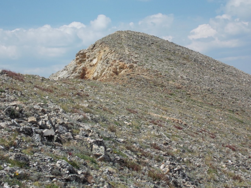
There were a couple false summits but it doesn't take long to see the final push.
Summit!
And there was a register! It was soggy so I didn't try to write my name in it. And the wind was blowing hard enough that I didn't try to take a picture of it but I did see the name Ken Nolan on it. I always feel special when I see a 14ers icon like Ken on a summit register. I've only spotted his name (along with superwoman Teresa Gergen) one other time and that was on Mt. KiaMia and I included a photo of that page on my TR here.
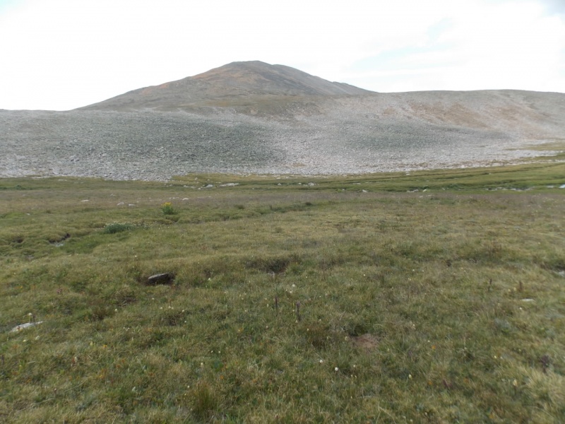
Lots of nice views of other 12ers and 13ers from the summit - even with all the smoke.
I took a slightly different route down just to see some different views.
From the saddle, I took a wide turn to the left.Looking back - the only sorta difficult spot was crossing the talus and iit wasn't all that tough
As I don't carry a GPS, this is an approximation of my route.
This ended up being a nice easy walk to a summit with nice views that I would recommend to anyone who is looking for an easy day.
And - as always - thanks for taking the time to read this and please be careful out there!
Thumbnails for uploaded photos (click to open slideshow):
Yes, a beautiful gulch. What peak is that in image #20? Just curious. I envy you being able to get out every weekend or so to stretch your legs in the mountains!
Yep - Brad and I are on the same page when it comes to that, I think. The older I get, the more I prefer to "walk the path seldom walked." (Boy - does that sound corny!!)
Caution: The information contained in this report may not be accurate and should not be the only resource used in preparation for your climb. Failure to have the necessary experience, physical conditioning, supplies or equipment can result in injury or death. 14ers.com and the author(s) of this report provide no warranties, either express or implied, that the information provided is accurate or reliable. By using the information provided, you agree to indemnify and hold harmless 14ers.com and the report author(s) with respect to any claims and demands against them, including any attorney fees and expenses. Please read the 14ers.com Safety and Disclaimer pages for more information.
Please respect private property: 14ers.com supports the rights of private landowners to determine how and by whom their land will be used. In Colorado, it is your responsibility to determine if land is private and to obtain the appropriate permission before entering the property.


")
")
")
")
")
")
")
")
")
")
")
")
")
")
")
")
")
")
")
")
")
")
")
")
")
")
")


