Download Agreement, Release, and Acknowledgement of Risk:
You (the person requesting this file download) fully understand mountain climbing ("Activity") involves risks and dangers of serious bodily injury, including permanent disability, paralysis, and death ("Risks") and you fully accept and assume all such risks and all responsibility for losses, costs, and damages you incur as a result of your participation in this Activity.
You acknowledge that information in the file you have chosen to download may not be accurate and may contain errors. You agree to assume all risks when using this information and agree to release and discharge 14ers.com, 14ers Inc. and the author(s) of such information (collectively, the "Released Parties").
You hereby discharge the Released Parties from all damages, actions, claims and liabilities of any nature, specifically including, but not limited to, damages, actions, claims and liabilities arising from or related to the negligence of the Released Parties. You further agree to indemnify, hold harmless and defend 14ers.com, 14ers Inc. and each of the other Released Parties from and against any loss, damage, liability and expense, including costs and attorney fees, incurred by 14ers.com, 14ers Inc. or any of the other Released Parties as a result of you using information provided on the 14ers.com or 14ers Inc. websites.
You have read this agreement, fully understand its terms and intend it to be a complete and unconditional release of all liability to the greatest extent allowed by law and agree that if any portion of this agreement is held to be invalid the balance, notwithstanding, shall continue in full force and effect.
By clicking "OK" you agree to these terms. If you DO NOT agree, click "Cancel"...
Trailhead: Starvation Trail (east end)
Route: Trail to North ridge, then follow ridge to summit
Length: About 9 miles
Vertical: 2300 feet?
Partners: Solo
Backstory
(Skip ahead to the pictures if you're not into this sorta stuff)
Many of you know that I'm a Vietnam Vet. And I do not say that to elicit any sort of response cuz I'm no hero. Not even close. The men and women who came back missing body parts or didn't come back at all are the heroes. Not me. And I think any vet would say the same thing. This TR isn't about me - it's an homage to others who have served and are now serving (shout out to HulkHikeGood).
My desire to hike this mountain began about 8 years ago with a chance meeting with Barry Raven on Trinchera Peak. (Side note - Barry doesn't seem to be on the forum anymore and if anyone knows how to contact him - or can give him my contact info, please do so as I promised him I would tell him if I ever made the summit and did a TR - Edit: I have gotten in touch with Barry!). Anyway, Barry had spotted the Vietnam Vet plates on my FJ and told me about how he and his father had been involved in the petition and ultimate success to rename UN11,282 to Mount KIA/MIA - for those of you that may not know, KIA/MIA stands for Killed in Action, Missing in Action. Barry and I talked some about it and he urged me to hike up that mountain and it immediately went on my to-do list. He pointed me to a website that described the renaming and gave directions on how to get to it. That link is here - Mount KiaMia Near the end of the page is a "DIRECTIONS" link. Click on that for a PDF of how to get to the west TH and the climb. Note - the TH sign in the PDF file was not there the second time I attempted the climb.
I initially thought that doing it on Veteran's Day would be appropriate, but the snow that November on Marshall Pass ruled that out. Next was Memorial Day but that had the same problem. The following summer, I thought I'd just do it on a nice day. I hiked the Starvation trail from one end to the other and did not see the cairn noted in the directions. Hiked it back and still didn't see it. I decided to do more research and come back. Which I did a couple years later. This time, I was SURE I knew where to cut off. Wrong. I ended up passing the proper cutoff and going up UN11,238 instead. Had a good time (and the only other name on the register on that peak was Ken Nolan so it was worth it). On that particular trip, I ran into a lot of mountain bikers coming down the trail as I was going back up and had to dive off the trail a couple times to avoid being hit (kinda like Nam...). Additionally, there was a note on my windshield castigating me for parking off on the side of the 4X4 road at the TH. There is no parking at the west end of the trail and I thought I had picked an appropriate place to park but I guess at least one mountain biker didn't like it.
On my first attempt starting at the west end and going to the east end of the trail, I had remembered that it ended at a road - a road that looked a lot better than the 4X4 road (FS230/230-1A) described in the directions I had. I spent some time looking at the map and realized this was the Poncha Creek road and while the hike from that end would involve a little more "up" and a little more distance, it would have the advantage of not having to climb back up and out and the end of the hike as described in the directions. Additionally, I thought if I did it on a weekday, there would be less of a chance that I would run into out of control mountain bikers.
And that worked. So - if you want to do this peak, I would recommend starting at the east end of the Starvation trail. Almost any 2 wheel drive vehicle could make it - only a little careful driving is involved and there is plenty of obvious parking near the TH. The only real problem is figuring out where to leave the trail so you go up the right mountain and I will try and explain that in the body of this report.
OK - to the pics and the narrative....
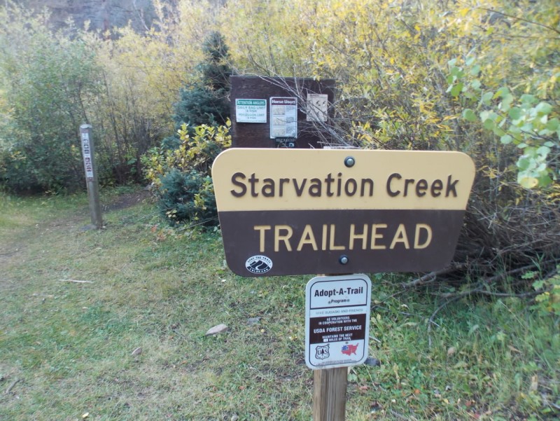
To get to the east TH, start as though you were going up Marshall Pass but instead of that hard right (near where there are some info boards), go straight and look for signs that indicate Poncha Creek. I have noted on the map below the route from that hard right turn. Red dot is the TH
You will spot the TH on the left side of the road. There is parking near the sign and just a bit further up the road from this sign.
East end TH
And you immediately cross a bridge. Nice little bridge
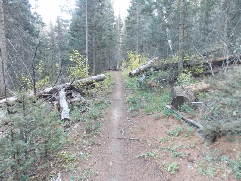
It's a good trail and you follow it for about 3 miles...
And you will come to another bridge.
If you want to climb UN11,238 head left (south) just before this bridge and head up. If you want Mt KiaMia, keep going another half mile or so.
I chose to cut over the creek and head up here. There were no good landmarks at this point. You just have to keep an eye on the hillside and pick a good spot. If you start crossing a bunch of rocks on the trail, you went too far. (ask me how I know)
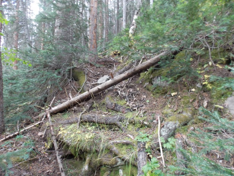
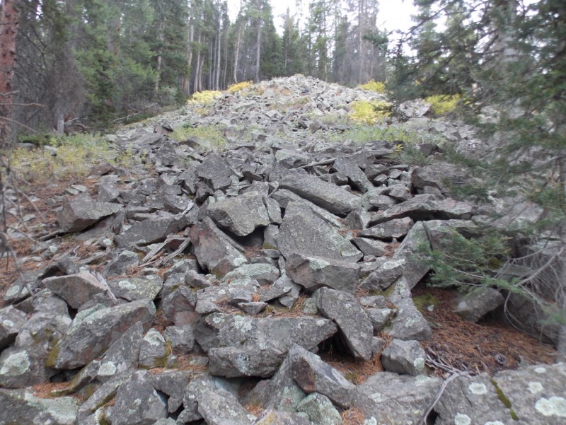
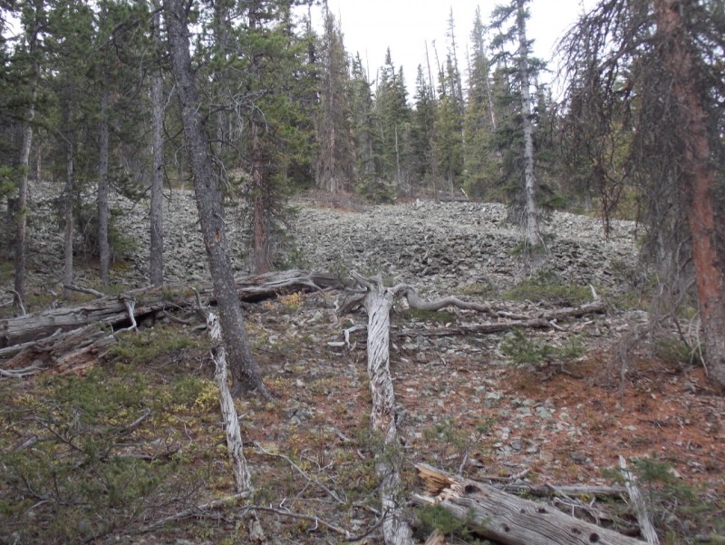
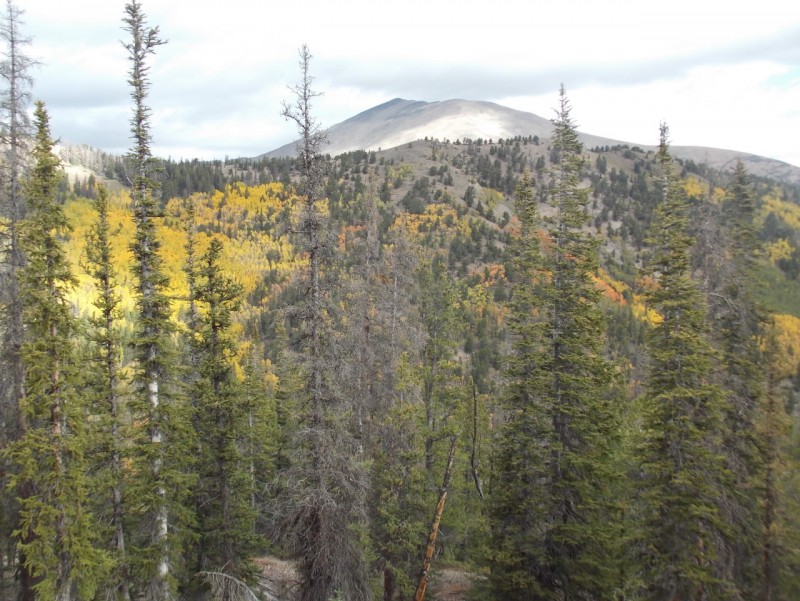
My entry point It's an easy bushwhack for the most part There wre a number of these rock patches. I rock hopped some and skirted others Some nice apsens on the other side of the valley. More rock patches Mount Ouray Cool tree
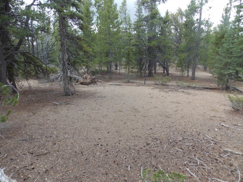
You will get to an open area that seems like it might be the summit. Don't be fooled - the summit is a little ways yet. True summit is visible as a rounded bump not far away. Summit area Summit (note the summit register in the glass bottle
The register as it looked in 2008 From the KiaMia website
Still not many names on the register. It was cool to see Ken Nolan's name (second one) and Teresa Gergen (three up from mine) on the register. The Raven's signatures were barely legible and my photo washed it out even more. Ken Nolan AND Teresa Gergen? Wow! Summit area
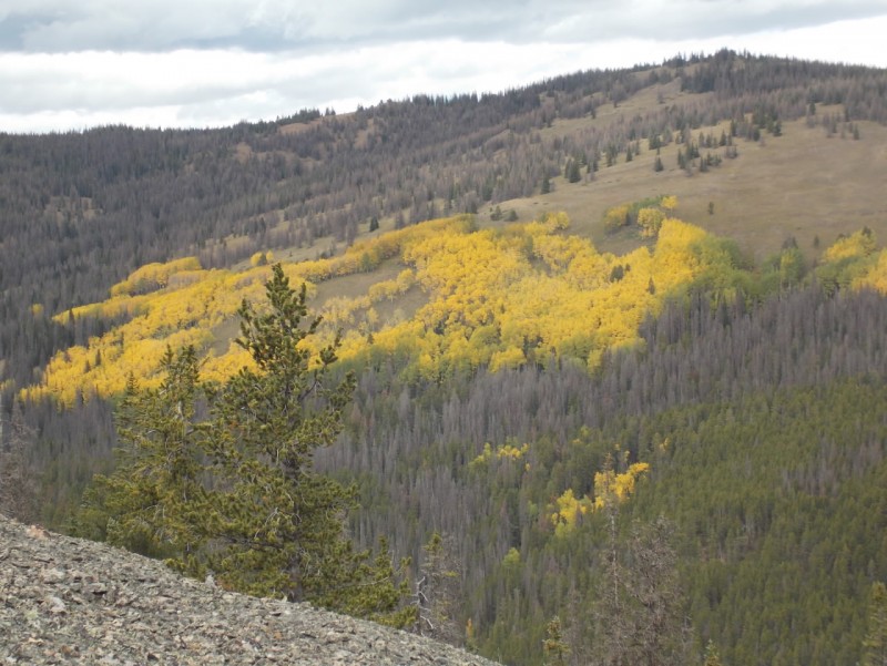
Some nice aspen shots from the summit
And on the way down.
As I don't carry a GPS and my map software doesn't have the entire route, I have put together two maps that hopefully will give you an idea of the route I took.
First, from the TH to approximately where I left the trail.
And then the portion from the kiamia website that shows the route to the summit. Copied from the Kiamia document
While my route is a little longer than the one proposed by the Ravens, it offers the advantage of a easier road and perhaps winter access?
Thanks for taking the time to read this and please be careful out there.
Thumbnails for uploaded photos (click to open slideshow):
for posting this one. I have heard of the name Mt. KIA/MIA but not knowing much about the mountain and being interested in all things history about mountain peaks and people this one and the link was a good one to read.
John - If I put a selfie in a TR, it would break a record for dislikes, I think... :lol: And yeah, I was in Nam but I had it easy compared to most. Thanks for your kind words.
Doug - Thanks, man. I wouldn't have known about this peak if I hadn't run into Barry Raven that day.
Are you watching Ken Burn's new series on Vietnam? If so, does it ring true for you? Nice report! I'll echo John's sentiments about your TR in general, you do hike some random peaks!
Not watching it but I hear it's good. I have mixed feelings about re-living that time in my life. Let's just say that servicemen and women are treated a whole lot better by the folks at home now than they were then. And that is a good thing.
Sometimes the unsung are the true heroes. All the males in my family (above a certain age) have served in one war or another. Some made it out, others did not. Some fought on opposite sides (WWII). I'm glad our treatment of Vets has improved since back then!
Thanks for your thoughts, Otina. Yeah - there are a lot of heroes out there, I'm sure. And I will try to keep writing reports on the out of the way stuff.
Nice report and interesting history... 10/2/2017 9:01am
...and thank you for your service. The father of one of my childhood friends spent 5 years 8 months in the Hanoi Hilton and Plantation POW camps after his F-105D Thunderchief was shot down in July 1967. He was listed as MIA for 18 months -- I guess the North Vietnamese didn't see fit to report the capture -- which obviously was tough on my friend's family. They didn't see him again until March 1973 when the POWs came home. I was always curious about what went on in the POW camps but knew better than to ask.
Sunny1 - Thanks for your kind words. You are always such a positive person and I appreciate that.
MM200 - Anyone who was in the HH is a hero. Period. Glad he got out alive. And you are very perceptive and wise not to ask. Some wounds take decades to heal and if/when he is ready to talk about it, he will.
great report. Your reports are always great, they are informative and give me a lot of excellent hike ideas for the future. And the pics are always on fleek.
Jay, I too knew you'd been in the service but didn't realize you were a 'Nam vet. Thank you for your service.
You are "THE MAN" with a camera in your hand and a trail under your feet. Keep it up bud.
Yeah, Pete - I was there. But I was one of the lucky ones - most folks had it a LOT tougher than I did. Thanks for your nice words.
Caution: The information contained in this report may not be accurate and should not be the only resource used in preparation for your climb. Failure to have the necessary experience, physical conditioning, supplies or equipment can result in injury or death. 14ers.com and the author(s) of this report provide no warranties, either express or implied, that the information provided is accurate or reliable. By using the information provided, you agree to indemnify and hold harmless 14ers.com and the report author(s) with respect to any claims and demands against them, including any attorney fees and expenses. Please read the 14ers.com Safety and Disclaimer pages for more information.
Please respect private property: 14ers.com supports the rights of private landowners to determine how and by whom their land will be used. In Colorado, it is your responsibility to determine if land is private and to obtain the appropriate permission before entering the property.


")
 East end TH")
 Nice little bridge")
")
")
")
")
")
")
 My entry point")
 It's an easy bushwhack for the most part")
")
 There wre a number of these rock patches. I rock hopped some and skirted others")
 Some nice apsens on the other side of the valley.")
 More rock patches")
 Mount Ouray")
 Cool tree")
")
 True summit is visible as a rounded bump not far away.")
 Summit area")
 Ken Nolan AND Teresa Gergen? Wow!")
 Summit (note the summit register in the glass bottle")
 Summit area")
")
")
")
")
 Red dot is the TH")
")
 Copied from the Kiamia document")
 From the KiaMia website")


