| Report Type | Full |
| Peak(s) |
Mt. Sherman - 14,043 feet Snowmass Mountain - 14,105 feet |
| Date Posted | 12/20/2017 |
| Date Climbed | 03/11/2017 |
| Author | Yikes |
| 815 miles to the Snowmass summit - A Winter Anthology |
|---|
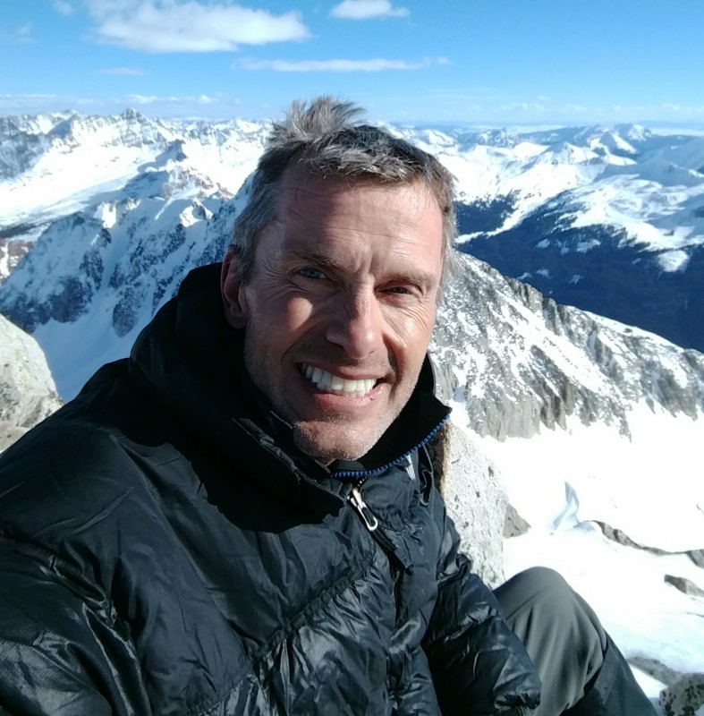 On March 11, 2017, I summited Snowmass Mountain, cold and very tired, possibly becoming the 10th person to complete the 59 Colorado 14ers in Winter. I have a strong suspicion that I'm the 11th (or more)... thinking Joe Winters had quietly finished prior to me. When I started climbing the peaks in winter, I had zero expectation that I would be able to complete more than 40 or so. As a weekend warrior who sits at a desk all week, many of the frosty summits appeared to be far out of reach to mere mortals such as myself. So now finished, I thought I would write a few words on my journey. Disclaimer: 14ers can be dangerous, yadda, yadda, yadda. Lives are unexpectedly lost in the best of conditions. It is difficult to say how much I relied upon good judgement and skill, or just plain luck. I think there was only one time when I slipped on ice and thought "whoa, that was close", but there were many hours spent tiptoeing through dangerous terrain. I'm not one who leans towards "life is precious, think of your family, don't go into the mountains"... but, at the same time I wouldn't recommend this activity for people who have a significant other to support and/or have children at home. Why did I start climbing the 14ers in Winter? I had completed the peaks in summer conditions and I found them somewhat too easy. "That's it?!? I'm done?!?" I'm not any sort of uber athlete, I'm no long distance trail runner, I'm pretty damn slow above 13k. But I just didn't feel challenged enough. Sure, I suffered altitude headaches, tired joints and was frequently exhausted at the end of a long hike. But it didn't feel like I suffered enough. I do enjoy nice, easy hikes in bluebird weather, but I also need to feel like I earned something. The Winter 14ers definitely provided that challenge. There were a few Winter summits where the weather was nice enough to strip to a t-shirt on the summit, but there was much more pain and suffering. Crazy amounts of pain and suffering. I think the strength I bring to the game is not endurance or speed, but being able to hike until dropping with exhaustion, and then getting back up and making a little more progress, over and over again. Partners and soloing A good partner helps, a lot. Not required apparently, since Aron Ralston finished the peaks soloing all summits. But having one or more people to help break trail make things considerably more manageable. When I started the list, I had simply joined up when there was a posting on 14ers.com ("Come join us on Bierdstadt"). The number of peaks where this presented itself was somewhat limited (Quandary, Bierstadt, Elbert, etc). So after completing these âstartersâ, I had to start being more active in looking for partners ("Anyone interested in Yale this weekend?"). This was met with mixed results. In a few cases I ending up with a decent sized group of capable individuals pulling together to split the trail breaking effort. Other times would start with 10 or so "I'm super excited, definitely will be there" responses, dwindling to a few "Probably, but there is the big game on tv..." and finally down to none. I would start up the trail hoping the others would simply be behind schedule and would quickly catch up on the broken trail, but never did. Even more frustrating, having individuals show up but refuse to take their turn breaking trail because it was too hard. To avoid these frustrations, sometimes I just headed out alone. I have soloed nine peaks in winter (Uncompahgre, Wetterhorn, Snowmass(ish), Huron, Handies, Ellingwood, Blanca, Antero, Lincoln). When I go solo, I am very methodical and don't âpush itâ. I proceed with a self-agreement to turn around if I feel uncomfortable. I don't recall having felt any "dang, I really wish someone else was here". I was fortunate to meet Jeff (finisher #7?) as he was climbing Columbia. I wasn't feeling strong that morning and only expected to help break trail to treeline. But we ended up summiting, and I partnered with Jeff for at least half of my winter peaks. It really helped having a motivated partner to drag me out and help push my boundaries. Snow conditions Over the numerous winters, snow conditions varied greatly. Some years experience much greater than average snowpack and other years run dry. It seems like the winters used to be more severe, where weekly storms would wreak havoc on many plans. But this might simply be a case of old man syndrome... "I remember the old days, when the snow was neck deep and winds raged 80 mphâ¦" The big issues with snow are avy danger and additional efforts required to break tail. I spent a lot of time watching CAIC avalanche forecasts day after day, looking for safe zones across the state, learning how long it takes snow to stabilize and reading accident investigations. I have taken in-the-field avy training (where I encountered my only in-real-life avalanche). But I wouldn't call myself very experienced, and often hold my breath crossing likely avalanche paths and sigh relief when gaining the wind-blown upper ridges. Avoiding going immediately after a storm gives the snow time to settle. After a few days, a 48" dump will settle enough to be manageable in snowshoes. Most trenching was knee deep. When it gets deeper than thigh deep, it is very difficult to make forward progress. Fortunately there conditions were rare. Even more rare, a few chest deep sections, typical encountered when crossing steep gullies. Another challenge is spring conditions where wet snow can stick to crampons and make every step a frustrating "bang the crampon with the ice axe" slog. When lucky, the snow can become a hard supporting crust that can make the hiking summer-easy (sometimes easier-than-summer when the snow hides loose gravel). On trips involving camping out, it really helps breaking additional trail after setting up camp. Instead of stumbling around in the dark at 3am trying to find the best route to treeline, you can more easily jump into the pre-existing trench and proceed up the mountain while still half asleep. It usually doesn't help to break any further than treeline, since winds typically pick up overnight and fill in existing trenches. Clothing Good clothing can help prevent turning you into a frozen popsicle. My boots are Scarpa Charmoz, but I'm not too thrilled with them. They are a bit cold mid-winter and the fabric has a tendency to absorb water and freeze solid. I should have bought some warmer boots. One recurring issue was wet socks. I would always bring a second pair, but would still frequently spend long periods of time attempting to dry them out over the stove. I really like my Patagonia Guide pants and my First Ascent jacket. The Tent and sleep (or there lack of) If you need a good 8 hours of sleep to function, Winter 14ers might not be for you. With few exceptions most of the trips were done on 2-3 hours of sleep. Whether leaving Denver at 2am, hanging out in the back of the truck at the trailhead or laying in a tent at 11,000 in below freezing temperatures, sleep just doesn't happen. I'm not sure if my chronic insomnia helped or hurt. I did not use a fancy 4-season tent finding it hard to justify owning a 4th tent. So I alternated between my heavy 3 person and my ultralight. Neither of them provided much warmth, but they did provide a little shelter from the snow. Trying to keep important things from freezing overnight, you end up sharing the sleeping bag with many tems - water, food, batteries, boots. Food Options on food that doesn't freeze as hard as a rock when the temperature plummets are pretty limited. Most food needs to be kept in your pants or jacket pockets where body temperature helps out. Sled (aka pulk) A backpack filled with winter camping gear is heavy, in some cases 60+ pounds. Breaking trail for many miles with that much weight on your back is pretty strenuous, so any way to reduce that effort is desirable. For some winter routes, there are miles of flat(ish) terrain where hauling the pack in a sled is considerably easier than on your back. A simple $20 kid's sled with some webbing attached to a harness suffices. The sled works great in some situations, mostly on snowed-in roads (Maroon Lake, Holy Cross, Lindsey, etc). And the sled works terribly in other situations - side slopes, heavily treed terrain. Having a 50 pound sled roll down into a creek bed time and time again is maddening. Skiis vs Snowshoes While some 14ers share their summer trailheads in winter, others require more mileage due to snowed-in road closures. All of my summits were done with snowshoes. I wish I was able to ski many of the miles, since skiing is considerably quicker. I had even bought a decent AT setup and began backcountry skiing to build up skills. But skis were not meant to be. My messed up feet become severely painful after skiing about 5 miles, to the point of having to rip off the boots to relieve the agony. I'm impressed by those who can ski off the summits, at which point my leg muscles are sufficiently trashed that I can barely stumble off the mountain. The peaks I remember each and every winter attempt with fair detail as to route, weather and effort. Unfortunately I didn't record details from many of the earlier trips, so the exact order I completed the list and names of other hikers who joined me has unfortunately slipped from recall. Scott's "Colorado 14ers in Winter" page on summitpost.org provides a very useful summary of the peaks; any additional thoughts are captured below. While Scott ordered the 14ers by difficulty, my list is sorted by elevation. While a few of the peaks have a winter route which is considerably different than the summer standard route (N Maroon, Capitol, Handies), most are just "follow the summer route" and add in some snow, wind, cold, additional miles⦠and way less people on the mountain. Mt. Elbert It took two attempts to summit Mt Elbert, both on the East Ridge route. The first attempt was a large "14ers.com meetup" where maybe a dozen or so attended. I was a little too eager to summit and spent a little too much time at the front of the pack breaking trail in deep snow. By the time I reached 12,500 I was totally spent and had to turn back. I returned a week or two later with a few others, paced myself better and was able to summit. Elbert is fairly straightforward and gets a fair amount of traffic during an average winter, likely due to its status of being the tallest 14er. The winter TH is the same as the summer 2wd TH, and will add about 3.6 miles. Mt. Massive/N Massive It took two attempts to succeed on Mt Massive. On the first attempt, the winds above treeline were ferocious, and the group decided to turn back instead of being blown off the mountain. That was the right decision, because to get both Mt Massive and North Mt Massive you have to spend a long time on the connecting ridge. It is pretty long for a day hike even in nice weather. The second attempt on 3/15/15 with Mark (MarkMadness) was successful, but was a very long and tiring day. North Massive (the reason the list is 59 and not 58) appears to be "right there" but it took a long time traversing to/from across the long ridge. Back at treeline late afternoon, we encountered spots of unsupporting snow where we sunk waist deep. Suggest becoming familiar with the trail up to treeline. In winter, there can be a maze of tracks by the lakes. Mt. Harvard Summited with Jeff on 12/28/13. This was done via Frenchman Creek. In winter you need to park down by the highway, making the route roughly 16 miles RT. Jeff had gone the prior weekend, breaking trail up the Colorado Trail junction. It was a long hike up the snowed-in road, but fortunately the road was packed down by snowmobiles. Since the lower section was packed down, I neglected to put on gaiters. Once we started breaking trail, I didn't want to stop and dig the gaiters out of the pack, ending up with wet socks and frozen feet. There is nice camping in a meadow right below treeline. We were planning on camping two nights, but didn't want to spend another cold night out and hiked down. Blanca Peak/Ellingwood Point Completed solo on 12/23/14. I had a week off from work, but was unable to find anyone interested in these peaks. So I headed down to Alamosa just to "check things out". I was able to drive about a mile up the Lake Como road before the drifts got too deep. Someone had hiked up to the lake in the days just prior to the last snow, and if careful I was able to find a narrow section of harder snow where I wouldn't sink as deep. The snow was pretty deep above the lake. I thought I would be able to simply walk up the windblown road, but instead wallowed in thigh-deep snow. I was pretty tired by the time I summited Blanca, but didn't want to return for Ellingwood so traversed high on the connecting ridge. Some of the steep gullies had chest deep snow, but it was stable and didn't cause any issues. This area has highly variable snow depth, some years having much less snow than when I was there. La Plata Peak I completed this summit as one of the "14ers.com meetup" trips. There were about a dozen participants, which helped a lot with trenching in the sometimes waist-deep snow. The summit was warm and many stripped to t-shirts. La Plata gets a fair amount of traffic during an average winter. Uncompahgre Peak I had originally expected to hike Uncompahgre with a "Uncompahgre/Wetterhorn meetup", but no one showed up. I returned about 5 years later to complete this one solo on 3/16/16. The drive provided most of the challenge that trip. A storm had hit Monarch Pass pretty hard and I drove to Gunnison at about 10 mph. The road to Lake City doesn't get plowed before 5am, so I huddled in the back of the truck at the Gunnison McDonald's waiting for the night to pass. Heading down CO 149, the plow had only gone in the opposite direction, so I slowly drove mostly in the wrong lane, drifting back to the deep snow when an infrequent car passed. The winter TH is the summer 2wd TH, adding 8 miles RT. The fresh snow provided a nice snowshoe up to the summer TH, but I wasn't sure how stable the snow was on the steeper terrain nearing the summit. But I continued on with the expectation of turning back if any instability was observed. Fortunately the snow was stable and I was able to complete. Crestone Peak/Crestone Needle These peaks were done on 1/26/14 via Cottonwood Creek approach and the Needle-to-Peak traverse. I had though the winter traverse was going to be above my skill level, but it was easier than I expected. Jeff and I hiked up Cottonwood Creek, navigated around the initial slabs and set up camp below treeline where Natalie showed up later that evening. After a few hours of sleep, we hiked up to the lake and ascended the slopes to the left of Broken Hand Pass. The gullies on the Needle had a few sections of ice, but we were able to easily work our way around them. I wouldn't be comfortable downclimbing from the summit, so we had brought a rope and rapped off. The traverse was fairly straightforward, only having to backtrack one short section. We summited Crestone Peak around sunset. Descending the red gully in the dark took a LONG time. There were sections of hardpack. At one spot halfway down, my crampons slipped on hard ice and I started sliding down the gully, fortunately stopping just prior to a drop-off. Jeff and I hauled our snowshoes the entire day, which worked out since we encountered deep snow at the bottom of the gully. Jeff and Natalie spent a second night in their tents, but I had a doctor's appointment earlier the next day in Denver, so packed up and hiked back down. At some point I lost the trench (not sure how that happened) and spent a lot of effort breaking trail before I finally found the trench again. Grays Peak/ Torreys Peak Summited with Greg (finisher #11) on 3/4/12. I had previously snowshoed up to the summer TH several times for conditioning and to become more familiar with the approach. Knowing Greg is considerably faster than I am, I started an hour early and Greg caught up with me near the summer TH. We avoided the Kelso avy slope by crossing lower in the basin. It was a beautiful, warm day in Denver but bitter cold on Gray's summit. Greg was nice enough to "lounge" on Torreys and let me catch up. Winter TH is at the I-70 exit, adding 6 easy RT miles. Mt. Antero A trip where several "I'll be there" individuals bailed without notice, so this ended up being a solo trip. Winter TH is at the summer 2wd TH, adding an easy 9 miles. I had snowshoed up Baldwin Gulch several times prior, so was pretty comfortable up through treeline. I wasn't sure if I should remain on the road, but one of the gullies seemed very stable and I headed straight up. It was a very windy day, progress only made between gusts. Quandary Peak I don't remember if this was a "14ers.com meetup", but do remember there being a crazy amount of people on the mountain that day. I counted over 95 people on the trail (considerably different than Blanca or Wetterhorn, where the closest person was likely 10 or more miles away). Castle Peak/Conundrum Peak Summited on 1/10/16 with Jeff. Montezuma Basin is nicknamed the "valley of death" in winter, so should be handle with some caution. Jeff and I went early season and didn't observe any instability. I'm not sure of the safest path, but we remained near the bottom of the drainage. I'm also not sure if hiking that section in the dark made us more nervous or less nervous. The winter trailhead is at Ashcroft. The first section of road is snowcat groomed and very flat. The road up to the Pearl Pass turnoff is often frequented by skiers using the huts. If overnighting, a pulk might be useful. The upper mountain is pretty straightforward. There was one section nearing the summit where you need to climb steep snow over a large drop, otherwise it was fairly simple. Mt. Evans Completed on 1/22/14 with Britt (globreal). We had considered doing the Sawtooth traverse, but decided to play it safe and limit ourselves to Mt Evans. Winter TH is 1.5 miles below the pass. The road is sometimes slick, but usually isn't an issue. Longs Peak Done with GeoJed during a low-snow year (Jan 2013). We went up through Gates, over Meeker and the Loft, dropping down to the home stretch. It was crazy hot near Clark's Arrow and there was minimal snow returning via the Keyhole route. The only sketchy section was encountering patches of ice on the homestretch. On that day, there was a large group summiting via Cables Route. I'm glad we didn't join them because their group size left them on the summit as darkness fell. I think it took them a few more hours to complete. Mt. Wilson/El Diente Peak I had jealousy read several Winter Traverse trip reports the prior winter. Based on Gladbach's TRs I believed two multi-day trips would be required. Jeff talked me into the traverse as a single day push on the last day of Winter 2016. Winter TH is on CO145 near Lizard Head Pass. Many people complain about hiking into Slate Creek, but we didn't have any issues. Once in Slate Creek, it is a straightforward but long snow climb up to the summit. I didn't find the traverse to El Diente very difficult, but it did take a fair amount of time with all of the caution required. We rapped down the Class 4 crux, but I didn't feel the rope was absolutely necessary. We returned to the car with an hour (or two) to spare before the spring equinox. Mt. Democrat/Mt. Lincoln/Cameron/Mt. Bross What should be a single straightforward day took three separate attempts before I finished these four summits. I joined up with a large "14ers.com meetup" on the first attempt, and was feeling very weak. Not wanted to slow the group down, I skipped Lincoln and headed over to Bross. On the second attempt (with Jeff and Jennie) we summited Democrat in a white-out and decided not to risk the other summits. My third trip was soloing Lincoln from Quartzville (parking at Moose Creek). It was a very easy "just hike up the road to the summit" trip. Mt. Shavano/Tabeguache Peak Completed on 1/18/15 with Mark (Mark Madness), Cynthia, and brerrabbit. Residing in Salida for a few years, I expected to complete these peaks earlier on. The winter TH is Angel of Shavano, whose access is paved and well plowed. I had tried a solo attempt over Esprit Point but deep snow near treeline forced me to turn around. I had also gone solo up the East Ridge, but was too uncomfortable with snow conditions at treeline to continue. The final attempt was East Ridge (above the summer traverse). There are some slopes near treeline where you need to exercise caution. Mt. Princeton I completed Mt Princeton as a "14ers.com meetup". There were about a dozen participants and it was one of my few hikes with Gladbach. In winter, you need to park at the bottom, adding 6 miles R. Most of the mileage is on the road, but shortcuts through the trees on the highest switchbacks, avoiding some avy slopes. I was exhausted when reaching the ridge at 13000, ready to turn around, thinking "I'm done with these Winter 14ers, I'm not strong enough". ScottP provided the necessary motivation, saying to simply go slow, take frequent breaks and not worry about keeping up with faster hikers. I think if ScottP wasn't there, I would have never continued to work on the list (Thanks Scott!). Mt. Yale It took two attempts to complete Mt Yale. The first attempt, I posted "Anyone interestedâ¦" on 14ers.com and received a few affirmatives. We attempted via East Ridge, but the other individuals were daunted by the deep snow, leaving me to break trail on my own. By the time I reached treeline, I was exhausted and called it. The second attempt was a "14ers.com meetup", maybe 6 people. Everyone took turns breaking trail, and we didn't have any issues summiting. Kit Carson Peak/Challenger Point Summited on 2/23/14 as a 3 day trip with Jeff and Rob. Spanish Creek approach. We ascended too high above the "trail" and spent considerable effort dropping back down through the deadfall; the trail was much easier to follow when heading back down. We set up camp in the trees below the Prow. Ascended the South gully. The Avenue was pretty sketchy, at one point having to brush snow off some rock ledges to find passage. Maroon Peak Completed on 2/27/16, with Jeff (Mickeys Grenade), Ryan (kushrocks), Matt (I Man), Lee (mountainfreak241), and Rob (XterraRob). Probably the second most intimidating peak in winter (after Pyramid). Many people ascend the Bell Cord in spring, when stable snow conditions are likely. In winter, you hold your breath for 5+ hours and hope the mountain doesn't slide . After the 26 hour single day on Pyramid, I wanted to break this trip into two days. I brought my mtn bike, expecting to make easy progress to/from Maroon Lake, but the warm temperatures made the road very slushy. It was near impossible to ride the bike, so ending up pushing it up and down the road. I should have left the bike at home and taken a sled. I camped right below the Cord, passing time spending hours drying wet socks over the campstove. Jeff/Ryan/Matt/Lee/Rob did it as a day trip and met me at my camp. The Garbage Chute was a little challenging with a large section of ice near the top (ice tools would have been more usable than a mtn axe). We continually took 10 minute turns kicking steps up the couloir, reaching the saddle soon after dawn. From the saddle, we ascended a short, steep cliff with loose rock which can be easily bypassed. We were able to glissade down most of the Cord. Mt. Belford/Mt. Oxford Completed on 1/10/15 with Greg (Summit Lounger). We were fortunate to be able to drive up the snowy road and park a mile short of Missouri Gulch TH. Someone had gone up the trail recently, so we followed the trench. Mt. Sneffels Summited on 3/13/16 with Jeff and Michael. Went down a day early and enjoyed lounging around in Ouray. The road is gated down low, so you need to add another 7 miles or so of road. Due to warm late winter conditions, the road was a muddy mess. We camped near treeline and had an enjoyable summit day. Capitol Peak Summited on 12/31/16 with Jeff and Will (mountainstoke). I would suggest hiking up to Moon Lake in summer to become familiar with the trail. We went through the ranch so we could take their bridge across Snowmass Creek. The hike up to Moon Lake was pretty miserable, deep and steep. Camped in trees, not at the lake where the wind was fierce. We probably had the best possible conditions for this mountain. The snow was supportive up to K2. We used a rope to simul climb, and to rap off the crux. Pikes Peak Summited on 3/6/11 with a group of 5 or 6 from Crags. It was a cold and windy day, which I believe is typical for Pikes. This was the only 14er that I have not hiked other than in winter. Snowmass Mountain Snowmass was my Winter Finisher. Hiked up to summer TH with Jeff (who was there for Haggerman). Used a pulk to drag the heavy camping gear, but crossing numerous avy slides made it frustrating. After setting up camp, we broke trail up to Geneva Lake and returned to camp. The next morning, I split off from Jeff at the lake and made my way up to the west slopes. There are about 4 gullies to choose from, not sure if they vary much in difficulty. It was a warm day, so the snow stuck badly to the crampons, forcing me to hit them with the ice axe almost every step. I was very slow and tired, fighting to desire to turn around. I'll admit to tearing up a little when reaching the car, having completed all 59 summits. I ended up getting a bad cold that took a month to recover from. Sunlight Peak /Windom Peak/ Mt. Eolus/North Eolus 6 day trip with Jeff in nice Spring-like weather (mid-March 2014). We took the train from Durango, where you get dropped off at Cascade Wye. The 5 mile hike along the river was icy, but there wasn't much snow. The snow was a lot deeper when heading up Needle Creek and made for a tiring approach. We set up camp and broke trail up to 12500. The next morning heading up to Sunlight. There was some collapsing on the slopes leading up to Sunlight but nothing was sliding. We added on Windom that day to avoid an additional hike back up to the lakes from camp. Since we had two peaks completed, we took a rest day where I hung at camp and Jeff broke trail for Jupiter. The Eolus face used in summer looked absolutely miserable, so we stayed on the highly exposed ridge which provided easy rock scrambling. The next day, we summited Jupiter and packed up camp. We were ready to get the trip over with, so skipped camping out along Needle Creek and hiked back down to the Cascade Wye. Mt. Columbia Summited on 2/11/12 with Jeff (Mickeys Grenade), Don (chambliss). This was where I met Jeff for the first time. I wasn't planning on summiting, but thought I would help break trail for Jeff and Don. We were able to drive to the CT junction. There was some deep snow ascending through the trees, but then it is just a long ridge walk. Missouri Mountain Summited on 1/2/12 with (Jed) GeoJed and Ryan (Dchild10). We were able to park at Missouri Gulch. I was recovering from a bad cold, so was feeling pretty slow and weak. Jed/Ryan went over to Iowa/Emerald while I headed down. Humboldt Peak Two attempts; first time strong winds and a sick hiker turned us around at 12,500. Second attempt went well. The ridge is pretty steep in the trees and mellows out at treeline. Mt. Bierstadt I believe I hiked this as part of a "14ers.com meetup". Must have been pretty boring, because I can't remember much about this trip. Handies Peak Soloed on 2/19/17, Handies was one of my final peaks. There was an approaching storm, so I started around 10pm and hiked all night. The road from Cataract Gulch to Boulder Gulch was easy rolling hills. The snow conditions were very stable with supportive crust, so ascending the drainage was like walking up a skateboard park. There is a short crux on the ridge to pass some towers, but it isn't very challenging. Suggest hiking up Boulder Gulch in the summer to familiarize yourself with the trail. Culebra Peak Hiked on 2/3/13 with about 20 others on the mountain. Since Culebra is privately owned, you are at the whim of the owners as to when (or if) you can climb in winter. Many winters, they only open the mountain for a single day (or two). If the weather turns bad on the scheduled day, it is possible no one is allowed on the mountain that year. I was moving slow, so simply followed the trench. Mt. Lindsey Winter TH is below the ranches, making the trip 22 miles RT. First attempt was solo; more of a "I'll see how far i can get" and I ended up turning around just before the summer TH. It was a little spooky crossing the landslide in the dark since I wasn't expecting it to be so large. The second trip was with Jeff, Greg and Will on 1/29/17. We had beautiful weather. The road initially alternates between dry and drifts. Sled helped hauling the camping gear on the long road. Ascended via Northwest Ridge to avoid any avy danger in the gully. Little Bear Peak On 2/8/15 with Mark (MarkMadness) via the SW ridge. We were able to drive to the winter TH; didn't expect any issue with private property since it was mid-winter. I found the Mamma Bear to Little Bear traverse fairly straightforward in the dry conditions. Mt. Sherman I believe this was my first winter 14ers. The trip was not very memorable. Additional 5 miles in winter. Pyramid Peak Completed with Jeff on 2/13/16 as a single day 26 hour trip. I found this to be the most challenging winter summit, spending many hours in danger terrain. There was bulletproof snow in the gully which prevented kicking steps, and we had to rely on the crampon front points and axe. Higher up, we traversed to the the left for relief, only finding soft snow covering ankle twisting loose rocks. There were several scary traverses across the upper avy bowls, hoping the snow was stable enough not to slide. We ended up summiting in the dark. We had brought a rope for the Class 4 crux, but it was easy enough that I didn't find the need to place any pro. However, the rope was useful in rapping that section in the dark. The hours long descent was face-in on front-points with chunks of ice raining down. When we finally got back to the truck, we fell asleep in the front seats in less than 5 minutes Wilson Peak Winter route is south slopes from Cross Mountain Trail. The trail is heavily traveled. It is a nice hike, but crosses lots of slopes, so you need to go during low avy danger. One fall trip, I had turned around at the false summit since I didn't have the gear to comfortably continue. With ice axe and crampons, the crux is fairly easy when you take your time. Highly recommend staying a few miles down the road at the very reasonably priced hotel in Rico instead of sleeping in a cold vehicle. Wetterhorn Peak Completed solo on 3/16/13. Winter TH is back at Nellie Creek 2wd TH, so you need to add 11 miles RT on a flat road. It was one of those trips where people said "will definitely be there" and no one showed up. Being slow, I started up the long road expecting others to catch up, and set up camped near the summer TH. It was pretty warm and there were some recent wet slab avys on the steeper slopes. There was some deep snow immediately below the notch, but the crux was melted out and no more difficult than in summer. When I got back to camp, I had trouble getting the stove to light, so decided to hike out. San Luis Peak Single day trip with Greg and Jeff. Parked at the 503/504 intersection, and hiked up the snow-packed road past the Equity mine and up to the saddle at 12,300. We elected not to attempt a high traverse in order to avoid some known avy slopes. The drop down to the valley floor at 11,000 was steep and deep. Trenching down the hill in waist deep snow was manageable; I can't imagine breaking a trench up that hill. The hike up the south slopes to the summit was straightforward. But I was suffering severe foot pain, so it was a long day. North Maroon Peak Summited on 12/22/16, as a 3 day trip with Jeff and Will (mountainstoke). This peak is rarely done due to the lengthy miles (likely the least completed Winter 14er). This was the first trip where I used a pulk to haul my gear. I found it very frustrating, as the sled would frequently slid off the trail and get hung up in trees. Jeff and I hiked up West Snowmass creek about a mile past the log jam, where we found Will crashed in his bivy. After we made introductions and set up camp, Jeff and I continued to break trail for another 1.5 miles up to treeline. We weren't able to find an easy route, frequently having to weave around tight trees and losing elevation to bypass sections of cliff. Once we reached the last of trees, we returned to camp for a few hours of sleep. The couloir to Gunsight is near the very back of the valley, much further than I expected. The only real snow climb was a short, easy slope up to Gunsight. There is a short, spicy traverse across Gunsight Tower, but then the ridge remains surprisingly easy to the summit. If not for the mileage, I would think this would become the standard summer route. Mt. of the Holy Cross Summited on 3/4/2017 as a 3 day trip with Jeff. Winter TH is down by the highway where the road is gated. Tigiwon Road is groomed for snowmobiles, so I would recommend hauling gear on a sled. Trail breaking didn't start until the summer TH. The snow was pretty heavy and the sled wasn't sliding through the snow, so I heaved the heavy pack on my back and we broke trail to 11000, where we set up camp. After the tents were set, we immediately broke trail again, up and over Half Moon Pass, and down to the creek. This section would be difficult to navigate in the dark, with numerous sections of cliff. Our route switchbacked north of the summer trail, crossing steep hillsides and gigantic boulders, and we had to hike up the creek to regain the trail. We finally completed our "pre-trenching", turning around where the trail turns south and starts climbing up the steep North Ridge. It was a long 14 mile day with lots of trail breaking, but it helped considerably on summit day. The next morning we took advantage of our trench and dropped down to the creek. Natalie and her friend caught up with us as we neared the end of our trench, and they shouldered the trench breaking duties up to treeline. That ridge is very steep in the trees, and I was impressed the skiers could ascend and descend so expediently. Jeff is also working on Winter Centennials, so we added on the additional mileage over to Holy Cross Ridge. We got back to the tents very late and exhausted; it would be difficult to complete this in 2 days unless you are very strong and/or ski out the long road. Huron Peak Completed solo, on 1/26/2013. Huron is pretty far back from the pavement and doesn't see a lot of winter ascents. Round trip mileage may vary...greatly. I highly recommend doing this in a low-snow year where you might be able to drive as far as Winfield. Many years you can drive to Missouri Gulch, but some years you can't make it past the last ranch near the reservoir. You could be looking at possibly adding as much as 20 additional miles, making this a possible multi-day trip. I ended up being very luck and the road was passable to Winfield, so only had an additional 4 miles to tackle. Some other party had also taken advantage of the opportunity and a trench was already in place, so this peak ended up being fairly easy. Sunshine Peak/Redcloud Peak Completed on 3/17/12, with Natalie (SnowAlien) and Adam (awilbur77). Winter route is typically East Ridge, starting directly across from Mills Creek campground (which is a nice place to camp the night before). The trail is not very obvious, and I would suggest scouting out the first mile or two in the daylight to become familiar with the route. The slope faces south and can be fairly dry; any deeper snow is usually at treeline. I wasn't feeling very strong that day, and was very slow traversing back and forth on the summit ridge. On the return, I thought I would skip the extra elevation regaining Sunshine, but found crossing the steep gullies to Sunshine's NE slope to be sketchy. Overall Stats Easiest summer routes 460 miles 192k vert My winter trips 742 miles 263k vert That's it. See you on the beach! Thumbnails for uploaded photos (click to open slideshow):
|
| Comments or Questions | |||||||||||||||||||||||||||||||||||||||||||||
|---|---|---|---|---|---|---|---|---|---|---|---|---|---|---|---|---|---|---|---|---|---|---|---|---|---|---|---|---|---|---|---|---|---|---|---|---|---|---|---|---|---|---|---|---|---|
|
Caution: The information contained in this report may not be accurate and should not be the only resource used in preparation for your climb. Failure to have the necessary experience, physical conditioning, supplies or equipment can result in injury or death. 14ers.com and the author(s) of this report provide no warranties, either express or implied, that the information provided is accurate or reliable. By using the information provided, you agree to indemnify and hold harmless 14ers.com and the report author(s) with respect to any claims and demands against them, including any attorney fees and expenses. Please read the 14ers.com Safety and Disclaimer pages for more information.
Please respect private property: 14ers.com supports the rights of private landowners to determine how and by whom their land will be used. In Colorado, it is your responsibility to determine if land is private and to obtain the appropriate permission before entering the property.


