| Report Type | Full |
| Peak(s) |
Mt. Bierstadt - 14,066 feet Mt. Democrat - 14,154 feet Mt. Lincoln - 14,293 feet Mt. Sherman - 14,043 feet Mt. Blue Sky - 14,268 feet |
| Date Posted | 07/16/2012 |
| Modified | 07/17/2012 |
| Date Climbed | 07/13/2012 |
| Author | Craig Cook |
| Seven (and 9/10ths) 14ers in Five Days: A Flatlander's Adventure |
|---|
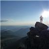
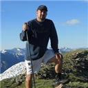
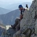
Note: This is a fairly long trip report, since it's a week's worth of hiking, but I figured this was better than cluttering the page with five separate smaller ones. I hope you enjoy! PrologueAs a flatlander, I've only had the opportunity to hike one 14er during my wife Kellie and my trips to Colorado. Pikes Peak (twice), and Grays Peak last September. Since December, I had been planning a week-long trip this summer to do some multi-day hiking. With Kellie and I expecting a son at the end of this month, she couldn't make the trip with me, so I planned on going solo. My mom, however, told me she wanted to try hiking some 14ers, and I certainly didn't mind having some company. My original plan was to hike nine 14ers over the course of six days. The final outcome ended up being seven summits in five days, with a failed eighth summit due to weather. My mom also notched her first two 14ers, so a big kudos to her! Monday, July 9 - Beautiful BierstadtHeading from Kansas City to Georgetown on Sunday, July 8, my mom and I stopped for an early dinner at Beau Jo's in Idaho Springs. We ordered a 3 lb. pizza with pepperoni, hamburger, and mushrooms (along with the salad bar) so we could take a couple extra slices with us the next morning. It was delicious, as usual. With a bad weather forecast for Monday, we decided to try Bierstadt Sunday evening right after dinner. However, we hadn't even made it to the creek yet when a huge, ominous wall of fog came pouring over both Mt. Spalding and through the Pass. We hightailed it back to the car and drove back to the Super 8. Looking down Guanella Pass in the evening, before the fog  Despite the bad forecast, Monday morning brought clear skies and we headed back to the Bierstadt trailhead. On the way, we had to stop on the road for a momma moose and her baby to cross the road, which was very cool to see. We were the second car in the parking lot, and set off right before 6 a.m. Scott Gomer Creek was full and moving at a very brisk pace, and the rocks were wet, so we proceeded across with caution. At the point in the trail where you clear the willows and have an amazing view of the Sawtooth, my mom decided she was going to stop and wait for me. She felt okay, but could see the summit and knew she wouldn't make it. Looking back to the trailhead  As I quickly made my way up the trail, I (and another group of about 5 people) heard what sounded like a long, massive peal of thunder. We all stopped dead in our tracks and looked back in confusion at the non-threatening looking clouds. Then a dust cloud puffed up from below the Sawtooth, between the gully leading to Evans and the exit ramp of the Sawtooth. My mom reported later that there had been a large rockslide, which she had a front-row seat view of. I don't know what caused it, but it didn't appear to be in an area where hikers would have been. After determining the noise wasn't thunder, I proceeded up to the ridge, where I encountered a sea of clouds on the Abyss Lake side of Bierstadt. I also got to experience my first taste of class 2 scrambling on the large boulders near the summit. Nothing difficult, but still a lot more fun than simply walking on a trail! A sea of clouds  The route ahead  Abyss Lake  Class 2 scrambling near the summit  I summited with about 7 other people at roughly 9:15 a.m., and had hardly pulled a slice of pizza and a Gatorade out of my pack when some serious clouds started rolling in. All of us quickly snapped a few pictures and grabbed a couple bites before deciding it would be wise to get off the summit soon. On our way down, we probably passed a hundred people on their way up. Hopefully everyone was safe. On the summit, with clouds rolling in  Still looks decent on the Guanella Pass side  Where did Abyss Lake go?  Beating possible storms  Sunny on the trail, but surrounded by clouds  Clearing up over Bierstadt  Or not...  I met back up with my mom, who was being attacked by flies, and we quickly made our way back down the trail. As the weather cleared, we stopped, had some pizza, and took in the views. Bierstadt sometimes gets a bad rap because it's so popular, but it is an absolutely beautiful area. I think I could do this hike over and over. By late morning, the creek was much easier to cross, and the rocks were mostly dry. We spent the afternoon driving to Fairplay, where we had dinner at Mason's High Country Barbeque. We both tried the chopped beef sandwiches, and here's where I have to admit to being a bbq snob. I've lived in Kansas City my whole life, so I'm used to the BEST bbq in the world. The sandwiches at Mason's were decent, but it just wasn't like home. They did, however, have some amazing sweet iced tea - I even had to go back and get another two cups the next day. Much easier crossing on the way down  A beautiful area  One last look - still confused by the weather  Tuesday, July 10 - Sherman surpriseAfter feeling down by her performance on Bierstadt, I was proud of my mom for getting right back after it the next morning. I parked the 2WD Impala in the parking area near the Leavick site, and we were grateful for a couple of young gentleman who offered us a ride up to the gate. If either of you guys are 14ers.com members, thanks again - my mom says she wouldn't have made it otherwise! Our goal for the day  Old mining building on a bluebird day  I found a starter home for Kellie and I  The trail for Sherman couldn't be any more different from Bierstadt. Working our way up to the Sherman/Sheridan saddle, I feared twisting an ankle on every step. Methodically working our way up, we reached the saddle and worked our way up the ridge. Bill, on this site, labels the exposure on the ridge as class 2 out of 6. In my previous three summits, I'd never had any exposure. It didn't bother me, and was pretty fun actually, but it was certainly a new experience! My mom did a great job pushing up the windy ridge, and after numerous false summits, could claim her first 14er! On the saddle  How many false summits are there?  My mom's first 14er, and my fourth  Looking down at the Iowa Gulch trailhead  Peering out at Gemini Peak  After a nice, long break at the summit, it was time to begin the arduous descent down the ridge and talus below. Right before reaching the trailhead gate, I saw movement above us and to the right. My mom and I stared at the animal moving down the slopes toward us for a minute before realizing it was a bear! I tried to take a quick picture of it, but the zoom on my iPhone made it to blurry to see anything. We slowly turned around and kept walking past the gate. Unfortunately, by the time we returned to the gate, there was only one vehicle left, and nobody was around. I kept glancing back at the bear, but it had stopped and wasn't paying any attention to us. We ended up hiking the long, hot road back down to the car. After returning to Fairplay, we decided to give dinner in Buena Vista a shot. We drove through town, eventually picking out Eddyline. We each had a salad and shared the Meat Pizza (minus the jalapenos), which was delicious. I also noticed Eddyline is the place that serves the Crank Yanker IPA, which I've heard about numerous times on this site. How ironic. After dinner, we went over to the Alco and Family Dollar for Aloe Vera and a bandanna. Even with sunscreen, I had a nasty sunburn on my neck after two days. The $1.07 I spent on the bandanna may have been the best purchase of my life. Headed down the road...  My poor attempt at a flower photo  Wednesday, July 11 - Depressing DeCaLiBronAfter a successful Sherman summit, my mom decided to take the next two days off, and read at the trailheads while I hiked. Heading up Kite Lake Road, I was forced to park at the last switchback before the parking area due to a rather large, washed-out ditch going all the way across the road. Still, after walking Sherman's road the day before, it was an easy hike to the trailhead. I noticed both an Acura and a Subaru Impreza made it past the ditch - whoever you are, well done! You have more guts than I did! Early morning sunlight hitting Democrat  Kite Lake sprung a tail near the trailhead  Another beautiful morning  I started off at 6 a.m. on the trail to Democrat at a brisk pace - in fact, it was probably too brisk. It didn't take long before I started feeling winded and my legs were sore. I'm guessing it was a combination of my third straight day of hiking, and moving too fast before I was warmed up. Either way, depressing image #1 came in the form of Democrat's false summit. I knew there was a false summit, and I felt like I wasn't getting any closer to it, let alone the real one. I started thinking maybe knowing about a false summit is worse than being caught off guard by one. That idea would soon change. The Democrat/Cameron saddle...finally!!  This part took me forever  Marmot posing for a photo op  At some point between the Democrat/Cameron saddle and the false summit, I got off-route. The trail was faint and while I first thought it went up closer to the right side of the ridge, I saw 4-5 people above me way off to the left. I started veering to the left as well, and soon found myself way off-route. I figured that the trail would eventually have to cut back to the left, so I just started doing some class 2 scrambling straight up. It wasn't difficult, but some of the talus in this area is pretty loose, so if you get off the trail (or even if you're on it), watch your footing. Lesson learned: watch the route and not other hikers ahead of you. After regaining the trail, I finally topped the false summit, and from there it is a breeze to the true summit. I had the very windy summit of Democrat all to myself at 8:30 a.m., and am sad to say I did not see any toasters up there. I quickly called Kellie back at home, and headed back down to the saddle. Beautiful views at the summit  Looking out to Cameron, with Lincoln poking above in the background  Looking down at the dreaded false summit  Depressing moment #2 came while on the summit of Democrat. Looking over to Cameron, you realize just how much elevation you have to lose and regain. It never looked that bad in the route pictures I've seen. I kept telling myself that once I reached Cameron, the rest of the route would be a breeze. Then came depressing moment #3, and when I made up my mind about false summits. I knew about the false summit to Democrat - what I didn't know is that Cameron has what feels like about 20 false summits! I wasn't expecting that. And yes, not knowing about them is definitely worse. Every time I thought I'd made it to the top would simply bring more false summits. After an hour and a half, I topped out on Cameron at 10 a.m. Once again, I had the summit to myself. A nice view of Quandary on the ridge to Cameron  Heading up Cameron, looking back to Democrat  Atop Cameron, with Lincoln in sight  The trip from Cameron to Lincoln was easy, and I reached Lincoln in just 30 minutes at 10:30 a.m. Mt. Lincoln was easily the highlight of the trip, from hiking over the bump before the summit, to climbing up the true summit, to the views from the top. The only scare I had was a steep, narrow chute right below the Lincoln summit. It's easily avoidable, but it caught me off guard, and freaked me out. It's on the right side of the trail, right below the summit, so you may want to watch for it. For the third time that day, I was alone on the summit. The sun was shining, there was a nice cool breeze but it wasn't windy, and I soaked it all in. A group of three people were heading up from the Quartzville Creek trailhead, but were still far below. I sat down, ate a PB&J sandwich, drank a Gatorade, and relaxed for 20-30 minutes. Sadly, I knew I needed to get moving on to Bross, and said goodbye to Lincoln. Narrow chute to the right of the trail  Atop Mt. Lincoln  Relaxin' on Lincoln  A nice view of Quandary from Mt. Lincoln  Mt. Bross, as seen from Lincoln  About halfway across the ridge from Cameron to Bross, I noticed some storm clouds moving in behind me. Stuck in no man's land, I booked it over to Bross. I will admit here that, yes, I summited Bross. I spent roughly 30 seconds on the summit, took two pictures, and returned to the bypass trail. To be honest, I have no desire to return to the DeCaLiBron (except Lincoln, which I think I'll do from Quartzville Creek from now on), and I especially have no interest in returning to Bross if and when the trail ever "opens". I also determined that if I was going to suffer descending the infamous scree slope off Bross, I was darn well going to summit it first. Just my thoughts - I'm not telling anyone else what they should or shouldn't do. Kite Lake on the way to Bross  On Bross' summit, with Lincoln on the left and Quandary behind on the right  Ascending Bross gave me my first scare of the day. I read here on 14ers.com awhile back about a guy on a four-wheeler with a shotgun, threatening people who went up Bross. About halfway up the "closed" trail to Bross, I saw three four-wheelers shoot up to the Cameron/Bross saddle. At 11:20 a.m., it was my fourth summit alone, almost unheard of in the summer on the DeCaLiBron, and I couldn't enjoy it. However, back at the bypass trail, I saw it was just a group of guys playing around. Meanwhile, it was time to descend Bross. This was both depressing moment #4 and scary moment #2. Depressing because the scree mess that is the descent route royally sucked. It took me over an hour to return to the trailhead, as I finished at 12:40 p.m. Scary because I took one fall (and numerous close calls) and hurt both my left arm and leg. Two girls hiking just in front of me also had some close calls. For those contemplating the DeCaLiBron, be careful. Bross' scree slope is a steep, extremely loose pile of crap. Remember that lesson I said I learned about following the route, not other hikers? Well, it took me two times to truly learn it. Near the bottom of Bross, the rocky trail appeared to hook to the left around the base of another mountain (South Bross?). There was a smaller, faint (but obvious) trail that cut to the right leading towards Kite Lake. I could see the two girls hiking down below to the right and took the faint trail down. I started questioning my decision when I had to hop across rocks to avoid stepping on the tundra. Eventually this faint trail joins up with the real trail, and there is a sign there that says the area is closed for restoration. However, there is no sign where the trail branches higher up where I cut right. So be careful about this area when descending Bross. At least I can say I didn't step on any tundra. The only good thing about going down Bross is the cool little waterfall you see near the bottom. It is a beautiful area, and a nice reward after going through scree hell. I quickly made my way back to the car, returned to the hotel, then we set out for dinner in Manitou Springs. Driving east along hwy. 24, we saw a portion of the burn area from the fire. So sad to see, and we only viewed the edge of it. We had dinner at The Mason Jar, where I dined on fried catfish, fries, and a salad. Good sweet tea here as well. Then we made the long drive back to Fairplay. Waterfall at the bottom of Bross  Back at the trailhead  Thursday, July 12 - Cancelling Quandary (then uncancelling, then cancelling again)After three straight days of hiking, a very sore left knee and arm, and a late return from Manitou Springs, I shut off my alarm at 4 a.m. Thursday and decided to skip Quandary. My mom and I eventually got up at 7 a.m. and walked out to the free continental breakfast. After three days of Smart Start cereal and a banana, I let myself go and had a bowl of Fruit Loops. We then drove over to the Java Moose, where I got a cup of hot chocolate and my mom had coffee. Not exactly the breakfast of champions. Our plan was to walk around Breckenridge, relax, then drive back to Georgetown. However, it was such a beautiful day that as we neared Hoosier Pass and Quandary Peak, that my aches and pains disappeared. I made an impromptu decision to attempt Quandary despite the late morning hour, and we turned off and parked behind the line of cars on the road to the trailhead. I started out at 10:15 a.m., which I would typically never do, but the weather was beautiful as could be. That would soon change. The trail starts you uphill in a hurry, but I made good time through the woods up to treeline. Here I encountered my first ever mountain goats. They grazed for a bit, then one followed some guys down the trail. I asked people as I ascended about the weather and everyone said it was beautiful. My spirits were high - I was going to summit Quandary despite my late start. What a bonus! Mountains goats enjoying brunch  Up and up and up...  There's the summit!  Making good time  After crossing the flat portion above the false summit, I caught up with a mother and daughter and hiked with them for a bit. As we got closer and closer to the summit, the weather took a sudden turn for the worse. Storm clouds built up out of nowhere, and we could see strong rain coming down just to the north of us. We debated amongst ourselves whether we should continue or turn around. At first, we kept going, but the storm clouds kept looking bigger and darker. Just before reaching the summit, at 12:20 p.m., we all decided to turn around and wait to summit another day. It was hard, but talking later at the trailhead, we all agreed we made the right decision. It looks so nice...  ...until you turn to the north  The turnaround point  My guess is that we might have made the summit safely, but we were worried about being stuck in the flat area between the false summit and the true summit, which appeared very exposed to the weather. That ultimately influenced our decision. On the way down, I pulled away from the mother/daughter, and passed about 10-15 still ascending at nearly 1 p.m. Some were just reaching the false summit at this point, and it had started raining. I mentioned the bad weather and wished them luck, then kept making my way to treeline. As I reached treeline, I heard some loud thunder, and heard more for the remainder of my hike down. The mother and daughter told me later at the trailhead that it poured on them across the flat area. I sincerely hope everyone who was still going up stayed safe. I've never had to read the weather on a 14er hike before, so I found this to be a great lesson. With a wife and daughter at home, and a son on the way, my risk tolerance is low. I hated not making the summit (my first ever failed summit bid), but approve of the decision. It was a learning experience, and sure beat walking through Breckenridge - plus I got to see a bunch of mountain goats! Another mountain goat on the descent  And a baby mountain goat working his way up the mountain  At treeline, with the storm moving in  Hope everyone up there was safe  "Be aware of changing weather conditions."  After making it back to the car, my mom and I headed back to Georgetown. After stopping at the Super 8, we went on to Idaho Springs for dinner at Tommyknockers. I enjoyed a tasty buffalo burger, wonderful onion rings, and a salad. I also bought a 4-pack of root beer in glass bottles to take back home. I tried one tonight and it was wonderful. Friday, July 13 - Easy Evans (relatively speaking)Friday brought our last day of hiking. I originally planned to do Torreys on Friday, and Evans via Summit Lake Saturday before we drove home. But being tired and sore, I gave up the idea of Torreys, moved Evans up to Friday, and then planned to hit up the Rockies game Friday night in Denver. The drive to Summit Lake was beautiful, except my mom being freaked out by the sheer drops off the road and no guardrails. I was confused about the Mt. Evans road fee, as there was nobody at the entrance shack at 6:30 a.m. and the pay lanes were coned off. We went on and parked at Summit Lake. Apparently, if you don't pay the fee, you can't use the facilities, as they had placed guard bighorn sheep at the men's room. Restroom guards  I wasn't sneaking in this way, either  I ended up using the women's restroom, and my mom and I head up the road to the northeast face. The trailhead isn't obvious, but it's still easy to find if you're looking for it. We headed up the steep but easy trail until halfway up, when it turned into a lot of loose scree that had multiple branching dead-ends. If you somehow get off route, just aim for the smiley face above you. The "smiley face"  A closer look  My mom, looking thoughtful  When you reach the smiley face, you're in the middle of a parking lot, which even though I knew it was there, still felt bizarre. From there we ascended the easy switchback to the actual summit, where I played on the summit blocks. I absolutely loved the views from here, gorgeous doesn't really begin to describe it. It was my ninth 14er, and my mom's second. Along the switchbacks, we heard what sounded like a cat meowing. It was surreal, as we kept hearing it, but saw nothing. My mom commented that she hoped it wasn't a lost baby mountain lion. Eventually, we saw the culprit - way below, down along the road, a couple baby mountain goats were running after their parents, and making those bizarre noises. No lost mountain lions this time. The final push...from a parking lot?  The quick way back to Summit lake  Me and my fashionable bandanna  14er #2 for my mom  Playing on the rocks  Looking out to Mt. Bierstadt  Summit Lake from above  Grays & Torreys in the distance  We headed back down, and I met a forest ranger in the summit parking lot. I asked him about the $10 fee, and he said there would be an envelope on our windshield and to just pay on the way out. He said he looks like the bad guy because people like us show up early to hike like we should, and nobody is there when we start up the road, so he has to put envelopes on our windshield. Anyway, the guy was very nice, and we paid on the way out. Before leaving, though, I had to head over and check out the Chicago Lakes area. Beautiful! We also met an entire herd of bighorn sheep. My turn to look thoughtful on the descent  Back at Summit Lake  Herd of bighorn sheep near the Summit Lake parking lot  Saying hello to the tourists  A perfect day  The Chicago Lakes  Goodbye Evans  We drove back down the Mt. Evans road, and headed for Denver. We ended up staying at the Hampton Inn & Suites downtown, which was very nice, and walked to The Old Spaghetti Factory for dinner, always a favorite. I had spaghetti with half meat sauce/half mizithra cheese, and a salad with creamy pesto dressing (my favorite). From there, we walked to Coors Field and watched the Rockies beat the Phillies 6-2. It was my second time going to Coors Field, and the Rockies are 2-0 in those games! We got an incredible deal on seats - they were Club Level (the small section between the upper and lower decks), and the tickets were $50 apiece. However, with those tickets, we also got $30 credit toward concessions or the Rockies team store. So in reality, the tickets were $20. We had an amazing time at the game, then walked among the throngs of people back to our hotel. Coors Field  Club Level seats!  Saturday morning meant sleeping in a bit, hitting the free hot breakfast at the hotel, then beginning the long, boring drive back to Kansas City. It was a wonderful week in Colorado, with great hikes, amazing views, and a few lessons learned along the way. I can't wait to head back out there next year! The not-so-wonderful views on the drive back home 
|
| Comments or Questions | |||||||||||||||||||||||||||||||||||||||||||||
|---|---|---|---|---|---|---|---|---|---|---|---|---|---|---|---|---|---|---|---|---|---|---|---|---|---|---|---|---|---|---|---|---|---|---|---|---|---|---|---|---|---|---|---|---|---|
|
Caution: The information contained in this report may not be accurate and should not be the only resource used in preparation for your climb. Failure to have the necessary experience, physical conditioning, supplies or equipment can result in injury or death. 14ers.com and the author(s) of this report provide no warranties, either express or implied, that the information provided is accurate or reliable. By using the information provided, you agree to indemnify and hold harmless 14ers.com and the report author(s) with respect to any claims and demands against them, including any attorney fees and expenses. Please read the 14ers.com Safety and Disclaimer pages for more information.
Please respect private property: 14ers.com supports the rights of private landowners to determine how and by whom their land will be used. In Colorado, it is your responsibility to determine if land is private and to obtain the appropriate permission before entering the property.