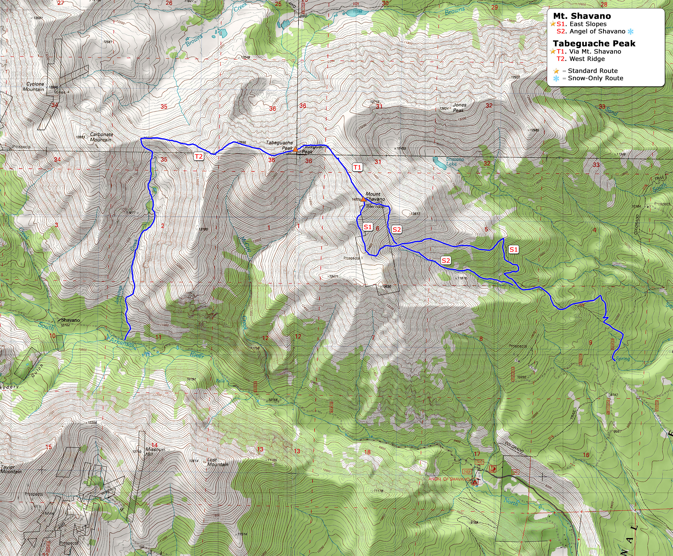
Log In 

Mount Shavano and Tabeguache Peak Routes

 
Routes
Routes Gain RT Distance  Difficulty     Risk Factors    
route
Mt. Shavano - East Slopes
Difficulty: Class 2
Total Elevation Gain: 4,500 feet
Round-trip Distance: 9.50 mi
Mt. Shavano - East Slopes 4,500' 9.50 mi   Class 2  Moderate
Exposure: Moderate
Rockfall Potential: Moderate
Route-Finding: Low
Commitment: Moderate
route
Tabeguache Peak - Via Mt. Shavano
Difficulty: Class 2
Total Elevation Gain: 5,600 feet
Round-trip Distance: 11.50 mi
Tabeguache Peak - Via Mt. Shavano 5,600' 11.50 mi   Class 2  Considerable
Exposure: Moderate
Rockfall Potential: Moderate
Route-Finding: Moderate
Commitment: Considerable
route Tabeguache Peak - West Ridge
Difficulty: Class 2
Total Elevation Gain: 4,000 feet
Round-trip Distance: 8.00 mi
Tabeguache Peak - West Ridge 4,000' 8.00 mi   Class 2  Considerable
Exposure: Moderate
Rockfall Potential: Considerable
Route-Finding: Considerable
Commitment: Considerable
route  _
Mt. Shavano - Angel of Shavano
Difficulty: Class 2  Easy Snow
Total Elevation Gain: 4,600 feet
Round-trip Distance: 8.00 mi
Mt. Shavano - Angel of Shavano 4,600' 8.00 mi   Class 2  Considerable
Exposure: Moderate
Rockfall Potential: Moderate
Route-Finding: Considerable
Commitment: Moderate
Standard Route
_Snow-Climb! Only climb with stable spring/early summer snow
 Trip Reports:
  Mt. Shavano Trip Reports (283)
  Tabeguache Peak Trip Reports (182)

map
map

This map can only be accessed by registered 14ers.com users. If you don't have an account, you can register in the forum.

Log In
14er Routes, 14ers, Hiking Routes, Climbing Routes, Routes, Mount Shavano and Tabeguache Peak, Mount Shavano and Tabeguache Peak Routes, Mount Shavano and Tabeguache, Fourteener Routes