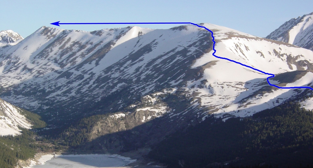
1 and
2 show most of the route. On the west side of the parking area, start up a dirt road which heads northwest. At 11,600', stay left at and continue up the good road (
3) to 12,100' where the road crosses a large, open saddle -
4. Stay on the road as it curves west to a gate.
Turn right at the gate and hike up to some old mining roads. Turn right again and zig zag northwest up North Star's southeast shoulder -
5 and
6. You'll probably find a faint trail on the upper shoulder. Near 13,200', angle left beneath the 13,400-foot point on the east end of the summit ridge and follow the trail to a small saddle on the summit ridge.
Hike west along the narrow ridge -
7. Once on a high point, near the middle of the ridge, the summit becomes more obvious -
8. Continue along the ridge (
9) and over a few remaining rugged sections (
10) to reach the summit -
11.
