This route has long been considered the standard route on Lindsey, but it becomes an unpleasant ascent/descent once the snow has melted out of the northwest gully. If the snow is gone, consider using the
Northwest Ridge once you get to the 13,150-foot saddle between Iron Nipple and Mt. Lindsey. The ridge is steeper, more exposed, and requires Class 3 scrambling, but it is far more stable despite the added challenge.
From the parking area, follow the Lily Lake trail south through trees into a large meadow (
1). Walk 1 mile to a trail junction where the Lily Lake trail veers right (
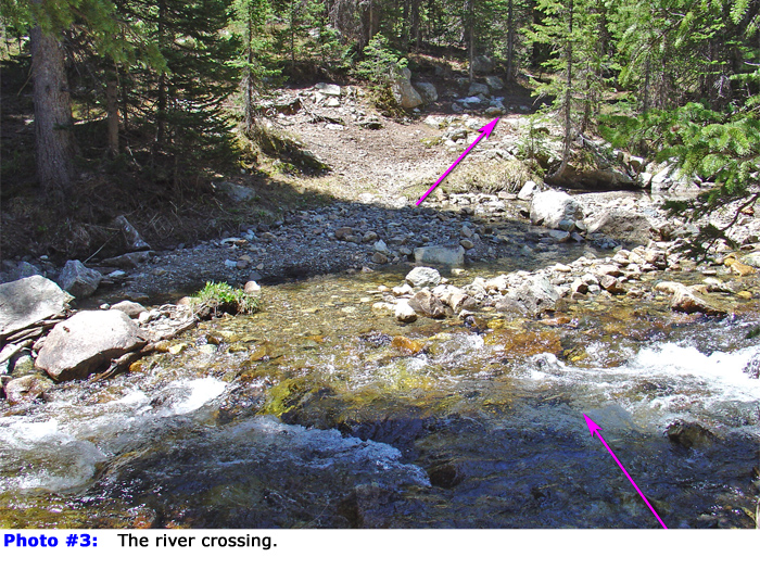
2). Continue straight on the unmarked trail for 100 yards, cross the Huerfano River
(
3), and head south. About 0.1 mile after the crossing, the trail climbs left, away from the river. Zigzag through the dense forest to reach a boulder field
near 10,800' (
4).
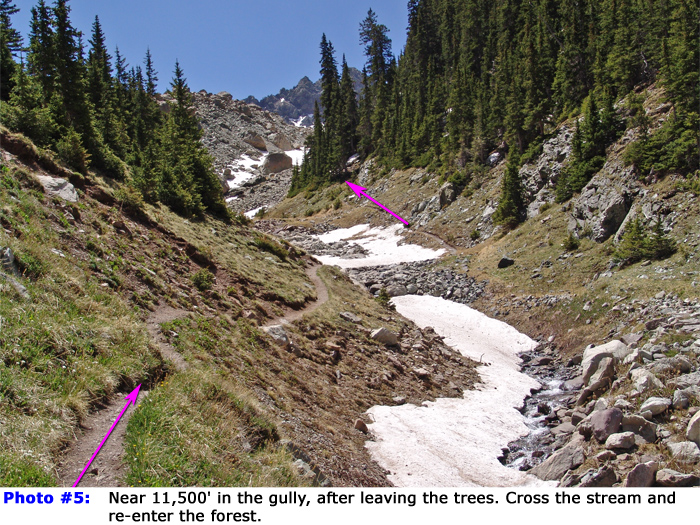
Now it's time to gain some elevation. Climb roughly 600 feet through the forest on the right side of the boulder field to reach a gully/stream around 11,400'. Follow along the stream's left side and cross it near 11,600' (
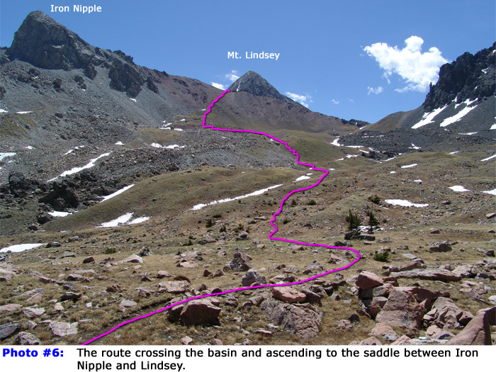
5). Continue south, climbing a hillside to emerge at tree line near 12,000', overlooking a high basin and Mt. Lindsey's summit (
6). Drop slightly, walk toward the east side of the basin, and ascend to 12,200' (
7). From there, follow a small ridge (
8) to reach a 13,000-foot crest (
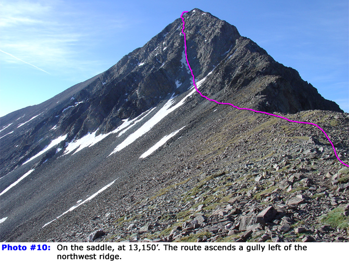
9). The remaining route is on private property, hopefully you filled out the landowner's liability waiver. Navigate through a boulder field to the 13,150-foot saddle
between 13er Iron Nipple and Mt. Lindsey (
10).
Ahead, you’ll see Lindsey's rugged north face and northwest gully (
11,
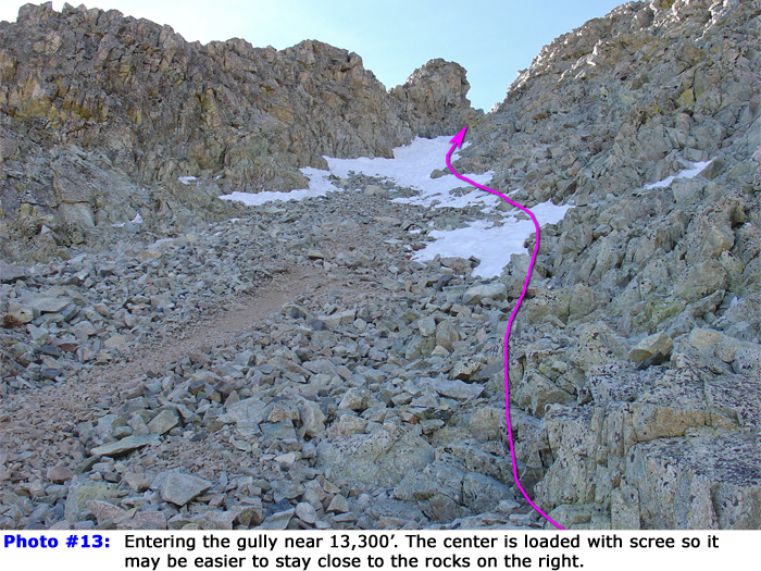
12). Follow the ridge southeast to 13,200', where the trail begins to traverse east toward the gully. Continue to the base of the gully
(
13). From here, the ascent becomes steep, loose, and more difficult. Climb carefully and try not to dislodge rocks. Use the more stable terrain along the gully's right/upper edge when possible. Near the top of the gully (~13,600'), narrow sections may require easy Class 3 moves if snow is not present (
14). At the top of the gully, pass through a small notch (
15) and traverse east across shallow gullies, gradually gaining elevation (
16). As an alternative to this traverse from the notch, you can also turn right and following angled Class 3 slabs which makes for more line toward the summit ridge. Above 13,800', the climb remains steep (
17,
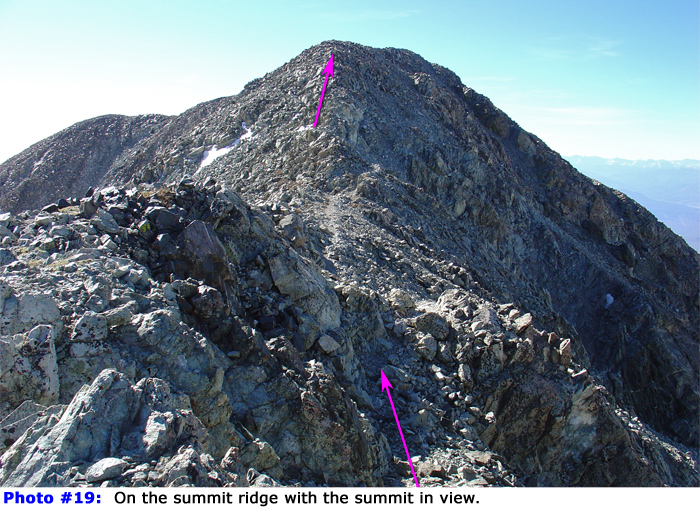
18) until reaching Lindsey's summit ridge near 14,000' (
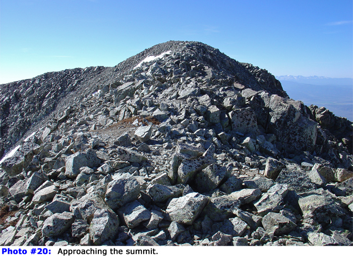
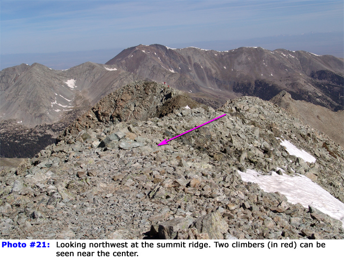
19). Hike southeast for 0.2 mile to reach the summit (
20,
21,
22).

 GPX Track File
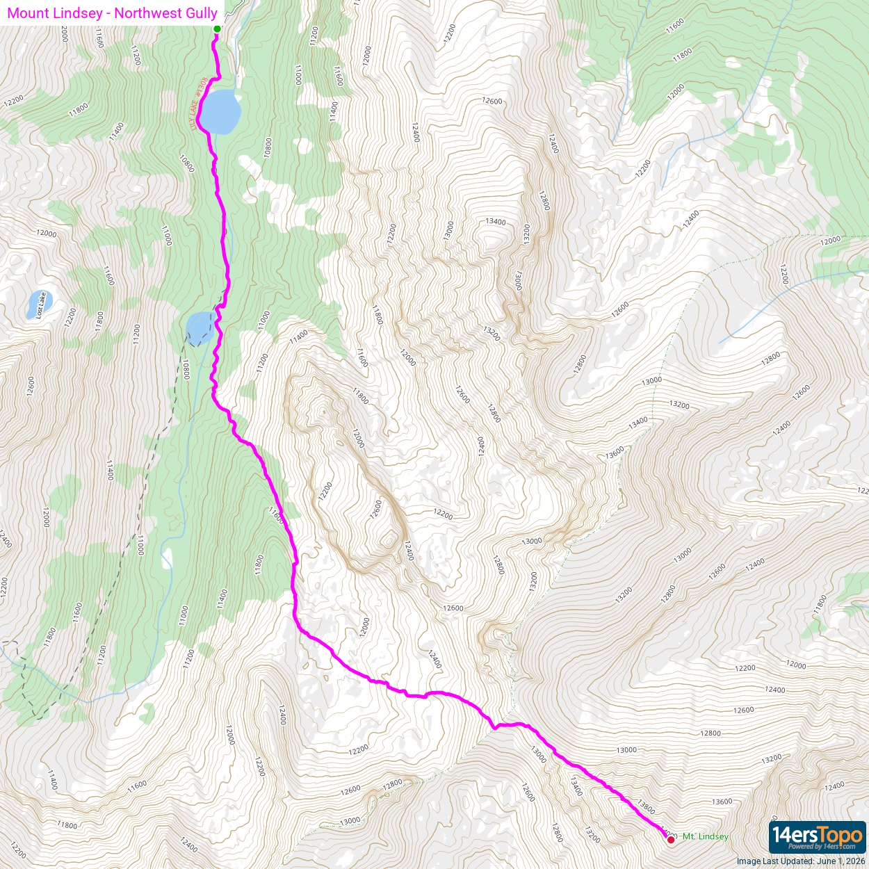


