This is NOT the winter variation of La Plata's standard hiking route. It is a spring couloir route up La Plata's steep north face. If you're looking for the winter hiking variation of the standard route, please read the "In Winter" notes on that route.
1 provides is an overview of the route and
2 is a closer look at the north face. From the parking area, walk down South Fork Lake Creek road 100 yards, cross a vehicle bridge (
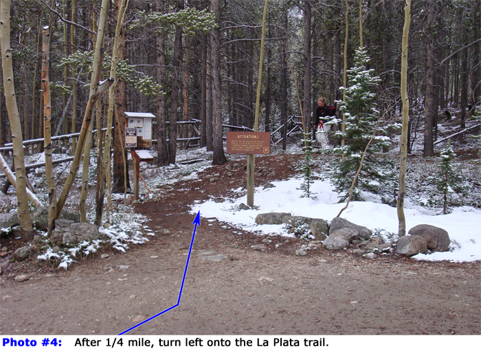
3) and continue on the road for 1/4 mile to find a trail sign on the left -
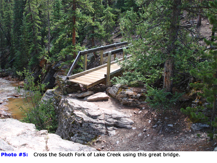
4. Walk east into the woods and continue on the good trail. Hike through the forest and cross South Fork Lake Creek on a bridge -
5. Turn sharply right up from the bridge, walk another 1/3 mile and cross La Plata Gulch on a small log bridge. Turn right and continue on the La Plata Peak trail as it parallels the stream in La Plata Gulch. Between 10,400' and 10,700', the great trail has log and stone steps that make the steep climb through the forest a bit easier. If the area is snow-covered and you can't locate the trail, simply take the easiest terrain you can find continue south up the hill on the east side of the gulch. Near 10,900', you'll want to break from the La Plata trail and climb southeast away from the gulch
. Your goal is to gain La Plata's northwest ridge at tree line so you can cross over into La Plata Basin. Without a trail, bushwhack southeast away from La Plata Gulch for about 100' vertical feet and continue southeast through the steep forest. After another 500' of gain, the angle eases as you approach tree line. Continue to a large clearing and a headwall
on the northwest ridge, near 11,800' -
6.
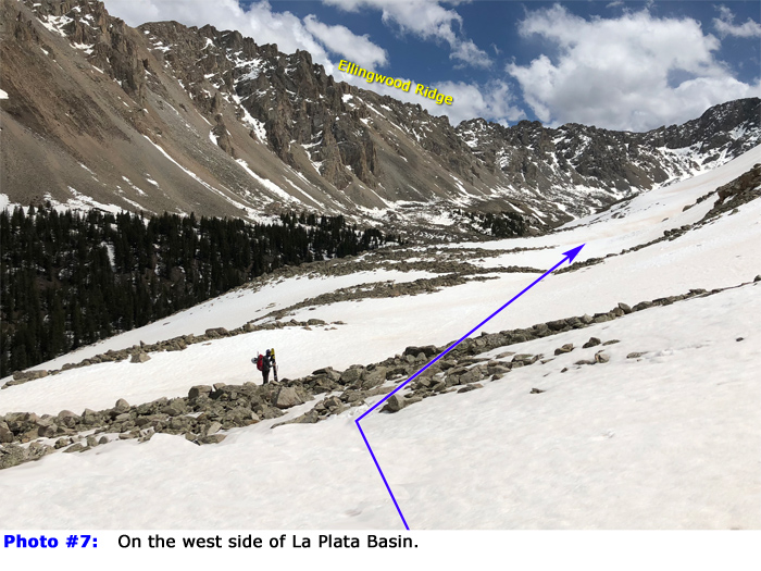
Exit the trees and turn left before the headwall and continue east along the talus below the northwest ridge -
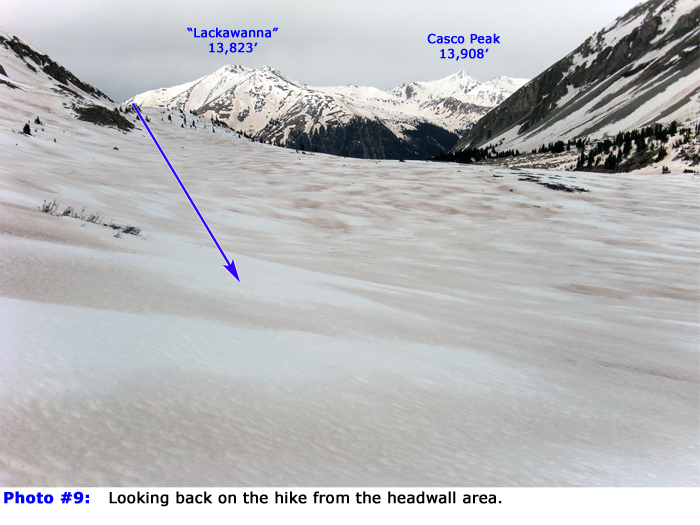
7. You are entering La Plata Basin. Without dropping too much to your left unless you must due to avalanche concerns to your right, continue south/southeast along the base of the ridge, toward the upper basin and La Plata's north face -
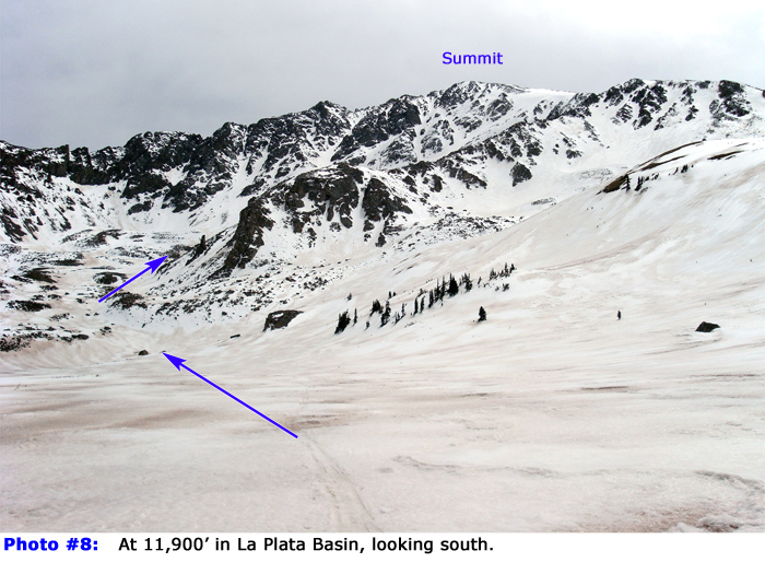
8 and
9. Angle into the center of the basin and continue up the drainage -
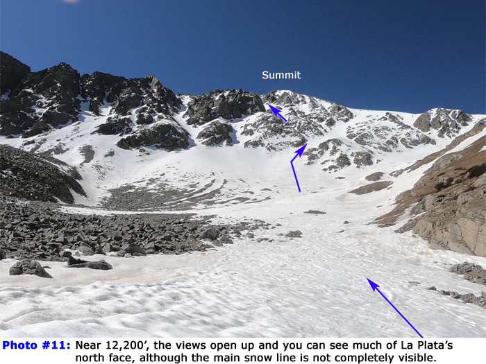
10. After passing through a narrow section at 12,200', the view opens up and the north face is not far off -
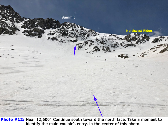
11. HOLD ON! The face is confusing from this vantage and you'll need to identify the main couloir, which is partially hidden. First, identify the summit. There are couloirs far left of it and far right of it but the main line is almost directly between you and the summit. Locate the entry point to the main couloir and continue south toward the face -
11 and
12.
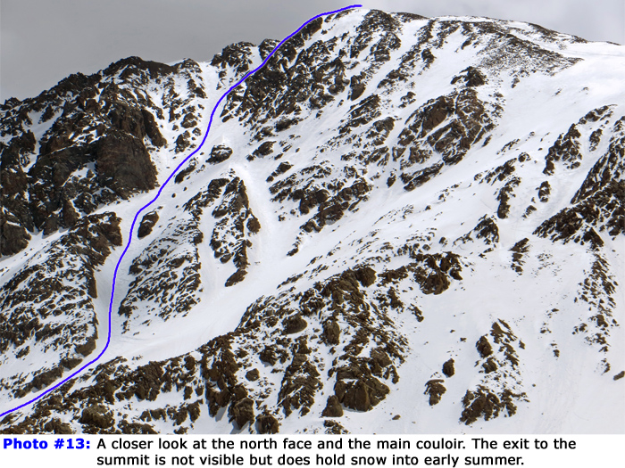
In case you forgot what the upper route looks,
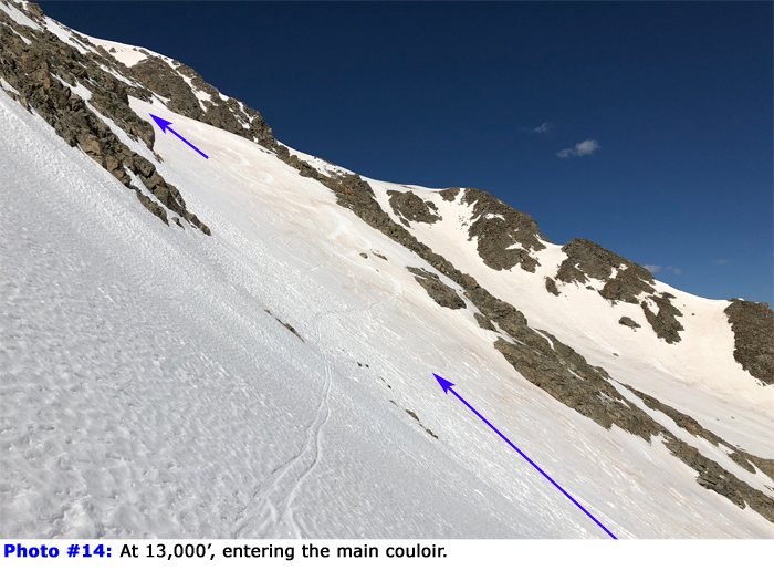
13 is a close-up taken from the lower, headwall area. Near 13,000', angle southwest into the couloir and begin climbing -
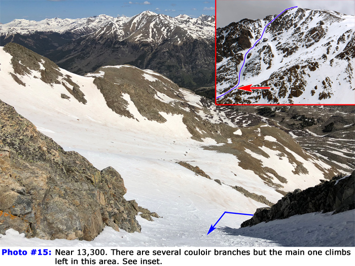
14. As you climb a bit higher, you'll notice some additional snow lines that branch off to the right but the best climbing line is to stay left and continue up the narrow main couloir -
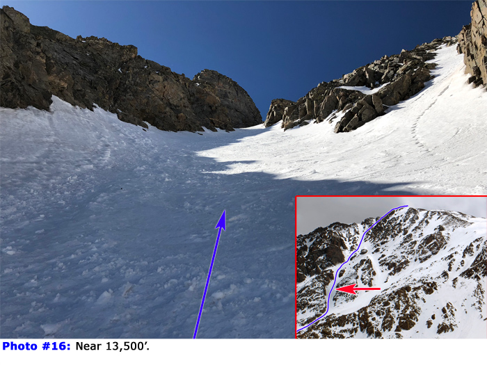
15,
16 and
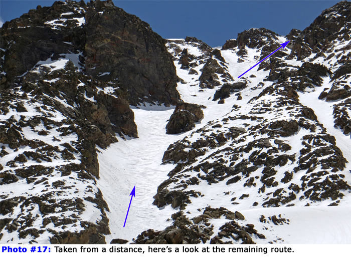
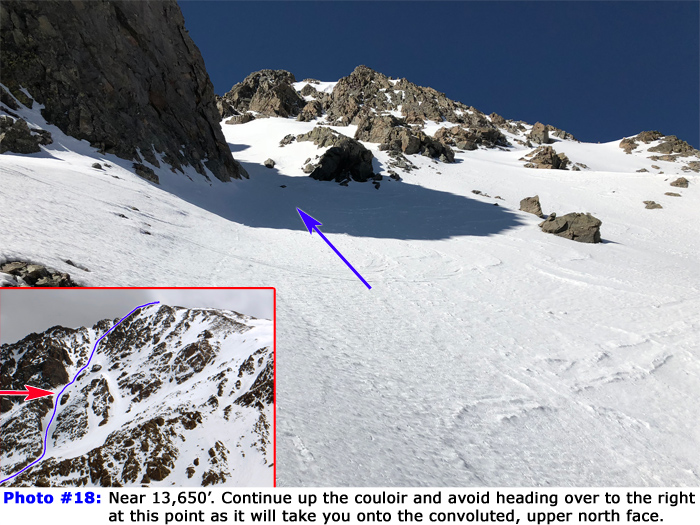
17. Fun! Near 13,650', stay in the couloir and avoid heading over to the right as it will take you onto the convoluted, upper north face -
18 and
19. Above 14,000' the couloir splits. Climbing left takes you to the ridge crest, near 14,250'. Stay right to climb directly to the summit -
20,
21 and
22.
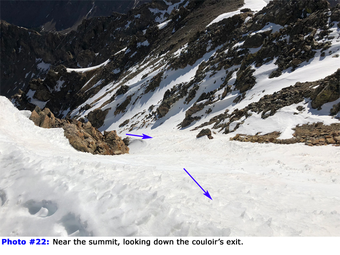
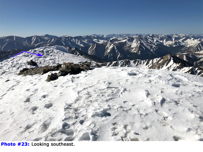
23 and
24 show views from the top.
If you're skiing the north face, you can exit via the same line you used to enter La Plata Basin. If you're hiking, your best option is to descend the (standard) northwest ridge route or the "winter variation" of that route if there's still the possibility of avalanches on the west side of the ridge. Follow the crest of the northwest ridge down to 12,700' where the standard trail drops west from the ridge. If there isn't too much snow on the west side of the ridge, you can continue down the standard route. For the winter variation, continue north along the northwest ridge for nearly 1 mile to reach the top of the headwall, just above tree line. Find a way down through the headwall and retrace your ascent route through the trees.

 GPX Track File


