Begin by following the
Mt. Harvard - South Slopes Route to reach Harvard's summit. To traverse to Columbia (
1), you'll need a couple of hours, so don't attempt it if weather conditions are deteriorating. Begin by hiking east along Harvard's summit ridge (
2). Pass through a notch (
3) and continue along the ridge crest. Near the eastern end of Harvard's summit ridge, pass a rocky point on either side (
4) to arrive at a small flat area. Descend southeast along the ridge toward a distinct pointed rock formation near 14,100' (
5,
6). Pass this point on the right (
7), then follow a faint trail through loose talus on the ridge's south side (
8).
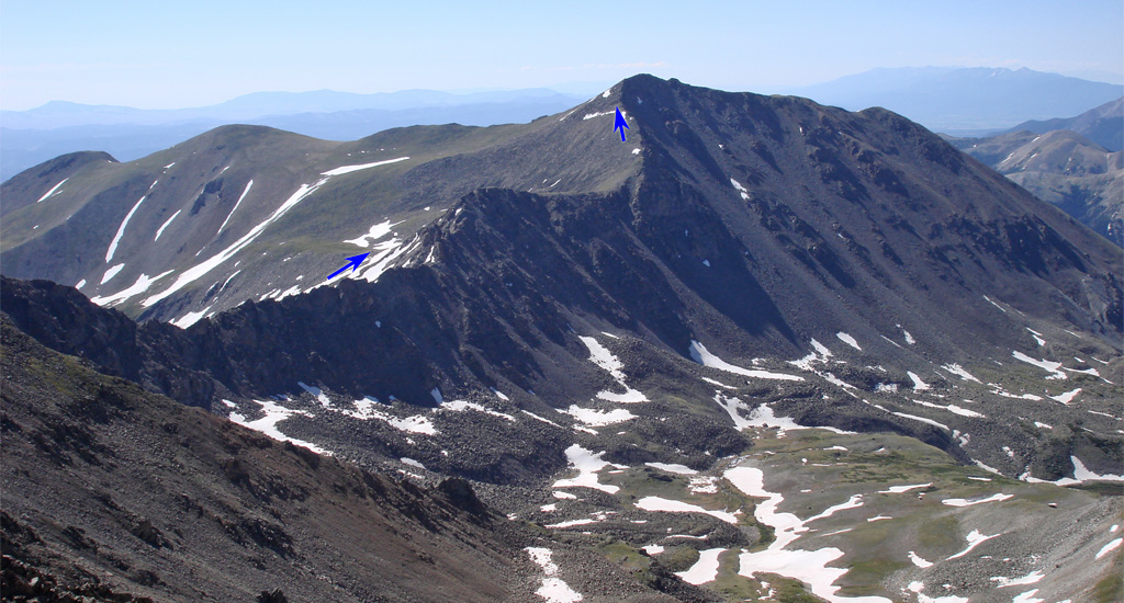
Return to the ridge trail and descend toward a prominent 13,516-foot point (
9,
10). The faint trail vanishes as you enter talus along the north side of this point. Work your way across the north side of the point (
11,
12) to reach the edge of its east ridge, where you'll have a clear view of the remaining route (
13). From this point, the route bypasses a long portion of the connecting ridge because it's far more difficult. Your route will parallel the ridge but at a lower elevation. So, turn left and descend the east ridge of Point 13,516' (
14). Once you've dropped below 12,800', leave the ridge where it feels most comfortable (
15) by turning right.
The route now becomes much more tedious. The route does not go back to the ridge crest any time soon but you do want to reagain some elevation. Contour southwest to talus and choose your line to climb closer to the ridge (
16). After some notable effort just to climb a short distance, turn left and continue south (
17,
18,
19).
20 shows a view back from approximately 12,900'. Continue navigating talus as you approach 13,000', where the terrain becomes easier (
21). Above 13,000', Columbia's summit comes into view. Hike right (south) around Point 13,497' (
22,
23), then ascend grassy terrain to regain the ridge left of the saddle between Columbia and Point 13,497' (
24).
On the ridge, near 13,400', turn left and continue toward the summit (
25,
26). Around 13,900', climb approximately 100 feet of steeper rock (
27,
28) before walking to the summit (
29,
30). Descend to Horn Fork Basin via the
Mt. Columbia - West Slopes Route.
