Log In 
Photo

Mount Columbia

 West Slopes
Difficulty Class 2 
Risk FactorsExposure: Moderate
Rockfall Potential: Considerable  
Route-Finding: Moderate  
Commitment: Moderate  
 
Start9,900 feet
Summit14,075 feet
Total Gain4,250 feet
RT Length12 miles
Last UpdatedApr 2025
Show More
Photo

Trailhead

In Buena Vista, 1/2 mile north of the center of town, turn west onto County Road 350 (Crossman Ave.) and measure mileage from here. Continue on CR 350 for 2 miles and turn right onto CR 361. At 3 miles, turn left onto CR 365 (dirt). Continue for over 5 miles to the reach the trailhead and end of the road, at 8.1 miles. The trail starts on the west side of the parking loop.

Route Description

 1 shows the route above the tree line. From the trailhead, take the excellent trail downhill to a bridge crossing, and follow it ( 2) for 1.4 miles to another bridge. Shortly after crossing it, you'll arrive at a trail junction. Stay right for Horn Fork Basin and Bear Lake. Follow the trail ( 3) for another 1.75 miles to a small clearing at 11,250', where Columbia's southwest shoulder becomes visible to your right ( 4). Continue on the main trail for another 0.3 mile to the Columbia trail junction ( 5). Turn right for Mt. Columbia.

Hike a short distance through the forest and enter a linear clearing to arrive at another trail junction ( 6). Turn right and continue through the forest until reaching another small, linear clearing. Cross this clearing and head southeast, exiting the trees at the base of a wide gully on Columbia's southwest side ( 7). Follow the defined trail up through talus, then swing right (southeast) to gain a shoulder ( 8,  9,  10).

Once on the shoulder ( 11), follow the trail as it traverses east and then north, switchbacking up the shoulder ( 12,  13). Near 13,300', the terrain becomes steeper, and the trail becomes more rugged and less defined ( 14). Carefully zigzag through the rocks until the terrain levels slightly at 13,500', then follow the trail to the ridge at 13,680' ( 
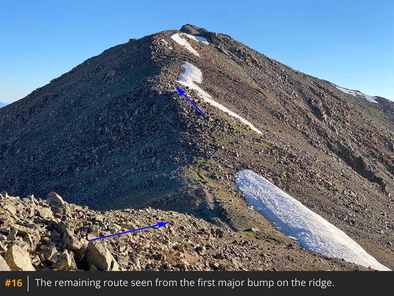
15). The summit is still a half mile away. With the remaining route now visible, hike north along the ridge, navigating rock bumps ( 16). Near 13,800', you'll reach a point where the summit comes into view again, across a flat section ( 
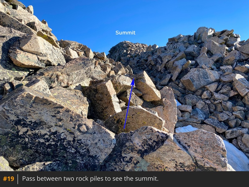
17). Continue along the ridge ( 18), pass between two rock piles, and finally gain the summit (
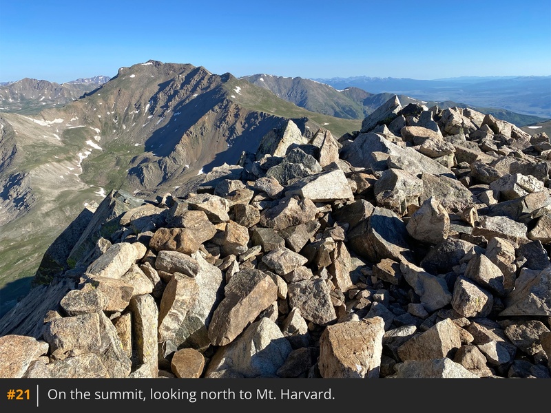
 19,  20,  21).

Notes

IMPORTANT: This route enters the Collegiate Peaks Wilderness area. Designated wilderness areas have special regulations and restrictions for party size, dispersed camping, campfires, etc. Also, dog owners should read the wilderness information carefully because some wilderness areas prohibit dogs to be off-leash and/or limit how close dogs can be to lakes and streams. If you have questions about the wilderness area, please contact a U.S. Forest Service office for the National Forest(s) listed above.
#1 #2 #3 #4 #5 #6 #7 #8 #9 #10 #11 #12 #13 #14 #15 #16 #17 #18 #19 #20 #21

This page is only available to registered 14ers.com users. If you don't have an account, you can register in the forum.

Log In_

This page is only available to registered 14ers.com users. If you don't have an account, you can register in the forum.

Log In_

This page is only available to registered 14ers.com users. If you don't have an account, you can register in the forum.

Log In_

Caution: The information contained in this route may not be accurate and should not be the only resource used in preparation for your climb. Failure to have the necessary experience, physical conditioning, supplies or equipment can result in injury or death. 14ers.com and the author(s) of this route provide no warranties, either express or implied, that the information provided is accurate or reliable. By using the information provided, you agree to indemnify and hold harmless 14ers.com and the route author(s) with respect to any claims and demands against them, including any attorney fees and expenses. Please read the 14ers.com Safety and Disclaimer pages for more information.

Please respect private property: 14ers.com supports the rights of private landowners to determine how and by whom their land will be used. In Colorado, it is your responsibility to determine if land is private and to obtain the appropriate permission before entering the property.
Heading to a 14er soon? Don't forget the 14ers.com mobile app.
Google Play     Apple App Store