Start up the #277 jeep road -
1. Snow often covers sections of this road until early July. It's steep and rough but can be navigated slowly with a high-clearance, short wheelbase, 4WD vehicle. Hike or drive approximately 3 miles to reach a road junction
at 10,850' -
2. Turn left onto the #278 road and cross the stream in Baldwin Creek -
3. Continue for nearly 1.5 miles until you reach tree line, then stay on the road as it begins to switchback up Antero's west slopes -
4 and
5.
Follow the road as it zigzags up the west side of Point 13,800' -
6 and
7. Around 12,800', there's a long section (
8) that ascends southward, leading to the ridge crest
near 13,100' -
9. After gaining the ridge, your next objective is to reach the top of Point 13,800'. Continue east along the 278A road -
10. Shortly after departing the ridge crest, keep left at a junction -
11. Proceed another 0.4 miles and stay left at another junction
, near 13,200'. Follow the road up the south side of Point 13,800' to arrive at a small saddle on the eastern side of Point 13,800' -
13 and
14.
Pass through an ugly mining area to reach Antero's south ridge -
15. Follow the ridge crest and trail segments along its right side -
16. This stretch offers the most engaging terrain of the route. After the ridge traverse, you'll arrive at a small saddle at 13,850', at the base of the final pitch -
17. Here, you have two options: 1) Follow a braided and eroded trail that traverses to the right and crosses the upper south slope. 2) Hike directly toward the summit by staying near the ridge crest. Most hikers take the 2nd, direct line, given the deterioration of the original traverse trail. Gain the summit and enjoy the views -
19 and
20.


 GPX Track File
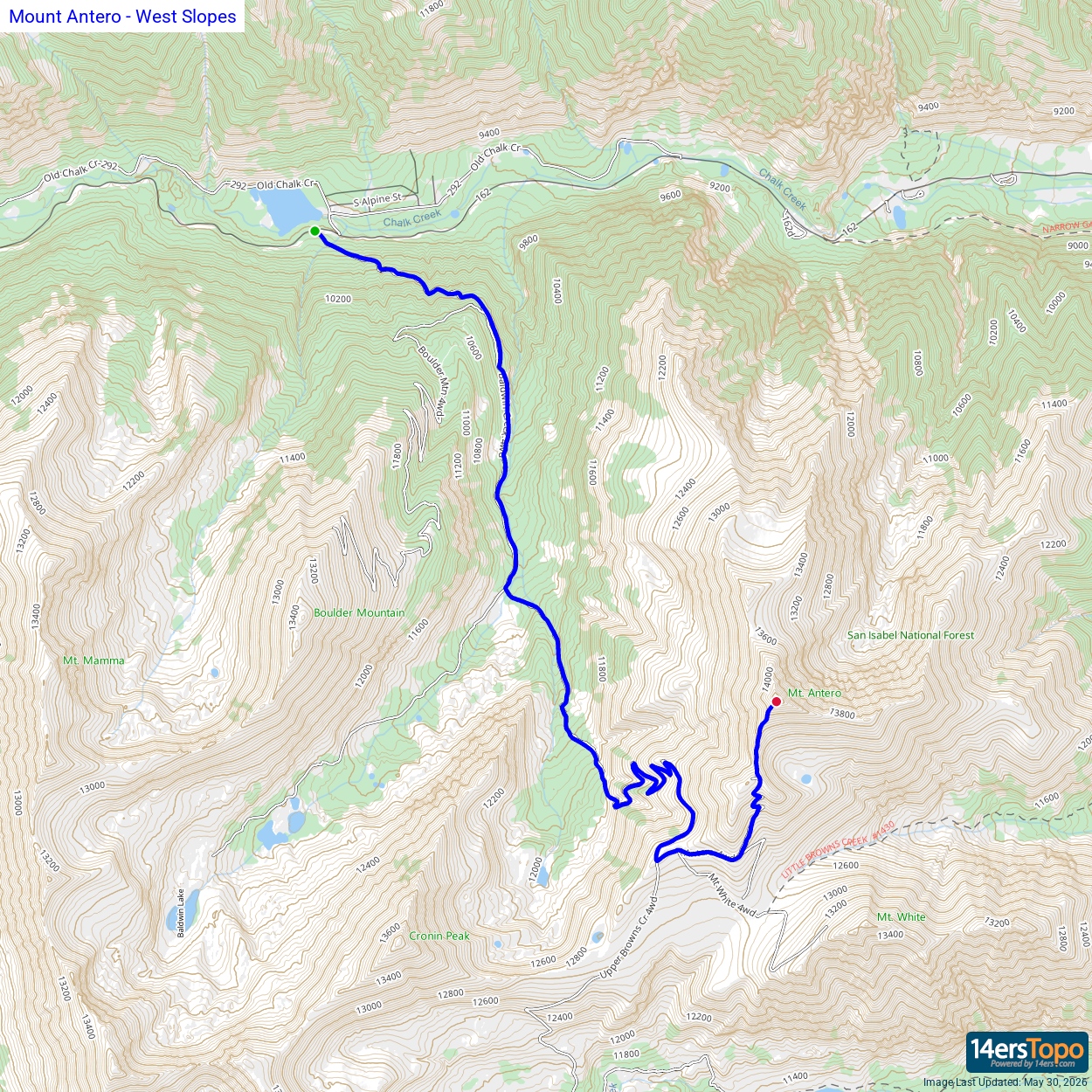


