Log In 
Photo

Notch Mountain

Notch Mtn via Half Moon Pass
Difficulty Class 2 
Risk FactorsExposure:
Rockfall Potential: Moderate  
Route-Finding:   
Commitment:   
 
Start10,320 feet
Summit13,243 feet
Total Gain2,917 feet
RT Length6.2 miles
Authorarianna2
Last UpdatedJul 2018
Show More
Photo

Trailhead

?LATE OPENING
The Tigiwon road is closed each year between late November and June 21st. Until it opens, you'll have to bike or hike the road.
From Interstate 70, take Exit 171 and follow U.S. 24 to Minturn. Continue 3 miles and turn right (west) onto the Tigiwon dirt road. The road is a bit rugged but most cars can usually make it to the trailhead. Drive 8.5 miles to reach the trailhead, at the end of the road. IMPORTANT: The Tigiwon road is closed each year between November 22nd and June 21st but biking or hiking the road is allowed. If you plan on heading there around the time of the road opening, please contact the Holy Cross office of the US Forest Service Eagle-Holy Cross Ranger District at 970-827-5715 to see when they will be opening the gate.

Route Description

It takes about 30 minutes from the turnoff onto Tigiwon Road to the trailhead. Expect a lot of campers along the 8 mile road and a lot of cars parked at the trailhead in busy months.

Hike up the Half Moon trail 1.7 miles to Half Moon Pass. The north ridge of Notch Mountain (13,237') is up to your left. There is a large cairn with a tall stick in the middle on the right of the trail at the summit of the pass. A trail takes off to the left just a few feet past the cairn. The GPS coordinates are 39.4940 N and -106.4537 W.  1

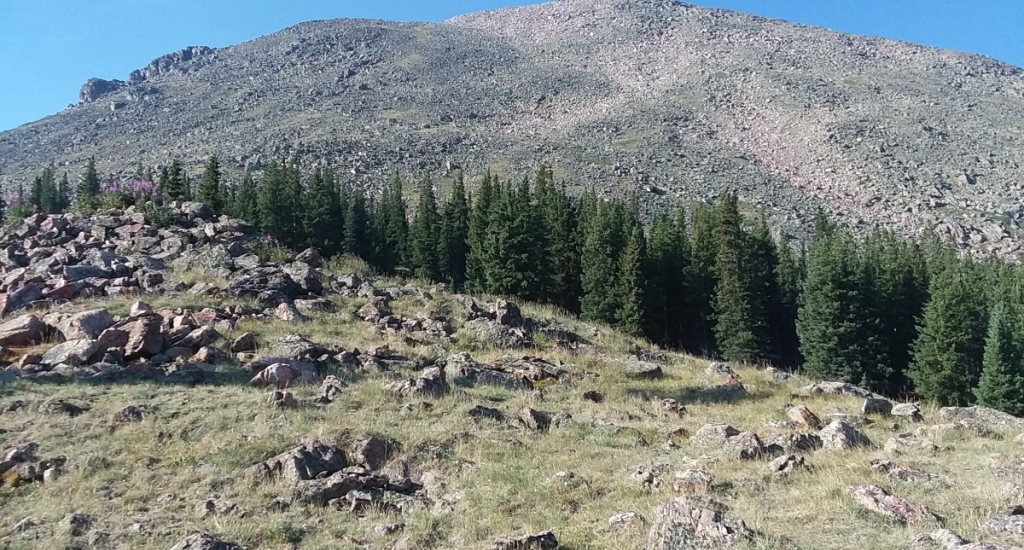
Pass through the trees and begin your ascent towards Point 12,743 (39.4859 N -106.4557 W). Hike up the hill mostly on grassy slopes towards the small saddle to the left of the point, and then head toward the point as you approach it. (There is also a fairly large cairned trail that goes to the southeast and around and follows a path well below the ridge.)

From just below point 12,743, stay to left of the ridge on large talus.  3 At about the saddle where the snow is in this picture, you will transfer over to the right of the ridge.  2 You can talus hop your way to the summit anywhere but there is a cairned trail, if you can see its origin, that is down a little ways to the right of the ridge. The summit coordinates are 39.4773 N and -106.4605 W. It is approximately 3.1 miles to the summit and takes roughly 3 hours to get there. There are no major water sources.
Notes

None
#1

Caution: The information contained in this route may not be accurate and should not be the only resource used in preparation for your climb. Failure to have the necessary experience, physical conditioning, supplies or equipment can result in injury or death. 14ers.com and the author(s) of this route provide no warranties, either express or implied, that the information provided is accurate or reliable. By using the information provided, you agree to indemnify and hold harmless 14ers.com and the route author(s) with respect to any claims and demands against them, including any attorney fees and expenses. Please read the 14ers.com Safety and Disclaimer pages for more information.

Please respect private property: 14ers.com supports the rights of private landowners to determine how and by whom their land will be used. In Colorado, it is your responsibility to determine if land is private and to obtain the appropriate permission before entering the property.
Heading to a 14er soon? Don't forget the 14ers.com mobile app.
Google Play     Apple App Store