Leave the trailhead (
1) and hike north into Sheep Gulch on the Colorado Trail. Stay right at a trail junction (
2) and continue up the excellent trail (
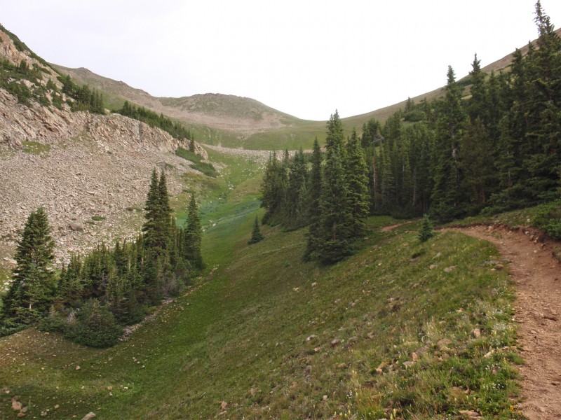
3) to 11,300' where the trail crosses to the east side of Sheep Gulch -
4. Continue north along the gulch (
5) and exit the trees near 12,200' where you can see Hope's east ridge and Hope Pass, the saddle between Hope and Quail Mountain -
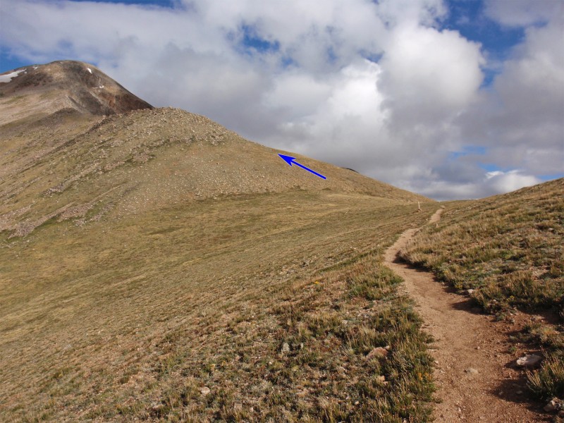
6. Continue up to Hope Pass (12,550') -
7,
8 and
9.
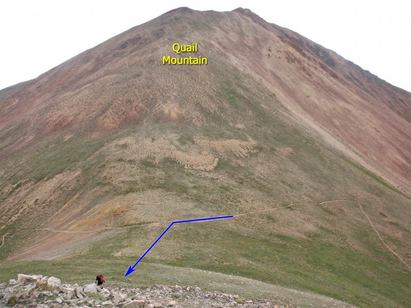
Taken from Quail Mountain,
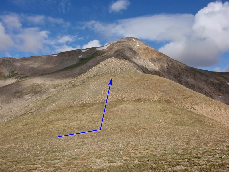
10 provide an overview of Hope's east ridge route. From the pass, leave the trail and begin west up the ridge -
11. You may find a faint trail to the left but if you don't, pick your line and gain the ridge crest -
12. Once you reach the top of the first ridge bump (
13), the remainder of the ridge comes into view. Continue along the ridge crest -
14 and
15.
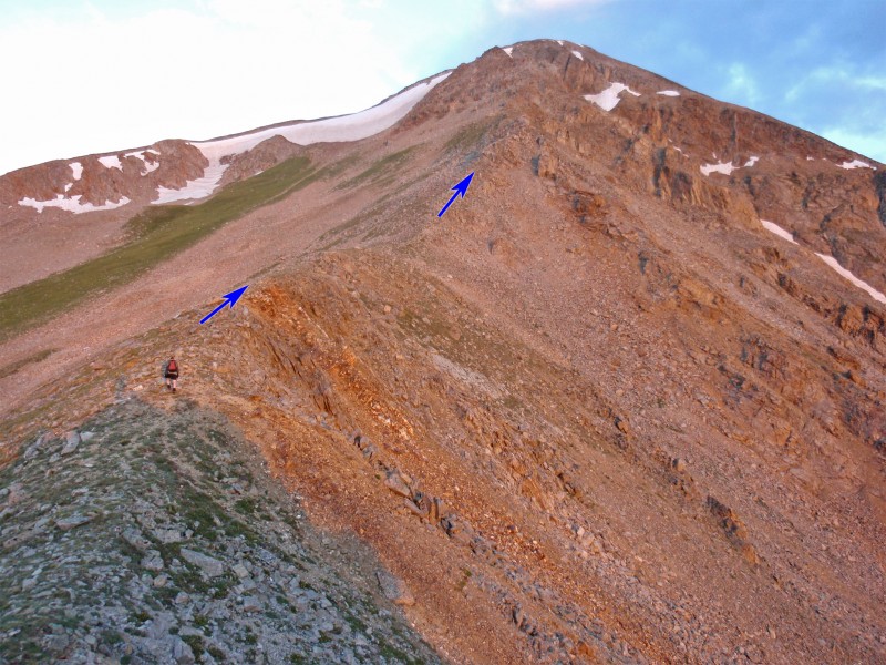
Near 13,400', you'll reach the crux of the route - a 300-foot section of jumbled rock which is unlike the defined ridge you've enjoyed since Hope Pass -
16. The ridge crest is along the right side of this mess but it's easiest to stay a bit to the left instead of scrambling along the northern edge. In
16, you can see some small gullies on the upper left of the photo. A good way up is to angle into one of the gullies and ascend back to the ridge. Walk up to the base of this area and traverse left (
17) to reach a defined gully -
18. Ascend the gully and regain the east ridge -
19 and
20. Turn left and pass a ridge point to reach the top of Hopeful Couloir -
21 and
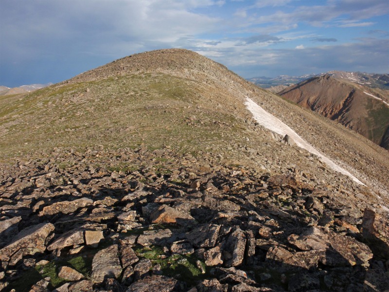
22. Continue up to a false summit and then the true summit -
23 and
24.

 GPX File
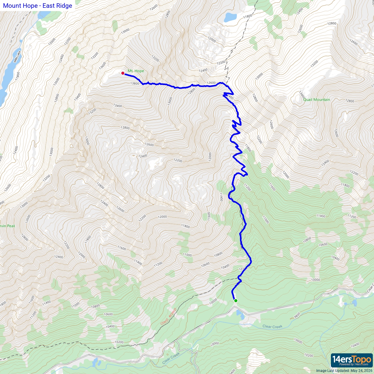


