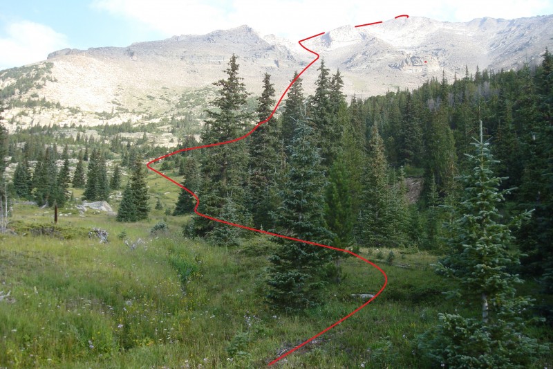
From the Sandbeach Lake Trailhead, follow the excellent trail over 3 miles to the Hunter's Creek crossing (the second bridge). Immediately before (east of) the bridge, turn right along a small but obvious trail roughly paralleling the creek -
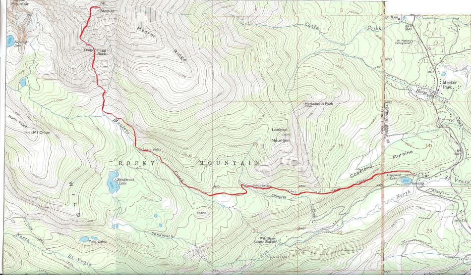
1. This hunter's trail is not well-marked or maintained, but without snow can be fairly easily followed -
2. If you lose the trail from downed trees or excessive underbrush, a quick glance around will rediscover it, usually behind a bush or abruptly descending a small hill -
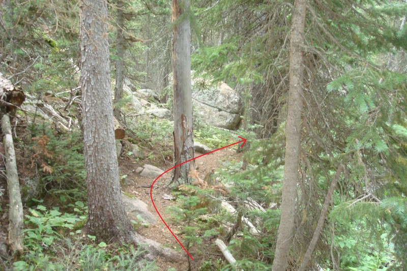
3. Follow this trail for over 1 mile before it disappears, shortly past Lyric Falls -
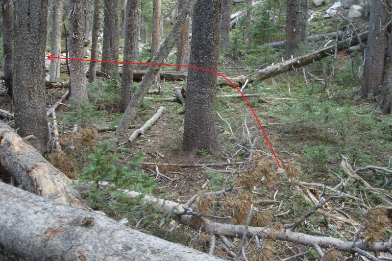
4. Continue following the creek on the east side, passing about 50 feet to the east of the creek through clearer, easier terrain. You will see a rocky ridge rising 400-500 feet above you to your right. Continue past this ridge into the south "bowl" of Meeker.
At 10,520', abruptly leave the trees and enter Meeker Meadows -
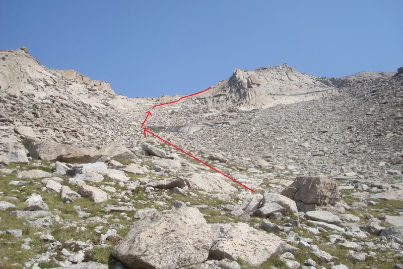
5. This area is marshy in an average summer, and trail segments are few and far between. Stepping carefully through the grasses and flowers, head toward high ground between the various small stream beds. Dragon's Egg Rock is roughly centered in this area. The most direct route through here is to head up a small gulley at 11,000', about half way between the end of the southwest ridge and Dragon's Egg Rock. This is not the easiest path, but it is the shortest. An alternative is shown here with the dashed line - this decreases the strenuousness of the hike, but is on looser terrain and adds about 1/4 mile -
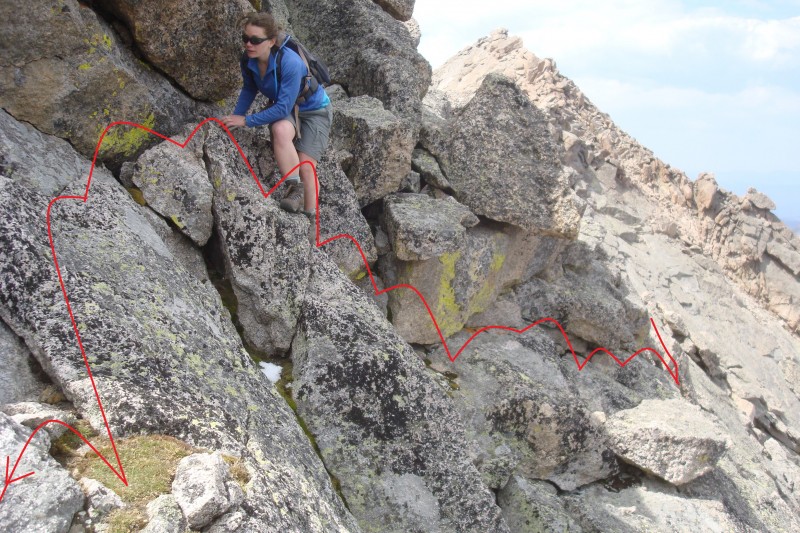
6. At the top of the gulley, see the grassy ascent below the large cliff at 12,200'. Climb straight up the mountain to the base of this cliff -
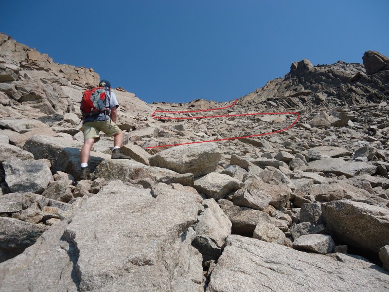
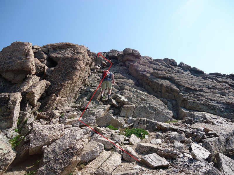
7. Angle left, and pass a small rock band on the left side -
8. The right side is possible as well, but is much looser. To this point, the climbing has been steep but solid. From here to the ridge line, the terrain becomes significantly more loose.
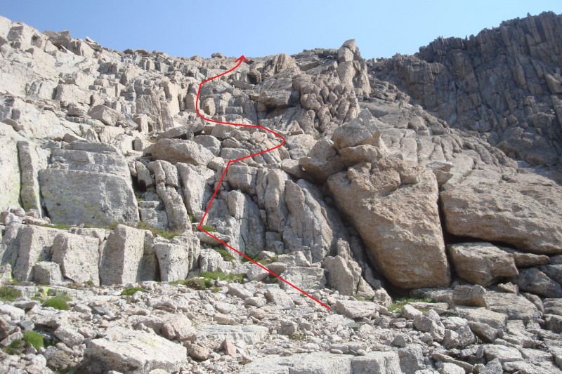
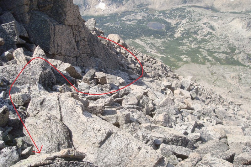
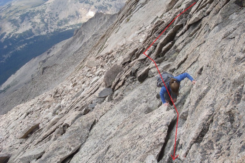
Head up the gulley, zigzagging to gain the various small ledges on loose class 2 terrain -
9. As you near the top of the gulley, the rock becomes more angled and the ledges taller, and care must be taken in the increasingly difficult climbing -
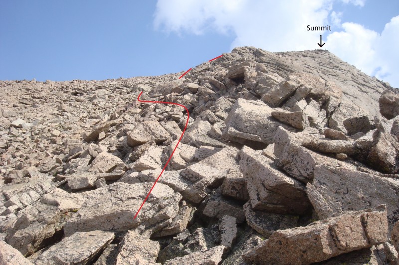
10. Climb out of the gulley and gain the ridge at 12,875' on difficult class 2 rock -
11.
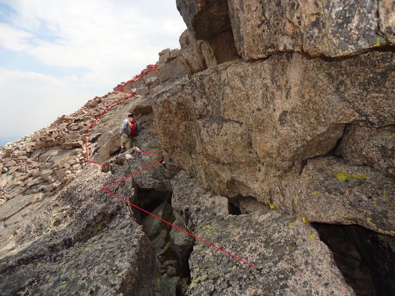
From this point, you will stay either on or just left of the ridge. The ridge itself is often a smoother climb, but has some exposure. Staying left and just below the ridge provides cover, but is looser and takes a more zigzagging path -
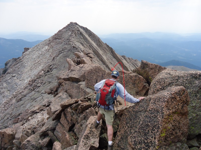
12. Neither option exceeds difficult class 2. Continue along or beside the ridge to 13,700' -
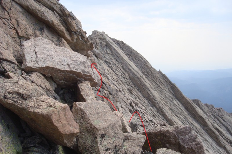
13. From here, the route banks right and heads more or less directly to the summit. The rocks become increasingly steep and Meeker's legendary slabs present significant class 3 exposure at times. Staying on the left side of the ridge, climb up to reach Meeker's dangerous, slanted, and slabby summit on class 3 rock. The last 30 vertical feet present the crux of the climb. Careful route-finding is required to avoid class 4 exposure.
If you intend to cross the Knife Edge to Meeker Ridge, from the summit of Meeker head east into rapidly more difficult scrambling
14. The descent to the base of the knife edge quickly becomes difficult class 3 with what I would consider class 5 exposure -
15,
16. Ascending to and then across the knife edge is comparatively easy, with solid, grippy rock and plentiful hand- and footholds. The east side of the knife edge is less exposed and has easier, though still solid class 3, climbing -
17,
18.


