This is the standard route and easiest way to hike Drift. From the paved, 2wd trailhead hike or drive (good-clearance Awd/4wd) 1.4 miles up Mayflower Gulch road to reach the Boston Mine area, at 11,500'. Park on the side of the road or in one of the pull-offs near the gate, just below the mine. Instead of heading left toward the mine area, start up the old, closed road on the right -
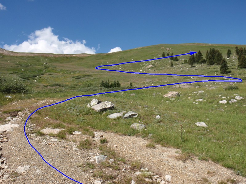
1. After a short distance you'll exit the trees to see Drift and much of the upper route -
2. Continue southwest on the road as it climbs toward the lower, northwest ridge -
3,
4 and
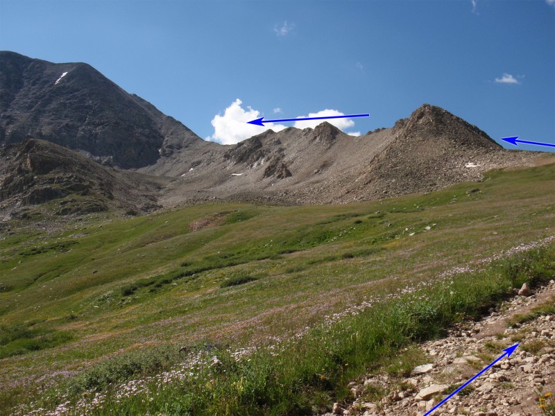
5. When the road hits the ridge, leave it, turn left and hike south up the ridge to a flat spot, near 12,060' -
6.
Walk over to the first bump on the ridge (
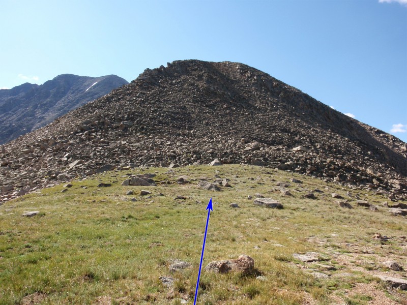
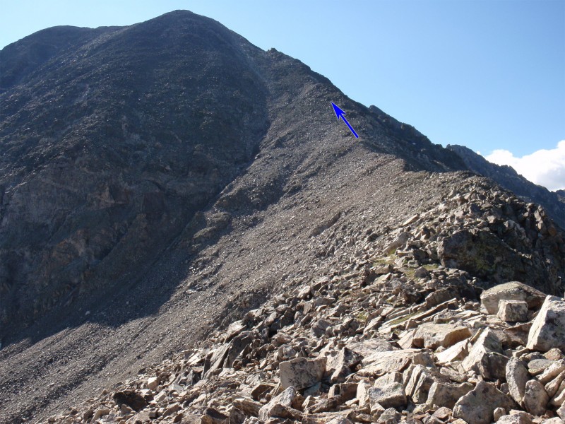
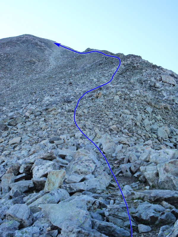
7) and locate a trail which zig zags up through the rocks -
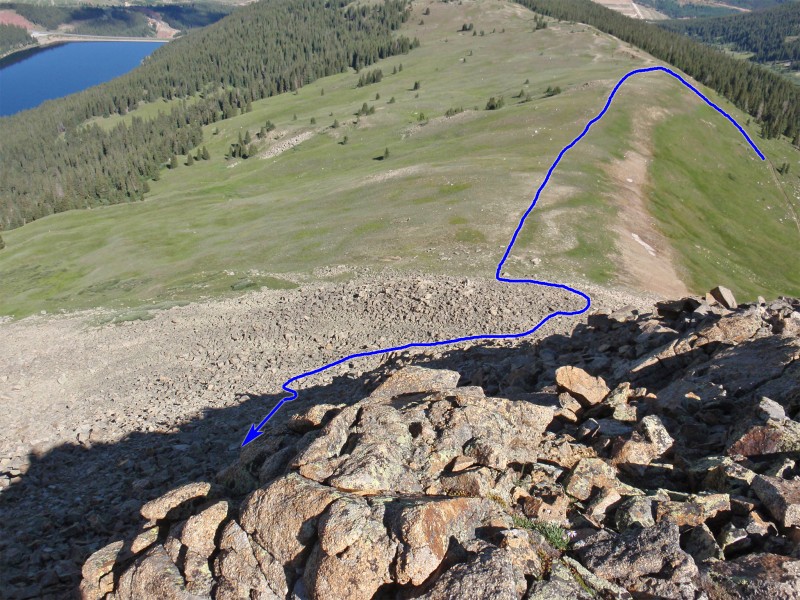
8. Follow the trail until it runs out in the middle of the loose slope and then carefully ascend loose rock and/or dirt to reach the ridge crest -
9. Continue along the narrow ridge (
10) to reach another prominent point and look for a faint trail which ascends the right side to re-gain the ridge -
11. Continue along the ridge crest -
12 and
13. Once you're past the ridge bumps, the remaining route is obvious -
14.
Near 12,900', reach a strip of rust-colored rock and adjoining prospect hole -
15 and
16. From here, the remaining route is steeper and you'll find some loose rock. Continue along the ridge crest (
17) where you might find some brief trail sections -
18.
19 looks down the ridge from approx. 13,400'. Staying on or just left of the ridge crest (
20), keep climbing to reach a point of dark rock, near 13,500' -
21. Bypass the point on the left (Class 2) or scramble over the top (Class 3) and continue up a strip a white rock (
22) to reach the summit -
23.


 GPX Track File


