This route does not have a trail and the beginning requires a bit of steep bushwhacking. Study topo maps, bring a good headlamp and start early. From the unmarked trailhead (
1), pick a line between the cliffs along the road and climb north through dense aspen trees (
2) until you reach a small clearing, above 11,200'. If you don't find a clearing near this elevation, continue north until you finally pop out of the trees. Once you leave the dense trees, angle northwest to reach large clearings, near 11,400' and continue northwest to reach tree line, near 11,600' -
3. Now on the defined ridge, hike west then northwest (
3,
4 and
5) to reach 13,000', where the ridge narrows -
6 and
7.
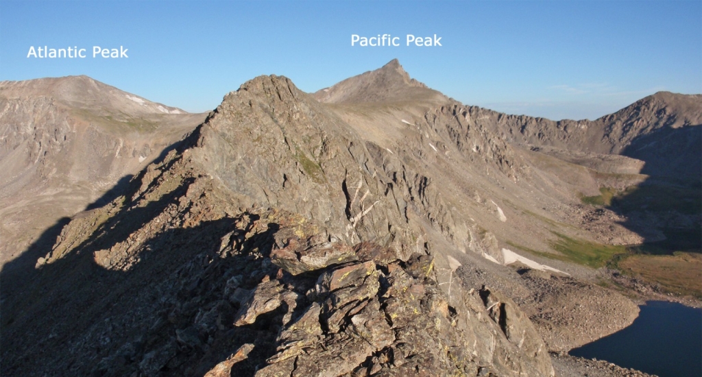
Next up, 1.25 miles of Difficult Class 2 and Easy Class 3 terrain along a beautiful ridge. There are even some Class 3 options if you want to make the route more challenging. Continue along the narrowing ridge to reach Point 13,238', the first major point on the ridge -
8 and
9. From this point, the views are spectacular -
10. Continue toward another, more-rugged point -
11 and
12. Climb on or just left of the ridge crest to reach the top of this point -
13,
14 and
15.
Now that you're more than half way across, the ridge becomes more difficult. Downclimb a steep pitch (
16), pass through a notch and climb to another point. Scramble along the narrow ridge as you approach another major point -
17,
18 and
19.
20 and
21 look back on this exciting section. Continue along the ridge (
22), downclimb to yet another notch (
23) and scramble a bit more (
24) to reach easier terrain, near the end of the ridge -
25.
Drop northwest from the ridge and cross flat terrain to reach Pacific's upper, east ridge, above 13,400' -
26. You've now joined the final section of Pacific's standard route, which uses the Spruce Creek trailhead. Once on the ridge, climb 450' on somewhat loose rock to reach the summit -
27,
28 and
29.
30 and
31 look back over the route. The shortest way back to your vehicle is to descend the same route.
If you'd like to add Atlantic Peak or you do not want to return over the ridge, descend
Pacific's Southeast Slopes route. If you descend this way, you'll end up at the main McCullough Gulch trailhead and have to walk the roads approx. 1.25 miles to the "North" McCullough Gulch and your vehicle.
