Log In 
Difficulty
 Easy Class 3 
Risk Factors
ExposureConsiderable
RockfallConsiderable
Route-FindingConsiderable
CommitmentModerate
TrailheadHuerfano/Lily Lake 10,700 feet
Summit14,055 feet
Elevation Gain3,500 ft
Length Round-TripRT8.25 mi
Peak Conditions339 reports
Downloadsgpx GPX  kml KML
Photo
Show More
Route Last Updated: Jul 2026
Waiver Required
Mt. Lindsey's standard routes are now open, you just have to sign a climbing waiver. This is required by the landowner and can be completed HERE.

Trailhead

From the town of Gardner, located northwest of Walsenburg, take Colorado 69 west for approximately half a mile, then turn west onto County Road 550. The trailhead is 22+ miles from this point. Start measuring mileage here:

  • At 7.0 miles, the road turns to dirt.
  • At 11.8 miles, stay left on Forest Road 580.
  • At 15.7 miles, stay left at the entrance to the Singing River ranch. The road becomes narrow, but usually still 2WD with good clearance.
  • At 16.7 miles, pass the entrance to the Aspen River ranch.
  • At approx. 20 miles, reach the the west side of large, landslide area where the road was re-routed in 2016. After this point, there's a steep section that requires 4WD.
  • Continue 2 miles on the rough, narrow road to reach the Lily Lake TH. There are dispersed camping spots along this section.

Route Description

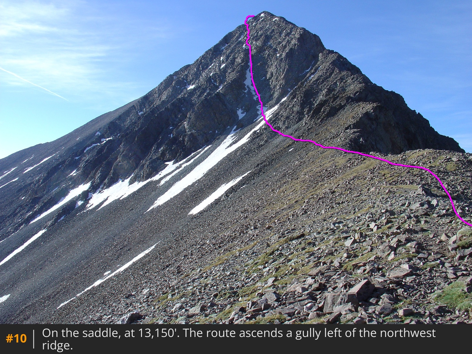
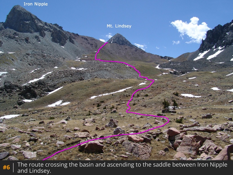
This route has long been considered the standard route on Lindsey, but it becomes an unpleasant ascent/descent once the snow has melted out of the northwest gully. If the snow is gone, consider using the Northwest Ridge once you get to the 13,150-foot saddle between Iron Nipple and Mt. Lindsey. The ridge is steeper, more exposed, and requires Class 3 scrambling, but it is far more stable despite the added challenge.

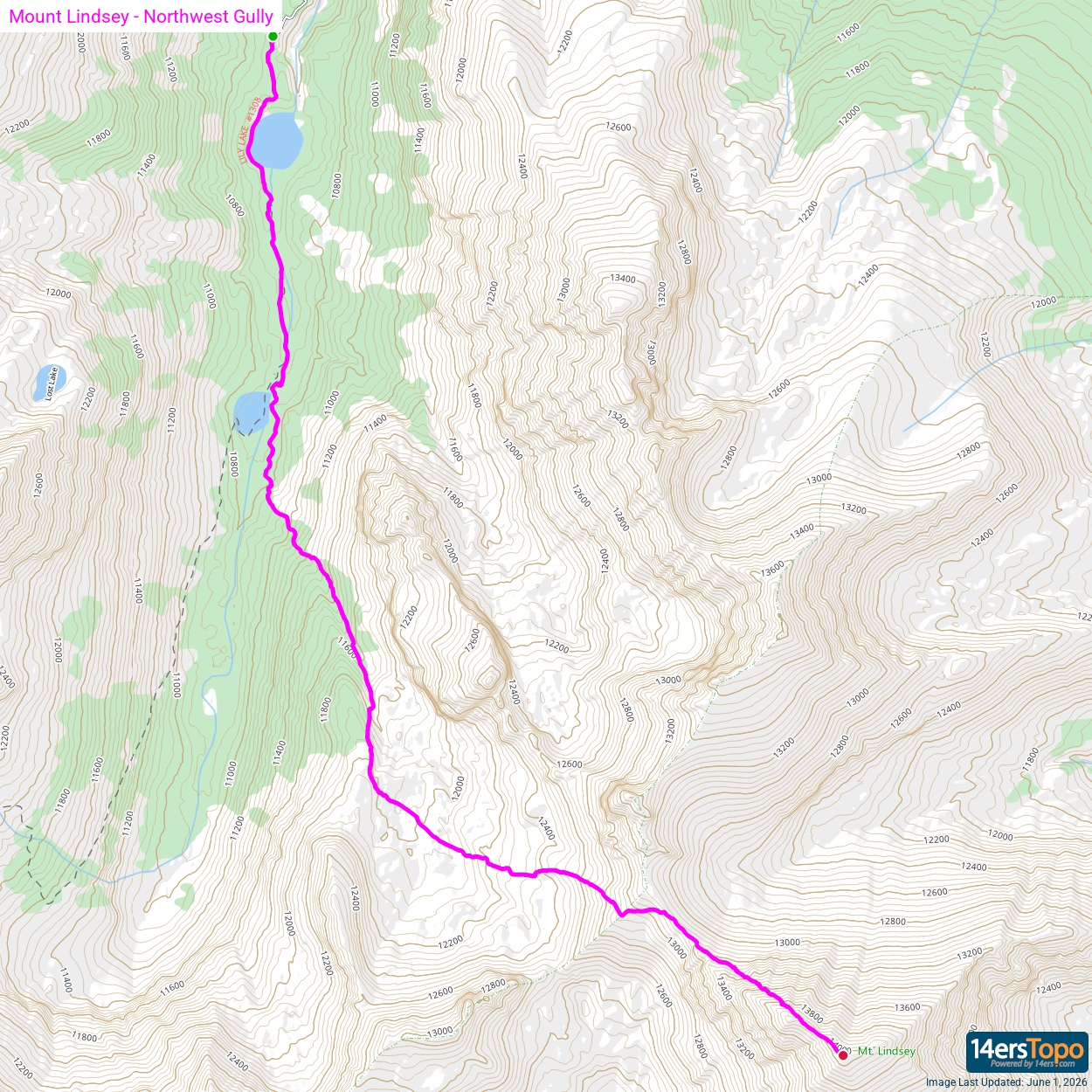
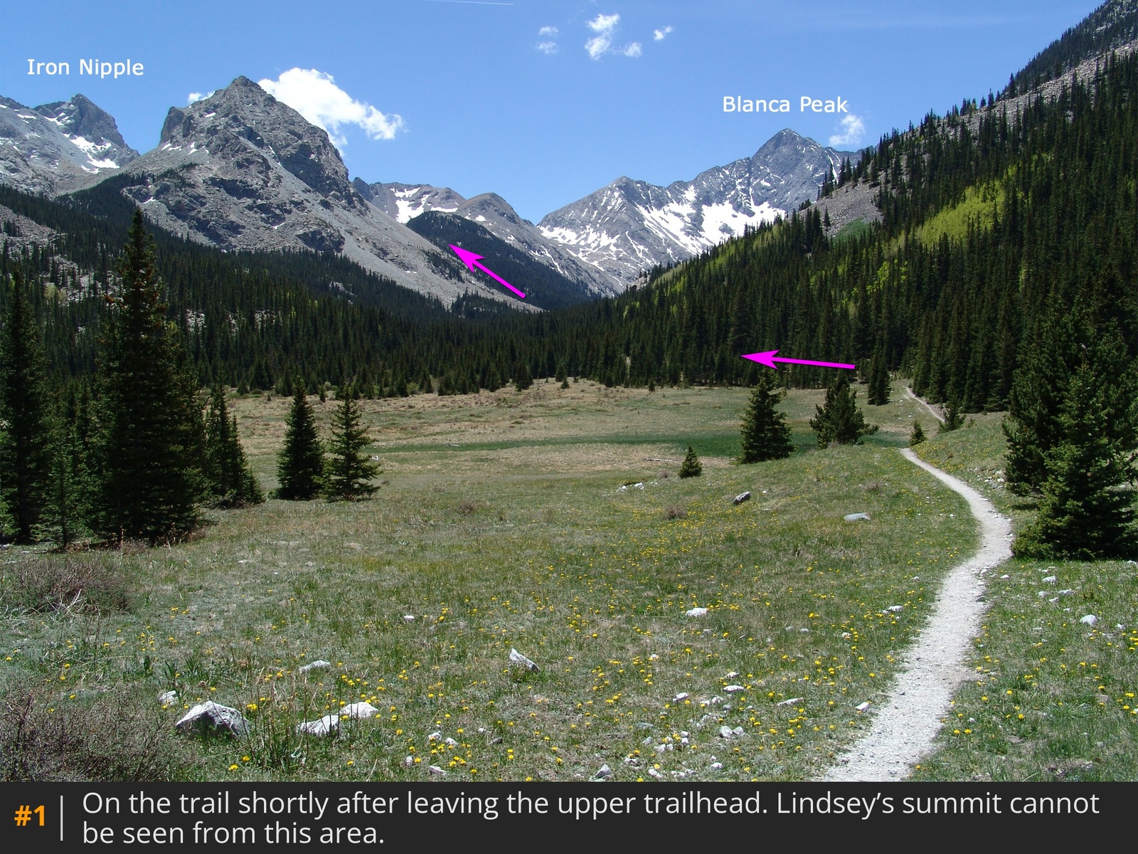
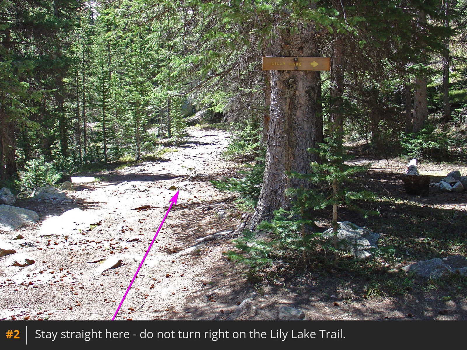
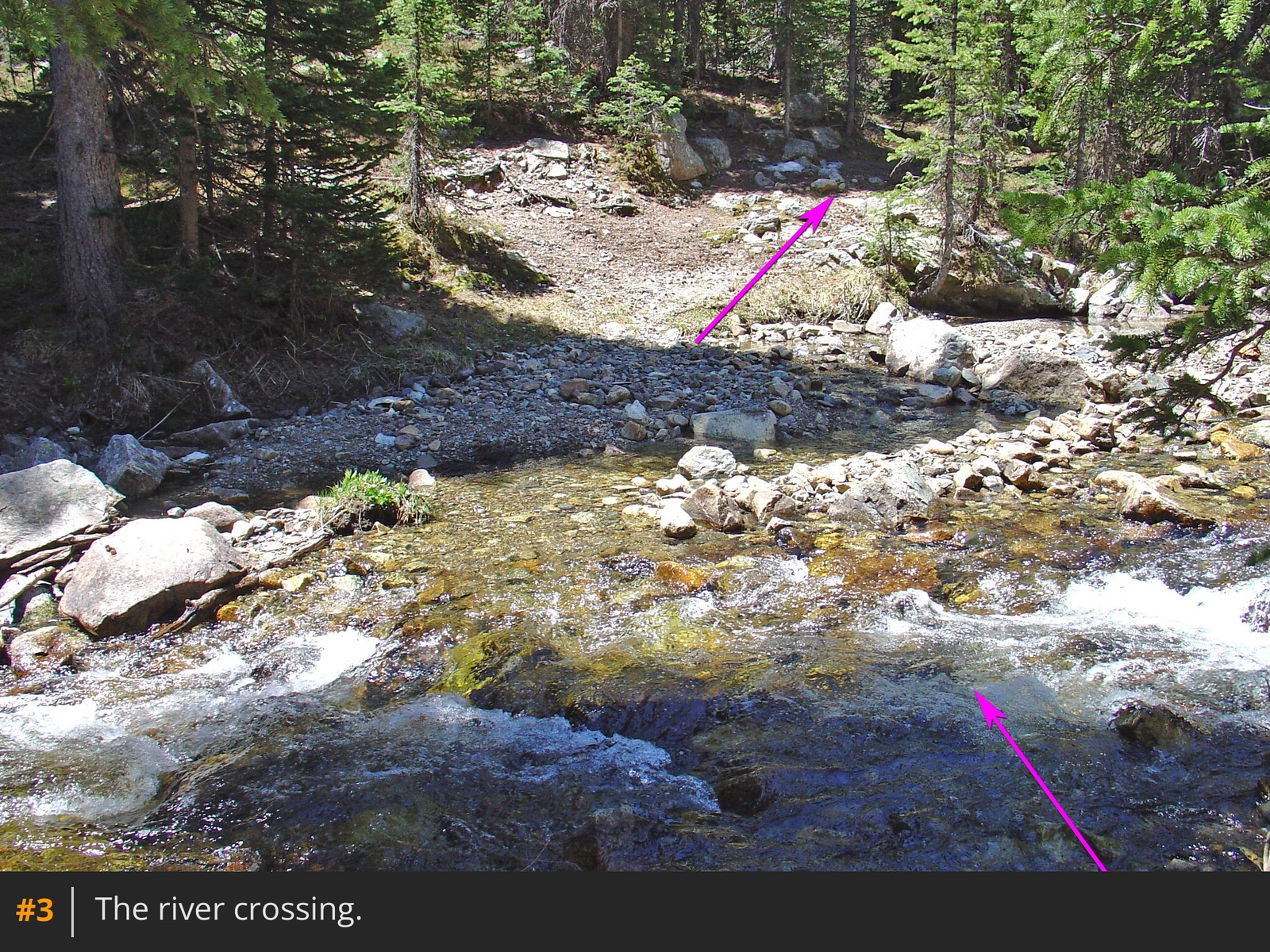
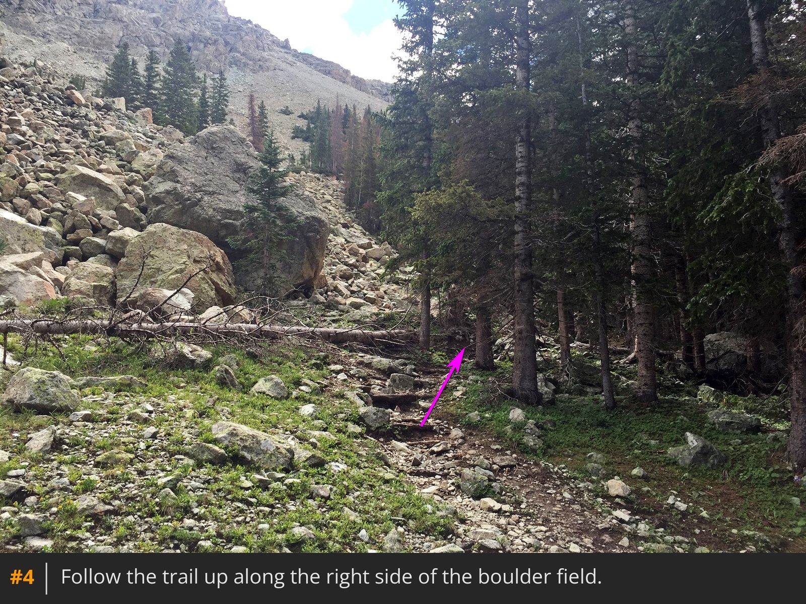
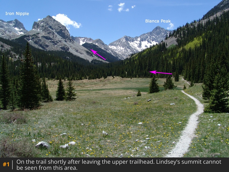
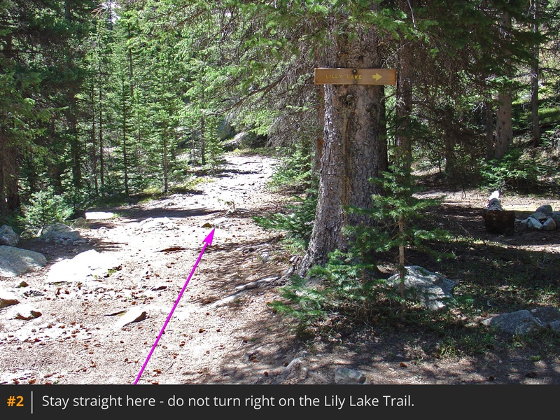
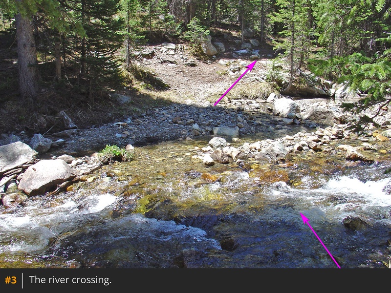
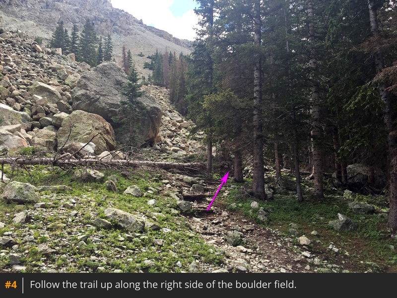
From the parking area, follow the Lily Lake trail south through trees into a large meadow  1. Walk 1 mile to a trail junction where the Lily Lake trail veers right  2. Continue straight on the unmarked trail for 100 yards, cross the Huerfano River  3, and head south. About 0.1 mile after the crossing, the trail climbs left, away from the river. Zigzag through the dense forest to reach a boulder field near 10,800'  4.

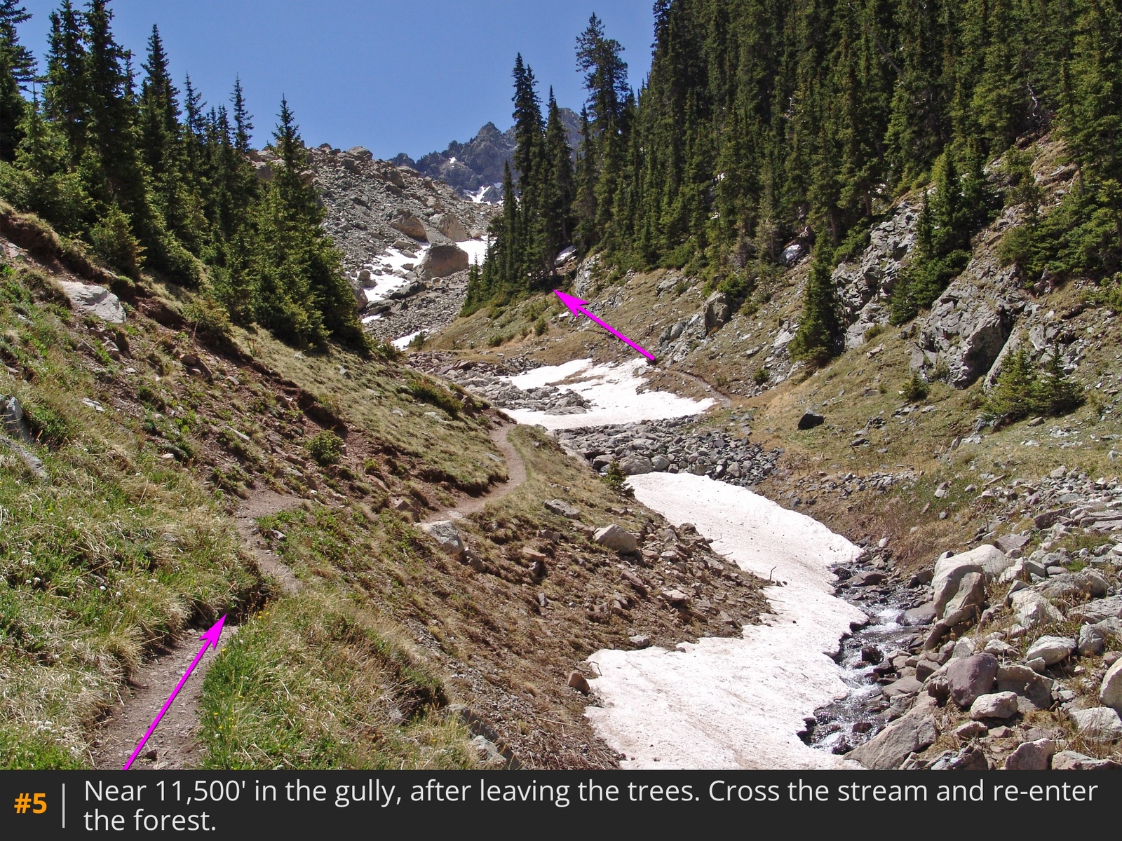
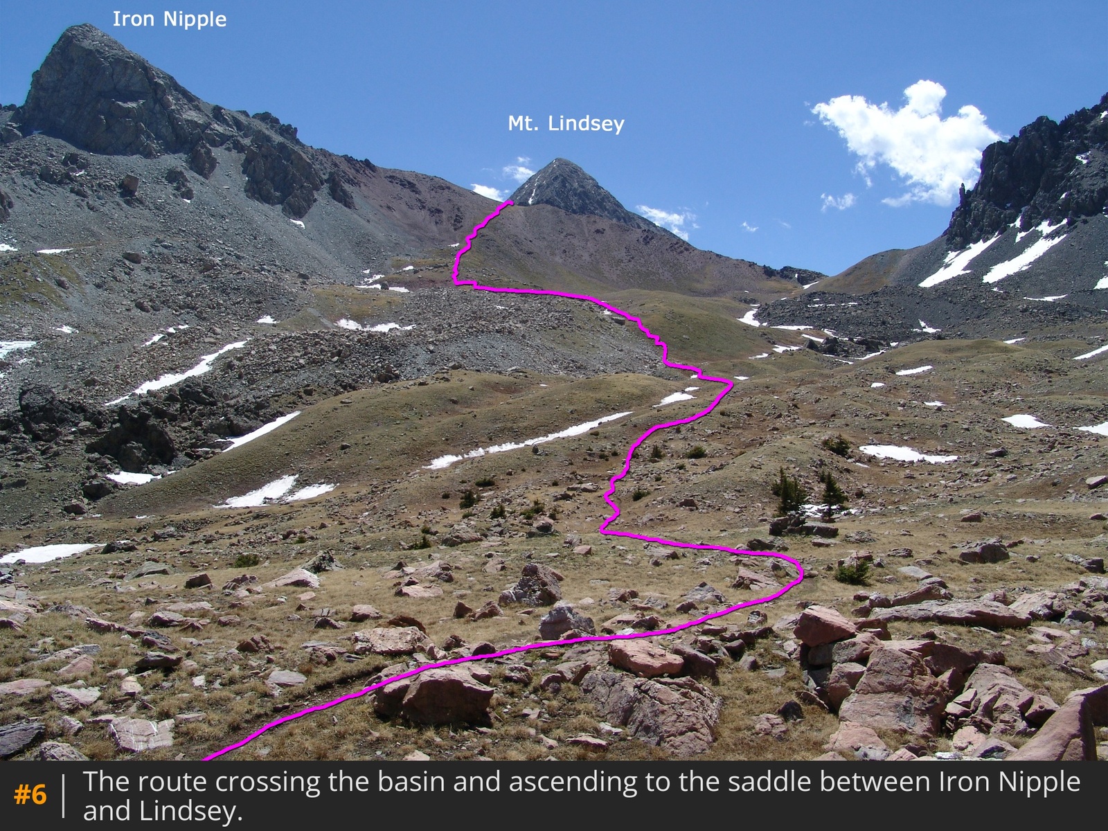
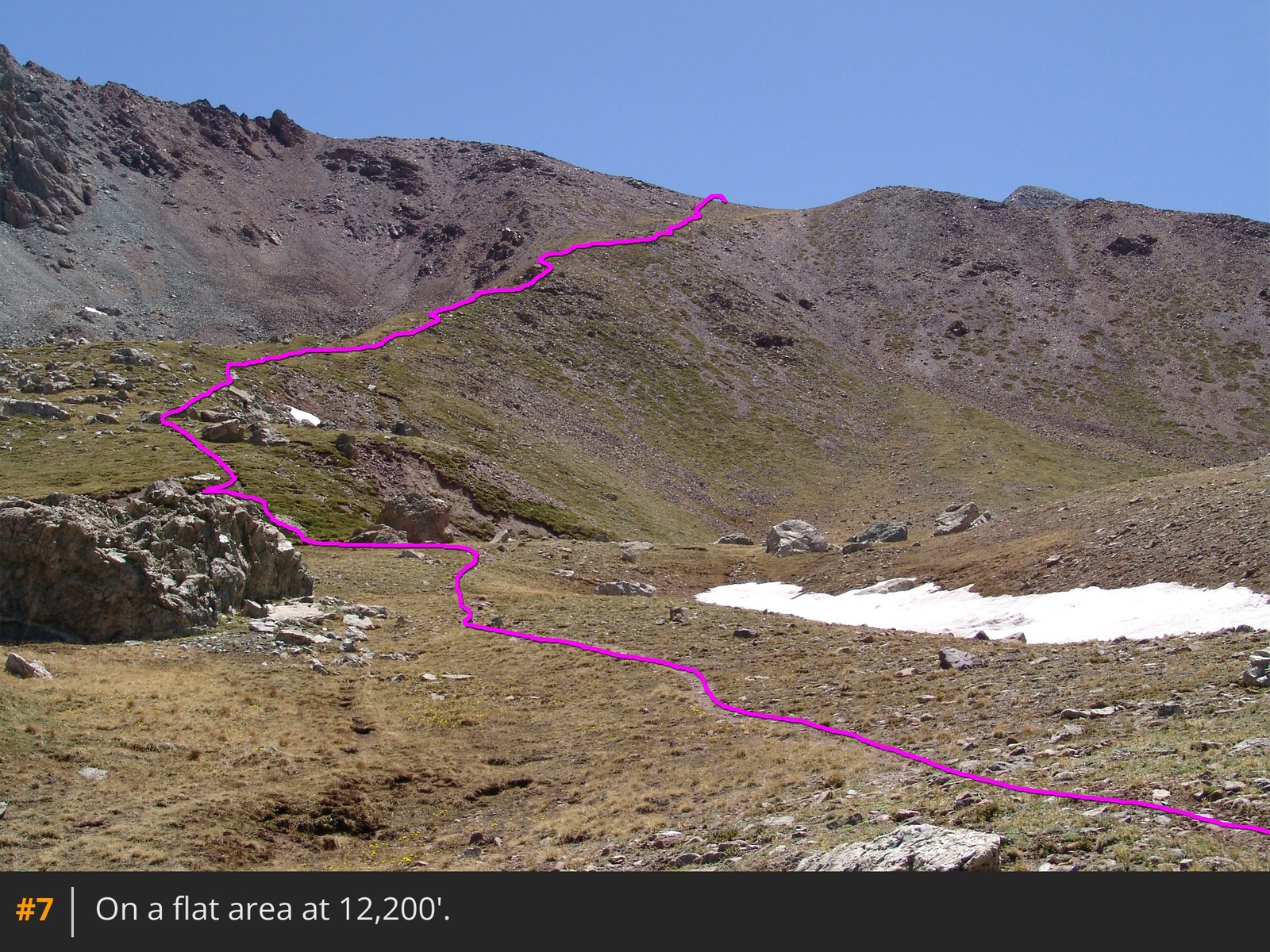
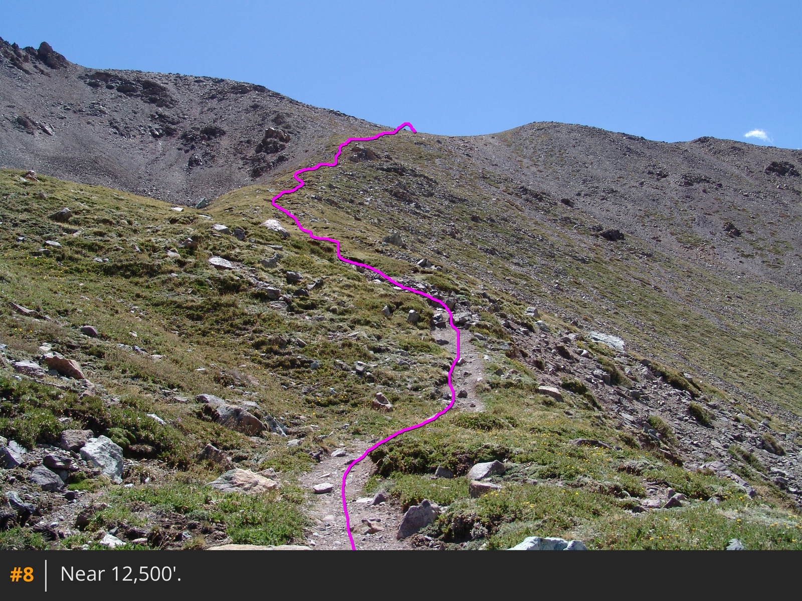
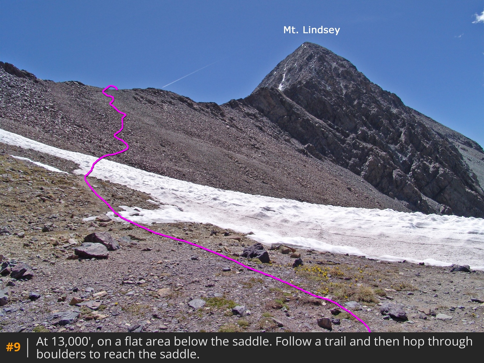
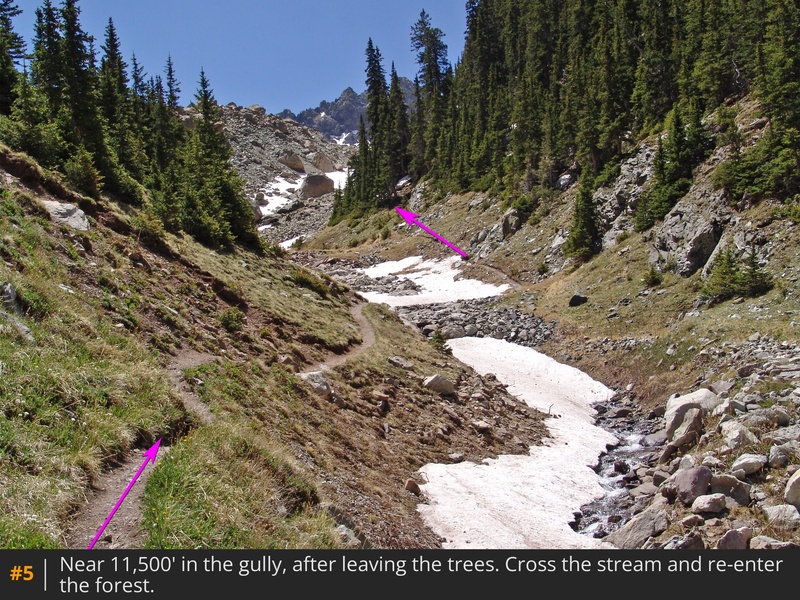
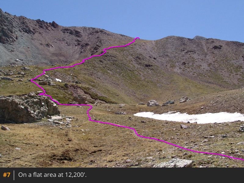
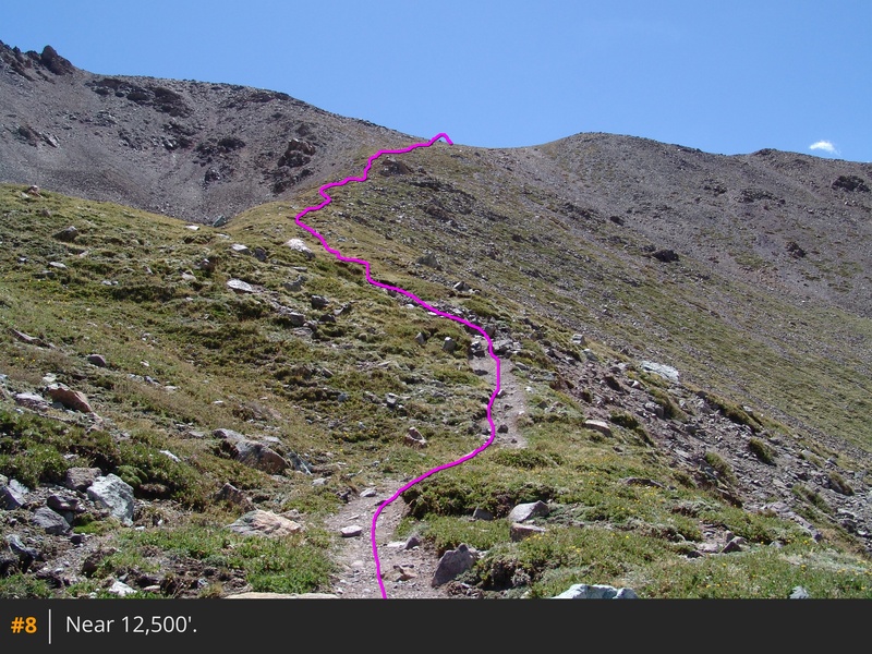
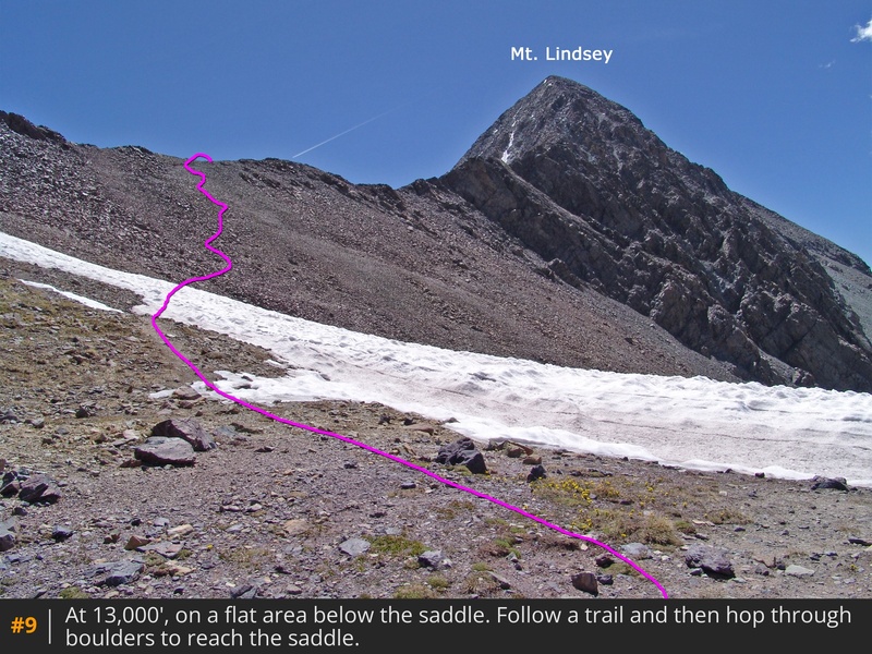
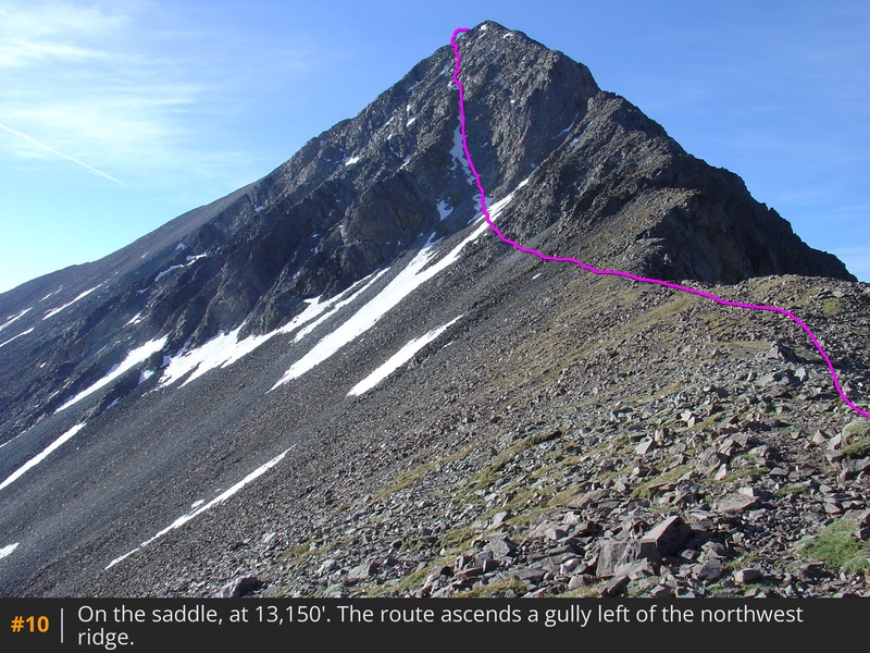
Now it's time to gain some elevation. Climb roughly 600 feet through the forest on the right side of the boulder field to reach a gully/stream around 11,400'. Follow along the stream's left side and cross it near 11,600'  5. Continue south, climbing a hillside to emerge at tree line near 12,000', overlooking a high basin and Mt. Lindsey's summit  6. Drop slightly, walk toward the east side of the basin, and ascend to 12,200'  7. From there, follow a small ridge  8 to reach a 13,000-foot crest  9. The remaining route is on private property, hopefully you filled out the landowner's liability waiver. Navigate through a boulder field to the 13,150-foot saddle between 13er Iron Nipple and Mt. Lindsey  10.

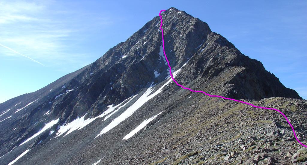
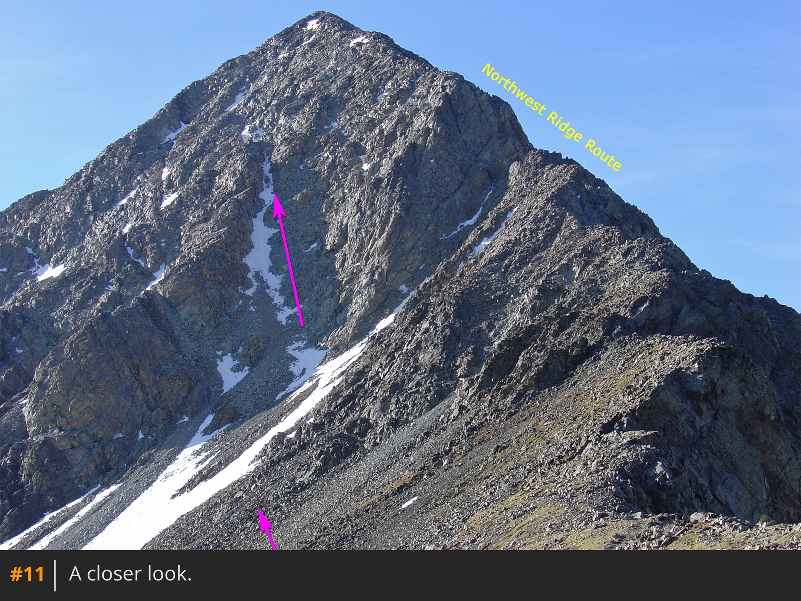
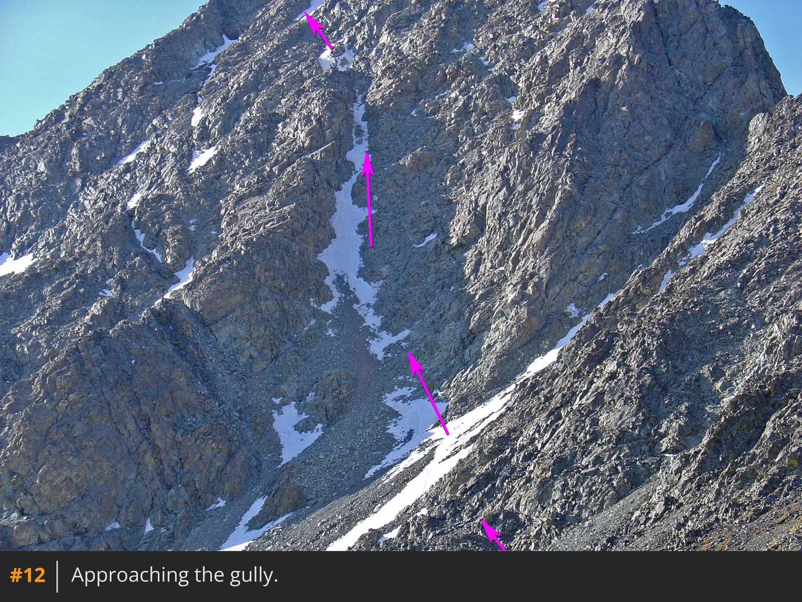
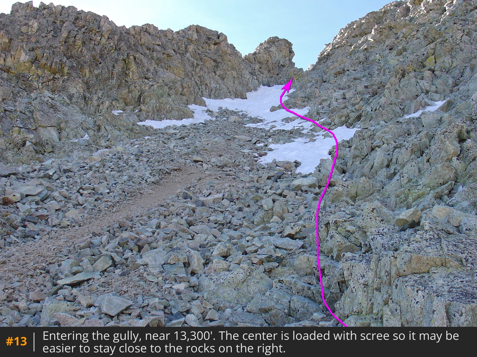
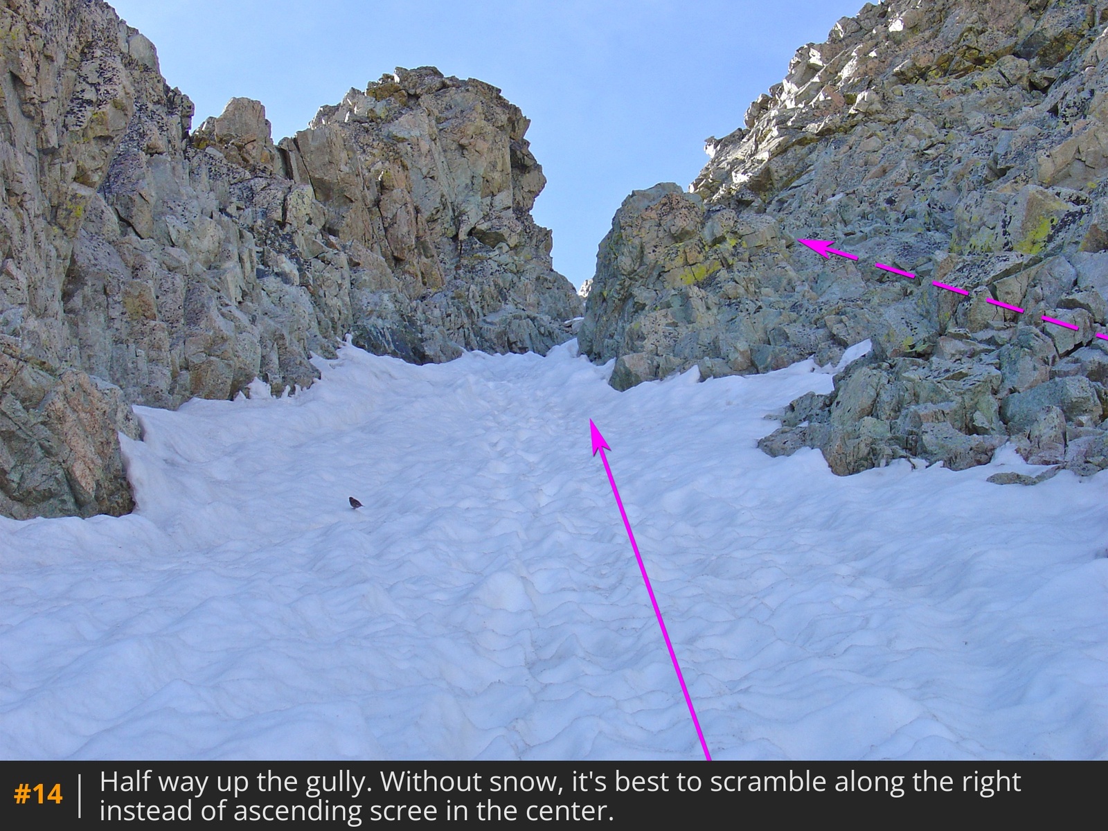
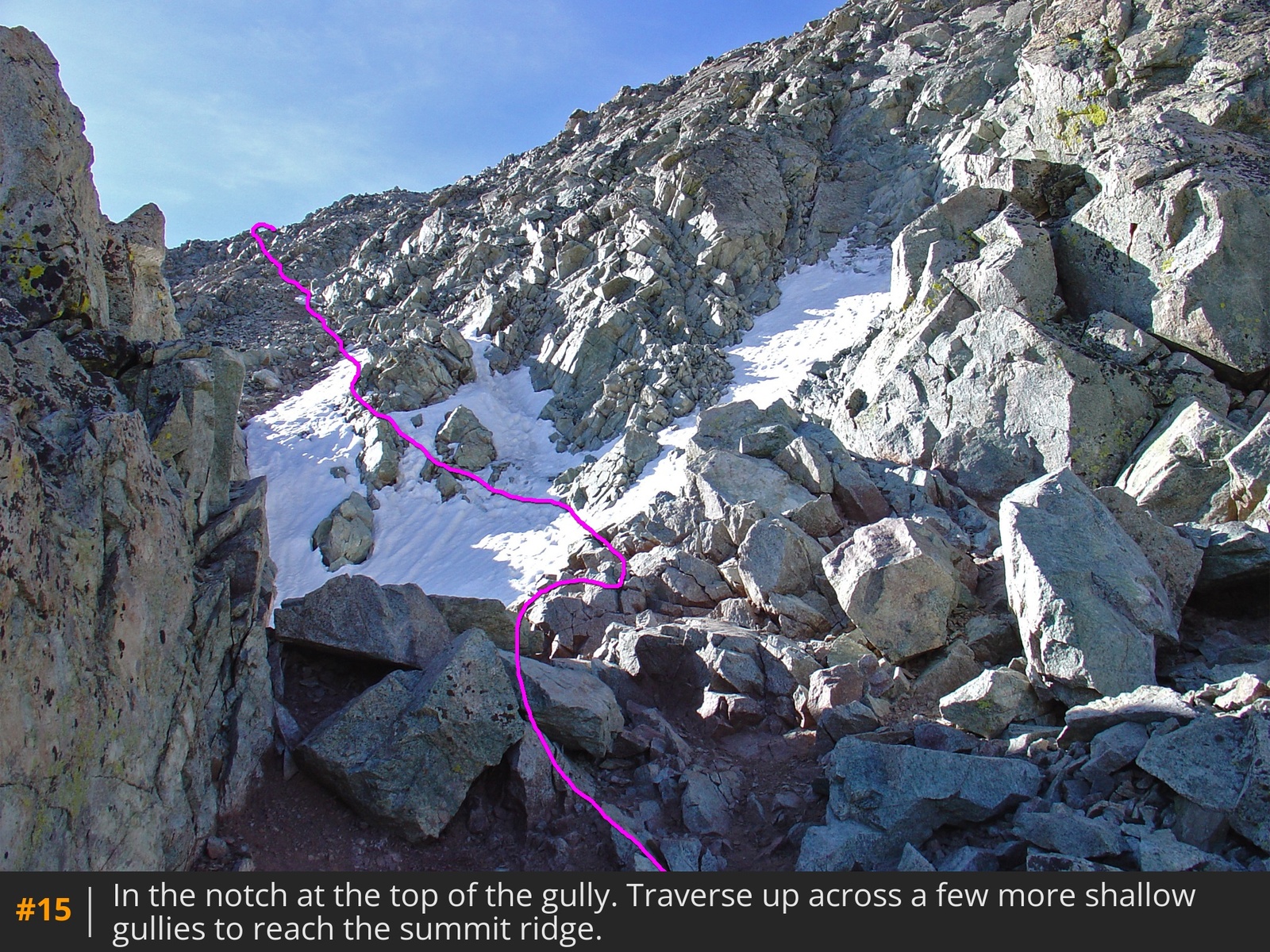
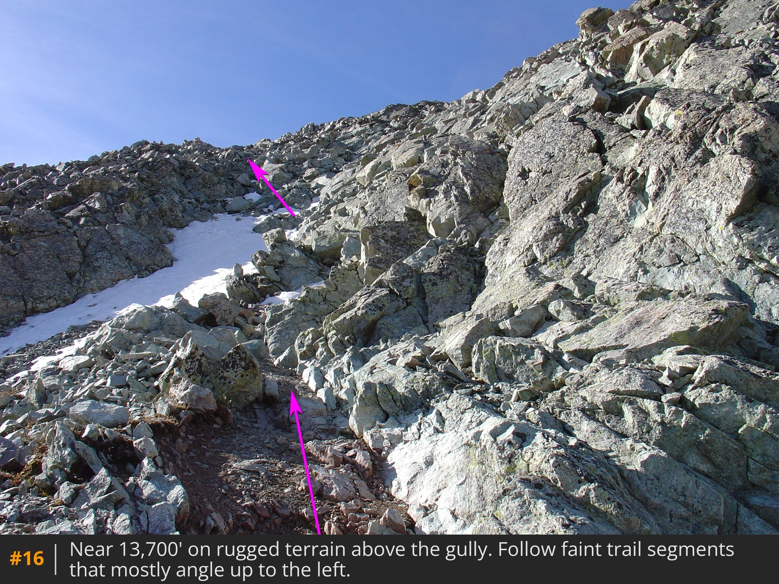
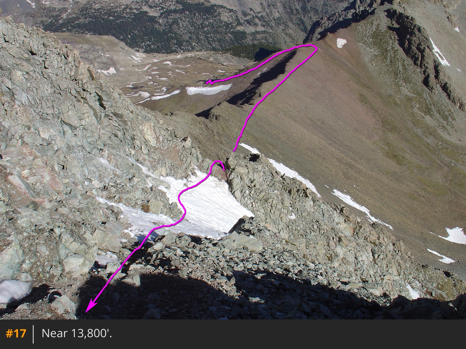
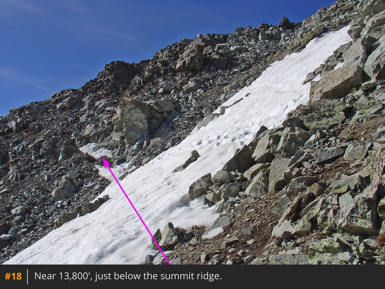
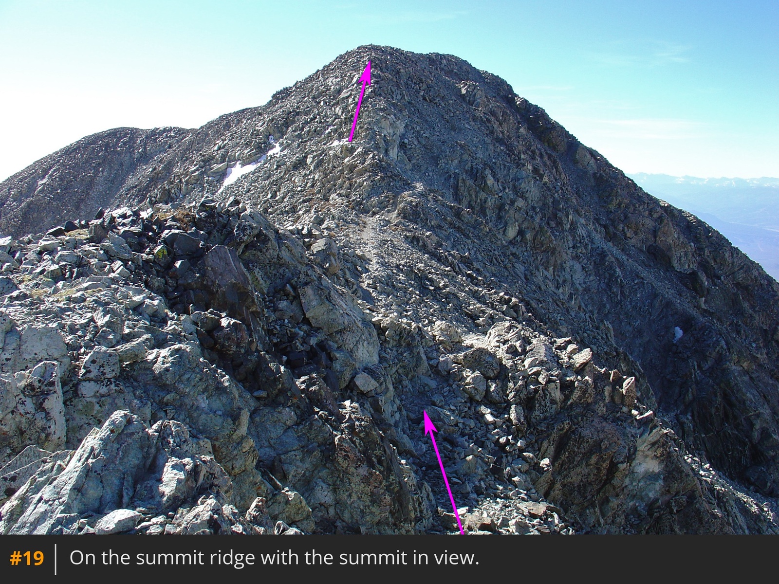
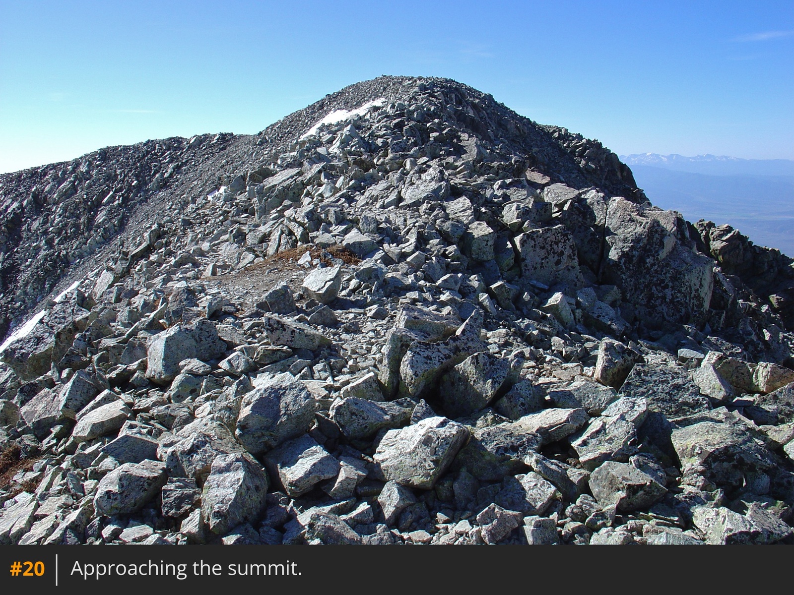
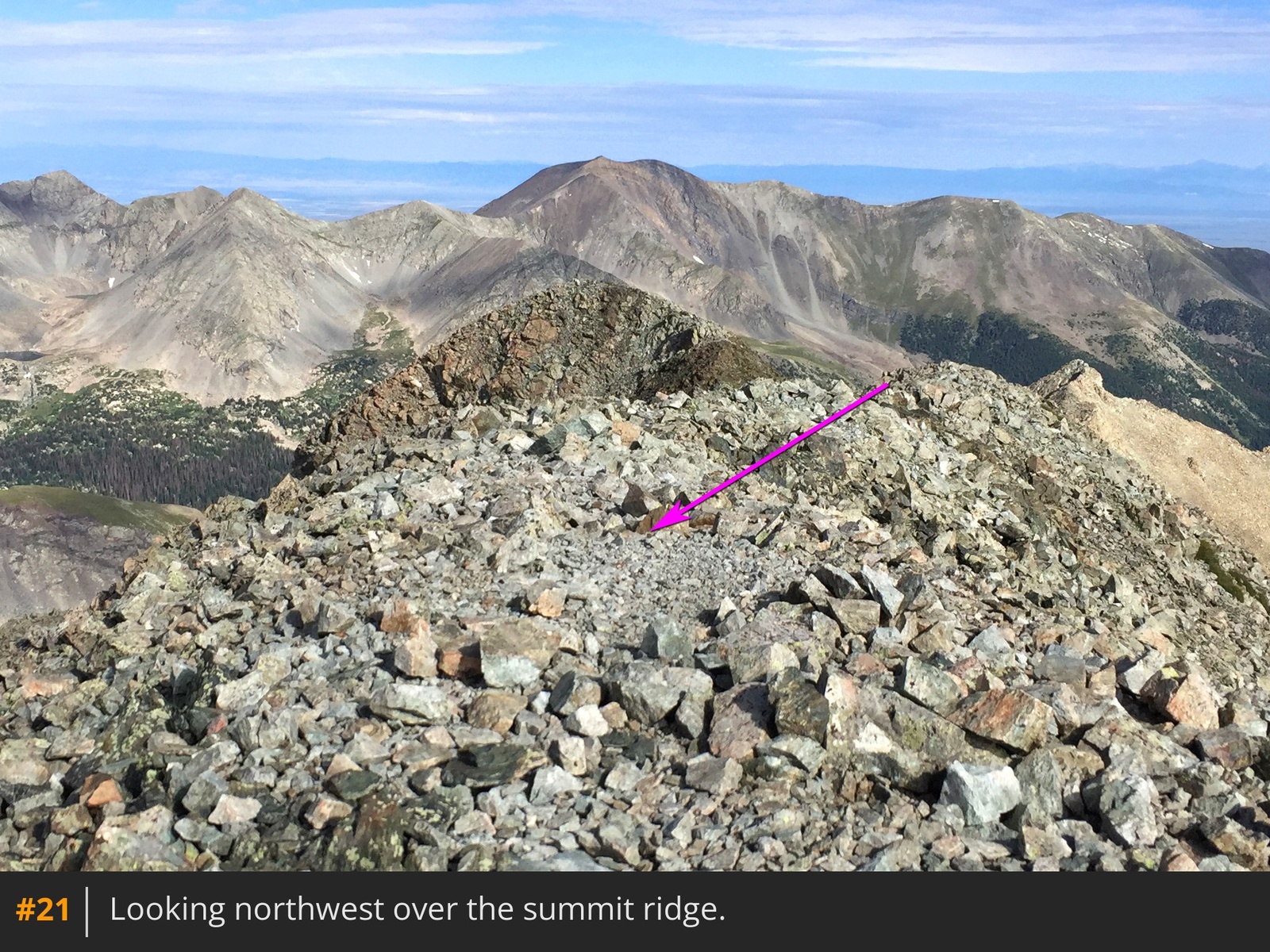
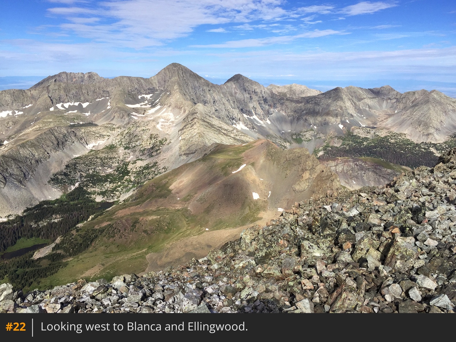
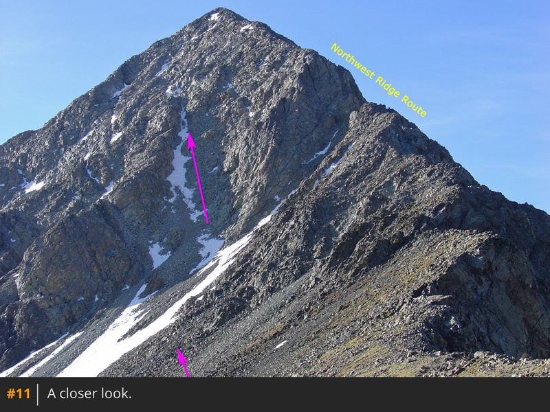
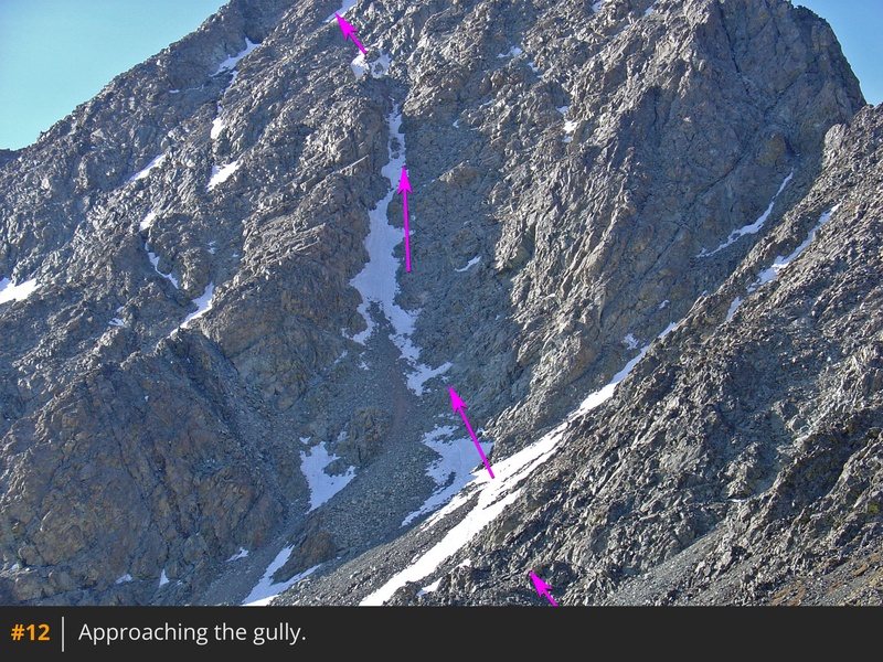
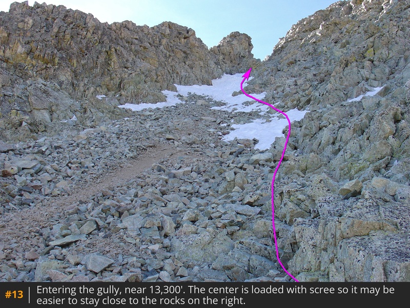
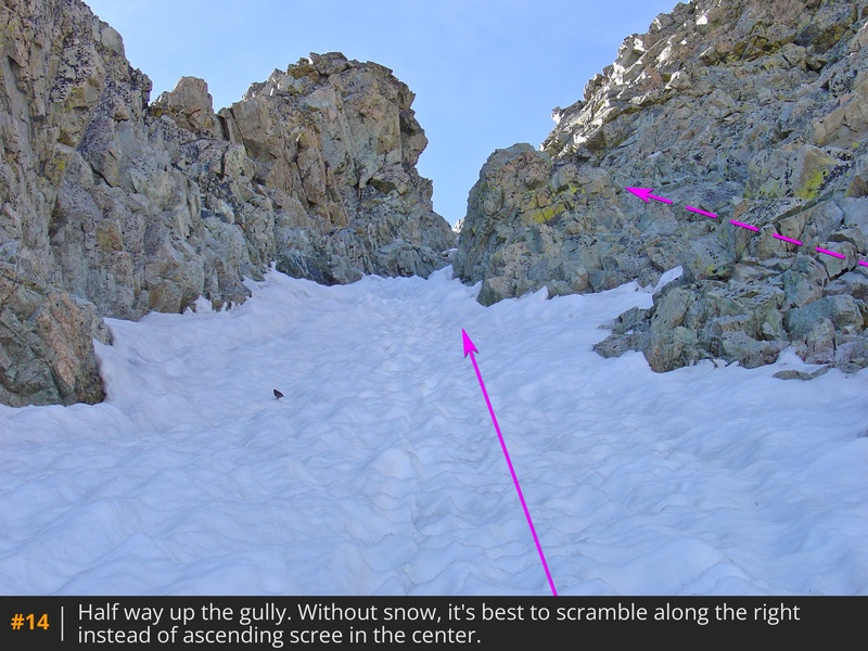
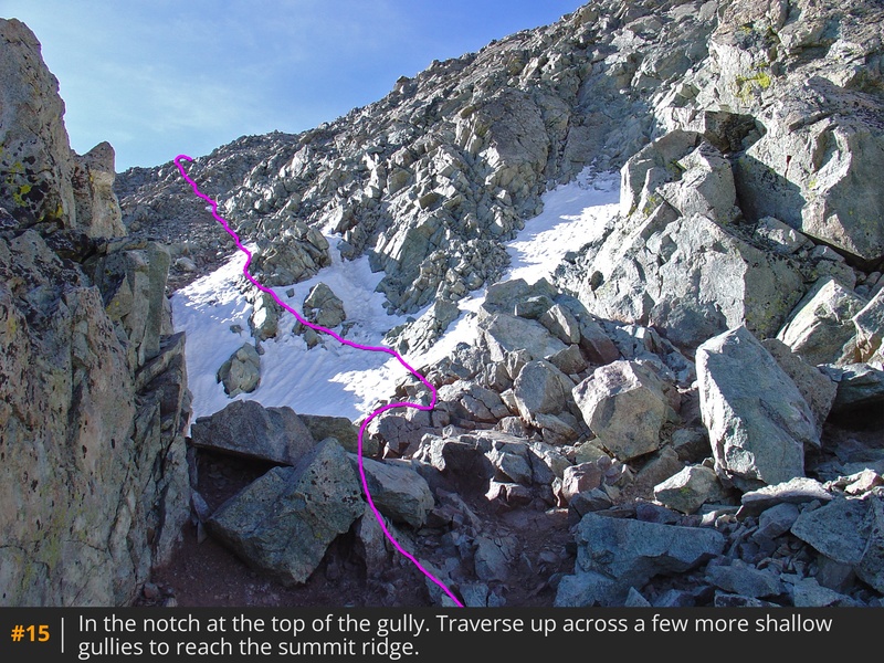
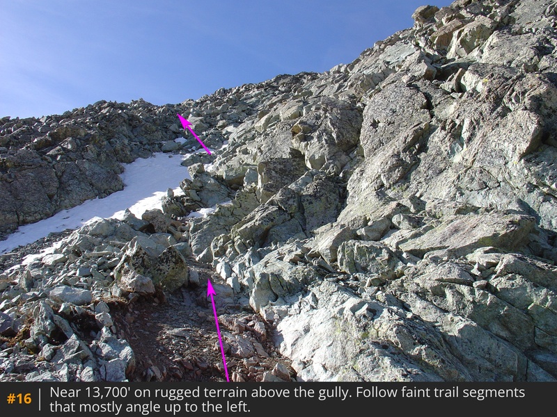
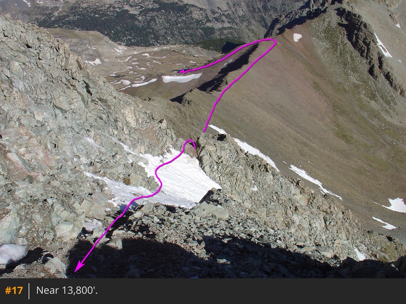
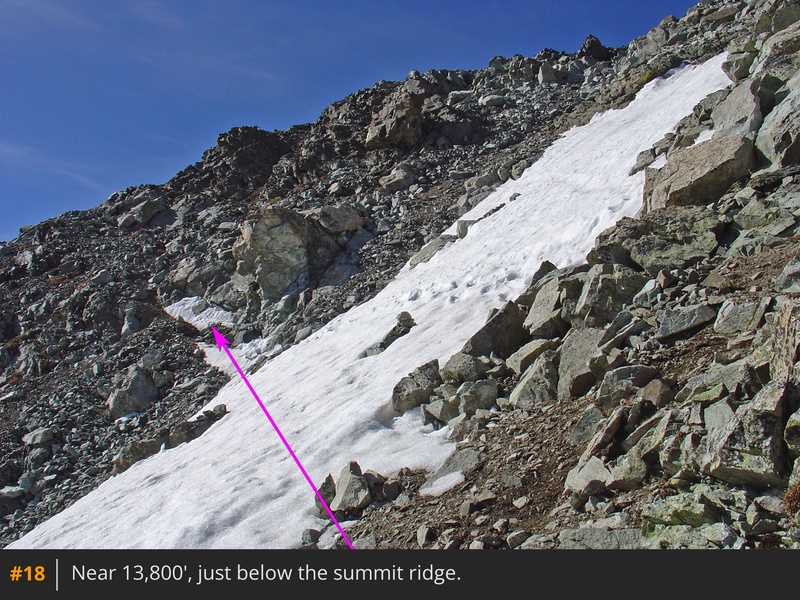
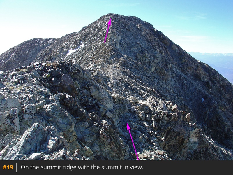
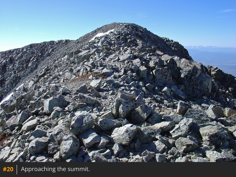
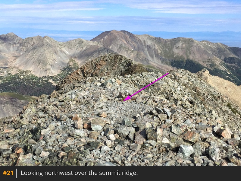
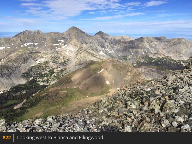
Ahead, you’ll see Lindsey's rugged north face and northwest gully  11  12. Follow the ridge southeast to 13,200', where the trail begins to traverse east toward the gully. Continue to the base of the gully  13. From here, the ascent becomes steep, loose, and more difficult. Climb carefully and try not to dislodge rocks. Use the more stable terrain along the gully's right/upper edge when possible. Near the top of the gully (~13,600'), narrow sections may require easy Class 3 moves if snow is not present  14. At the top of the gully, pass through a small notch  15 and traverse east across shallow gullies, gradually gaining elevation  16. As an alternative to this traverse from the notch, you can also turn right and following angled Class 3 slabs which makes for more line toward the summit ridge. Above 13,800', the climb remains steep  17  18 until reaching Lindsey's summit ridge near 14,000'  19. Hike southeast for 0.2 mile to reach the summit  20  21  22.

Notes

IMPORTANT: This route enters the Sangre De Cristo Wilderness area. Designated wilderness areas have special regulations and restrictions for party size, dispersed camping, campfires, etc. Also, dog owners should read the wilderness information carefully because some wilderness areas prohibit dogs to be off-leash and/or limit how close dogs can be to lakes and streams. If you have questions about the wilderness area, please contact a U.S. Forest Service office for the National Forest(s) listed above.

Maps

JPG Image
Static Map JPG

Interactive Map & 3D Flythrough
Human Verification Required

Photos

#1#2#3#4#5#6#7#8#9#10#11#12#13#14#15#16#17#18#19#20#21#22

Weather

Caution: The information contained in this route may not be accurate and should not be the only resource used in preparation for your climb. Failure to have the necessary experience, physical conditioning, supplies or equipment can result in injury or death. 14ers.com and the author(s) of this route provide no warranties, either express or implied, that the information provided is accurate or reliable. By using the information provided, you agree to indemnify and hold harmless 14ers.com and the route author(s) with respect to any claims and demands against them, including any attorney fees and expenses. Please read the 14ers.com Safety and Disclaimer pages for more information.

Copyright: Route information, text, risk factors, maps, GPX files, charts, photos, 14ers.com-created map imagery, flythroughs, and other content provided in this route description are copyrighted by 14ers.com and may not be copied, reproduced, republished, distributed, modified, or used to create derivative works without prior written permission.

Please respect private property: 14ers.com supports the rights of private landowners to determine how and by whom their land will be used. In Colorado, it is your responsibility to determine if land is private and to obtain the appropriate permission before entering the property.

Heading to a 14er soon? Don't forget the 14ers.com mobile app.
Google Play     Apple App Store