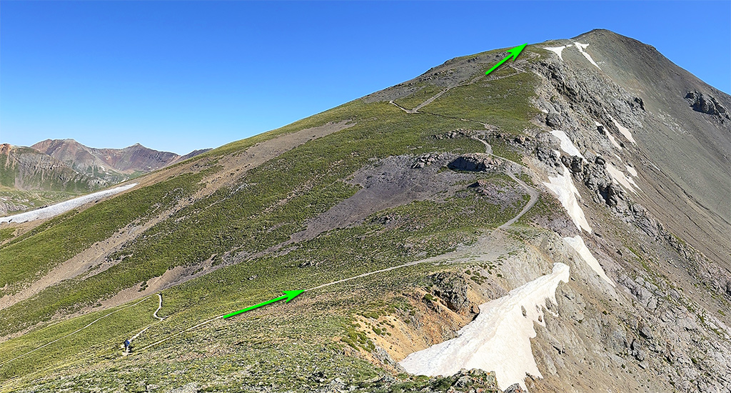
If you parked below the trailhead, walk up the remaining section of the 4WD road to reach the main trailhead. From there, follow the trail as it climbs south into American Basin (
1,
2,
3). Near 12,400', turn left and ascend a slope at the center of the basin (
4,
5). At 12,700', the terrain levels out, revealing the broader upper basin. Continue east (
6,
7). The summit is up to your left, but rather than heading directly toward it, stay on the trail as it curves right (south) and ascends toward Sloan Lake (
8,
9). Climb 300+ feet to reach a trail junction
just north of the lake (
10,
11).
From the junction, turn left and head east onto more rugged terrain (
12). Here, you will traverse a talus slope to reach easier ground on Handies' southwest slope. During this traverse, descend slightly at the most challenging section of the trail (
13). Above 13,000', leave the talus behind and switchback up the southwest slope (
15,
16). At 13,500', reach the saddle
between Handies and unnamed Point 13,588' (
17). Turn left and follow the trail along the ridge (
18,
19) to arrive at the summit (
20,
21).
