Log In 
Difficulty
 Difficult Class 2 

Snow Steepness: Moderate
 Advanced, D8 / R3 / II
Risk Factors
ExposureModerate
RockfallConsiderable
Route-FindingConsiderable
CommitmentConsiderable
Trailhead
Grizzly Gulch 9,800 feet
Summit
14,272 feet
Elevation Gain
3,000 feet starting near 11,200 on the GG road
4,500 feet starting at I-70
Length Round-TripRT
2.75 miles starting near 11,200 on the GG road
10.5 miles starting at I-70
Peak Conditions
Downloads
Photo
Show More
Route Last Updated: Jul 2026
Snow Only Route
This route should only be climbed with consolidated, stable snow, usually in spring or early summer. In mid-winter, many snow routes have frequent risk of avalanche.

Trailhead

The Grizzly Gulch 4WD road is rough and narrow and not recommended for an SUV. From I-70, take exit #221 at Bakerville and continue to the south side of the highway and the start of Forest Road 189. Drive up 189 over 1 mile and turn right onto the Grizzly Gulch road. Stay right on the "189.1c" road after 1/4 mile and continue west into Grizzly Gulch.

Route Description

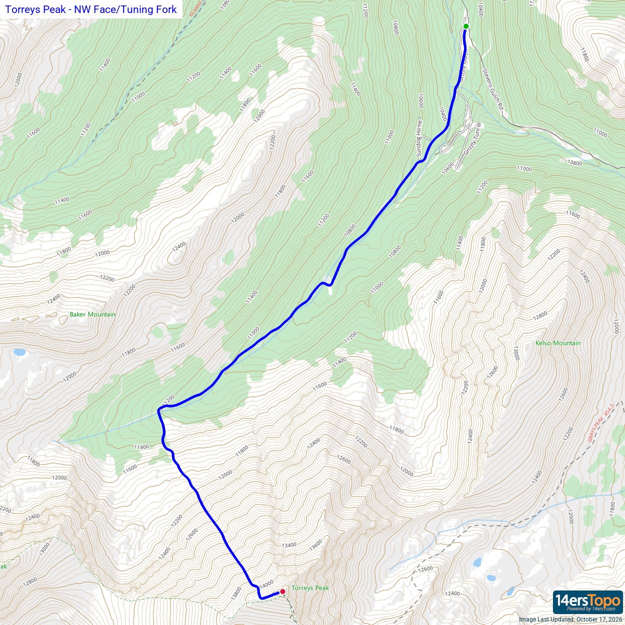
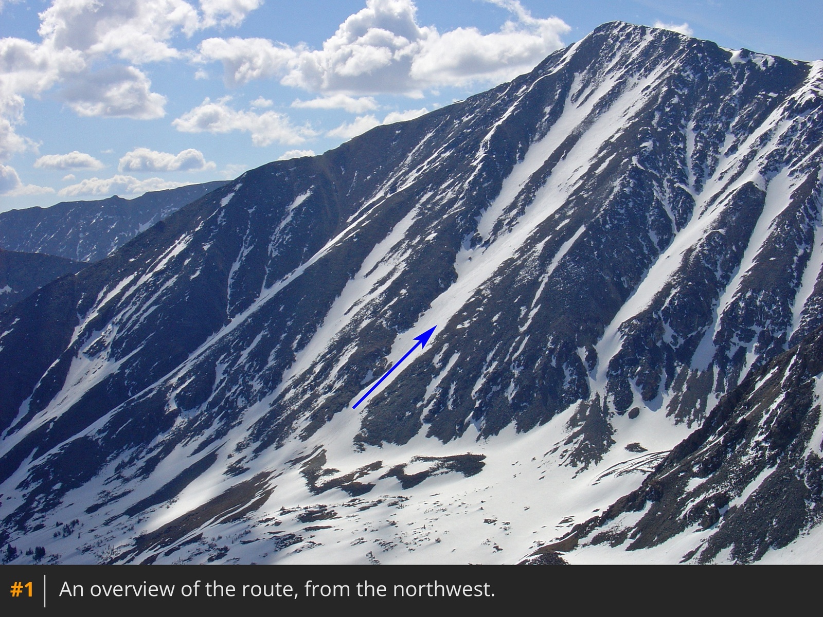
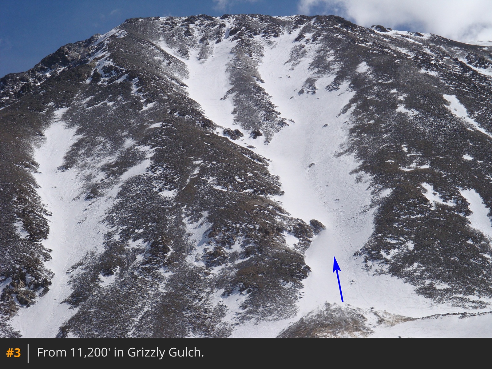
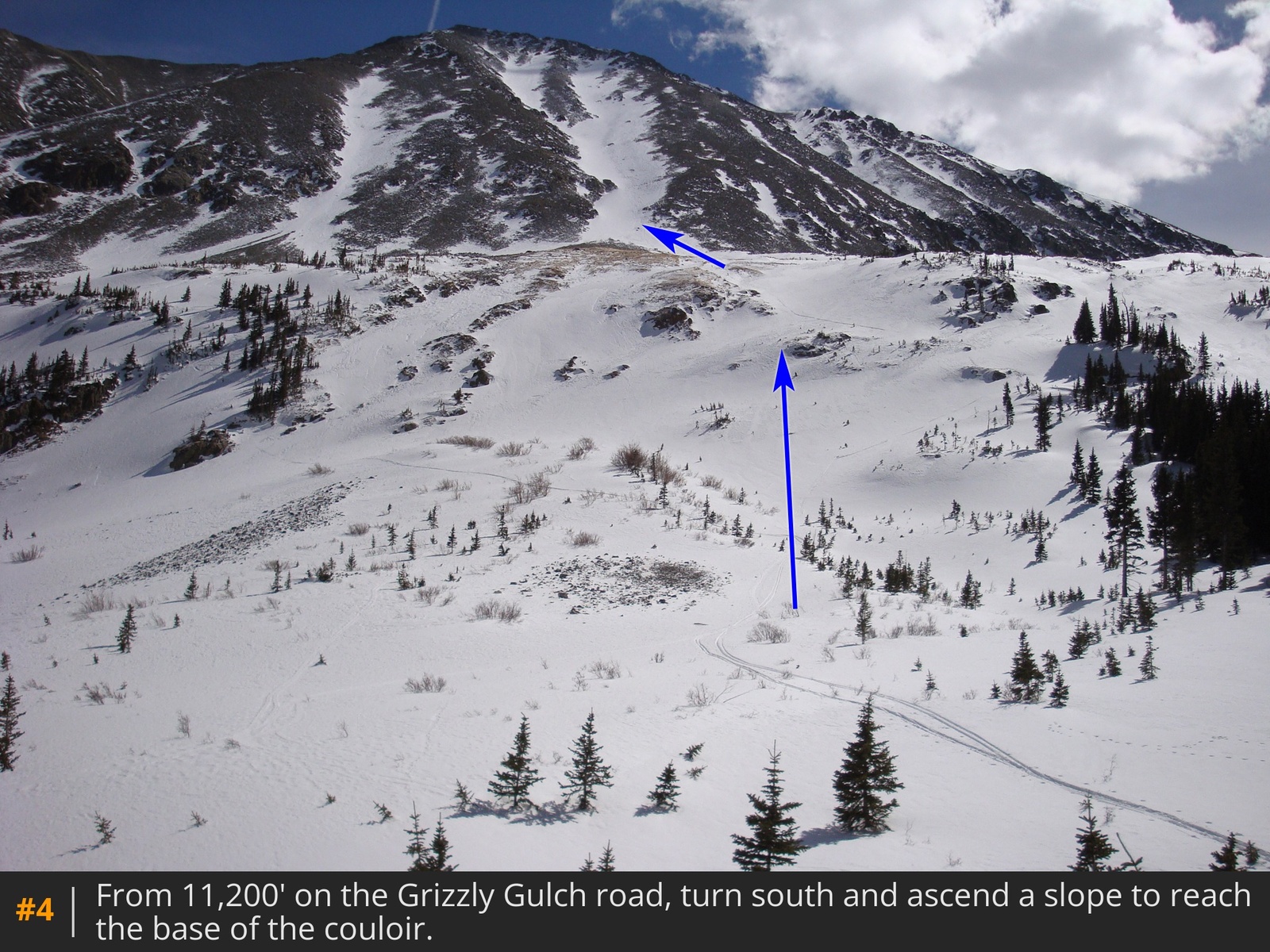
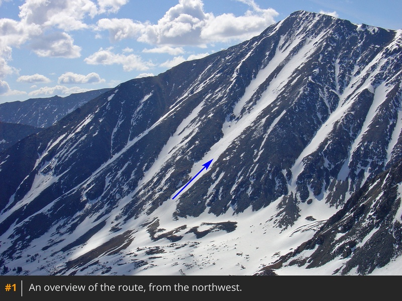
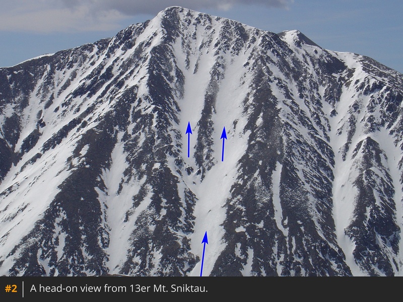
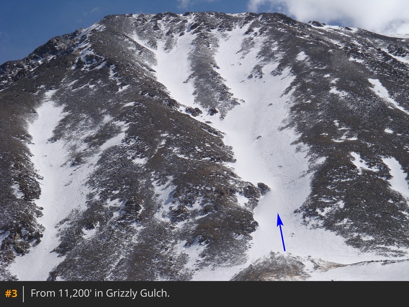
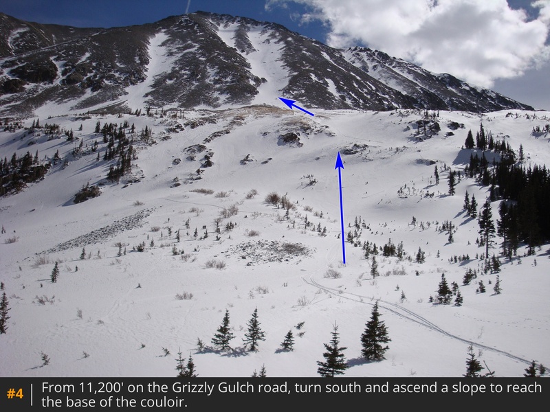
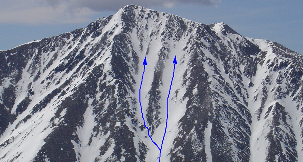
The "Tuning Fork" is one of the longest 14er snow routes  1  2. In spring, it can provide 3,000 feet of continuous snow, maybe even from the summit. Lou Dawson refers to it as the "Big-ol-strip-o-snow" in Colorado's Fourteeners Volume 1 The Northern Peaks. After passing the buildings 1/4 mile up the Grizzly gulch road, continue on 189.1c for approximately 1 mile to a stream crossing and then another mile to a clearing, near 11,200', where you can see the route off to your left (south)  3  4.

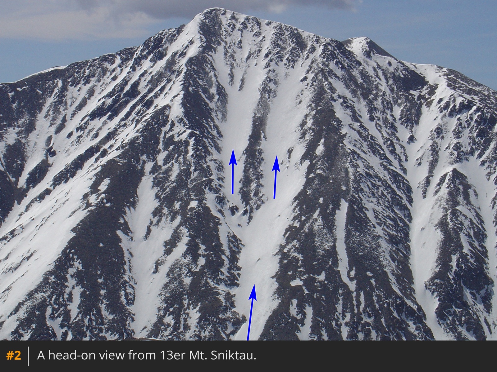
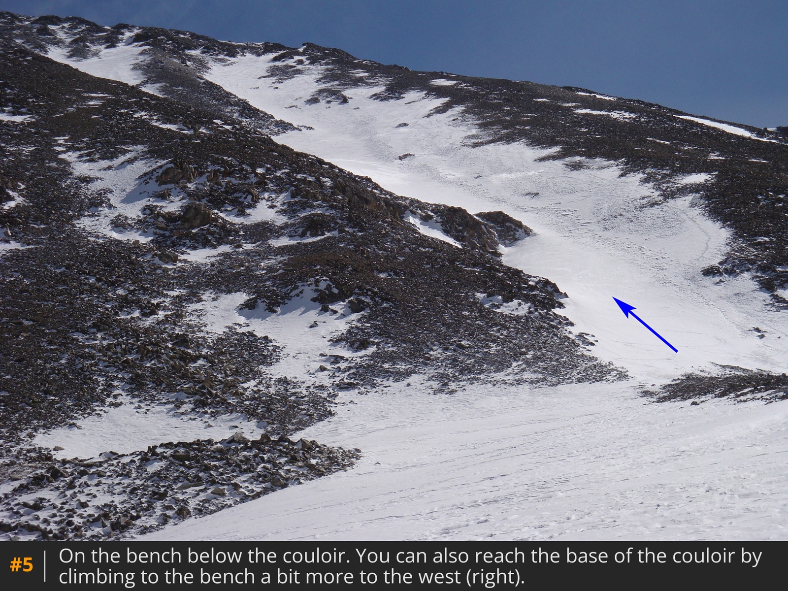
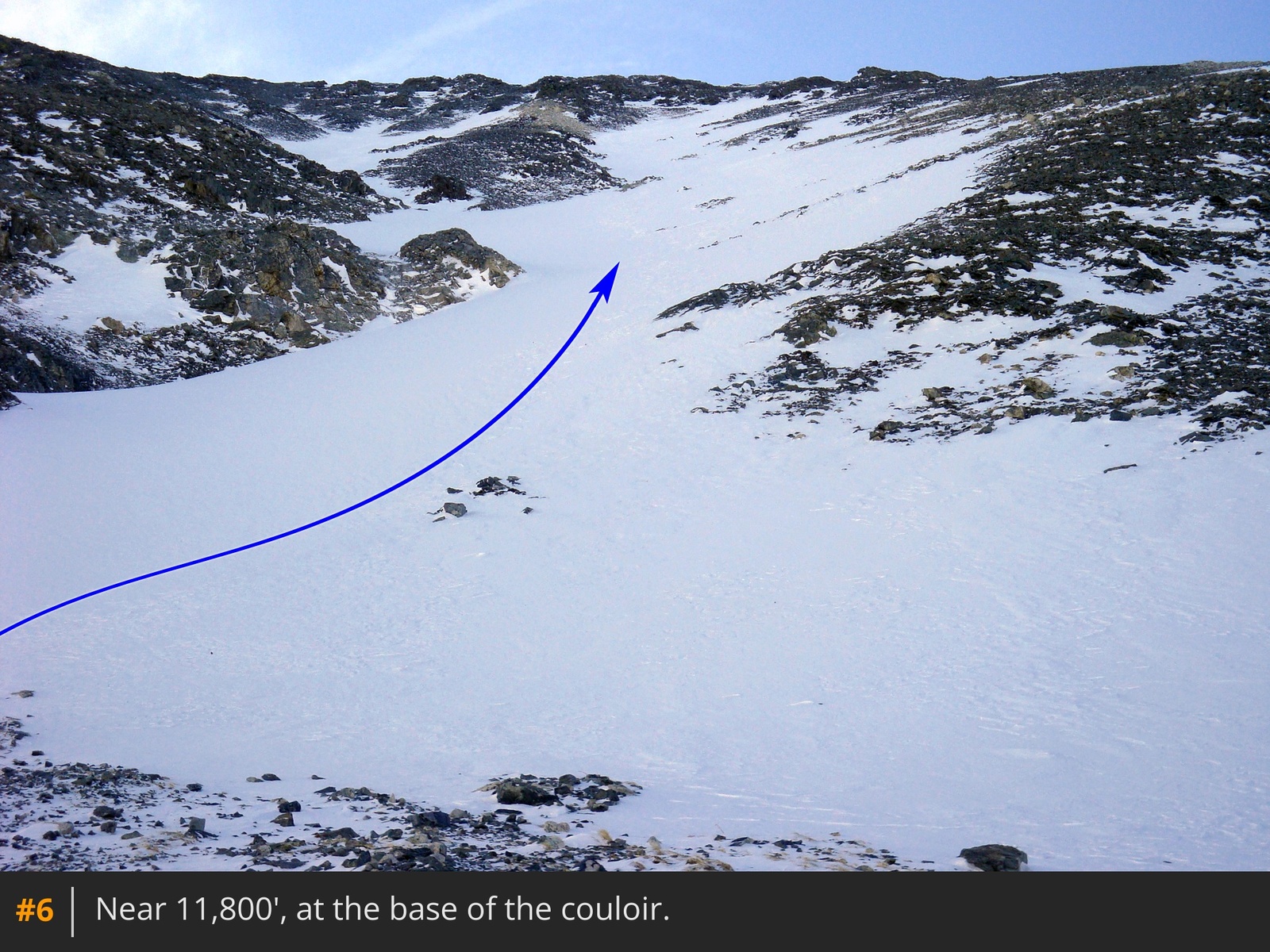
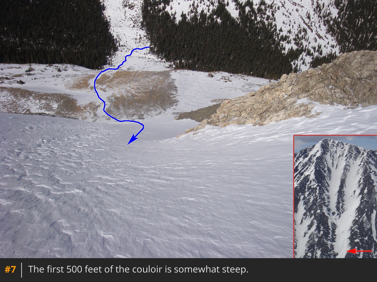
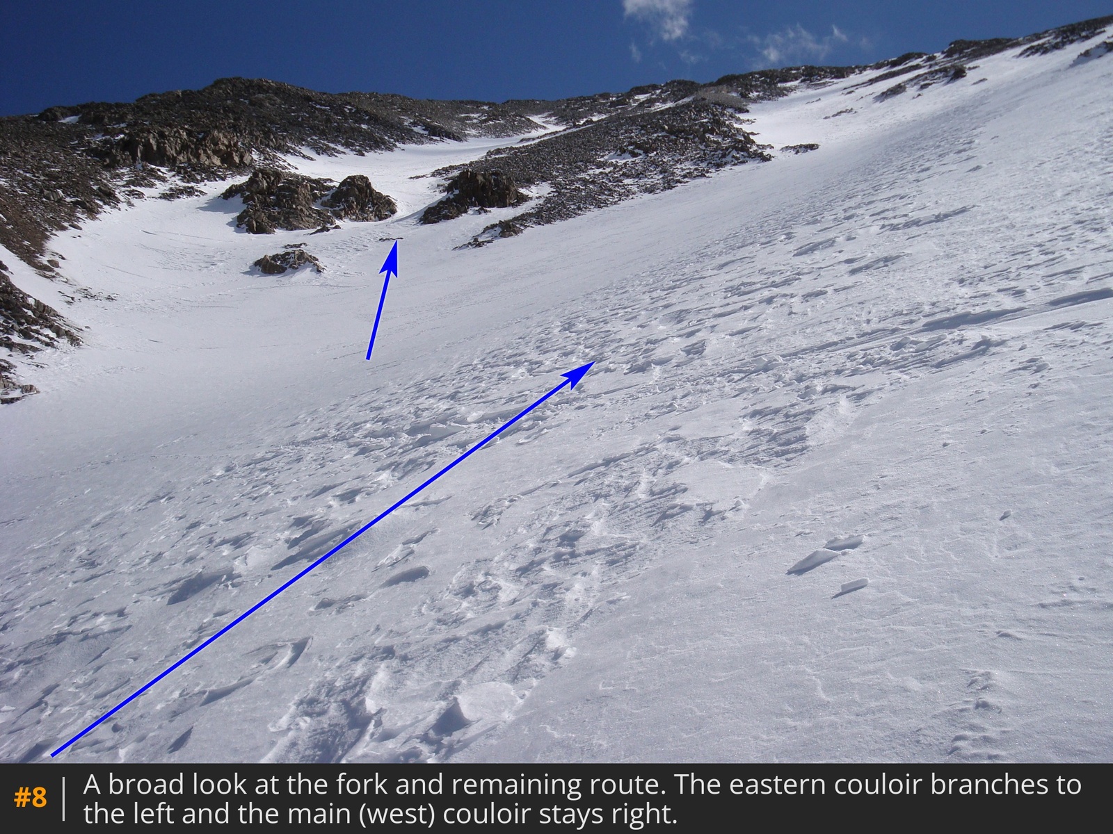
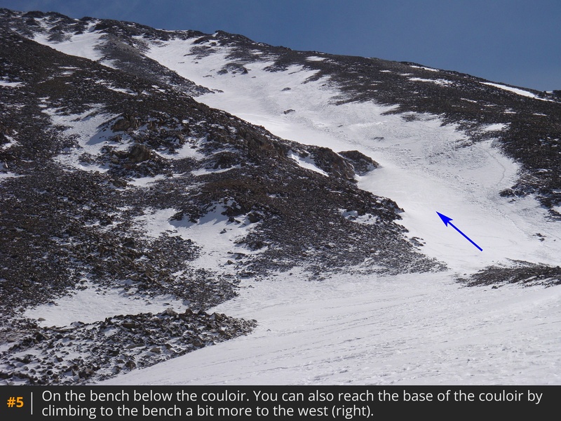
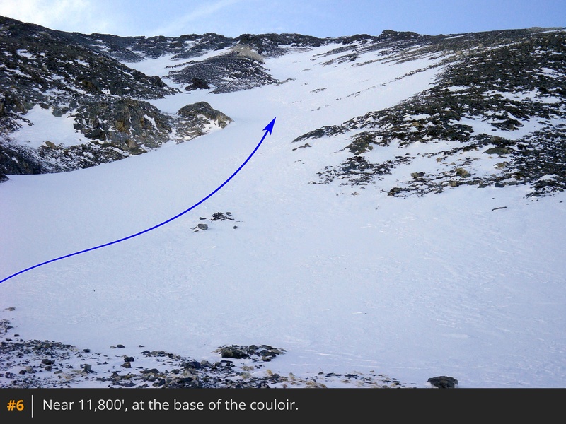
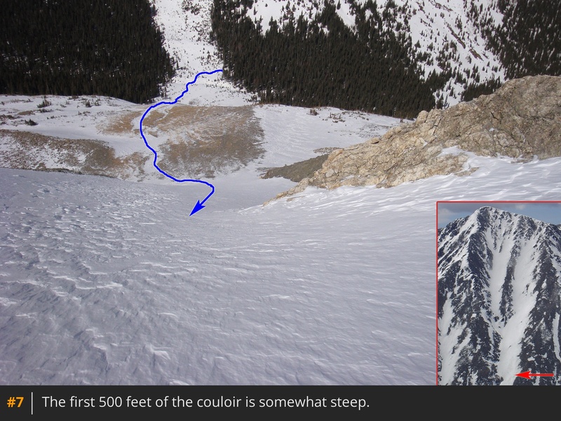
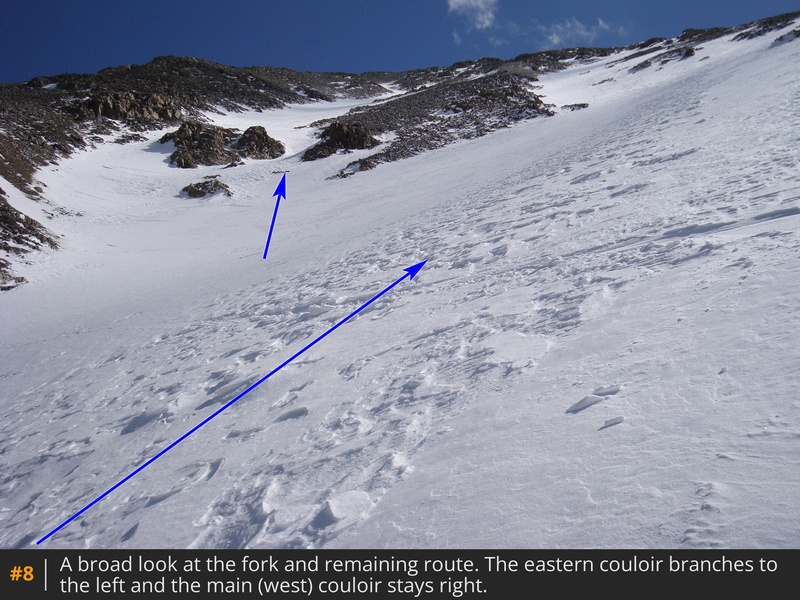
Drop to Grizzly Gulch and hike south  4 to reach a slope below the base of the couloir. Climb the slope and angle toward the the couloir  5  6. Crampons and axe are recommended beyond this point. Also, this is a good place to make a decision on the safety of the snowpack. You are immediately faced with some moderately-steep snow and it's a bad place to be if the snow above is at high risk of avalanche. Start climbing  7. Continue to approximately 12,400' and a fork where the left side of the Tuning begins  8. You have two options: 1) Continue up the main (west) couloir, or 2) turn left and climb the east couloir. The east couloir is slightly less steep and ends just below the summit and the west couloir hits the west ridge a bit lower. There's no huge advantage to either option and your decision may be based on snow-coverage:

Ascending the main (right) couloir:
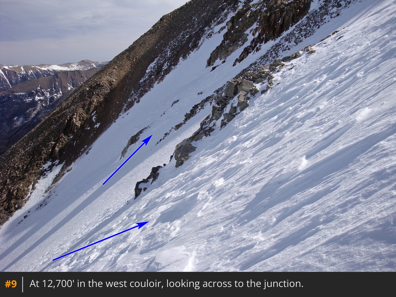
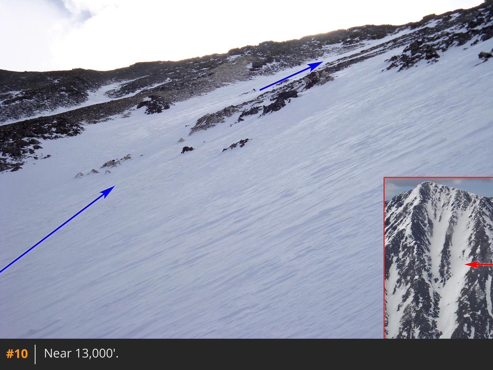
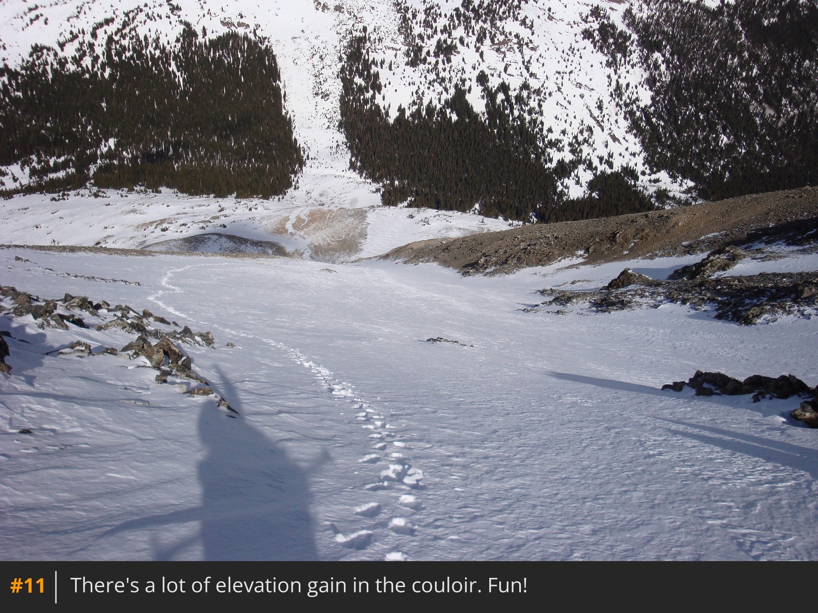
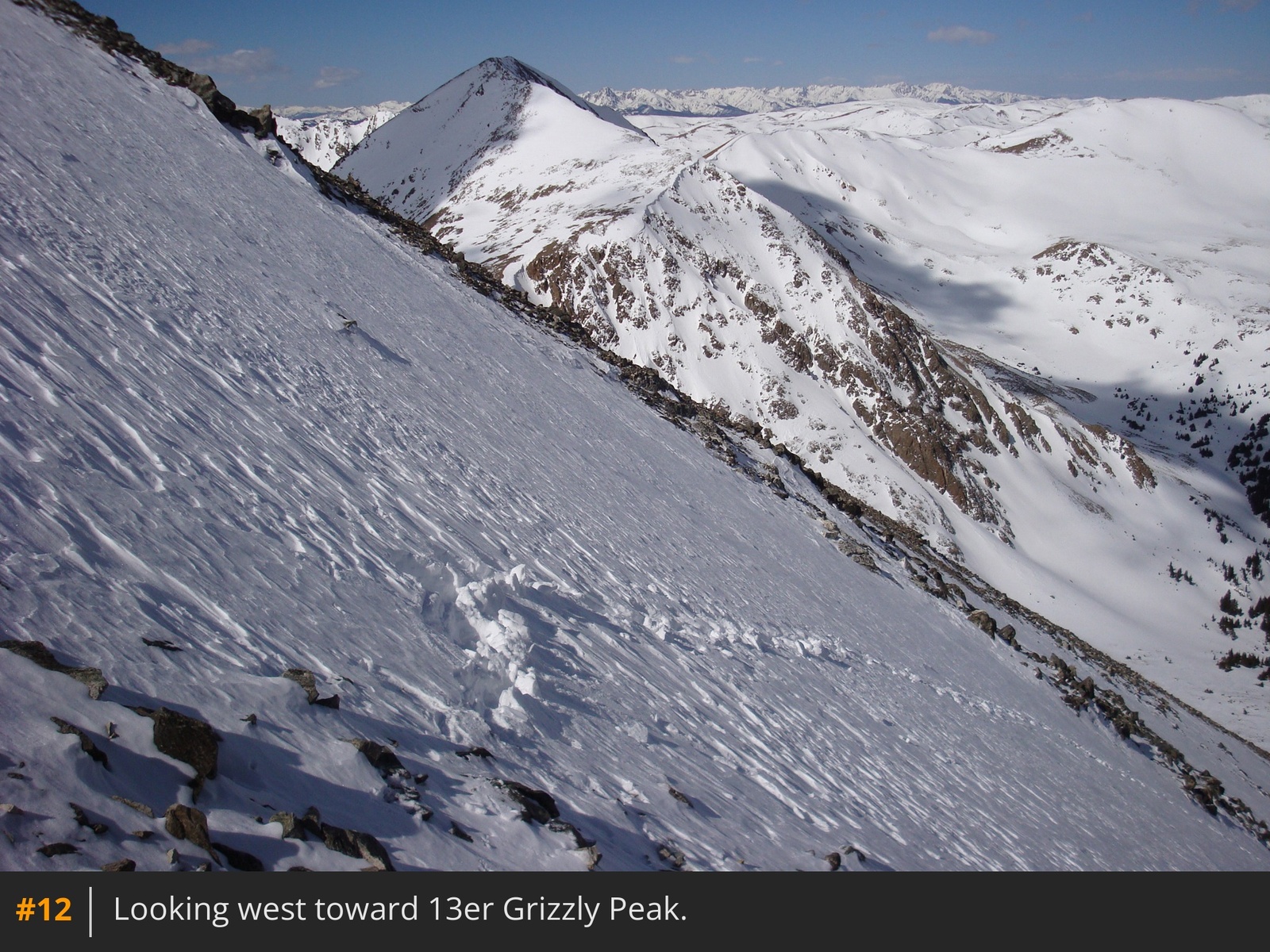
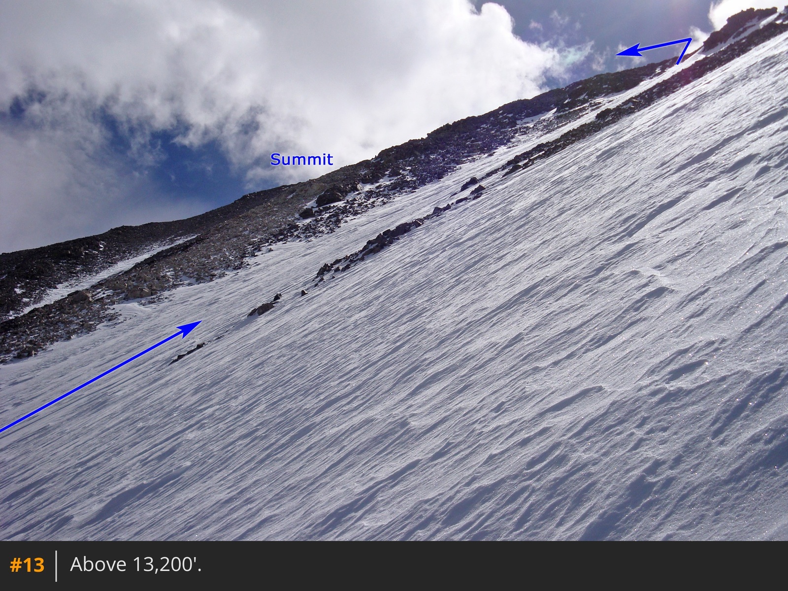
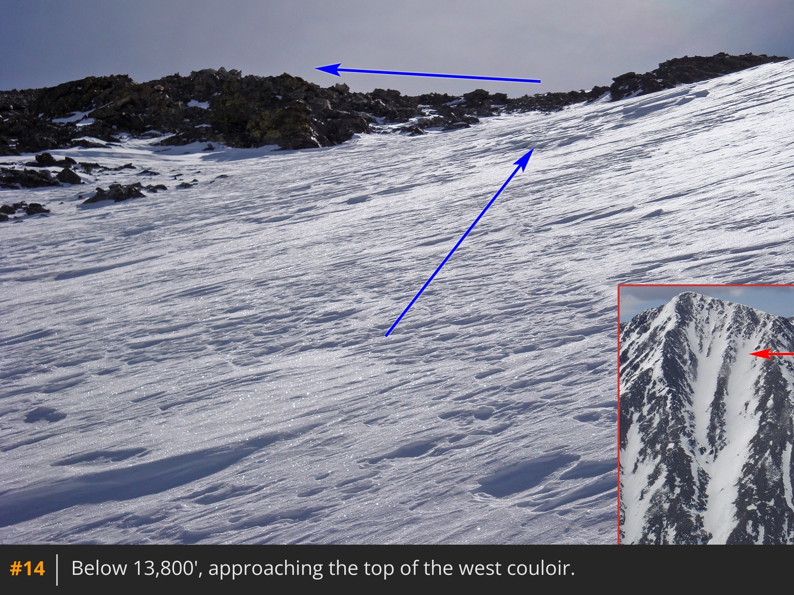
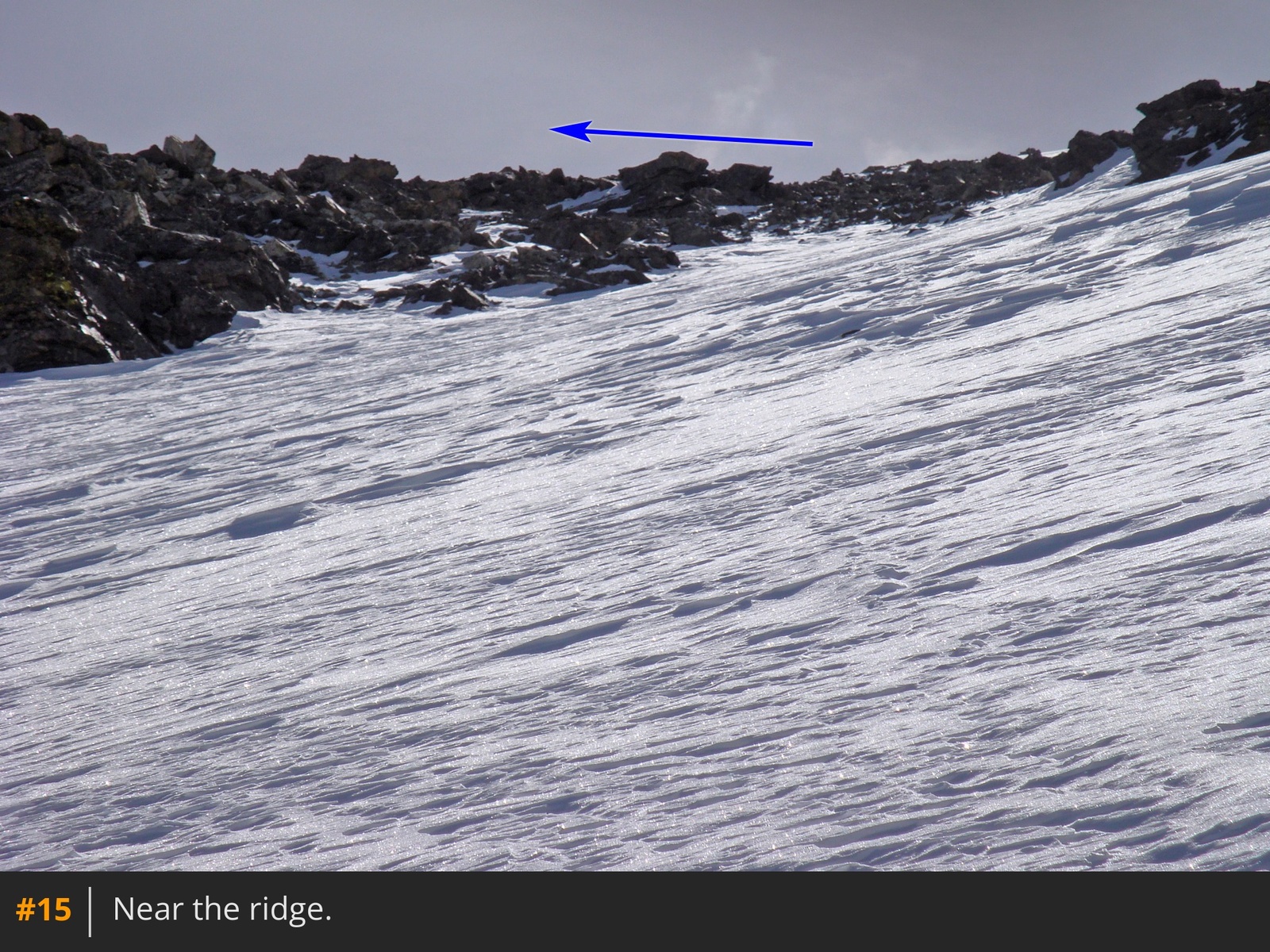
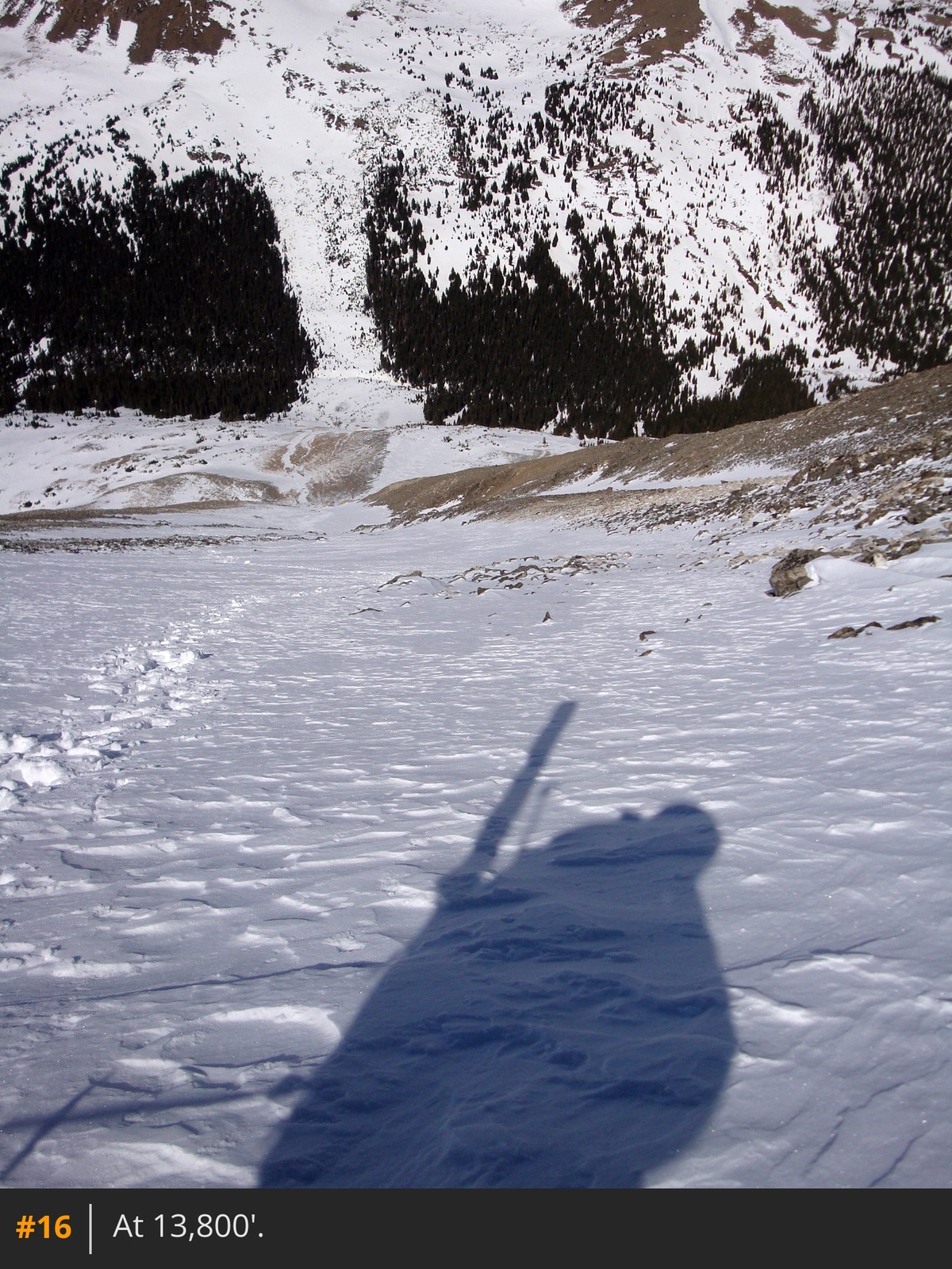
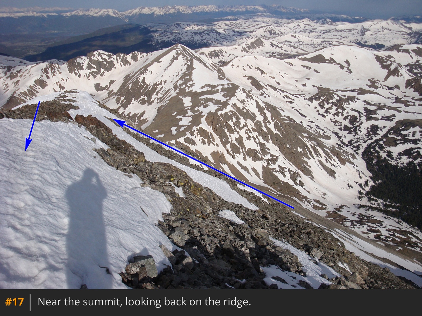
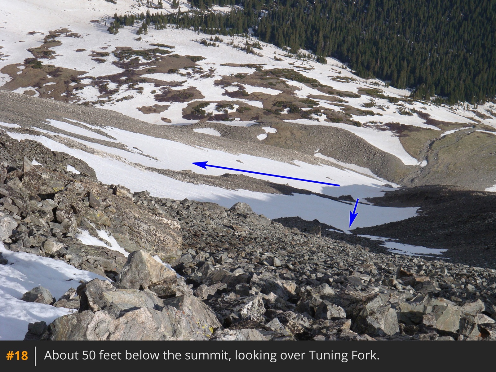
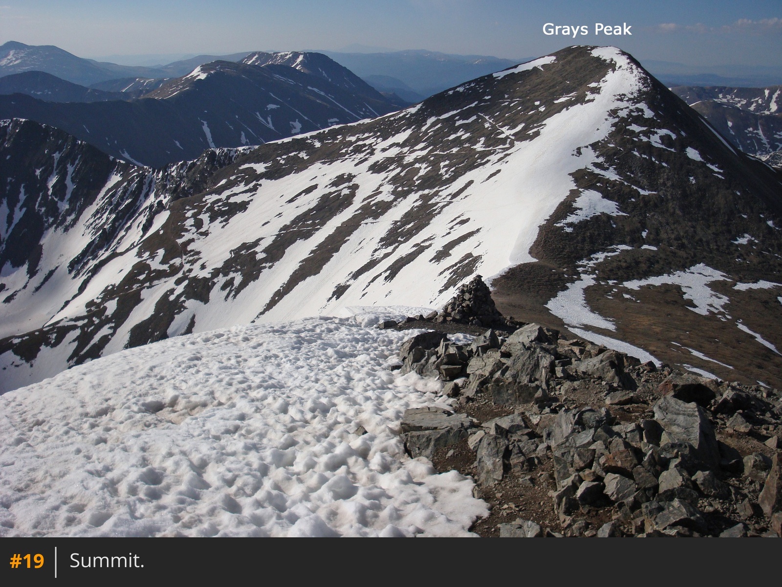
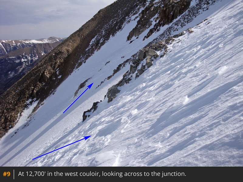
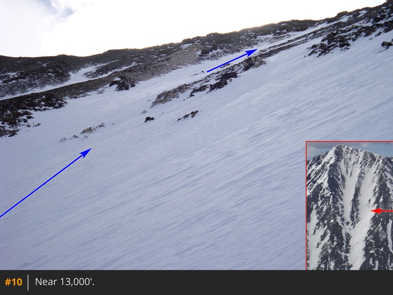
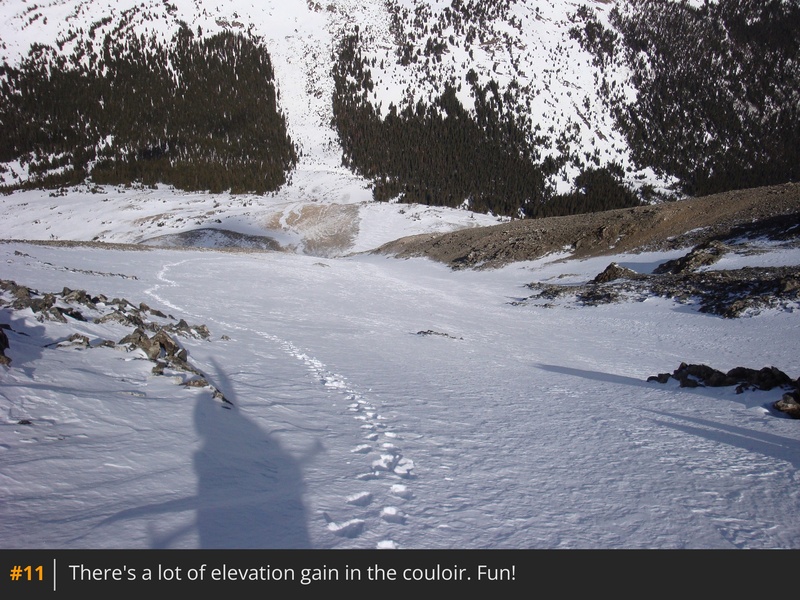
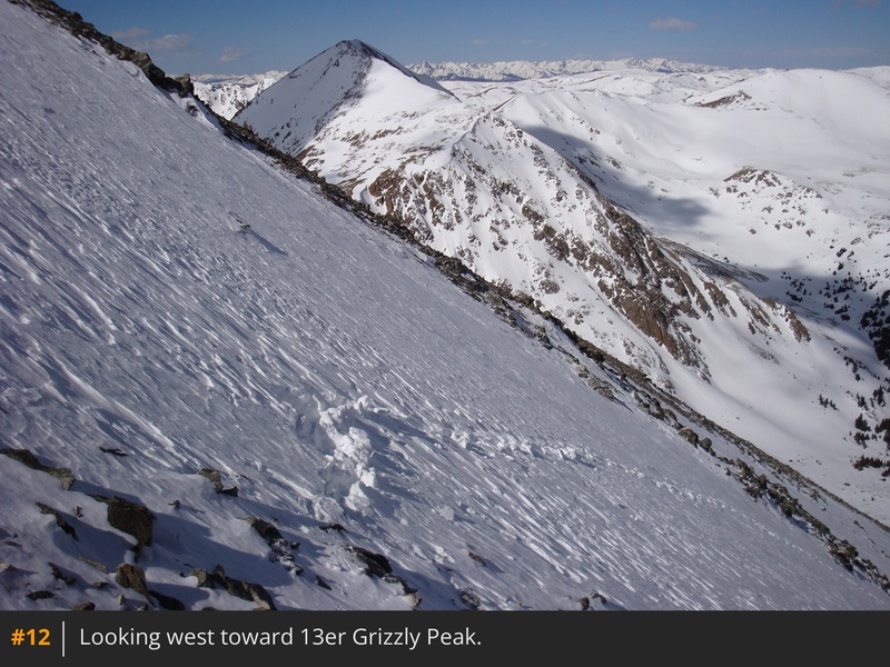
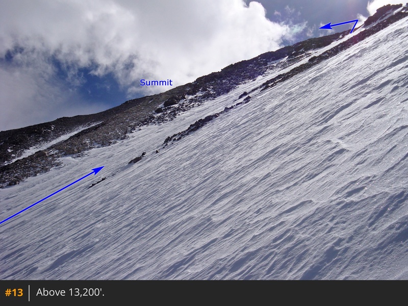
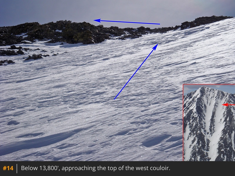
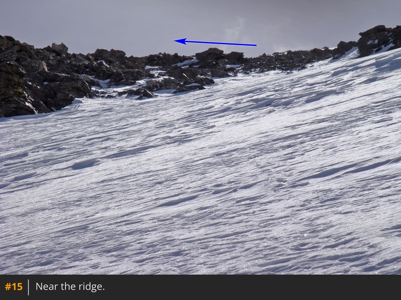
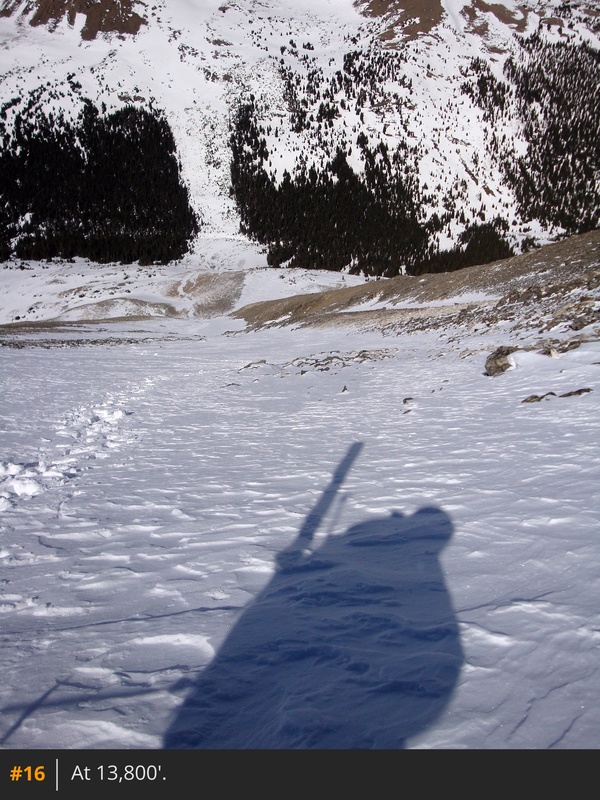
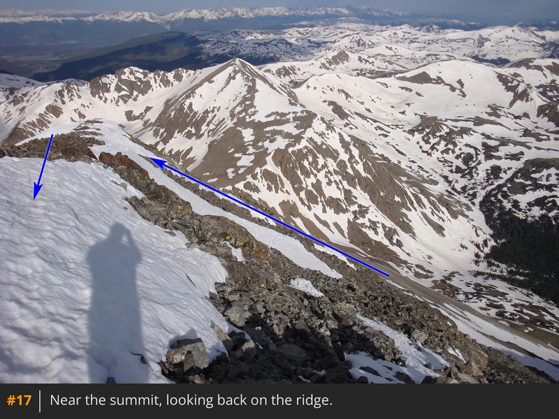
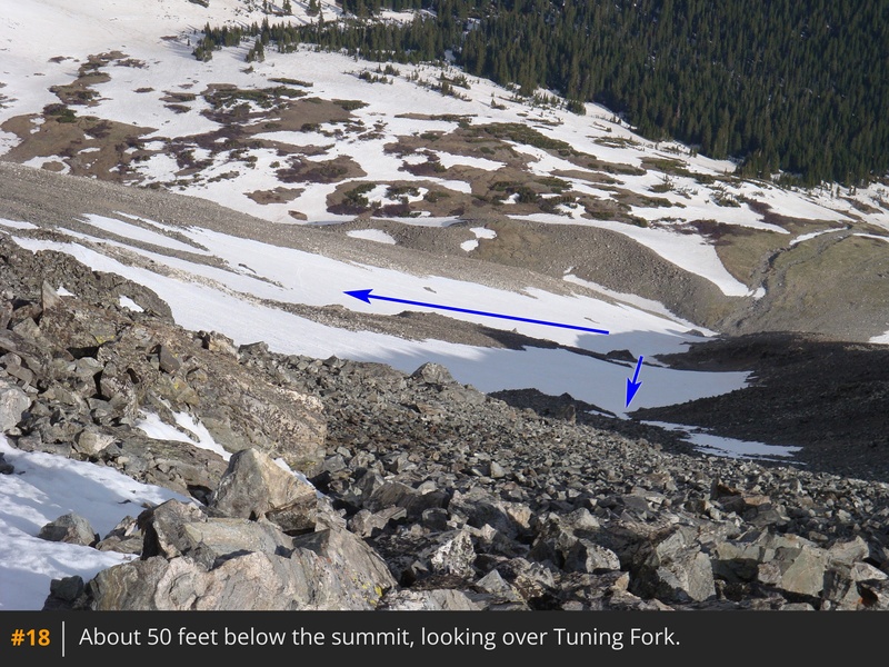
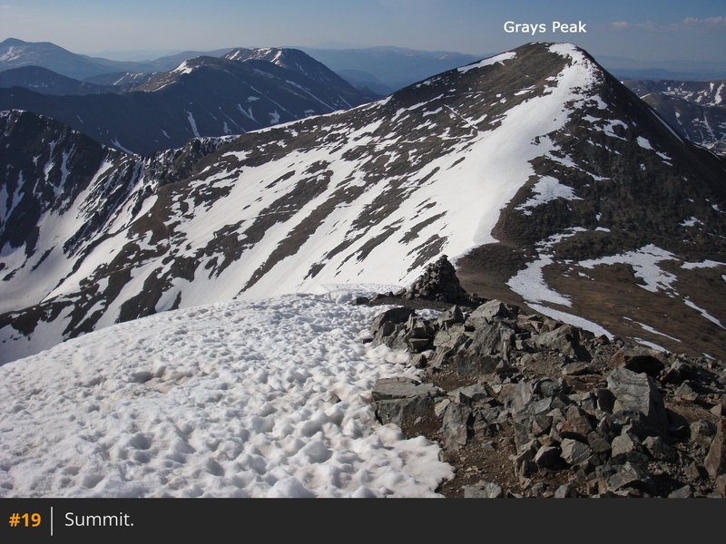
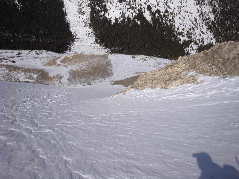
Stay right at the junction and continue up the main couloir  9  10, 11  12  13. Above 13,500', you can see the ridge but the snow doesn't always cover the rocks below the ridge  14. Pick your line and gain the ridge  15  16. Turn left (east) and hike 0.1 mile to the summit  17  18  19.

Ascending the east (left) couloir:
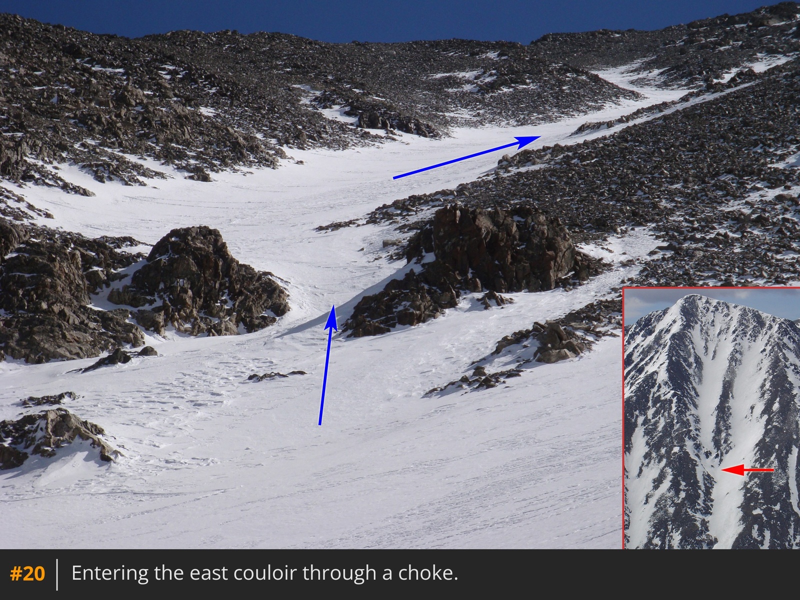
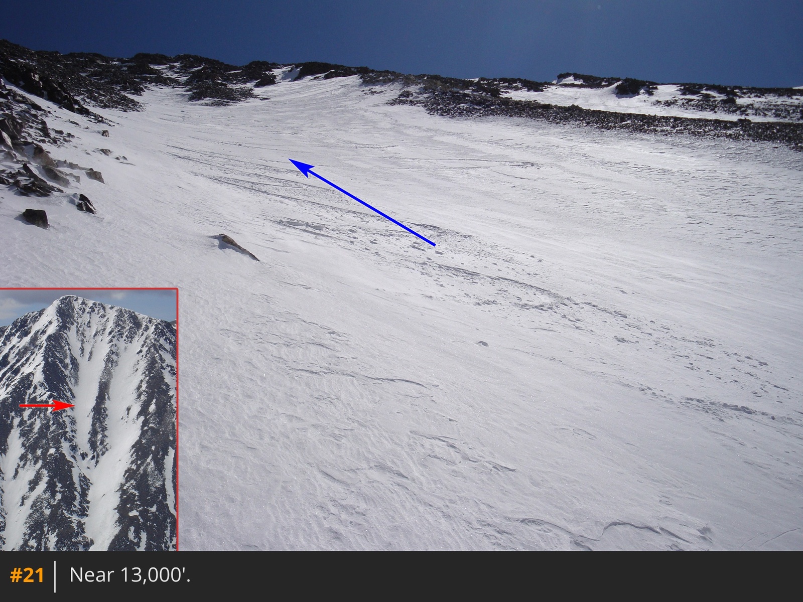
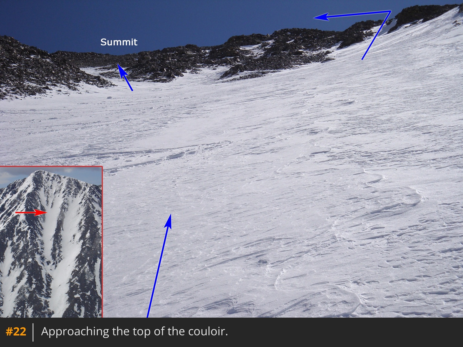
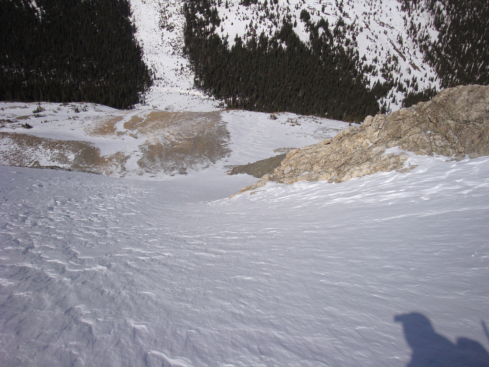
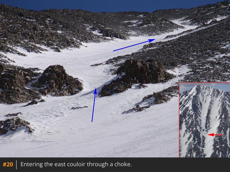
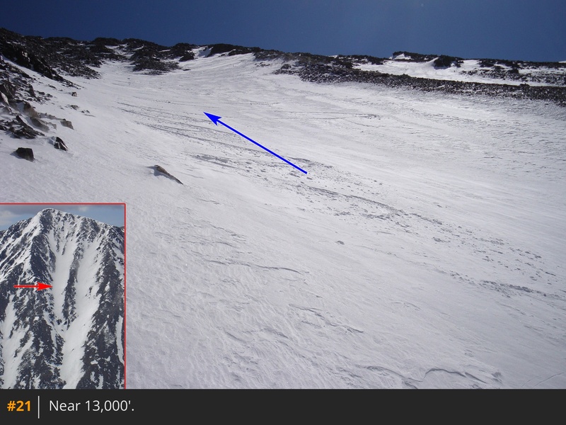
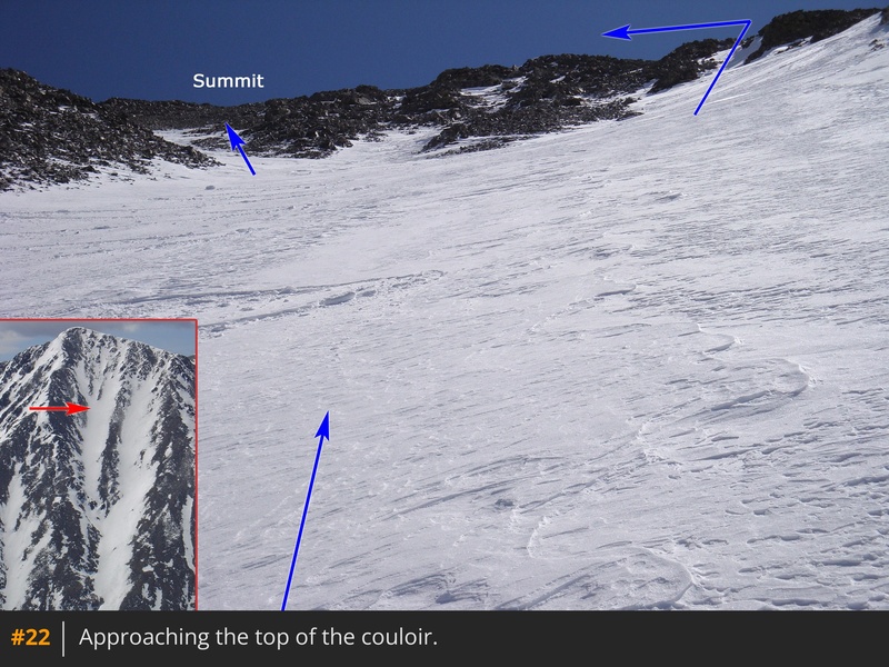
The east couloir is a more-direct climb when it has continuous snow to the summit. At the fork junction turn left and climb through a choke to enter the east couloir  20. Above the choke, continue up the obvious couloir  21. As you approach 13,800', the snow may run out on you and you'll have to make a decision on which line to take to the summit  22.

Skiing?

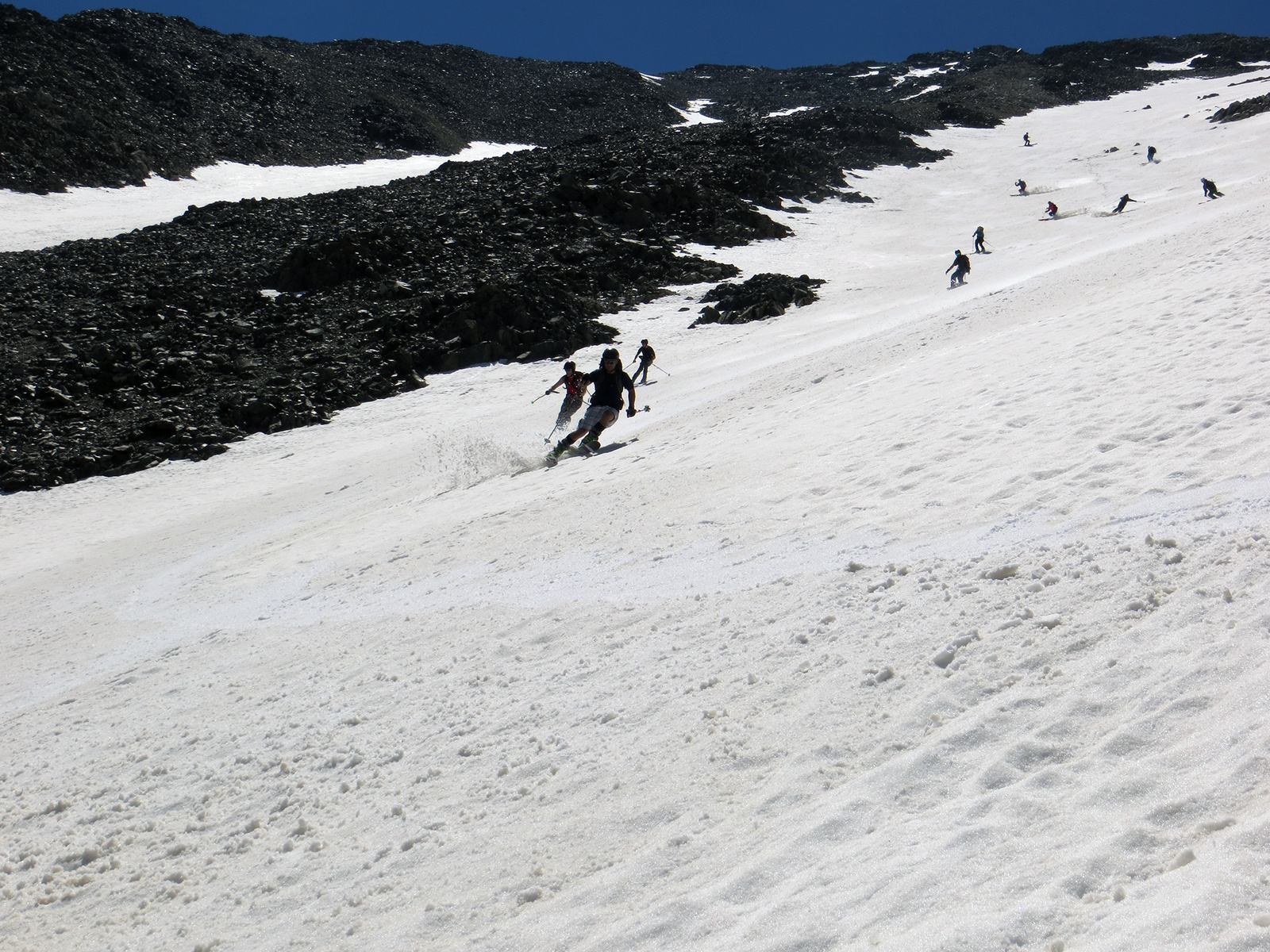
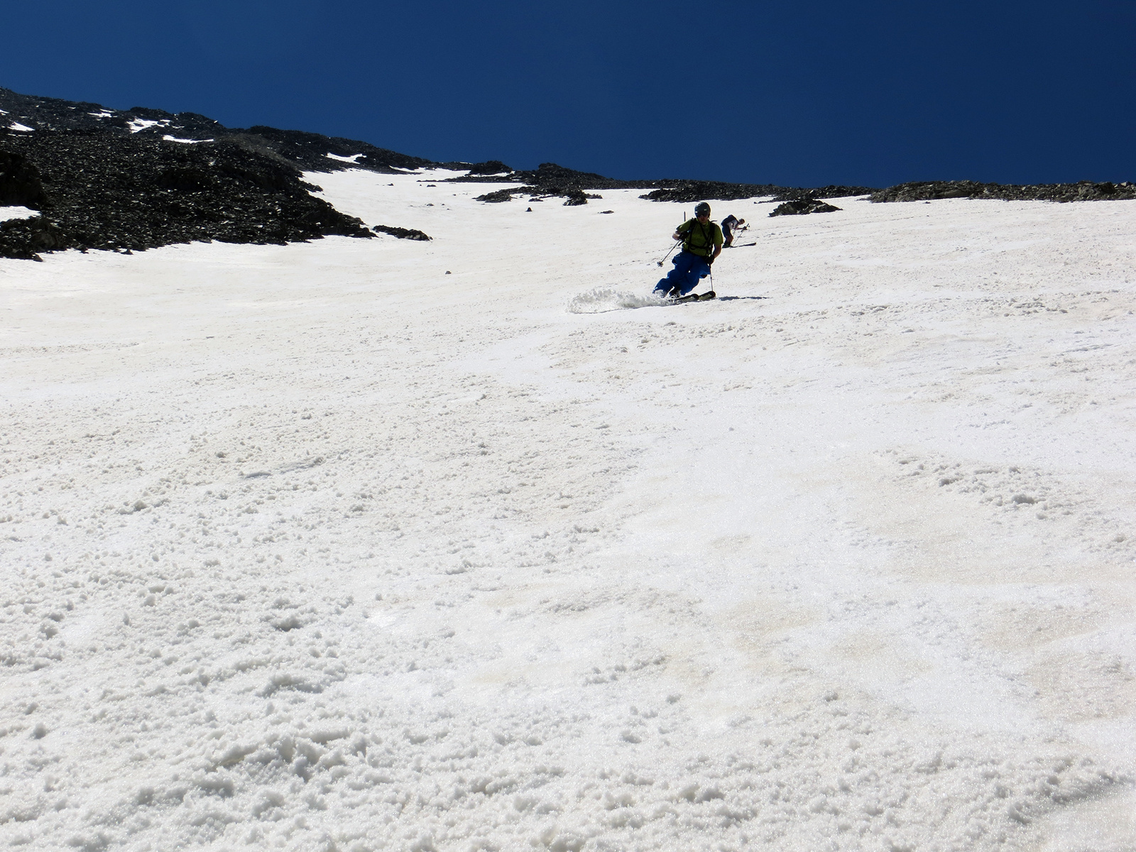
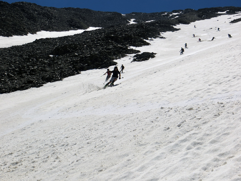
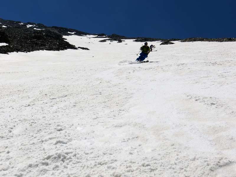
This route provides one of the longest 14er skis in the state  23  24  25. In fact, you could ski all the way back to I-70 without much trouble. That's 4,500 feet of elevation. In spring, the terrain just below the summit tends to be snow-free or provide limited continuous snow into the couloirs that make up the tuning fork. Even if you have to downclimb a bit to reach the snow, two very long snow-filled couloirs await.

Notes

Snowmobilers ride on the Grizzly Gulch road, but don't bet on it. It's a narrow road and, without a sled track, it can be hard to follow through the forest. A GPS with pre-loaded waypoints may be quite helpful.

Maps

JPG Image
Static Map JPG
Interactive Map & 3D Flythrough
Human Verification Required

Photos

#1#2#3#4#5#6#7#8#9#10#11#12#13#14#15#16#17#18#19#20#21#22#23#24#25

Weather

Caution: The information contained in this route may not be accurate and should not be the only resource used in preparation for your climb. Failure to have the necessary experience, physical conditioning, supplies or equipment can result in injury or death. 14ers.com and the author(s) of this route provide no warranties, either express or implied, that the information provided is accurate or reliable. By using the information provided, you agree to indemnify and hold harmless 14ers.com and the route author(s) with respect to any claims and demands against them, including any attorney fees and expenses. Please read the 14ers.com Safety and Disclaimer pages for more information.

Copyright: Route information, text, risk factors, maps, GPX files, charts, photos, 14ers.com-created map imagery, flythroughs, and other content provided in this route description are copyrighted by 14ers.com and may not be copied, reproduced, republished, distributed, modified, or used to create derivative works without prior written permission.

Please respect private property: 14ers.com supports the rights of private landowners to determine how and by whom their land will be used. In Colorado, it is your responsibility to determine if land is private and to obtain the appropriate permission before entering the property.

Heading to a 14er soon? Don't forget the 14ers.com mobile app.
Google Play     Apple App Store