Follow the
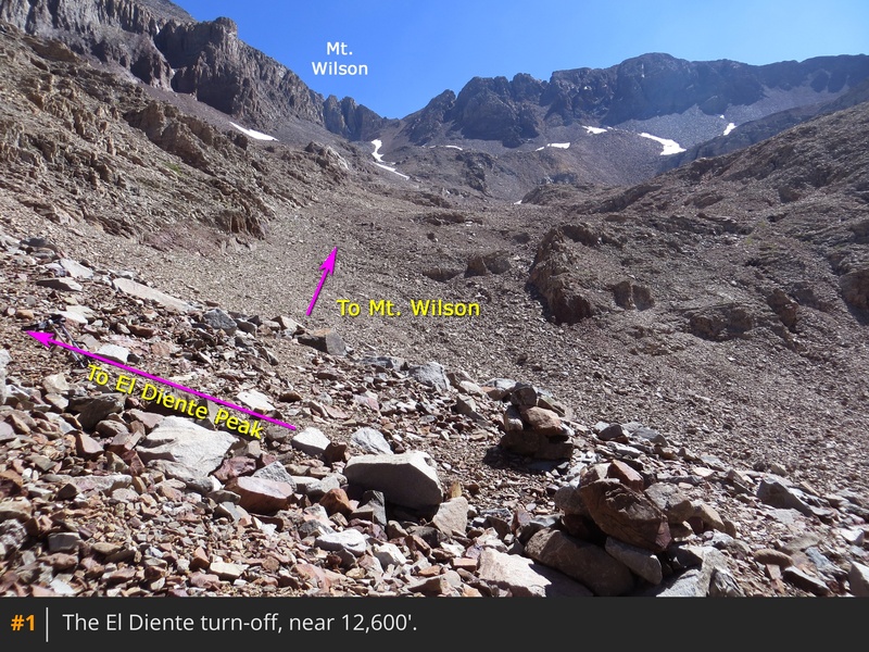
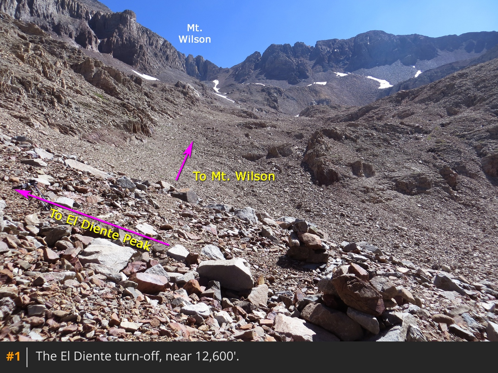
Kilpacker Approach to the turn-off
for this route at 12,600'
1. The turn may be marked with cairns, but it's not always easy to spot, as trail crews don't maintain this section.
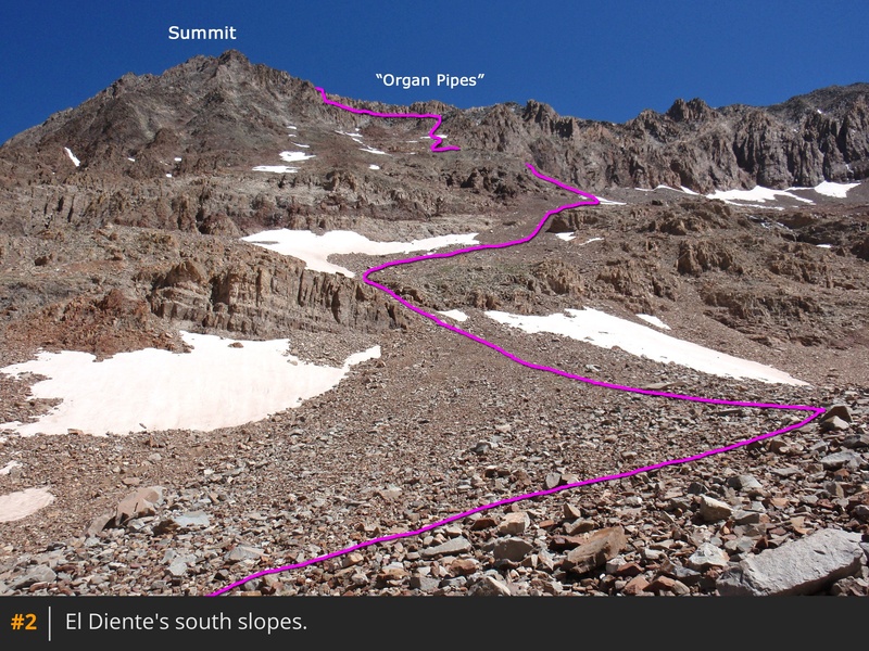
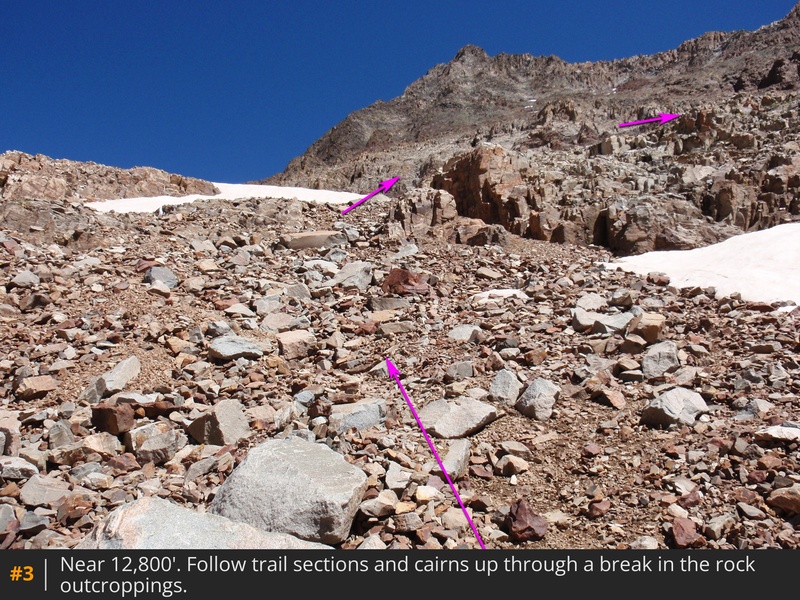
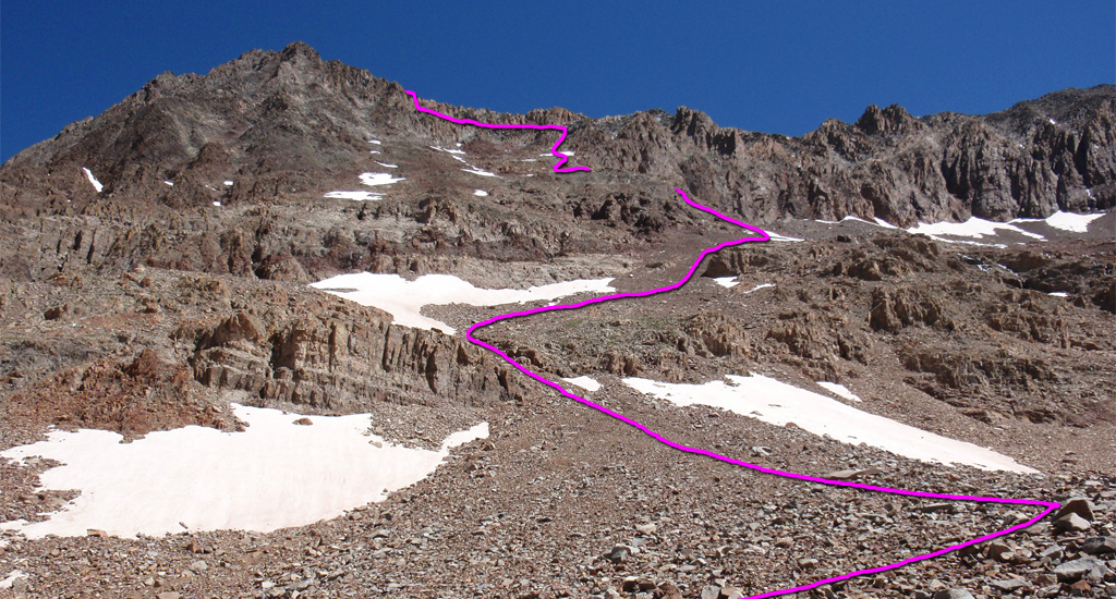
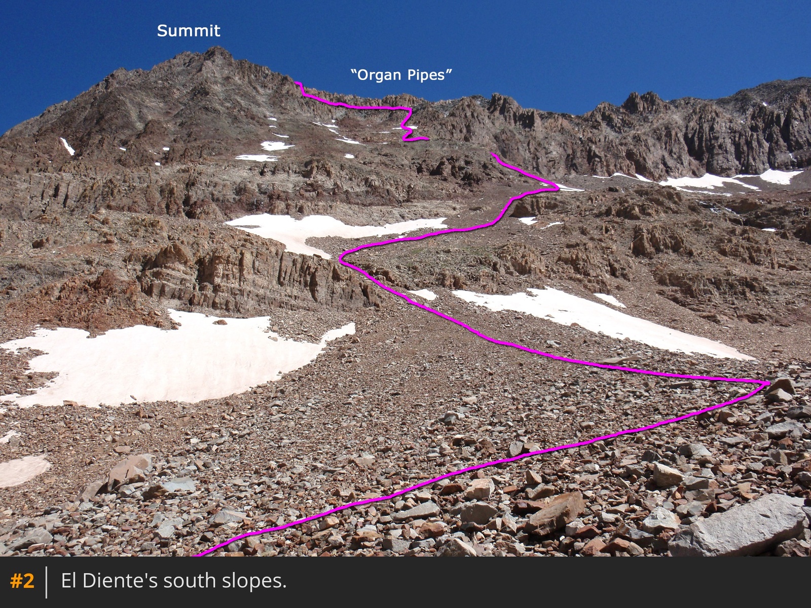
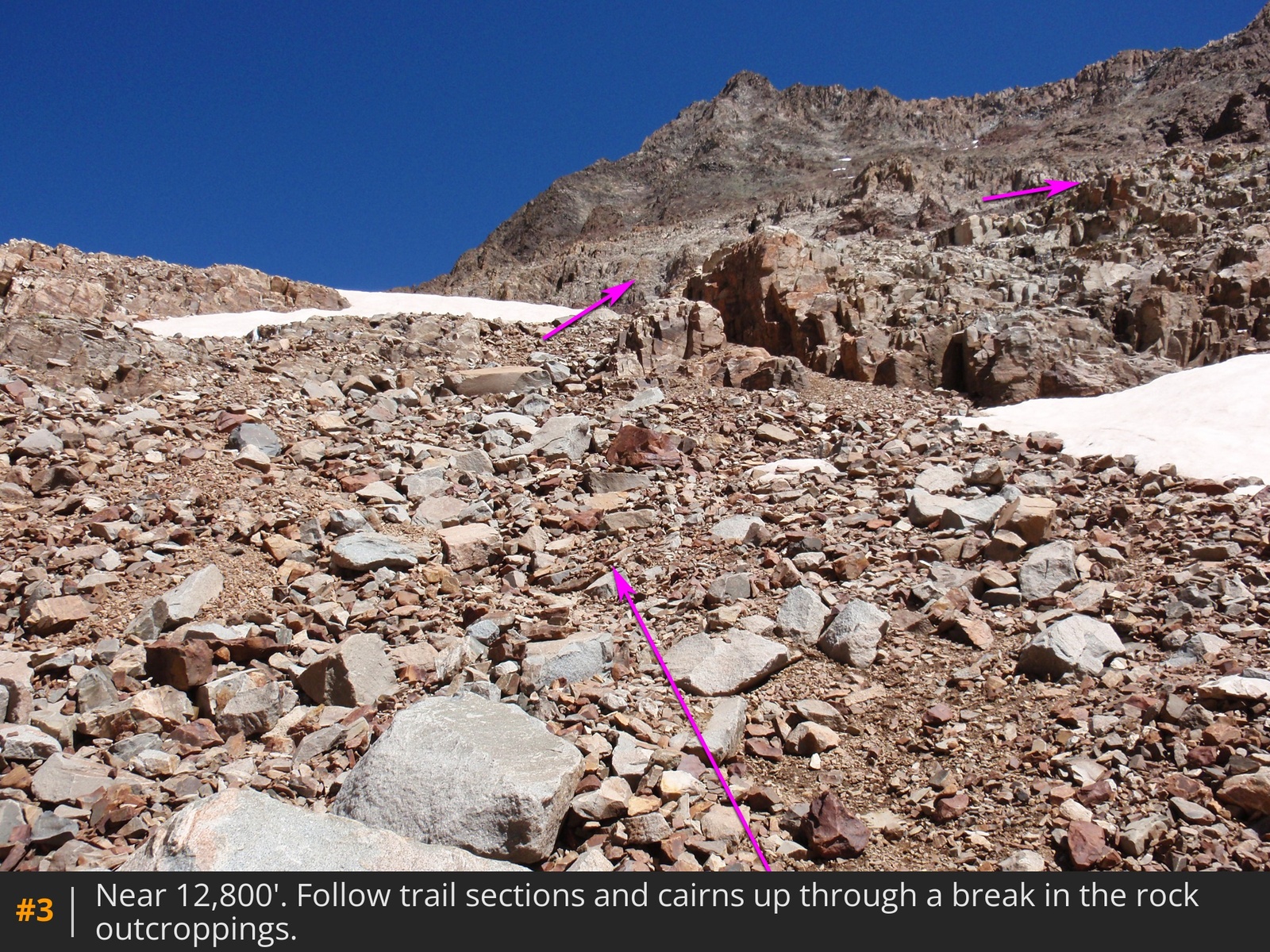
2 provides an overview of the route up the south slopes, as seen from just below the El Diente turn-off. Locate the turn and follow segments of loose trail between rock outcroppings
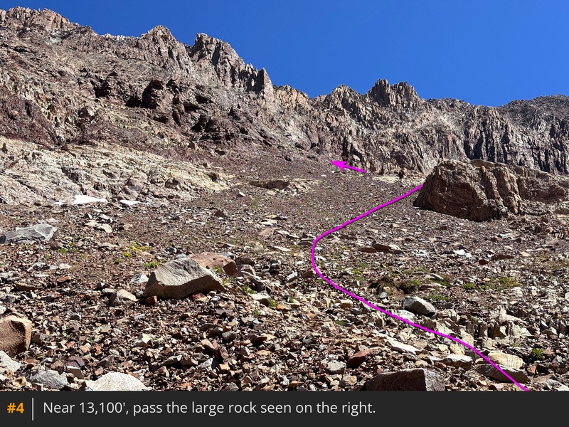
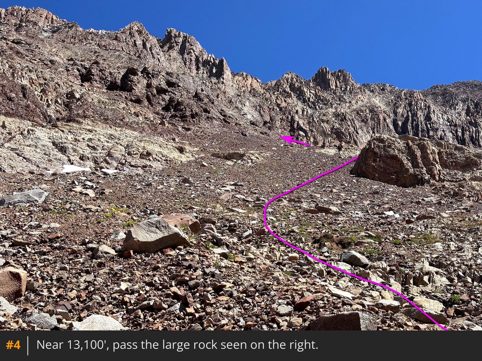
3, then veer to the right to reach a large rock on your right
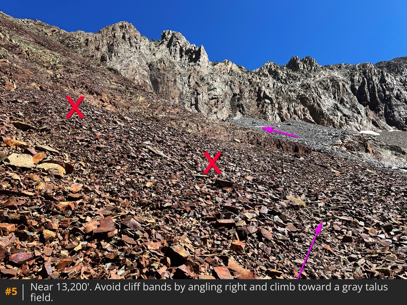
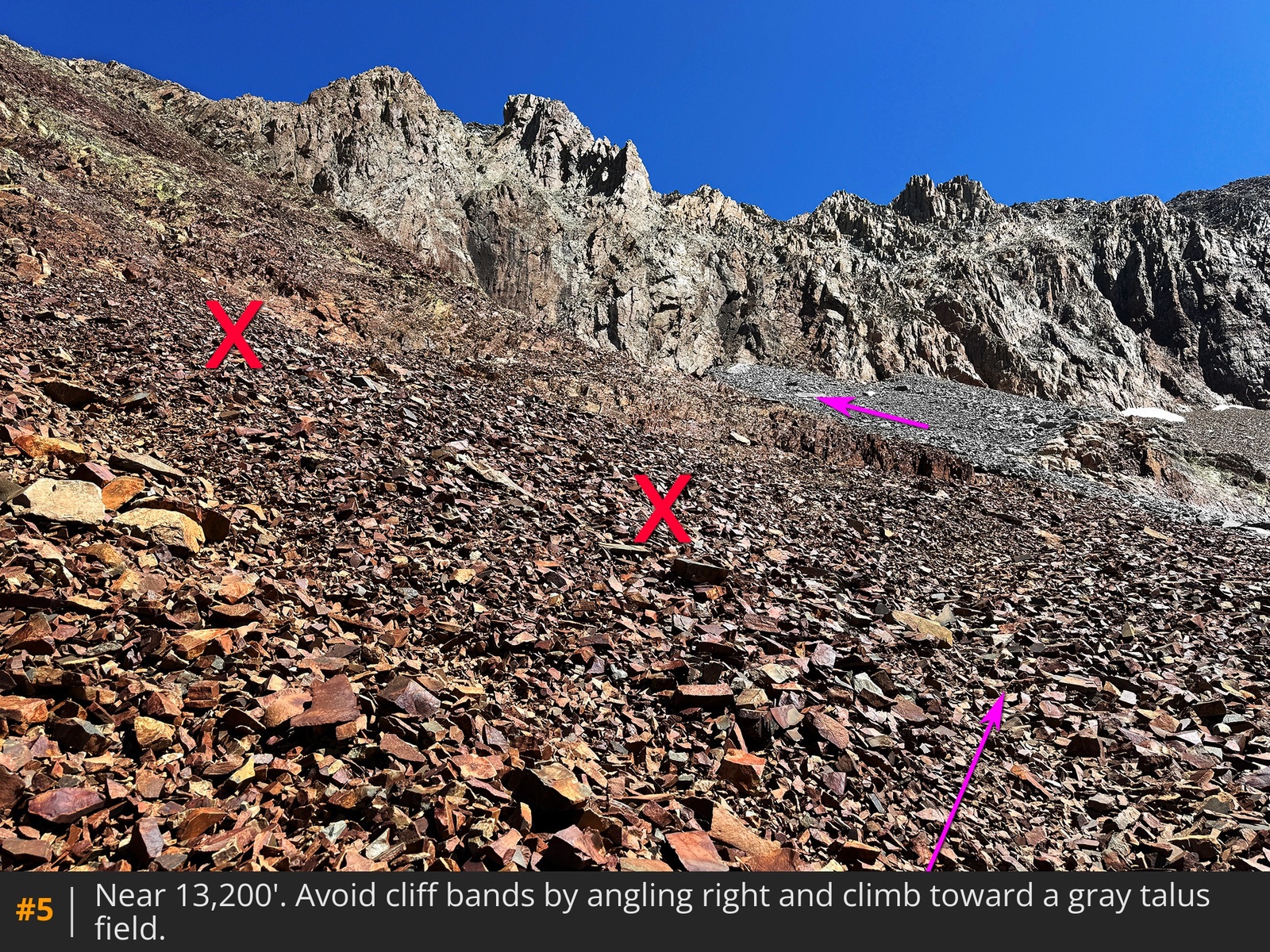
4. Pass along the left side of the rock and angle slightly right toward a gray talus field near 13,200'
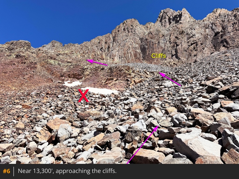
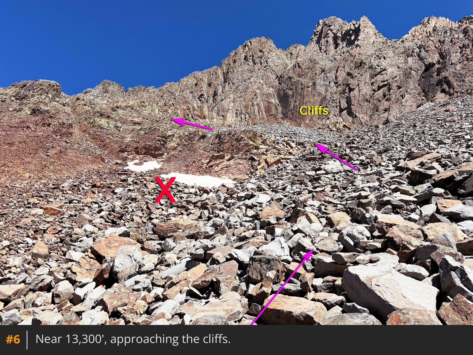
5. Upon reaching the talus, ascend toward the cliffs ahead
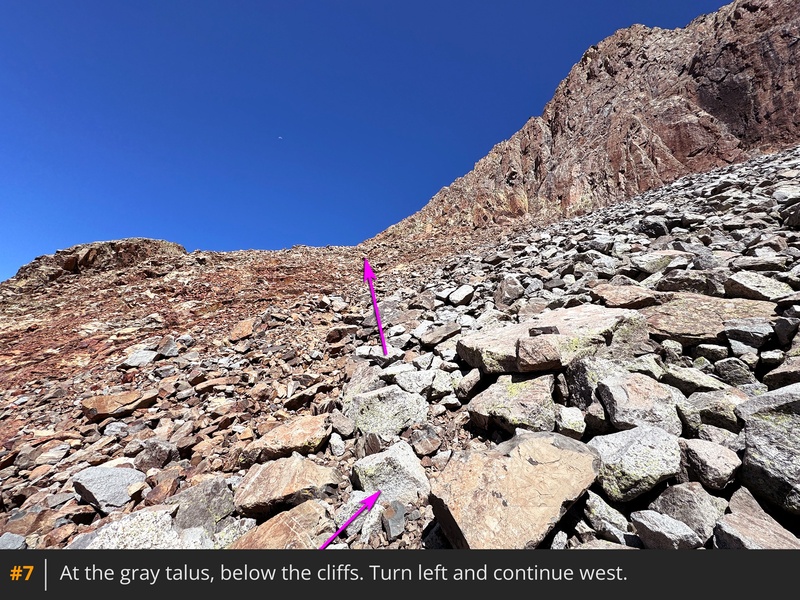
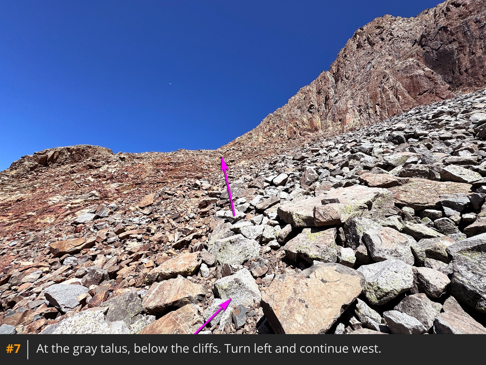
6. Before you get to the cliffs, turn left and continue west on the talus
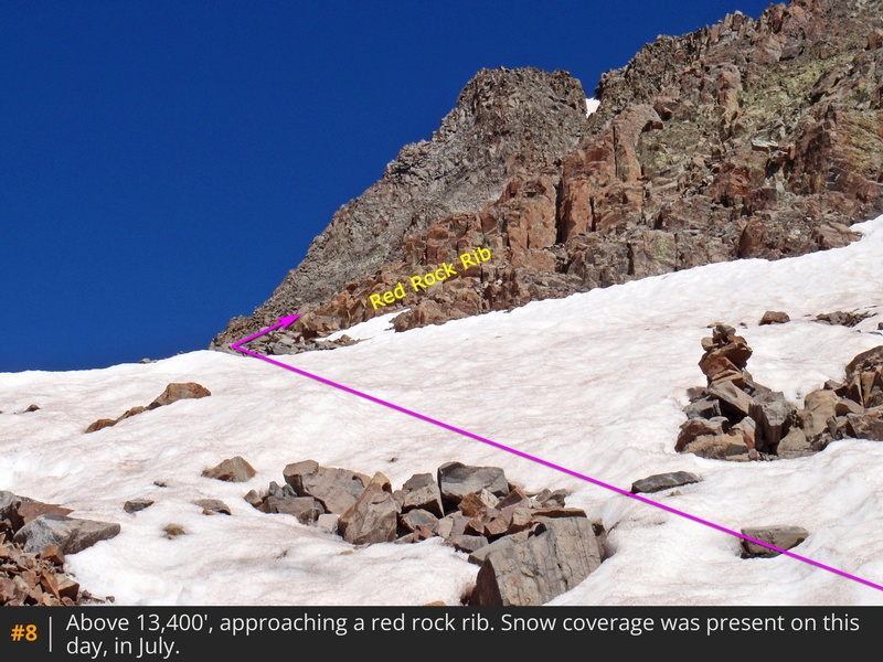
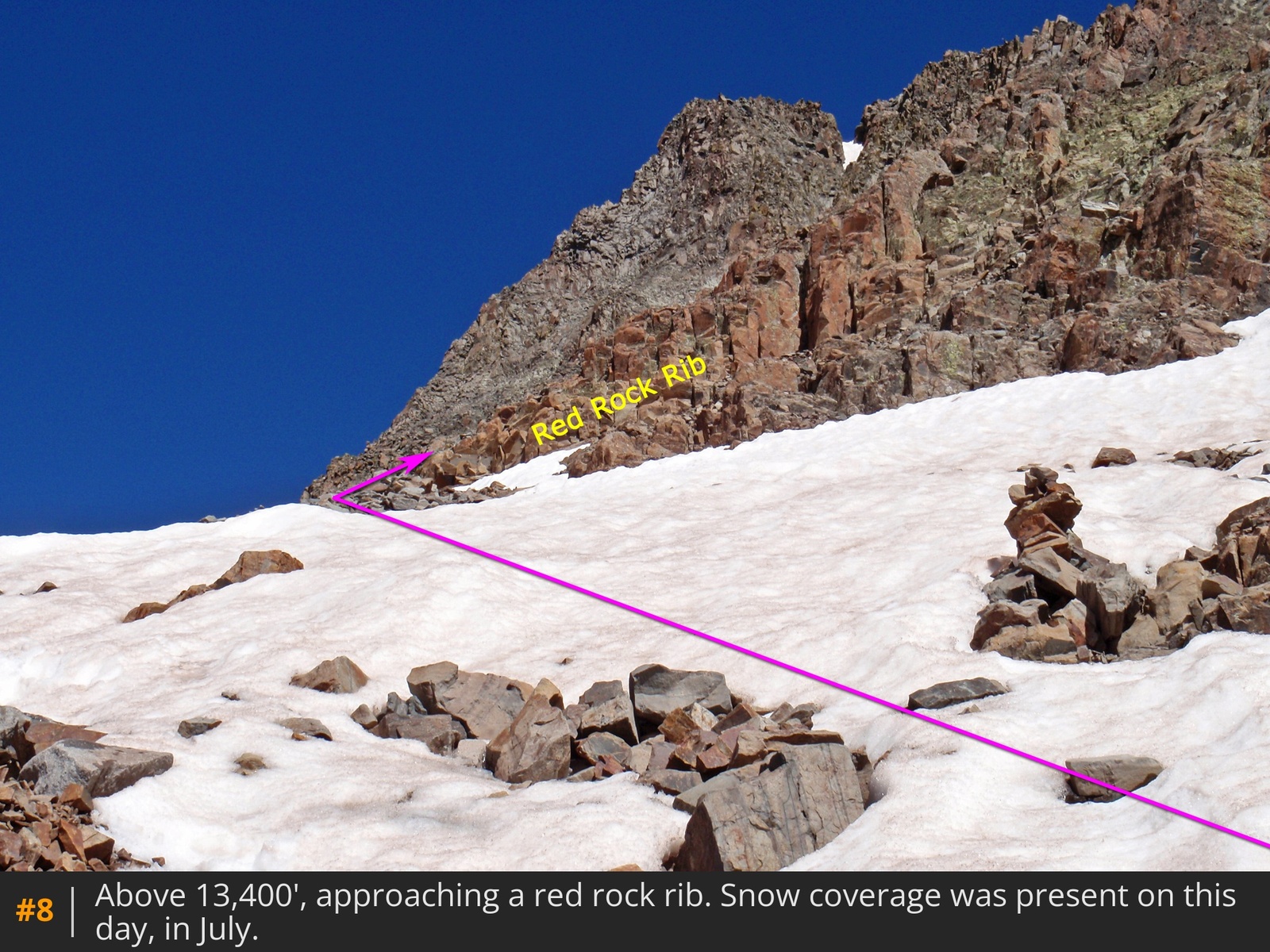
7. Traverse beneath the cliffs and climb to the base of a rib of red rock
8.
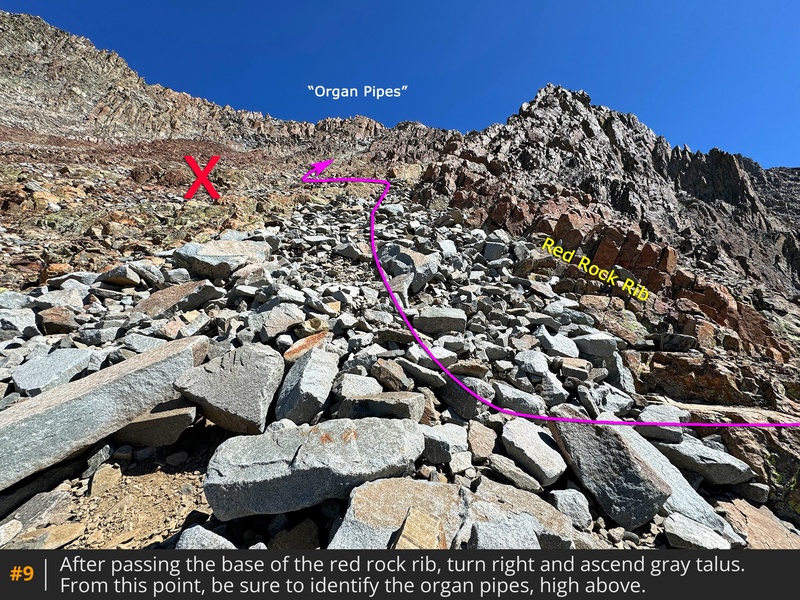
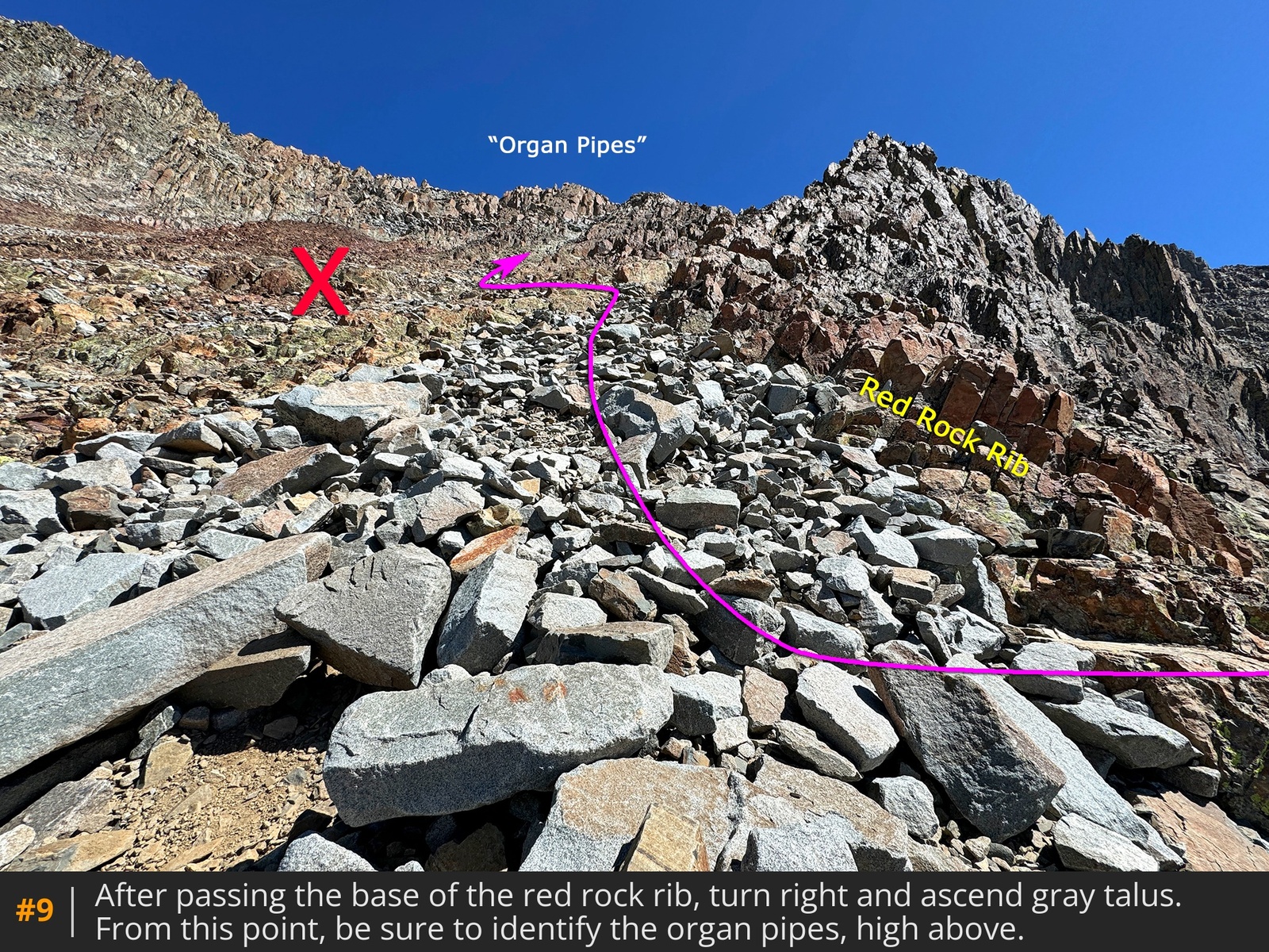
Around 13,500', at the base of the rib
, the view broadens
9. Take a moment here to identify the "Organ Pipes," a wide rock feature on the ridge above, as the route ascends to the base of the pipes
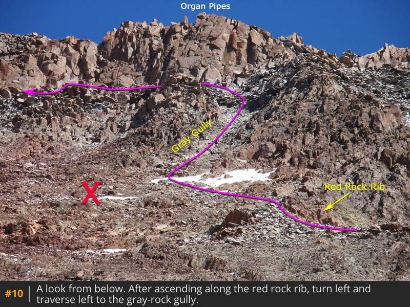
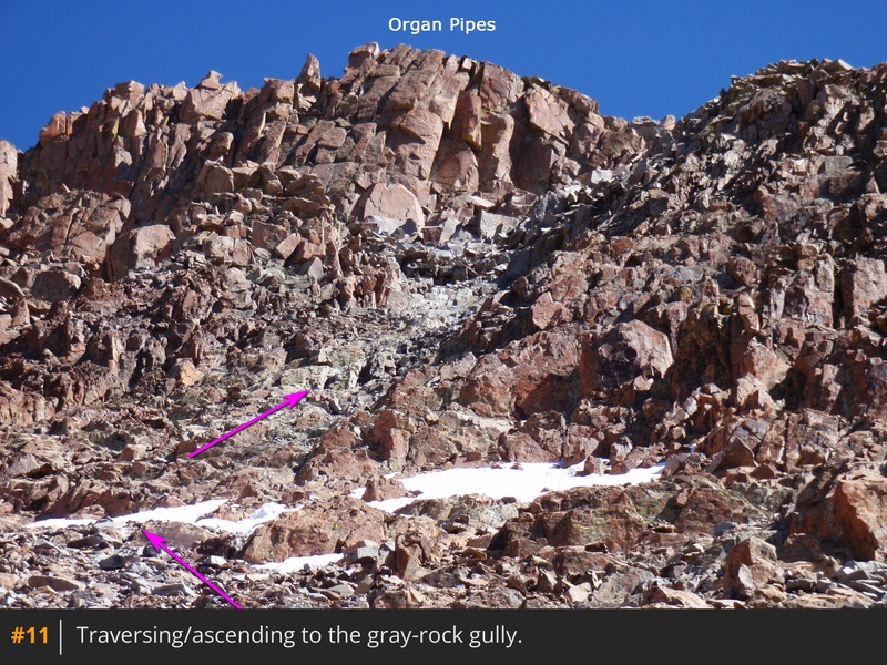
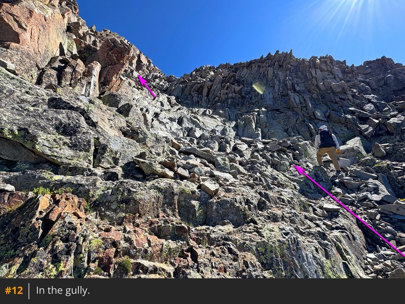
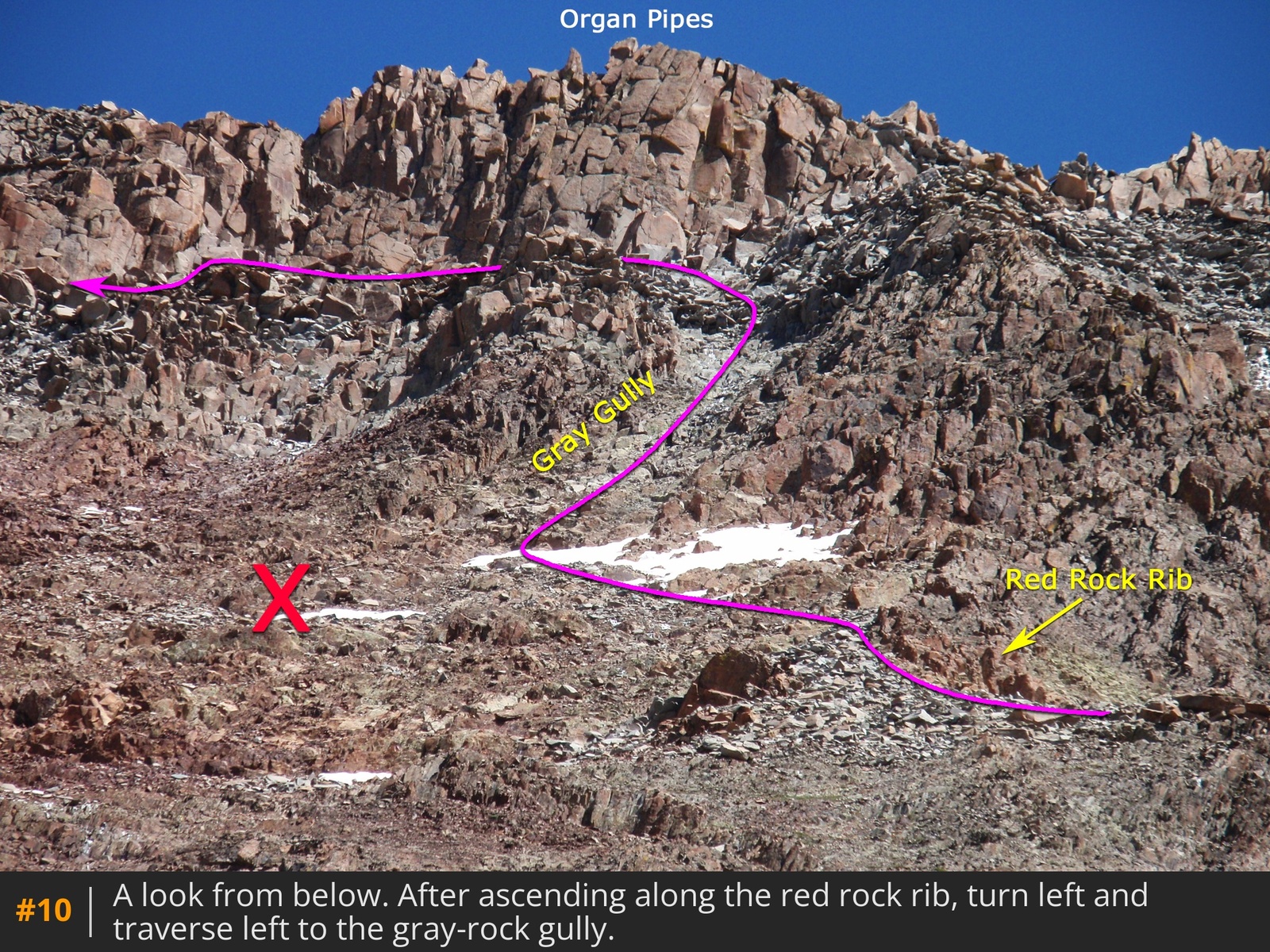
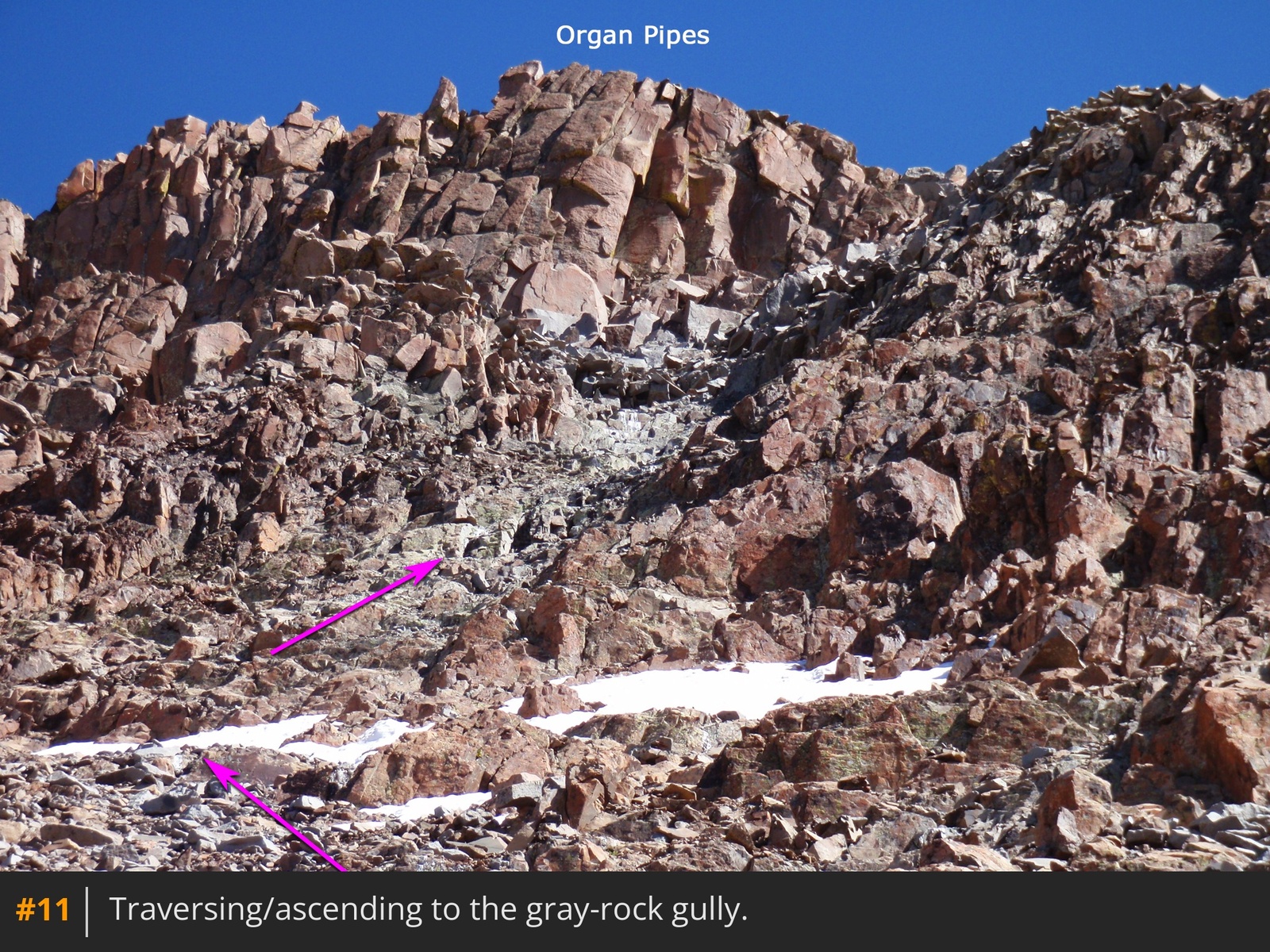
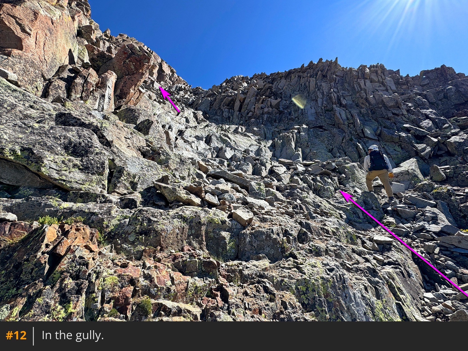
10. Climb through gray talus and traverse left under some rock outcroppings, heading for a gully made of gray rock. Identifying this gray gully is important, as it leads directly to the base of the Organ Pipes. Reach the gully around 13,600' and climb it
11 12. Once at the top, carefully navigate over larger rocks to reach easier terrain just below the Organ Pipes
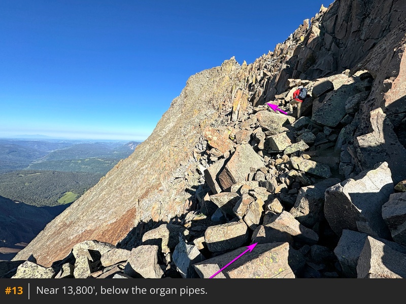
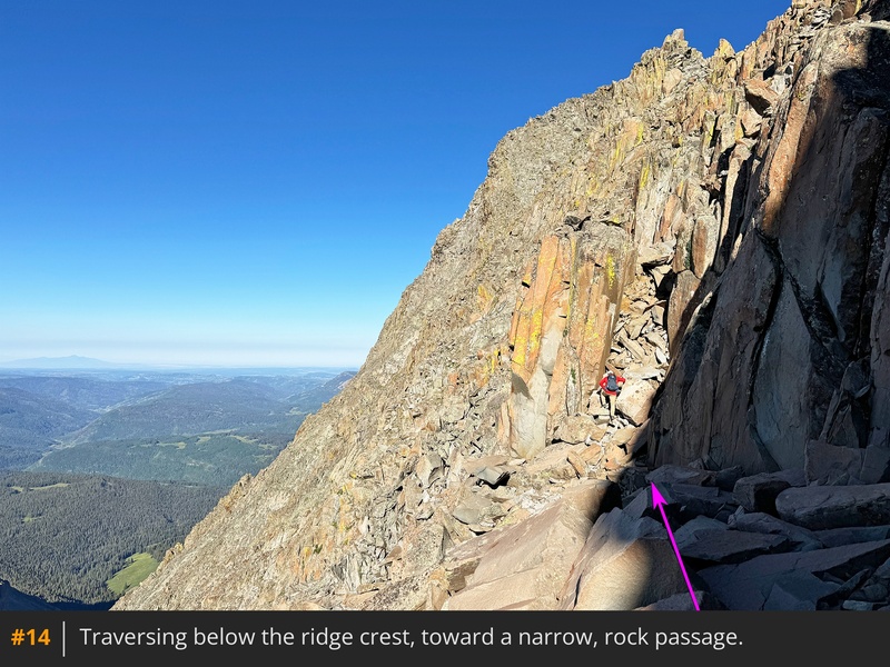
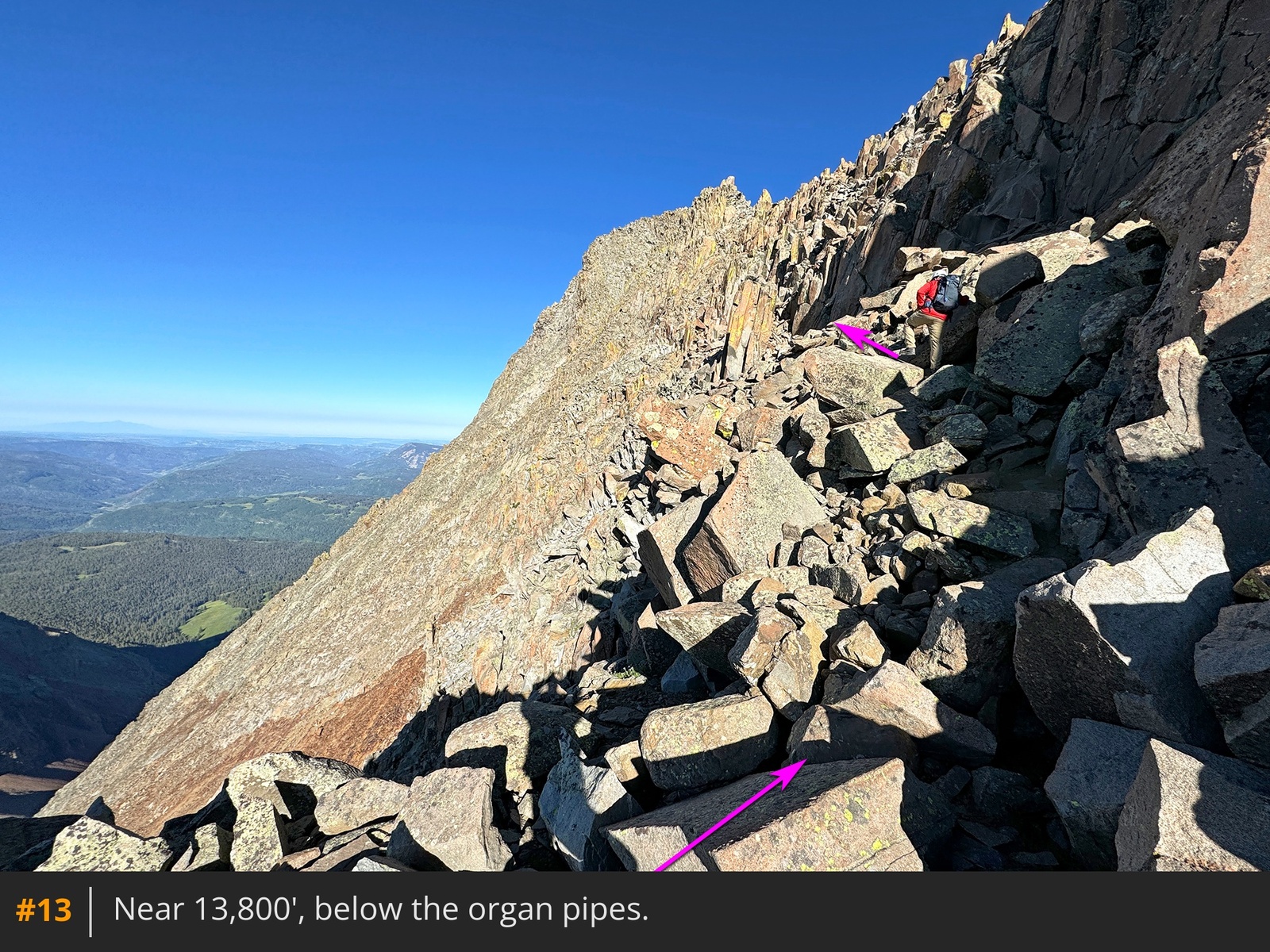
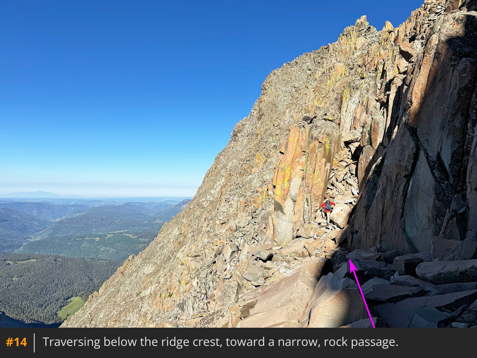
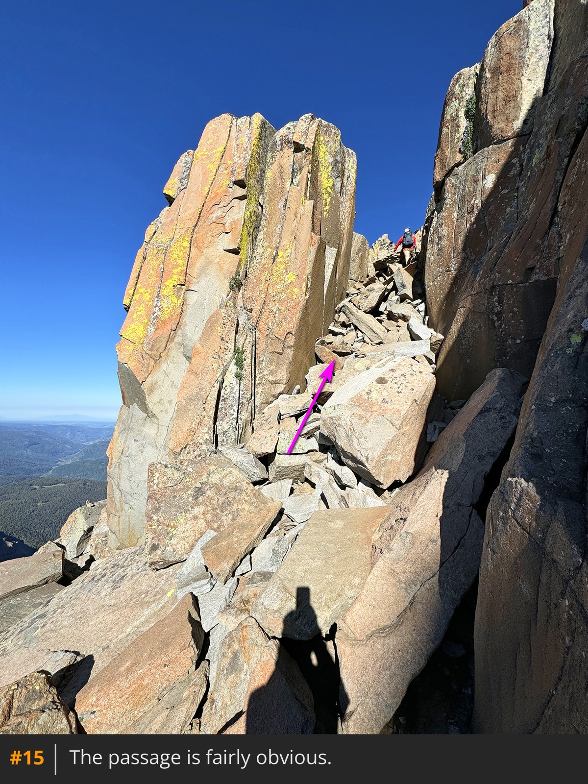
13. Turn left and scramble toward a rock passage resembling a chimney
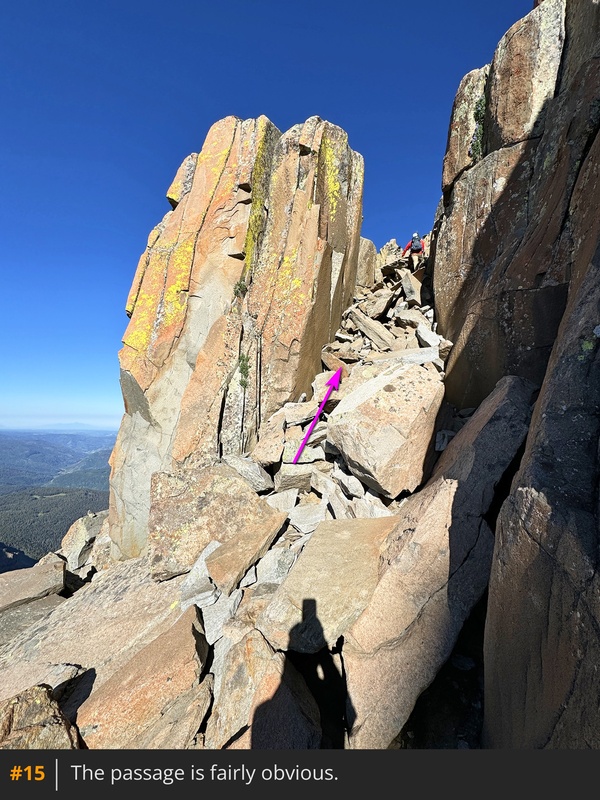
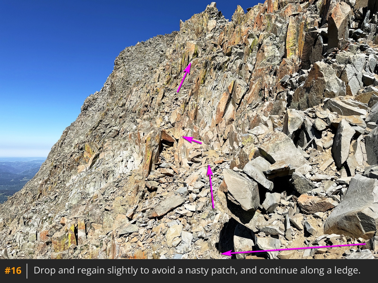
14 15. Climb through and continue to a section where you'll work around jumbled, stacked rocks
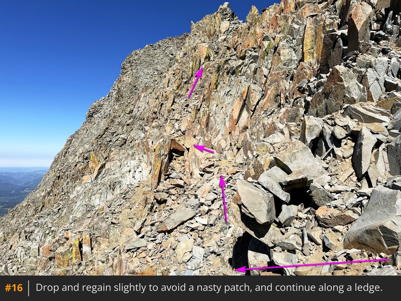
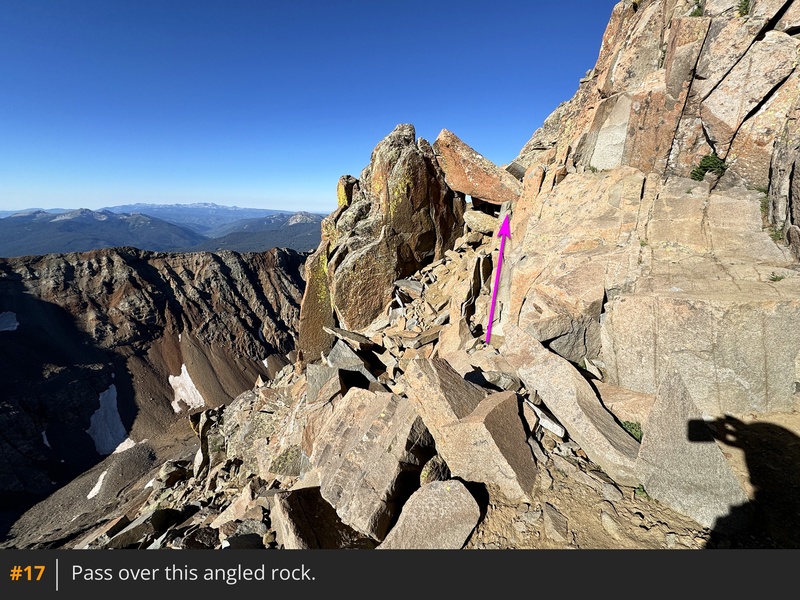
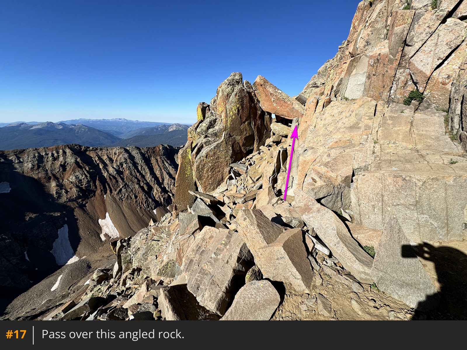
16. After a short drop and re-ascent, follow a ledge and cross over an angled rock
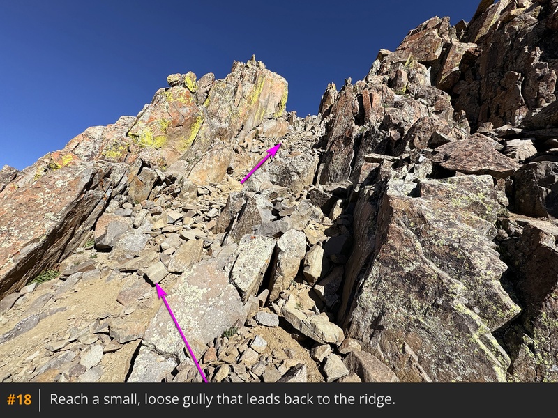
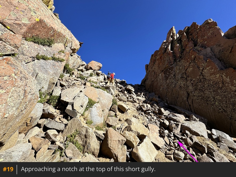
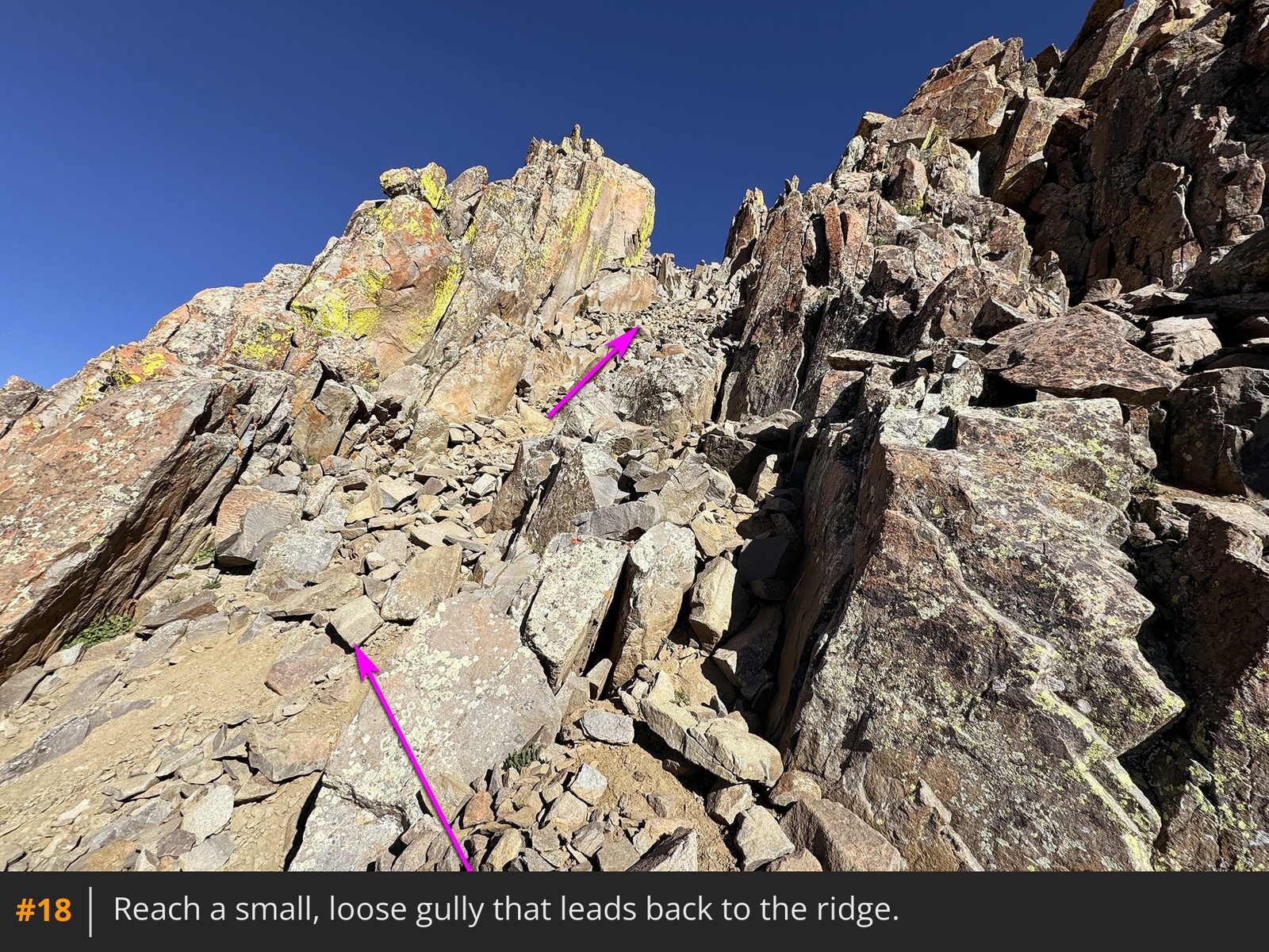
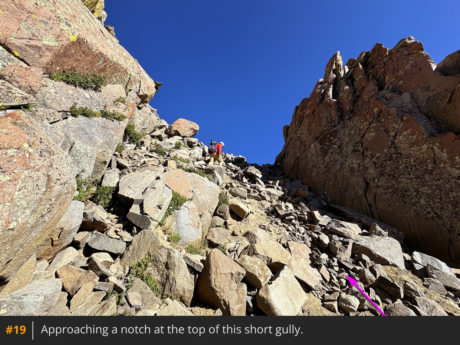
17. Then climb a short, loose gully that brings you to a notch in the ridge crest
18 19.
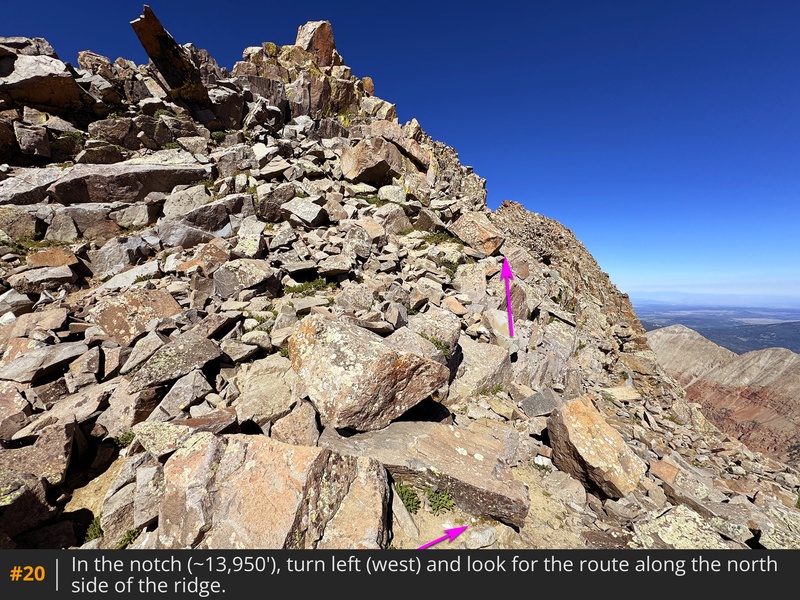
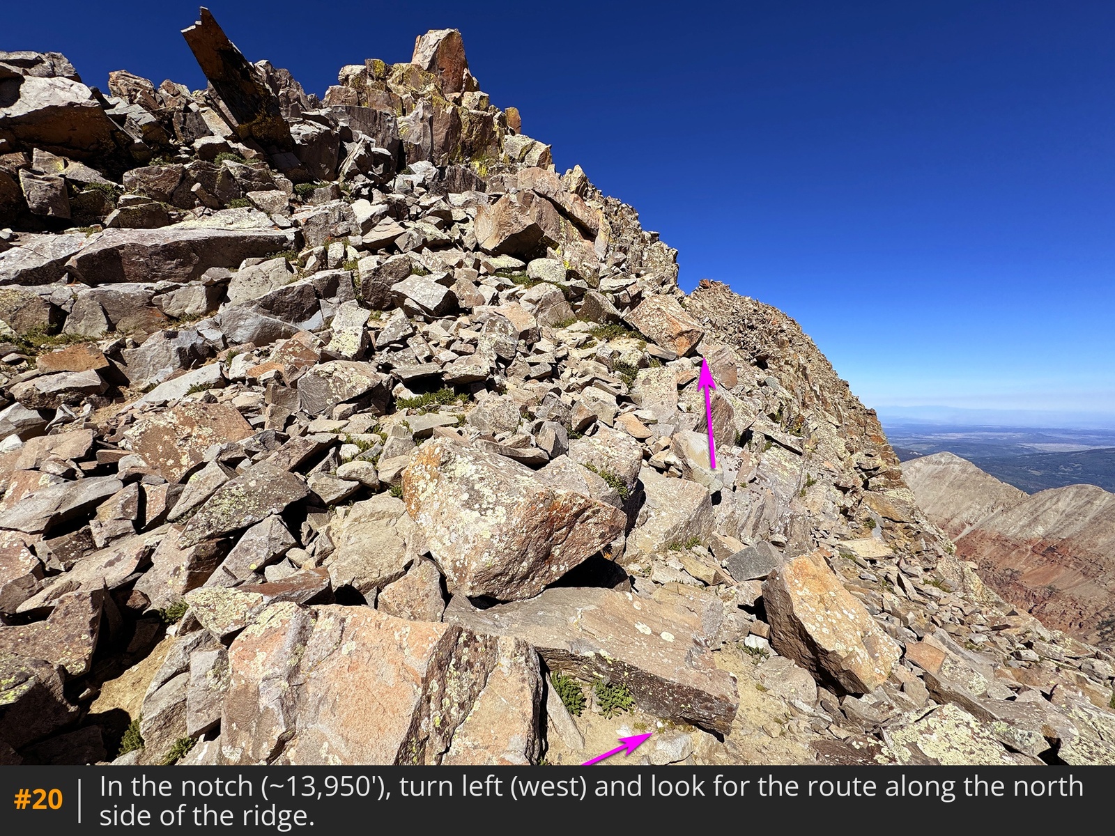
At the 13,950-foot notch
, turn left to view the next segment of the route on the north side of the peak
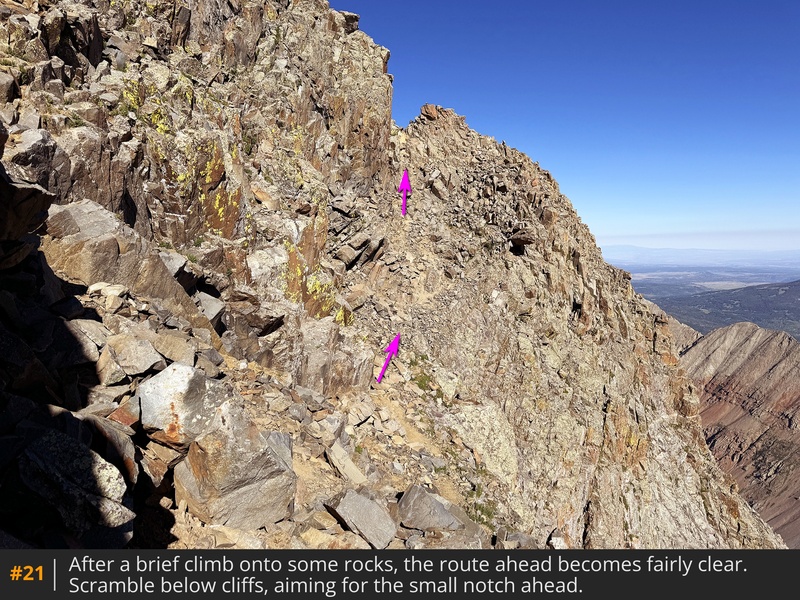
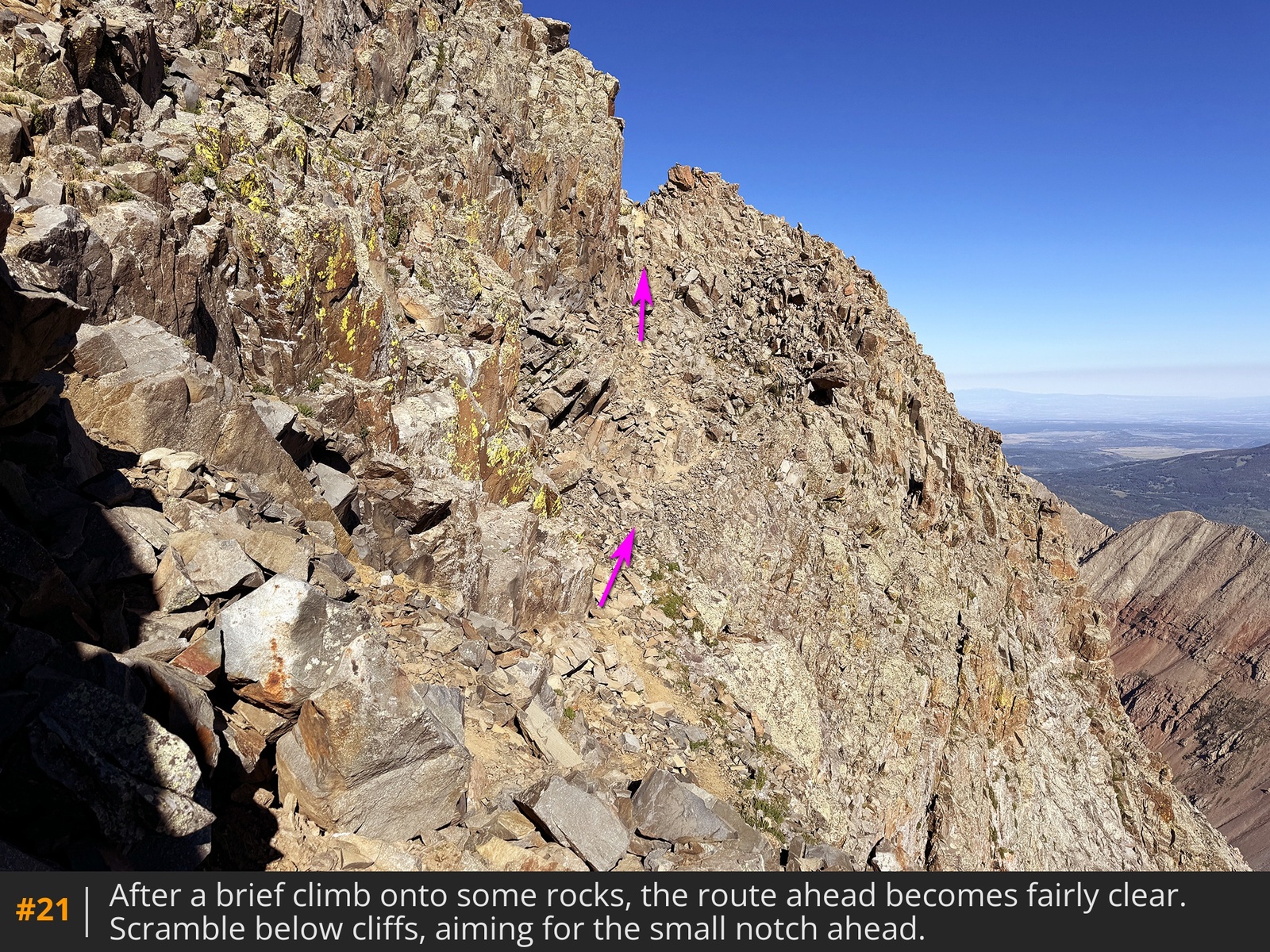
20. Follow a cairned route that leads to another notch on the north side of the summit area
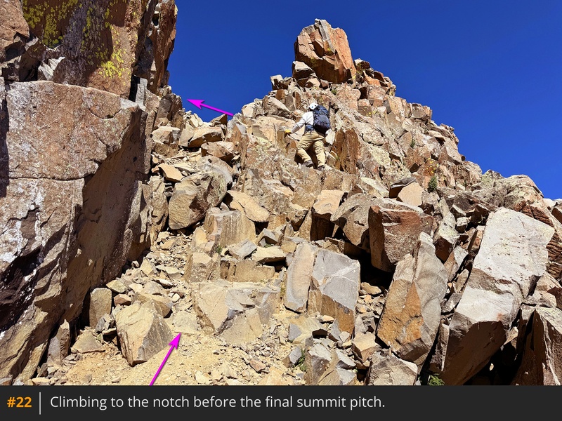
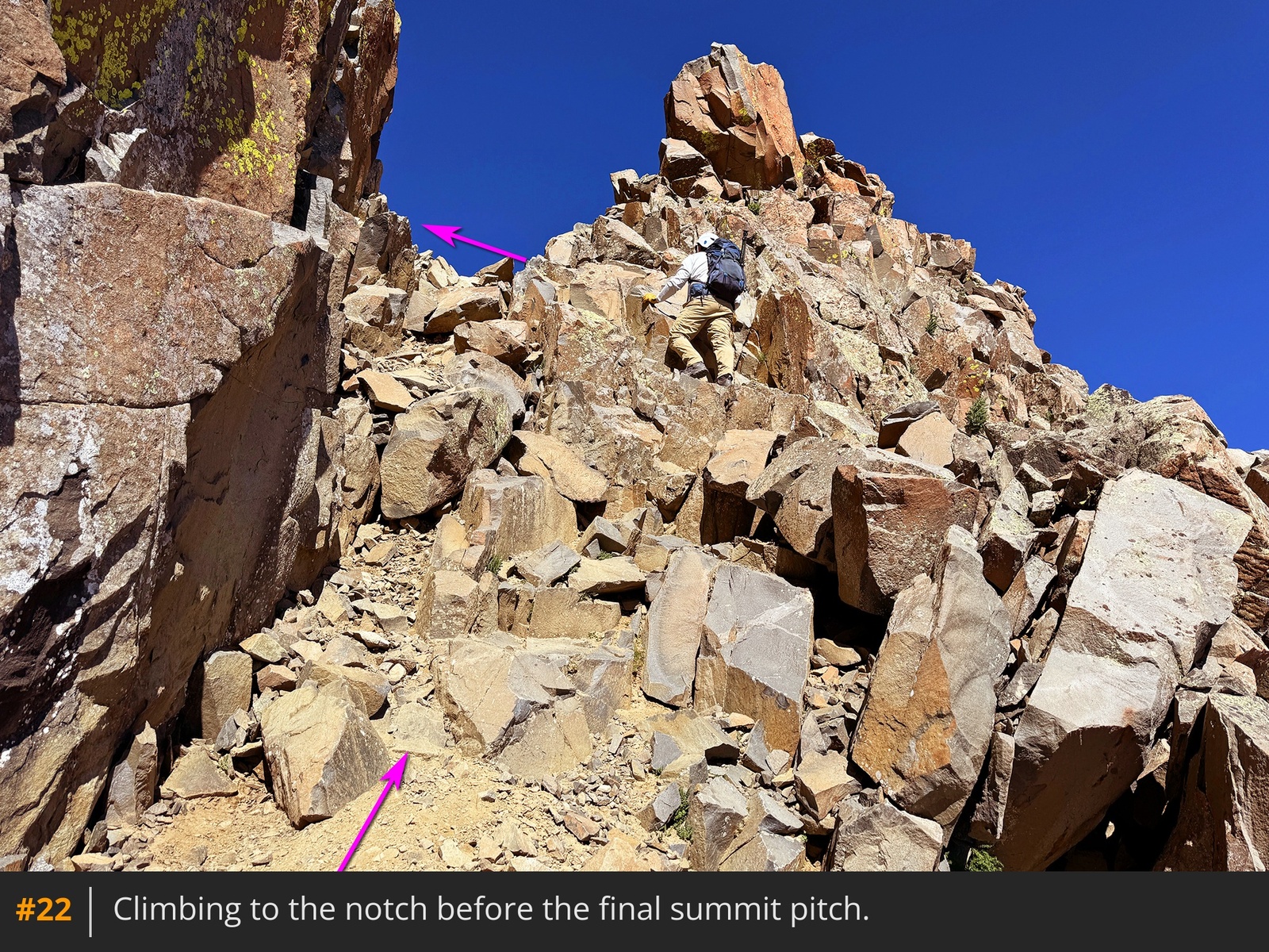
21. Scramble up to this notch
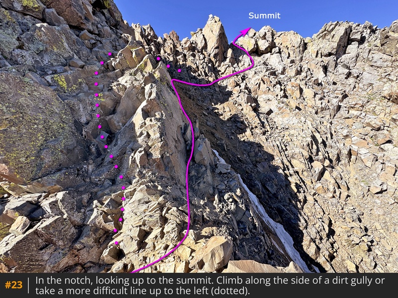
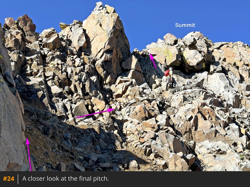
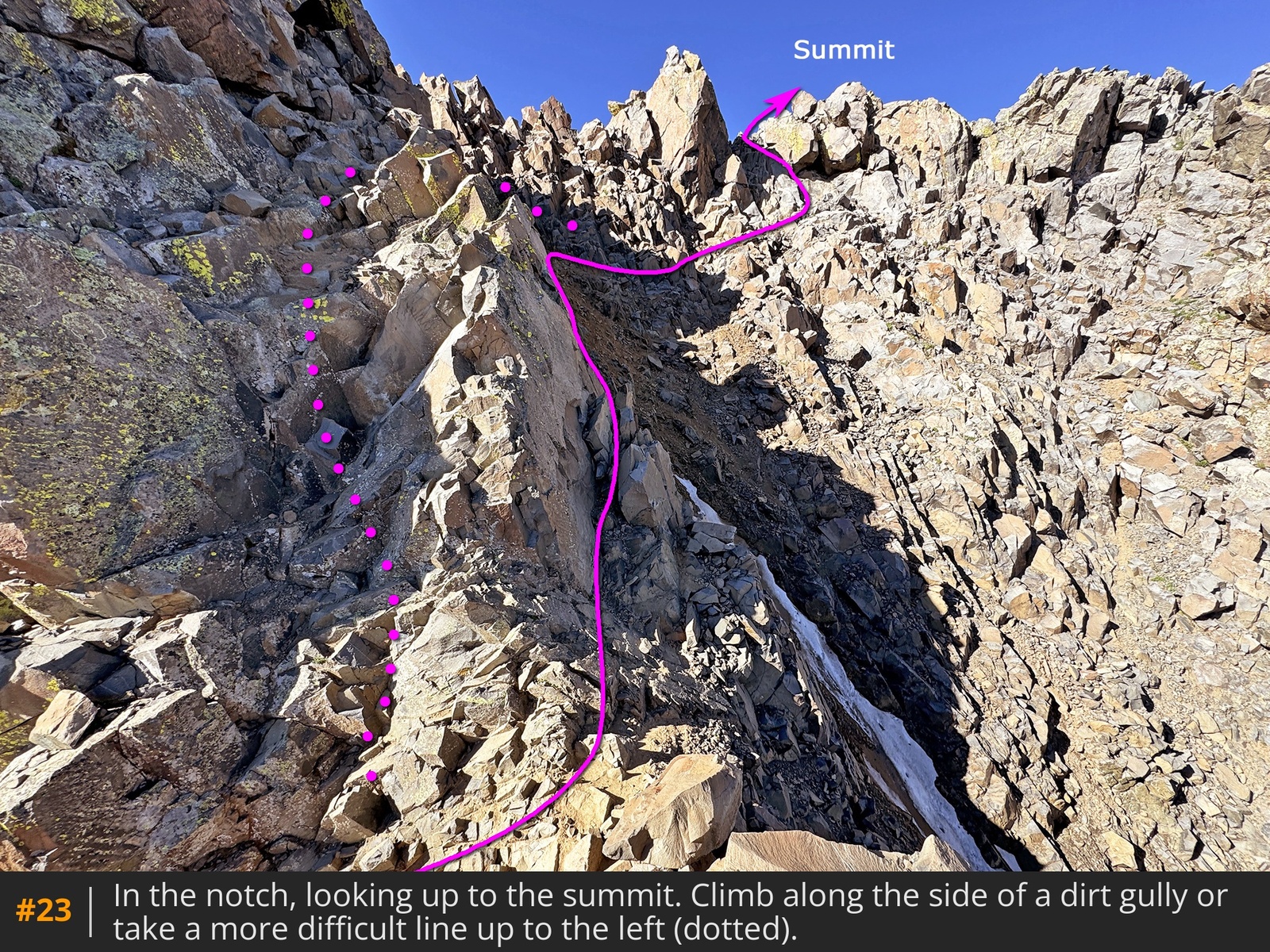
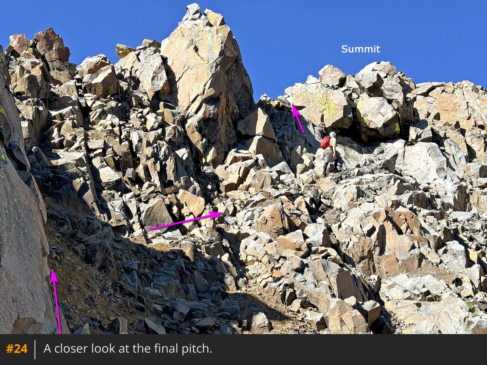
22. With the summit now visible, climb the final pitch by passing through the notch and following angled rock on the left side of the dirt gully
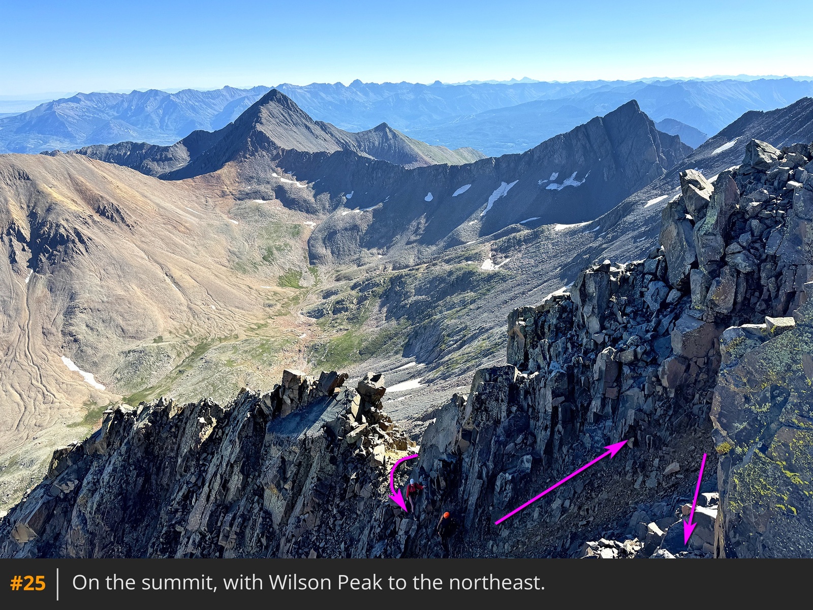
23. Near the top of the dirt, turn right and traverse a short distance before climbing left to the summit
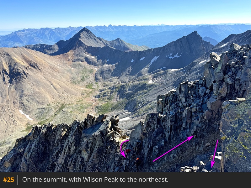
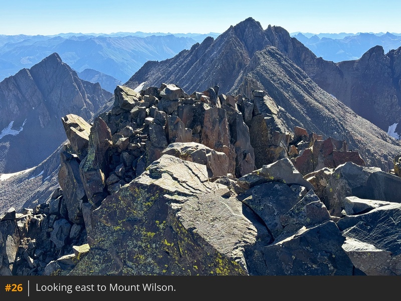
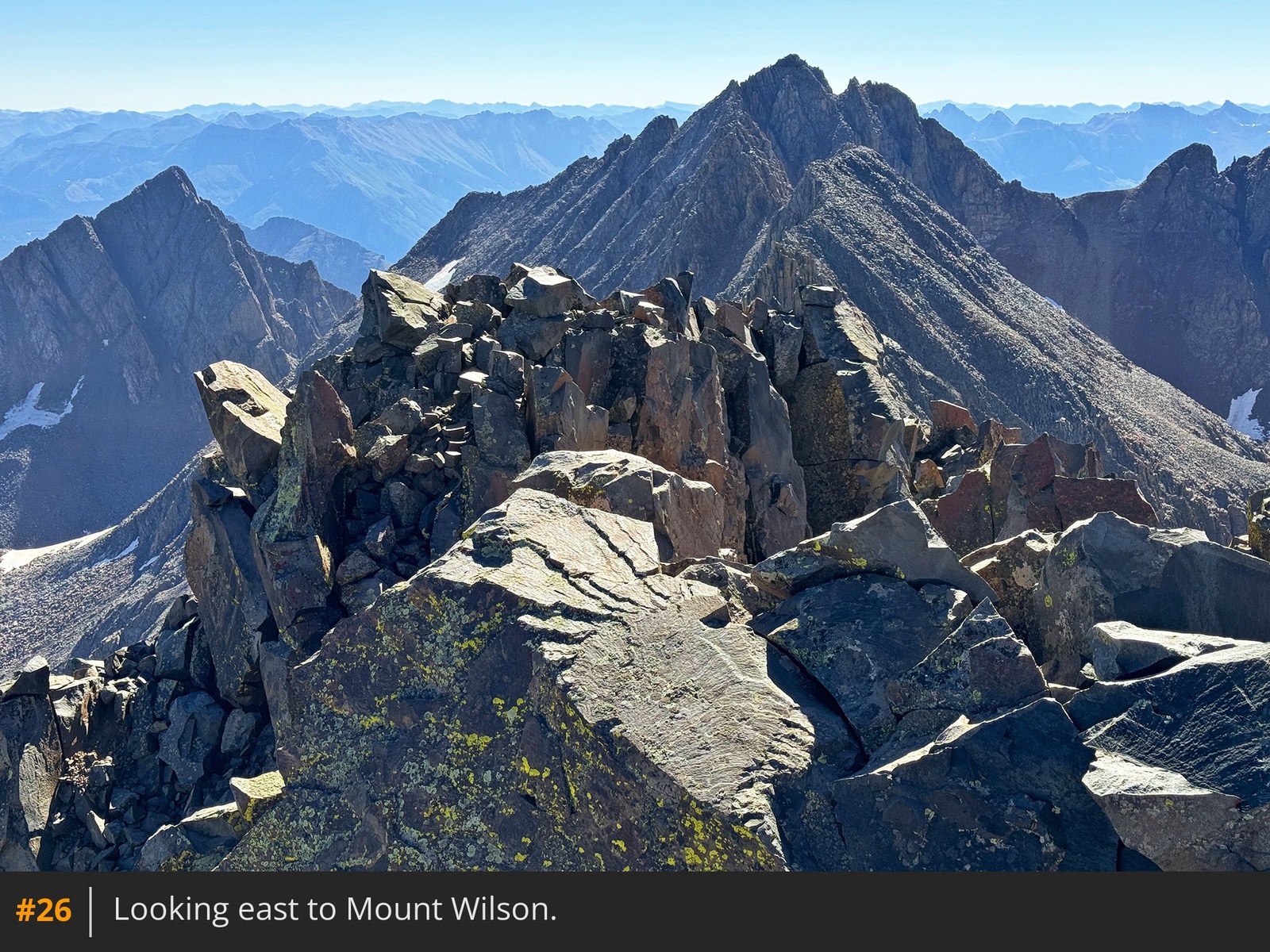
24 25 26.




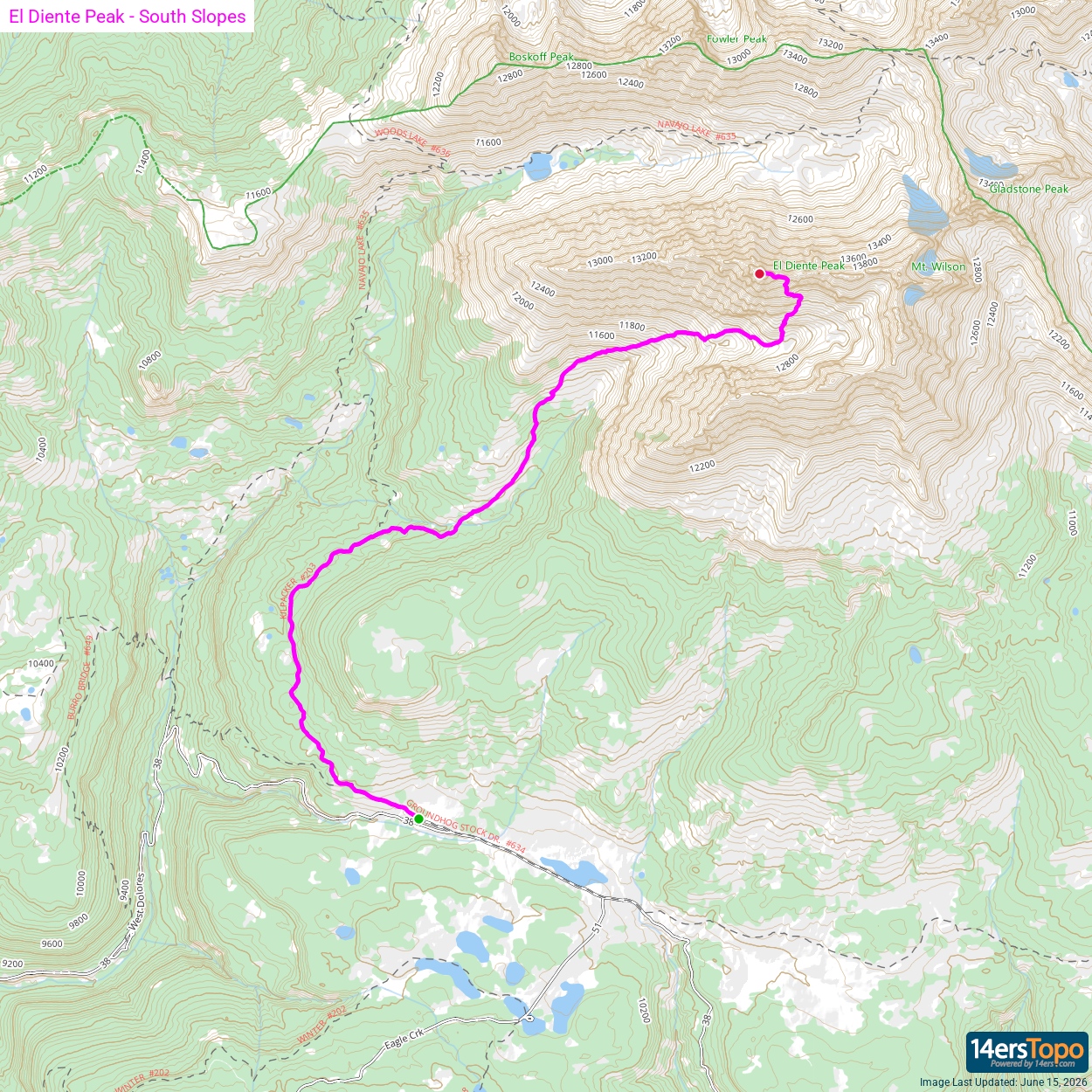

 GPX
GPX KML
KML