Download Agreement, Release, and Acknowledgement of Risk:
You (the person requesting this file download) fully understand mountain climbing ("Activity") involves risks and dangers of serious bodily injury, including permanent disability, paralysis, and death ("Risks") and you fully accept and assume all such risks and all responsibility for losses, costs, and damages you incur as a result of your participation in this Activity.
You acknowledge that information in the file you have chosen to download may not be accurate and may contain errors. You agree to assume all risks when using this information and agree to release and discharge 14ers.com, 14ers Inc. and the author(s) of such information (collectively, the "Released Parties").
You hereby discharge the Released Parties from all damages, actions, claims and liabilities of any nature, specifically including, but not limited to, damages, actions, claims and liabilities arising from or related to the negligence of the Released Parties. You further agree to indemnify, hold harmless and defend 14ers.com, 14ers Inc. and each of the other Released Parties from and against any loss, damage, liability and expense, including costs and attorney fees, incurred by 14ers.com, 14ers Inc. or any of the other Released Parties as a result of you using information provided on the 14ers.com or 14ers Inc. websites.
You have read this agreement, fully understand its terms and intend it to be a complete and unconditional release of all liability to the greatest extent allowed by law and agree that if any portion of this agreement is held to be invalid the balance, notwithstanding, shall continue in full force and effect.
By clicking "OK" you agree to these terms. If you DO NOT agree, click "Cancel"...
We've tried Yale on skis three times, and were turned back for:
1. a blizzard on the summit ridge, 400' below the summit
2. running out of daylight in the middle of winter, due to a late start
3. just a month ago, at 12,700', for high winds and approaching weather
The forecast looked good, so Friday night was spent, like before, in the back of our truck at the Denny Creek trailhead. Our one-year old dog, Rocket, joined us again.
Saturday morning broke clear and cool, with light southeast wind, temps in the high 20's, and a cloudless sky. We got an early start and had to carry skis on our shoulders for about half a mile, due to the receding snowline. Once the skis were on, we made good time on the firm snow, with only a few bare spots on the trail. We were glad to see the snow bridge still over Denny Creek at the crossing, and made the clearing at the bottom of the south ridge in Delaney Gulch in about 2 hours.
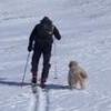
Rocket reviews our path so far, with the Gladstone Ridge in the background -
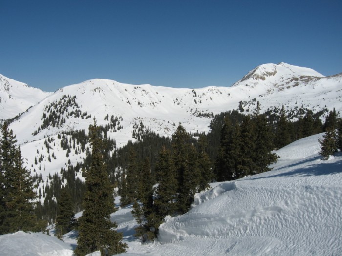
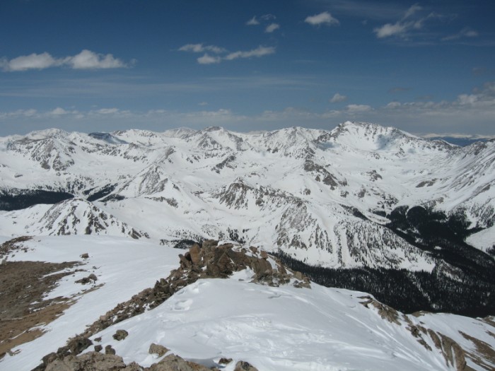
The snow was very firm, so we avoided the deep sugar snow in the trees from our last attempt, and headed southeast up the ridge. It was steep, but efficient climbing (as long as skins stayed flat on the snow!), and we cleared the treeline a lot quicker than before. The wind picked up on the ridge, but it was till clear. Here's the view west, with the ridge just southeast of Brown's Pass:
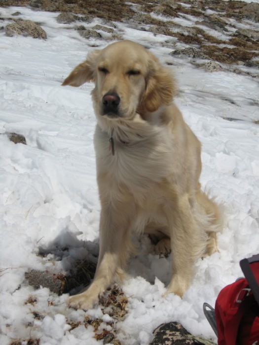
Here, Tracy poses in front of Turner Peak and Hartenstein Lake, while Rocket sneaks a quick nap:
We followed the thinning snowpath through the rocks for another 500', and then made a straight path over firm windblown snow to the base of the headwall.
Here's Rocket and me, working our way through the rocks, with the objective behind us:
We stashed our skis at 13,300', the beginning of what looked like safe, skiable snow for descent, and switched to crampons. The wind really picked up here, to a steady 30 mph, as you can tell from this photo:
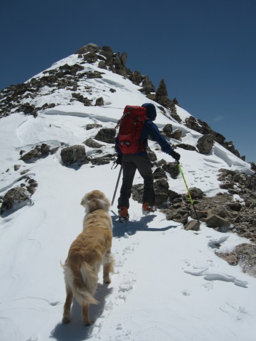
With the strong southwest wind at our backs, we made the hike up the headwall to the summit ridge, and took a quick break before the final push to the top. The path looked easier on the north edge of the ridge, but the snowpack showed a 4-5 inch crust with a deep layer of large facets, so we stuck close to the rocks. Here's Rocket and me heading up the summit ridge:
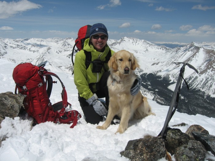
We made the summit at 1325, and took a nice thirty minute break there, since the winds had let up quite a bit. We dug in the snow at the base of a few rockpiles, but could not find the summit register, so we just enjoyed the view and took a few requisite summit photos.
The view west, up Texas Creek:
Tracy and Rocket:
Rocket and me:
The trip down to the skis was quick and uneventful, with the strong wind in our faces now. Rocket was excited to see us finally get on our skis, as usual, and had a great time chasing me down to the treeline. That's where the fun ended, though, as nice soft snow turned to isothermic mush. It was a slow and difficult descent (for all three of us) back into Delaney Gulch, as we tried to avoid a wet slide, and not sink into the quicksand-like snow.
Once safely down into the gulch, we took our last break before the warm descent to the trailhead. The couple in the parking lot, in t-shirts and sandals, looked at us in disbelief as we walked to our truck in winter clothes, helmets, and skis on our backs, but we had big smiles on our faces after finally pulling this one off. It took 11+45, and it was the only time we never saw another person on the trail on a hike like this (probably because everyone else was smart enough to avoid this kind of snow).
Anyway, the pale ale in the cooler has rarely tasted better.
Thumbnails for uploaded photos (click to open slideshow):
My son and I tried in March but couldn't get up the headwall right before treeline - too steep for skins to bite but couldn't move without the flotation. We built an igloo at about 11,500 in Delany Gulch right beside the trail where it parallels the creek. Was it still there? or has it melted?
We didn't see an igloo, but we headed southeast up that wall, instead of heading further up the gulch (where the summer trail goes), so we might not have gone far enough in that direction to see it. I know what you mean about the skins--we slipped a few times as we angled up that slope. As soon as the slope angle eased off a bit, we headed straight up to the fall line to get a decent grip.
Mango
Caution: The information contained in this report may not be accurate and should not be the only resource used in preparation for your climb. Failure to have the necessary experience, physical conditioning, supplies or equipment can result in injury or death. 14ers.com and the author(s) of this report provide no warranties, either express or implied, that the information provided is accurate or reliable. By using the information provided, you agree to indemnify and hold harmless 14ers.com and the report author(s) with respect to any claims and demands against them, including any attorney fees and expenses. Please read the 14ers.com Safety and Disclaimer pages for more information.
Please respect private property: 14ers.com supports the rights of private landowners to determine how and by whom their land will be used. In Colorado, it is your responsibility to determine if land is private and to obtain the appropriate permission before entering the property.


")
")
")
")
")
")
")
")
")
")