| Report Type | Full |
| Peak(s) |
Mt. Bierstadt - 14,066 feet The Sawtooth - 13,780 feet Mt. Blue Sky - 14,268 feet |
| Date Posted | 09/27/2010 |
| Date Climbed | 09/13/2010 |
| Author | rking007 |
| Tour de Adventure!!! I mean Abyss... |
|---|
|
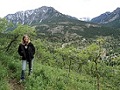
4:00am is early no matter how you slice it. Farmers, I feel for you all, I really do... However, at 4:00am on the morning of Monday September 13th, the air was slightly crisp and held the breath of adventure. I welcomed the groggy tiredness with open arms... after a shower and cup of coffee of course... My head was recycling all the images and information of the previous two weeks of scouring trip reports, maps, and route guides - I was feeling a slice of nervousness as well... This was to be the first time my brother Eric and I attempted any sort of Class 3 climb and also any level of exposure that would make me wish I had died from a fall rather than cripple or break every bone in my body. Still, the deep call for adventure, the part inside me that resides with the creator of the universe was beckoning me, 'Come play, explore, learn more about yourself.' Mt. Bierstadt's east ridge was the path chosen; then on to the infamous Sawtooth traverse which would bring us to rest on top of Mt. Evans. The road to Mt. Evans partially closes after Labor Day so we trusted our car to the care of Summit Lake's dirt lot and took to the road... on foot. A small group of Mountain Goats stood watch, contemplating us while they casually chewed the tundra. 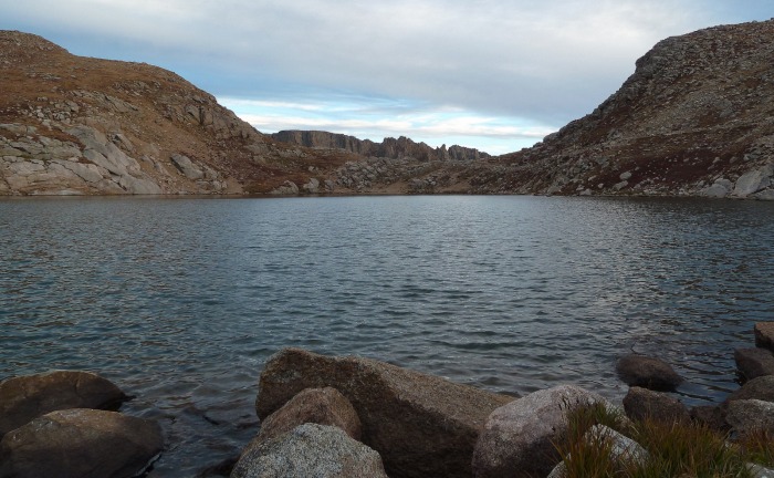 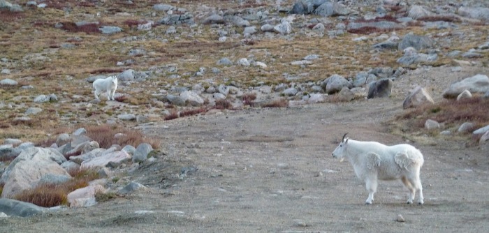 We walked about a mile before we found an old service dirt road and took it to its end, which spit us onto an open span of tundra. Ahead, we could see the mouth of the gully we needed to take to gain access to the Abyss lake valley. At this point we could see a good chunk of our route for the day: Ahead across the valley was Mt. Bierstadt's ominous East Ridge and point 13,641. To our right and in the distance, the impressive jagged and shadowed profile of the Sawtooth. Somewhere on that rock was the other place I was thinking of constantly for the last two weeks other than point 13,641 - the ledges that take you from the Sawtooth ridge to the amazingly gentle slope that guides you to the top of Mt. Evans. We were already being tested mentally for what lay ahead. It's hard to give good justice to something like this in a picture. It's even harder to place a feeling to what we were looking at and knew we were going to climb. This was our first attempt at anything above a class 2 hike so there was a sense of healthy fear and respect for point 13,641 even from this distance. 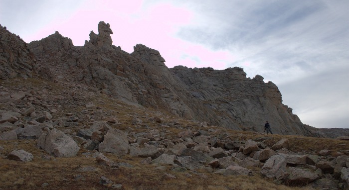 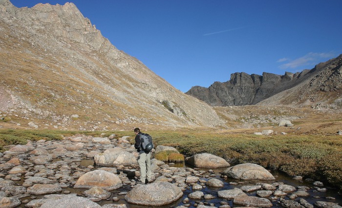 The rocks littering the gully were somewhat loose but not too bad a hike down without sending any on a free trip to the valley below. Crossing the valley was nice and gentle. After negotiating a few patches of willows, we took to the stream flowing from Abyss Lake. There are several large water rounded stones in the flow so we decided to do some hopping up stream to find a place we could continue on without getting into anymore willows. Beyond the icy stream was the first real exertion of the day - the leg-burning climb straight up the steep slope of Bierstadt to gain the ridge. We eventually started making our own micro switchbacks to save energy. Once at the top we rested for a bit, looking out into the valley far below and beyond at the subtle patchy fall colors starting to consume the vegetation. 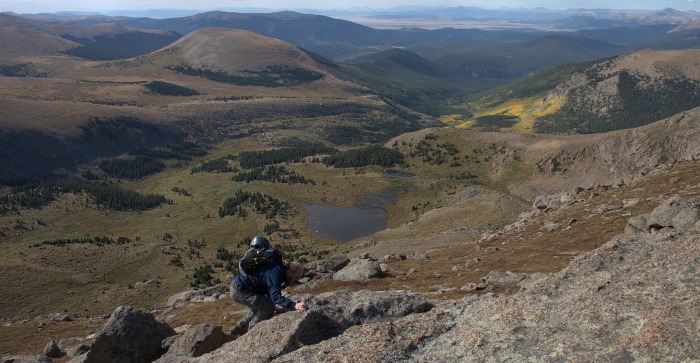 After our first break of the day we strapped on our helmets and began to tackle the first obstacle in our way to the summit. The rock on this ridge is really amazing - sticky, solid, and chock full of holds. This first mass of boulders didn't prove any challenge and it was good to get our upper bodies into the game and warmed up. 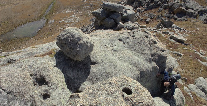 At the top, point 13,641 shows it's real self for the first time. This thing is massive and for someone who has never climbed beyond Class 2 this can really test your mettle. The North West facet holds a severely slanted sheer face that should not be considered without protection. As a juxtaposition, the South face's grassy stepped ledges seemed to stretch their arms out us saying, 'If you please, this is the way.' There were still negotiations to be made here but far more welcoming than the alternative. 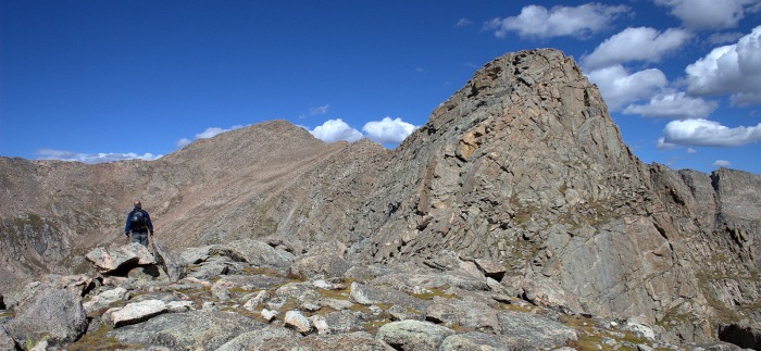 Gaining the ledges was fairly straightforward and here for the first time of the day our route finding skills were put to the test. A quilt works pattern of puffy flat clouds had made their way to us, carried on a slight breeze, and that, with the warm morning sun, accentuated some great climbing. The exposure here is drastic but the grassy ledge and solid footing quelled it to a manageable experience. 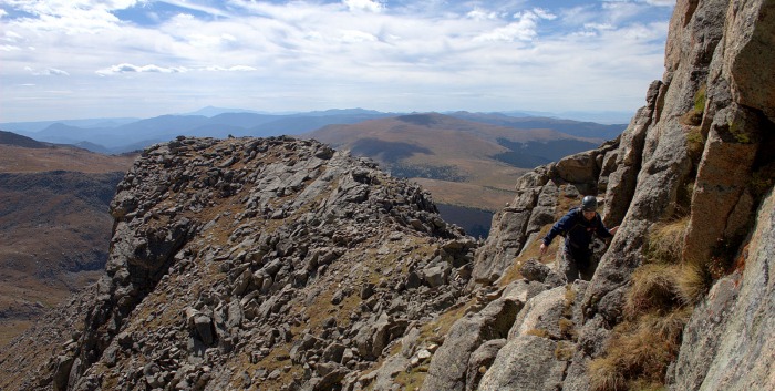  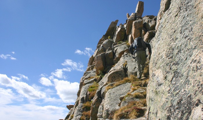 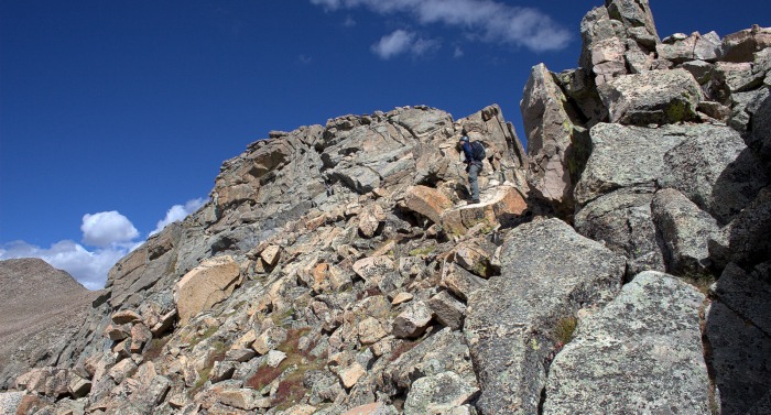 The last section to the summit of point 13,641 held one awkward maneuver and it was the most exposed we had been all day. I had to face a large rounded boulder and traverse to the other side while behind me was the North West face that would lead to my demise if I were to slip. After this and a small rest period on the summit, it was time to head on to Bierstadt. 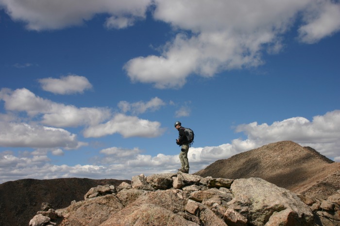 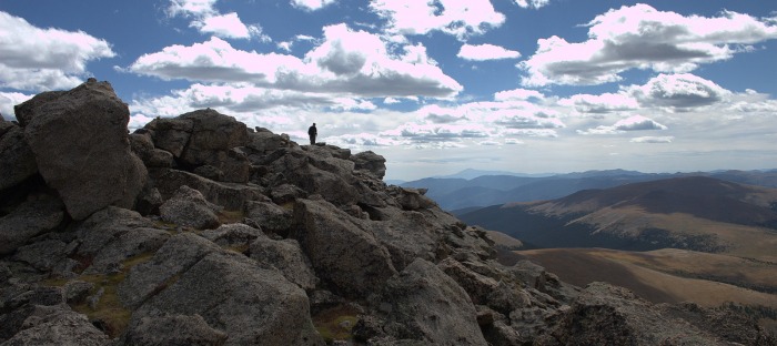 Getting down from point 13,641 proved to be more difficult than getting up it. This was for a three reasons: The wind had decided to pick itself up to 15 to 20mph choppy gusts, a larger puffy cloud came in and took our warm sun away (and somehow my confidence), and we hit a down climb section that was narrow and exposed on both sides. I froze here. My stomach turned inside out and I had a mental freak out moment. I'm not too sure why but everything just felt wrong. The move down to the next spot required you to either hop down with only a foot of space on either side of the rounded rock below or turn around and slide on your stomach until your feet met the boulder below. We both chose the second move.  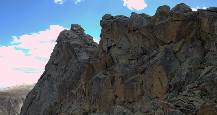 I needed a moment to recompose myself so I chose the 'stuff your mouth with a ham sandwich' method which turned out to work okay. We pressed on to the final steep summit pitch to Mt. Bierstadt without more than easy scrambling and boulder hopping. All the while I still couldn't seem to shake the icy fear and inability to control my body up on that ridge spot ('Foot move forward... why won't you listen to me foot!?) I was experiencing something new on my 14er quest and I wasn't liking it. I forced it into the back of my head and pushed onward and upward. 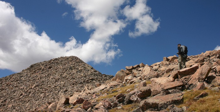 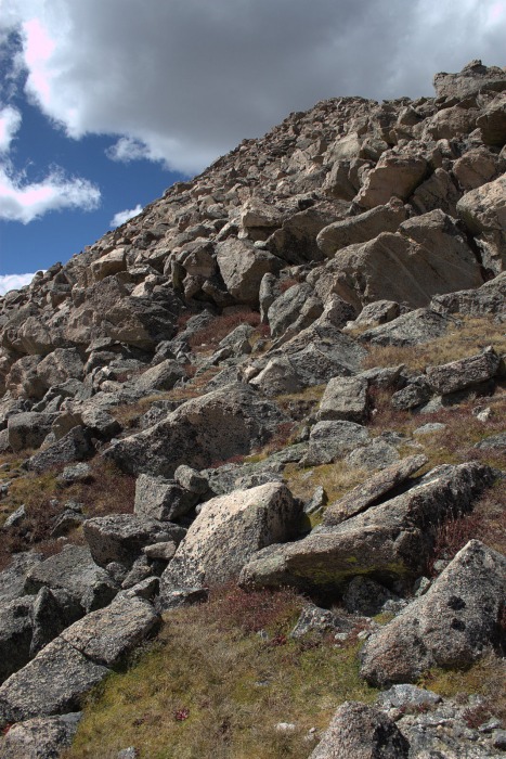 Up at the top, on the summit, we could hear laughter and talking and here, for the first time that day, we met other humans, 5 of them to be exact and all of them experiencing their first 14er via the standard Guenella Pass trail. One of them even drove from Kansas just to do this hike and she told us that when she asked her friend what to expect her friend told her that they would be near 'tree line'. Over the phone she heard 'near tree lions' and was apparently freaking out on her entire drive out here. No one told her until they started that there was no such thing... 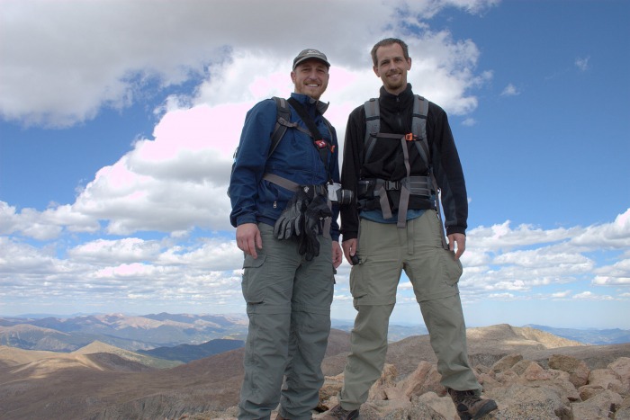 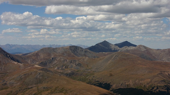 After a quick drink and pack adjustment we moved towards the beginning of the ridge that would take us to the Sawtooth. Now, EVERY picture I have seen of the Sawtooth ridgeline is accurate; a rugged and intense mess of broken rock spilling down into the Abyss valley. Two large gendarmes block a straight line to the sheer face that holds the ledge across and on the other side, a sheer drop to tiny Frozen Lake the entire length of the traverse. The ONLY thing I didn't expect was the approximately two or three hundred-foot elevation drop on this mess just to get there. This was the beginning of time slowing down for the rest of the day. Having to choose every step down lest you knock a pile of sharp rocks at your partner can be quite a feat (if you succeed). 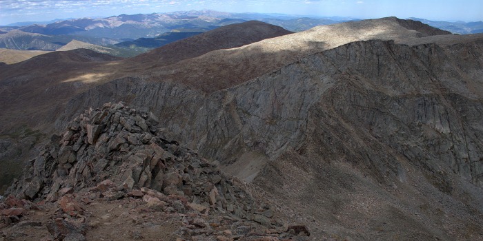 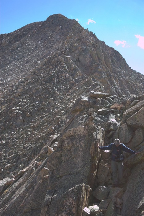 It seems that there are quite a few cairns that mark around three different routes that would take you high, middle or low on your way across the actual ridgeline or saddle (not sure what you would call it). We tried to stay as high as possible but once or twice had to drop down a couple twenty or so feet just to climb it back up again. By the time we got to the first gendarme we were beat. Imagine walking up and down the seats at Red Rocks Amphitheater for two straight hours... that's what my legs felt like (actually would make for a great training regimen). On top of that, Eric has asthma and every once in while would have to stop to hit the Albuterol. The first gendarme is fairly large and getting up and over wasn't that bad. Mostly class 3 stuff again. Here I was challenged with the first time experience of climbing up and forward without really knowing what to expect to get down on the other side. We actually got to a spot where we had to hang onto the ledge and a large crack, let ourselves down to completely outstretched arms and drop a foot to the step below. The second gendarme was larger and it was easy to see the Cairns marking the upper and lower route around. We chose the lower route and it proved easier than the first gendarme. Here we also found the only scraps of actual trail we had seen all day. Finally, with much exertion, we saw the large Cairn marking the entry point to the ledges. We were tired, a little cooked from the sun and almost out of water (well over 150ozs between the two of us). We stopped for another hammy sammy. I have to admit that I was mentally done with the day. I was having spotted moments of just wanting to be at the car mixed with thoughts of just stopping for the day (irrational to say the least) and thoughts of asking God why people do this stuff... By the time I made it up to the entry point, Eric had already checked out the first turn and twenty or so feet. When I got closer to the edge I could start to feel that turning feeling again in my stomach - the ledge was just there... okay feet, go forward... I surmised that if I just kept to the wall on the inside I would be fine and for the most part this was true. The first half of the ledge is solid and straight as well as even on the ground. It wasn't too bad even though it was by far the narrowest portion. It's kind of a weird sensation to be looking at your feet and the ground right below you moving in contrast to the six hundred or so feet WAY down below you and out of focus moving at a much much slower pace. There was one space at the beginning where a large boulder obtrusively sits on most of the ledge. You can choose to face it and edge around it with your back once again to Heaven or just crawl underneath it, I admit I was so tired and uncomfortable I chose the crawling method. 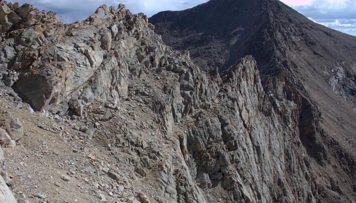  The second half of the ledge turns to total crap. It's as if God decided to dump a wheelbarrow full of dirt and randomly shaped rocks up against the inside wall. Add a few massive broken boulders into the mix and then turn the even ground to an almost 45 degree angle and viola! Interesting to say the least. I headed straight up to the inside wall again, testing every thing I touched while visions of me sliding uncontrollably towards the edge danced in my head. The wind was obnoxious again but it pushed us against the wall and not away from it so I was actually thankful. 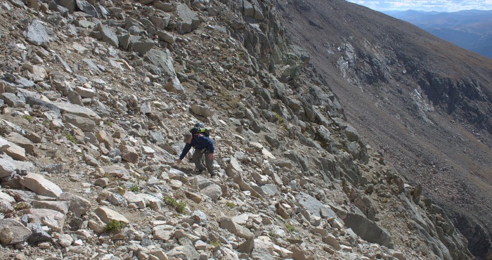 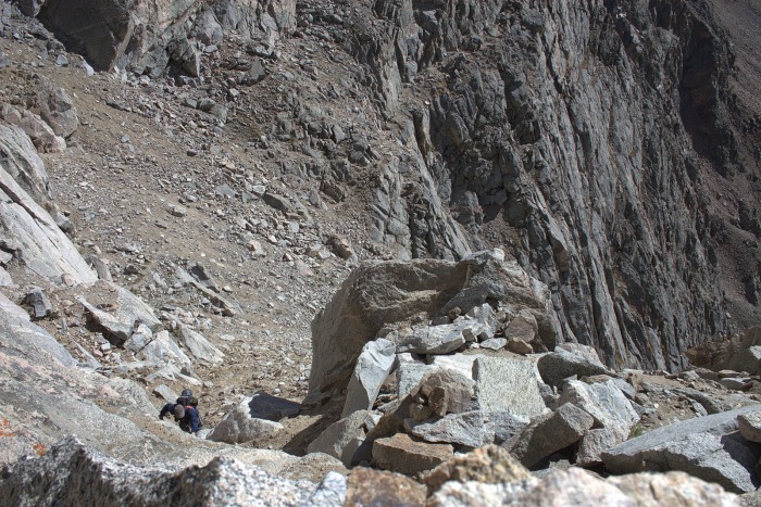 Finally there was a large Cairn marking the exit point up ahead. I actually let out a short laugh when I saw because I knew from the trail guide what was on the other side. Gentle. Soft. Glorious tundra. Sloping up towards Evans. The wind up here was unabated but not bad. We plodded along following widely spaced cairns until we made it to the trail and parking lot area at the top of Evans. I was so relieved. When we got to the actual foot path that leads up to the top of Evans I just dropped my pack on the ground right there. Eric was beat and took an extended break on the path which wasn't that big of a deal considering there was absolutely no one there. 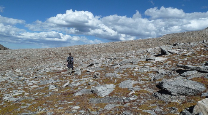 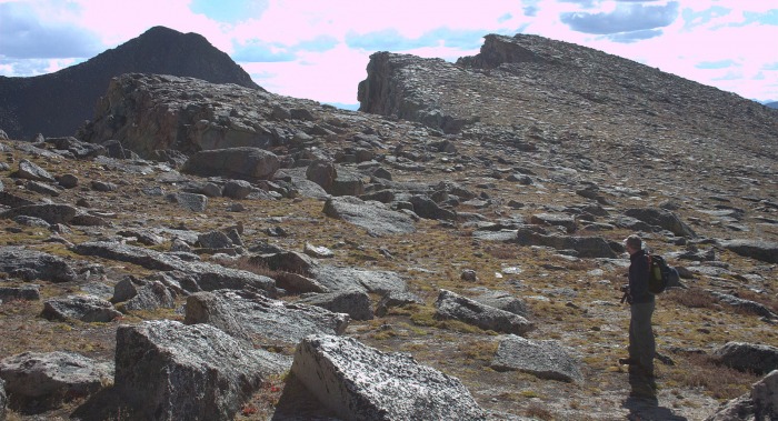 At the top I nearly stumbled to the summit block and just hugged it. I called out to Eric to hurry while I climbed up onto it. The view was awesome. The observatory sat on the ridge just across the parking lot waiting for the night sky, the parking lot itself was gloriously empty and the sun was just getting ready to head to bed. This was really a great way to be on the top of Evans. The only thing I didn't like was looking all the way back down to summit lake and seeing our car; a tiny dot of white contrasted against the brown dirt lot. 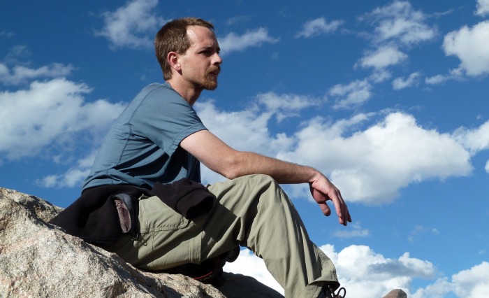 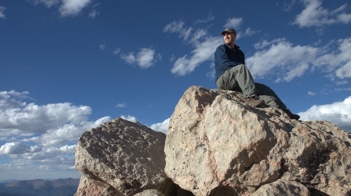 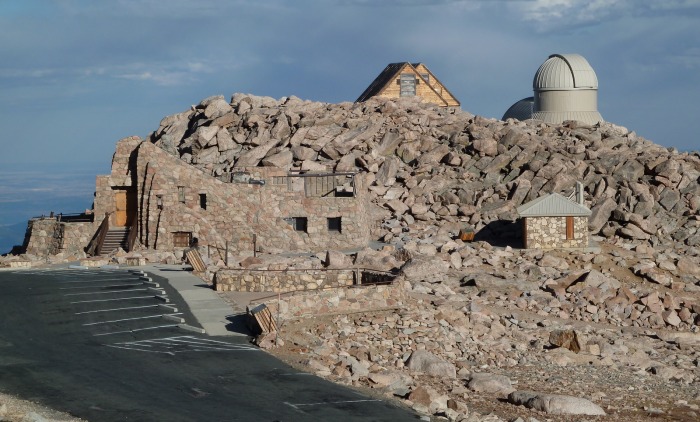 The rest of the walk back down the road was uneventful but long. We cut a few of the road switchbacks by staying on the rocks and by the time we got back to the car it was dusk. 14 hours in total. What a day. We stopped at the restaurant/gift shop at the bottom of the Mt. Evans road and consumed their awesome buffalo chili, corn bread and a piece of homemade pie each. Totally worth the $9.00 it cost. All in all I was stretched. Physically, mentally and a little emotionally as well. I touched the limits of my body and realized that I need to train harder and more consistently. I realized that I have a very healthy fear of heights (or falling) and ultimately I realized what the writer of Genesis meant when he said that God made the heavens and earth and all the things in it and that it was GOOD. All the danger and beauty of this place and the invitation to explore it while treading carefully. It was all GOOD. Thumbnails for uploaded photos (click to open slideshow):
|
| Comments or Questions | |||||||||
|---|---|---|---|---|---|---|---|---|---|
|
Caution: The information contained in this report may not be accurate and should not be the only resource used in preparation for your climb. Failure to have the necessary experience, physical conditioning, supplies or equipment can result in injury or death. 14ers.com and the author(s) of this report provide no warranties, either express or implied, that the information provided is accurate or reliable. By using the information provided, you agree to indemnify and hold harmless 14ers.com and the report author(s) with respect to any claims and demands against them, including any attorney fees and expenses. Please read the 14ers.com Safety and Disclaimer pages for more information.
Please respect private property: 14ers.com supports the rights of private landowners to determine how and by whom their land will be used. In Colorado, it is your responsibility to determine if land is private and to obtain the appropriate permission before entering the property.