Download Agreement, Release, and Acknowledgement of Risk:
You (the person requesting this file download) fully understand mountain climbing ("Activity") involves risks and dangers of serious bodily injury, including permanent disability, paralysis, and death ("Risks") and you fully accept and assume all such risks and all responsibility for losses, costs, and damages you incur as a result of your participation in this Activity.
You acknowledge that information in the file you have chosen to download may not be accurate and may contain errors. You agree to assume all risks when using this information and agree to release and discharge 14ers.com, 14ers Inc. and the author(s) of such information (collectively, the "Released Parties").
You hereby discharge the Released Parties from all damages, actions, claims and liabilities of any nature, specifically including, but not limited to, damages, actions, claims and liabilities arising from or related to the negligence of the Released Parties. You further agree to indemnify, hold harmless and defend 14ers.com, 14ers Inc. and each of the other Released Parties from and against any loss, damage, liability and expense, including costs and attorney fees, incurred by 14ers.com, 14ers Inc. or any of the other Released Parties as a result of you using information provided on the 14ers.com or 14ers Inc. websites.
You have read this agreement, fully understand its terms and intend it to be a complete and unconditional release of all liability to the greatest extent allowed by law and agree that if any portion of this agreement is held to be invalid the balance, notwithstanding, shall continue in full force and effect.
By clicking "OK" you agree to these terms. If you DO NOT agree, click "Cancel"...
A bad day in the mountains is better than a good day in town right? That was my rationale for climbing the bell(s) yesterday. I figured with the poor forecast, at least I would get a good workout up to the ridge and that would be the most probable turn around point. Yet still, I prepared for a possible summit bid and left the TH at 3am because you never know right?
My alarm went off like a bomb in my head at 230am, I wasn't REALLY sleeping anyway, promptly got dressed and hit the trail. To my surprise there was a group of 2 hikers leaving as I was eating breakfast, maybe I wouldn't be alone up here afterall!
After turning up my headphones so I couldn't hear all the creepy crawlies (I know I'm a chicken) I blazed my way up to the bent tree. The only other people I saw were at Crater Lake, and they asked me where the cairn was for Pyramid. Shortly after I banked off the main trail at the cairn. I was lulled into serenity by my music and ease of trail, but the introduction to this gargantuan wall quickly snapped me out of my splendor.
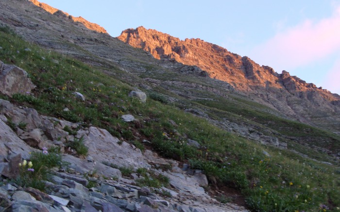
first light of the day
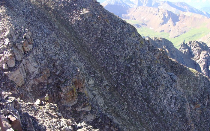
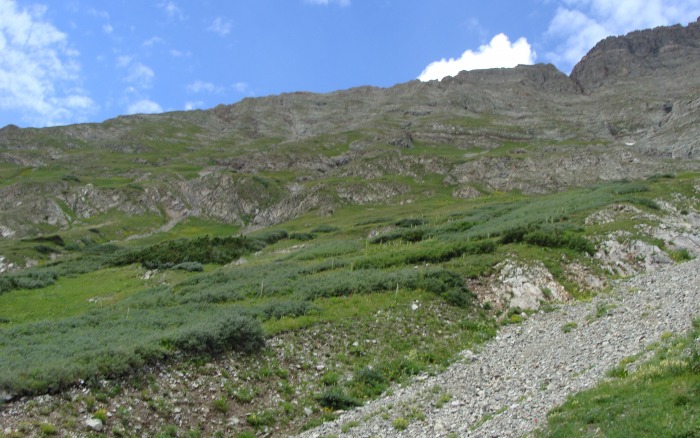
This slope was no joke, and it was interminable! The higher I climbed the further my intent seemed. So I pushed on and on and on..........
I'm getting closer to the sun!
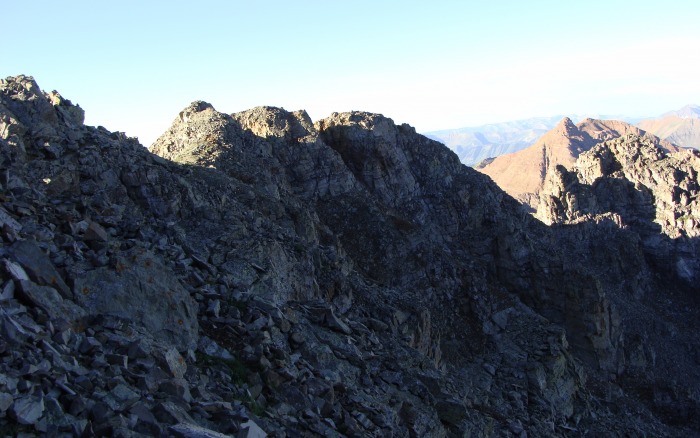
So, here's my problem with this slope. I don't know if I was tired, or just annoyed with the damn thing but somehow I thought I lost the trail. The terrain started getting more cliffy and I felt like I was on a goat path. I noticed a remarkably distinct trail (or so I thought) off to my left. During my studies of this route I read a TR that said something like "Go left!" So I went left and kept going until I hit a very discernable trail, it wasn't the one I had seen but this trail was further south. This definitely wasn't on any TR I read, oh well. (As an afterward, I looked at the TR's, Bergsteigen's was the report that mentioned to go left, and the trail I found was the trail they used) Eventually I made it to the top, took one look at Maroon and knew I was way off. This problem was easily surmounted as I traversed across the ridgeline down to the correct entrance. On my way down I found the spot where I left the trail and was only about 50 yards from the top, go figure.
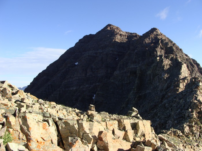
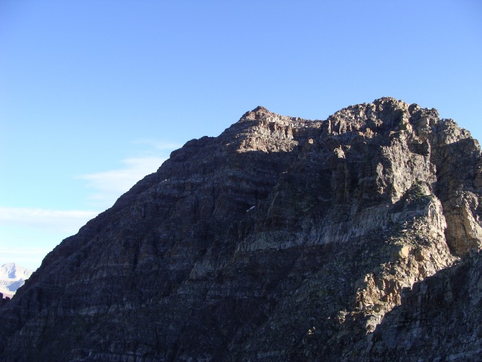
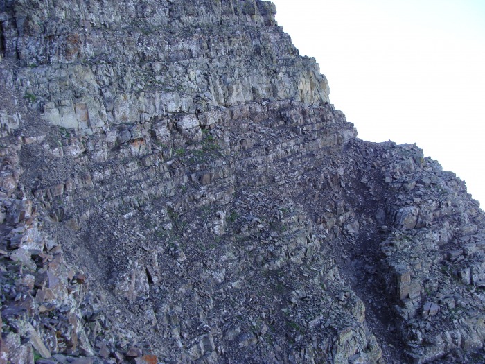
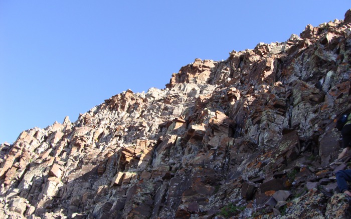
Man! One look at Maroon from the backside is enough to give the most battle hardend climber a pause. I have to admit I was a little nervous, there looked to be no non-technical way up. But I know the best way for me to get over that fear is to just dive in!
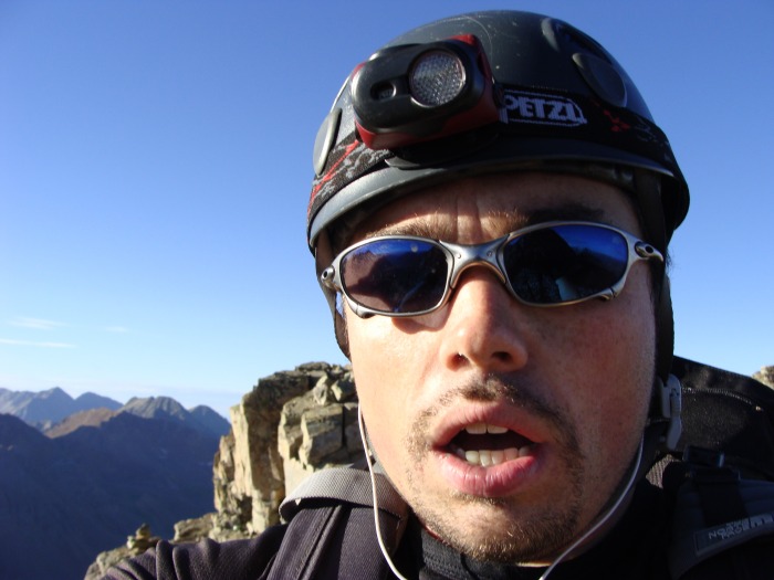
You can tell by the look of pure joy on my face, that 2600' straight up is easy as pie...
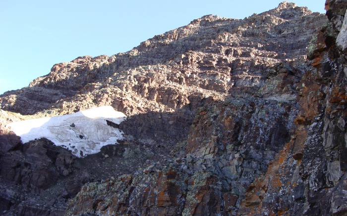
beautiful yet intimidating. Of the 3 snowfields present, the upper right field sits just above the terminus of the 2nd gully
I assessed the weather situation and started laughing! One thing's for sure, the weather ain't stopping me today!
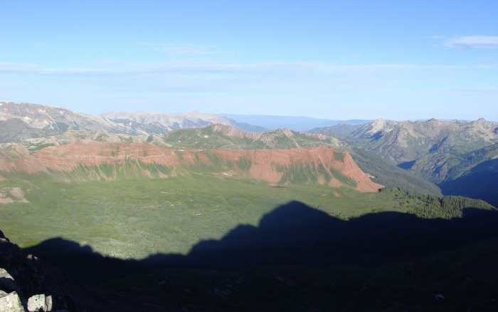
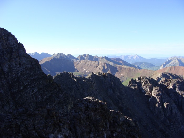
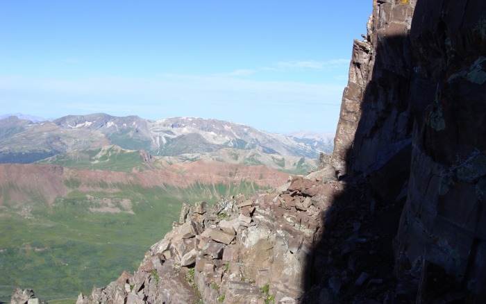
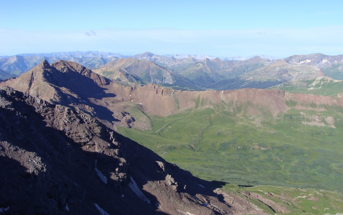
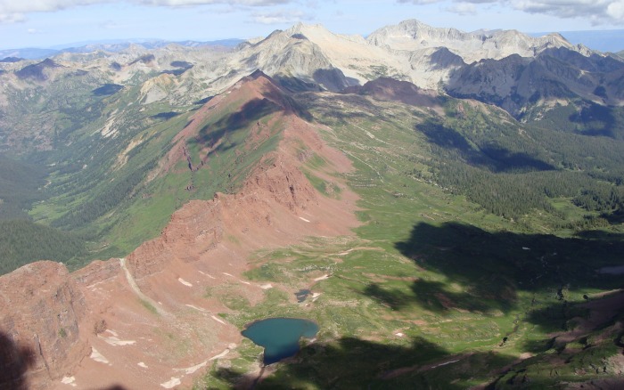
I was awestruck by Fravert basin, it's so unique with the red ridge that surrounds it. The Bells overshadow.
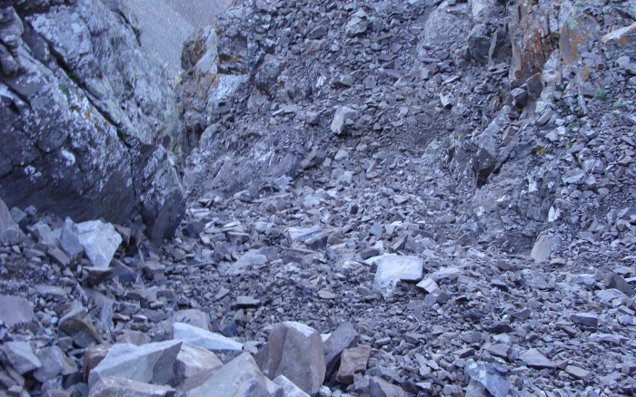
Traversing across and up to the summit is actualy much easier than it looks. Most of the elevation on this mountian had already been gained and the upclimb in the gullies wasn't too long. The whole route is saturated with fairly accurate cairns, however I've read that there are cairns everywhere and they lead everywhere. But these cairns combined with Bill's route description make for a fairly easy route finding adventure.
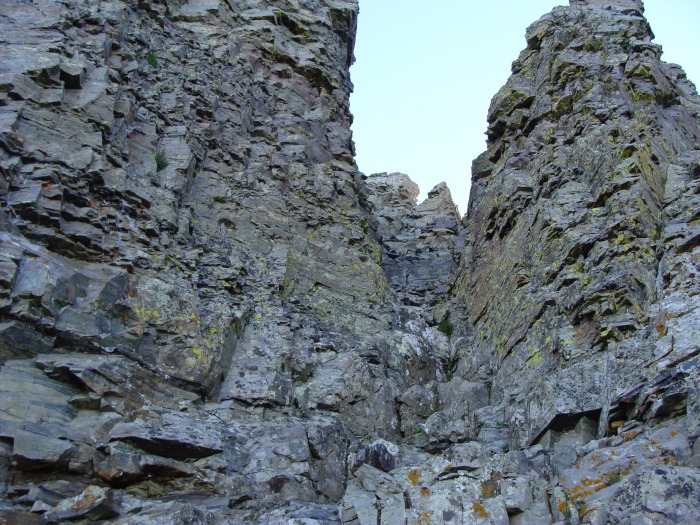
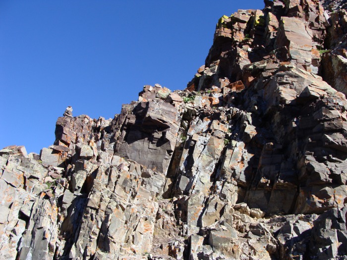
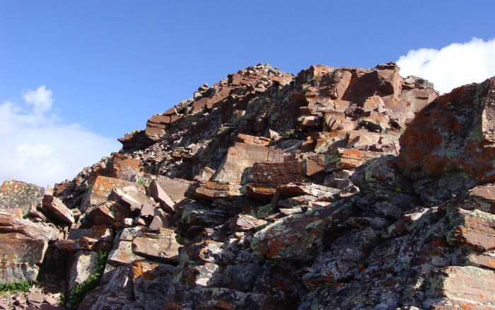
This large rock formation is a good landmark for the chimney entrance.
Looking back from near the chimney
looking up the chimney
taken after exiting the chimney
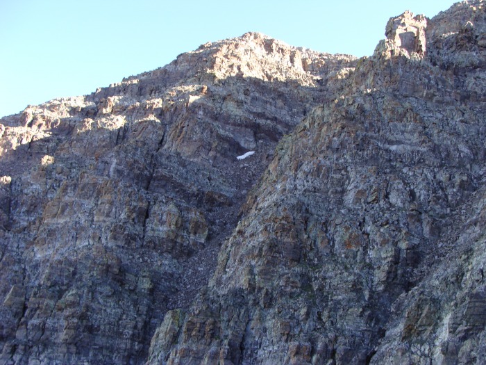
After I exited the chimney my next goal was to find either of the two gullies that would move me on over to my next hurdle. If you take your time, the gullies are easily discernable.
can you spot the two gullies?
I choose the second gully for two reasons. The first reason was that is was wider and it seemed all around more friendly than the closer, first gully. The second reason, I was also mentally mapping my way down, and the snow field was a good landmark. It turns out the snowfield was really helpful because it was right above the gully's exit.
Looking back at where pic 10 was taken. Taken from the bottom of the second gully. Can you see the cairn?
Looking down from near the crossover point in the gully
Looking up from the crossover point. I thought this may help.
On my way down I helped put three people back enroute at this very spot which explains the preponderance of these gully pictures.
Looking back at the entrance point from where the previous picture was taken
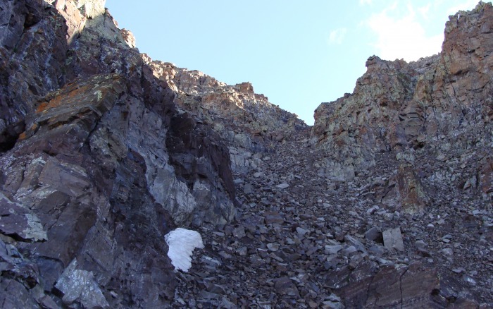
The summit can be seen, it's the second bump on the left. This snowfield is indicative of the last gully to be climbed.
I hit the final gully, which was mostly dirt. This made going up favorable because of all the recent rain, it had softened it up and made traction a breeze.
When I took the above picture, at the time I didn't realize I was looking at the summit. I thought that was point 13,753. It was around this time that a group of three hikers caught up to me, which was kind of scary. I had my headphones on and I thought I was alone so I wasn't being the most careful climber in regards to rockfall. I felt like an idiot and asked them if I had knocked down any rocks, they told me I hadn't. I apologized and they asked me if I wanted to do the traverse with them, I said no I was too tired and a little embarassed. Lesson learned for me: don't listen to the ipod while hiking in technical terrain.
the entrance to the summit pitch as marked by the cairn
a climber can be seen near the pictured cairn in photo #18
Once here, the theme of traversing some ledges, ascending advantageous little ramps, and following cairns continued. I thought that this might be the most technical area of the climb, although it wasn't too difficult.
typical terrain beyond the final gully
Nearing the summit ridge
A hard earned summit.
I can't believe the weather I had! This was one tough mountain but I am glad I doubted the forecast and chanced it! To the three guys that summited right before me, I hope the traverse went well for you! This was a tough mountain, and that 2,600 ft slope will not be revisited by me for a while, of course we hikers/climbers have short memories! To all the cool people I met on the way down, thank you for the company!
Here are some more pictures I thought were worth putting up:
Awestruck
North Maroon
It will be a long time until I see this beast again, a very long time
I will never tire of this picturesque scene
Having climbed both of these monarchs, I have gained a deeper appreciation for this special place and it will always be special.
Thumbnails for uploaded photos (click to open slideshow):
The first line of your report pretty much sums up my climbing philosophy. Congrats on beating the weather demons and getting a tough peak, solo no less! And I couldn't agree more, that view of the Bells from Maroon lake never gets old.
Good summit for you. Its a difficult peak, I still reflect on my descent of that peak and know that if I had to do it again I wouldn't remember nada. I really think the easiest way up and down that peak is the Bell Cord.
Congrats on your summit and great trip report. That one is next for us ... too bad our plans fell through this weekend to climb with you. You're getting close!
You have had a solid Summer. Such a nice well documented report. I like the way you wrote out your thought processes. I am going to climbing Pyramid Saturday and enjoyed your TR from last year on that peak as well.
Awesome pictures and report! And for your own safety, don't wear headphones in technical stuff! Sure, you've got to watch the party below you, but with headphones in there is 0% chance of hearing rockfall coming towards YOU. Either way, it shows you learned your lesson, I'm glad you shared so I won't make the same mistake. :wink:
Have fun out there,
brendan
Caution: The information contained in this report may not be accurate and should not be the only resource used in preparation for your climb. Failure to have the necessary experience, physical conditioning, supplies or equipment can result in injury or death. 14ers.com and the author(s) of this report provide no warranties, either express or implied, that the information provided is accurate or reliable. By using the information provided, you agree to indemnify and hold harmless 14ers.com and the report author(s) with respect to any claims and demands against them, including any attorney fees and expenses. Please read the 14ers.com Safety and Disclaimer pages for more information.
Please respect private property: 14ers.com supports the rights of private landowners to determine how and by whom their land will be used. In Colorado, it is your responsibility to determine if land is private and to obtain the appropriate permission before entering the property.