| Report Type | Full |
| Peak(s) |
Venable Peak - 13,333 feet Spring Mountain - 13,248 feet Comanche Peak - 13,277 feet |
| Date Posted | 07/26/2010 |
| Modified | 10/12/2012 |
| Date Climbed | 07/16/2010 |
| Author | jdorje |
| Comanche-Spring-Venable loop from North Crestone TH |
|---|
|
A day last week dawned beautiful with a perfect weather report, and I decided to jump on the trailhead quick. My intent was to head straight up North Crestone trail to Comanche Pass, hit Comanche Peak, then weather and energy permitting hop over to Spring Mountain and potentially to Venable Peak then down to Venable Pass. Distance: 14-18 miles? Elevation gain: ~5800 feet This loop can be done from either side and easily includes all three mountains. I chose to do it from the west because the trailhead was a lot closer, though the mosquitoes are worse on this side and the I believe the trailhead is significantly lower. I also chose to do it in the Comanche->Venable direction to put the highest peak last, to put the steepest portion (Venable->Venable Pass) in the downhill direction, and in case the weather did not cooperate I felt it would be easier to short-circuit the loop if going this direction.  Comanche Pass TrailThe uphill trail portion of this hike turned out to be quite straightforward. Heading north out of the town of Crestone and through the campground brought me to the North Crestone trailhead just after 7AM. Like all trailheads in the area this one is quite low, between 8500 and 9000'. It's a couple of very gentle miles up the trail to the first creek crossing over the "North Fork" of the North Crestone Creek and right after that is the "three forks" trail fork at (supposedly) 9760'. At three forks I took the middle fork, heading up to Comanche Pass along the aptly named North Crestone Creek "Middle Fork". This climbed up quickly into the basin right in between the three peaks I was eying. Some portions of it were a bit scrub-like and some looked like there had been a recent fire, but much of it was beautiful and flowers were everywhere. 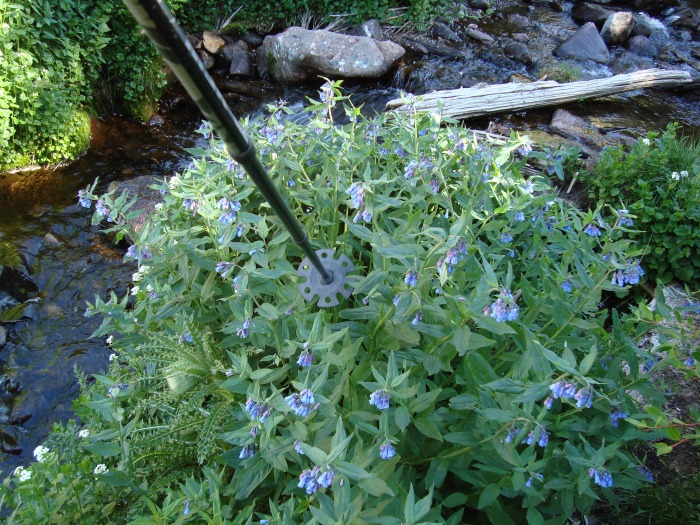  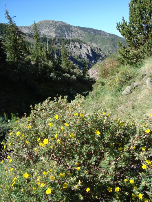 I didn't really know how far it was to the pass; on the map it looked like it could be as far as the North Crestone Lake which is 6-7 miles and quite a haul. Of course Comanche Pass is higher, but it didn't take too long at all. I believe there is one short switchback along the trail before the fork, and just a couple on the Comanche trail prior to leaving treeline. I followed a pretty sedate pace but made it to the Comanche Pass, which is the Comanche-Spring saddle and 12700' around 11:15. This was a pretty solid trail, despite the excessive unnecessarily gentle switchbacking through the tundra up to the saddle. 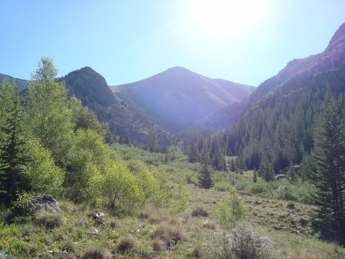 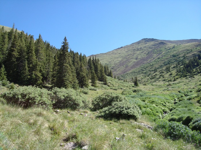 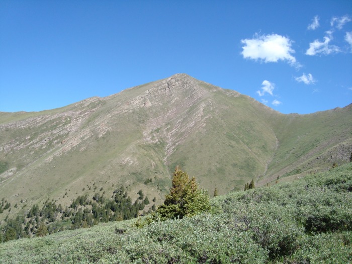 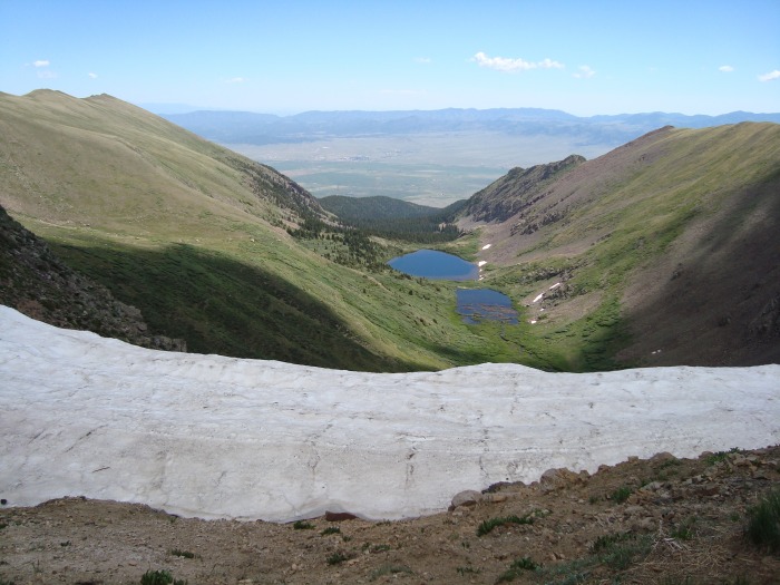 Comanche PeakRight at the saddle, I noticed a big cloud coming past Venable Peak and heading right for me. Despite the perfect weather forecast, all of a sudden I was quite concerned. After watching it for about 15 minutes to try to decide if it would drop lightning, eating a sandwich, and feeling around for any sign of static, I decided it would be safe to go up Comanche. To lighten my load and allow a quick exit down the mountain if needed, I dropped my pack and pole at the saddle. In a trip report I'd read the author had done this, though he also mentioned marmots came sniffing around the packs while they were left alone.  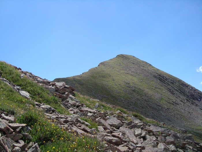  The climb up was simple, though obviously steep. The west side of the ridge is relatively gentle tundra and easy to walk along; the eastern side on the other hand faces a bit north and is quite sheer. There was an intermittent trail, but it was in poor condition and turning to scree at some points; still, I tried to stick to it as much as possible to avoid stomping on the tundra. The rest of the way I stayed a bit below the ridge itself, to avoid weather exposure and to stay on what appeared to be slightly gentler terrain. I reached the top right at noon and found that the cloud looked a lot less imposing, so I sat around for about 20 minutes eying the beautiful scenery. 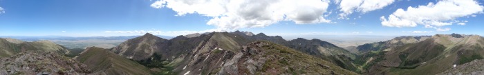 The return to the saddle was uneventful. However on arrival, I realized the error of my ways: marmots had struck, chewing through the mouthpiece of my water bladder and draining out half my water, as well as eating the deliciously sweat-covered grip of my hiking pole. I pulled off the mouthpiece ($6 would get me a replacement) and used the lock to keep any more water from draining, but I now had a tough choice. The weather was clearing and with the wind blowing from the west-northwest, there wasn't a cloud in sight to threaten the rest of my climb. But the only water source was way back down the mountain so I either had to continue with half my water or turn around and call it a day. I chose to continue. Spring MountainThe south ridge of Spring Mountain leads right down to the saddle, but it looked fairly rolling and rugged from what I could see. In my research, other hikers went straight up the ridge but I instead chose to follow the "Phantom Terrace" trail as it contoured around the west slope of the mountain. This trail was in great shape and made for a quick traverse under the peak. Before I got all the way under it though, I turned and cut along a likely-looking line diagonally back up the slope. 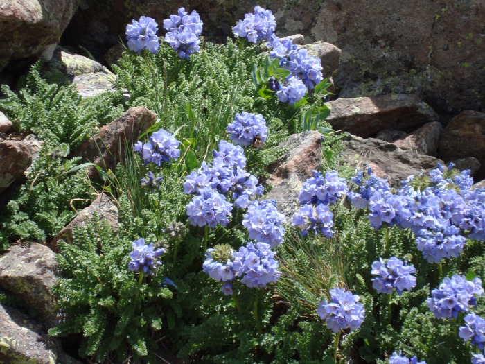 It was another easy-but-steep tundra-and-scree climb that brought me to the ridge and then quickly to the summit at 1:30. The view from this peak was pretty similar to Comanche's and I only stuck around about 15 minutes. Annoyingly however, I believe I left my hiking pole right at the summit. Anyone finding a badly-chewed-near-unusable black MSR pole let me know! 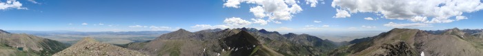 Venable PeakThe weather continued to look outstanding, with not a cloud in sight upwind, so despite my dwindling water supplies I pressed on toward Venable. This time I did follow the northwest ridge of Spring Mountain down toward the saddle, though this lead to a series of very short class-3-ish downclimbs and ended up being pretty slow; I should have just taken the fastest route down to the trail again. 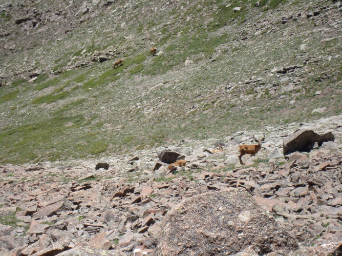  Eventually I gave in and just made my way down to the trail anyway. The trail passes a bit below the saddle so there was a slight loss of elevation, but it runs evenly along the contour of the mountain so it was a fast trek from there over to the "Phantom Terrace" entrance. I don't know where the name "Phantom Terrace" came from, but it's labeled on some maps. Basically the northeast side of Spring Mountain and the east side of Venable Peak run together as a single sheer cliff, and the trail passes east of Spring Mountain, crosses the saddle, then runs along a ledge of this cliff to connect the Comanche Pass and Venable Pass trails. On the Venable Pass side though it appears to drop down sharply on the east side to meet up with the trail from that end, so I didn't follow it at all that way. Instead I left the trail behind near the crossover and headed straight up the southern tundra slope of Venable. 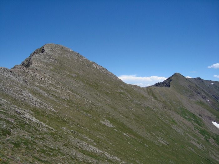 Venable Peak is a bit of a ridge itself, and the ridge line from Spring Mountain connects with the eastern (lower) end of that ridge, so there wasn't much to be gained by sticking to the ridge on the climb up. I knew this from researching the topo maps and other trip reports, but it was also pretty obvious just looking at the mountain all day. From the Venable-Spring saddle at 12700' or so it's only about 100' more of a climb than the other two peaks, but it certainly felt steeper and took longer. This was surely because I was getting a bit dehydrated by this point, and trying to conserve the last of my water and to avoid losing any unnecessarily to sweat or breathing. Following an easy-looking line up to the ridge, I arrived about midway along it. The ridge is an easy class 2 walk. It was 2:40 before I arrived at the true summit. 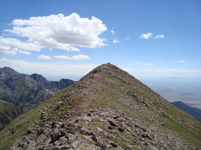 All day long, it had seemed to just get more and more clear, and by this time I could see forever. Venable also has the best vantage of any mountain in the area - higher than the ones immediately to the north and south, and offset a bit to the west from the main ridge of the Sangres. This combination made it one of the most spectacular summits I've yet set foot on.  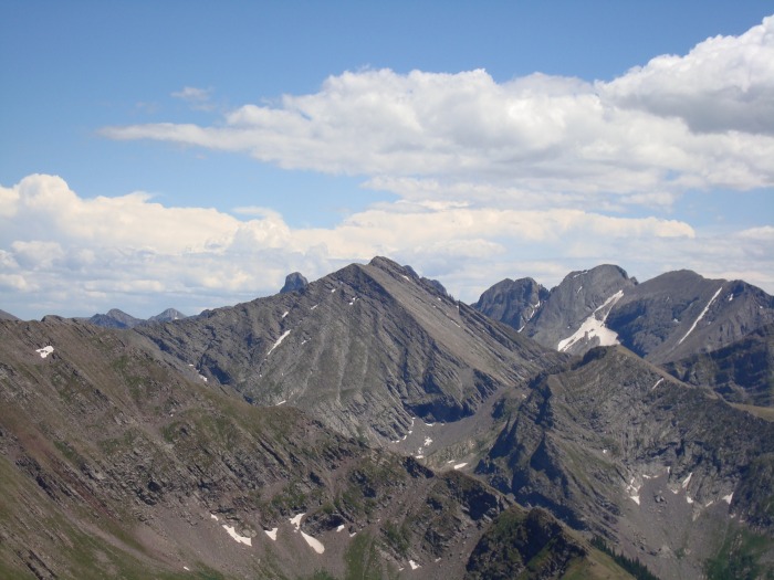  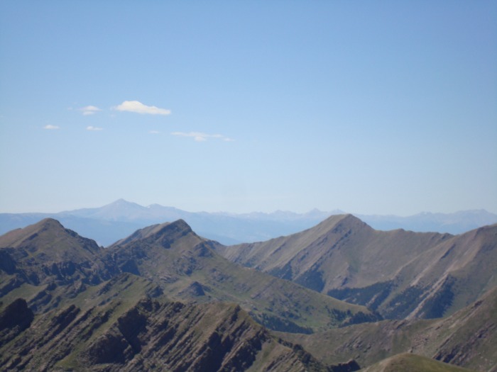  I stayed on this summit for about 30 minutes before finishing the rest of my water and food, regretting the loss of my hiking pole, and heading back down toward Venable Pass. Venable Pass TrailThe plan was to hike down the ridge from Venable Peak to Venable Pass, and take the North Fork trail right back down to Crestone Creek. All my research indicated this was a good move, but it turned out to be a real time waster. One trip report I read had the author hiking up from Venable Pass to the Peak (the opposite of my direction) and he claimed that it was a steep hike. This was a bit misleading: it was actually a very gentle descent, but traversing across a very steep slope; even the ridge at the top was steep. With my growing dehydration, the focus needed to do this safely was very tiring. In hindsight, it would have been far easier and faster to return by the Phantom Terrace trail to Comanche Pass and back down the way I came up; this wouldn't have given me the nice loop feeling to the day though. Had I come up from the east, I could have dropped down and taken the Phantom Terrace trail which would have been even better (this loop is significantly shorter if done from the east).  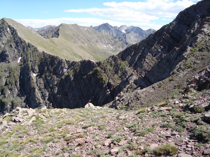 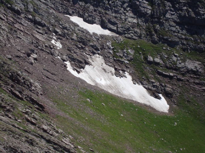 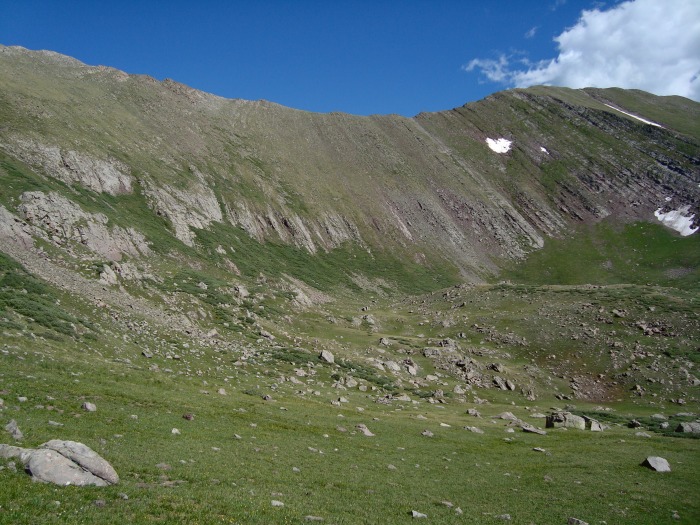 On finally arriving at the Venable trail (well below the pass itself), the work was just beginning. First there was a lengthy set of over-gentle switchbacks, then even before treeline, the trail entered and got lost in a bunch of bushes. I picked it up easily enough afterwards, but then missed the turnoff to follow down the North Fork and walked about 5 minutes up the trail toward San Isabel; neither my GPS nor my Sangres map was helpful as they both placed the trail split in the completely wrong location/angle. Still, I worked my way back down to the proper trail easily enough and was on my way again. 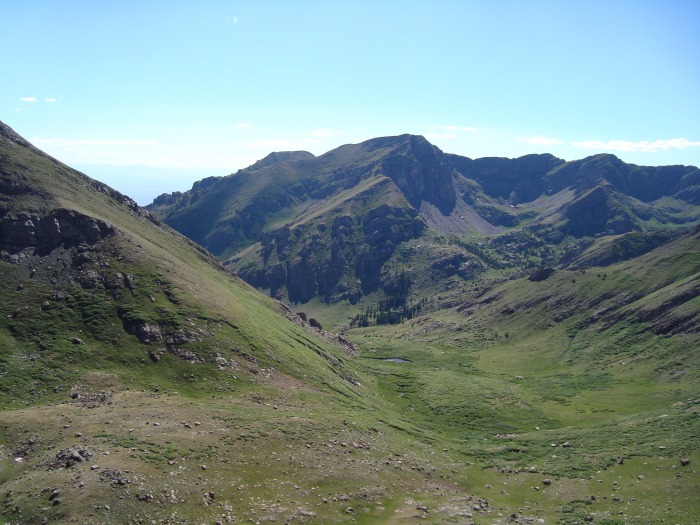 More trouble was in store however. The trail hit a creek crossing and simply did not appear on the other side. After ten minutes of hunting for it I gave up and bushwhacked downstream for about 30 minutes before finding it again. Then there was a 10-foot-deep drift of snow, completely and dangerously covering another creek crossing and running all the way up a side gully so that I had to climb around and then across it. After that there were a ton of downed aspens to cross. All in all this particular fork showed strong signs of having not been maintained in a while. 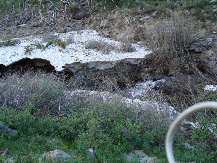 After these obstacles, the only issues left were distance and mosquitoes. Both were intense, and it was after 7 PM before I made it back down to the trailhead. Still, I didn't let the tedious return trip detract from what was a spectacular hike. It wasn't an original route and at class 1-2 not particularly challenging perhaps, but 6000ish feet of elevation gain made for a long day and the three beautiful tundra-covered peaks were well worth it. Thanks to Furthermore, stevevets689, and the always descriptive Kevin Baker for prior trip reports on these peaks. 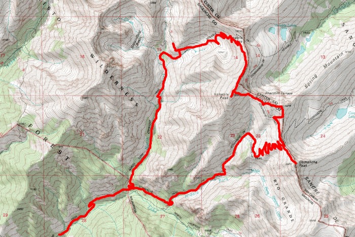 Thumbnails for uploaded photos (click to open slideshow):  Comanche Peak is the really pointy one visible along much of the trail")
 Looking east from Comanche Pass at Comanche Lake. The east side of the trail continues around the left of the snow.")
 Spring Mountain is just left of Comanche Peak, seen from the trail")
 Venable Peak is visible early in the hike, but then I was right under it for a couple hours and didn't get a close up vie")
 The class 2 ridge from Comanche Pass to Comanche Peak")
 View of the N ridge of Comanche from a bit lower")
 Medium-res 360 panorama from Comanche Peak")
 Medium-res 360 panorama from Spring Mountain")
 Medium-res 360 panorama from Venable Peak")
 Flowers and a bee - right below the ridge on Spring Mountain")
 Looking down at some pretty flowers and the saddle, from near the top of Comanche")
 Some elk on Spring Mountain were about to get spooked off as I walked right above them")
 From one rib to the next along the ridge, the rock changed color completely from red to gray")
 Spring Mountain is on the left with Comanche on the right. The connecting trail is visible as well.")
 On the Venable ridge...getting close to the final summit")
 Very approximate topographic route")
 From the T road, Venable-Spring-Comanche line up left to right behind the N Crestone valley (taken later).")
 Close-up of Mount Adams, Crestone Needle/Peak behind it, Columbia/Kit Carson/Challenger on the right")
 Looking north to Rito Alto peak. Hermit Peak is nearly invisible in front of it with Eureka Mountain on the right.")
 Looking north-northwest at the Sawatch/Collegiate Peaks.")
 Amazingly, Uncompaghre (I believe) was visible and is right in the middle of this photo. The San Luis group is on the left.")
 Venable lake(s) in view from the ridge; Pikes Peak on the left")
 I was really proud of this shot; Phantom Terrace in the foreground with 14ers in the background")
 Looking down at some elk(?) right below Venable eating snow")
 Obligatory flower picture #1")
 Obligatory flower picture #2")
 Obligatory flower picture #3")
 Looking back up at the Venable->Pass ridge")
 Pretty view down on the North Fork basin")
 Random snow cover completely blocked a creek crossing")
|
| Comments or Questions | |||
|---|---|---|---|
|
Caution: The information contained in this report may not be accurate and should not be the only resource used in preparation for your climb. Failure to have the necessary experience, physical conditioning, supplies or equipment can result in injury or death. 14ers.com and the author(s) of this report provide no warranties, either express or implied, that the information provided is accurate or reliable. By using the information provided, you agree to indemnify and hold harmless 14ers.com and the report author(s) with respect to any claims and demands against them, including any attorney fees and expenses. Please read the 14ers.com Safety and Disclaimer pages for more information.
Please respect private property: 14ers.com supports the rights of private landowners to determine how and by whom their land will be used. In Colorado, it is your responsibility to determine if land is private and to obtain the appropriate permission before entering the property.