Download Agreement, Release, and Acknowledgement of Risk:
You (the person requesting this file download) fully understand mountain climbing ("Activity") involves risks and dangers of serious bodily injury, including permanent disability, paralysis, and death ("Risks") and you fully accept and assume all such risks and all responsibility for losses, costs, and damages you incur as a result of your participation in this Activity.
You acknowledge that information in the file you have chosen to download may not be accurate and may contain errors. You agree to assume all risks when using this information and agree to release and discharge 14ers.com, 14ers Inc. and the author(s) of such information (collectively, the "Released Parties").
You hereby discharge the Released Parties from all damages, actions, claims and liabilities of any nature, specifically including, but not limited to, damages, actions, claims and liabilities arising from or related to the negligence of the Released Parties. You further agree to indemnify, hold harmless and defend 14ers.com, 14ers Inc. and each of the other Released Parties from and against any loss, damage, liability and expense, including costs and attorney fees, incurred by 14ers.com, 14ers Inc. or any of the other Released Parties as a result of you using information provided on the 14ers.com or 14ers Inc. websites.
You have read this agreement, fully understand its terms and intend it to be a complete and unconditional release of all liability to the greatest extent allowed by law and agree that if any portion of this agreement is held to be invalid the balance, notwithstanding, shall continue in full force and effect.
By clicking "OK" you agree to these terms. If you DO NOT agree, click "Cancel"...
I haven't been to the Sangres (my favorite range in CO) since early July, so with the unusually warm and dry November weather we have had, a long ridge run in the Sangres was in order. This long hike would be tough in deep snow, so we hoped the deep snows would hold off a little longer. John and Renata joined me on this one along with Dave Longenecker, who I hadn't hiked with before. My friend Steve Mueller joined me as well, who I hadn't hiked with since Jan on Pikes.
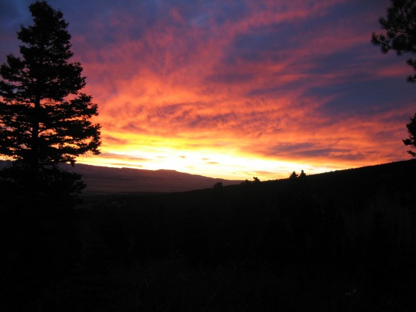
We met at the Westcliffe Inn in Westcliffe early Sat morning and headed for the trailhead. As expected, the Sangres didn't have much snow to contend with. I didn't even mess with bringing snowshoes, and it turned out we didn't even need gaitors! We set out at 6:28am from the Comanche/Venable TH at the defunct Abbots Lodge and were immediately treated with an awesome sunrise filled with color. Could it be a rare bluebird day in Nov?
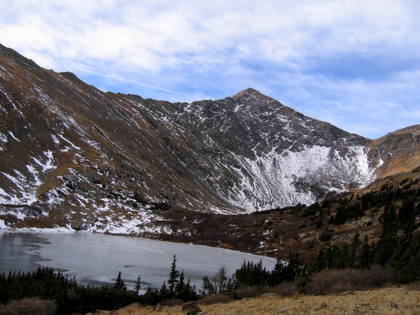
We planned this loop hike going clockwise, starting up the Comanche Lakes basin and descending the Venable Lakes basin. We did this so we could hit the 3 13ers first and add ranked Pt 12873 if we had enough time on our way down. We made excellent time up the well graded Venable/Comanche trail and didn't run into any snow until it started switchbacking up north facing slopes. There were patches of ice and hard packed snow in spots, but it didn't slow us down much. Once in the basin, the trail contoured up south facing slopes and the snow was minimal. The east face of Comanche beckoned us as we hiked up this scenic valley.
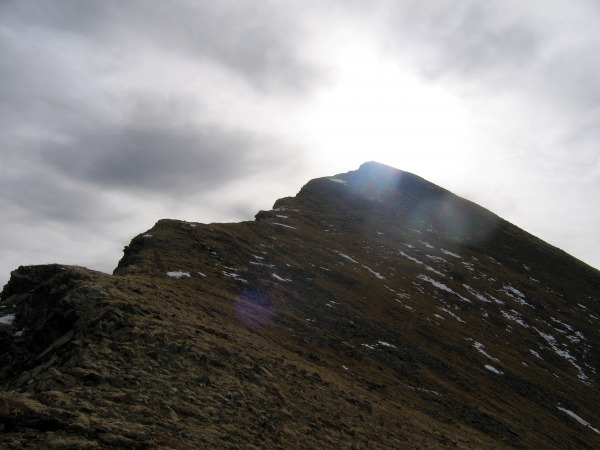
Once on the Comanche/Spring saddle, we added some layers as the wind picked up and some clouds moved in. Comanche would be our steepest peak of the day as the route up the north ridge gains 580' in 1/4 mile.
We left our packs at the saddle so we didn't make the same mistake as one Mr. Doug Hatfield did on Comanche as he forgot his pack on the summit on a hike with Sarah T and Piper! Sorry Doug. There were bits of a trail up the steep ridge, and it was cool staying on the crest and peering down the east face. We topped out at around 10am and were rewarded with inspiring views of the Crestone and Kit Carson groups.
Even the north facing slopes in the Sangres were holding little snow. 1 down, 3 to go! We didn't hang around long as temps were hovering in the mid 30's. It was a bit colder than I thought it would be with the cloud cover, but it sure was nice for November! On the way down Comanche I caught a 10 ft glissade on a patch of snow, the first of the fall. It was pretty pathetic. On the traverse to Spring, we followed the trail initially and skirted a bump on the west side of the ridge, then regained it to the summit. It took only 45 minutes to get over to Spring, which is mellow on the south side and laden with cliffs on the north side.
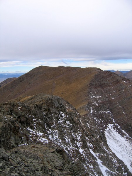
Venable and Phantom Terrace from Spring summit:
We found a nice place below the summit on the leeward side to take a break. This was probably the windiest place on the day, but it still was still pretty mellow.
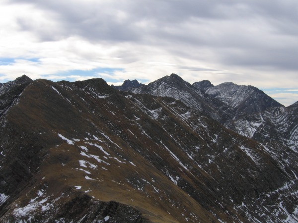
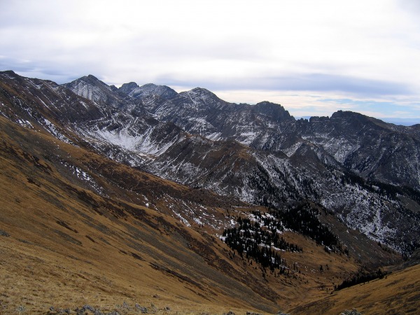
The next 13er on the ridge run was Venable, which is only 3/4 mile to the n.w. We followed the n.w. ridge of Spring down to the saddle. It was fun staying on the crest of the ridge and peering down Phantom Terrace below us. The trail actually zigs through these cliff bands on the way down to Venable Lakes.
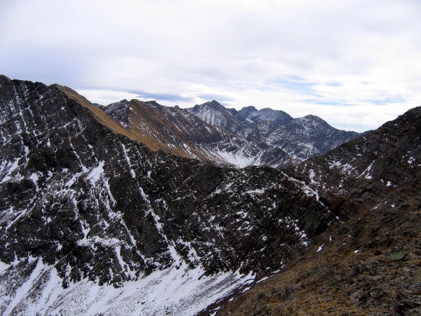
Phantom Terrace and Kit Carson group in background:
The summit of Venable is actually not on the ridge to Venable Pass, so we contoured over to it and switchbacked up its grassy s.e. slopes. The trip over to Venable from Spring took 50 minutes, and we were all beginning to feel the long day. Venable was our highpoint for the day, and we took a long break soaking up the views. I need to hit the Sangres more often!
Since it was only 12:45, it would be ashame not to include ranked Pt 12873 on the way down. We felt we could make it down before dark, and we timed it perfectly. The ridge down to Venable Pass was steep and a bit rougher than the rest of the day. From Venable Pass, we followed a trail that skirted below Pt 13012 and saved us some vertical. When the trail switchbacked back to the south, we contoured across grassy slopes to gain 12873's west ridge. This little bonus peak only requires an additional 370' of total gain, but there were at least 3 false summits to go over. The true summit is debatable, but the waypoint in my GPS said the far eastern summit was the spot elevation on the map. The register was on the next summit to the west. The trip over to this 12er from Venable took 1.5 hrs.
We left 12873 at 2:35 and decided to follow the east ridge and bushwack instead of backtracking to the trail at Venable Lakes. It's shorter, so surely it's faster, right? Big mistake. The ridge was enjoyable at first with some minor ups and downs, but once we hit treeline things weren't so fun. We drifted off the broad ridge a little too early and got into some knee busting, tree belaying type bushwacking where it seems to never end. We had to countour and switchback to save our knees, and eventually the angle relented when we caught a drainage that funnelled us back to the trail. I like to bushwack, but that wiped me out!
Once on the trail, we cruised the last 2 miles back to the cars. Both the northern and southern ends of this trail share the same trailhead. We were back at the cars at 5:05, just before dark. This was the most vertical I have done on a hike in November. Take advantage of the lack of snow while it lasts!
GPS track going clockwise, map can be zoomed in Picasa slideshow:
Thumbnails for uploaded photos (click to open slideshow):
It was a great day for Novemeber. We did Mt. Adams from the East that day. 12 mile round trip. Very fun at the top. We were on top at 11:30. You probably took a picture of us on the summit looking back at the Carson group. I am working on the Centennials if you are interested in climbing any time.
Great report Kevin...very nice pics as well! Looks to be a fun loop on a route less travelled :D
Caution: The information contained in this report may not be accurate and should not be the only resource used in preparation for your climb. Failure to have the necessary experience, physical conditioning, supplies or equipment can result in injury or death. 14ers.com and the author(s) of this report provide no warranties, either express or implied, that the information provided is accurate or reliable. By using the information provided, you agree to indemnify and hold harmless 14ers.com and the report author(s) with respect to any claims and demands against them, including any attorney fees and expenses. Please read the 14ers.com Safety and Disclaimer pages for more information.
Please respect private property: 14ers.com supports the rights of private landowners to determine how and by whom their land will be used. In Colorado, it is your responsibility to determine if land is private and to obtain the appropriate permission before entering the property.