Download Agreement, Release, and Acknowledgement of Risk:
You (the person requesting this file download) fully understand mountain climbing ("Activity") involves risks and dangers of serious bodily injury, including permanent disability, paralysis, and death ("Risks") and you fully accept and assume all such risks and all responsibility for losses, costs, and damages you incur as a result of your participation in this Activity.
You acknowledge that information in the file you have chosen to download may not be accurate and may contain errors. You agree to assume all risks when using this information and agree to release and discharge 14ers.com, 14ers Inc. and the author(s) of such information (collectively, the "Released Parties").
You hereby discharge the Released Parties from all damages, actions, claims and liabilities of any nature, specifically including, but not limited to, damages, actions, claims and liabilities arising from or related to the negligence of the Released Parties. You further agree to indemnify, hold harmless and defend 14ers.com, 14ers Inc. and each of the other Released Parties from and against any loss, damage, liability and expense, including costs and attorney fees, incurred by 14ers.com, 14ers Inc. or any of the other Released Parties as a result of you using information provided on the 14ers.com or 14ers Inc. websites.
You have read this agreement, fully understand its terms and intend it to be a complete and unconditional release of all liability to the greatest extent allowed by law and agree that if any portion of this agreement is held to be invalid the balance, notwithstanding, shall continue in full force and effect.
By clicking "OK" you agree to these terms. If you DO NOT agree, click "Cancel"...
| Report Type |
Full |
| Peak(s) |
Mt. Antero - 14,271 feet
|
| Date Posted |
11/19/2009 |
| Date Climbed |
11/18/2009 |
| Author |
RoanMtnMan |
| Antero - Fall, White, and Blue |
After receiving some great info about the 11/15 trip up Antero from sgladbach, I decided to head out for a solo recon mission on Wednesday (unfortunately my impatience caused a narrow miss of the TR). The goal was to assess the ski potential. Being so early in the snow season I wasn't too optimistic, but experience has taught me to never leave the skis behind unless you are certain it's not skiable. So up the Antero road I went.
The name of the game this day was, obsess about the snowpack, stay out of avy terrain as much as possible, move fast, and 80's music. The weather couldn't have been any better. Warm, blue, cloudless skies.
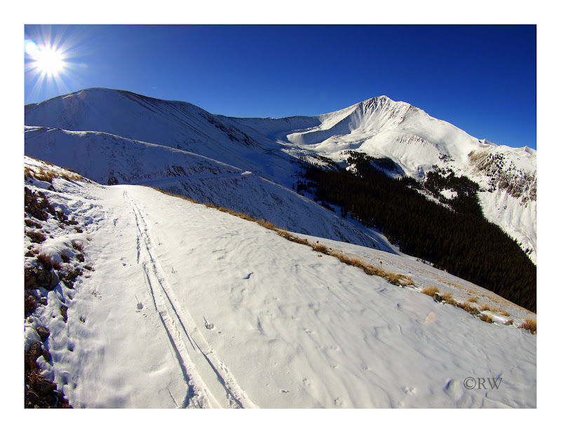
Progress up the switchbacks of the Antero road was quick.
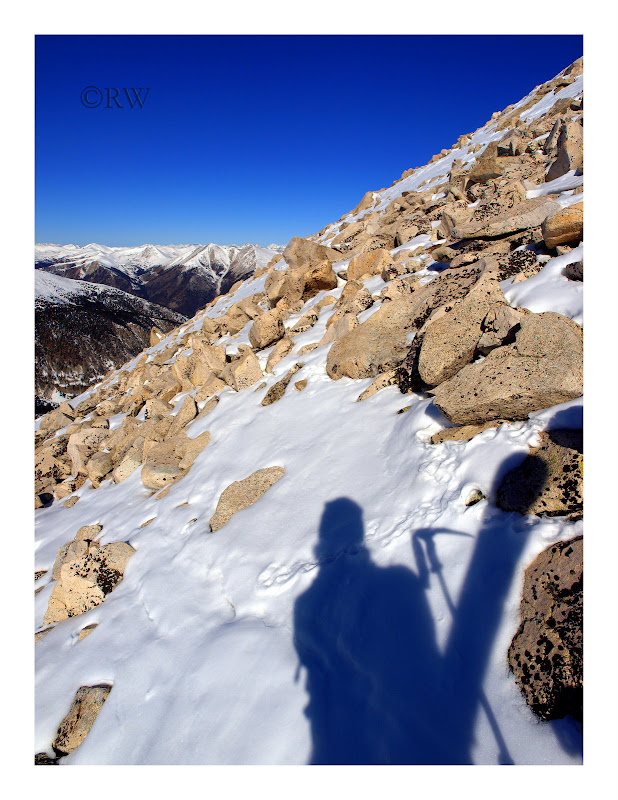
Due to a snow covered slope at 12,900ft on the road, that I didn't feel comfortable crossing, I was forced to boot pack up a boulder field to 13,600ft. Rock hoping with ski boots, fun stuff.
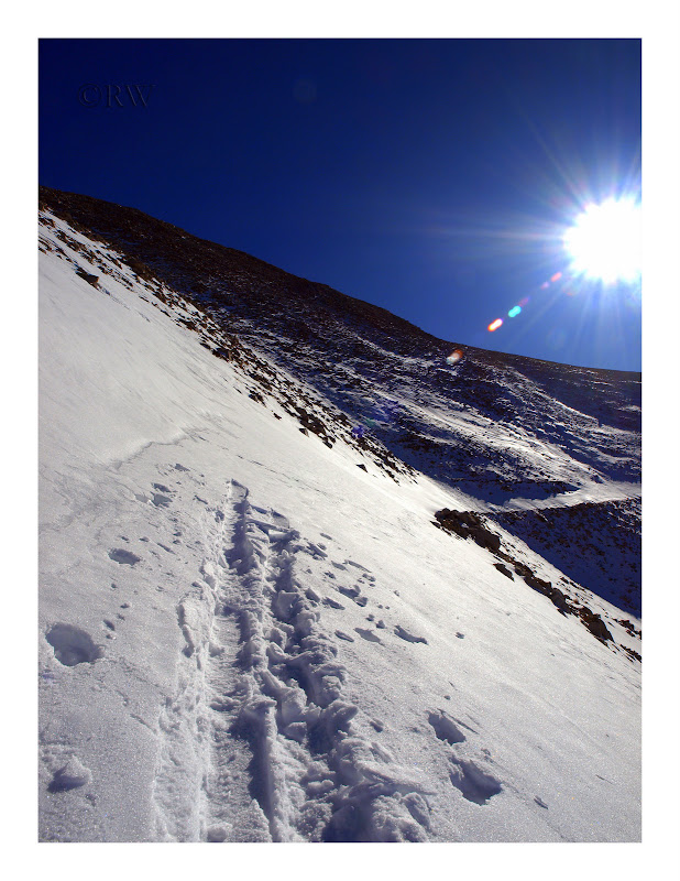
This was the slope I backed off of. Probably safe but no reason to risk it with another viable option.
The boot route.
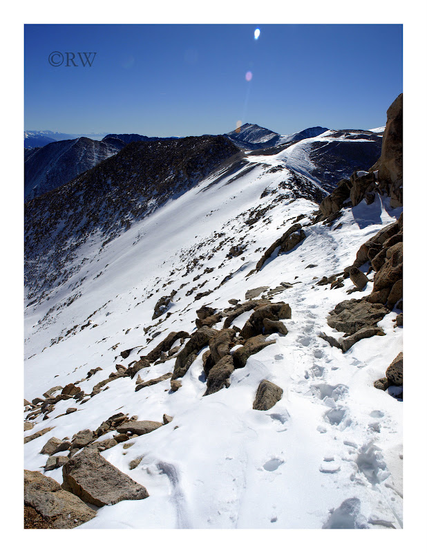
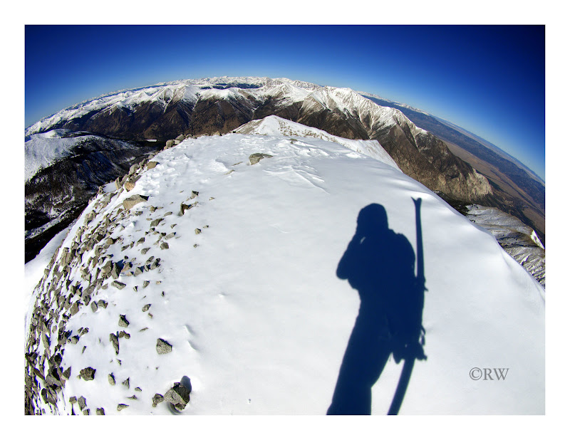
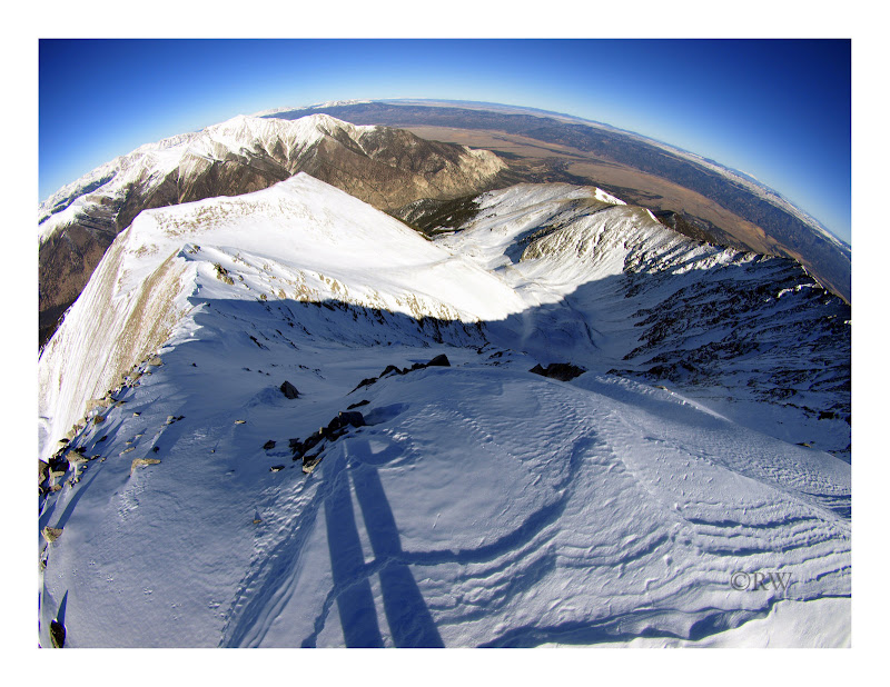
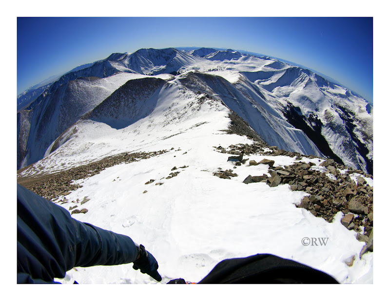
I gained the ridge and was finally rewarded with the view of a skiable line from the summit. Invigorated, I began the traverse over to the summit saddle. I stayed on the spine of the ridge initially, but eventually was forced to post hole my way across the traverse keeping as close to the ridge rocks as was viable. It was tiring to say the least.
A shot of Cronin, we skied that face last spring, highly recommended.
I reached the saddle below the summit ridge and the winds began their usual high altitude assault from the west. I added a layer and had a pleasant jaunt to the summit.
Almost there.
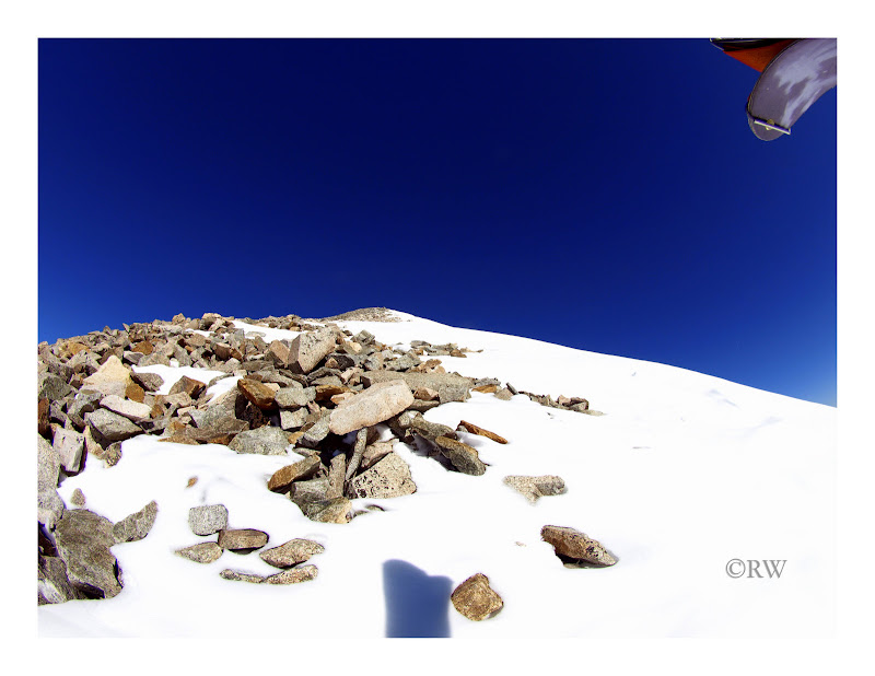
Topping out a few minutes later, I was surprised to see how much snow was on the summit. Thigh deep in spots.
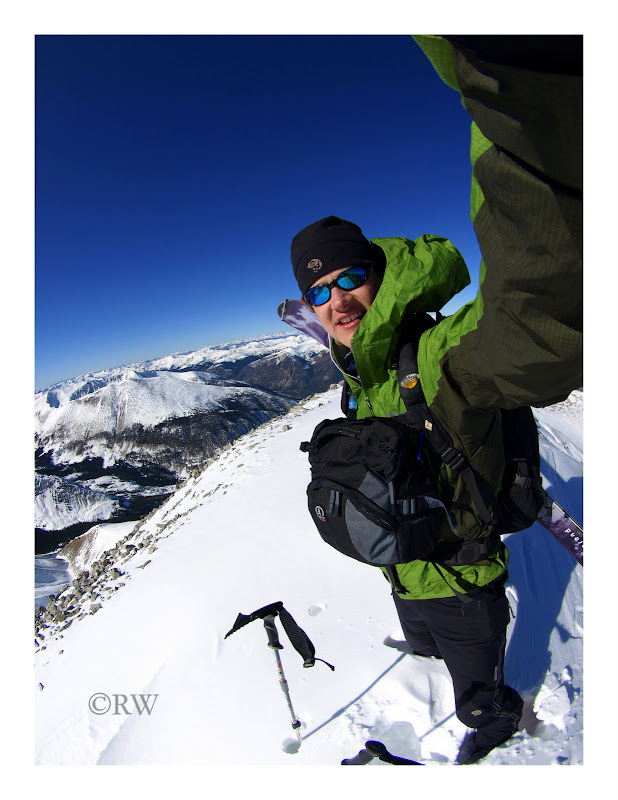
I took a few photos and enjoyed some refreshments.
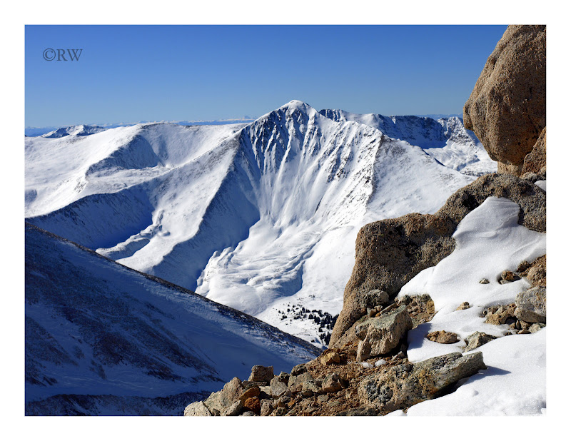
Looking north through the Sawatch Range.
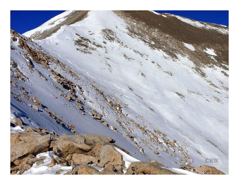
Admiring the northeast face, the only thing that will ever bring me back up this mountain.
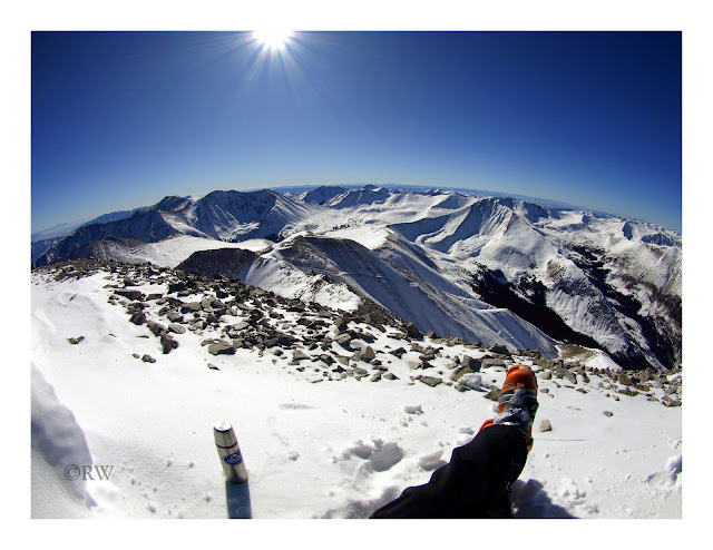
Warm Gatorade, an Iditarod racing standard, yummy on a cold day.
The wind finally forced me to click in to my Dynafits and begin my descent.
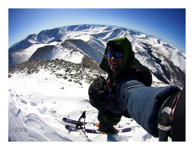
I had to ski the east ridge for a few turns and then traverse to the south ridge. The top 600 feet of the route was hard wind packed snow. Low angle and solid, but I still stayed close to the rocks on the west side of the snow strip to the saddle.
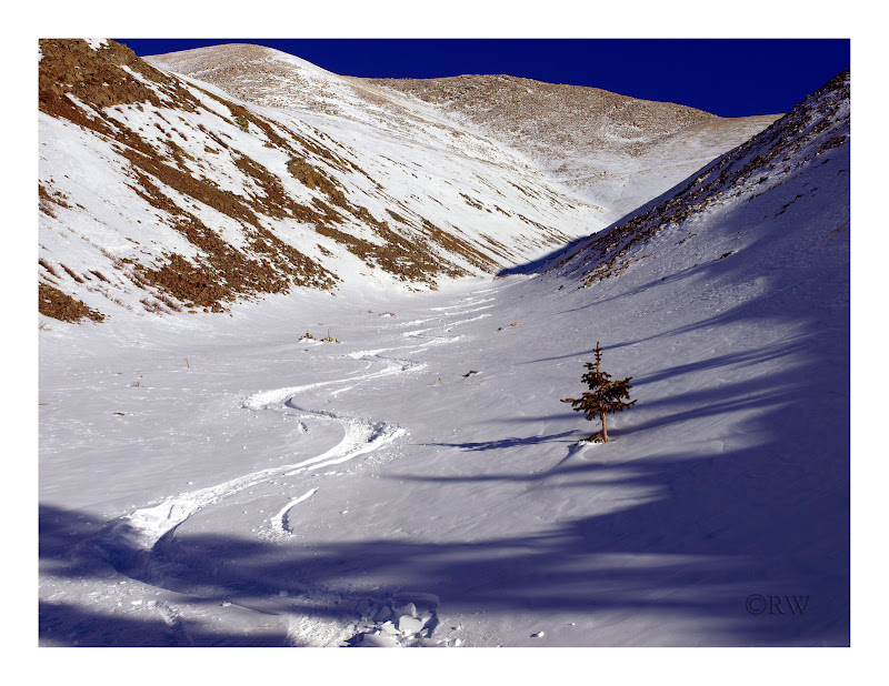
Once down the south ridge to the saddle, I dropped into the SE bowl, which looked to hold good snow on the ascent. Indeed it did. Recycled powder with a few 2 inch wind crust patches. I skied down to the basin at 13,300ft and shouldered the skis.
I assessed the slide danger to be fairly low on the route this day. However for safety's sake, I picked a rocky line for my ascent back to the south ridge. Though I was able to stay on rock most of the time, and the snow was well anchored, I did my fair share of deep post-holing between boulders. Arduous.
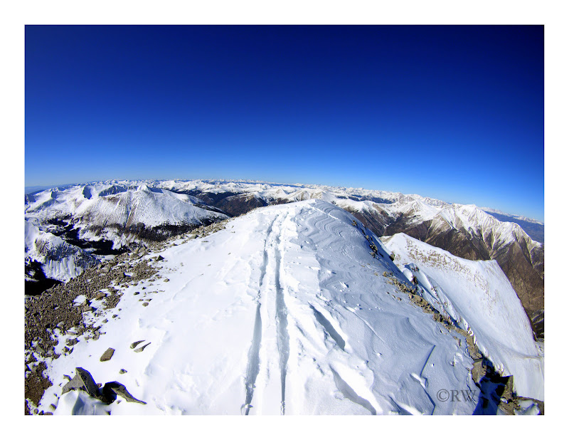
Once back on the south ridge, I skied all the way down to the Antero road. The ski down the road was a sit-back cruise, though I had to divert a few times to avoid exposure to potential slide areas. The many filled gullies on the way down were certainly tempting, but terrain traps were not on the menu for the day. Though just before the last switchback, I indulged in a few last low angle powder treats.
The fall has been kind to skiers this year. May it continue into the winter.
|
Caution: The information contained in this report may not be accurate and should not be the only resource used in preparation for your climb. Failure to have the necessary experience, physical conditioning, supplies or equipment can result in injury or death. 14ers.com and the author(s) of this report provide no warranties, either express or implied, that the information provided is accurate or reliable. By using the information provided, you agree to indemnify and hold harmless 14ers.com and the report author(s) with respect to any claims and demands against them, including any attorney fees and expenses. Please read the 14ers.com Safety and Disclaimer pages for more information.
Please respect private property: 14ers.com supports the rights of private landowners to determine how and by whom their land will be used. In Colorado, it is your responsibility to determine if land is private and to obtain the appropriate permission before entering the property.