Download Agreement, Release, and Acknowledgement of Risk:
You (the person requesting this file download) fully understand mountain climbing ("Activity") involves risks and dangers of serious bodily injury, including permanent disability, paralysis, and death ("Risks") and you fully accept and assume all such risks and all responsibility for losses, costs, and damages you incur as a result of your participation in this Activity.
You acknowledge that information in the file you have chosen to download may not be accurate and may contain errors. You agree to assume all risks when using this information and agree to release and discharge 14ers.com, 14ers Inc. and the author(s) of such information (collectively, the "Released Parties").
You hereby discharge the Released Parties from all damages, actions, claims and liabilities of any nature, specifically including, but not limited to, damages, actions, claims and liabilities arising from or related to the negligence of the Released Parties. You further agree to indemnify, hold harmless and defend 14ers.com, 14ers Inc. and each of the other Released Parties from and against any loss, damage, liability and expense, including costs and attorney fees, incurred by 14ers.com, 14ers Inc. or any of the other Released Parties as a result of you using information provided on the 14ers.com or 14ers Inc. websites.
You have read this agreement, fully understand its terms and intend it to be a complete and unconditional release of all liability to the greatest extent allowed by law and agree that if any portion of this agreement is held to be invalid the balance, notwithstanding, shall continue in full force and effect.
By clicking "OK" you agree to these terms. If you DO NOT agree, click "Cancel"...
I wanted to finish off the Tenmile/Mosquitos with a bang, but the standard route up Sherman doesn't really fit that description. So I decided to try another route with a few 13ers and some climbing.
I've been meaning to try this route since seeing it in Roach's Thirteeners, but was a little deterred by other sources saying it was very underrated at class 3. I decided to just go for it, figuring I could always drop way down on the south side if the ridge got too nasty.
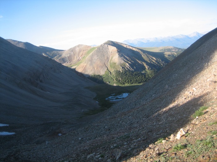
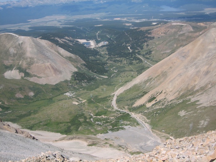
I parked 2.3 miles up Lake County 2B, at the foot of Dyer Amphitheater and headed north. The first section was cross-country on tundra with increasing amounts of talus. There is a stout-looking headwall at the foot of the plateau, but there are several easy ways over/through it. The subsequent plateau alternates between swampy/willowy and rocky. There are several lines up to the saddle over fairly stable, blocky talus.
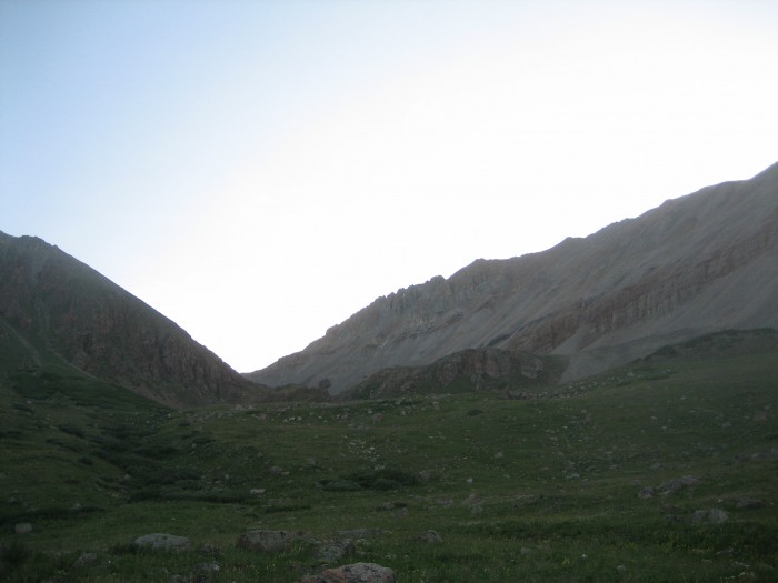
View from 2B.
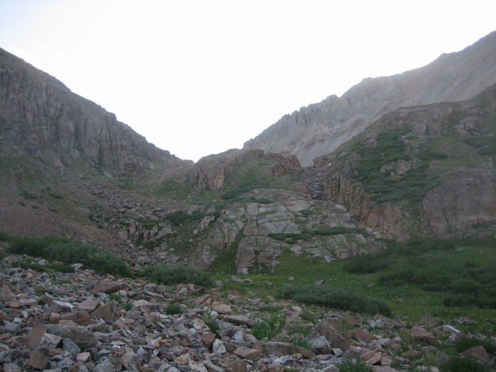
Closer view of the headwall.
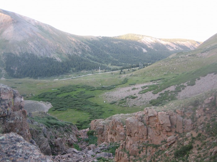
View back down the gulch from the plateau.
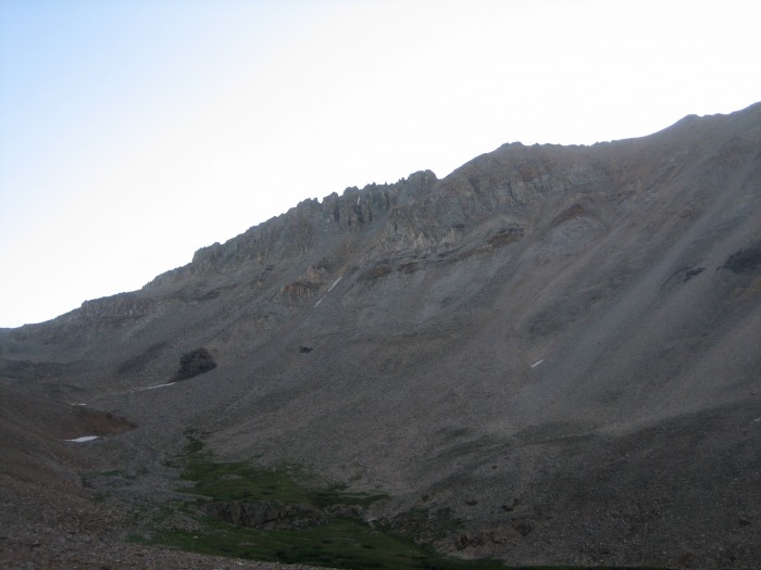
Heading toward the West Dyer/Dyer saddle (left) with the west ridge of Dyer looming.
View from saddle, looking at West Sheridan Mtn.
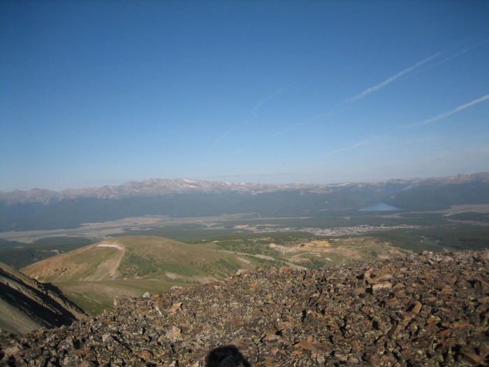
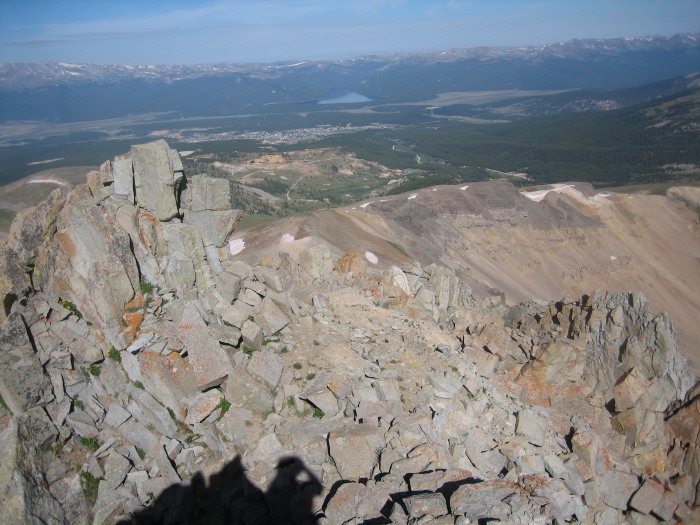
At the saddle, I took a left and made the quick trek up to West Dyer Mountain. Good views of the Massive massif and Leadville.
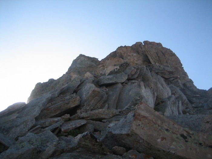
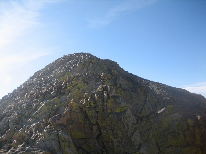
Back down at the saddle, the west ridge of Dyer looked pretty imposing. The jagged towers hovered in such a way that the ridge looked a lot more steep and hairy than it really was (I was trying to get a good picture of it, but the sun was rising right behind it). The first hundred feet or so is just class 2, but it quickly turns more serious.
The first tower, pretty easy.
The scenery soon thereafter.
The tower in the background (above) scared me on first sight. I reached the bottom and started up on climber's left and it just kept getting steeper and more exposed. Finally, self-preservation kicked in and I descended it and headed around to the south side of the ridge. Things were more mellow over there. The exposure wasn't quite as huge, and I was able to get away with only short sections of class 4.
This is a good example of most of the class 3 climbing.
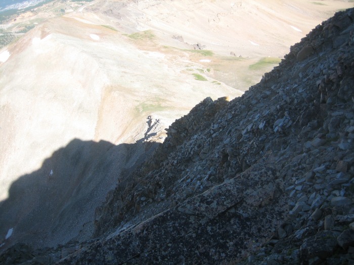
View back down the ridge
Eventually, some deep gullies started cutting into the ridge. Since I was slightly on the side of the ridge, this made for a lot of backtracking and elevation loss. But staying on the ridge crest probably would've required a ton of class 4 to get through the notches.
A representative view of the gullies. This stuff was loose and annoying.
Another.
The climbing finally eased at about 13600'. From there it was just a scramble over a few false summits to the actual summit of Dyer Mountain.
Looking back at the last tower.
Looking ahead to the summit of Dyer.
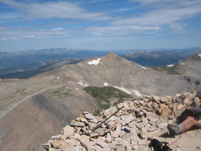
From the summit, Gemini and Sherman finally come into view across the Iowa Amphitheater.
Now that the adrenaline wasn't pumping quite so much, I looked forward to the ridge walk over Gemini to Sherman. Gemini is really just a pimple on the ridge, but it gives a nice alternate view of Sherman. From there to Sherman, it's a pleasant 200' of elevation gain over the gradually rounded ridge.
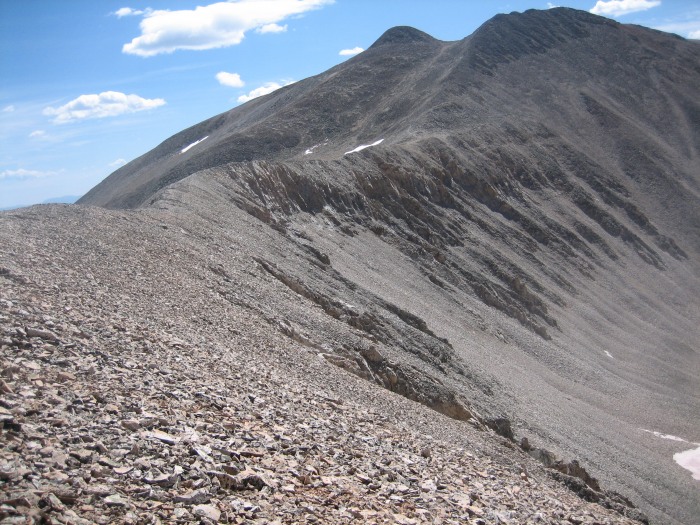
Dyer from Sherman.
The view down Sherman's west face.
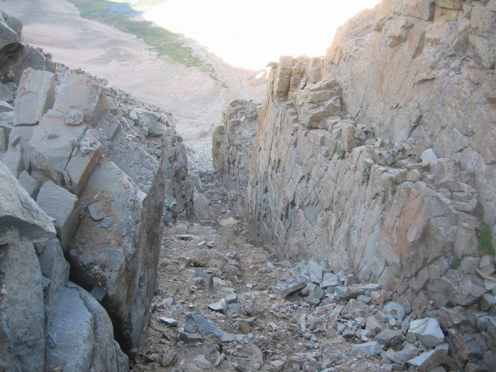
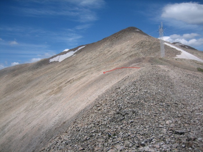
Instead of going back over Dyer for a second date with that ridge, I just circled the ridge back northwest and descended into Iowa Amphitheater. A word of warning: descending from the Dyer/Sherman saddle too soon will land you in some death-defying, steep scree slopes. There is a VERY faint trail that leads off the saddle (west of its low point) that meanders a few hundred feet down the western side of the amphitheater on a less-steep angle.
The saddle with the turnoff marked. Recommended if you want to avoid...
...this.
Thumbnails for uploaded photos (click to open slideshow):
TOPO! says ~7 miles. And I think it took me about 5:15 or 5:30.
Caution: The information contained in this report may not be accurate and should not be the only resource used in preparation for your climb. Failure to have the necessary experience, physical conditioning, supplies or equipment can result in injury or death. 14ers.com and the author(s) of this report provide no warranties, either express or implied, that the information provided is accurate or reliable. By using the information provided, you agree to indemnify and hold harmless 14ers.com and the report author(s) with respect to any claims and demands against them, including any attorney fees and expenses. Please read the 14ers.com Safety and Disclaimer pages for more information.
Please respect private property: 14ers.com supports the rights of private landowners to determine how and by whom their land will be used. In Colorado, it is your responsibility to determine if land is private and to obtain the appropriate permission before entering the property.