Download Agreement, Release, and Acknowledgement of Risk:
You (the person requesting this file download) fully understand mountain climbing ("Activity") involves risks and dangers of serious bodily injury, including permanent disability, paralysis, and death ("Risks") and you fully accept and assume all such risks and all responsibility for losses, costs, and damages you incur as a result of your participation in this Activity.
You acknowledge that information in the file you have chosen to download may not be accurate and may contain errors. You agree to assume all risks when using this information and agree to release and discharge 14ers.com, 14ers Inc. and the author(s) of such information (collectively, the "Released Parties").
You hereby discharge the Released Parties from all damages, actions, claims and liabilities of any nature, specifically including, but not limited to, damages, actions, claims and liabilities arising from or related to the negligence of the Released Parties. You further agree to indemnify, hold harmless and defend 14ers.com, 14ers Inc. and each of the other Released Parties from and against any loss, damage, liability and expense, including costs and attorney fees, incurred by 14ers.com, 14ers Inc. or any of the other Released Parties as a result of you using information provided on the 14ers.com or 14ers Inc. websites.
You have read this agreement, fully understand its terms and intend it to be a complete and unconditional release of all liability to the greatest extent allowed by law and agree that if any portion of this agreement is held to be invalid the balance, notwithstanding, shall continue in full force and effect.
By clicking "OK" you agree to these terms. If you DO NOT agree, click "Cancel"...
Denny Creek Trailhead - 9,900 ft
Summit Elevation - 14,196 ft
Elevation Gain - 4,300 ft
Round-trip length - 8.0 miles
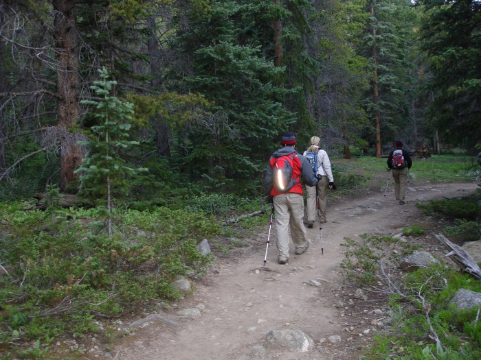
Since our first day hike was entirely above treeline (DeCaLiBron), we were excited to start Day 2 among the pine trees. With a great meal at Zichittella's in Leadville the night before, we were fully energized and on the trail around 7:00 am.
Starting up the well worn trail
Crossing Denny Creek
Then cross Delaney stream
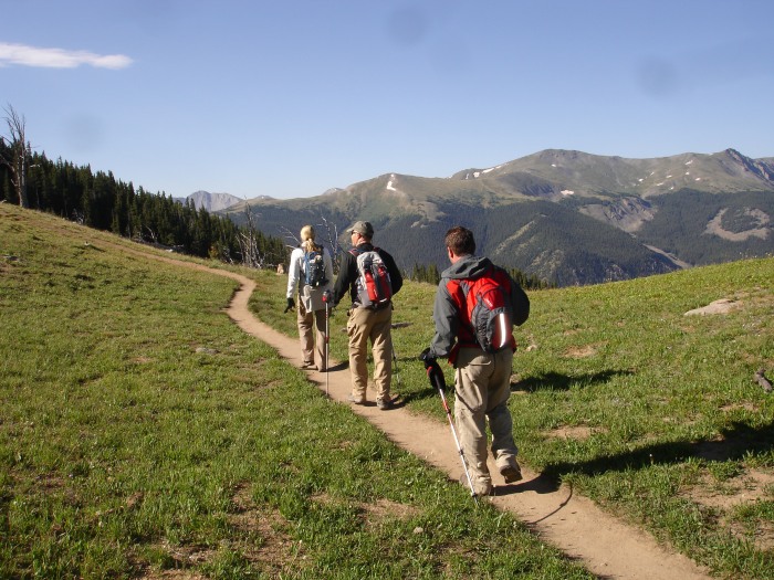
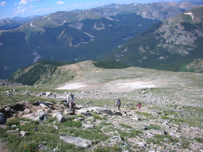
Progressing across flat area near 12,000 ft
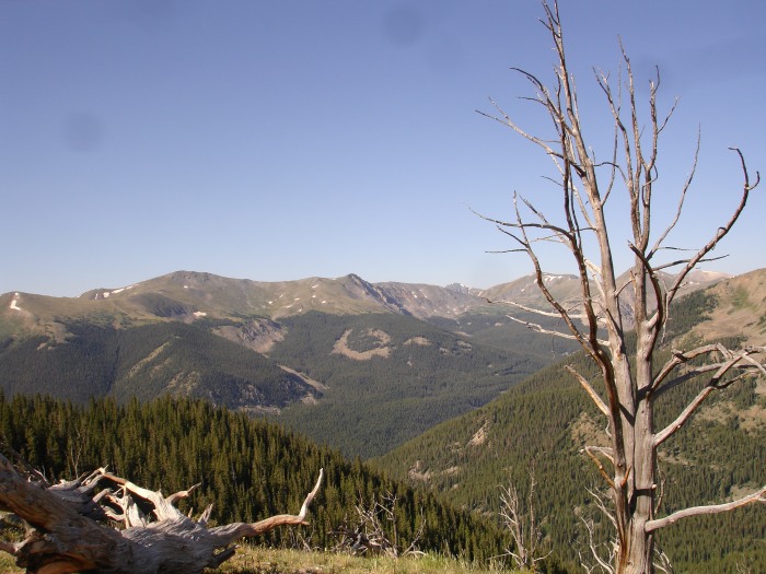
Interesting tree
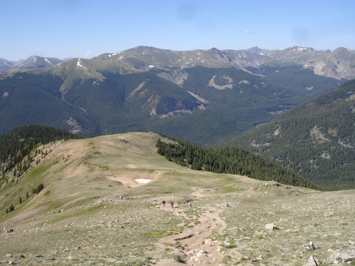
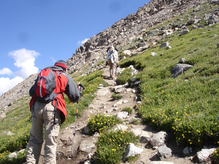
Making our way up the long steep shoulder
Further along the shoulder
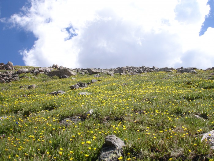
Plenty of wildflowers
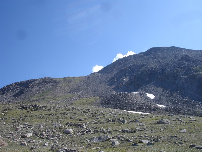
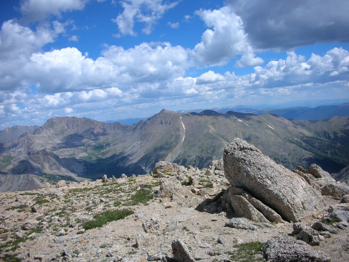
A look at the steep slope to saddle and the ridge to Yale (right)
Making our way up to the saddle
View back down from saddle
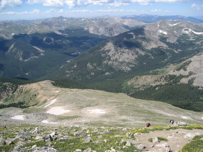
View of Horn Fork Basin with Harvard (left), Columbia (center) from the saddle
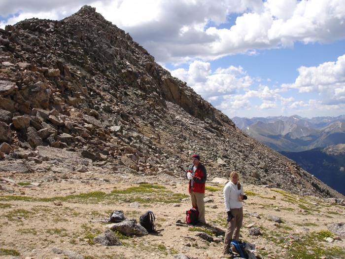
Brian and Carrie refueling before final scramble up ridge crest (summit not visible)
Fun scramble (hiker, center)
Trent on scramble (exposure is not as severe as it appears - maybe)
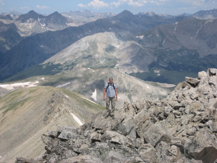
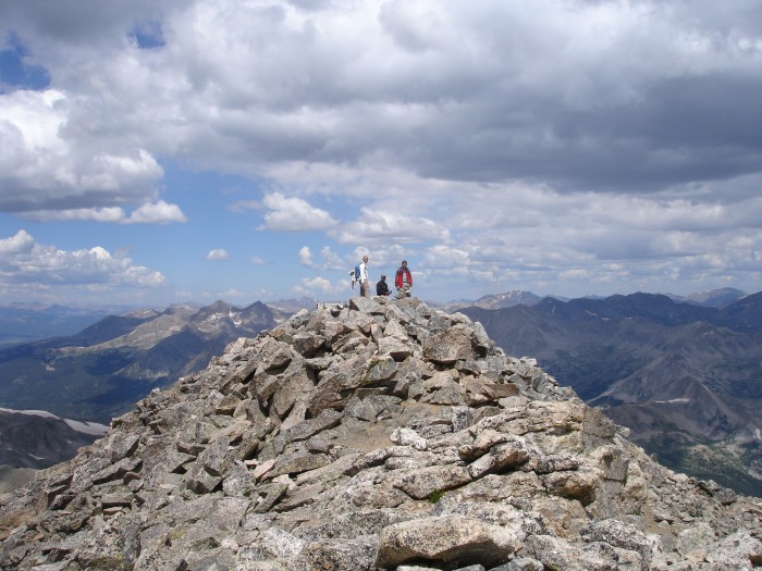
Final portion before summit 3762 (Carrie, Steve and Brian waiting patiently for Trent, not really! )
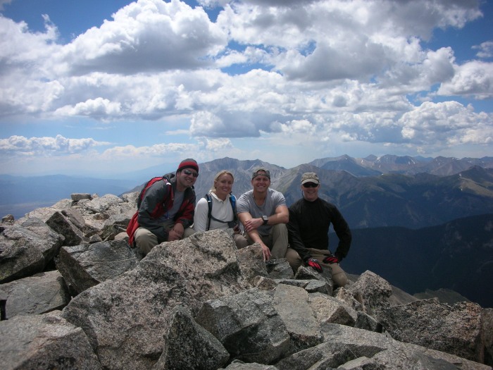
Group summit photo with Princeton in background over Carrie's head
Fantastic hike and wins the award for "Best Scramble" on this trip. We worked up an appetite on the way back down and most of our conversation centered around how much we would enjoy cold beers and a large filet at Quincy's. We satisfied both of these cravings once we returned to Leadville and finalized our plan to tackle Mt. Massive the following day.
Thumbnails for uploaded photos (click to open slideshow):
I especially like your photo captioned, ”Making our way up to the saddle.” I hiked Yale on 7/16, and that photo particularly shows the steepness involved. Thanks for sharing!
I remember commenting earlier in the climb about how steep the trail was. But I gained a brand new perspective as we neared the saddle!
Caution: The information contained in this report may not be accurate and should not be the only resource used in preparation for your climb. Failure to have the necessary experience, physical conditioning, supplies or equipment can result in injury or death. 14ers.com and the author(s) of this report provide no warranties, either express or implied, that the information provided is accurate or reliable. By using the information provided, you agree to indemnify and hold harmless 14ers.com and the report author(s) with respect to any claims and demands against them, including any attorney fees and expenses. Please read the 14ers.com Safety and Disclaimer pages for more information.
Please respect private property: 14ers.com supports the rights of private landowners to determine how and by whom their land will be used. In Colorado, it is your responsibility to determine if land is private and to obtain the appropriate permission before entering the property.