| Report Type | Full |
| Peak(s) |
Mt. Blue Sky - 14,268 feet |
| Date Posted | 09/22/2008 |
| Modified | 09/23/2008 |
| Date Climbed | 09/20/2008 |
| Author | JeffR |
| Fall arrives in Chicago |
|---|
|
Mt. Evans via Chicago Creek and northeast face Contemplating the route from Guanella pass, I instead opted for something a little more scenic. I had worked on this trail just above Upper Chicago Lake with the CFI a few summers ago and thought it would be interesting to go back and see how it turned out. I left the Echo Lake TH immediately west of the Echo Lake Lodge at 0545. This trail is pretty much a highway for the first 1/4 mile or so. But once the Chicago Creek Trail breaks off to the south, the route becomes a little more interesting (to the point that I made a few wrong turns, even with a headlamp). The trail ascends a bit, then starts heading down some steep switchbacks to the creek. Eventually it reaches the creek just south of Camp Shwayder, where it picks up a 4x4 road heading south for a bit. Upon reaching the Idaho Springs Reservoir, the Mt. Evans wilderness is entered and the actual trail returns. Dawn breaks over the reservoir. 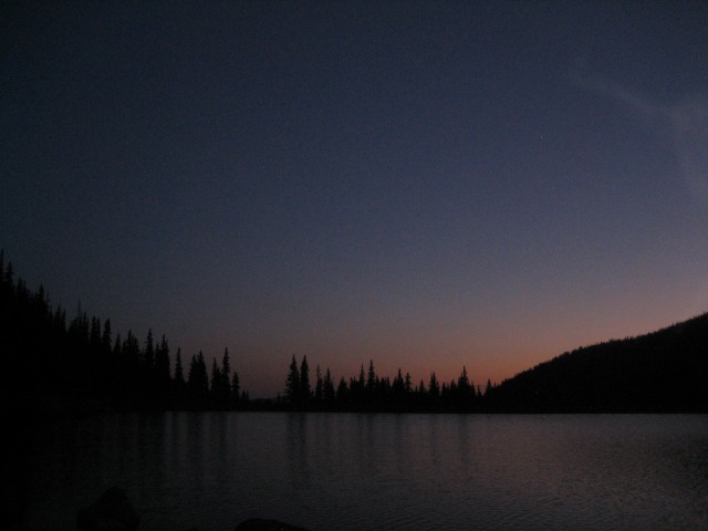 The canyon walls up ahead. 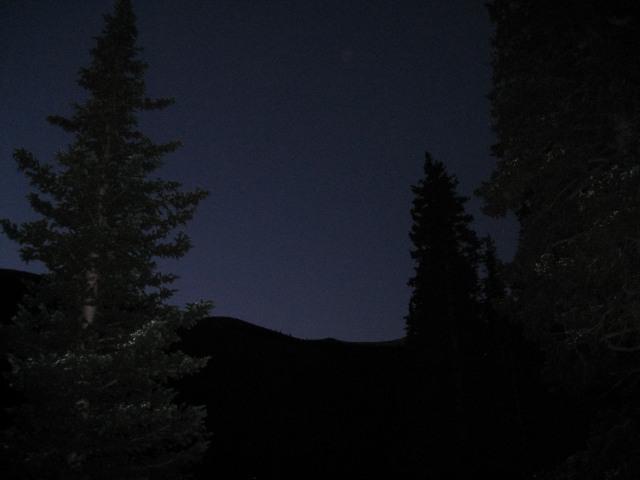 This area is very picturesque, with lots of fall-color growth above the sometimes-steep, meandering trail. There is a mess of deadfall up to the west and nice cliffs across the creek to the east. 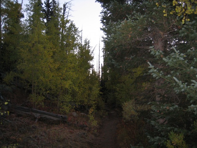 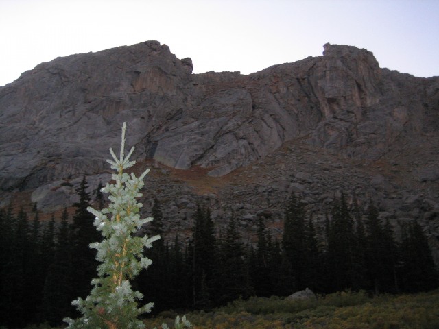 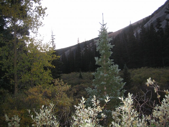 The trail is very straightforward as it passes from the west side of the valley, over to the east side and back to the west. Finally, just below the lower Chicago Lake, I began to get some good views of the target area. I had seen just a light dusting of snow from my workplace on Thursday and was surprised at what looked like the results of another batch from Thursday night. The Mt. Evans massif. 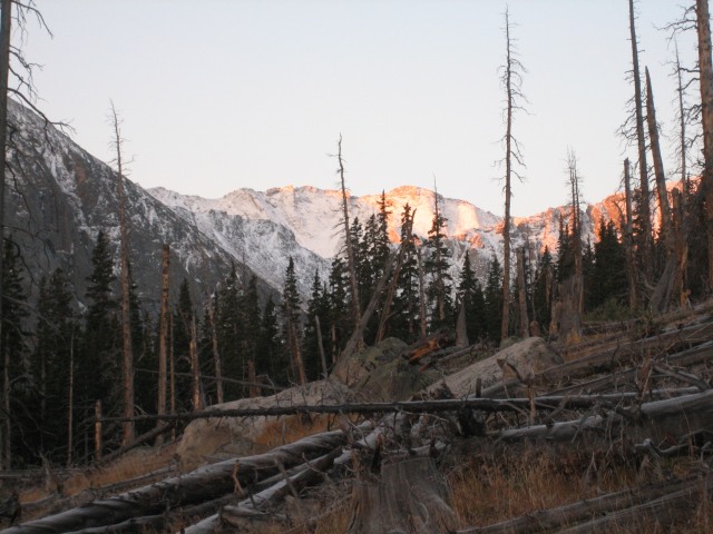 Upon reaching the lower lake, I was able to see the conditions on the headwall below Summit Lake. Fortunately it didn't look too bad. Headwall at the end of the valley. 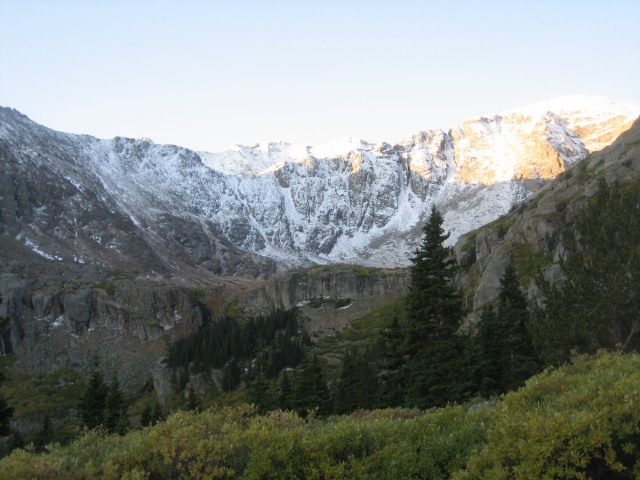 Lower Chicago Lake and Mt. Warren. 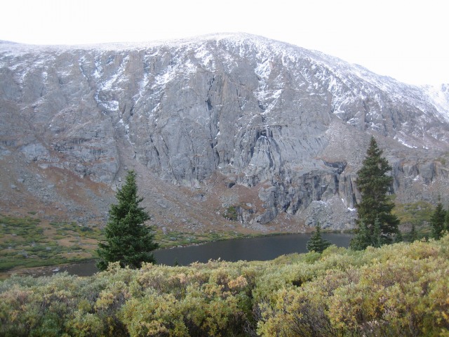 The trail proceeds to pass through some swampy areas and descends a little bit before ascending through a boulder-filled section. This is only marginally trickier than what came before, and the upper Chicago Lake is soon gained. The headwall with Mt. Spalding just above the ramp and the hump to the right. 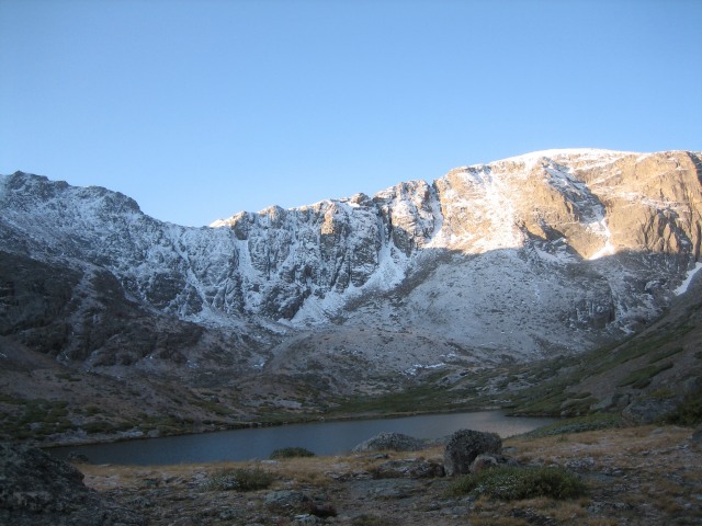 The trail ascending from the lake is steep but has nice rock steps to aid the climb. Soon, I was hiking more on snow than trail and eventually was crunching through 4+ inches of fairly solid snow. On the trail heading up under the west slope of Mt. Warren.  I wasn't sure about the exact route of the trail from here, so I eventually just cut south to head directly for the notch above Summit Lake. Traversed this slope to reach the notch. 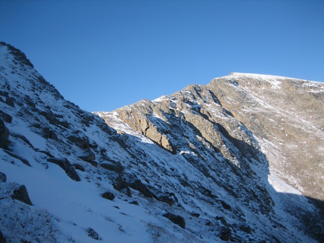 View back down the valley from the notch. 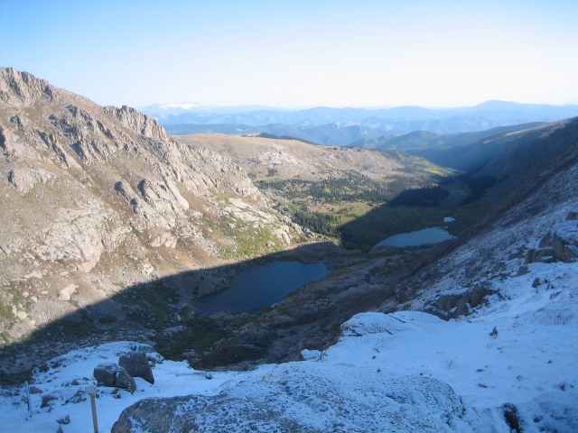 View ahead to Mt. Evans. 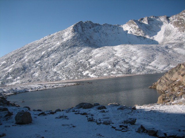 I passed the 15+ cars already in the parking lot (!) and made my way towards the road. It was pretty nippy and the wind was gusting, but the full-on sunshine warmed things a bit. I rehydrated at the lake and headed for the northeast slope. Unfortunately, I turned off the road a little too early and ended up climbing up a few hundred feet of huge, slick boulders before realizing my mistake. Hey, this isn't what I wanted.  I laboriously traversed SE until I saw the nice gully that I meant to take. This was much more sane, as I wasn't wasting all my (rapidly dwindling) energy lunging over snow-covered boulders. There was still 4-6 inches of snow in most places but at least the footing was generally even. Finally I joined the congregation on the summit. Looking back, I was amazed at the difference a few hours makes in the amount of snow. Summit Lake. I think I can see the shorts-and-Crocs-wearing hordes from here! 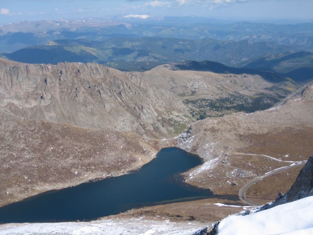 Epaulet Mtn. 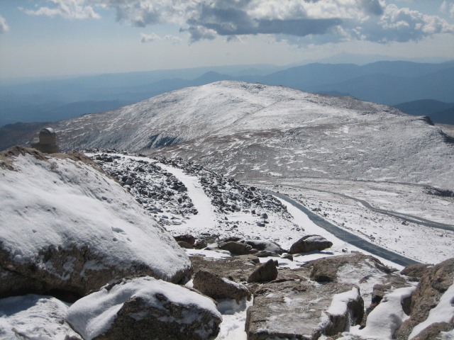 North Face 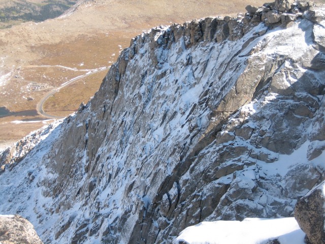 West Evans 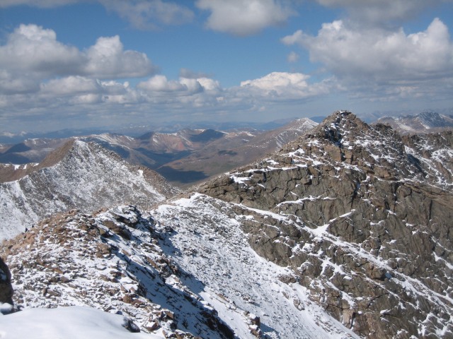 Northeast Face after descent. This snow will probably be completely gone early next week. 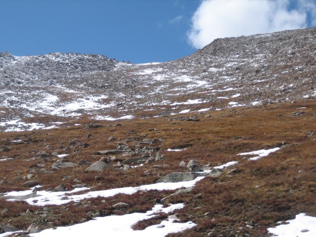 Thumbnails for uploaded photos (click to open slideshow):
|
| Comments or Questions |
|---|
|
|
Caution: The information contained in this report may not be accurate and should not be the only resource used in preparation for your climb. Failure to have the necessary experience, physical conditioning, supplies or equipment can result in injury or death. 14ers.com and the author(s) of this report provide no warranties, either express or implied, that the information provided is accurate or reliable. By using the information provided, you agree to indemnify and hold harmless 14ers.com and the report author(s) with respect to any claims and demands against them, including any attorney fees and expenses. Please read the 14ers.com Safety and Disclaimer pages for more information.
Please respect private property: 14ers.com supports the rights of private landowners to determine how and by whom their land will be used. In Colorado, it is your responsibility to determine if land is private and to obtain the appropriate permission before entering the property.

