| Report Type | Full |
| Peak(s) |
Mt. Bierstadt - 14,066 feet The Sawtooth - 13,780 feet Mt. Blue Sky - 14,268 feet |
| Date Posted | 08/04/2008 |
| Modified | 08/05/2008 |
| Date Climbed | 07/28/2008 |
| Author | MUni Rider |
| A long day on the mountain via the Sawtooth |
|---|
|
Date: 28 JULY 2008 Start time: 6:30 A.M. @ Mt. Bierstadt Trail (Guanella Pass) Agenda: Mt. Bierstadt - Sawtooth Ridge - Mt. Evans Finish time: 8:00 P.M. return back to car. Solo Hike: MUni Rider Weather: Mixed, mostly crappy, more info within narrative below. The original plan was to start the hike or at least arrive to the Guanella Pass trail head at 5:00 A.M. Lots of interference to that plan. The day prior to the hike I was at a run/party. I was told by the friend I took along that she didn't want to stay for the party, only the run... The run ended at 3:00 p.m. Fast forward to the party: "I'm having too much fun, I'm not ready to go...." After her finally securing a ride home with a guy she met, I was out of there, 3 hours later than I had planned and I'm off to my brother's house in Erie. I get to bed around 11:00 p.m., a good two hours later than planned, so instead of setting the alarm for 3:00 a.m., I set it for 4:00 a.m. The front car tire needs some air, 5 minutes backtrack to get the food out of the fridge.... I'm finally on the road, trail bound. Gotta love when a plan comes together. The sky is clear as I start the hike toward Bierstadt, hopefully it stays that way. Only 3 other vehicles in the parking lot, so I don't expect to see many people. Around 8:00 a.m. I notice a few feathery clouds forming overhead. Too soon. These seem to want to burn off eventually and about an hour later, they do, but they are evidence of the moisture content in the air.  I top out on Bierstadt around 9:15-9:30 a.m. I forget the exact time. The parking lot is just above that small blue colored lake way down there.  Far across the Abyss, I can see Mt. Evans, my next 14er goal. There is one other person up there. I had passed his mother about 30 minutes prior. We share some of my clementines. After his mom arrives I prepare to head down the Sawtooth. Another couple arrives. There are five of us on the summit of Bierstadt now. Feels crowded. I say my goodbyes, slap on my new toy, (bright yellow Petzl helmet) and off I go, down the sawtooth. Now I'm never really been sure when the terrain increases from class II to class III, so I'm expecting this traverse to be as a good example of class III. I understand that if I stay right, I can "sneak" the route and keep it at class II, so I stay as far left as possible on the more gnarly terrain. This proves to provide great views of both sides of the ridge. I stop periodically to take pictures along the way.    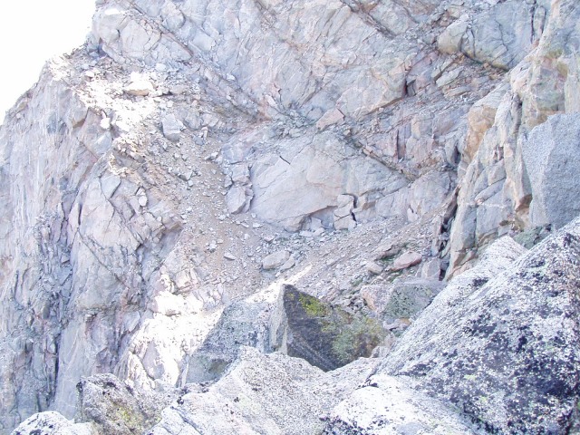 Early on, about 300 yards down the ridge, I'm passed by a mountain goat who goes by the name of Dave Carter. He slows down a bit until I tell him to go ahead since I'm purposely taking some slower more challenging lines. His shoes may have left burn marks on the rocks, I'm not really sure, but within 5 minutes he's out of sight. Later he will be spotted otop a high rock at the low part of the traverse eating lunch. As I near the low part of the traverse, he's headed back up Bierstadt to meet up with a co-hiker. Once again, after wishing each other a safe hike, the smell of burnt rubber is sensed. 10 minutes later, There is a group of 4 hiking up from the Abyss on the left. I pass them as they are just arriving to the lowest part of the traverse as they are breaking for a snack. I stay ahead of them for the remainder of the sawtooth, but remember that for one of them, this was her 1st time hiking, (ever?). I'm well ahead, but watch as they split into two groups below a crux upclimb, one of which takes a low road. The other half of the group, up and over, backside-right and returns to the left-side high up and eventually threads through the cliffs, finding their way back to the trail proper. Not the path I would choose, but a successful line is a good line. I snapped several pictures of the groups progress. I'm only posting 4 pics here, but if this is you, let me know and I can email you all of them.  close in,  same view farther out,  higher hikers  same view farther out. The clouds had been building slowly during the sawtooth trail.  After I finished the traverse, it was time to bust-a-move. I'm off to Mt. Evans. Path of least resistance, initially. But as I near the summit and all it's high points along the ridge, I stay high and enjoy the view down both sides as I progress. Rain falling on the far side/top of Bierstadt. It's slowly moving right to left, not nearing. A good sign. ---Flash-Bang!--- Lightning strikes Bierstadt's ridge, to the left of the summit. A bad sign. I'm about 100 yards to the Summit of Evans. I get there quicky and snap of few pics.  Here I am on the summit of Mt. Evans pointing to my car on the other side of Mt. Bierstadt. I quickly depart the highest part of the summit, down toward the developed area to cook lunch and wait out the weather. High noon. This is where I screwed up. One of those "Hind-sight is 20/20" bits. I should have turned back the way I came. But at the time, I was hungry and knew that the ridge back toward the Sawtooth/Spalding was exposed to the weather. I instead decided to wait it out. That spaghetti was oh so satisfying! Now it's 1:00 p.m. I had long ago donned my rain gear. The Original storm over Bierstadt is mostly gone but seems to have been replaced by rain clouds as far as the eye could see in every direction. At least the thunder isn't as close. I decide to head back (however lower) along the ridge to see what the weather is looking like on the other side. I am viewing my downhill into the Abyss option, just in case. 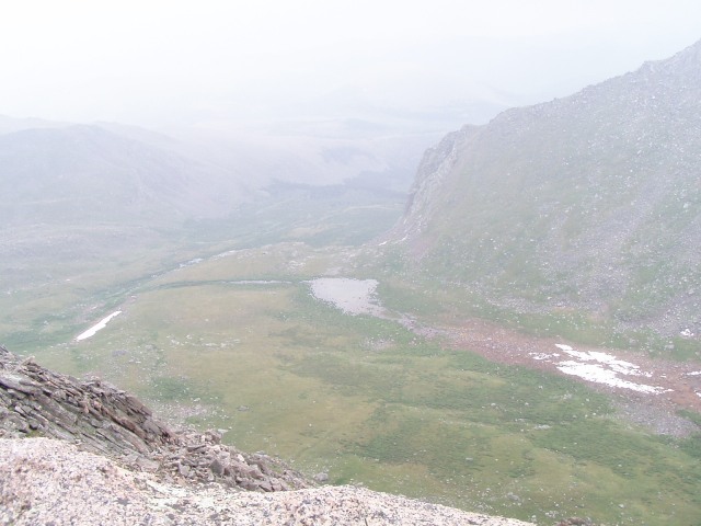 After I work closer to the Sawtooth, The rain continues to intensify and so does the thunder. There ain't no way I'm headed up and over toward Spalding now. I drop straight down and into the Abyss. 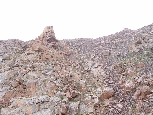 I fully realize that in order to get back to my car I will be hiking clockwise around the entire circumference of Bierstadt. I realize that the shortest way around Bierstadt is to forge a high road; the closer to the summit, the less distance around the circumference. The thunder had long stopped booming, but the rain was constant. My feet were wet, but warm. My fleece gloves are soaked, but warm. My body is dry and warm. From head to toe, I don't have a single stitch of cotton on me, at all. Socks, underwear, pants, shirts... all wicking. I have a map. I have my new toy, (bright yellow Petzl helmet). I'm good. I eat a small snack and prepare for a long afternoon of hiking.  I started rationing my food, unsure of how long this hike would be. I continued to drink water knowing I could get more at any time. I had a hiking filter with me. At the bottom, I had long ago sighted a trail. Nice. Upon arrival to the trail, progress is fast. Eventually, the trail works leftward, toward the wall I had down-climbed. I know this to be the trail that was used by the group of four of which I had shared the Sawtooth. I trot off to the right, leaving the trail and beginning what is to be several hours of cross-country ranging. Soon I come across the easiest stream crossing I have ever seen.  Very photogenic as well. this would make for a great camping area someday. Oh yeah, it's still raining too. There is another trail off to the left again, but I chose to stay right on nearly every situation the terrain throws at me. So no trail for me. I down climb a cliff line as apposed to going way out to the left. Ahead I can see a lofty lake of decent size. I aim to it's right side, staying high. Never give up the high ground. I know that in order to eventually regain the trail back to the car, I will need to work up and around at least a few ridges on my way around. For any down step, I will have to just go back up again, so I try to never go down unless the terrain leaves no alternative. I had used all three liters of water and refilled in the stream above the lake. This was actually pretty fun. I had to climb about 8-10 feet down amongst the car-sized scree boulders to get to the subterranean water. Play time over, time to hike. After I crest (the only true ridge climb) beyond the lofty lake, 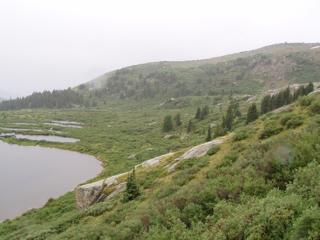 I know that the hard part is over. Now I just have to take a stroll around until I intercept the trail. I'm not really sure how far that is. It doesn't really matter. Although I don't know my exact location on the map, I have a general idea and recognize the terrain and know that as long as I continue this long, slow left curve around the mountainside I will get myself back to the car. I have clear view of the valley below. It looks like marsh and wetlands and the legendary and infamous Bierstadt willow mazes. I know that my choice to stay far above that junk is a good one. Not to mention the miles I have cut off my hike. It's still raining, but I'm warm. Anytime my fingers get cold, I'd just wring the water from the gloves and they are warm again. During my hike around the mountain, I would sight a far off ridge that I would have to get around. Knowing that once I get there, I might just see the trail, or better yet, the parking lot. The only problem was the low-lying clouds in the valley far below masking any such sightings. I was getting tired after the first three or four ridges. Now when I say "ridge" here, It's not like I'm hiking straight up. It's more like a higher spur 1/4-1/2 mile away that blocks my view beyond. Most often I would take these on while gaining altitude, all the while walking on thick alpine grass. 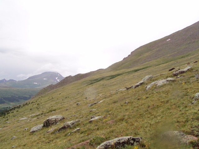 Any other pics would have not have looked much different. Easy walking along the sloping ground, but once I starting heading toward cliffs and scree slopes, I allowed myself to loose elevation. This moved me along faster and raised my spirits some. For a couple hours I thought about the possibility of spending the night on the mountain. I did have an emergency bivy, the mere presence of which added great psychological comfort. I did have the ability to make fire for warmth if it came to that via two boxes of matches as well as my stove. (I would have to descend to tree line if I chose to build a fire, but it was always an option.) I did have a bunch of food still and I had recently refilled my Camelbak with two liters of mountain stream water. There is an endless supply of water on this mountain. If I got chilled, I still had long thermal/wicking underwear in my pack that I could put on. I continued hiking with the confidence that I could handle anything the mountain could throw at me this day. Yeah, I was getting fatigued from the slow grind of progress, but I knew the mountain couldn't go on forever. Eventually after another ridge crested, I saw some lakes and ponds on the valley floor. I recognized them from the hike up. I still couldn't see the trail, but knew that it was above and beyond me. I struck out for an intercept as I headed slightly downward. I still couldn't see the parking lot beyond due to the clouds and rain masking everything to the West. Then there it was... a cut line above me, paralleling my route. I angled my path and about 10 minutes later the trail joined me. 6:00 p.m., still raining, and now windy. As I was hiking from the trail. I approached a rock that look a heck of a lot like a person huddled in a poncho. When I got within about 50 feet I realized that if really was a person! I said hello. I think I startled her. I was unsure why she was just hanging out here and we experienced some trouble communicating. She was deaf and I didn't know sign language. The weather was crap and the sun was nearing the high mountain horizon with every passing minute. I was able to figure out the her husband was still up above us on Bierstadt somewhere. Up to this point, the chance of me making it home in time to get to work (at midnight) were remote. But now I knew I would be calling off work for sure. An easy decision given the circumstances. We both gave long looks upward to the trail as it disappeared into the clouds covering a majority of land above us. She admitted to being a little bit nervous. I estimate that we were standing between 12,500-13,000 feet. Any thoughts of my warm dry car waiting for me below were quickly pushed from my head. I didn't feel comfortable heading home just yet, With not only her waiting on the trail and her husband still up on the peak somewhere in this weather and late hour. The wind continued but the rain abated. Neither of us had a pen or pencil. We took to communicating by scratching words into the dirt trail. She had been told by her husband that he would return by 6:40 p.m., but to head down the mountain if he didn't return by 7:00 p.m. Tick-Tock. Tick-Tock. By the time 6:40 p.m. had come and past, we had filled-up close to 100 feet of trail with our conversation. At least the clouds were breaking and bits of blue sky were appearing, as well as the peak above us. At about five minutes before 7:00 p.m. I spotted a hiker wearing a red spot up the hill, high above us. I was relieved and she was quite over- joyed. 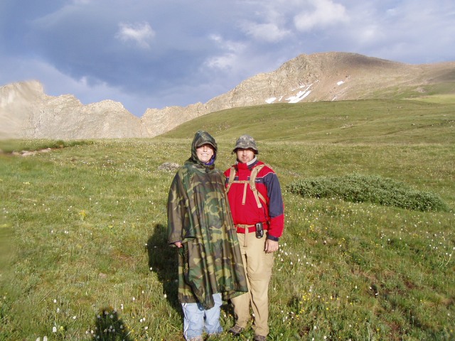 He knew sign language. He explained that he had mis-read the map and the 0.8 miles to the top was actually 1.8 miles. He stated that they had waited for the initial storm to pass and started hiking around 2:30 p.m. This was her second time hiking. Today was his 1ast 14er summit. They were from out of state. We took some pictures, said our goodbyes and I enjoyed the remainder of the hike off the mountain. As I was finishing the hike, the sun dipped below the horizon; just as I had started it. I was treated to some alpen glow-lit views of Bierstadt and the Sawtooth. I arrived to the car at about 8:00 p.m. Dry socks never felt so good. I was able to get a call out to work near the bottom of Guanella Pass as I neared Grant. They were understanding. I guess this all can be summed up with: "A looooong day on the mountain beats a good day in the office!"  Lesson learned: The nest time I'm at a party the day prior to a planned 14er and someone wants to keep me at the party a few extra hours, my response we be: No offense, but you can take yourself straight to hell; I'm leaving!" #25 and #26.....check! check! Next up, Mt. Lindsey! Thumbnails for uploaded photos (click to open slideshow): ")
")
")
")
")
")
")
")
")
")
")
")
")
")
")
")
")
")
")
")
|
| Comments or Questions | |||||||||||||||
|---|---|---|---|---|---|---|---|---|---|---|---|---|---|---|---|
|
Caution: The information contained in this report may not be accurate and should not be the only resource used in preparation for your climb. Failure to have the necessary experience, physical conditioning, supplies or equipment can result in injury or death. 14ers.com and the author(s) of this report provide no warranties, either express or implied, that the information provided is accurate or reliable. By using the information provided, you agree to indemnify and hold harmless 14ers.com and the report author(s) with respect to any claims and demands against them, including any attorney fees and expenses. Please read the 14ers.com Safety and Disclaimer pages for more information.
Please respect private property: 14ers.com supports the rights of private landowners to determine how and by whom their land will be used. In Colorado, it is your responsibility to determine if land is private and to obtain the appropriate permission before entering the property.