Download Agreement, Release, and Acknowledgement of Risk:
You (the person requesting this file download) fully understand mountain climbing ("Activity") involves risks and dangers of serious bodily injury, including permanent disability, paralysis, and death ("Risks") and you fully accept and assume all such risks and all responsibility for losses, costs, and damages you incur as a result of your participation in this Activity.
You acknowledge that information in the file you have chosen to download may not be accurate and may contain errors. You agree to assume all risks when using this information and agree to release and discharge 14ers.com, 14ers Inc. and the author(s) of such information (collectively, the "Released Parties").
You hereby discharge the Released Parties from all damages, actions, claims and liabilities of any nature, specifically including, but not limited to, damages, actions, claims and liabilities arising from or related to the negligence of the Released Parties. You further agree to indemnify, hold harmless and defend 14ers.com, 14ers Inc. and each of the other Released Parties from and against any loss, damage, liability and expense, including costs and attorney fees, incurred by 14ers.com, 14ers Inc. or any of the other Released Parties as a result of you using information provided on the 14ers.com or 14ers Inc. websites.
You have read this agreement, fully understand its terms and intend it to be a complete and unconditional release of all liability to the greatest extent allowed by law and agree that if any portion of this agreement is held to be invalid the balance, notwithstanding, shall continue in full force and effect.
By clicking "OK" you agree to these terms. If you DO NOT agree, click "Cancel"...
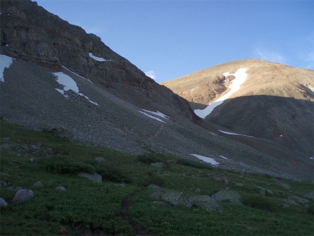
I arrived at the trailhead late Friday night after watching the fire works over Lake Dillon. The road up Iowa Gulch from Leadville is in good shape and passable to all vehicles. I started off at the modest hour of 710a through the meadows on the use trail that winds the start of the climb. After crossing two small snow patches the trail climbs steeply toward the saddle between Sheridan and Sherman. Just below the saddle I took a hard right on the trail to Sheridan, reaching the summit at 755am, it was clear and windy.
Looking across the valley toward Sheridan.
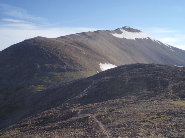
From the base of Sheridan looking toward Sherman.
I trotted down the rocky trail from Sheridan then along the smooth ridge over to Sherman. The trail up Sherman climbs steeply at first, then levels out along the upper ridge. The wind was whipping along the ridge, apparently this is normal. The final climb to the summit flew by and I topped out on the windless summit at 840a ahead of several large groups. Sherman's summit register cap is cracked off and could use to be replaced if anyone feels inclined.
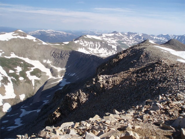
From Sherman's summit looking at Gemini Pt(right) and Dyer Mt(left).
Looking down from Gemini Pt toward Dyer Mt.
I took off for Gemini Pk soon after, jogging along the smooth use trail along the ridgeline across the flower laden tundra. Gemini Pt is the furthest pile of rocks along the ridge, requiring a little easy scrambling to reach its summit, at 905a. The use trail peters out as one descends off Gemini Pt to the ridge below. The ridgeline connecting to Dyer is fairly narrow, with the snow recently melting off the ridge there was just a 4ft wide passage. The climb up Dyer is rocky but not technical, and after postholing through one 100ft snowfield I topped out at 935a, finally done heading up! After weaving my way through several small snowfields on Dyer's SE slope I reached the tundra. From the open bowl head toward the electrical tower that sits on the edge of the high meadow. From this tower(seen in photo #6) I traversed diagonally right above the snow heading for the next electrical tower. Once down i was able to follow grass all the way back to the mining road, 1/4mile above the parking area. In all a 3:10 circuit, including 3 peaks over 13700 and one rocky pinnacle. A nice route for anyone looking to tack on a little more to Sherman.
Panorama of the Sawatch range as seen from the Iowa Gulch Rd.
http://www.ericjlee.com/Photos/080705%20ShermanHarvColum/Sawatch-Pano.jpg
Larger version of the Panorama
Thumbnails for uploaded photos (click to open slideshow):
Comments or Questions
Caution: The information contained in this report may not be accurate and should not be the only resource used in preparation for your climb. Failure to have the necessary experience, physical conditioning, supplies or equipment can result in injury or death. 14ers.com and the author(s) of this report provide no warranties, either express or implied, that the information provided is accurate or reliable. By using the information provided, you agree to indemnify and hold harmless 14ers.com and the report author(s) with respect to any claims and demands against them, including any attorney fees and expenses. Please read the 14ers.com Safety and Disclaimer pages for more information.
Please respect private property: 14ers.com supports the rights of private landowners to determine how and by whom their land will be used. In Colorado, it is your responsibility to determine if land is private and to obtain the appropriate permission before entering the property.


")
")
")
")
")
")
")
")

